Category Archives: Training Hike


SoMo Training Hike – Kiwanis | National | Pyramid
- Trail: Kiwanis Trail – National Trail – Pyramid Trail (and Back)
- Mileage: 6.5 Miles RT
- Accumulated Gain: 1800 ft
- GPX Track: https://hikearizona.com/map.php?GPS=37428
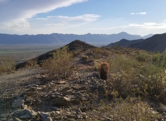
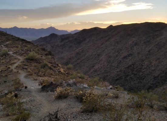
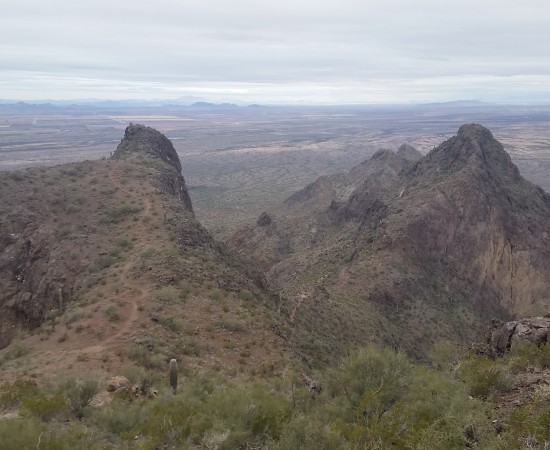
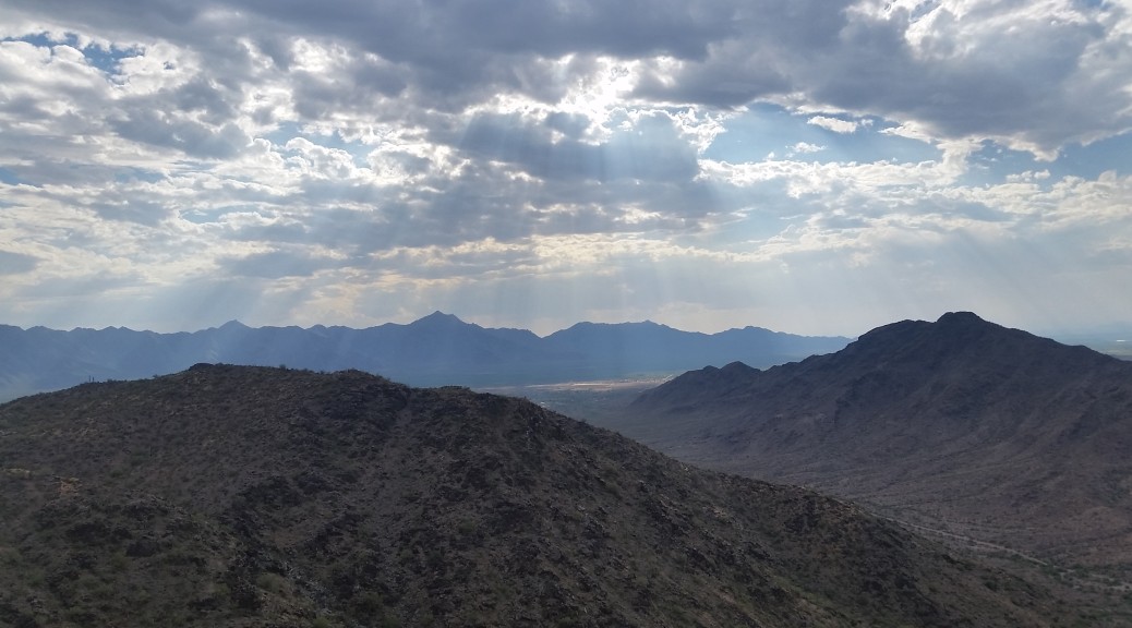
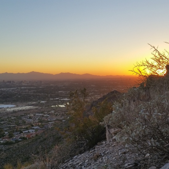
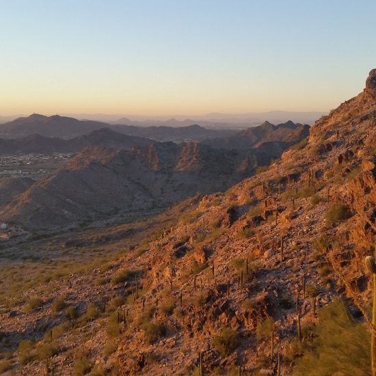
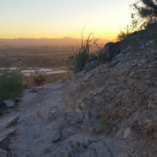
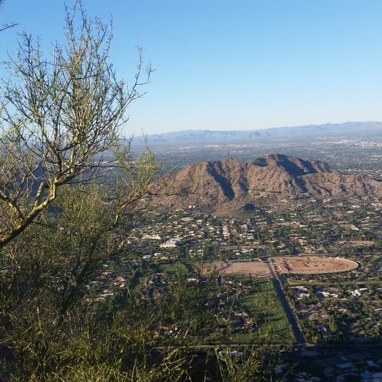
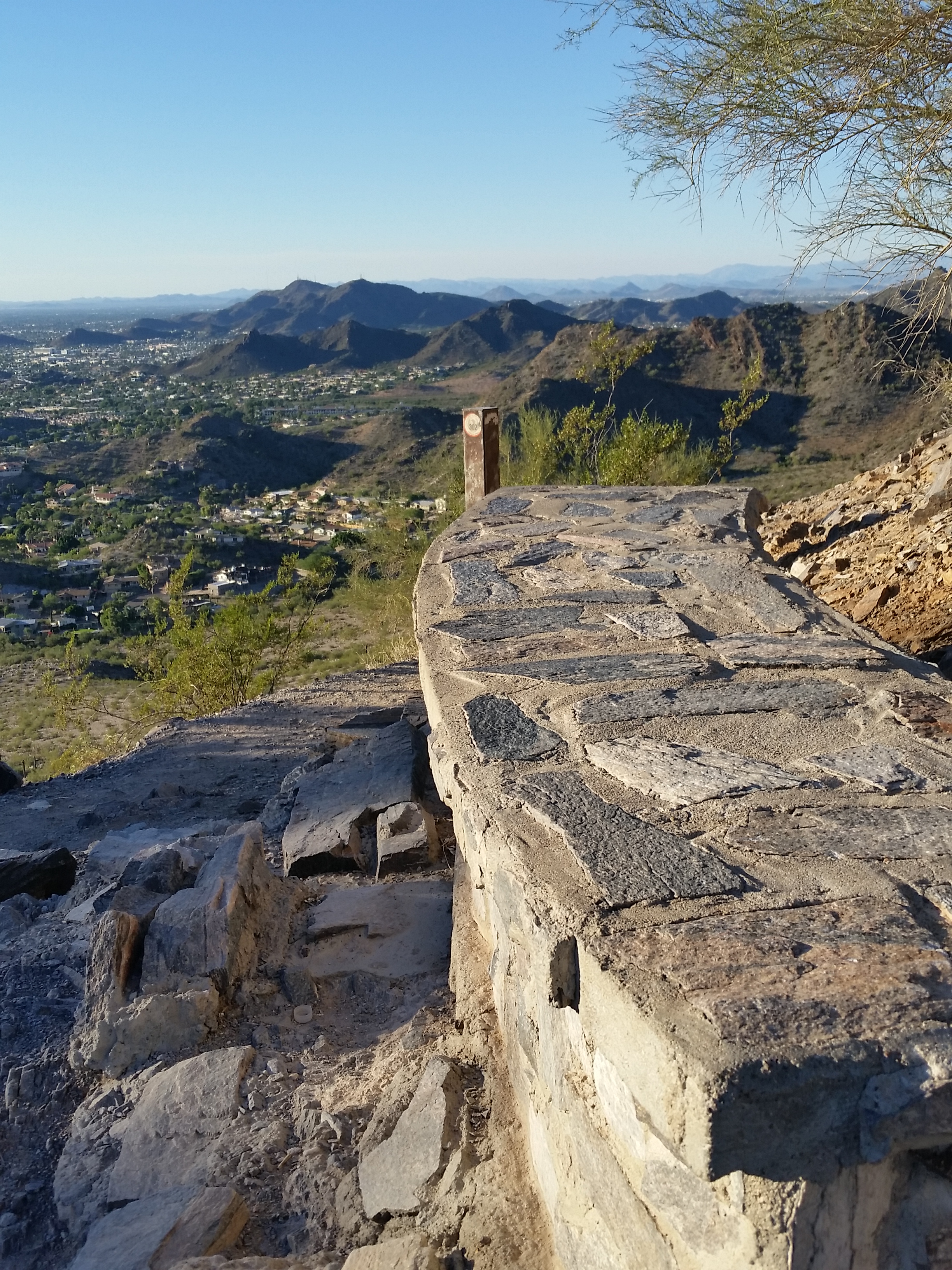
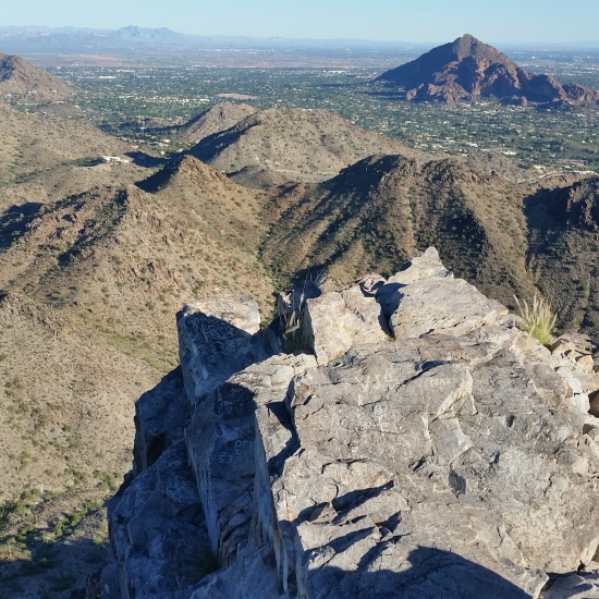
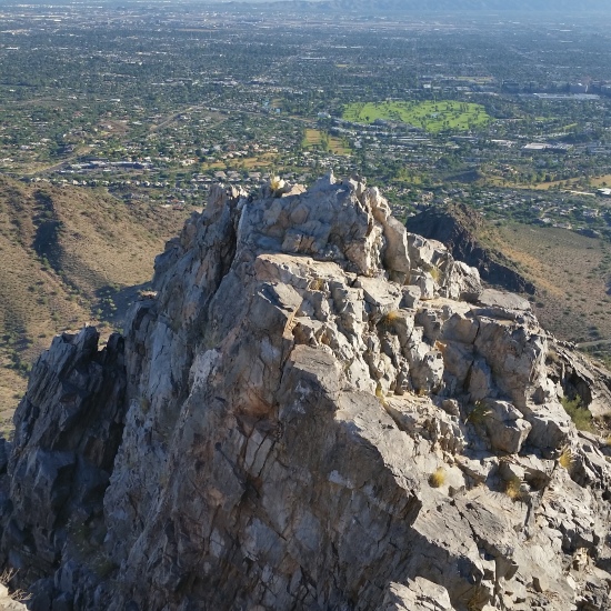
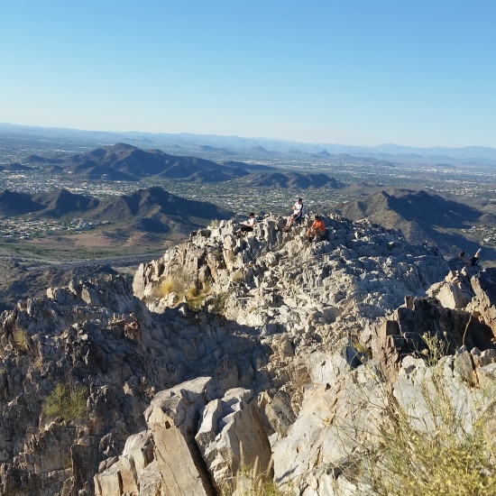
South Mountain (SoMo) is one of the most underutilized places for training hikes in Phoenix (with respect to Squaw Peak and Camelback Mountain) and there are plenty of opportunities for good mileage and gain (despite most Phoenicians predisposition against SoMo).
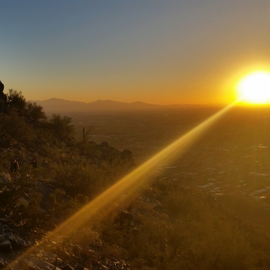
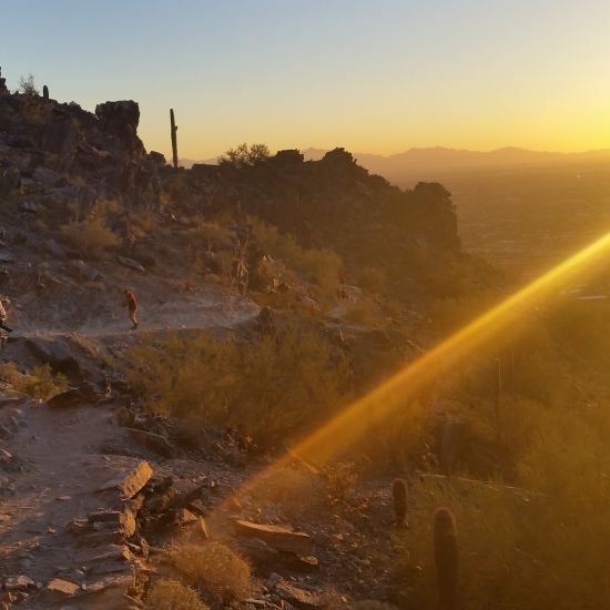
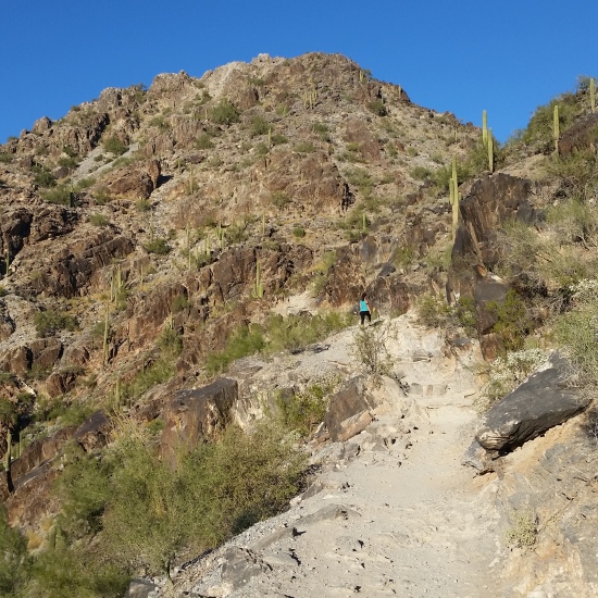
To solved the issue that SoMo isn’t very tall, I like to do “Over and Back” hikes. One great training hike is as follows: Start at Kiwanis Trail (TH), gain National Trail, drop down Pyramid Trail (to the flat), and return.
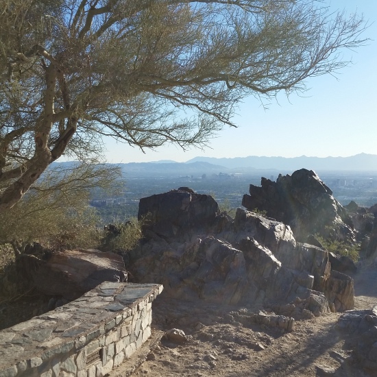
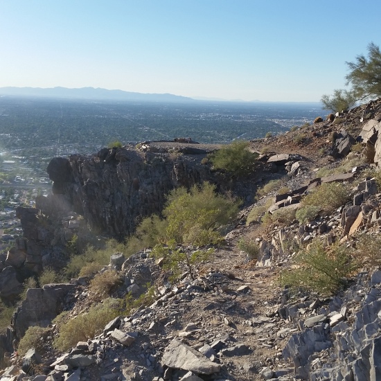
Not only is the trail really good for mileage and gain, it also has some very gorgeous views!
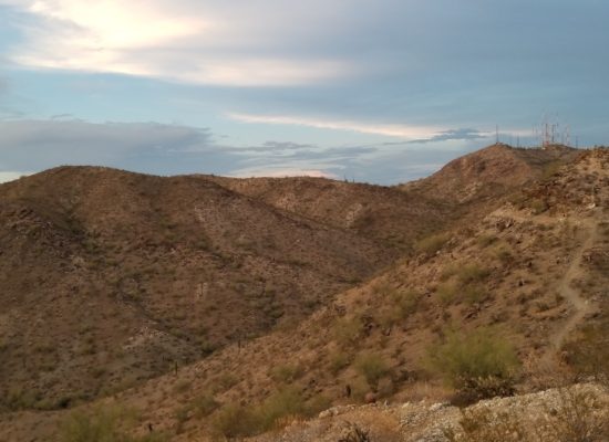
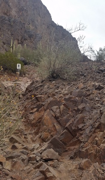
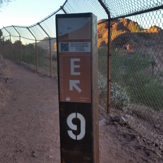
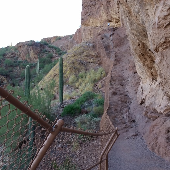
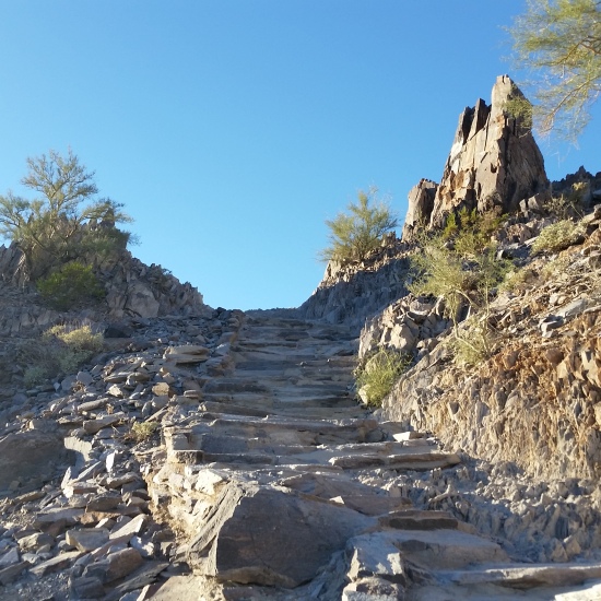
 Heading up Kiwanis

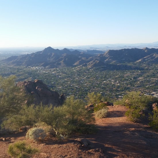
Picacho Peak – Unassisted Ascent – AZ (12.22.15)
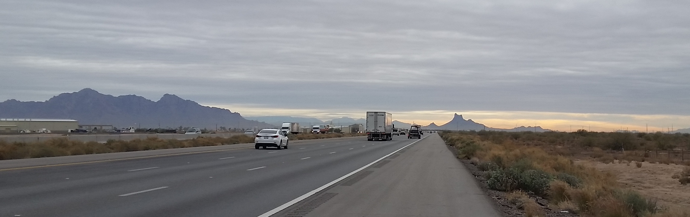
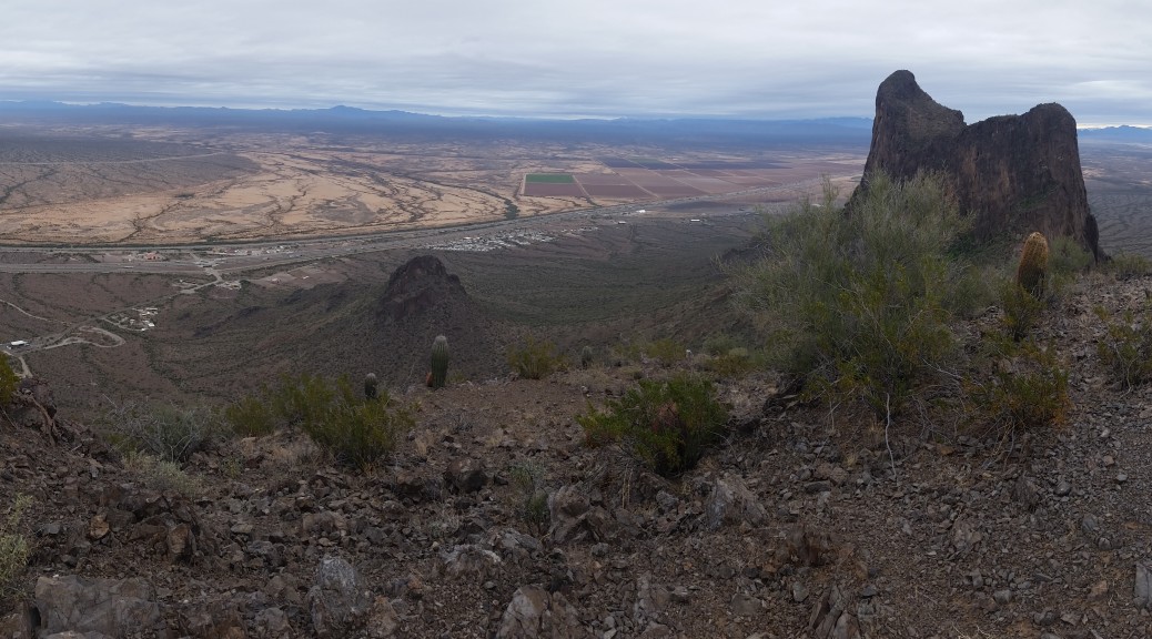
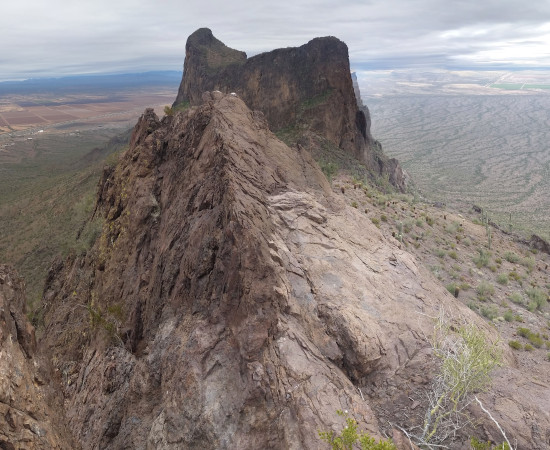
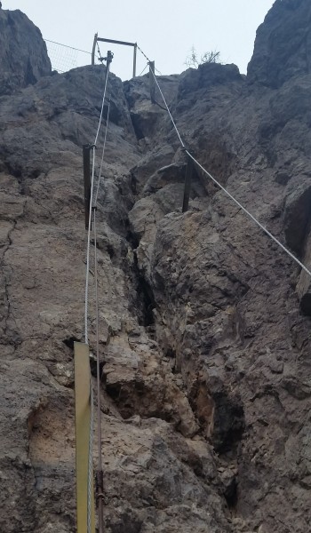
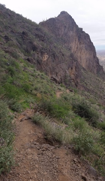
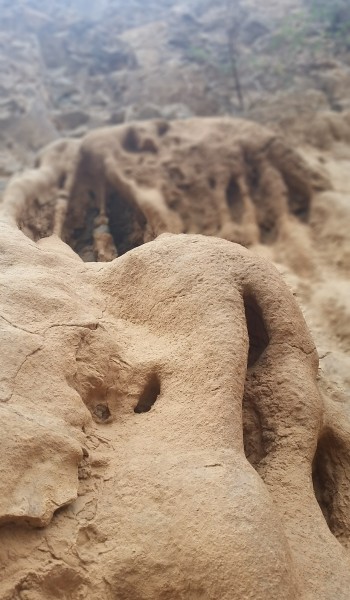
Picacho peak is one of those land marks that you can’t miss on the drive from Phoenix to Tucson via the I-10. About half way between the two cities it sticks out like a sore thumb just next to the freeway. The trail to the summit is very unique in that it has some short climbs and is anything but your typical desert hike. For those of you who left your climbing shoes at home, fret not for the trail has been retrofitted with steel rods, wire, and cable to assist you in your ascent.
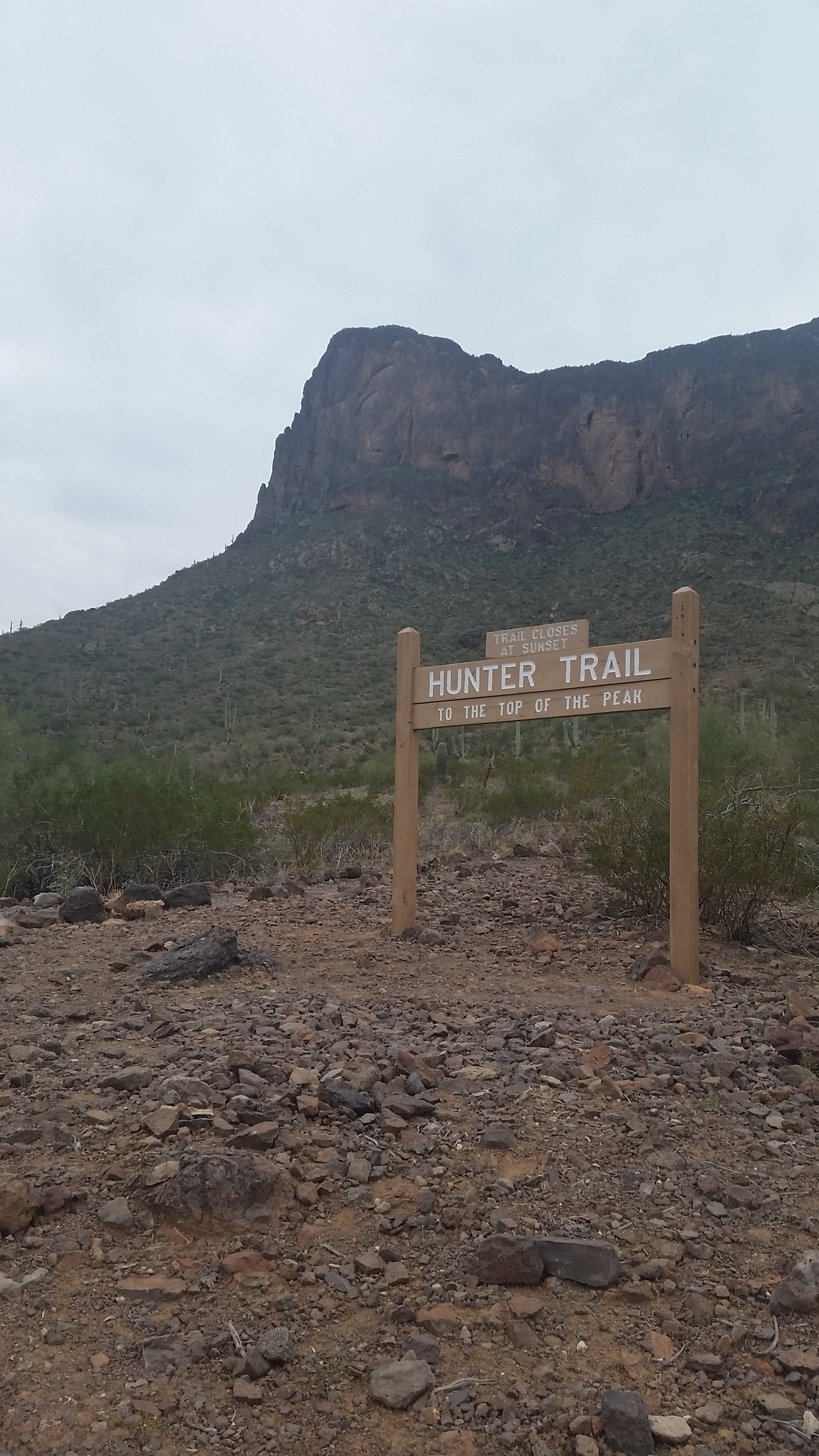
It was an overcast day and I decided it would be a good idea to head to Tucson for a few days of hiking and I couldn’t pass on the opportunity to take on Picacho on the way down from Phoenix. After paying my State Park entre fees, I pulled into the parking lot for the Hunter trailhead and looked up at the beast standing before me. Like all other treks that have ever came and gone; it was time to get to work!
I headed up the hill chilled from the mornings wind sweeping across the open base of the mountain. It wasn’t long as I ascended up the rocky switchbacks that I was peeling off my hoody and getting some good heat generated. I passed a large group of retirees who were all smiles and gave on some small talk as I passed. “Are you going to the peak”, I asked. One older woman smiled clutching her trekking poles in hand “that’s the plan” with a nervous chuckle. “Well I’ll see you guys up there!” I replied as I pushed on. They seemed like a well spirited group ready to take on the challenge ahead; I never count anyone out on the trail.
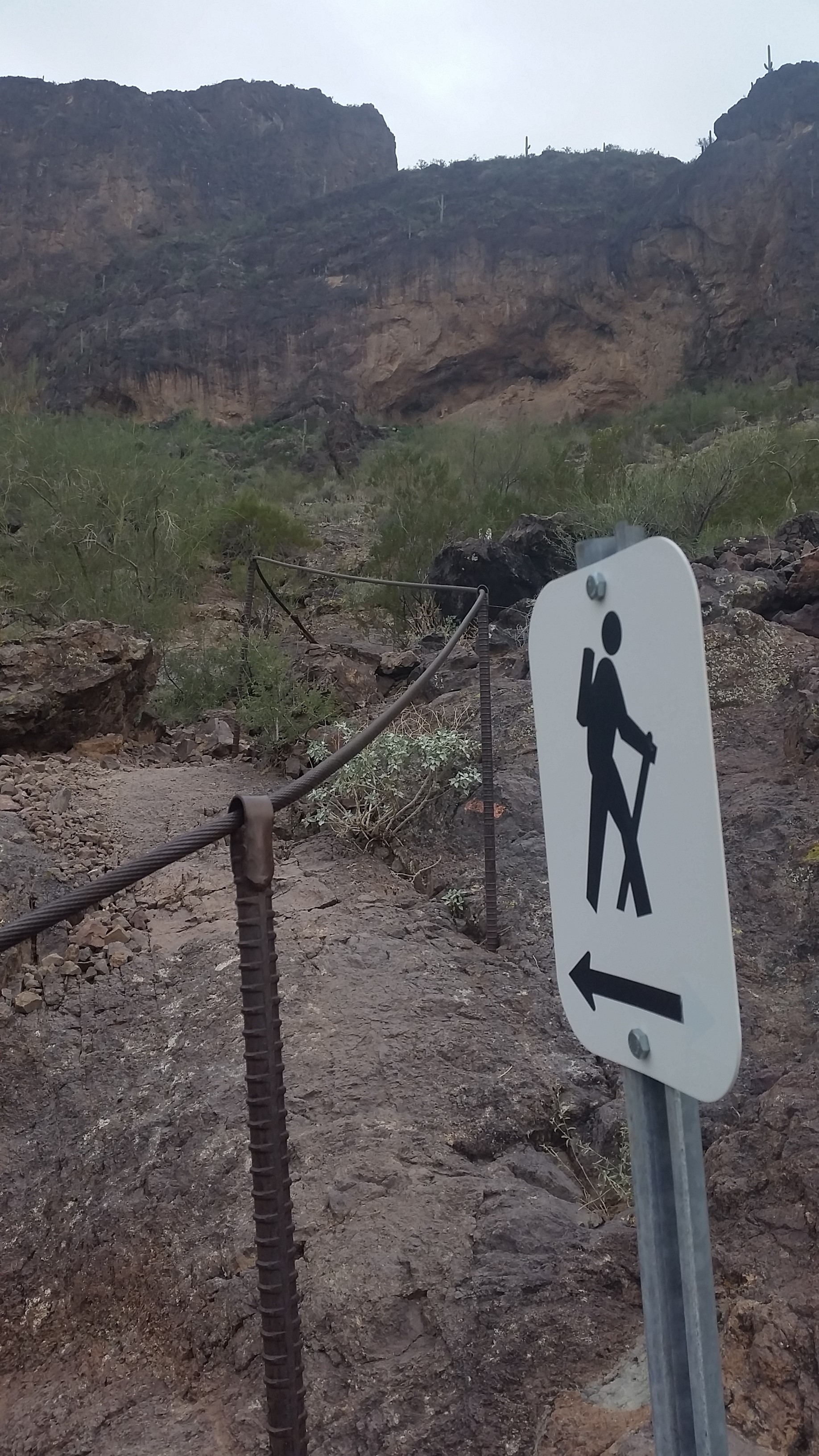
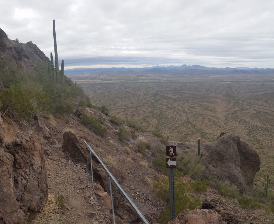
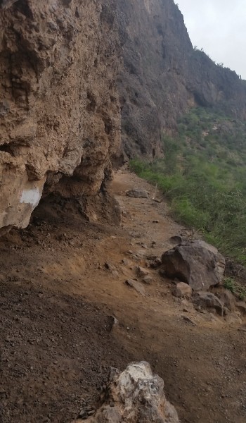
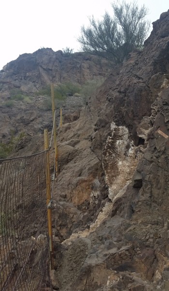
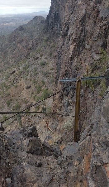
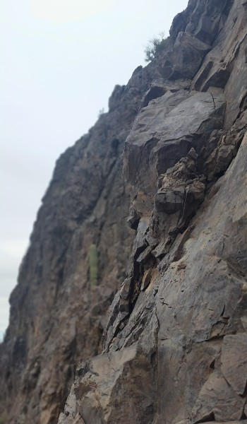
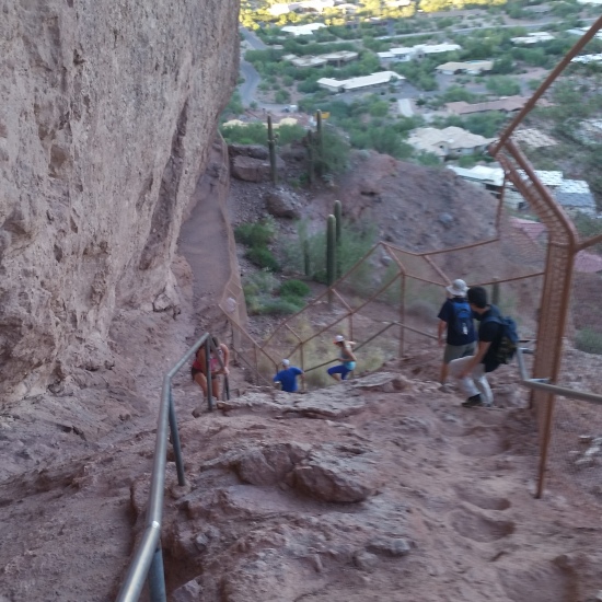
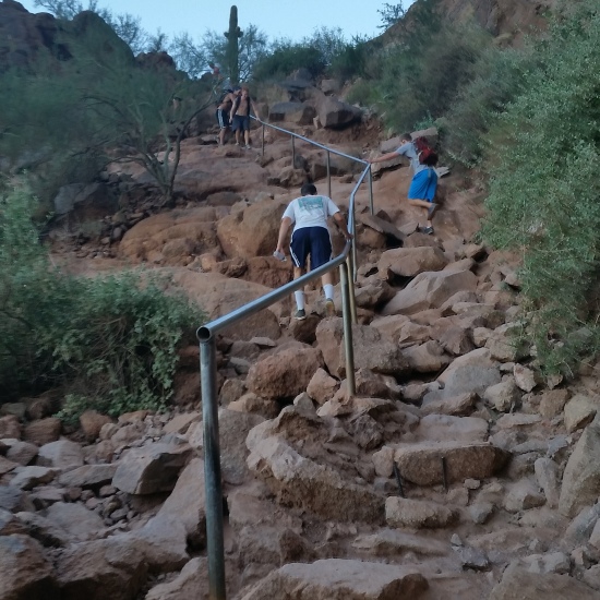
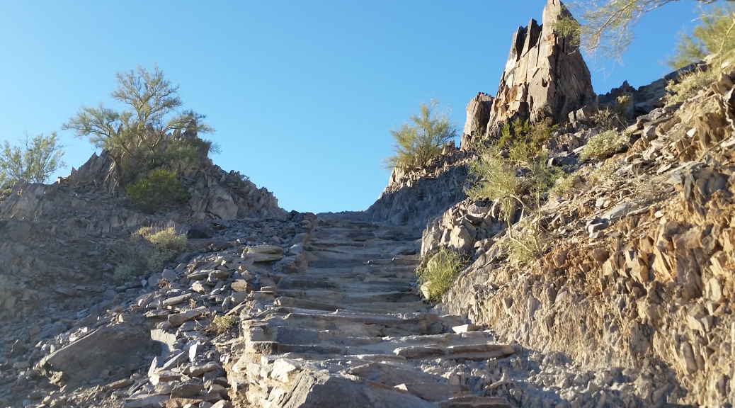
I pushed up along the switchbacks until finally I was up against the east face of the huge rock, the trail continued to skirt the face until it hit the main saddle. To finish the ascent you must drop down the backside (west) of the mountain. And when I day drop I mean drop! Almost all the work you did to gain the saddle is soon lost down the cabled backside. The trail becomes steep, down, down, until finally it levels off and you turn south against the west face of the rock where things start to get interesting. The rest of the ascent drives south east up the mountain with a few cables obstacles in the way. These are the climb areas where people with “heights” issues would certainly turn back! I am no rock climber, but I enjoy the challenge of trying to climb the obstacles unassisted by the cables and man-made railings left in the rock face.
The climbs themselves are really not bad, maybe class 3 with a touch of class 4 if you would remove the railings. It’s a very fun hike to challenge yourself as a scrambler to make the full ascent without touching the bars. After pushing on and up the last obstacle includes a wooden bridge spanning a skirt just above with a 30 foot sheer drop. All the hand and foot holds are angled down as if the mountain itself was begging me to use the railing. I clung to the rock like a lizard, pinching hard at the hand holds and sticking my feet to the small footholds. After a few moves I successfully made it across, and looked back at the penalty as if the rails were not there. I could be done by a climber easy, but not without a little pucker factor.
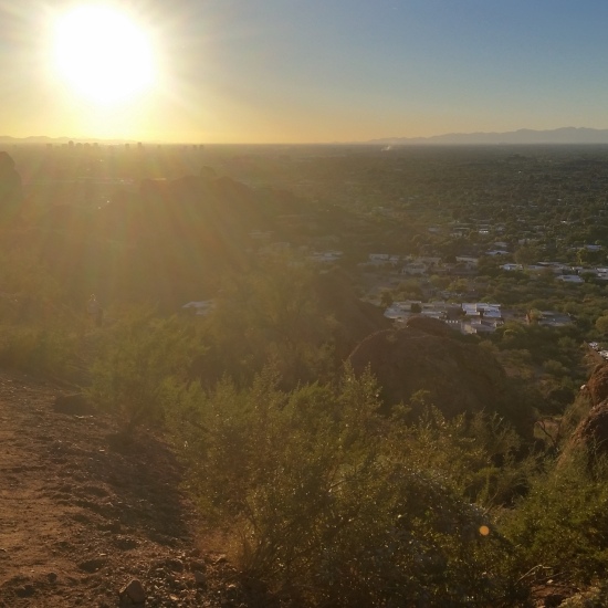
After the bridge it was all cake from there, just following the drainage trails to the summit where you get a great view of the surrounding desert (just try to ignore the hum of the I-10 trucks)! Breaking for a quick snack I chatted with a few other summiteers before heading back down the rock playing the “image there are no railings” game. What another awesome day and great hike; if you haven’t already done it, put this surprising different hike on your list of dirt to touch!
 Looking North from the Peak
 Headed to the Saddle
HIKE INFO:
http://hikearizona.com/decoder.php?ZTN=65
HIKE STATS:
- Weather: Hi: 55, Low 45, Overcast
- Water: 0.5 liters
- Food: 1 Orange, peanut M&Ms
- Time: 1.5 hours
- Distance: 3 miles Round Trip
- Accumulated Gain: 1,400 feet
GEAR:
- Mule Camelback backpack (3 liter bladder)
CLOTHING:
- 195 Smart wool long sleeve shirt
- Cotton Handkerchief
- Running shorts
- Merrell Mid Moab Hiking Boots
- Arkteryx Hoody
- Darn Tough wool medium weight sox
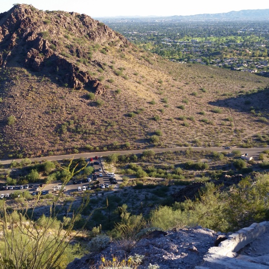
Squaw (Piestewa) Peak, Trail #300 – AZ (11.28.15)
Squaw (Piestewa) Peak is a great place to hike. It gets straight to work with its summit trail climbing 1100 feet in just 1.2 miles. If you’re a grinder and looking for good gain in short distance within the city limits, look no further.
The trail itself is much like the surrounding desert, rugged and tough. A years worth of trips to the peak will surely make quick work of any hiking boot you could throw at it. Sharp rocks jetting up reminiscent of Superman’s home world krypton create and line the trail to the summit.
I headed up the jagged trail with friends chilled from the 40 degree morning in shorts and a hoody. We quickly climbed hoping for sunrise to warm us, but the lazy autumn sun took its sweet time. We were all cold, but warmed as we pushed faster towards the top.
About one quarter the way up I placed my foot on a rock up push up and continue on, as I did my toe slipped from the rock face. With my hands in my hoody for warmth, I wasn’t much in the way of being able to catch myself. My left hip and soon my head slammed into the trail which was once beneath my feet. Startled by the swiftness of the fall, I jumped up and threw my hat back on my head and continued to push. The group all checked on me: Trail 1, Mike = 0. A little bloody, my bruised head reminded me to appreciate the trail and respect nature because it doesn’t always give hugs.
I love hiking, I love standing on a desert peak looking out across the expansive views of the southwest. Get outside, go explore, these aren’t the padded trails of the Northwest but they can be just as beautiful. See you on the trail!
HIKE INFO: http://hikearizona.com/decoder.php?ZTN=122
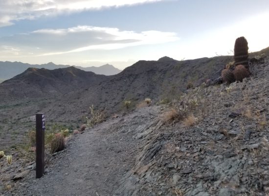
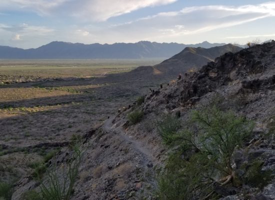
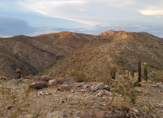
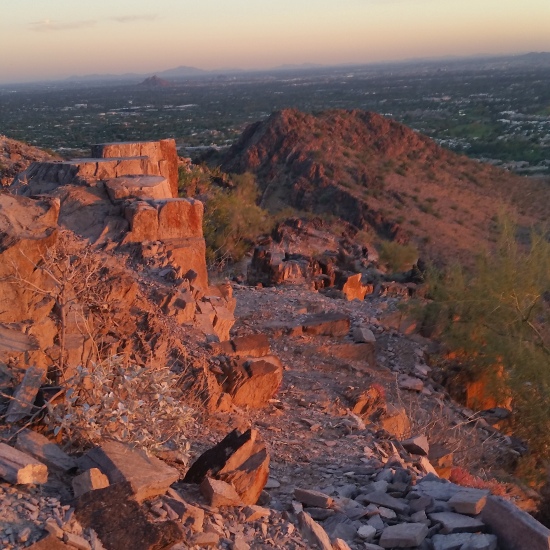
South Mountain Loop – Dust storm – AZ (9.3.15)
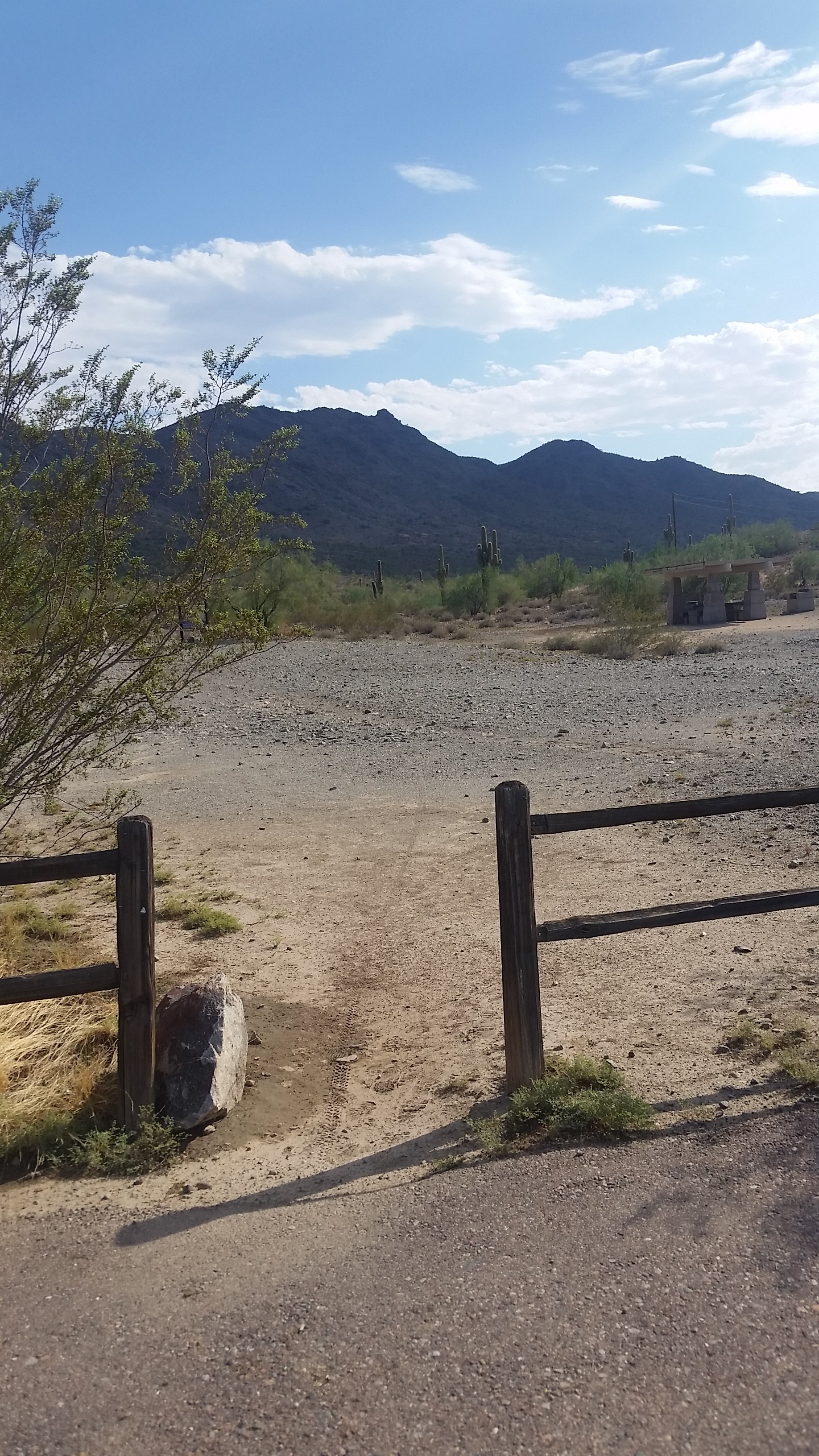
I headed to South Mountain after work, doing a quick training session for a nice 6 mile loop. This time of year means heat, dust storms, monsoons, or other malcontent weather that could deter any hiker from their trek. I was determined though and pushed up Ranger trail like it was my job.
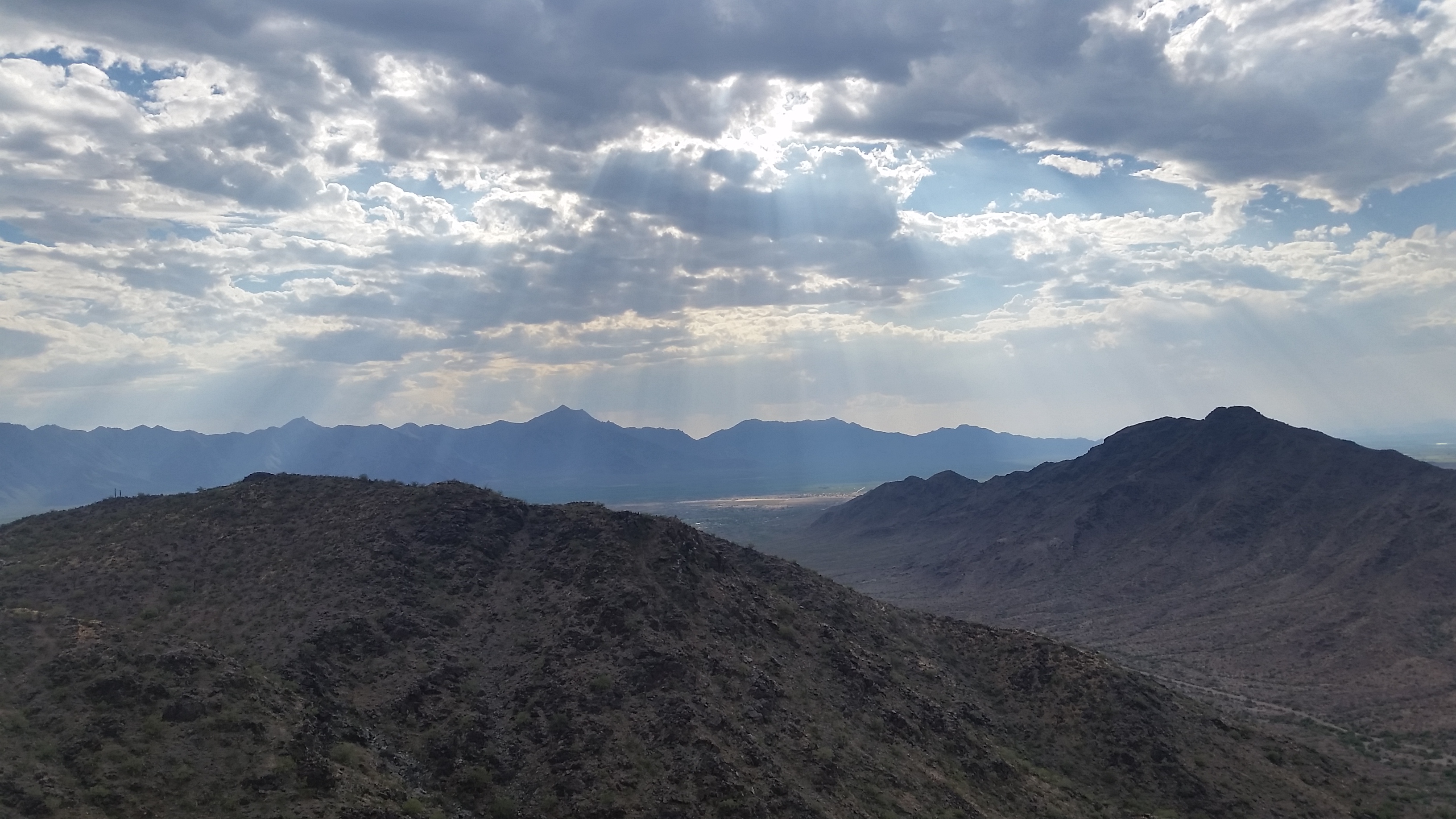
I peaked out on goat hill and took in the sun covered in the afternoon storm clouds, what a beautiful sight! I stopped for a moment to snap a few pictures when I turned to the south to take in the view. That’s when I saw the wall of dust, higher than the mountain headed my way. By the looks of it, (to my relief) it was a dust storm and not a monsoon that was accompanied with violent rain and lighting.
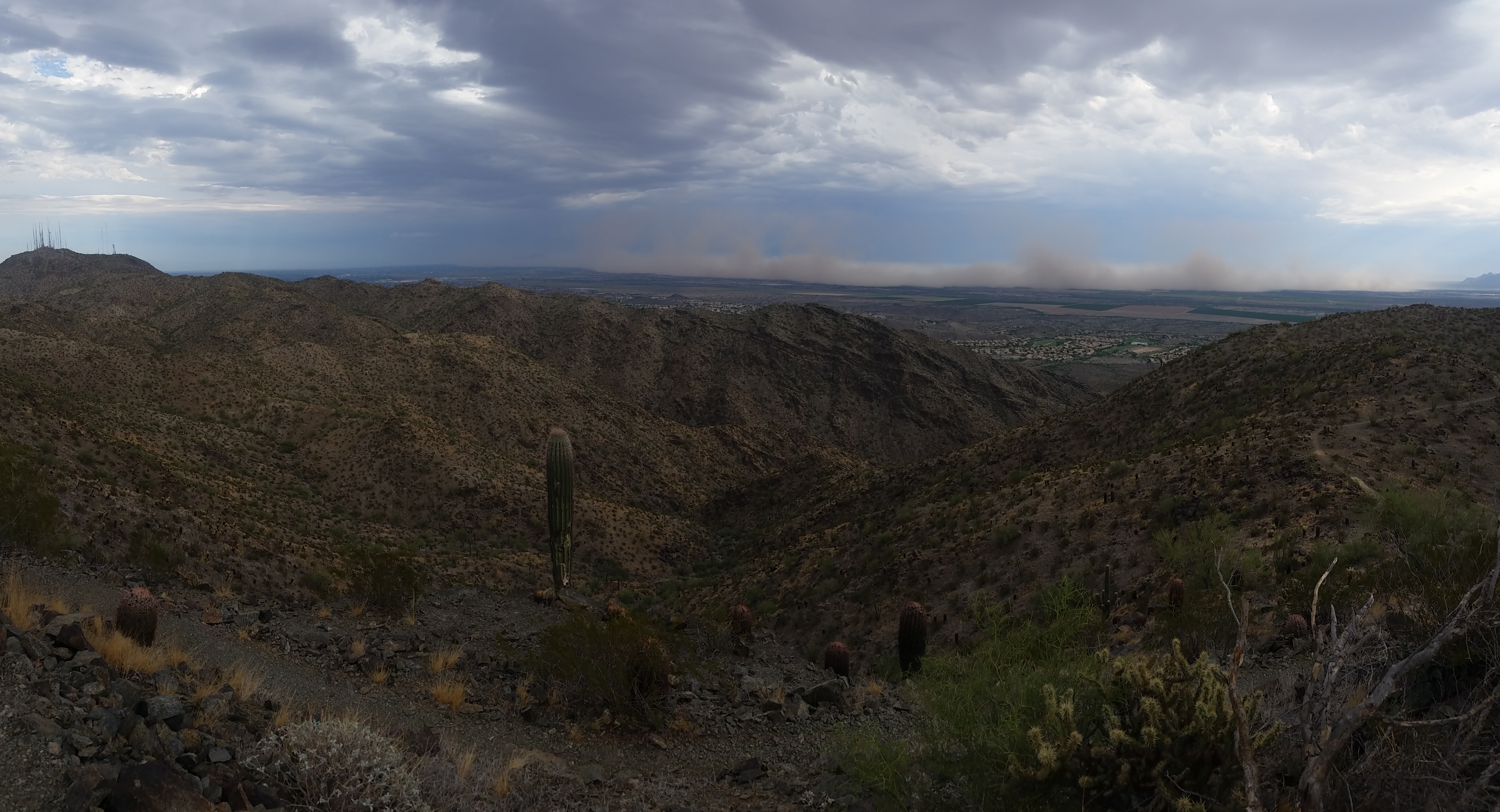
It was time to move! I trekked on, pushing through the loop I originally planned even though the threat of dust was headed my way. I figured without the treat of lightning I could put up with a little dirt in my face. I pushed hard and trail ran the whole way back to the truck (not much of a trail runner but hey a storm will give you motivation!), trying to suck down the least amount of dust as possible. Trekking on downhill I flew until I finally made it back to my truck. Dust still filled the air and I couldn’t see phoenix on the way down.
I love the trek here in phoenix, no matter the challenges of the weather. The storms here are an awesome force and mother nature is nothing but to be respected. Another awesome experience in the valley of the sun!
~~~~~~~~~~~~~~~~~~~~~~~~~~~~~~~~~~~~~~
Hiking Info: Ranger Trail to National to Goat Hill to National to Kiwanis to Los Lomitas
1 liter of water
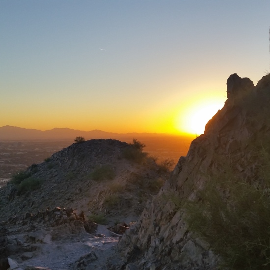
Monsoon on Squaw Peak – AZ (8.31.15)
I started hiking Squaw Peak (Piestewa Peak) just before sunset. As I started up I didn’t notice the Monsoon quickly rolling in from the east, my main focus was hitting the peak before summit. I hiked as fast as I could, focusing on the sun as it fell just beyond the mountains to the west. Minutes after the sun set I gained the peak. When I finally looked back to get a full view, I was taken back by what can only be described as one epic sky.
The wave of rain and dust from the monsoon rushed across the valley swallowing the light from the sunset like some hungry bottomless monster. What a sight! Lighting surged through the cloud on rapid fire like a brain firing neutrons, i knew it was time to roll! I bolted down the mountain in a hurry trying to reach my truck before the downpour reached me. Rain in the desert is a rare incredible event, one of the only times the desert gets its thirst quenched. The monsoon would give life to the once seemingly dead wildlife browned from the summer sun. Everything here has evolved to survive, adapt to such a harsh environment. Its truly incredible to see such a beautiful thing happen. Another awesome day on the mountain!!
HIKE INFO:
http://goatmanmike.com/2014/11/piestawa-peak-squaw-peak-11-10-14/
http://hikearizona.com/decoder.php?ZTN=122
South Mountain – Hidden Valley Figure Eight (5.7.15)
There is something about South Mountain Phoenix City Park that I just love. Just minutes from phoenix you can feel secluded, away from the hassle and bustle of the city, but still be close enough to peer back and appreciate whats in your back yard. South Mountain is the largest municipal city parks in the county, home to a ton of official trails, and plenty of un-official ones. South Mountain is a Choose Your Own Adventure best kept hiking secret in the Phoenix Valley. And I really dont mind it that way, get outside, live a little! Your mind and body will thank you.
Hike Info: http://hikearizona.com/gps=854
- Weather: Hi mid 80s, Low in the low 80s, bluebird skys
- Water: 0.5 liters
- Time: 2 hours
- Distance: 4.6 miles loop
- Accumulated Gain: 1,200 feet
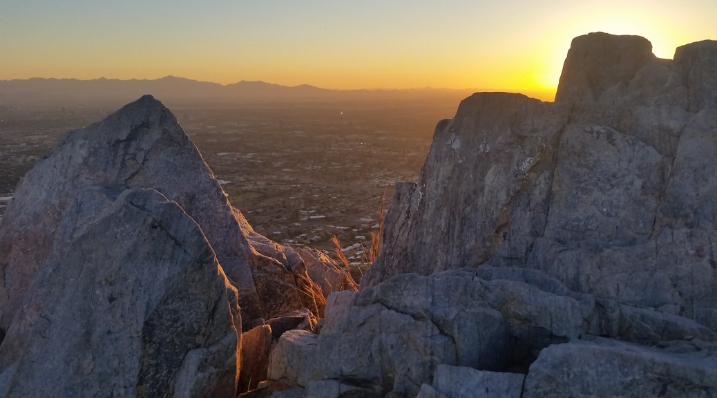
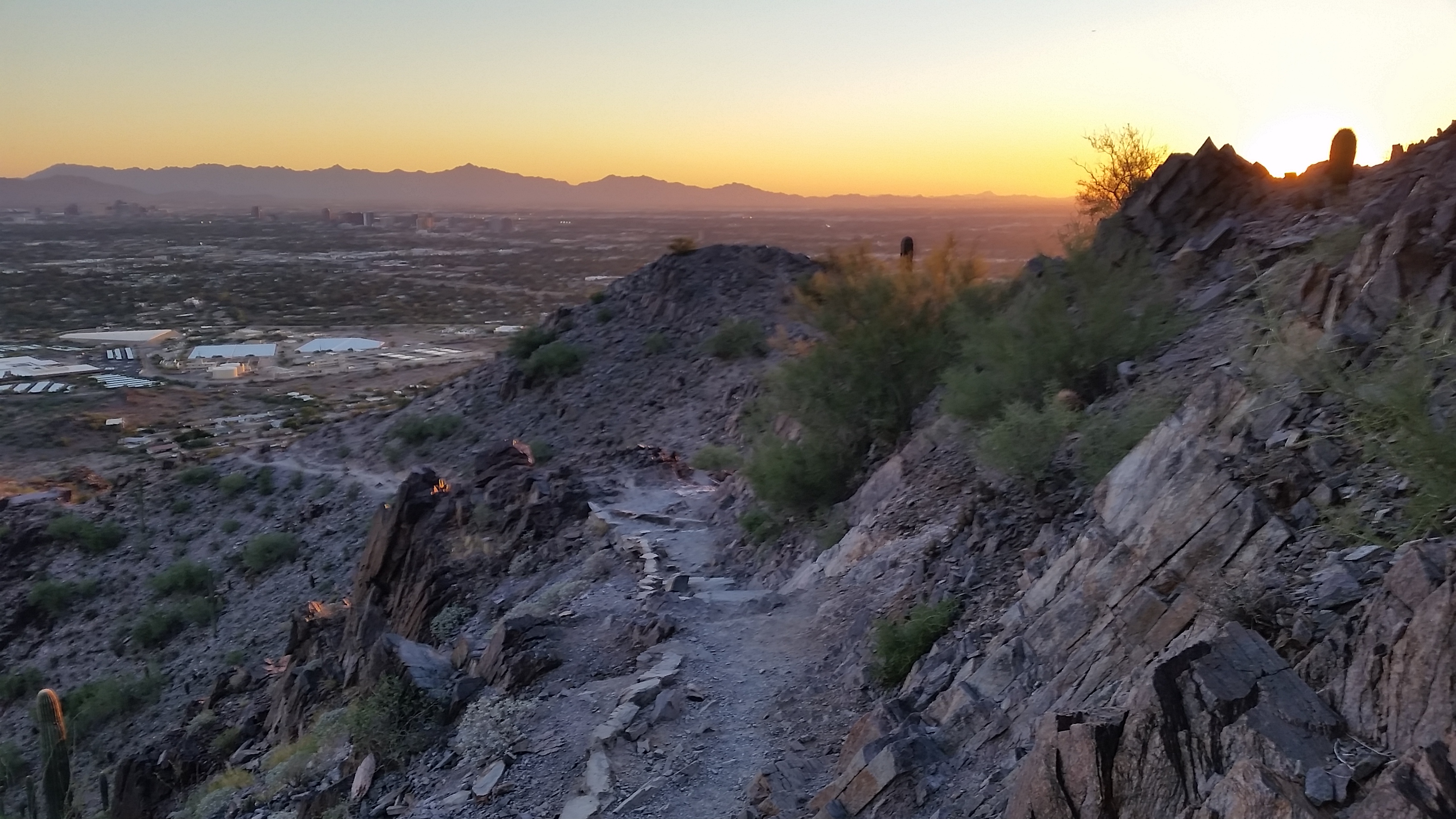
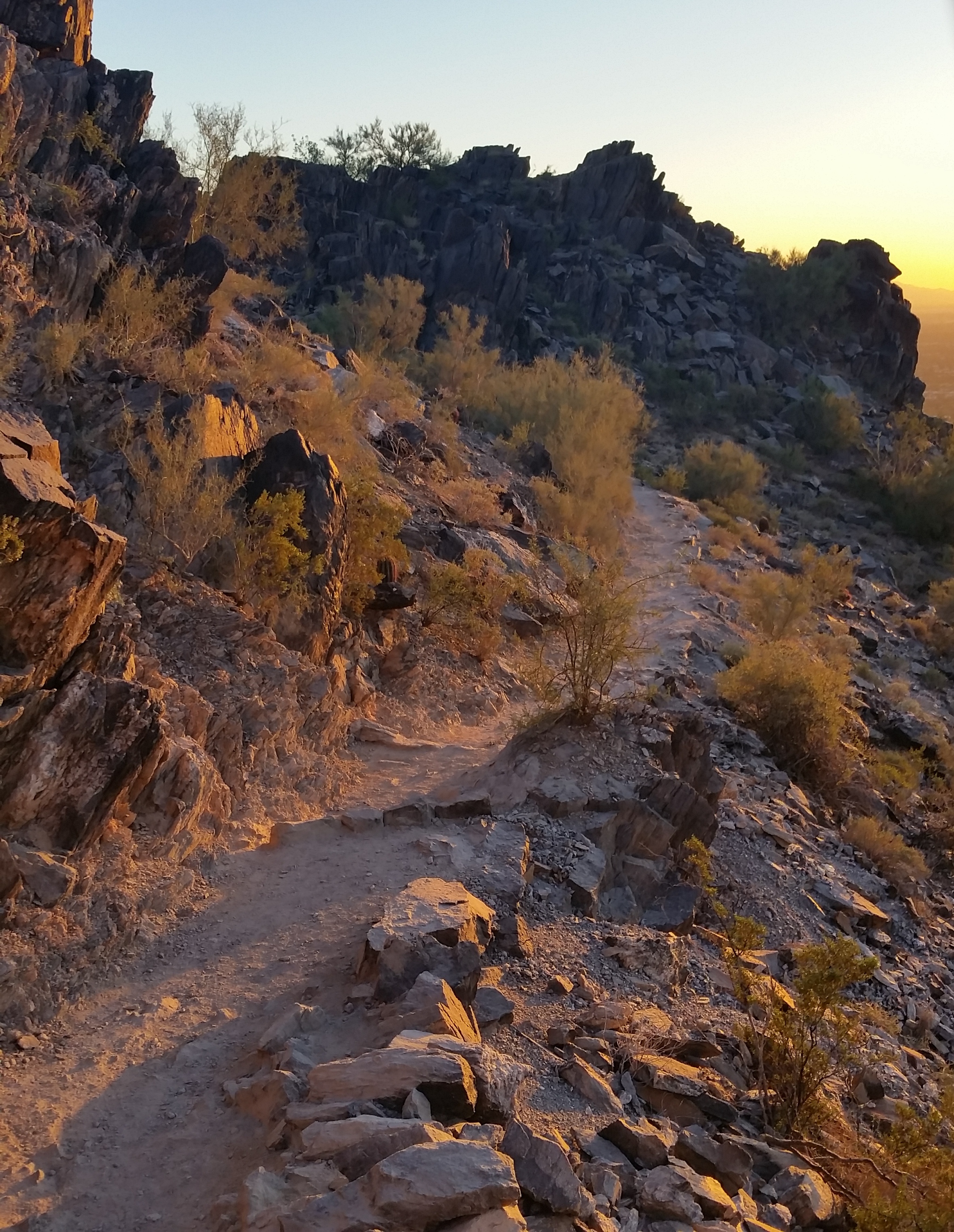
Piestawa Peak (Squaw Peak) – 11.10.14
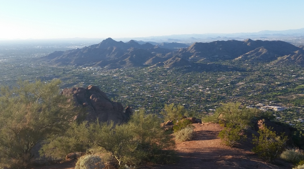
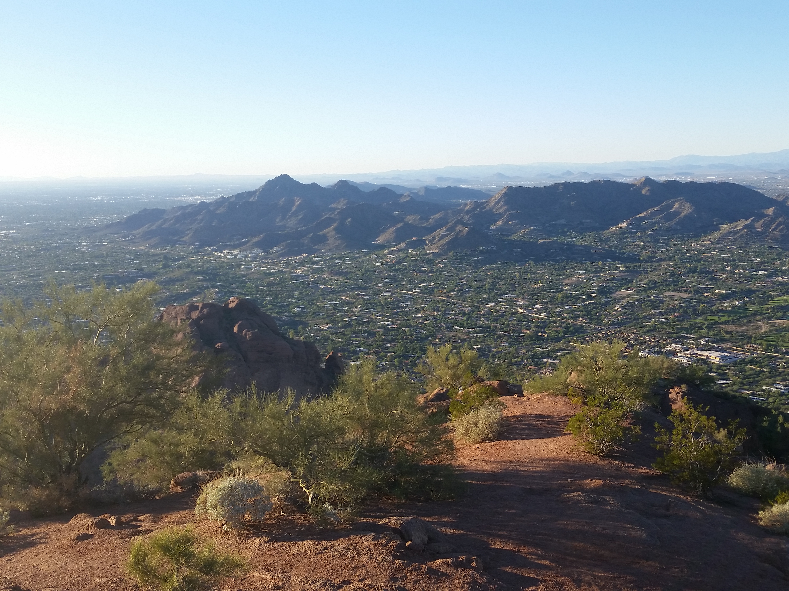
 Phoenix has some of the best sunrises and sunsets I’ve ever seen! There are long, open landscapes interrupted only by rising mountain ranges, which stand like sentries watching over the desert valleys. Once you ascend one of these mountains, you are presented with a view that words can’t describe and where pictures don’t do justice. Get out there and experience it if you have the chance!
Every once in a while, you have to pull out your stopwatch and see how you measure up to the time-trial hikers (curiosity killed the cat right?!). I haven’t timed myself in quite a while. It’s mainly because I go to the mountains to lose track of time, not to become ruled by it. However, after hearing friends boast about their summit times, curiosity got the better of me. Let’s just say I’m no Usain Bolt, and I’ve come to accept that there is always someone out there faster. I am content with beating my own time, trying to be better than I was the day before. That being said, sometimes it’s nice to know I am not the last guy up the mountain pushing for time.
I pressed hard for the peak. At the summit and on the way down, I was rewarded with the opportunity to see a gorgeous sunset. I find myself struggling to put the camera down when the light is just right. There’s just something to rocks that look blue against the orange, yellow, and reds of a fiery Phoenix sunset. Another awesome hike, I am so glad I have the chance to do this!
 Phoenix in the distance
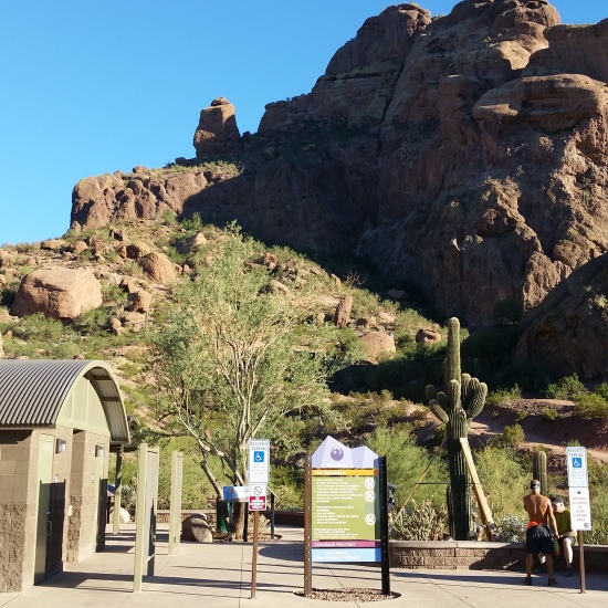
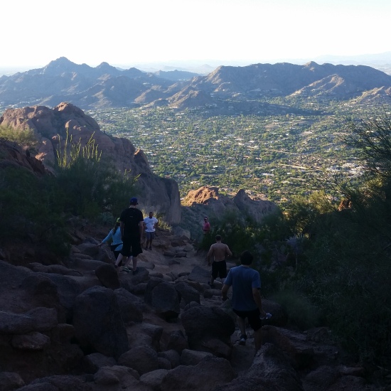
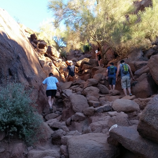
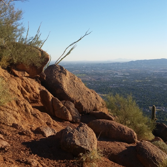
Camelback Mountain – Echo Canyon Trail – 11.06.14
Echo Canyon trail is one of the most frequented hikes here in Phoenix AZ. People are looking for a challenge, and they will find it here coming it at 1300 feet of gain in 1.1 miles! During the late Fall/Winter/early Spring weekends this mountain looks like a gang of ants at a picnic, people crawling everywhere! Everyone’s on the mountain for their own reasons, and I have no problem moving over for those trying to enjoy some outdoor goodness!
I started out this hike just trying to go a slow jam, figured I had been getting a good fill of trails during the week and I could take a chill day to peak out. For some reason as soon as I get on an incline I subconsciously switch over to grind mode and get after it, today was no different! I love pushing hard for the summit, then going slow on the downs enjoying the views and saving the knees.
The trail isn’t too hard to follow (well signed as seen in the slider below) and if you go at a popular time of year you can always just follow the other people on the trail. There will be many times you look up and think “oh the top must be right over that hump”, then you finally top that hump only to find another formidable uphill staring you right in the face! If your heart isn’t pounding out of your chest at the end of this uphill then you must be something other than human! Great views all along the way, and I was lucky to arrive early enough in the afternoon where it wasn’t too crowded. Bring some water and your guts; you’ll need it for this city mountain park trek!
Hike Information: http://hikearizona.com/decoder.php?ZTN=21
 Echo Trailhead View
- Weather: Mid 70s, Sunny
- Water: 0.5 liters
- Food: 1 Nature Valley Peanut butter granola bar
- Time: 1- 1.5 hours round trip (didn’t time it)
- Distance: 2.3 Miles round trip
Squaw Peak (Piestewa Peak) – Phoenix Mountain Preserve – Summit Trail 300 – 11.05.14
Another beautiful day for a good hike up a mountain!! Piestewa Peak is another one of my favorite weekday training hikes in the Phoenix area. I say training, but this peak is nothing to take lightly! It has 1200 feet of gain in 1.2 miles, a grind hikers paradise with 1000 feet of elevation gain per mile stats.
I set out right after work, hit the house, changed, and jetted for the mountain. Temps were in mid to high 70s another perfect day! My usual motivation is to push very hard for the peak and then take it slow on the down, saving the knees and taking in the scenery. The mountains are my way of staying in shape so I love to find a tough peak to bag and really getting after it. Today was no different
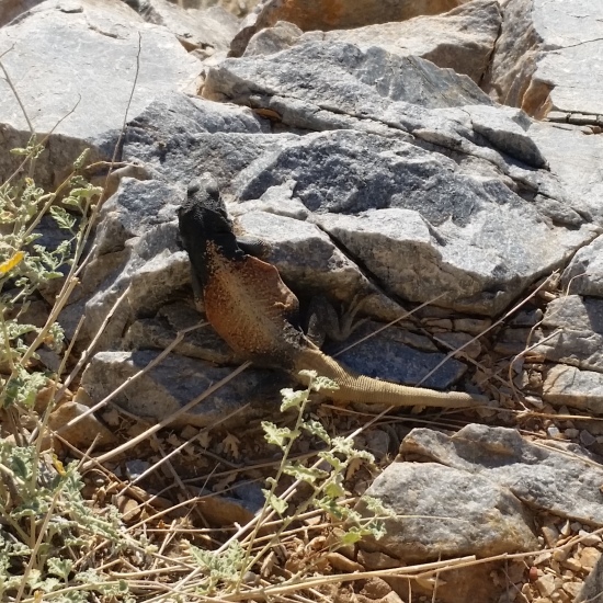
Once I peaked out I had a nice chat with a couple who were trail runners just taking in the views for the day. A Chuckwalla (seen in slider below) poked out just below the peak to get some sun and do a few masculine push-ups claiming his territory and showing off for the ladies! After some pictures and a quick breather I headed back down taking plenty of pics and pausing to watch the sun begin to set over the city at the many lookout points along the trail.
this mountain reminds me of Superman’s homeland (Krypton) with the way the rocks protrude from the mountain, very cool geology. This hike is pretty much a stair-master on the side of a mountain! Get out and check this peak out if you haven’t yet!
 Trailhead
Click for Enlarge View
Hike info: http://hikearizona.com/decoder.php?ZTN=122
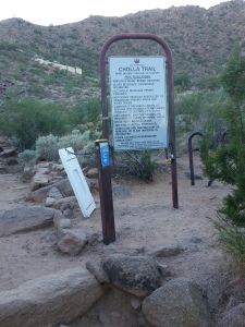
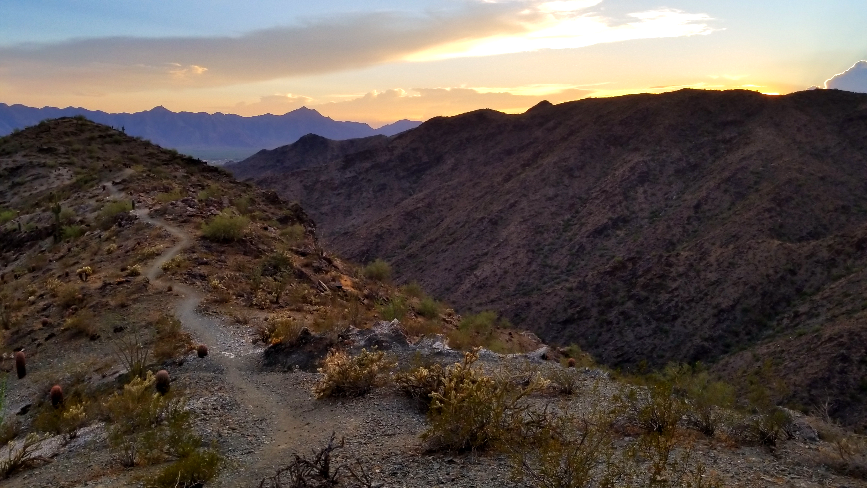
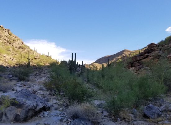
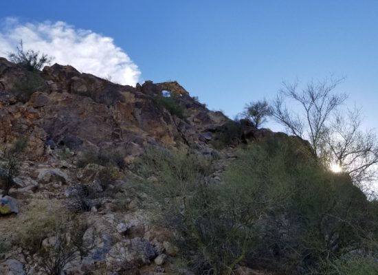
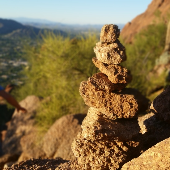
Cholla Trail – Camelback Mountain 11.03.14

Hiking is definitely back in full fashion in Phoenix seen my the number of people drawn to the trails like moths to the flame. The temperatures were strangely cool on this afternoons climb (cool for Phoenix haha – low 70s).
Camelback is one of my mid week training hike destinations. You can get some good elevation gain in short miles and its close to the city. Cholla walks a ridge to the peak from the East side of the mountain heading North West towards the peak and is broken up into 2 sections: a lower steady incline that can really get your cardio going, and an upper section which becomes a little more climbey (my fav part).
Cholla is stretched over 1.3 miles from the road side parking to the peak with about 1300 feet of gain. 1000 feet of elevation gain per mile is my kinda trail!!! Cholla’s big brother (Echo Canyon trail – Other summit trail on Camelback Mountain) boasts the same elevation gain in only 1.1 miles. Both trails are their own animal and are great opportunities to condition the body for big weekend endeavors.
Even though ive been up this trail a many of times I still enjoy finding ways to make it interesting and chatting other trail trekkers. Fun fact: There is an old timer that hikes cholla every afternoon (he rocks a white fisherman’s hat) that has completed over 2100 summits, just insane!!! No matter the reason, its always a good excuse to go climb a mountain!
This time of year the sun is setting around 5:45pm which makes for some gorgeous golden hour sunsets. Get out, check it out, you wont be disappointed!
Link for trail info: http://hikearizona.com/decoder.php?ZTN=28