
Category Archives: Superstition Mountains

Battleship Mountain – Superstition Mountains – AZ (1.22.17)
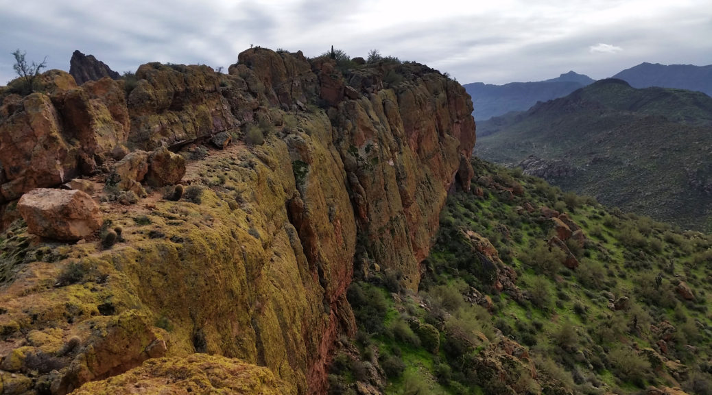
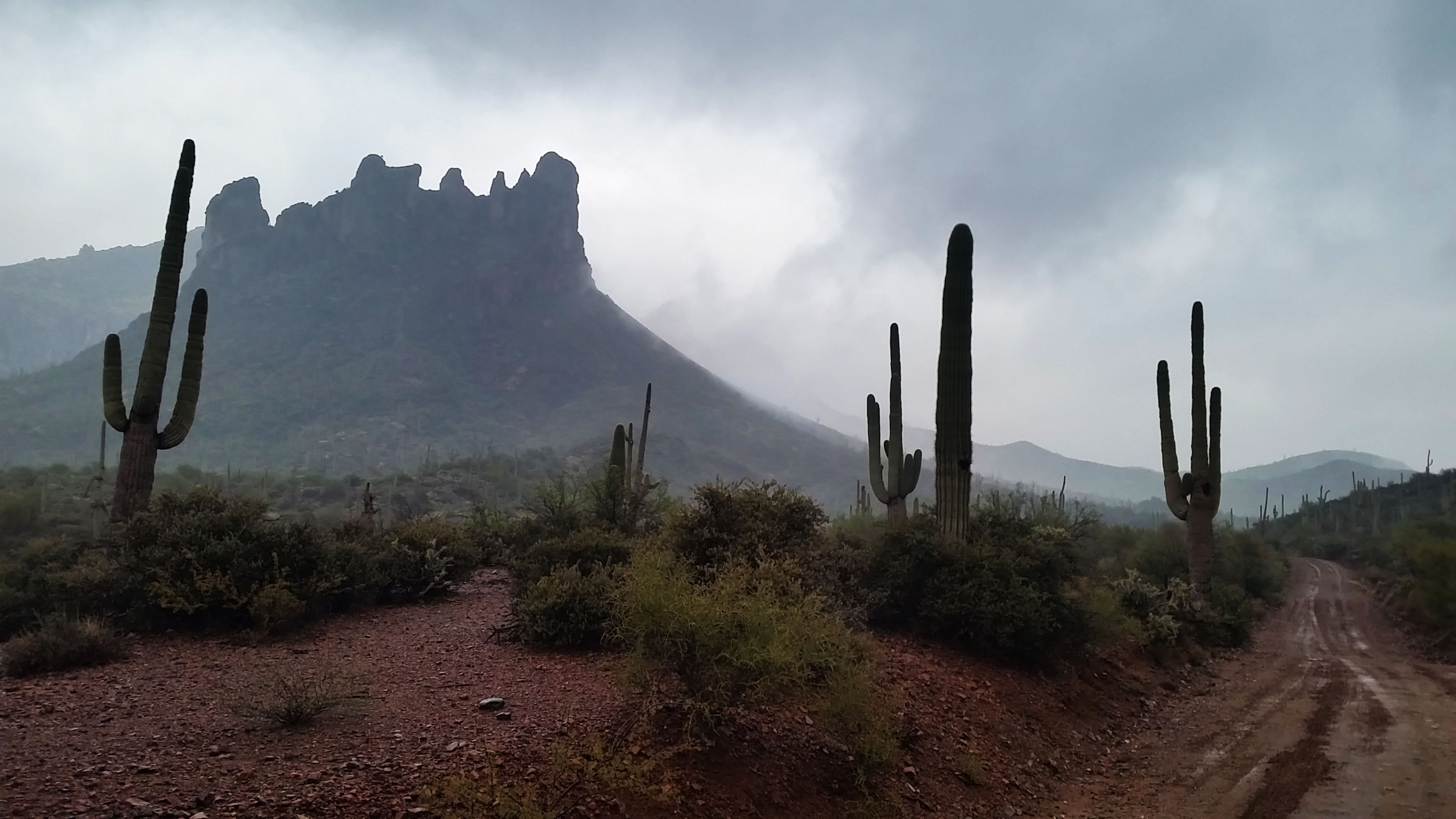
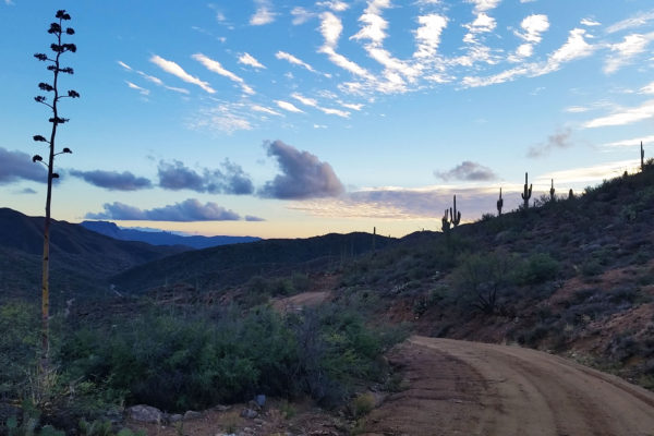
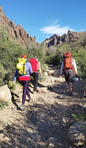
The Phoenix air was cool and brisk as I walked out the front door to meet Sam, Matt, and Mark to start the days trek. We threw our gear and ourselves into Sam’s 4Runner, ready to head towards the Supes in search for another adventure. It had been raining the last few weekends, which cut the option of rock climbing out, so instead we decided to do a nice hike/scramble to make up for it. The target for the day was Battleship Mountain in the Superstition Mountains. This route had been on my ‘to do’ list for quite some time, due to its “scramble” and position as a prominent feature of the Superstitions wilderness.
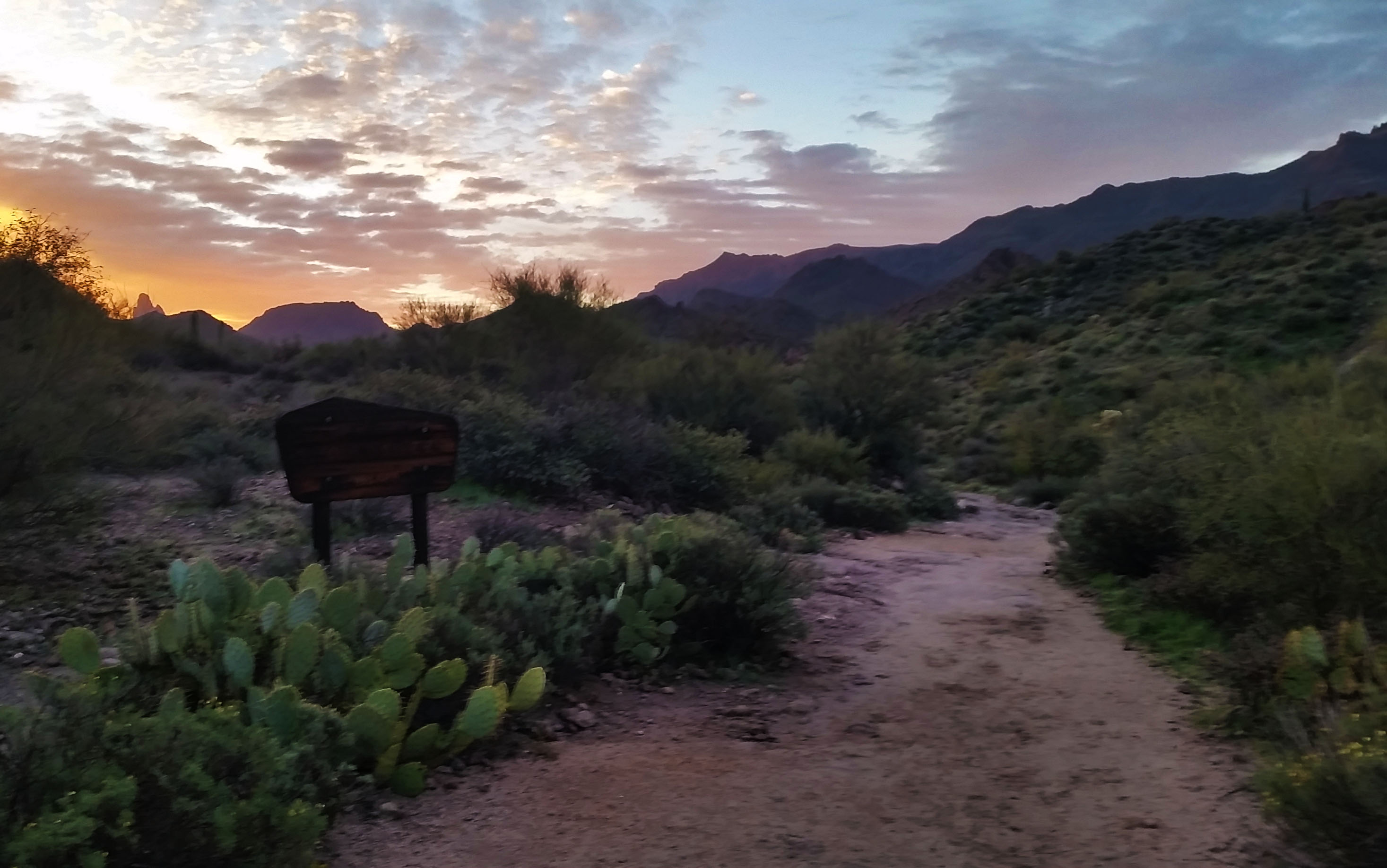
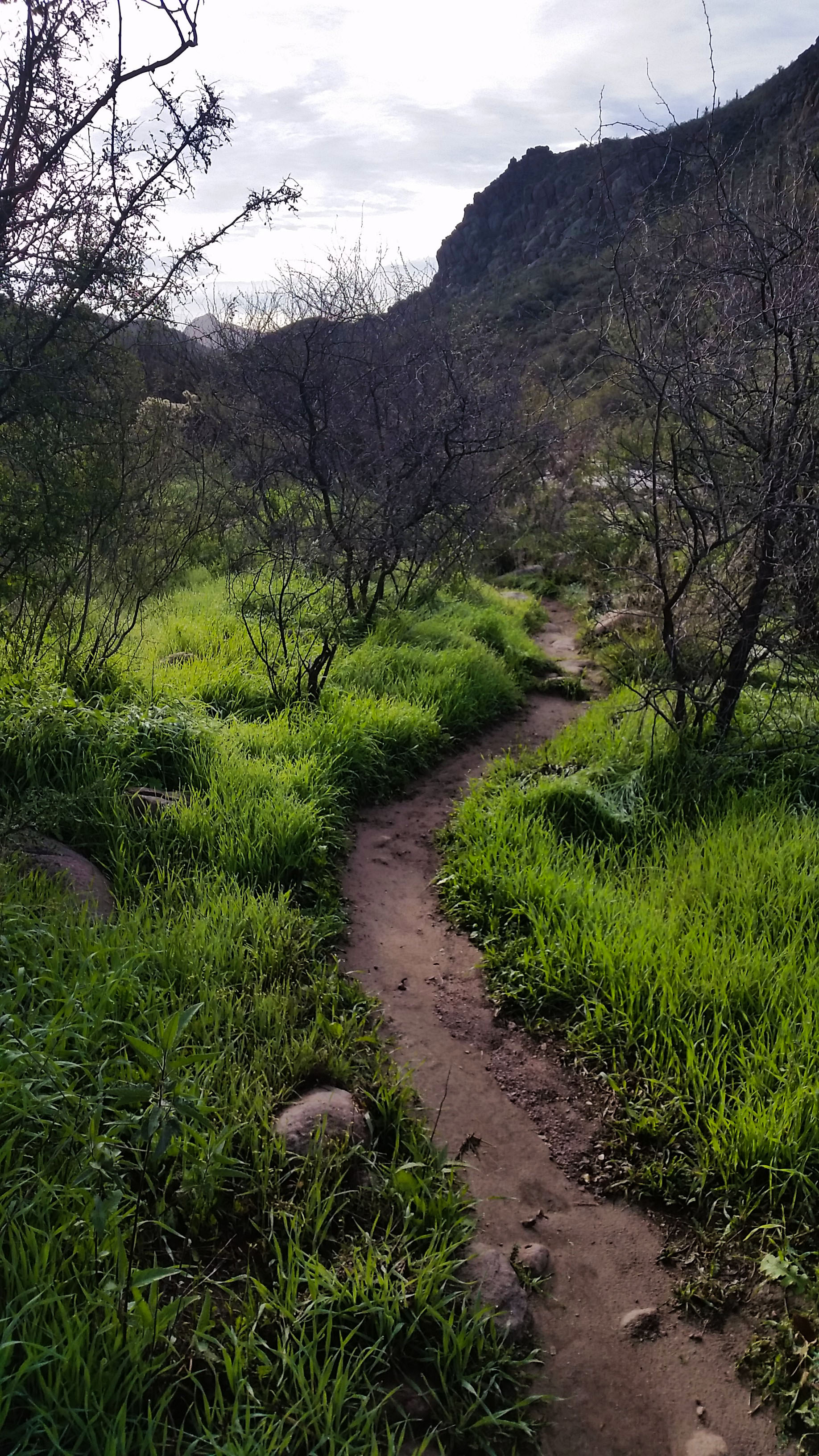
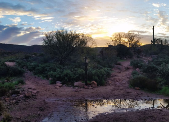
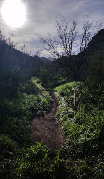
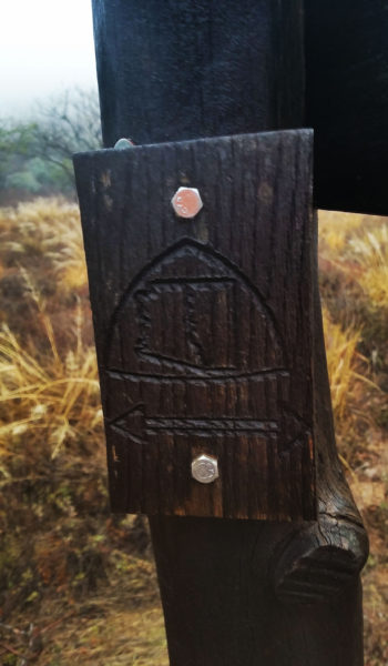
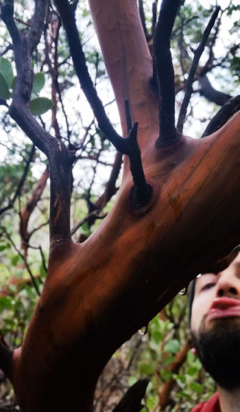
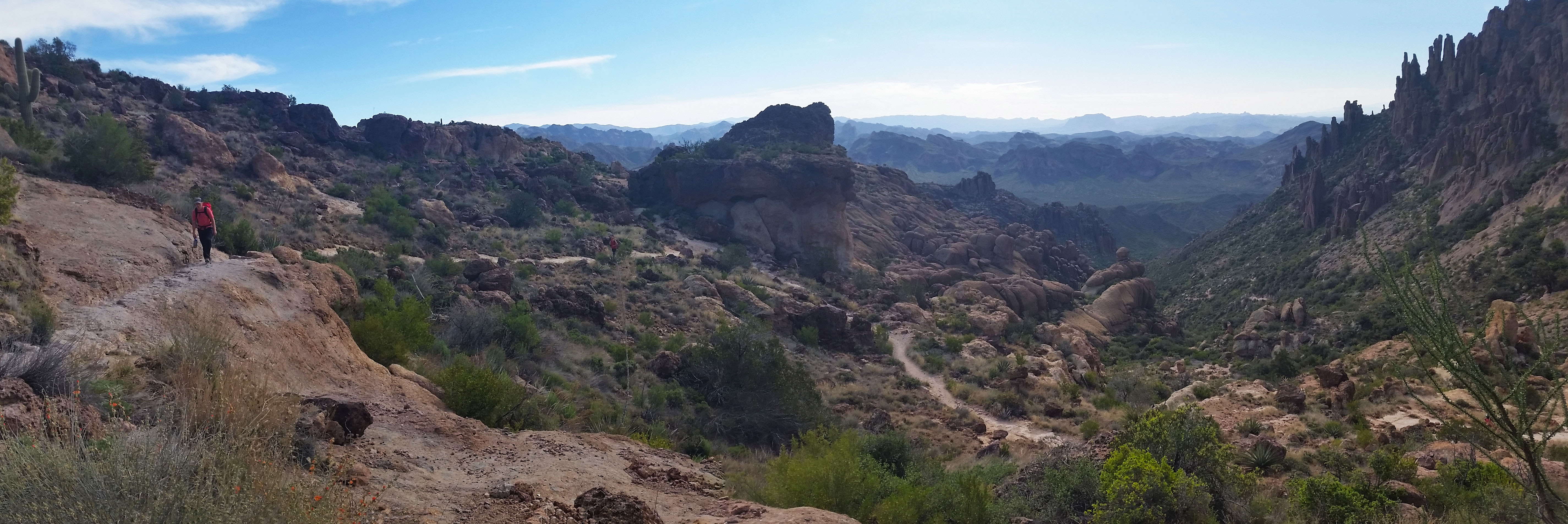
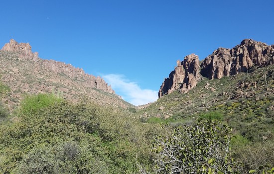
We headed to the trail-head, coffee in hands, chatting about the previous treks and what brought us all to Phoenix. The drive flew by and before we knew it, the car doors swung open, hoodies were zipped up, we were ready to put feet to trail. The sun was rising as we set out, but not quite over the mountains to our east yet. The golden haze filled the valley as we trekked forward. With all the rain, the Supes were alive with lush green color. We trekked the relatively easy rolling trail 236 through the Garden Valley. Golden sun, great views of the snow covered Tonto Mountains to the north, and the live breathing desert around us. What more could you want?!
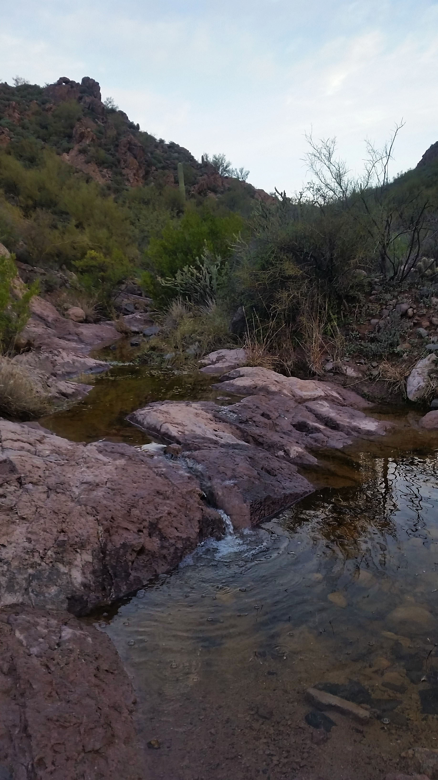
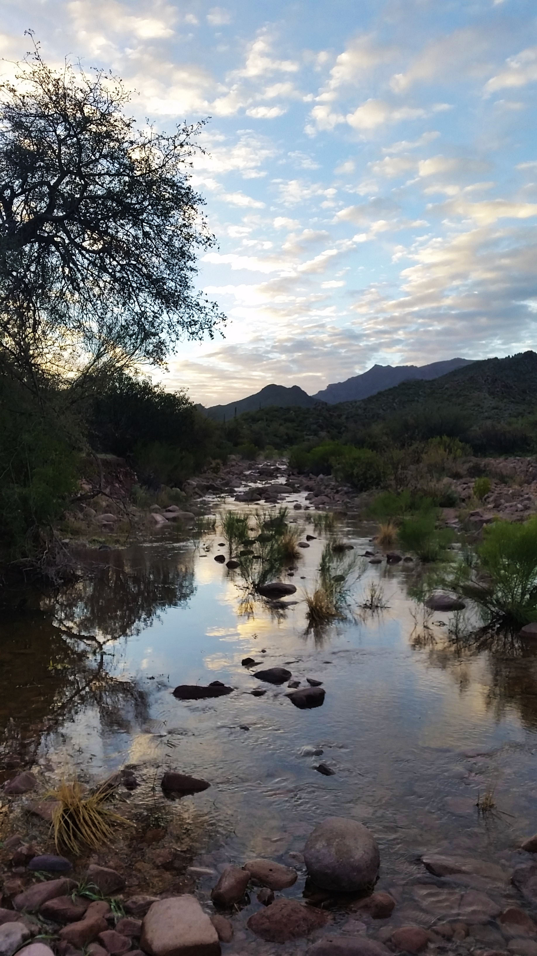
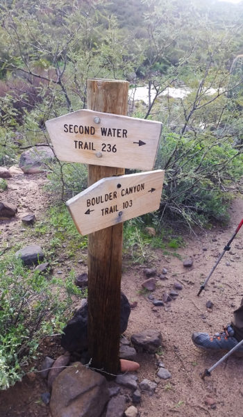
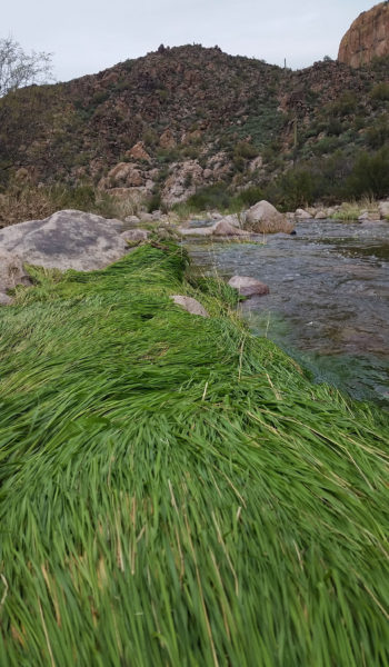
The trail was muddy in places, but as we hiked on the padded trail went from smooth to baby ankle buster boulders. We continued downhill until finally reaching the junction with trail 103 which wasn’t a trail at all, it was a raging creek! Undoubtedly, this was a byproduct of the weeks’ worth of rain. Green grass on the creek edge laid flat as a pancake as a tribute to the powerful flows rolling through just days before. We followed the trail to the southeast. Hopping from boulder to boulder, we attempted to stay dry.
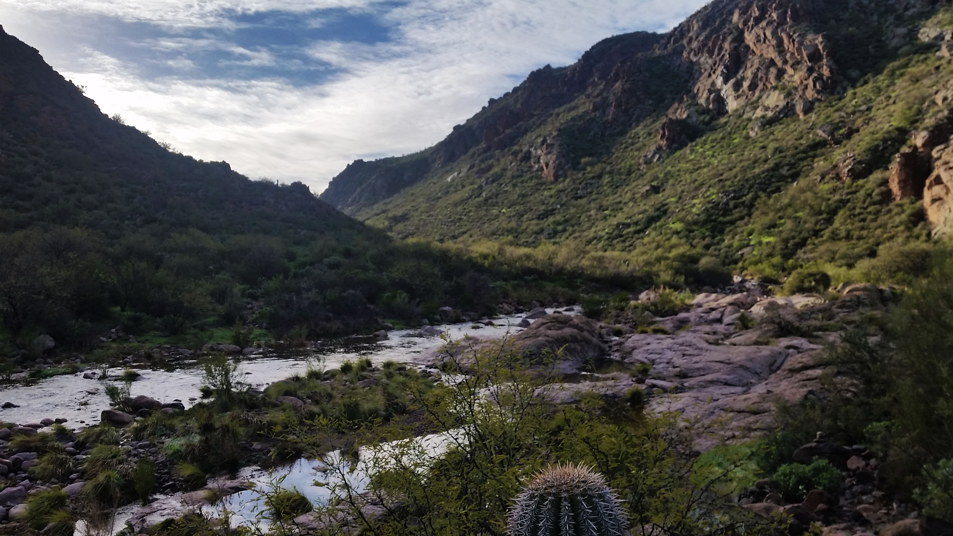
The temps were still cold, so I was like a cat on the edge of a pool, using all my will to stay dry. Mark and I crossed the river early where Sam and Matt decided to stay on the west side for some time. Almost to the other side I heard a large plop behind me. I turn to find Mark with his leg in a cascading waterfall up to his knee. A large rock had shifted (and not in his favor) plunging him into the creek. “Whelp there went that!” He trudged the rest of the creek without a care of being wet anymore. We made it to the other side and continued to find our way up the bank. Sam and Matt did the same, hopping from rock to rock until we all finally met back up further upstream. There was a good half mile of this silliness before we finally reached our turnoff: the end of the spine of Battleship Mountain.
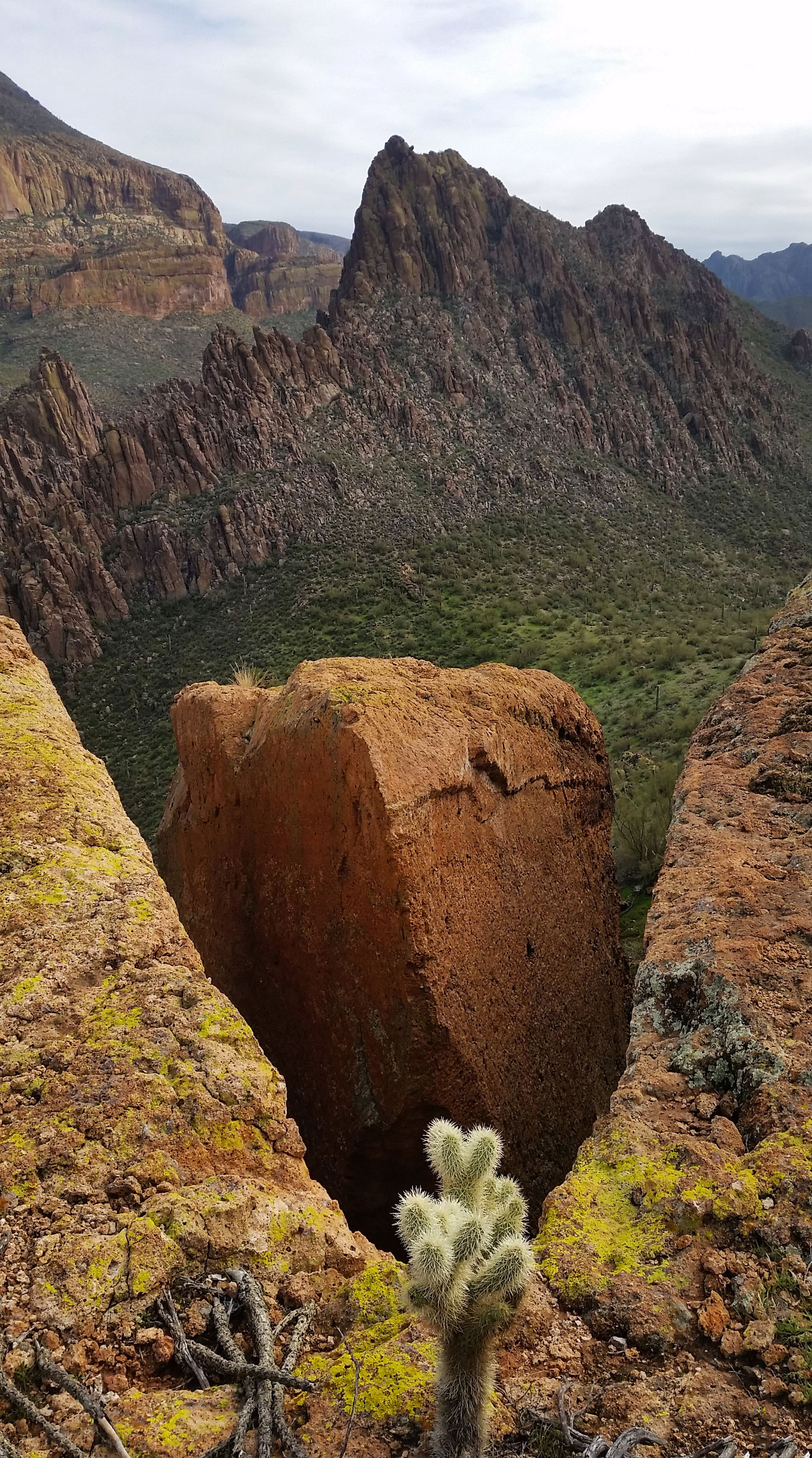
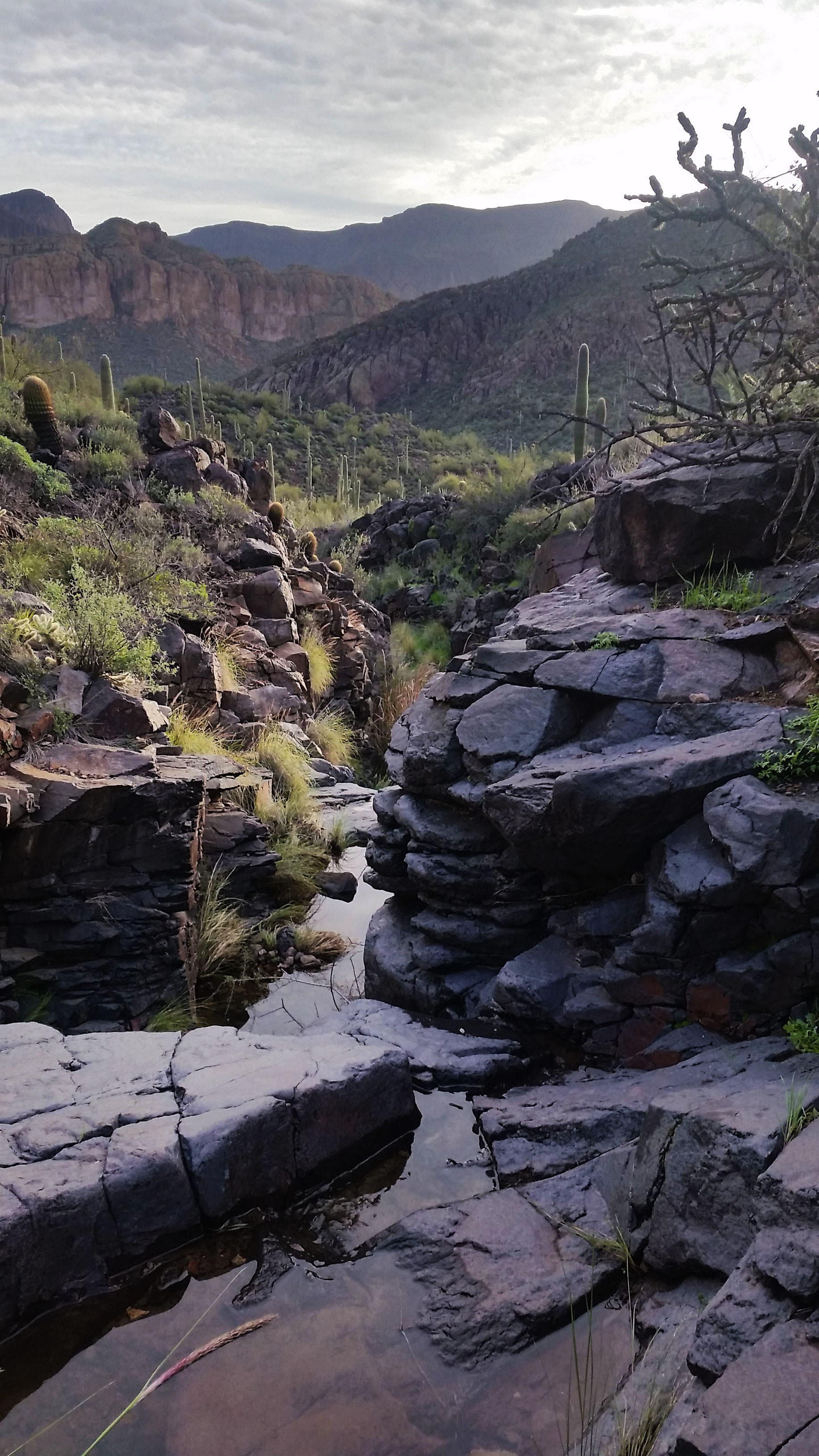
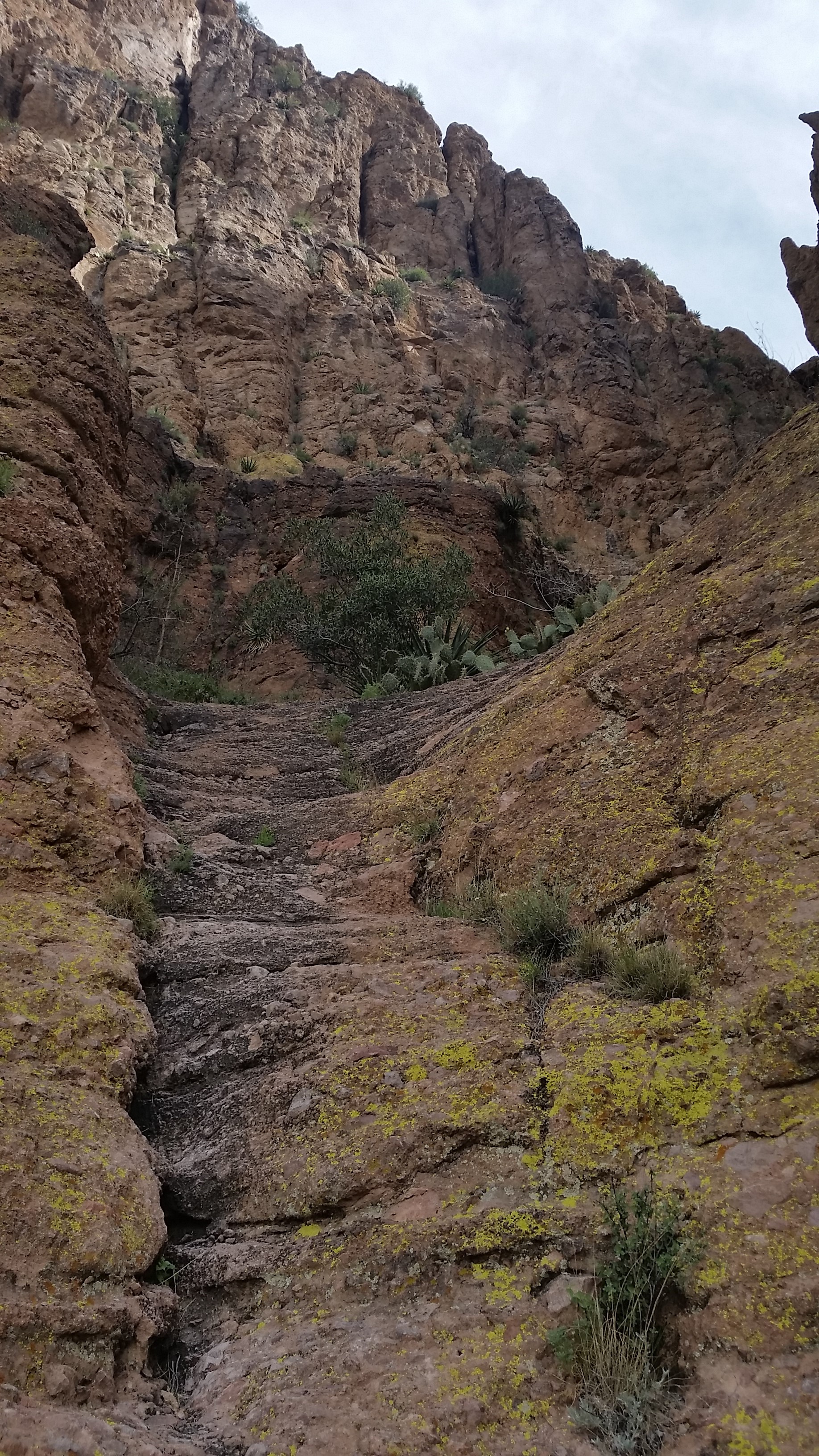
Happy to see a cairn or two headed uphill, and we got after it. We split from the creek and started to gain the ridgeline. I was tired of boulder hopping, and looked forward to the view of the surrounding area so the climb was much welcomed. We got made our way up the rock, and soon with hearts pumping and heavy breaths we gained the spine. We followed the cairns towards the head of the ridge-line and the summit. We would walk the ridge in some places, then get kicked off to the west in a small goat trail that bypassed a cliffed out ridge walk.
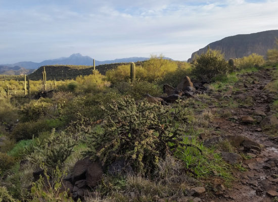
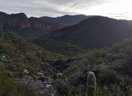
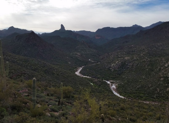
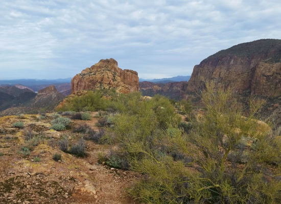
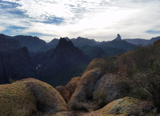
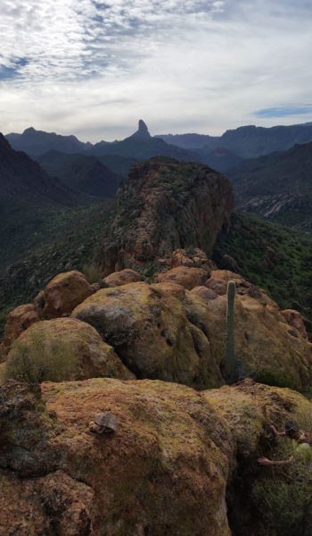
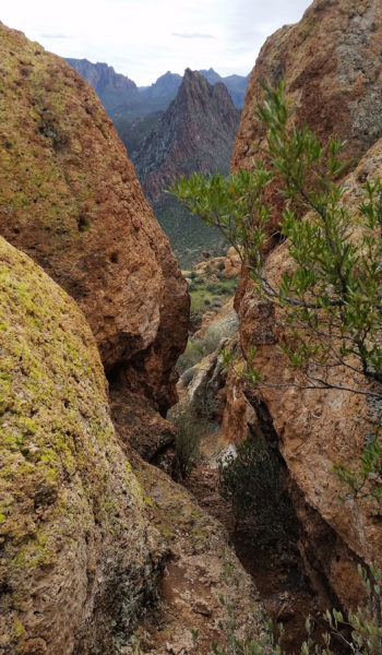
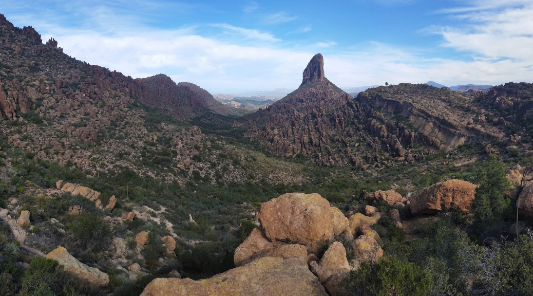
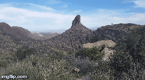
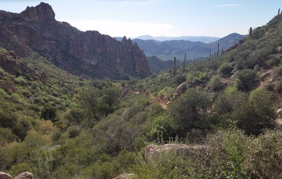
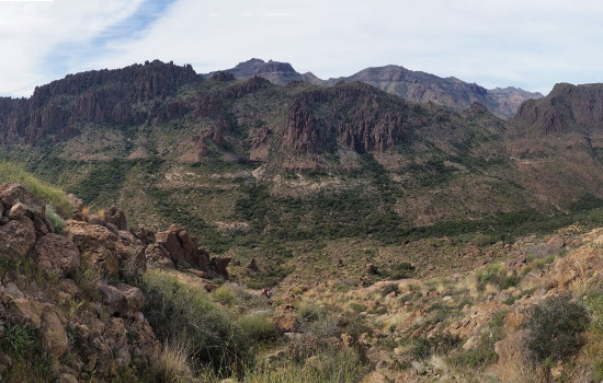
We pressed on to the first of three small climbs. After a short deliberation, we gained the face quickly and kept trekking towards the peak. The views were fantastic! The Supes were so green and alive. From the ridge of Battleship, you could see for miles, including the water that was everywhere. Canyon Lake, Weavers Needle, Flatiron, the Superstitions in all their glory! We paused looking at all the different formations surrounding us. The sights inspired fascination as to how they were formed and changed over time. Everyone was in good spirits and even some of the exposed scrambles didn’t seem to faze anyone in the group. Perhaps we were all too busy chatting and taking in the sights to notice.
After some good trail finding and a few scrambles, we found ourselves standing at the peak, simultaneously touching the highest rock with grins on our faces. We signed the registry, had a snack, and chilled for a while just taking it all in. It was so nice to be out there, amongst the rocks with some good dudes on a beautiful Saturday.
We turned back towards the trail-head and marched back the way we came. This time we had a little less regard for the cold of the creek and a few of us trudged right through. Mark and I couldn’t resist the 40 degree temptation at a neck deep pool on the trek back, so decided to get our Polar Plunge on. It’s definitely one way to wake up! Afterwards, we trekked our soggy selves back to the trail-head. Dried by arrival, we jumped in Sam’s 4Runner and headed back to Phoenix with another good story to tell in our pockets!
 Lets get moving!
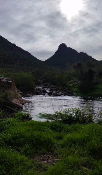
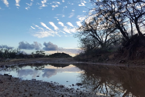
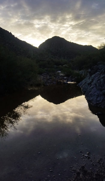 Morning View
HIKE INFO:
https://hikearizona.com/decoder.php?ZTN=261
HIKE STATS:
- Weather: Hi 70s, Low 50s, Sunny, Overcast, Sprinkled rain
- Water: 2.5 liters
- Food: 2 Protien Bars, 1 Cliff Bar, 1 apple, 1 bag of jerky, bag of salt and vennigar chips, PB&J
- Time: 6 hours
- Distance: 12 miles Round Trip
- Accumulated Gain: 1,200 feet
GEAR:
- Mule Camelback backpack (3 liter bladder)
- SPOT Tracker
CLOTHING:
- Cotton Handkerchief + Flatbill hat
- Smart Wool Long sleeve shirt 195
- Patagonia pants
- Merrell Mid Moab Hiking Boots
- Darn Tough Medium Wool Sox
- Arcteryx Atom hoody
Rogers Canyon – Superstition Mountains – AZ (12.23.16)
The Superstitions is such a special place. It is so rugged, raw, and the depths of which are hardly explored! My buddy Jason and I decided to do a nice day hike and hopefully see some Indian ruins in the process. The road to Rodgers Trough trailhead is an adventure all in its own. We headed out the night before in hopes to reach the trailhead, but we were thwarted by the Queen Creek running pretty deep from all the recent rain we had been getting.
We decided to camp for the night and wake in the morning in hopes that the creek would have gone down a bit, and the dirt road (which was undoubtedly a sloppy soup) could dry out a bit. We woke early, fired up the van, and headed back to the crossing. It was much better at this point and the rest of the drive to the trailhead went smoothly (although the road is anything but).
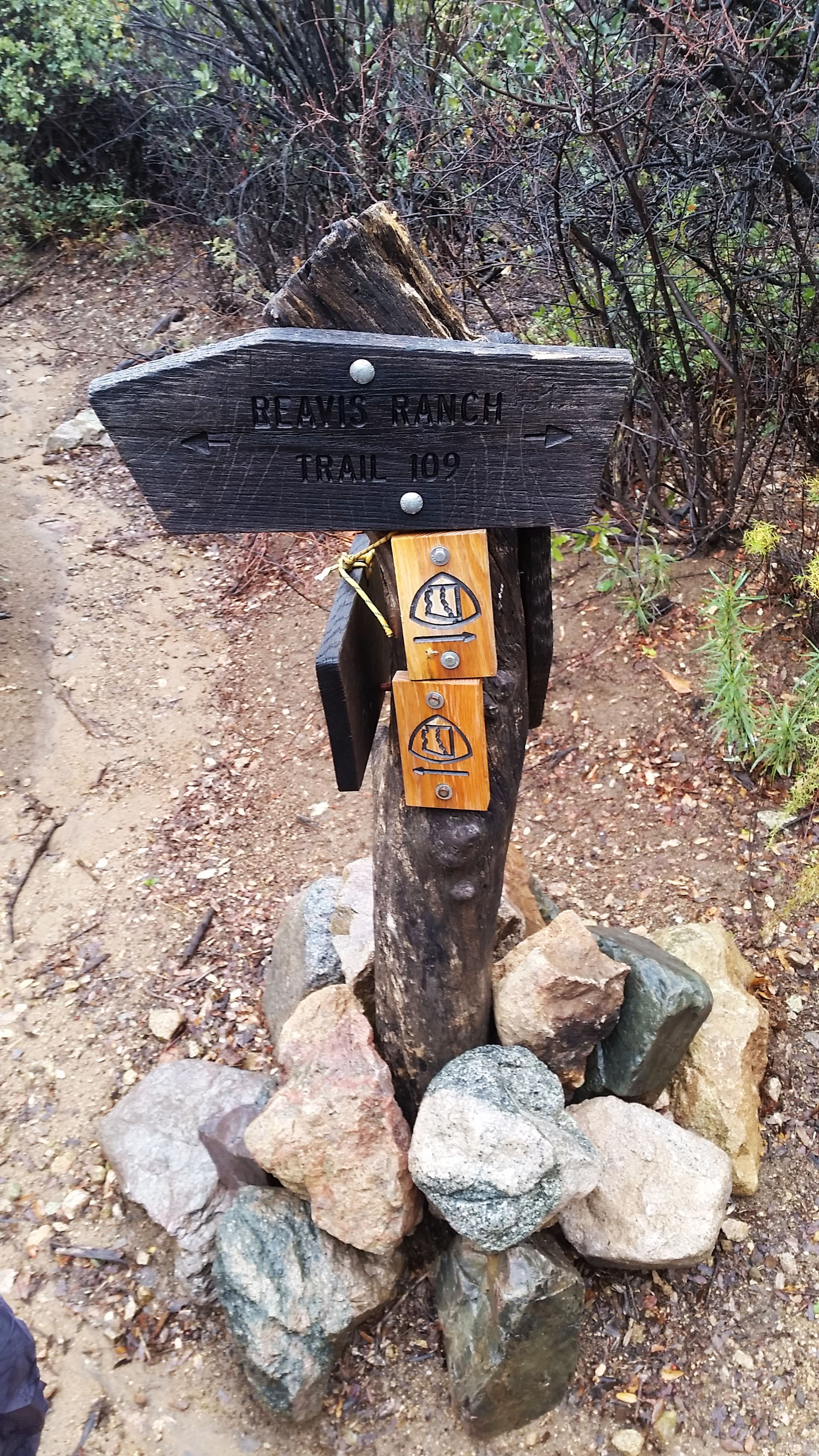
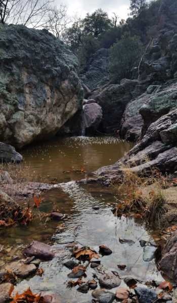
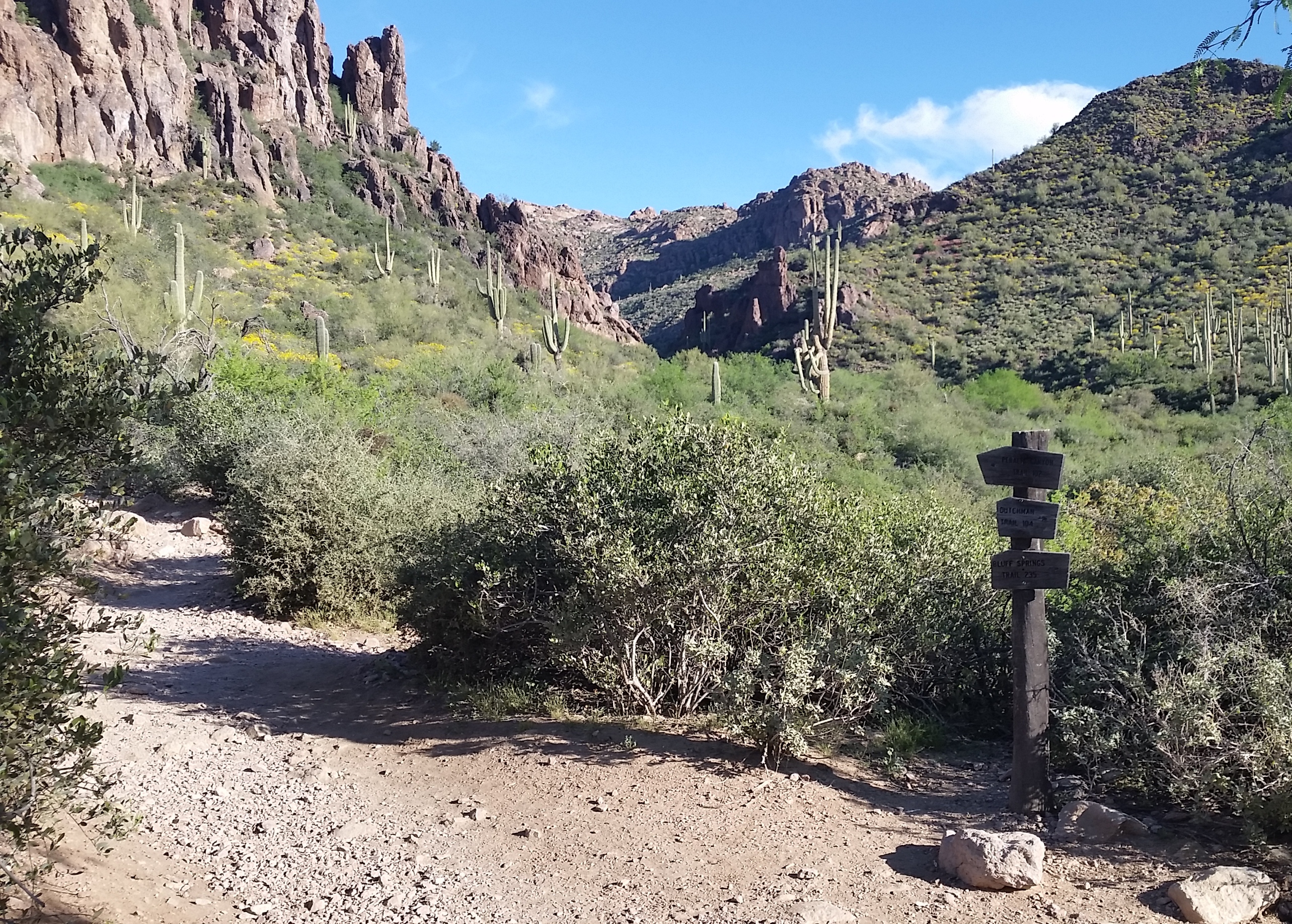
The sky threatened rain, and the clouds looked unwelcoming as we drove further into the heart of the Superstitions. After an hour or more we finally arrived at the trailhead. W grabbed our packs and rain gear and set out on the trail. Although it was sprinkling slightly it was a pretty nice day to hike. It didn’t take long before the dew covered trail side plants soaked our legs and pants. We trekked on further into the canyon until being dumped in the bottom where a small creek was running. We followed the trail, hopping back and forth until the canyon headed up and over the next hill. We made the junction for Rodger Canyon and we paused to admire the sign before headed west away from the AZT.
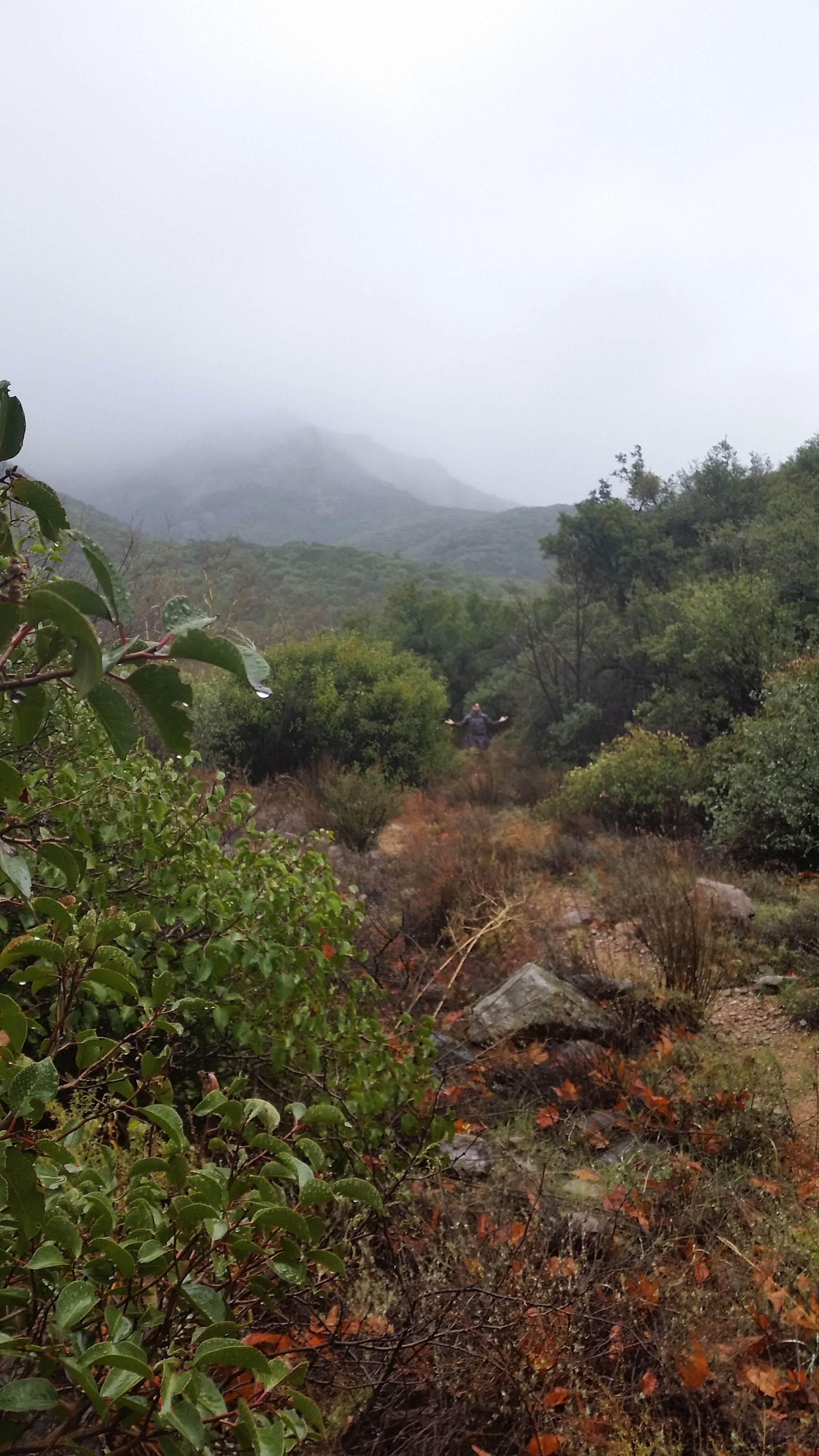
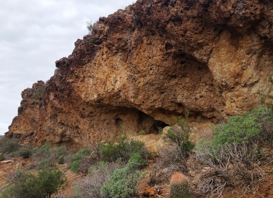
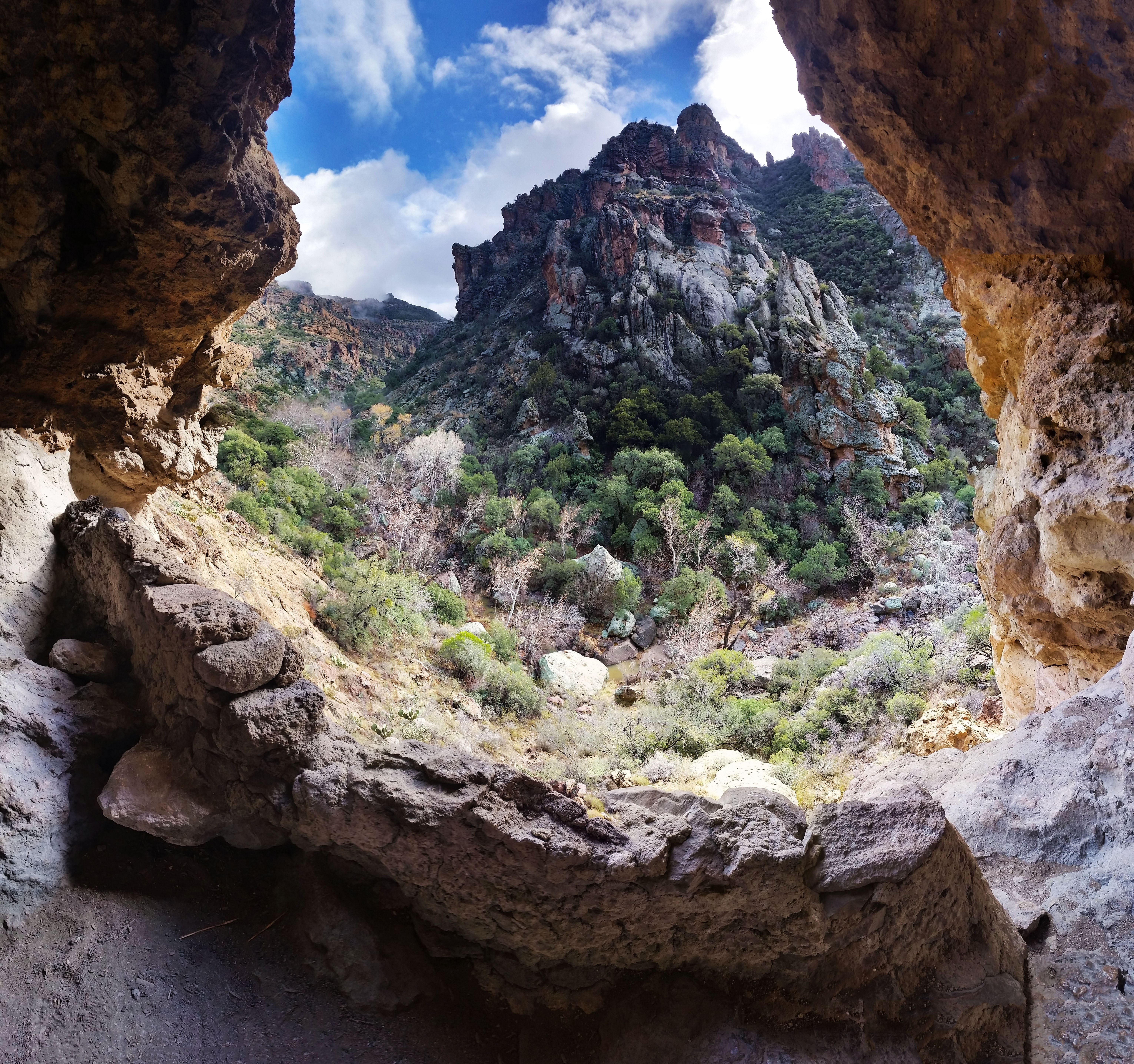
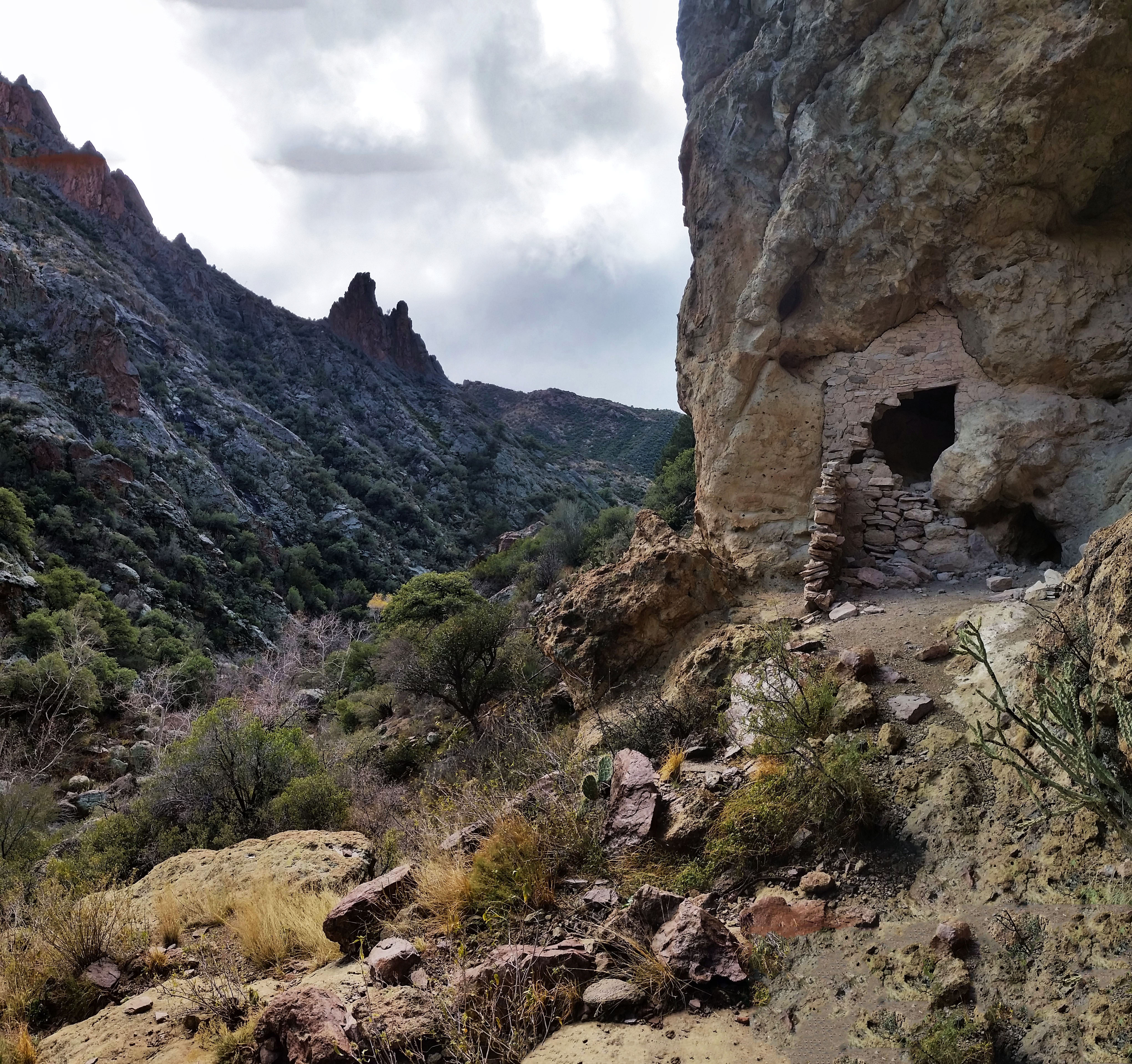
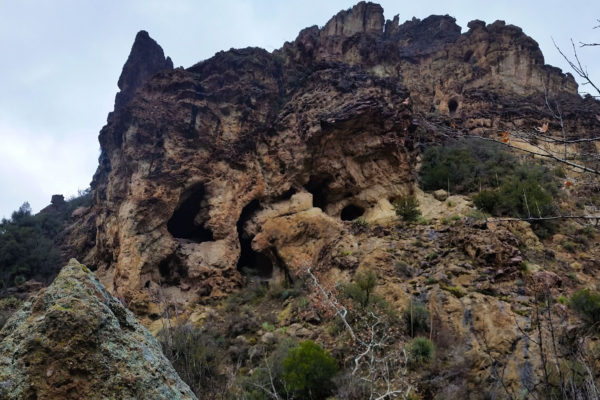
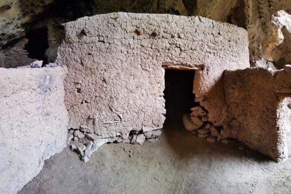
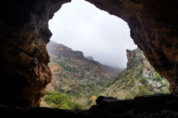
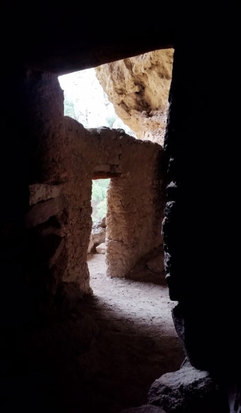
The trail was in pretty good condition despite the rain. We trekked on startling up a few deer and birds as we hiked. What a nice day, the overcast and cool temps were welcome as we pushed further. Finally after about 5 miles we reached our destination, the Salado Indian Ruins. I had been to this site before, but it was a bit of a surprise for Jason. We checked out the structures that stood for 600 years in total awe. We imagined what it was like to live in that time, what it took to survive there, how many people were in that small cliff dwelling, and of course, what actually happened to them.
We hung out in the dwellings for some time, had a snack, enjoyed the views, and finally the fog and the gloomy clouds began to give way to bluebird skies. The structures themselves were increduble. How the indians lugged that much rock, logs, and dirt up into the high cave was beyond me. I wondered how long it took them to complete just 1 room of the structure. How much food they would have had to gather just to feed the workers that labored on for days on end, perhaps months, to complete it. Thier fingerprints were frozen in time with the mud caked walls of the ruin. We could have stayed in the canyon forever, but we decided to get moving, back the way we came, towards the trailhead.
Back to creek hopping we went following the twisting trail back and forth heading out of the canyon. We turned a corner and 30 feet from us stood a huge 8 point buck. As soon as he saw us come into view, he and the doe with him turned and like lighting bolted up the canyon walls. It is always awesome to have that chance with nature encounters in the wild.
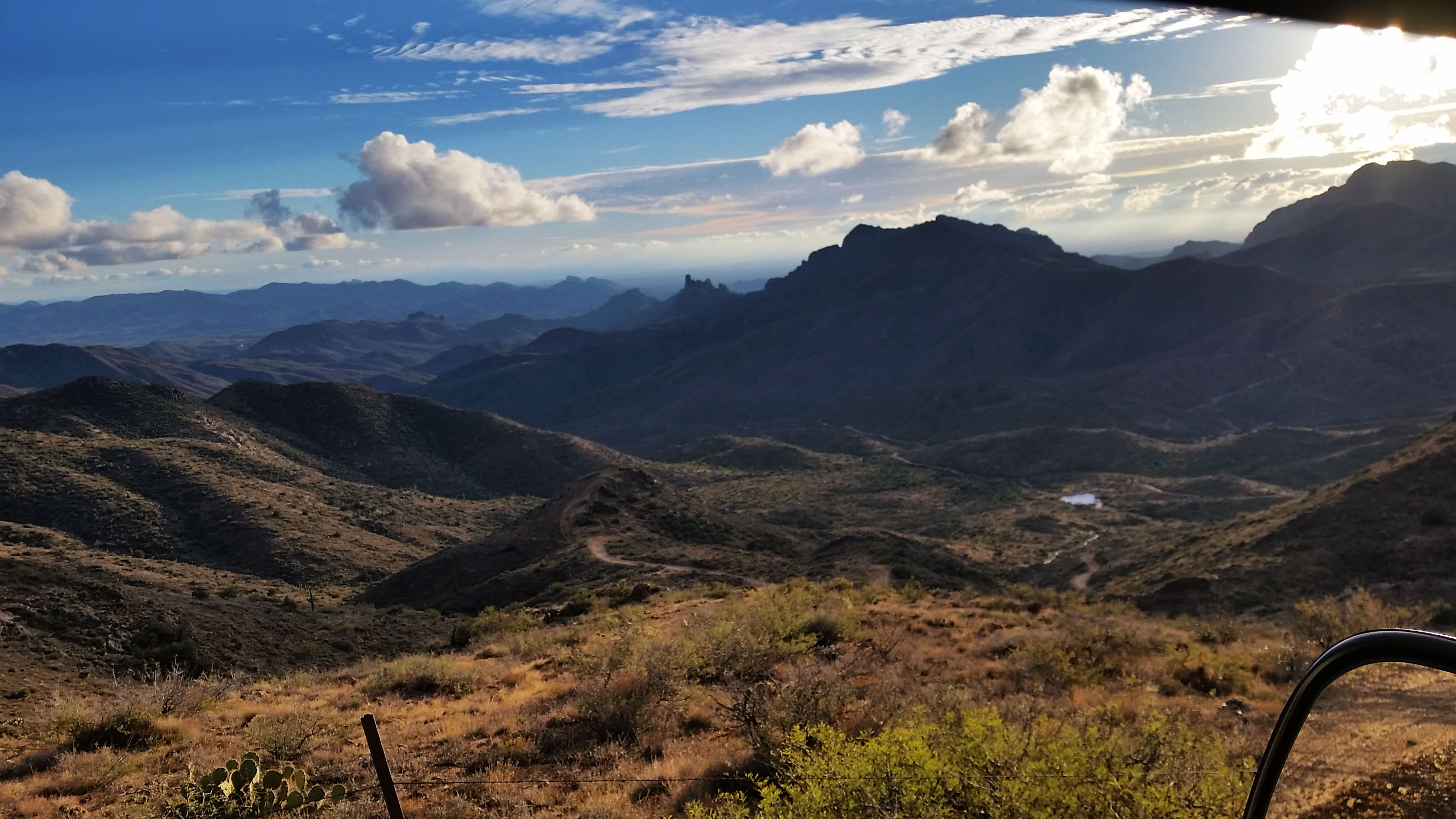
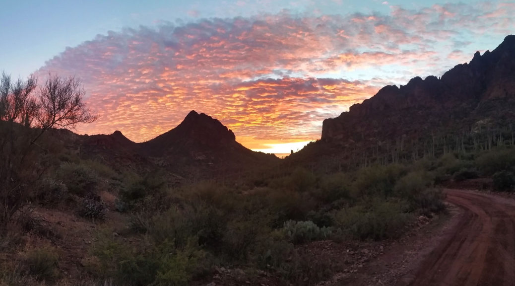
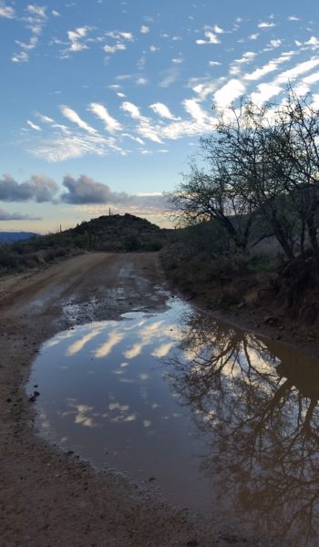
We pushed back to the trailhead, loaded back up in the van and drove back up the muddy dirt road towards phoenix. The sunset and the views on the way back were so incredible; pictures can hardly do it justice. Sometimes its hard to imagine a life without the amenities of the modern world: cars, smartphones, grocery stores. Its nice to come to places like this and be reminded to stay humble and grateful for what you have. Another awesome trek in the beautiful Superstitions was safely complete.
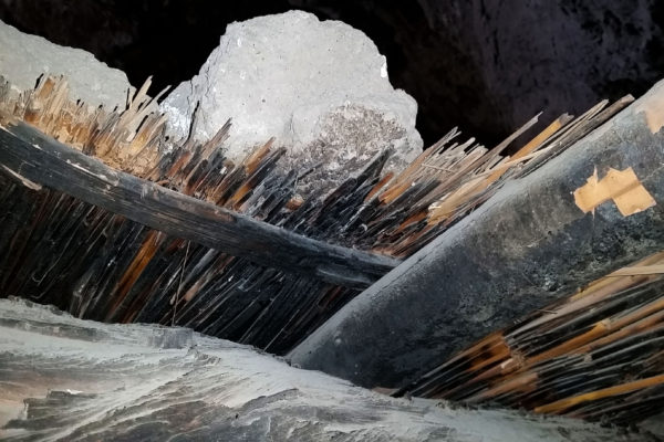 ruin roof assembly, Large beams, small support, hay covering, mud and rock on top

 AZT baby!
HIKE INFO:
Rodgers Canyon, Superstition Moutnains
HIKE STATS:
- Weather: Hi 60s, Low 40s, Cloudy, Rainy
- Water: 2.0 liters
- Food: 1 Cliff Builders Bar, 1 Cliff Bar, 1 apple, 1 powerbar, bag of Mediterranean vegitable chips
- Time: 6 hours
- Distance: 10 miles Round Trip
- Accumulated Gain: 1,100 feet
GEAR:
- Mule Camelback backpack (3 liter bladder)
- SPOT Tracker
CLOTHING:
- Cotton Handkerchief
- Smart Wool Long sleeve shirt 195
- Smart Wool beanie
- Nike Running Shorts
- Merrell Mid Moab Hiking Boots
- Darn Tough Medium Wool Sox
- Patagonia rain jacket
Weaver’s Needle Ascent – AZ (3.5.16)
I have been hiking in the Superstition Mountains for the past few years and I knew Weaver’s Needle on sight. The formation was massive and jetted out of the earth like the final breath of a dying volcano. It was always on my list to reach the top (more of a bucket list due to the rock climbing gear required) and I never thought it would be more than a dream until I got a text from a buddy with an invite. I started rock climbing in a gym a few months back, and this bucket list item was about to become my first outdoor climbing experience! Needless to say I was pretty ecstatic!
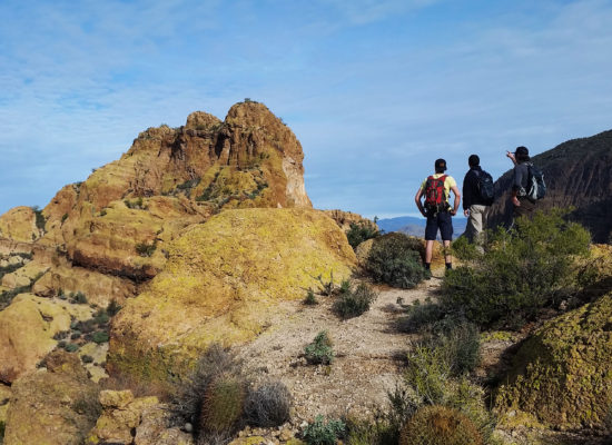
Kári, Inga, Craig and I met early in the morning, threw our gear into the back of Craig’s 4Runner, and headed for the Supes! We finally got to Peralta trailhead and started putting feet to trail around 8:30am. Little did we know, the day ahead of us was going to turn out to be a long one! I had Kári’s climbing rope draped over my shoulder as my day bag was already packed to the brim with food, water, and climbing gear. At the sight of the rope quite a number of people descending Peralta trail stopped and chatted; “looks like you guys are going to have some fun!”, “what are you going to repel?”. I was all grins but as Craig explained where we were headed I bit my tongue (didn’t want to jinx it). After short chats, we continued to sweat up the climb. The sun was already going to work on us as we approached Fremont Saddle.

Finally reaching the saddle and we laid eyes on our target: Weaver’s Needle! Every time I looked at it before it was a point of reference or landmark, this time it was a much more ominous beast as I started to wonder what the climb would be like, and how we were going to find our way up what seemed to be an impossible exposed climb. We bombed down Peralta on the north side from saddle headed for the west side of Weavers. As we approached it became more and more apparent we had a large amount of gain to take on just to approach the start of the technical climb.
We found our way to the climber’s cutoff approach rout and crossed the dry creek. After a little bit of bushwhacking I luckily stumbled onto the trail. “Trail”, I yelled to the crew who were in the bushes nearby. Soon we were all back together making the big push towards the base of a notch in the formation. As we hiked up the rock became a little less ominous. The steep, but clearly cairned trail walked right up to the start of the climb. Time for a nice break in the shade! We all plopped down, grabbing out our snacks and munching down.
After the break we got our climbing gear out and began to scramble up the first pitch (lesson learned here, bring your hiking shoes with you when you climb, repelling in climbing shoes is no fun!). We scrambled up the first pitch to the next anchor, it was time to climb! Kári took lead; he has a ton of experience in traditional climbing and knows the technical correct way to do things as he was in Mountain Rescue for many years with Inga. Craig is a seasoned sport climber and walked me through the ins and out of belaying, removing gear, and the general etiquette for climbing.
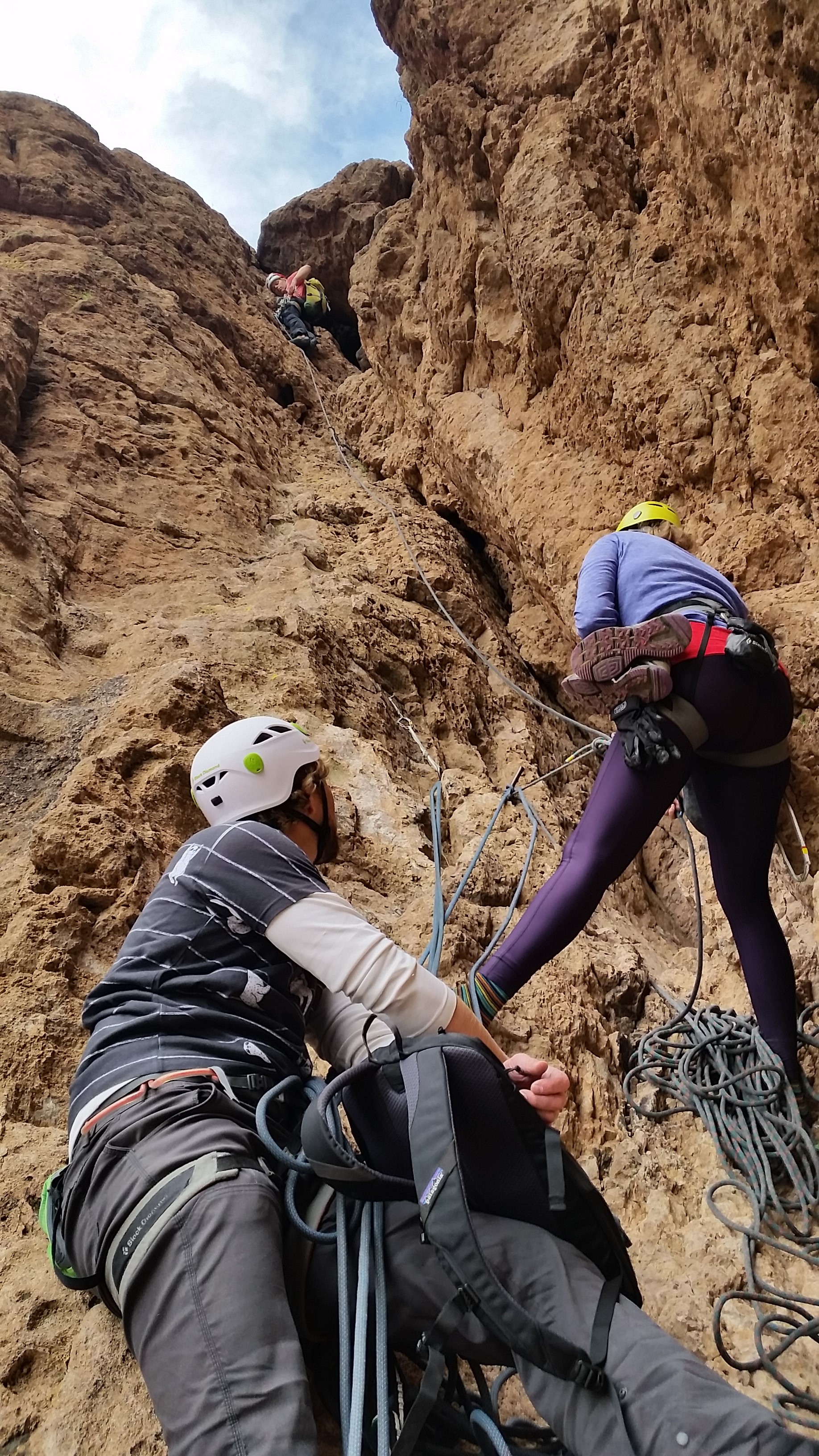
I watched as Kári and soon Inga and Craig disappeared above the chalk-stone at the top of the climb. I was alone at the bottom of the shoot looking up at my first attempt at outdoor rock climbing. Admittedly a little intimidated I made my first few moves up the climb. My hands were sweaty and I plunged them into my chalk bag. After focusing solely on the holds and where I was going the nervousness went away. Before I knew it I made it to the first piece of trad gear and pulled it from the rock clipping it to the side of my harness. It was cool to see the strategic placement of the gear, but it was strange concept to think I was removing the gear knowing it could be the difference in life and death for anyone lead climbing. Being as I was the last one up and tied into top rope this wasn’t an issue.
Some of the rock on the right felt as though with enough force it would pry from the wall, the left was solid. I climbed up, brushing small pebbles from the holds as I did. I went to put my right foot up on the next foothold, as I did I felt it. There was a rock in my climbing shoe, just under the ball of my foot. This was no bueno! Luckily I was close to a ledge and took a rest to pull my shoe off to empty it. As I did I looked down, yup it would most definitely suck not to be tied in! Some people can freeclimb this pitch, definitely not the case for me! I threw my shoe back on, stood up, found my feet, hands, and soon myself climbing over the chalk-stone! With the crux of the climb out of the way the whole crew scrambled their way to the summit for some incredible views!
We hung out for a half hour or so and soon realized we needed to get going in order to try and get to phoenix at a descent hour! We packed up our gear, and headed back down the climb. All four of us repelled all 4 pitches of the climb which took some time but was really fun (except for catching a few cacti in the leg). Repelling was a blast, especially down the length of the second pitch over the edge of the chalkstone to the bottom of the climb below. Soon when we had out hiking shoes back on and walked off the formation as the sun set. Once we were back on Peralta trail, we broke our headlamps out and trekked the 3.5 miles back to the car in the dark. It tuned into a 12 hour adventure, but I’d rather spend a day outside than any other way! What an awesome incredible unforgettable trek!
 Freemon Saddle Here we come!
 Lets begin!


HIKE INFO:
http://hikearizona.com/decoder.php?ZTN=545
HIKE STATS:
- Weather: Hi 70s, Low 60s, Sunny
- Water: 2.5 liters
- Food: 1 Nature valley sweet and salty bar, mixed 1 bag of chips (Salt and Vinegar), 1 Cliff Builders bar, apple, Power Protein Bar
- Time: 12 hours
- Distance: 8.1 miles Round Trip from trailhead
- Accumulated Gain: 3,400 feet
- Climbing Rating: 5.6
- Number of Pitches: 4
GEAR:
- Mule Camelback backpack (3 liter bladder)
- Black Diamond Helmet
- Petzl Corax Climbing Harness
- Black Diamond screw carabiner
- Phantom DMM screw carabiner
- Webbing for personal anchor
- Black Diamond ATC
- Arc’teryx Chalk Bag
- SPOT Tracker
CLOTHING:
- Cotton T-Shirt (Nom Nom Nom Shirt)
- Arc’teryx Hoody
- Arm coolers
- Cotton Handkerchief
- Nike running shorts
- Darn Tough Medium Wool Sox
- Merrell Mid Moab Hiking Boots
- 5.10 Rouge Climbing Shoes
