
Category Archives: Grand Canyon

Zoroaster Temple – Grand Canyon – AZ (Day 2 – Part 2) – 11.4.17
- Day 1: South Kaibab, Clear Creek, Redwall Notch
- Day 2 (Part 1): Redwall Notch to Zoroaster Climb P4
- Day 2 (Part 2): P5 to Summit and out via Bright Angel
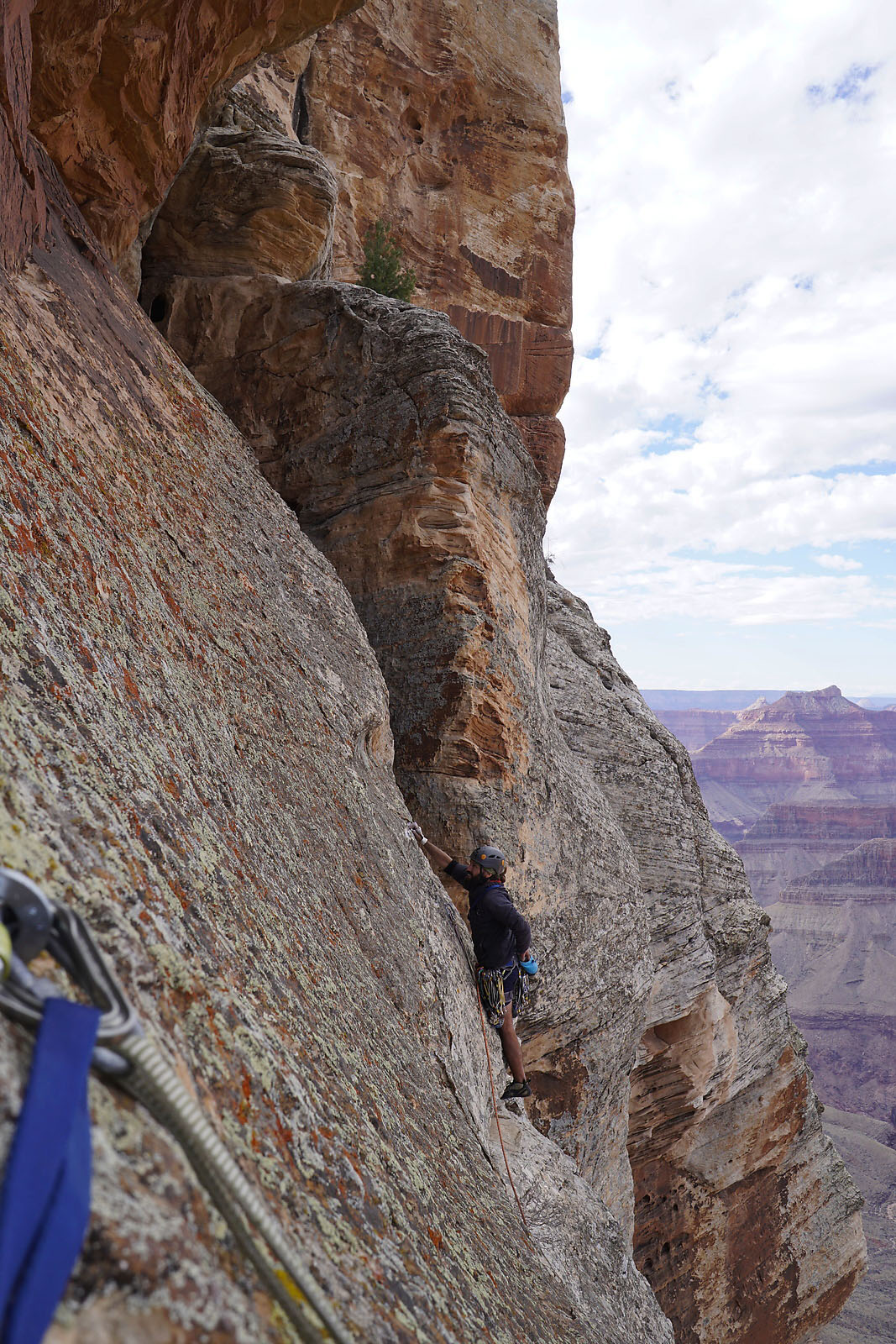
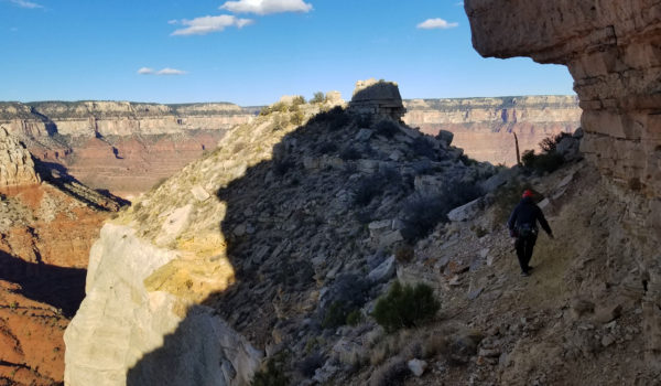
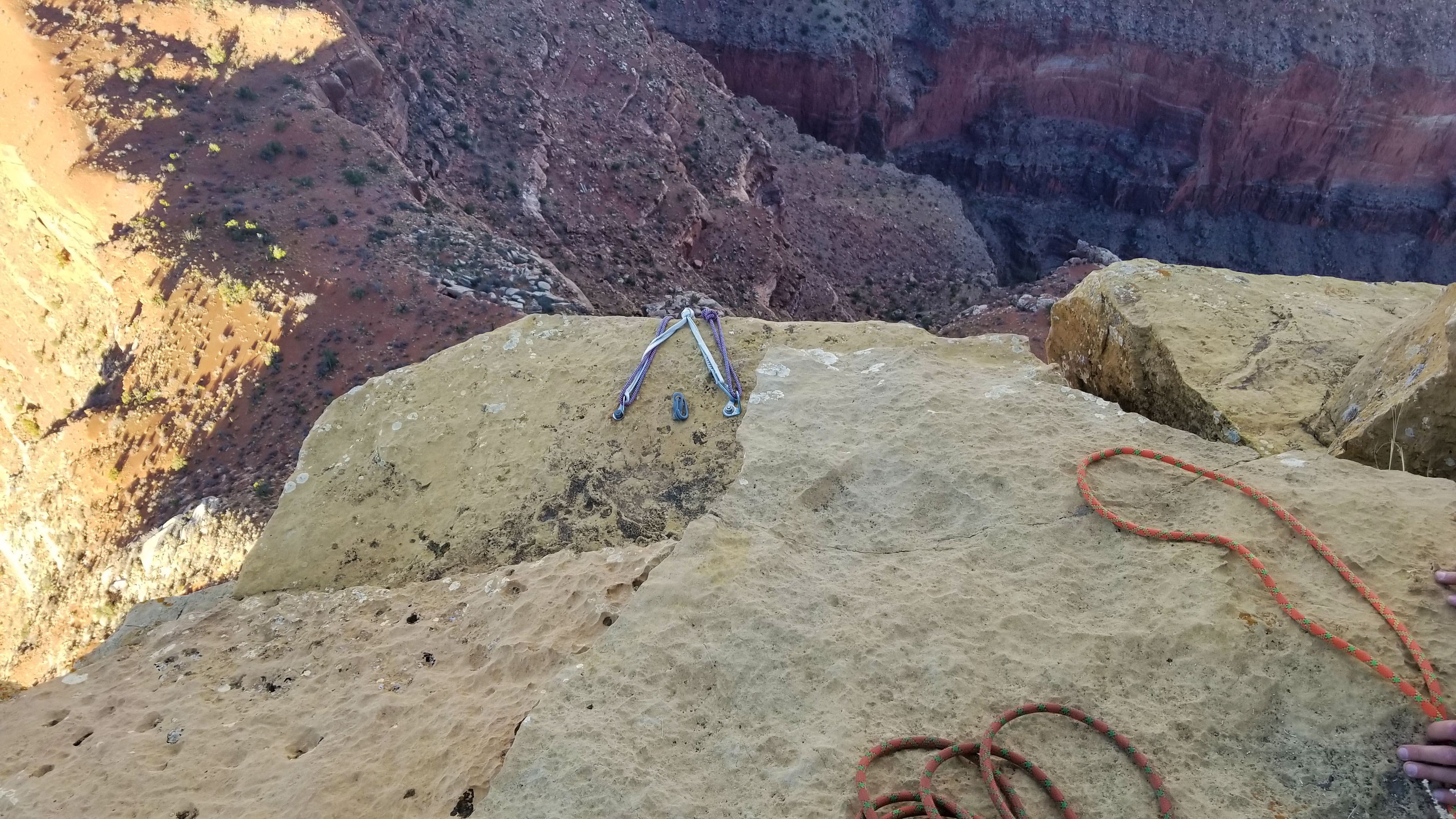
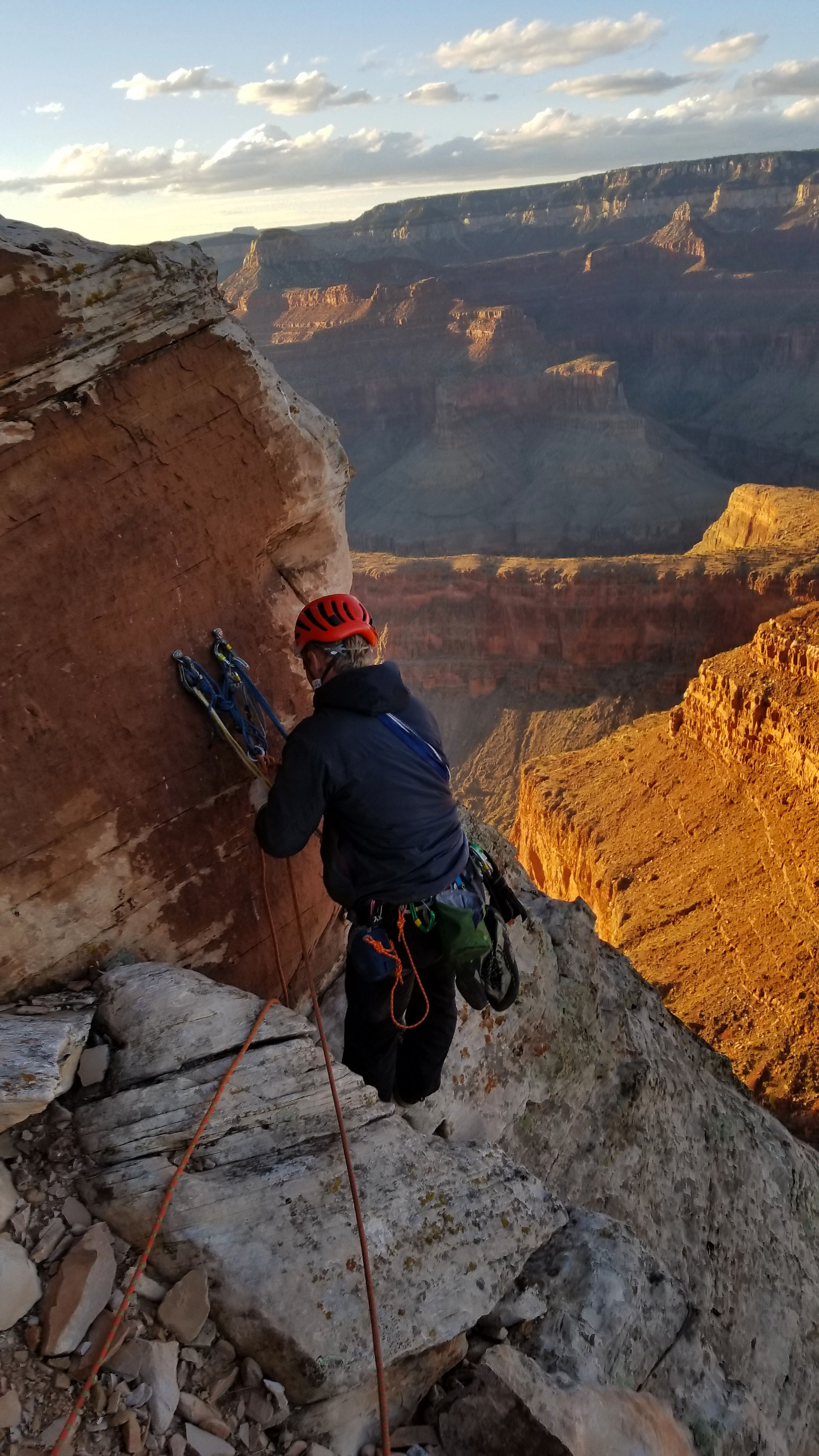
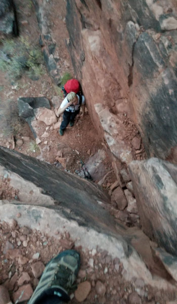
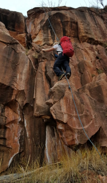
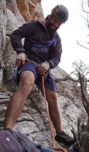
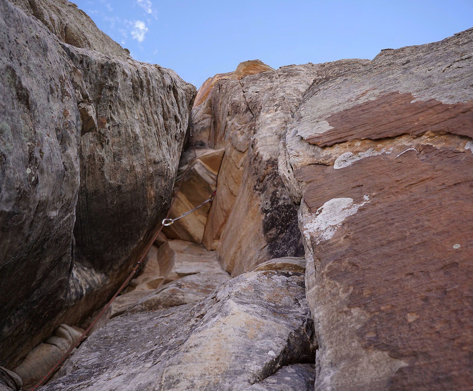
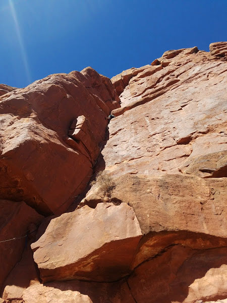
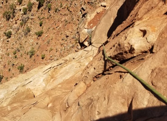
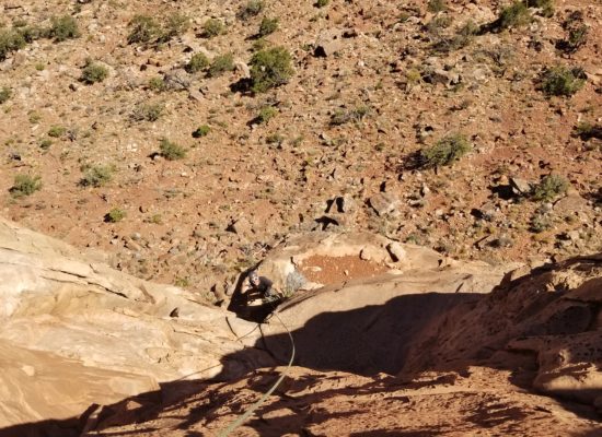
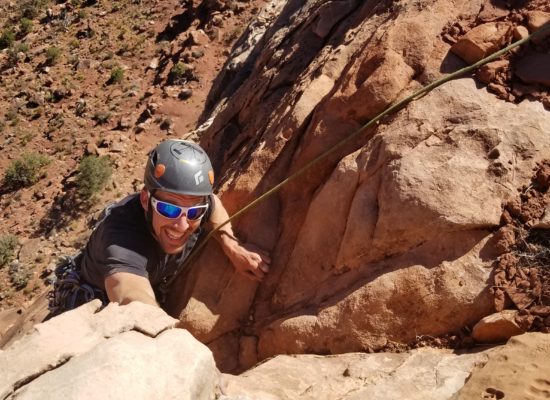
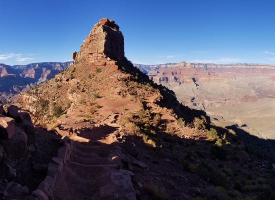
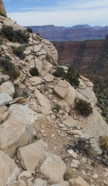
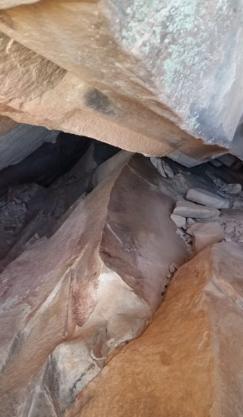
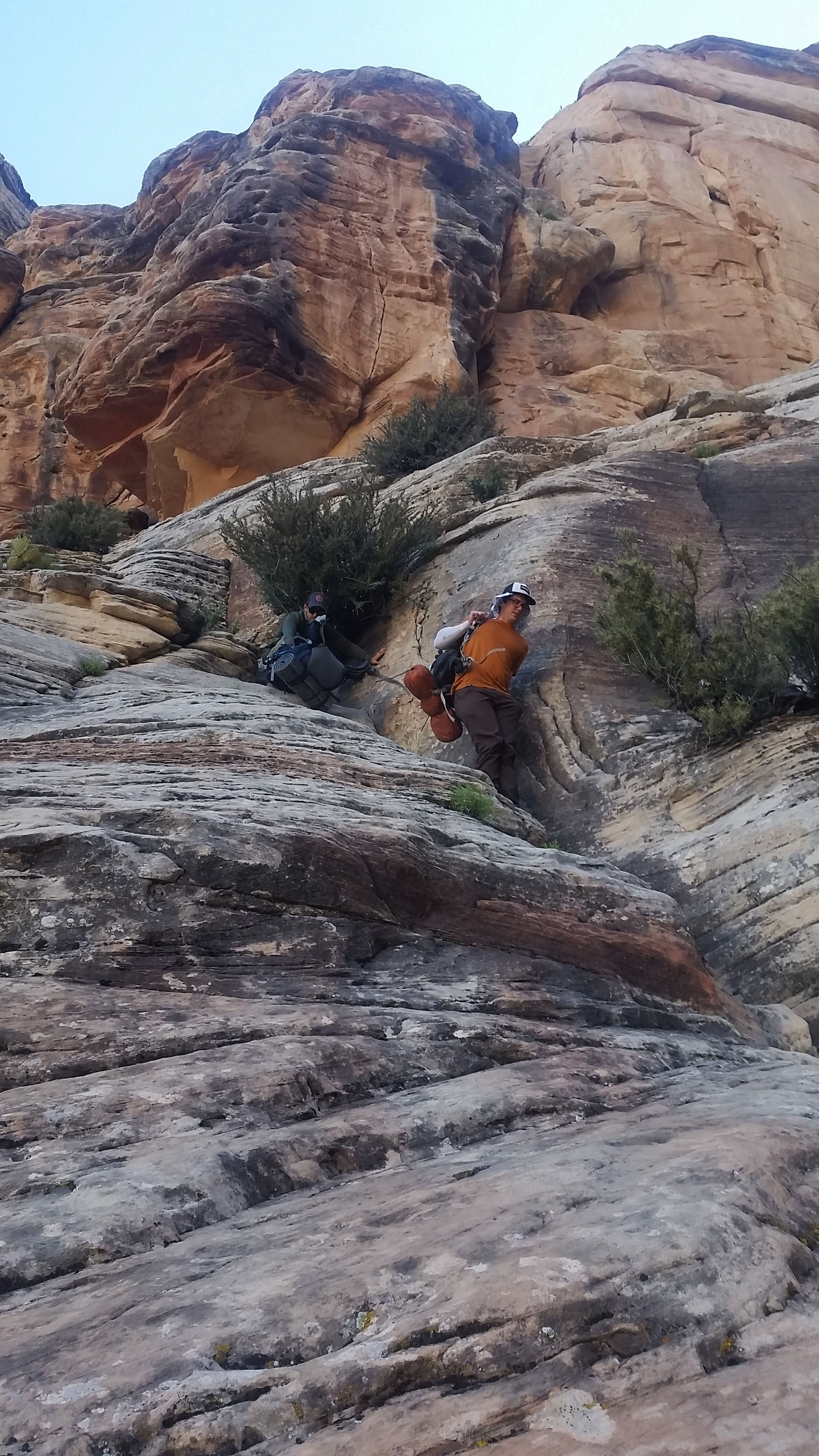
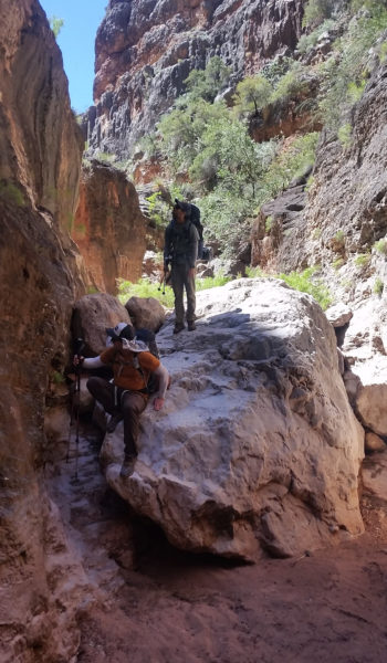
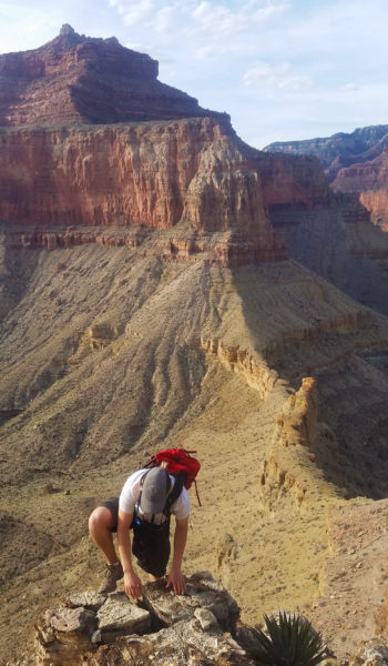
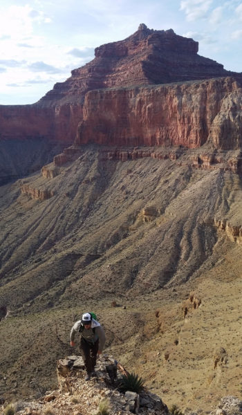
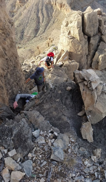
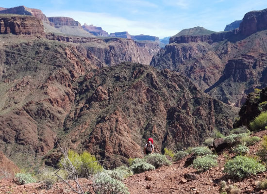
P5: From the horn belay I down climbed 15’ to a ledge. Slowly and meticulously I moved climber’s right and headed out into a 40’ airy traverse and finally clipped an old school rusty hanger. From here I had 2 options, get into a rated R chimney on the right and ascend the 20’ up until the first piece of pro, or take the rated R face directly above me and ascend to that same place. I chose the face. I explored the small nubbins with my hands, I chalked up as I planned my line. I started up on the small foot holds and was instantly searching for the next small rock nub that I could use for a hand or a foot. I slowly moved out left before finding a decent line that went back right towards slab paradise. I climbed slowly and very carefully, a fall here would certainly be a huge whipper on a questionable old school anchor. Rock nub after rock nub I moved up and right until finally the angle relaxed and the slab climbing began. Used the dished face until I finally straddled the R rated chute that dropped into nowhere. I slung a large column and finally clipped in, feeling a little more relaxed as I did. I mantled over the chimney chute to nowhere onto a large ledge. I walked around a large boulder and climbed up until I found the base of P6 and set a bomber anchor for Kari. “Climb On!” I yelled down. Following the lead with essentially 2 pieces of protection in 80’ is not fun, especially when you could swing out and seriously get hurt. So the pressure of following was not as relaxed as one may think. I couldn’t see Kari at all as I belayed. All I could is reel the rope in as he climbed. I listened for any noise in the wind and finally it came as he mantled over onto the ledge: “Woop!” letting me know he made it past the chimney. Soon he joined me w a big hi-5 and an exhausted smile. We were both tired, but still had 1 more pitch left.
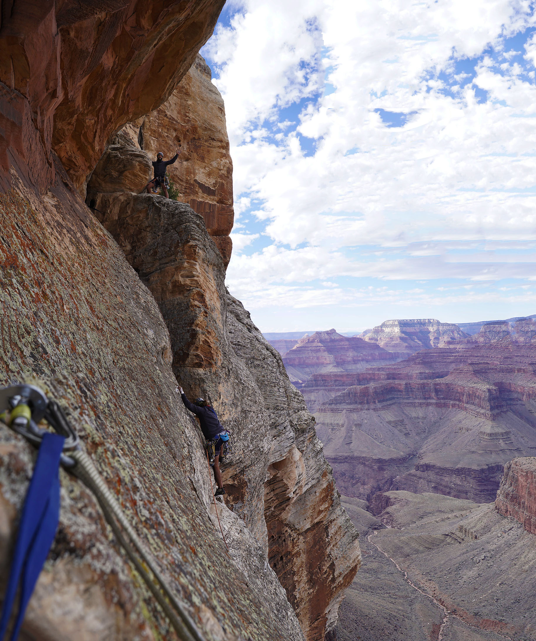
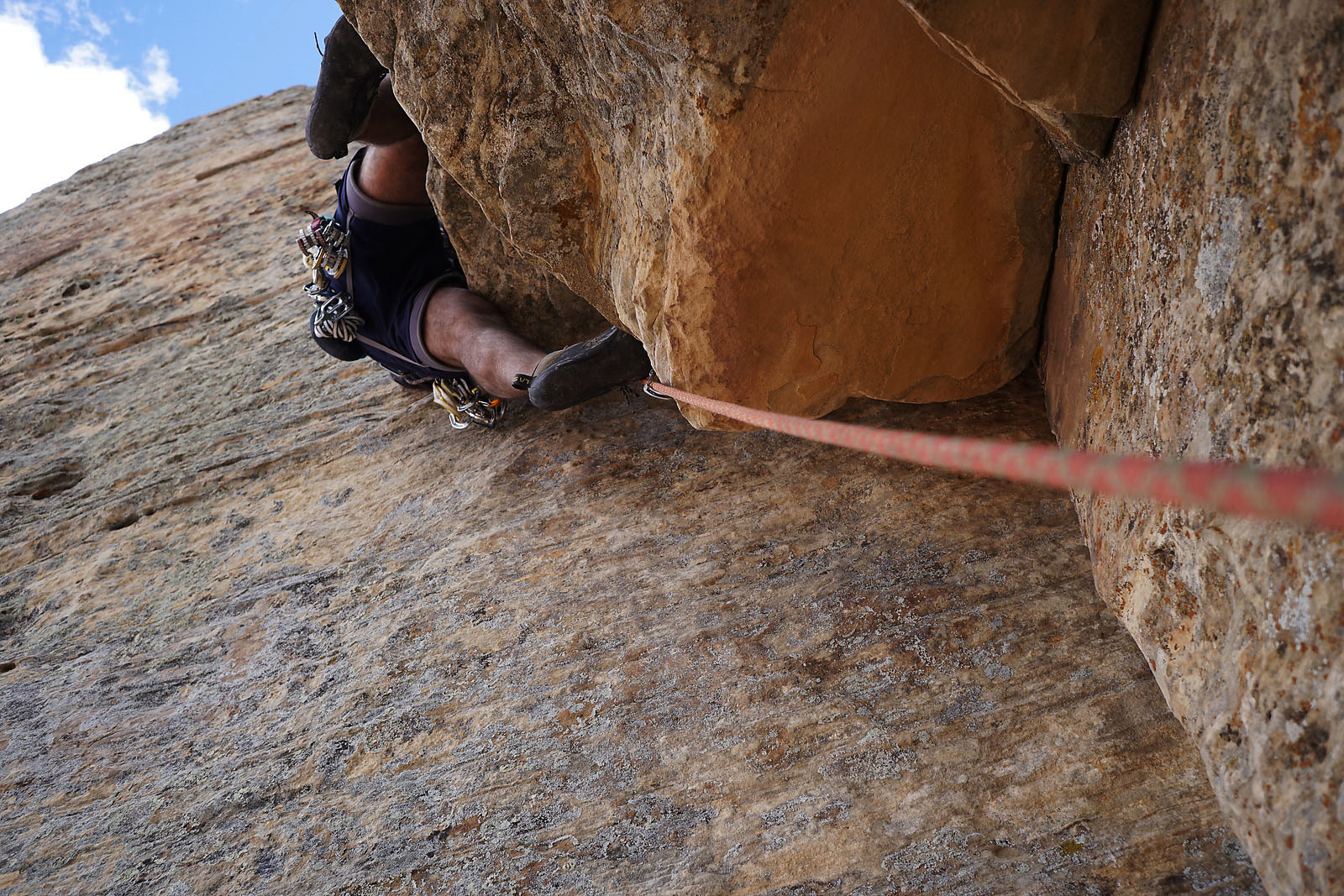
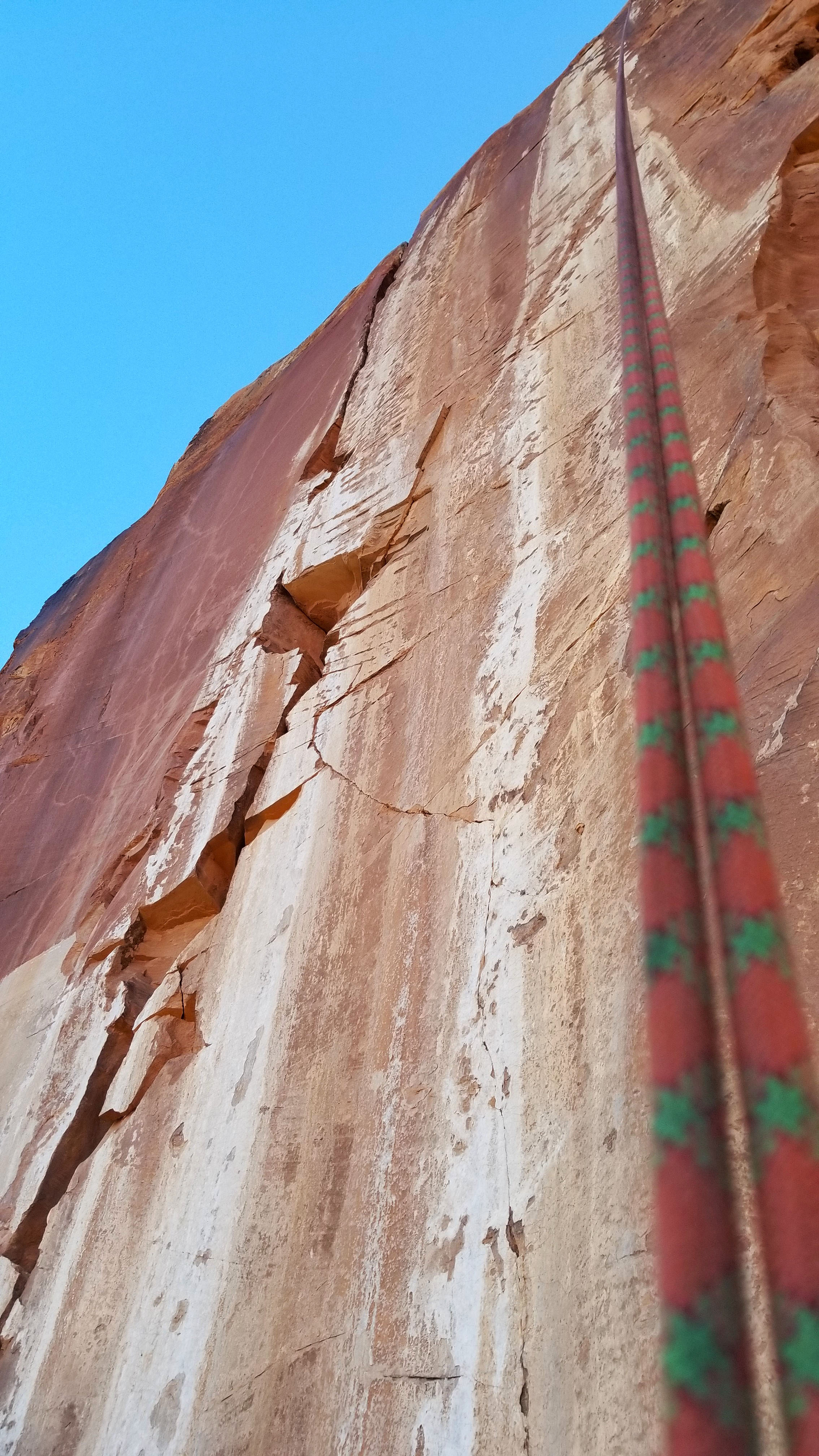
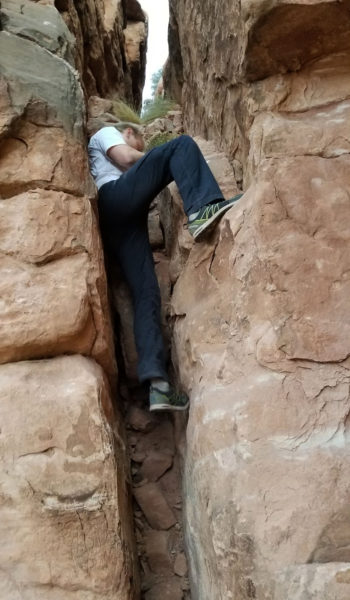
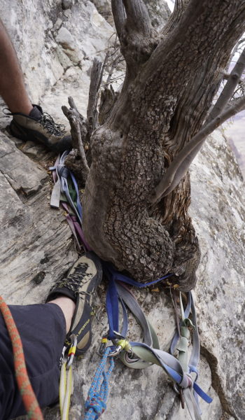
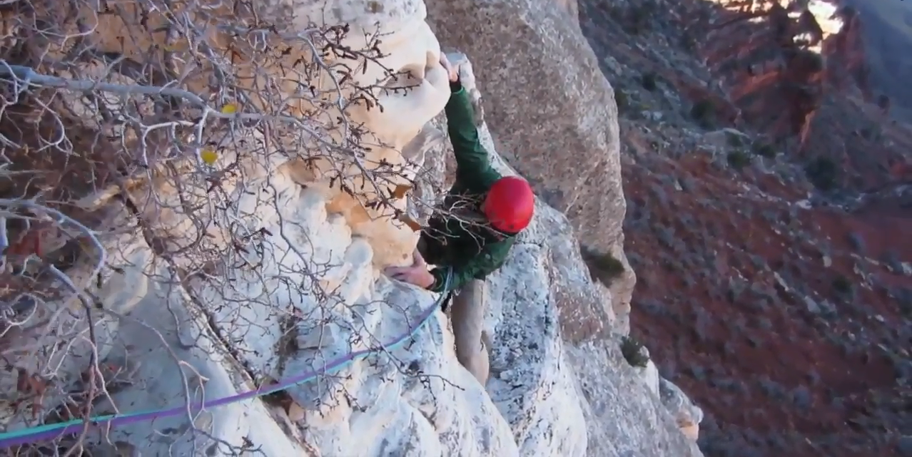
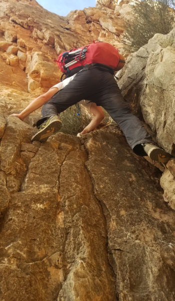
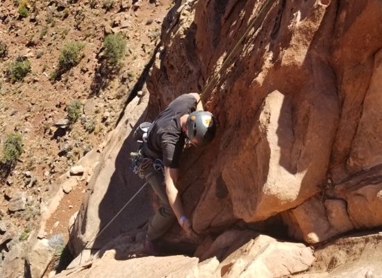
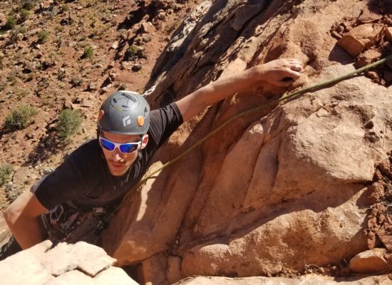
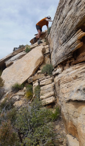
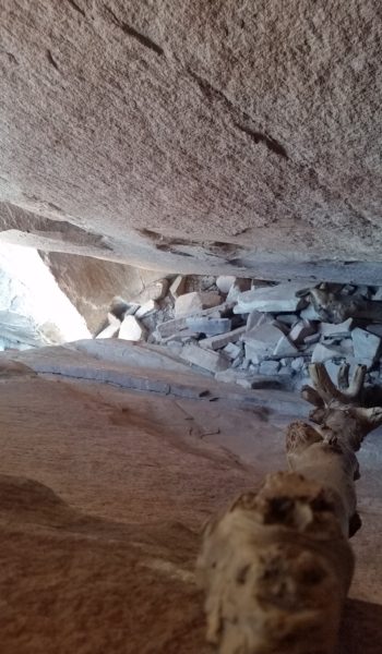
P6: I regathered the gear and grabbed the #4 Kari had been hauling up the whole time. I held onto a 0.75 Camelot (was so happy I had this later) and doubles from #1’s to #4’s. I once again started up, pulling a small roof before finding the off width pitch everyone boasted about. The corner facing wall to my left was blank and featureless and the bulge to my right was smooth and round. Nothing but the crack in front of me and smearing feat were there to aid my ascent. I worked at it, inch by inch, using the back of the crack with hand jams and used my gear as efficient as I could as I climbed. Once or twice I reclaimed a piece from below that I could use again higher up after placing. This pitch was the toughest and most painful! I fought for it, inch by inch, grunting, groaning through the pain. The flared wide crack finally started thinning up and I was so glad to have my 0.75 as it was perfect for the cracks exit. I placed my piece, took a rest, and finally reaching high and left for a really nice rail on the left wall. I knew I had it from there, even though the climbing wasn’t done. I kept fighting, up and on until Zoro finally seemed to give up a little. The pitch angle relaxed, my heart was thumping and the adrenaline was pumping through my veins. I kept fighting, and finally after 6 pitches of grueling technical climbing I topped out and slung a juniper pine at the top of the chossey exit. I set the belay and yelled down to Kari “Climb on!” Soon, after grunting and groaning, pulling hard for it, I saw Kari’s orange and red helmet come into view. I was overwhelmed with what we just did. I slapped his helmet, and the two of us, tired and ready to finish stood on the plateau just below the summit, knowing the technical climbing was done.
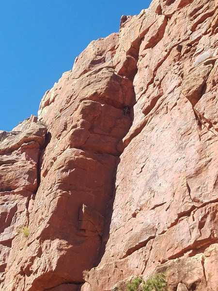
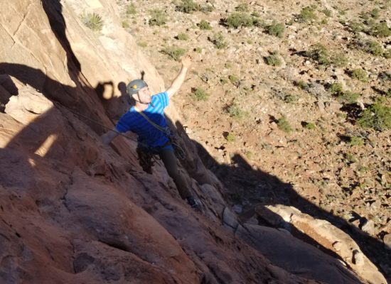
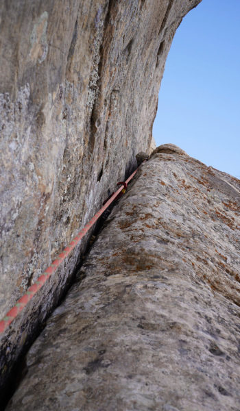 Looking up P6, the offwidth. Photo Credit: Kari Hreinsson
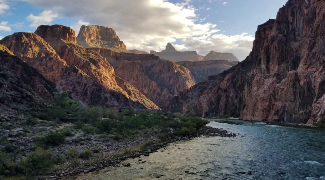
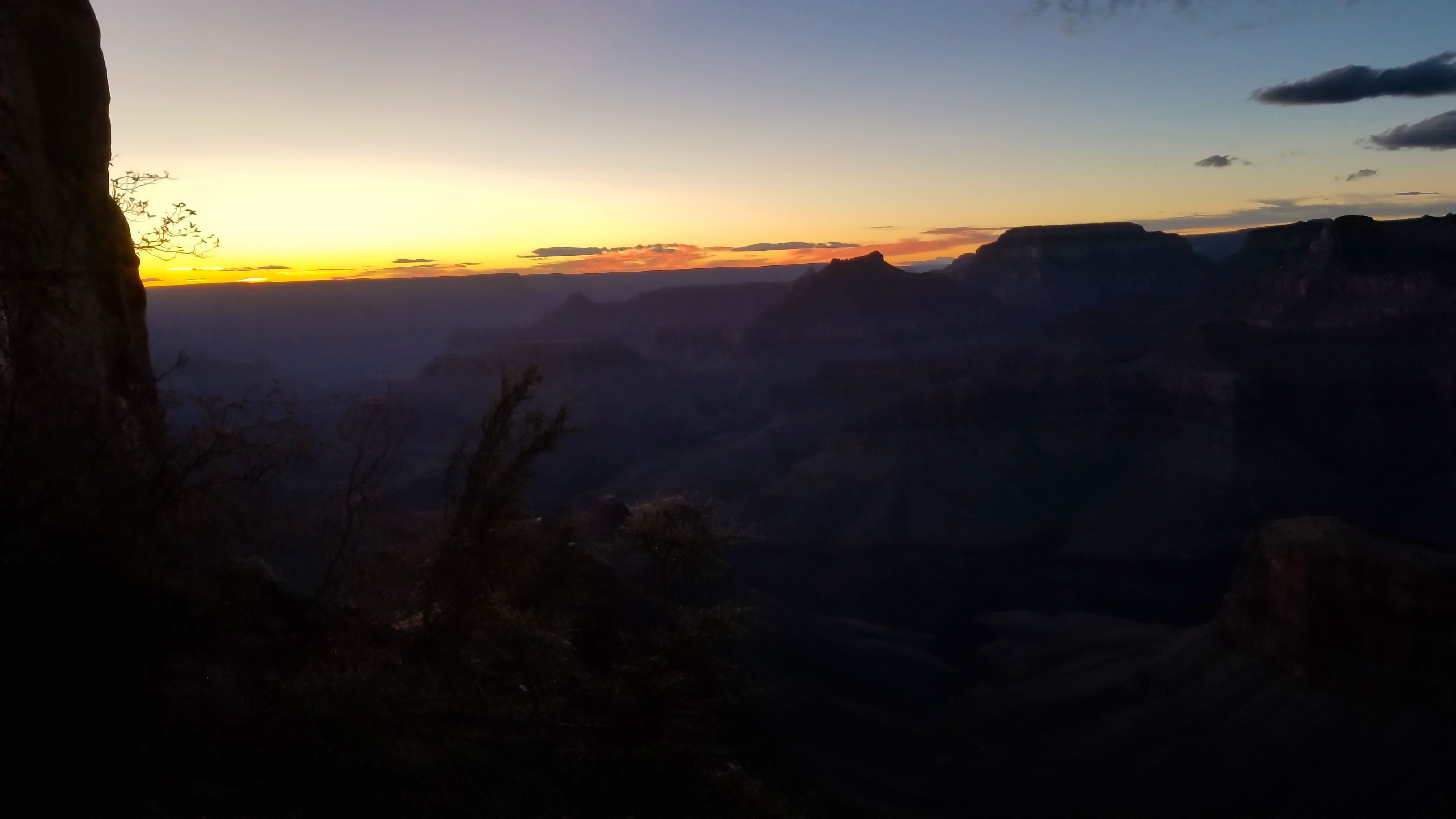
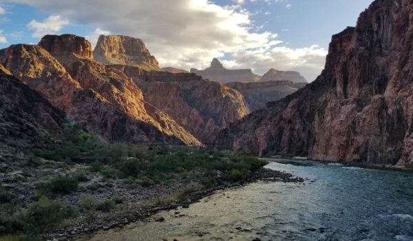
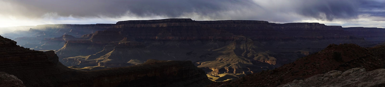
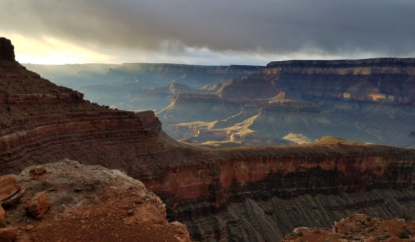
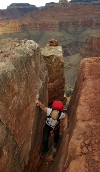
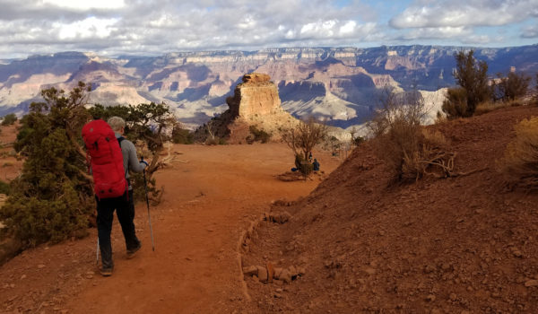
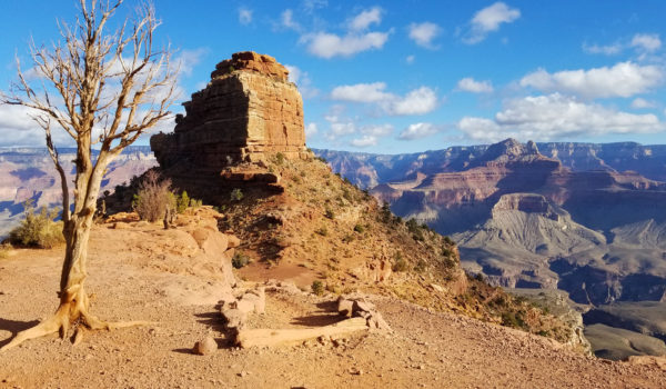
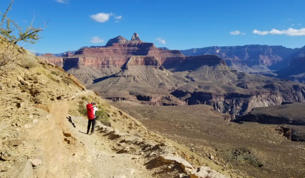
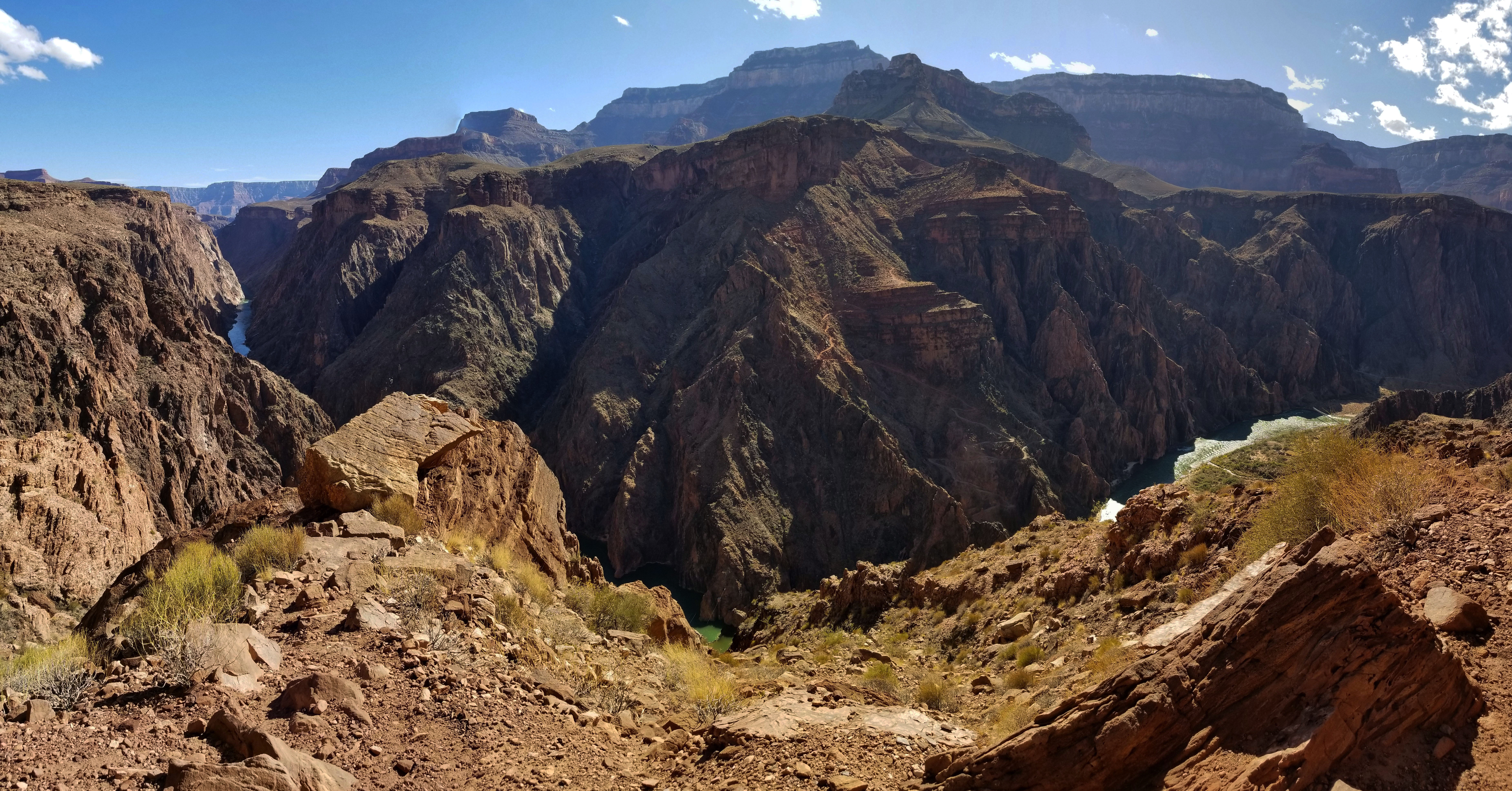
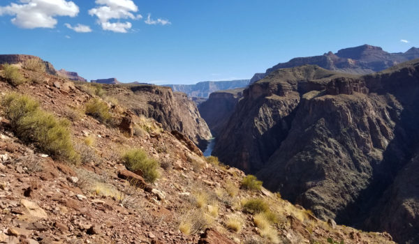
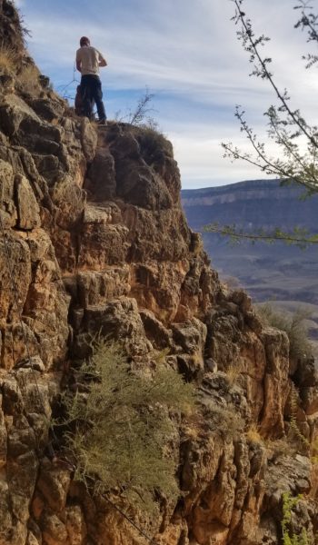
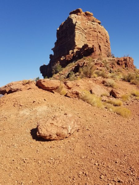
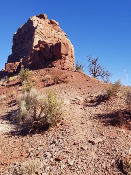
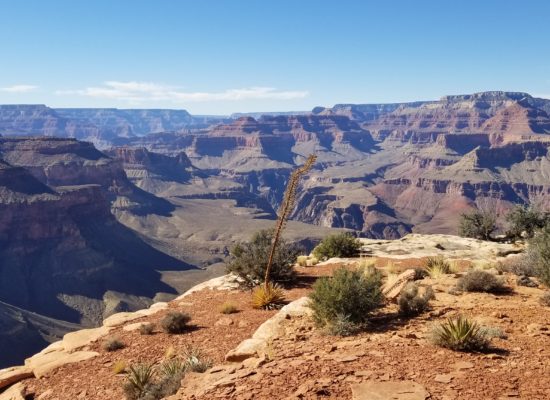
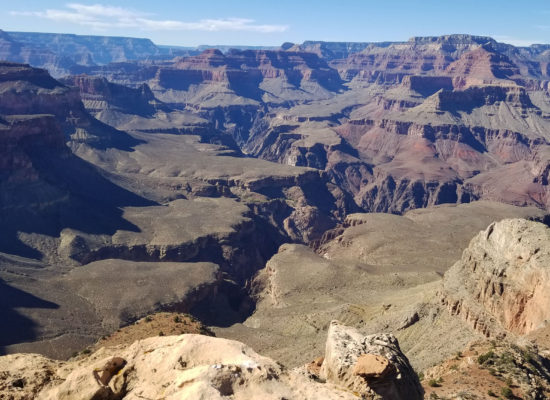
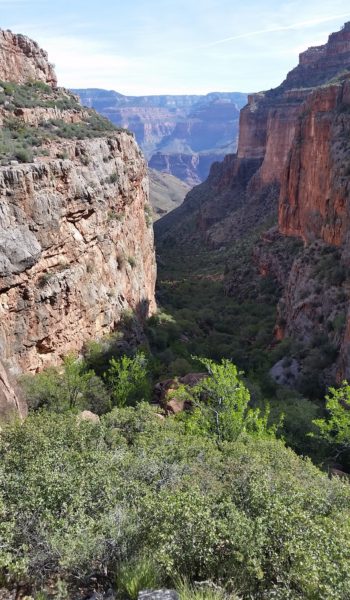
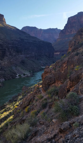
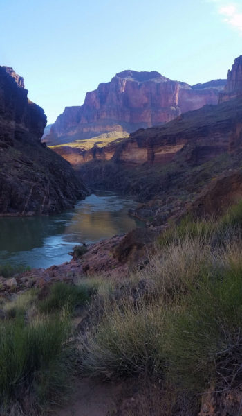
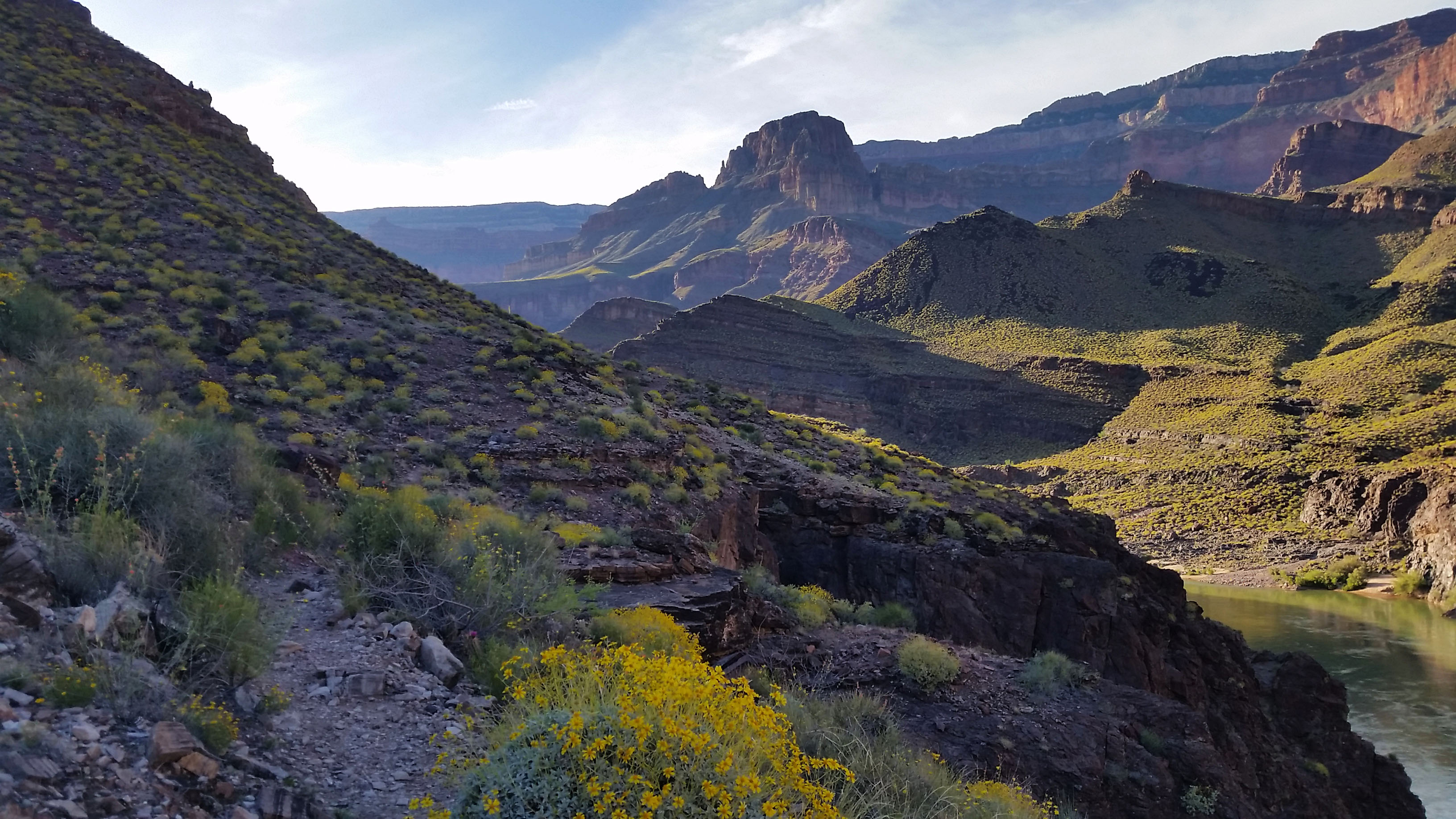
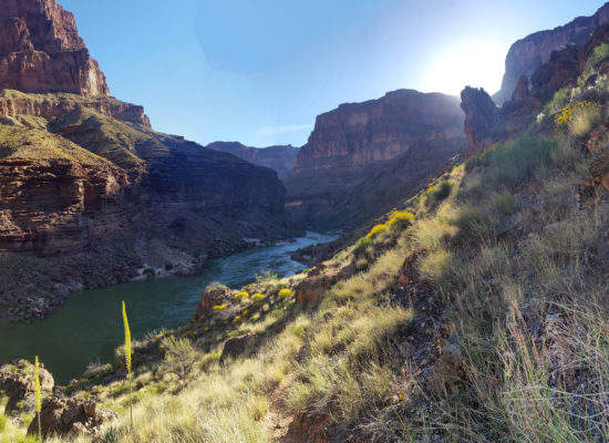
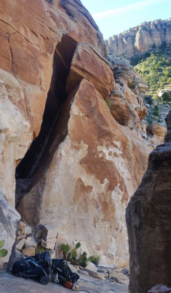
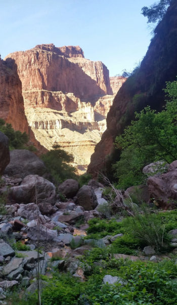
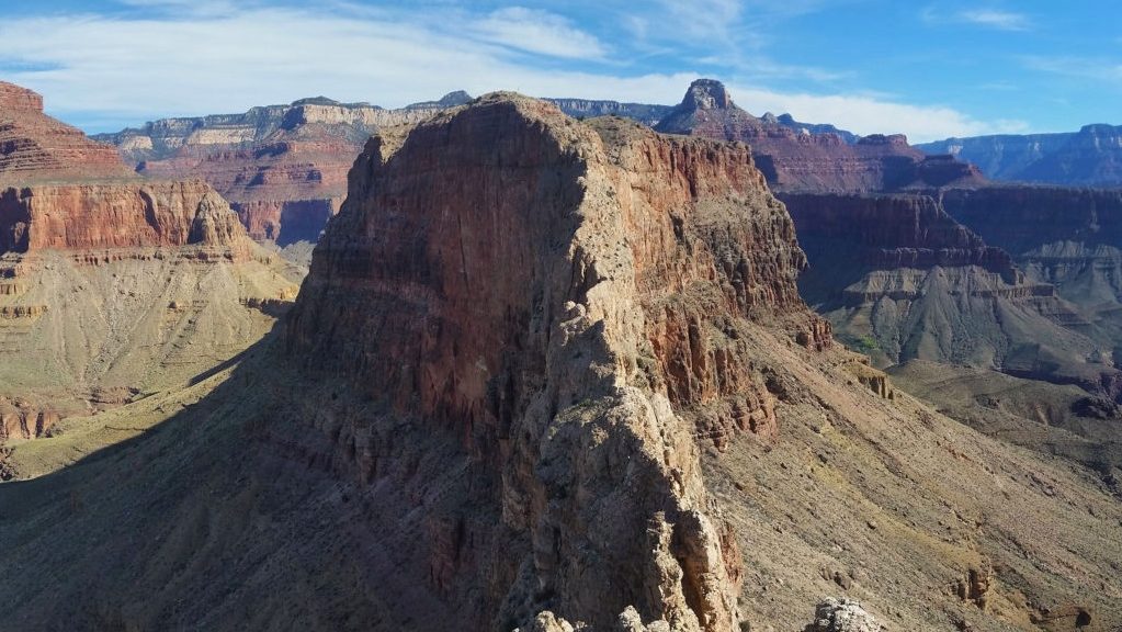
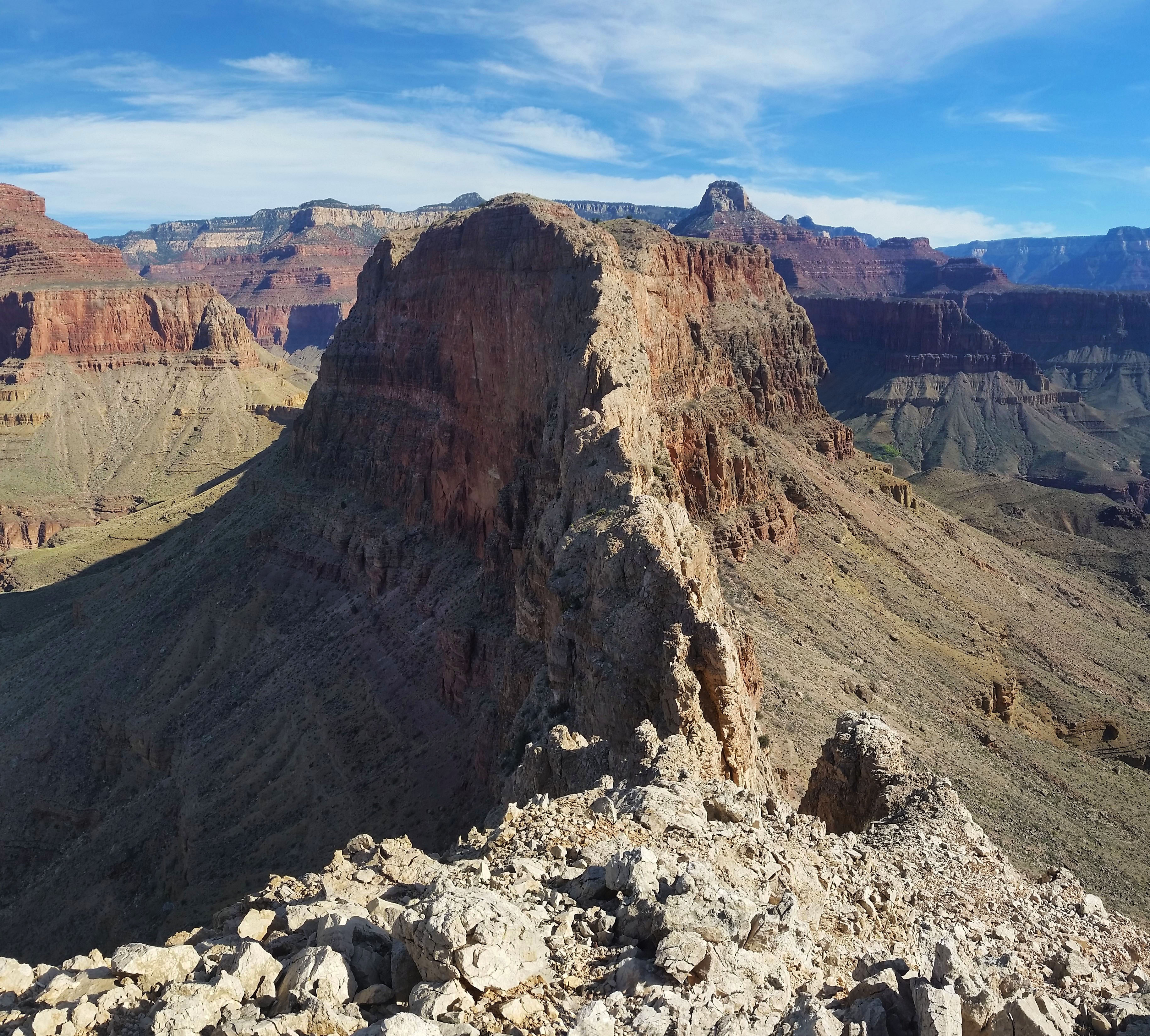
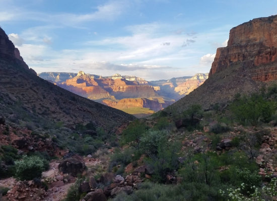
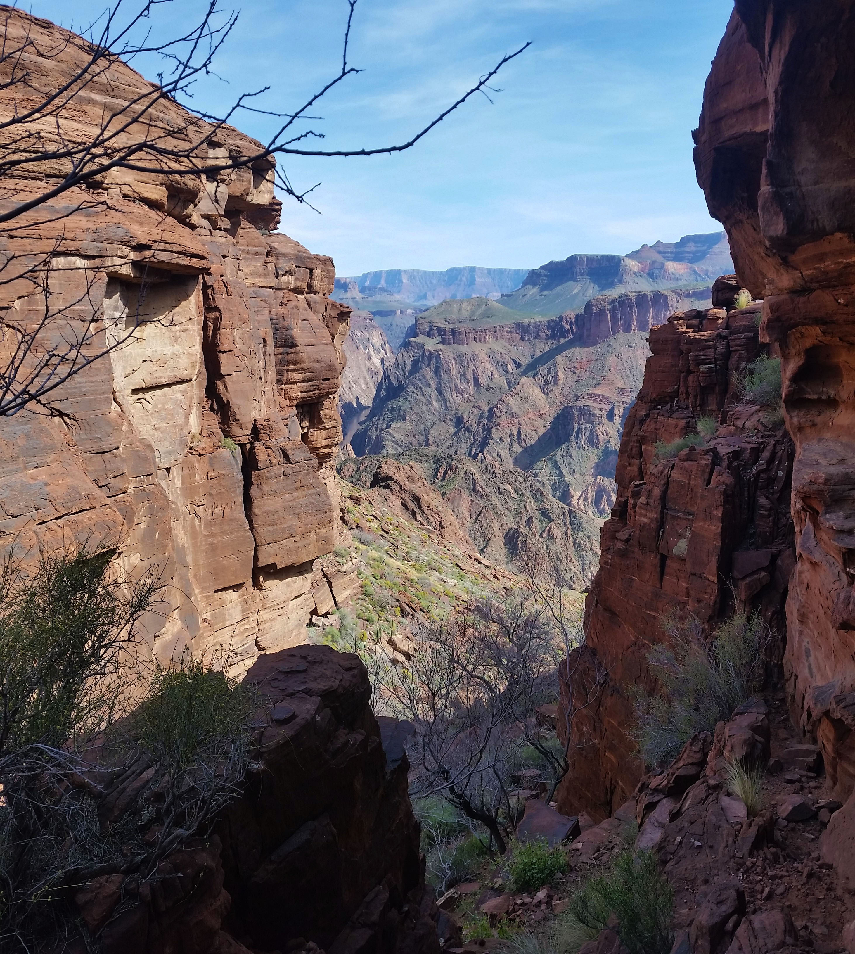
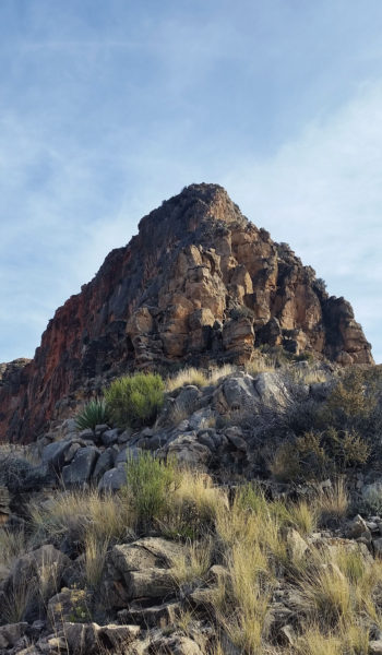
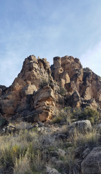
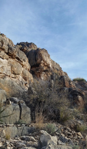
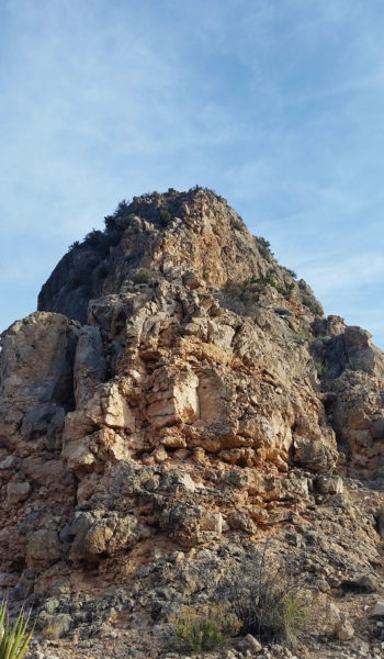
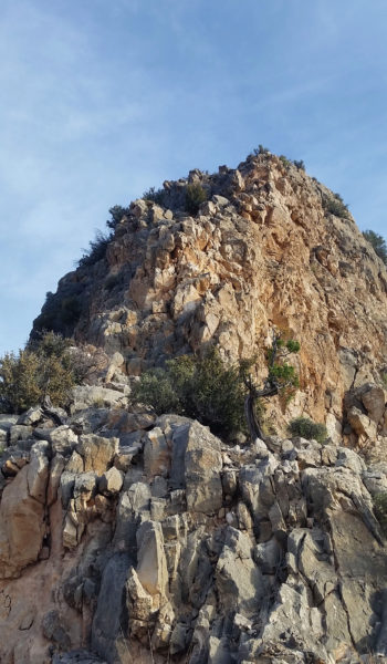
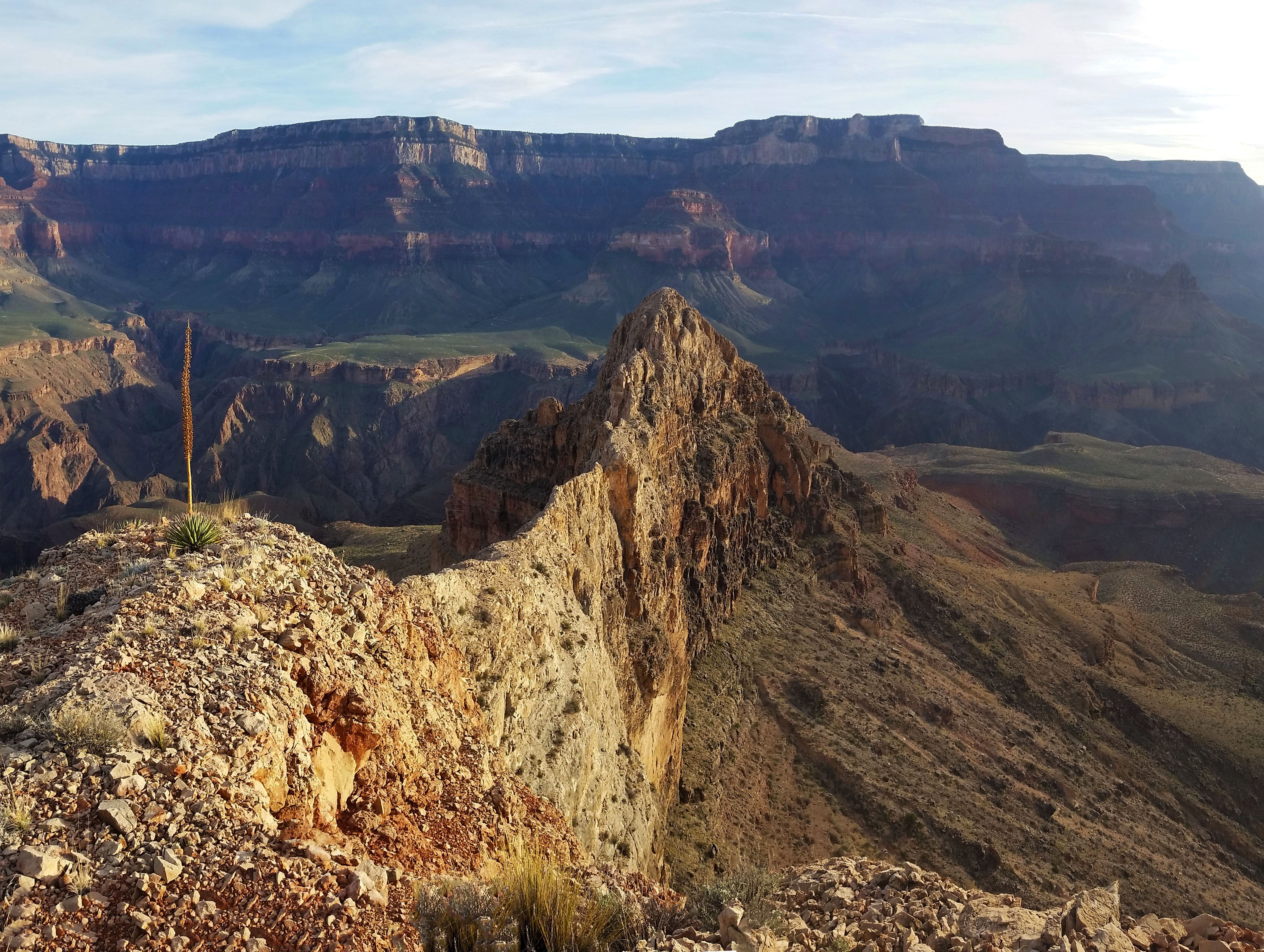
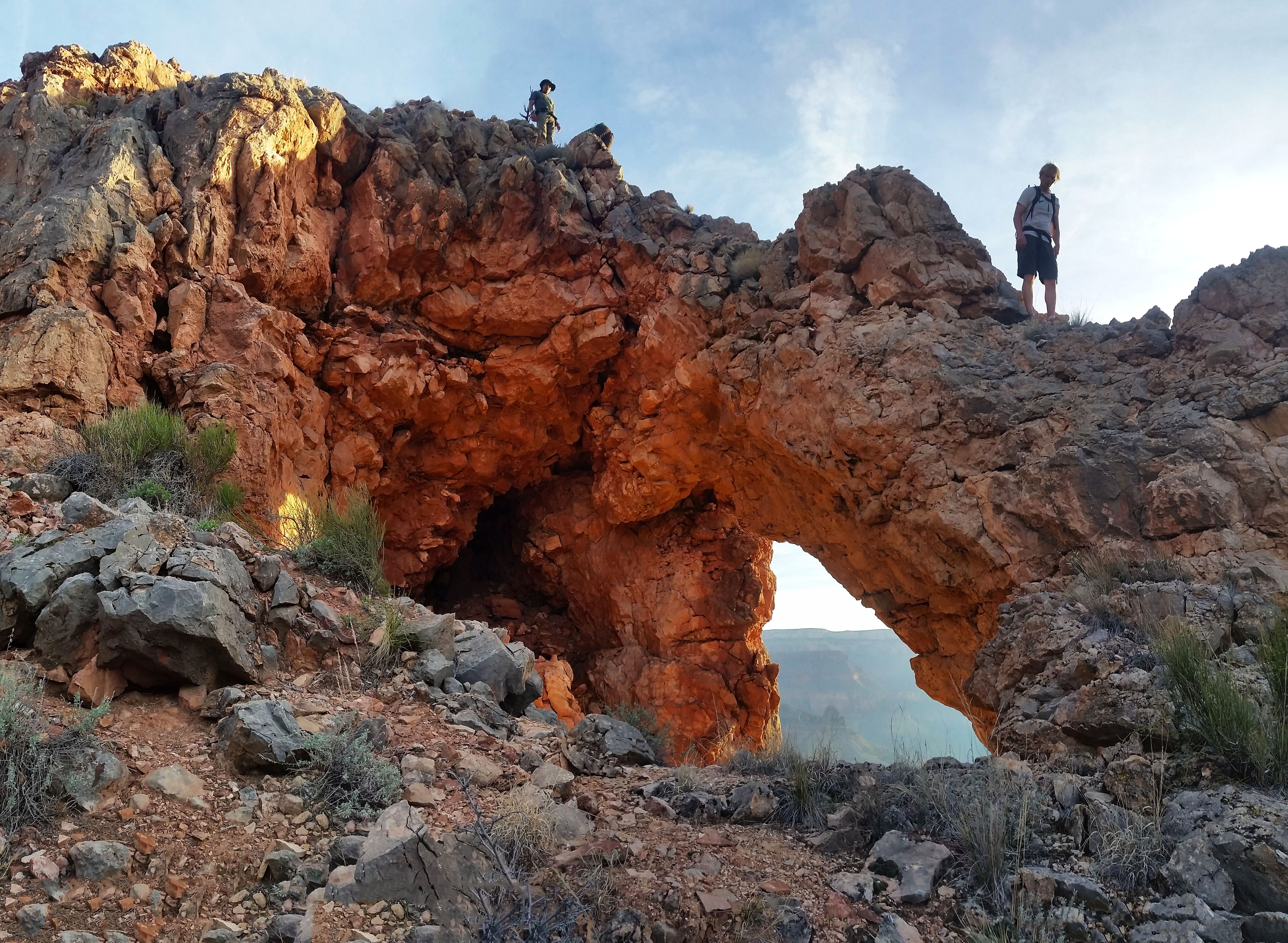
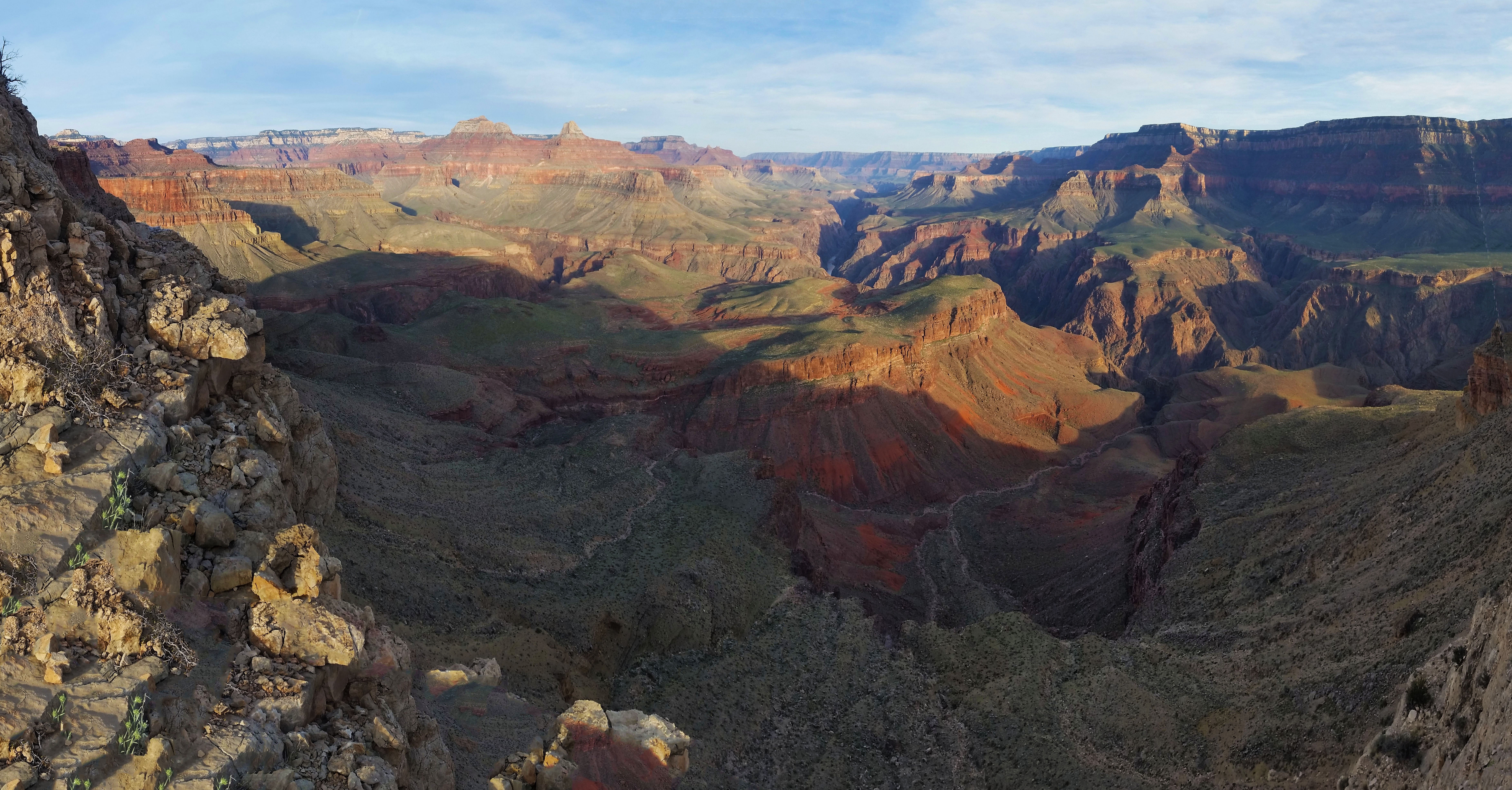
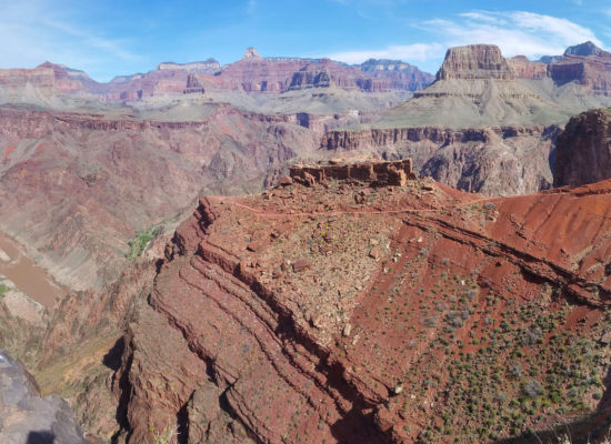
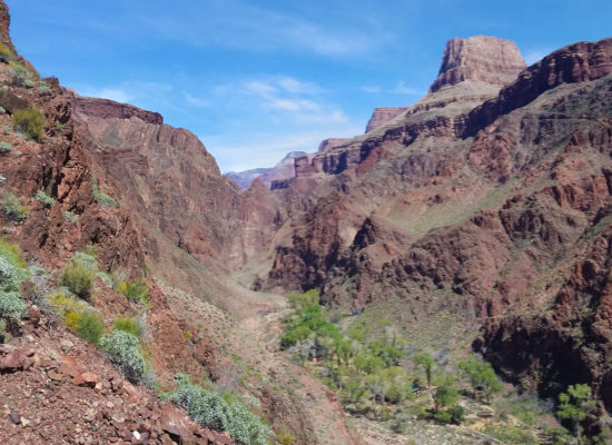
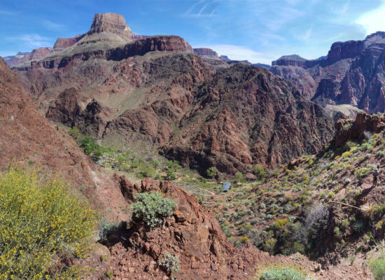
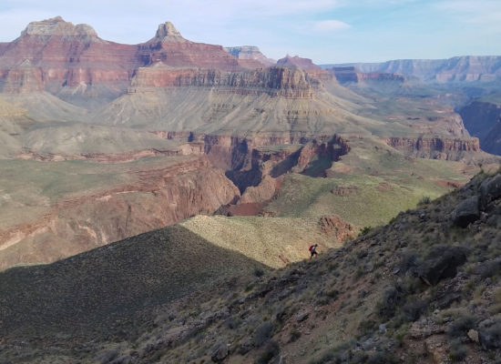
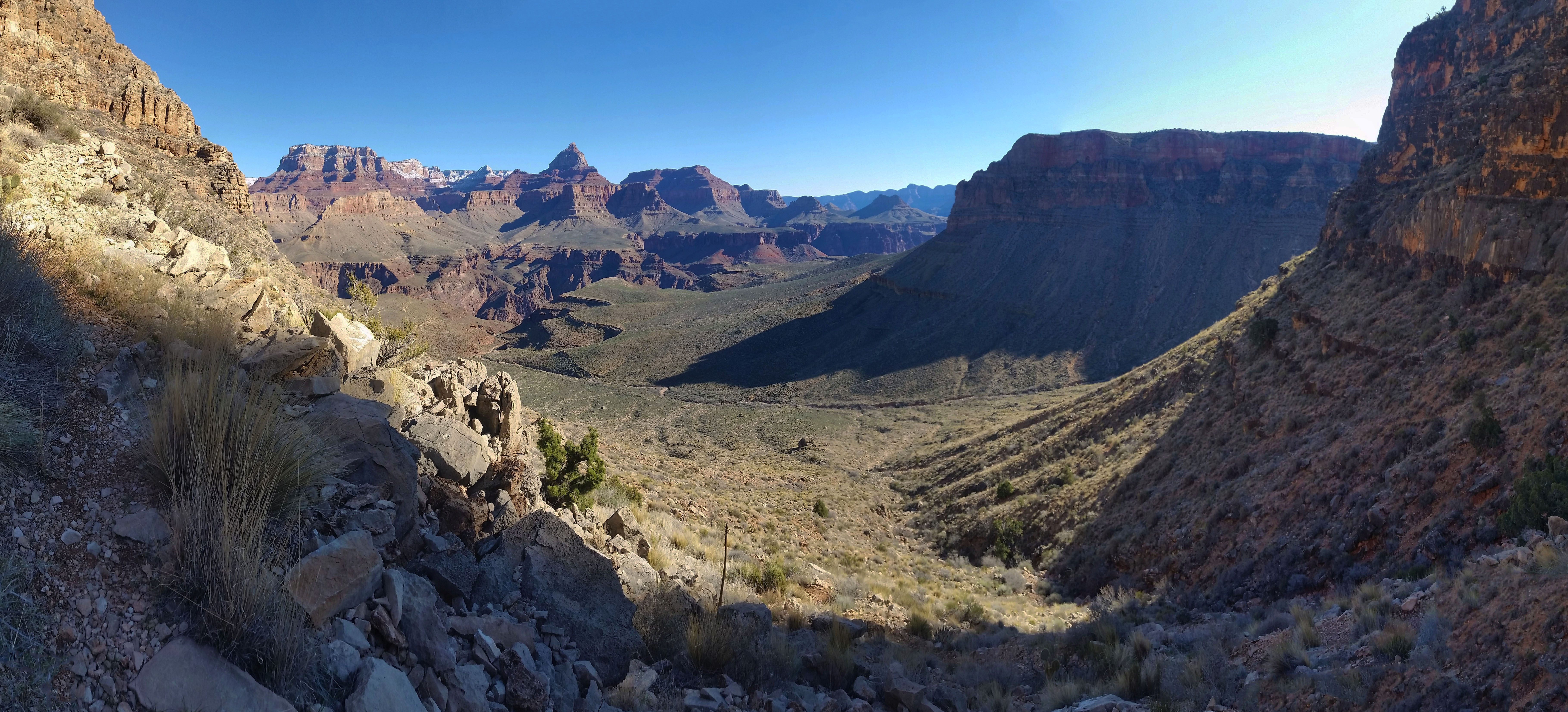
The Summit Plateau: We stood, beaten and bruised, looking towards the setting sun and the huge summit block that stood in front of us. We dropped our gear and brought just a pack as we walked in our climbing shoes towards the summit. The earth here was fresh and virtually untouched, we did surprisingly find a few footprints. As we neared the summit, the block just continued to grow and we started to wonder if we should have brought gear. We skirted south west of the block poking for weak spots until finally we found a route that went up. We scrambled the C4 route up a chimney crack up the sharp rock until finally we popped out into a large open plateau. The top was huge! We walked towards the south end and found a large cairn with a summit registry hidden below. The views were incredible, we could see the whole of the south rim and a lot of the Colorado River from here. We peered back to the approach we ascended, throughout the day and stood in pure amazement of the Grand Canyon’s beauty.
 Summit block!
 Skirting the summit block

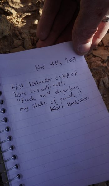
We wrote our names in the book, so stoked to finally be standing on top after dreaming of this moment for so long. Kari claimed first Icelandic ascent, and it was nice to thinking that the only way to the top was real climbing. The sights, the air, the feeling, the thrill, made every step worth it. We turned knowing our time was limited as the sun threatened to leave us, and walked towards the north end to find the rappel route down to the base where we started.
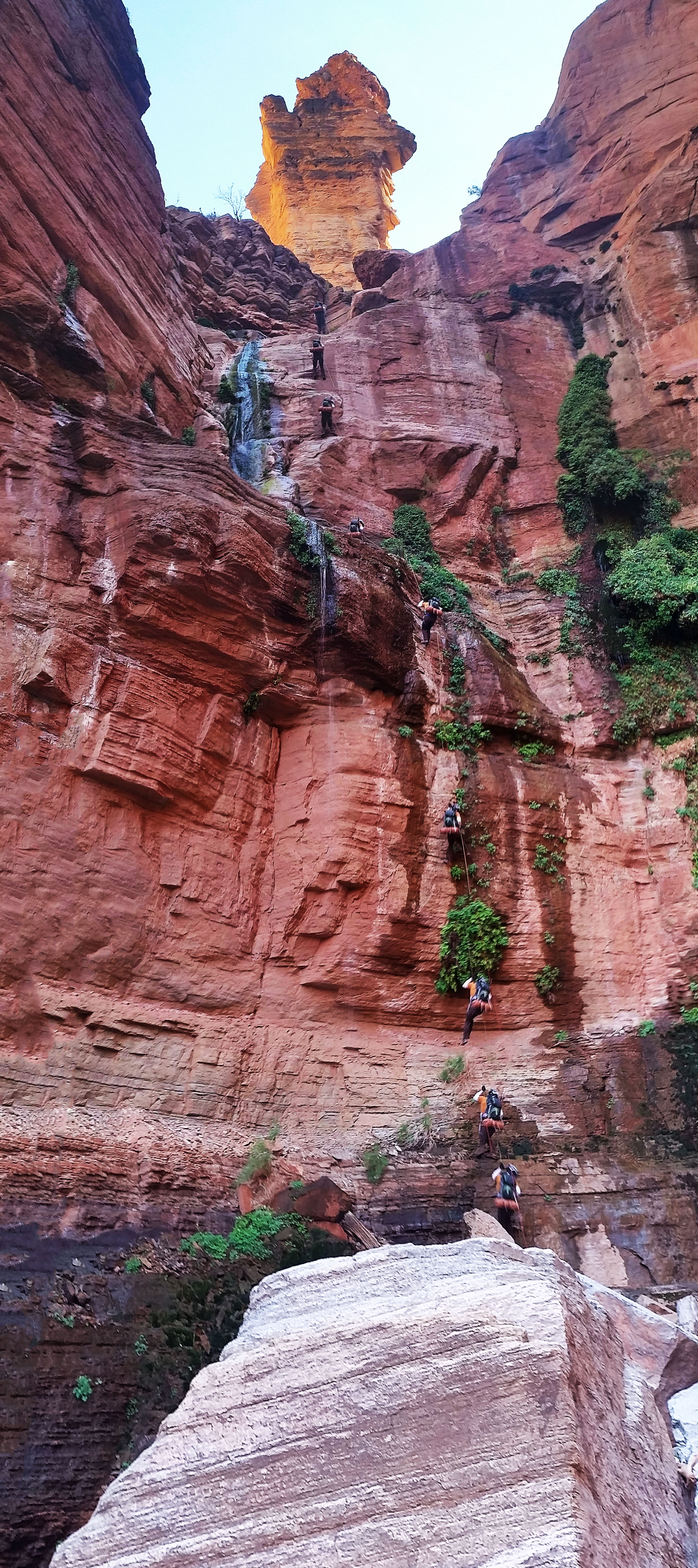
Rap Route: The chains were at the top out just to the climber’s right of screaming sky crack, a 5.11 trad route to the climbers left of the NE Arete.
R1: The first rap was a nice 100’ long free hanging which ended in another set of nice shiny bolts. We stopped at each station, replacing the webbing for the rap rings so fresh stuff could be used by the next climbers.
R2: A 60’ rap towards climbers left lead to a ledge with a nice tree and a couple more bolts, ready for fresh webbing on the rap ring awaited.
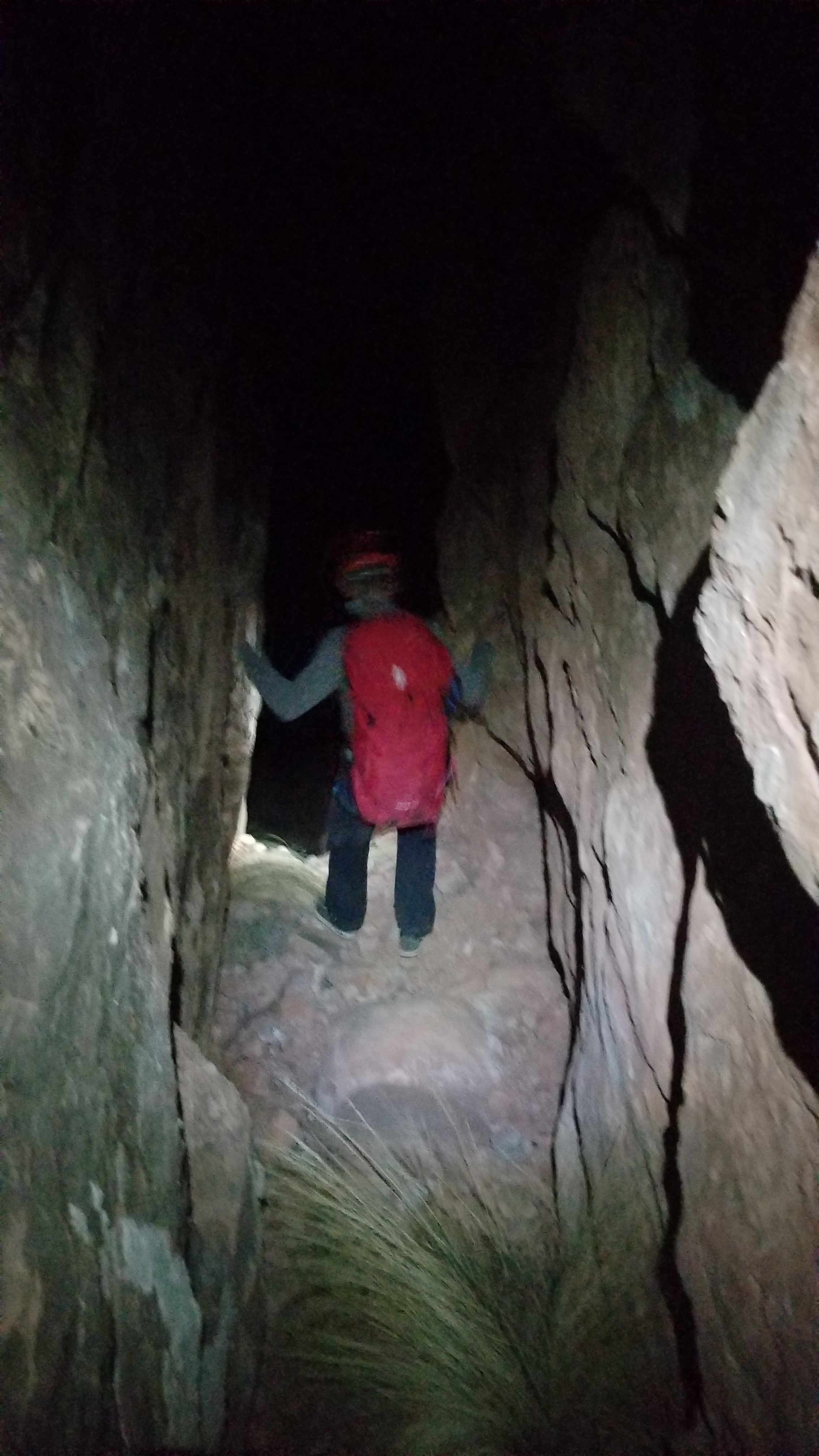
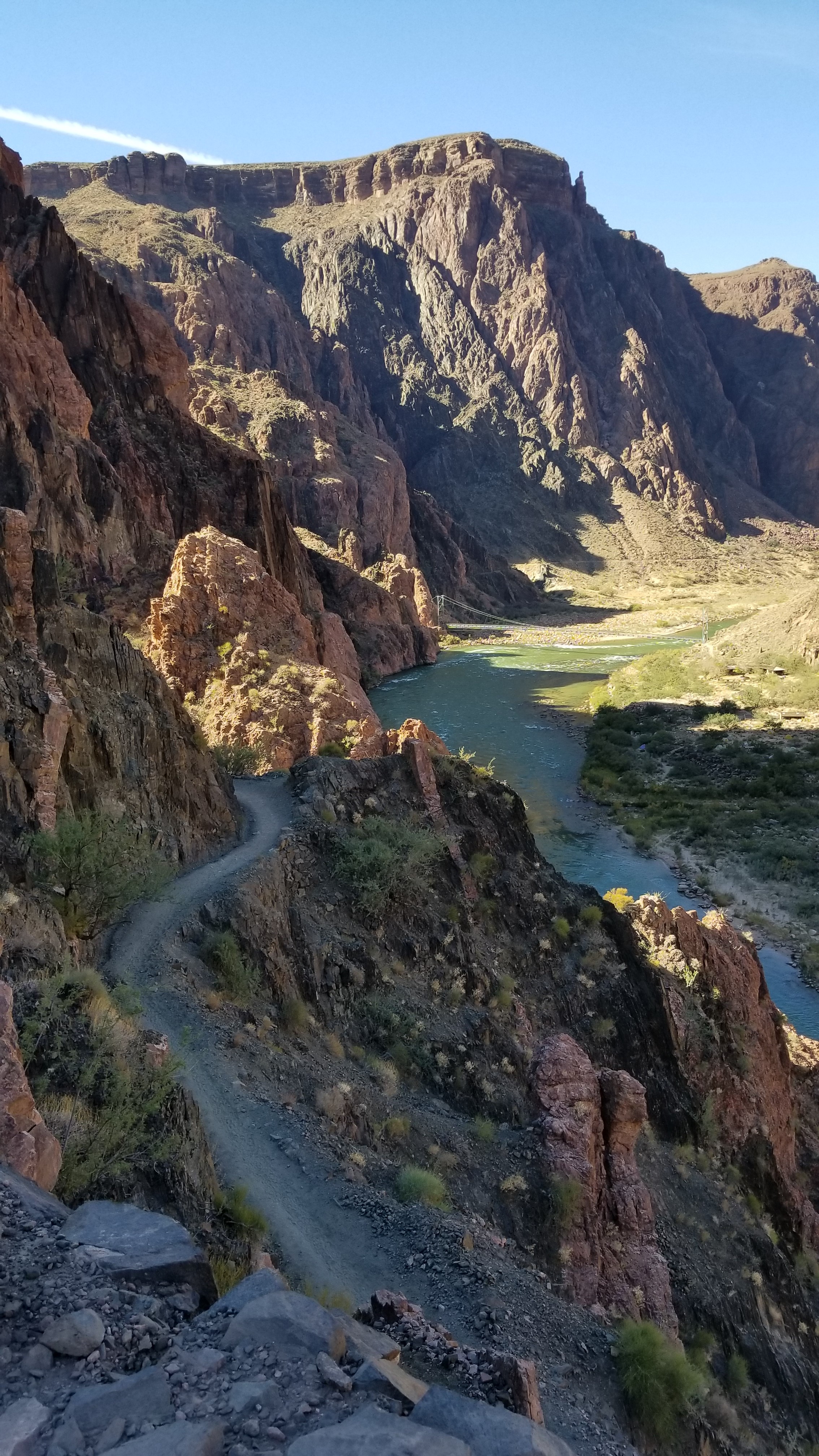
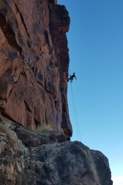
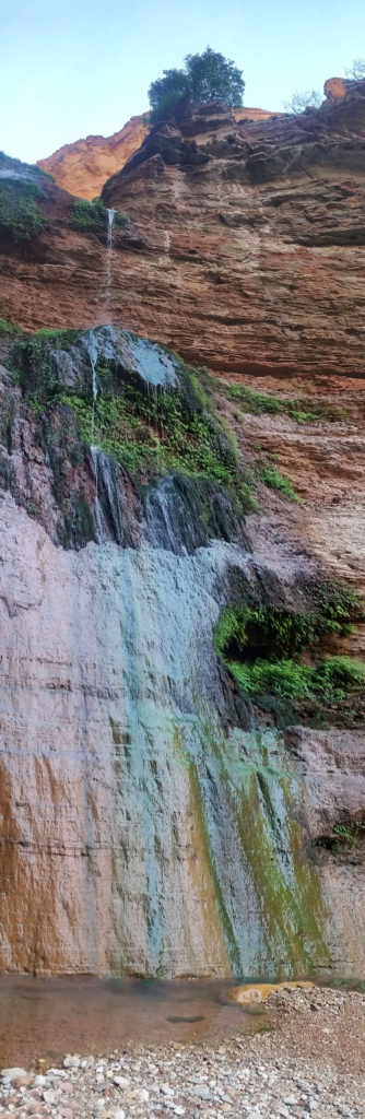
R3: A pretty straight forward 100’ rap down the face led to a large ledge. We worked to climbers left dropping another 10’ to another set of shiny bolts. R4: By this point we were pretty quick about replacing webbing, setting up and rapping down, I would keep my hand on the rope until I felt Kari’s tension release, then I’d start setting up. This time was no different I stood there waiting, hand on the rope, when all the sudden I felt a jerk of the rope and instantaneous slack on the rope. I though What the hell just happened, and I called down to Kari with no answer! There was only 1 way to find out and I set up the rap and had an ascender prussic ready in case I had to re-ascend the rope. I began rapping down, and finally about 60’ down the face Kari’s helmet came into view. “Kari!” I yelled. He answered back saying everything was fine and just come down slowly. Once I reached him I realized I was at the end of the 70m rope, but I was still dangling about 8’ above the ledge. I held onto the rock in front of my face, untied 1 knot out of the end of the rope, and repelled off the end of 1 side of the rope, and safely landed on the ledge. “Whewww!” I exclaimed, happy to be on the ground. Do not try this at home! I did see a set of bolts half way down the rap route that we could have used, but this turned out okay. R5: We found ourselves at the bolts at the top of P1 and relieved there was just a short 50’ rap left as the sun gave off its final rays of light for the day.
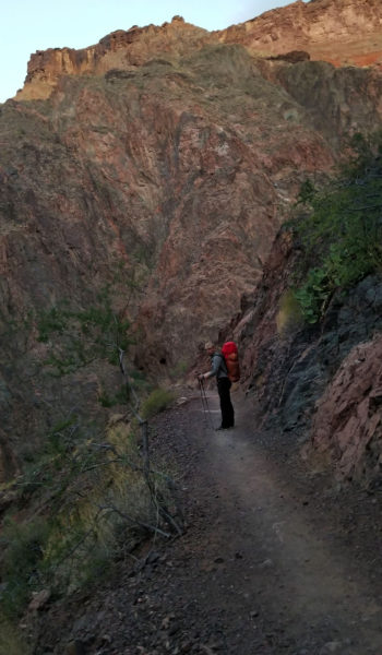
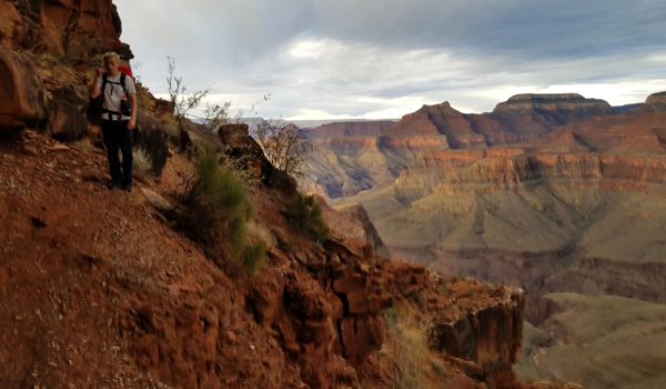
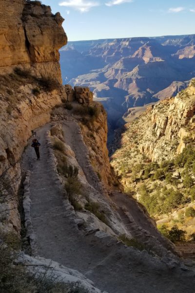
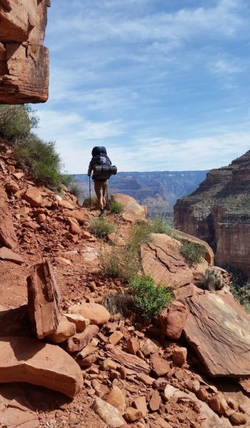
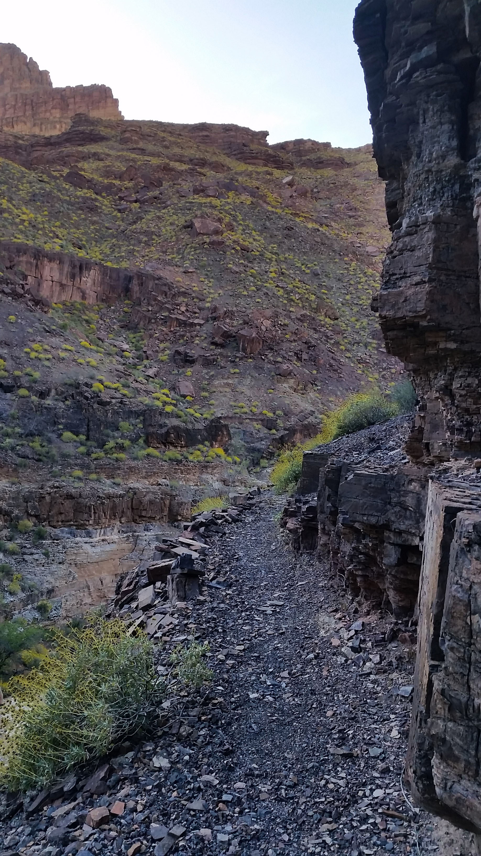
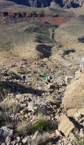
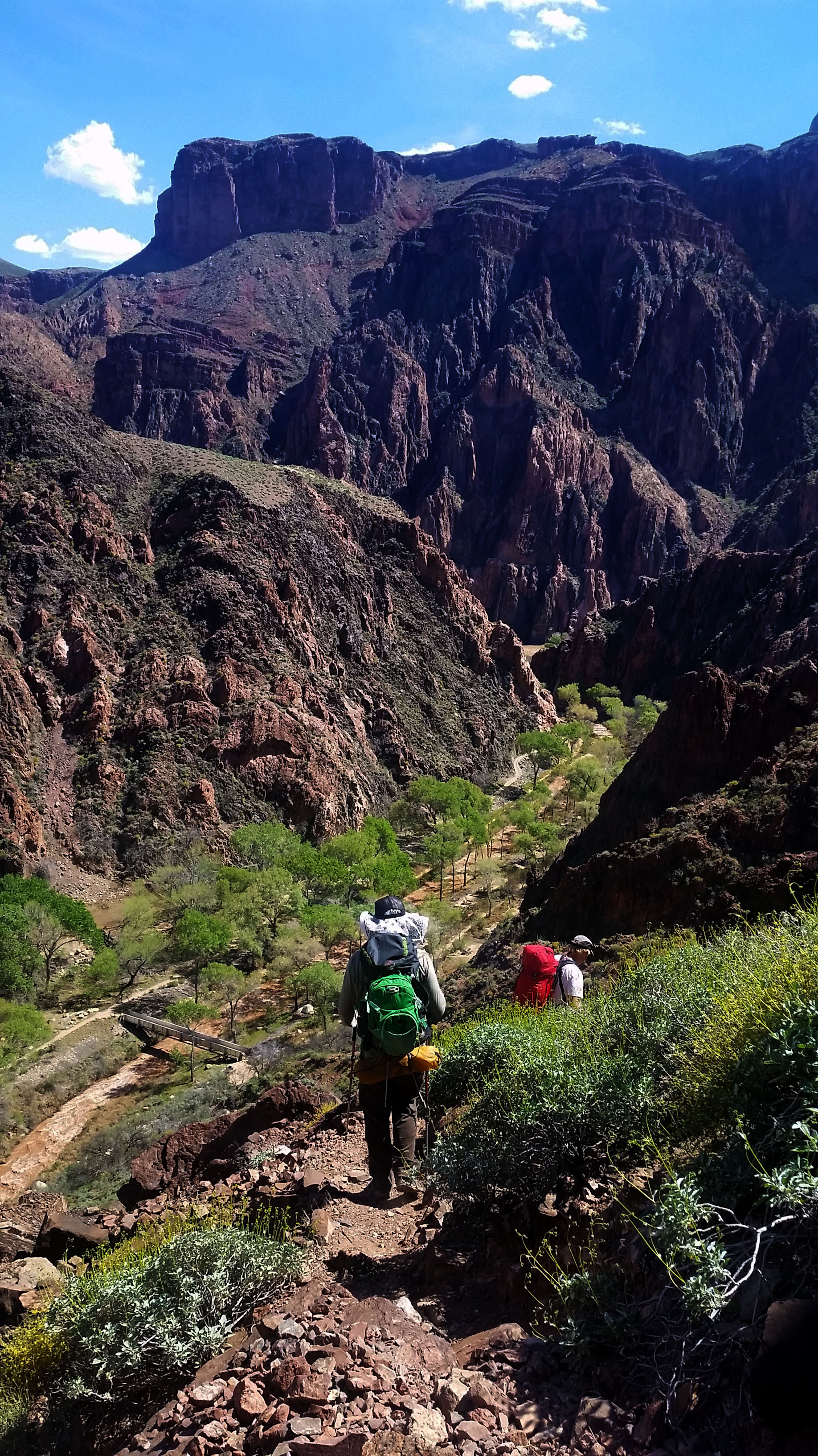
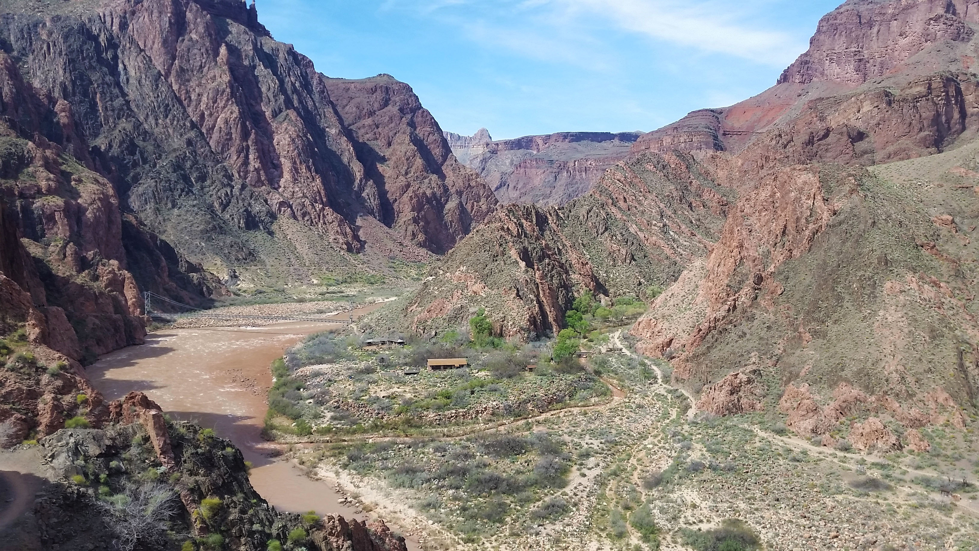
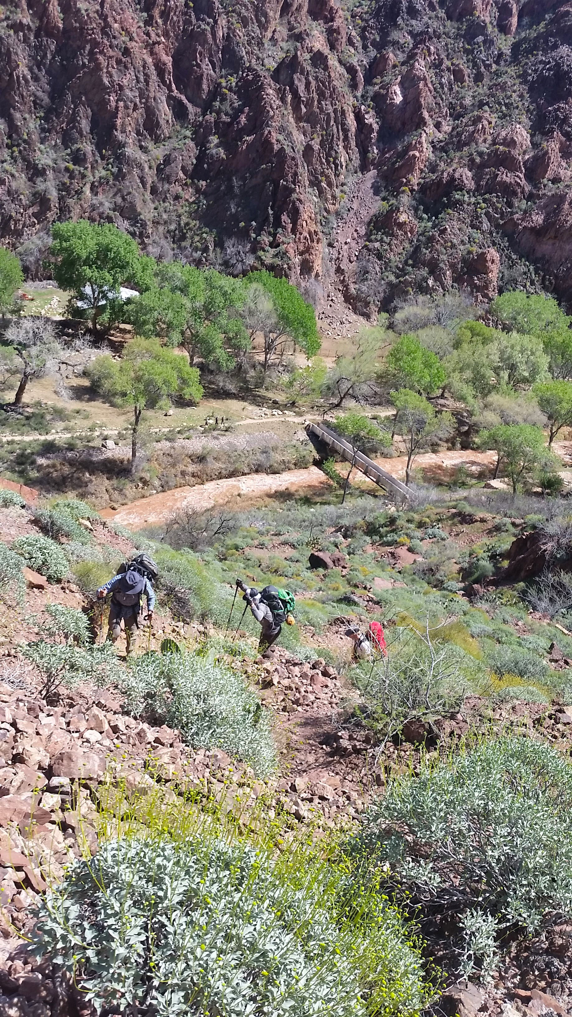
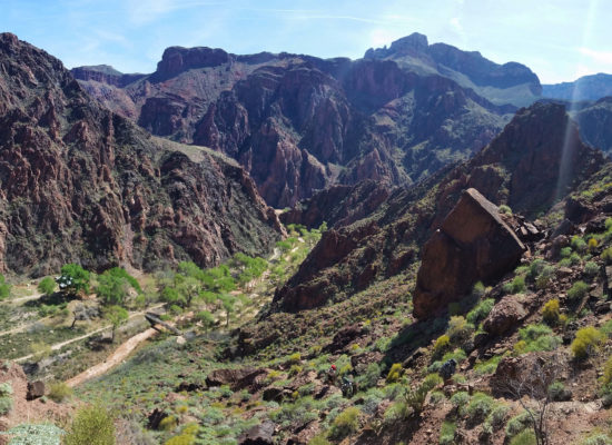
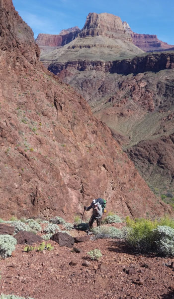
We were finally back on the ground, realizing we were on rock for a good 8 hours, between the climb, the summit block scramble, and rappelling with replacing all the webbing as we went. Tired, beaten, but happy to have accomplished out goal, we headed back towards camp the way we came. We hiked through the night reversing every obstacle we ascended, rapping where it seemed logical until reaching camp. We were both beat as we packed up camp and headed back down the red wall, how do people do this in under 24 hours?!
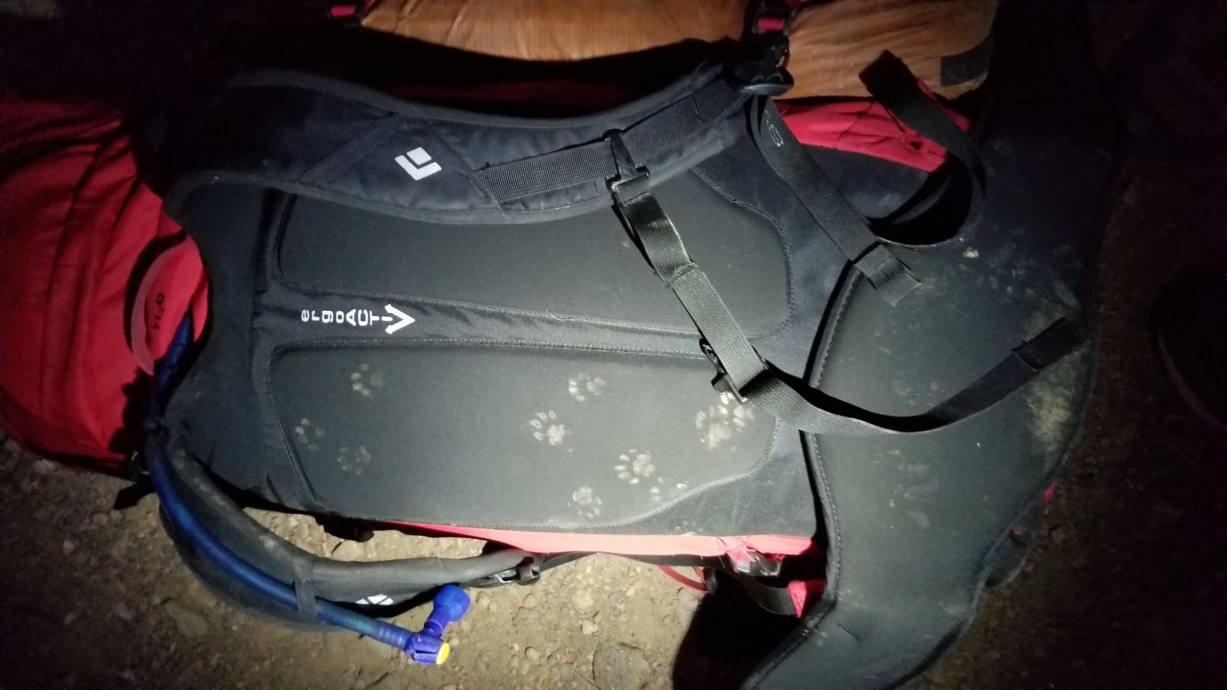
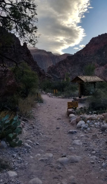
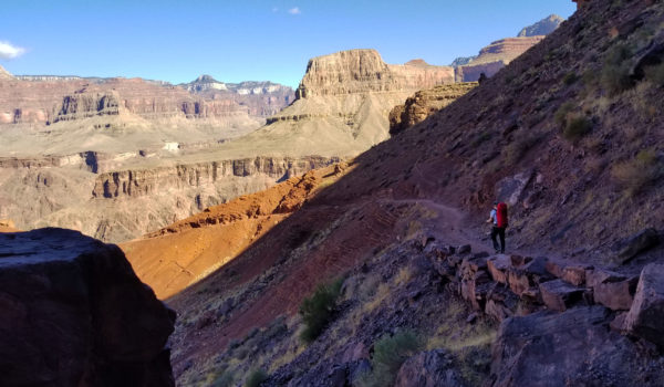
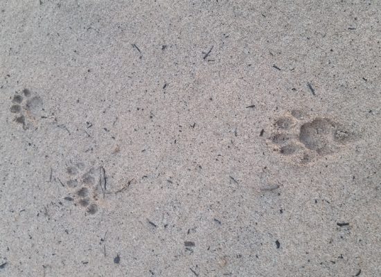
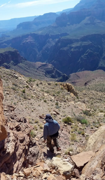
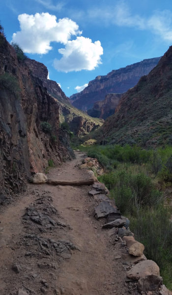
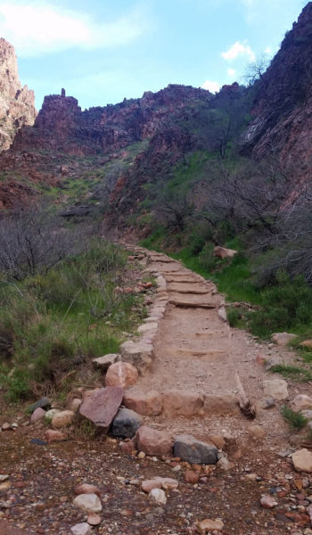
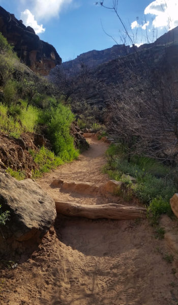
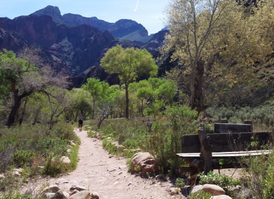
We descended Sumner Wash and finally found feet back on Clear Creek trail. With our slightly lighter packs we headed back towards Phantom Ranch totally beat. We reached the ranch overlook at about 1am and both looked at each other knowing there was so much more trail before we exited via Bright Angel . . . “let’s have a quick nap”, I said. We pulled out a tarp and our sleeping bags and laid in a pullout of the trail and crashed until 5am. A ringtail visited us in the night attempting to “borrow” a few snacks, probing our bags for weakness. I heard some stirring, woke up and scared the little fella off. By the next morning our packs were covered with his prints.
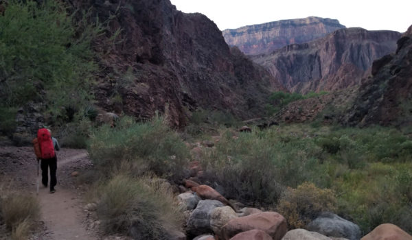
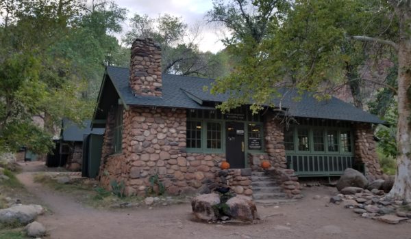
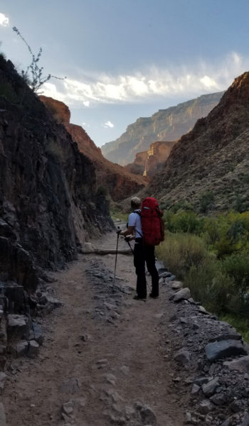
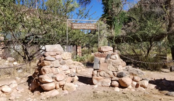
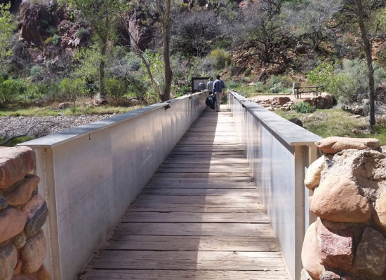
We woke, and packed our bags once again and were soon descending into Phantom Ranch. We took a quick pause to re-up on our almost depleted water supply. We snacked up, watered up, and chatted with other trekkers at the ranch with big smiles on our faces. It was only about 9 more miles out via Bright Angel trail. We walked those miles feeling pretty light despite our load. We had somehow accomplished the goal we set out to achieve. The entire day before seemed like a dream as we ascended to the south rim. We glanced back when we could, thinking about the day before and how rare of a chance we had to stand among the few who have summited. What a great feeling, another awesome trek in the Grandest of Canyons!
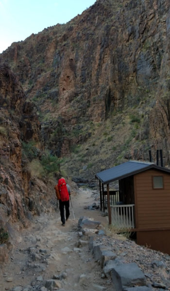
 Almost to Phantom!
 Heading back towards Phantom Ranch
HIKE/CLIMB INFORMATION:
- Approach: South Kaiab to Clear Creek to Sumner Wash to Zoroaster Temple via NE Arete, return via Bright Angel: https://hikearizona.com/gps=39407
- Climbing Route: NE Arete (5.9+ Trad): https://www.mountainproject.com/route/105789638/ne-arete
CLIMB/HIKE STATS:
- Weather: Hi 60s, Low 40s, Sunny
- Water: 4 liters
- Food: 1 Cliff Builder bar, 1 protein bar, 1 Nature Valley granola bar, bag of salt & vinegar, beef jerky, bag of pizza Pringles, gummy worms, apple
- Time: (Day 2) 7 hours
- Distance: (Day 2) 10 miles
- Accumulated Gain: (Day 2) 4,800 feet
- Climbing Rating: 5.9+ Trad
- Number of Pitches: 6
GEAR:
- Big Agnes Copper Spur UL2 tent
- Big Agnes QCORE SLX sleeping pad
- Cosmic Down Kelty Sleeping Bag (rated to 20 deg F)
- Jet Boil – Sol
- Black Diamond trekking poles
- SPOT Gen3 Tracker
- Sawyer Squeeze – Water Filter
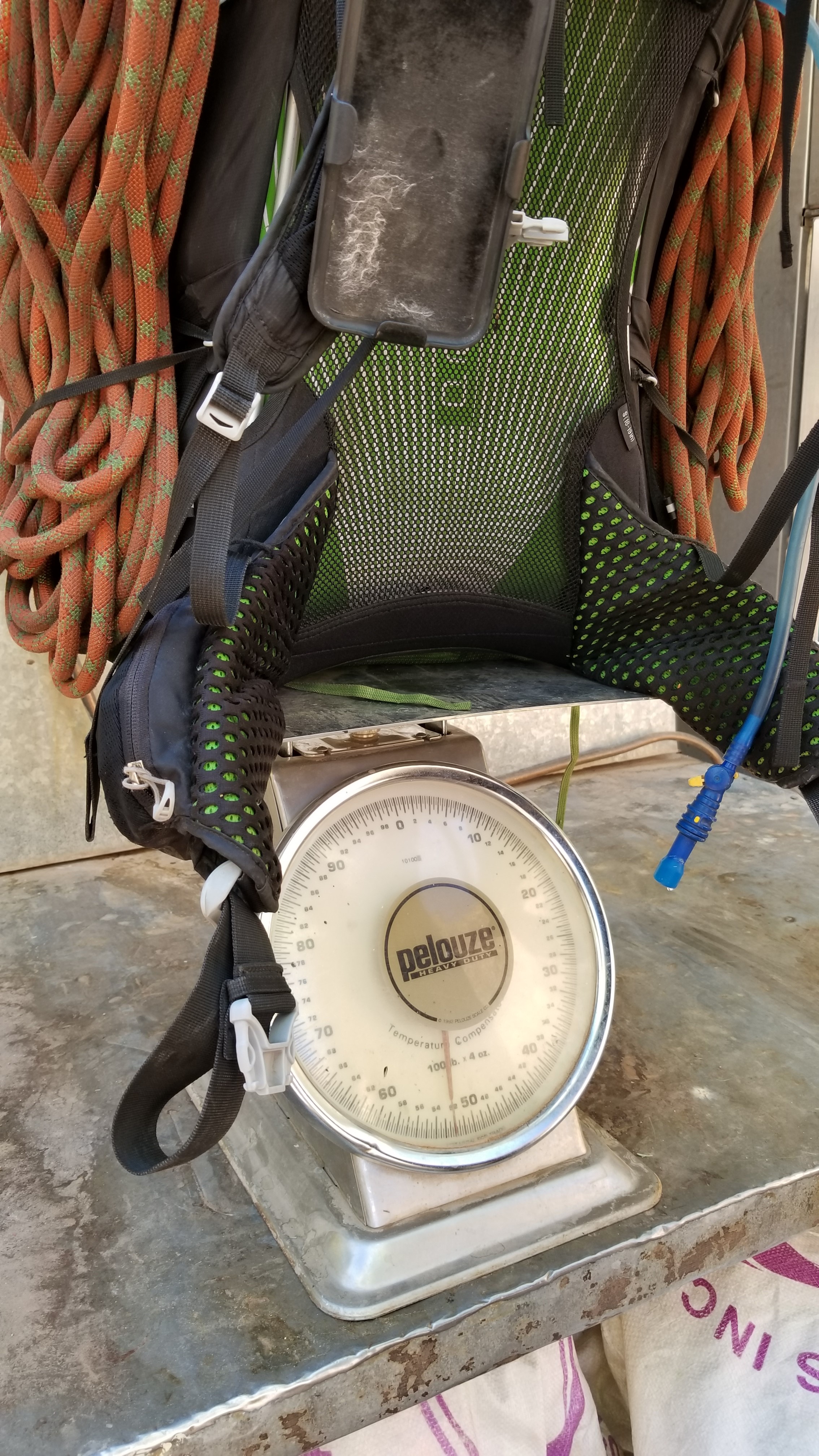
- 58 liter exos osprey backpack
- Black Diamond Helmet
- Petzl Corax Climbing Harness
- 2 Black Diamond screw carabiner
- 4 Phantom DMM screw carabiner
- 6mm Accessory Chord – Anchor
- Black Diamond Camelot X4+C4 Cams – Double Rack – (2x), 0.1, 0.2, 0.4, 0.5, 0.75, 1, 2, 3, 4
- Black Diamond Standard Nut Set
- 12 Alpha Trad DMM quickdraws – Alpine draws
- Black Diaimond ATC Guide
- 70 meter 9.8mm Rope (Orange Slice)
- Webbing/7mmCord for personal anchor
- 20′ Flat webbing to leave for anchors
- Arc’teryx Chalk Bag
CLOTHING:
- Smartwool 195 weight long sleeve
- Arc’teryx Hoody
- Cotton Handkerchief
- Nike shorts
- Patagonia Pants
- Darn Tough Medium Wool Sox
- Merrell Mid Moab Hiking Boots
- La Sortiva TC Pro Climbing Shoes
Zoroaster Temple – Grand Canyon – AZ (Day 2 – Part 1) – 11.4.17
- Day 1: South Kaibab, Clear Creek, Redwall Notch
- Day 2 (Part 1): Redwall Notch to Zoroaster Climb P4
- Day 2 (Part 2): P5 to Summit and out via Bright Angel
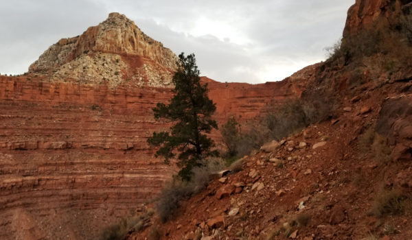
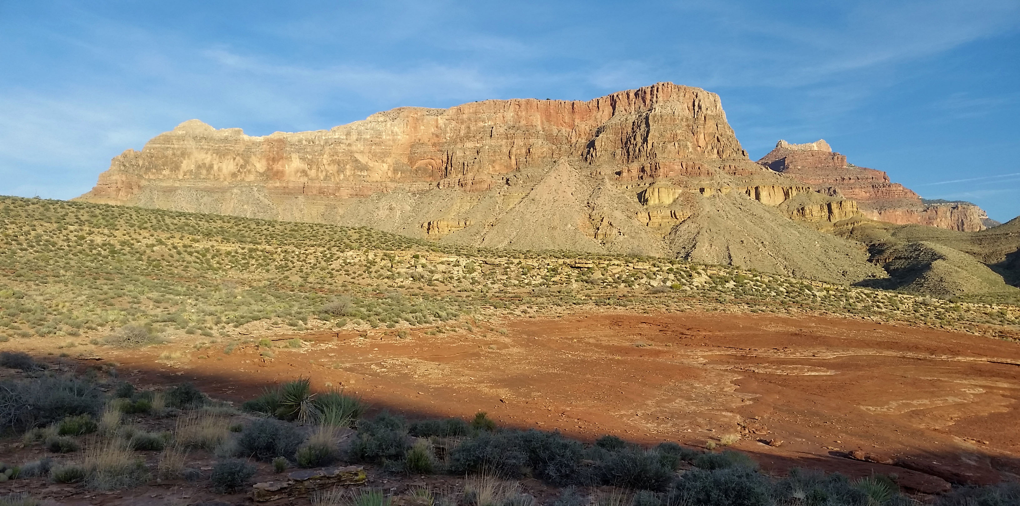
The wind screamed by our tent most of the night, waking us every 15 minutes it seemed. Finally, after midnight, I remember it dying down and getting some solid sleep. The alarm blasted, Bzzzz Bzzz Bzz, man was it time to get up already?! We woke, staying still for a moment checking the time. Sure enough, it was time to start our haul to the base of Zoroaster and hopefully attempt our bid on the summit.
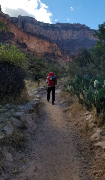
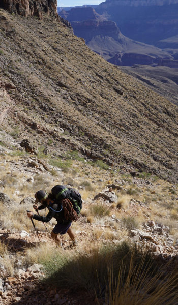
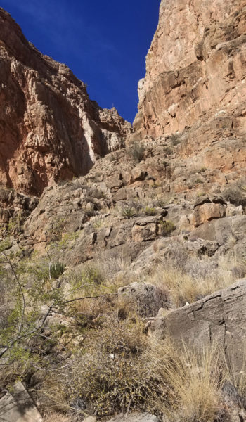
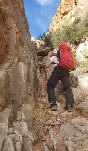
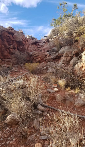
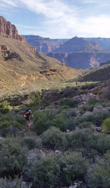
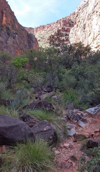
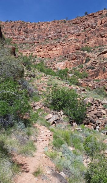
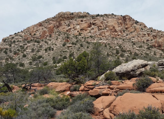
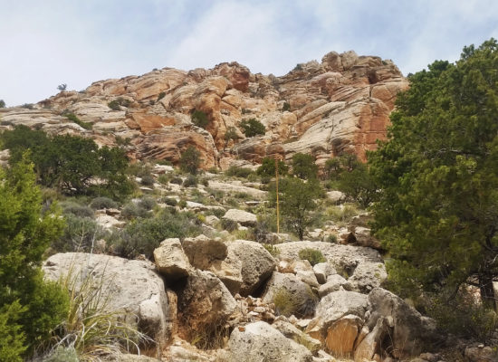
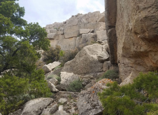
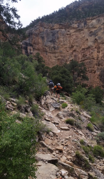
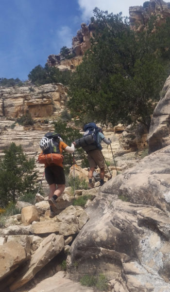
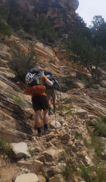
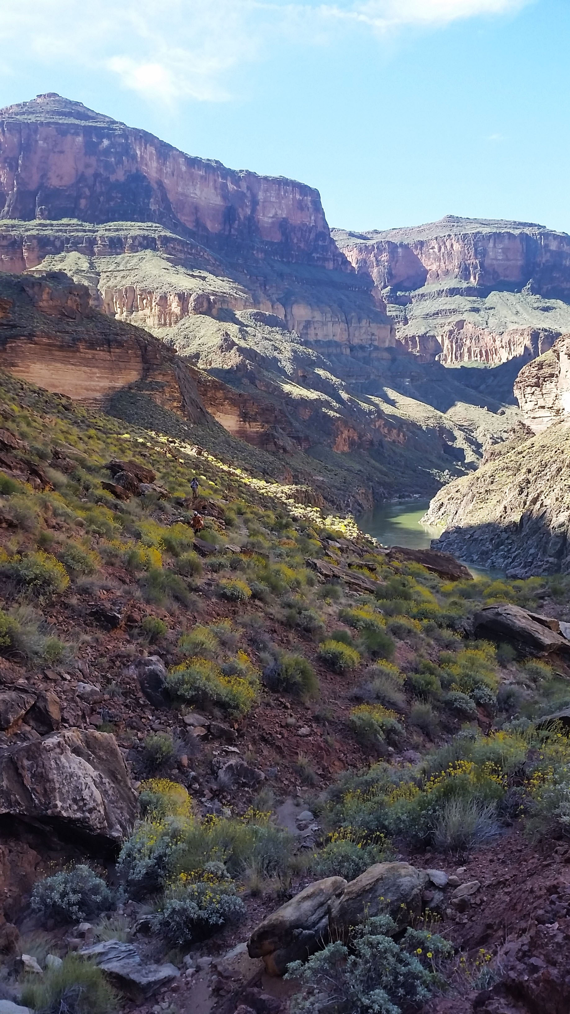
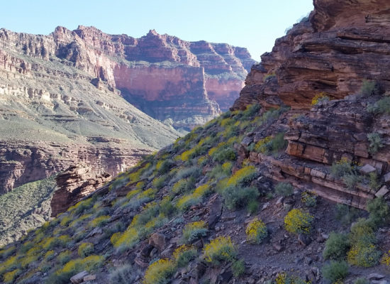
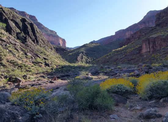
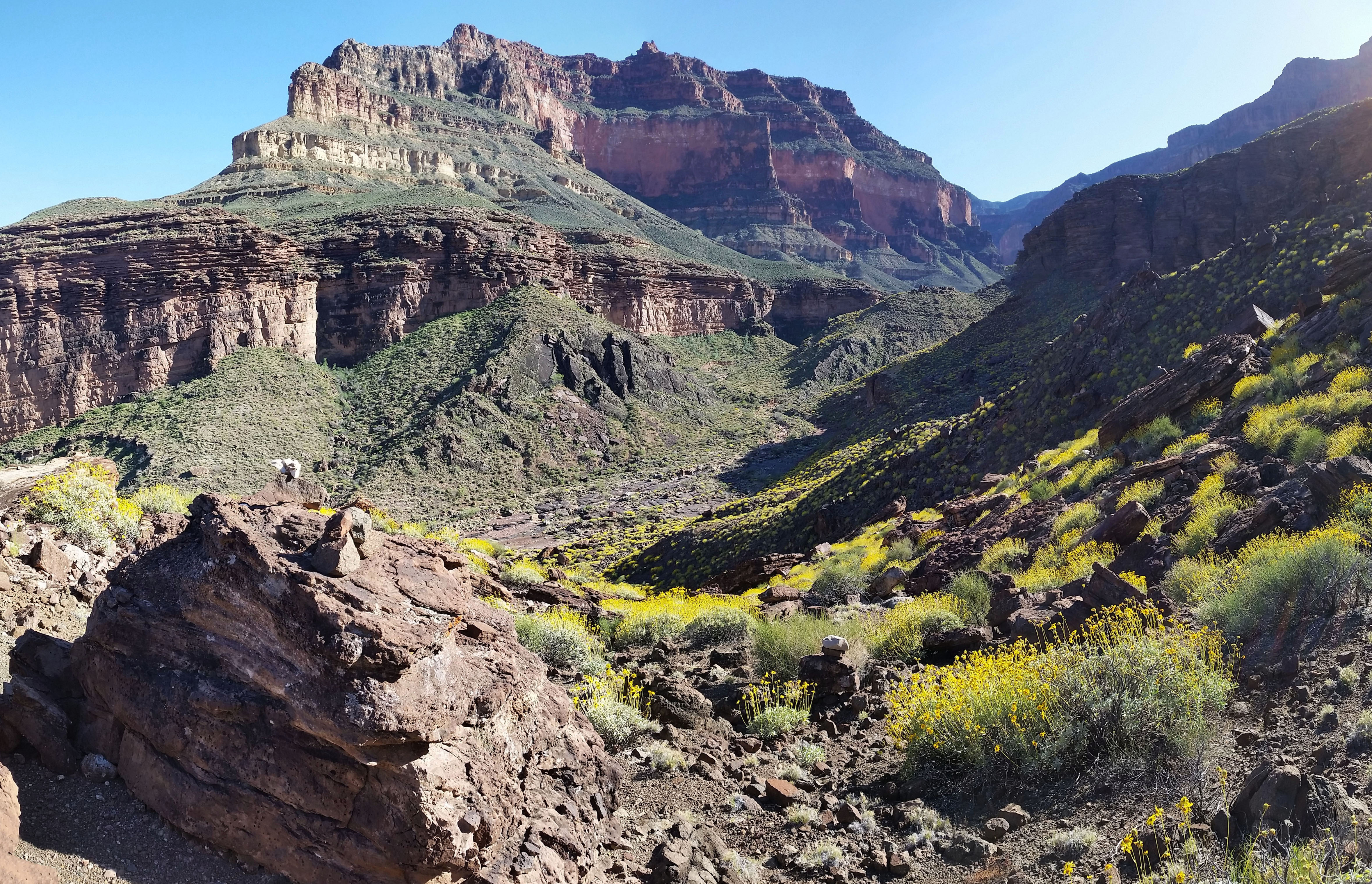
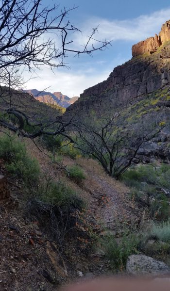
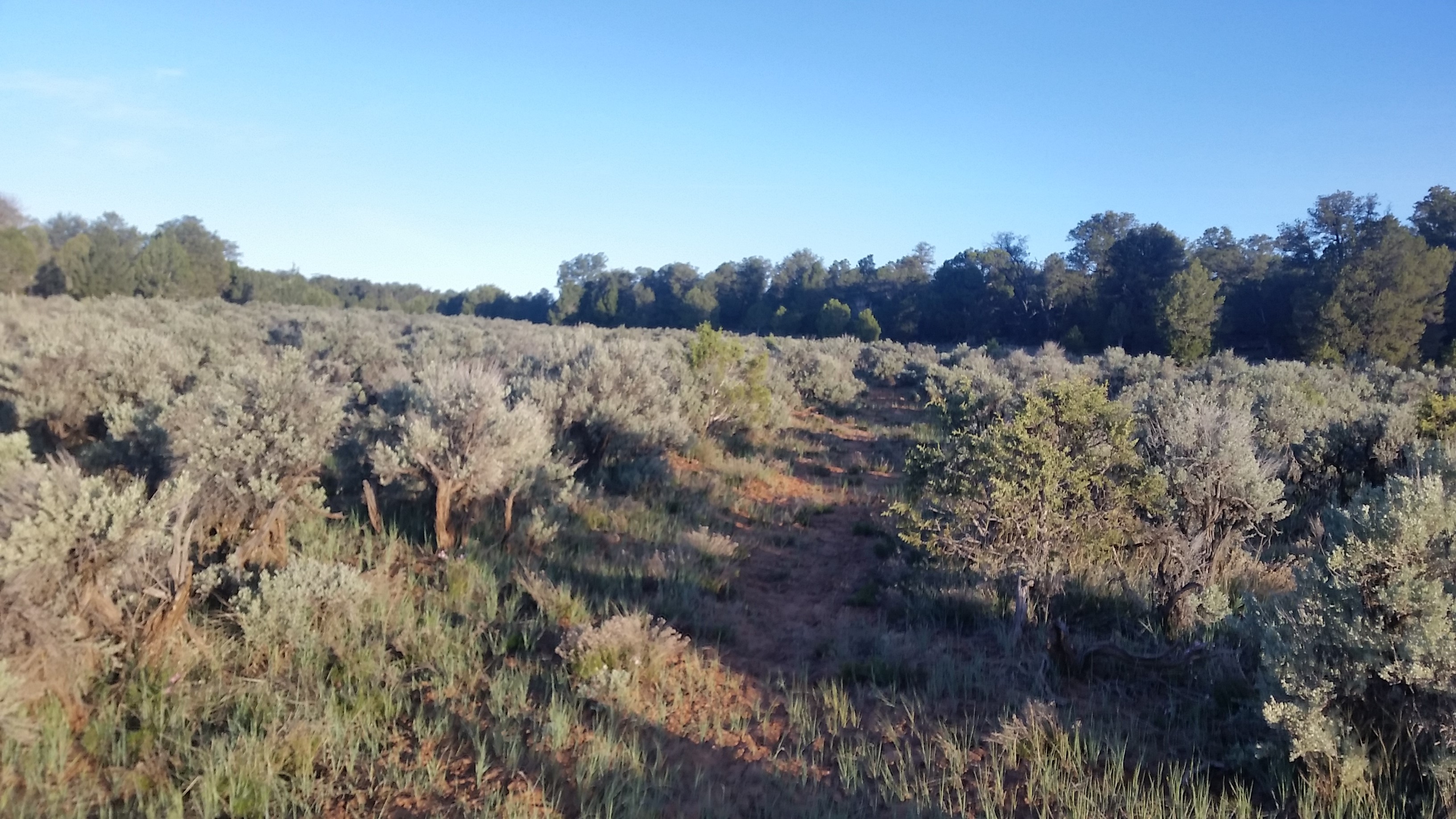
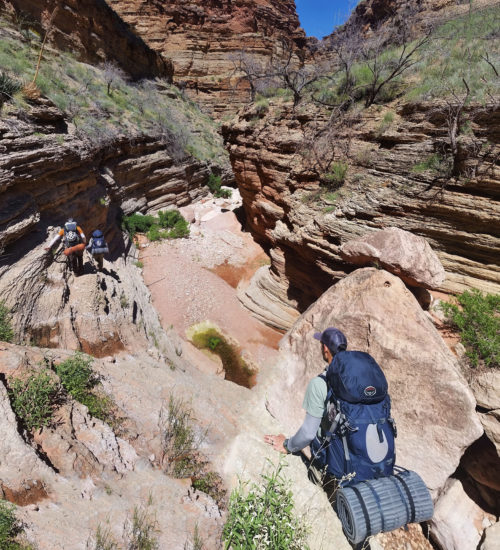
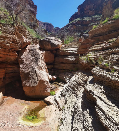
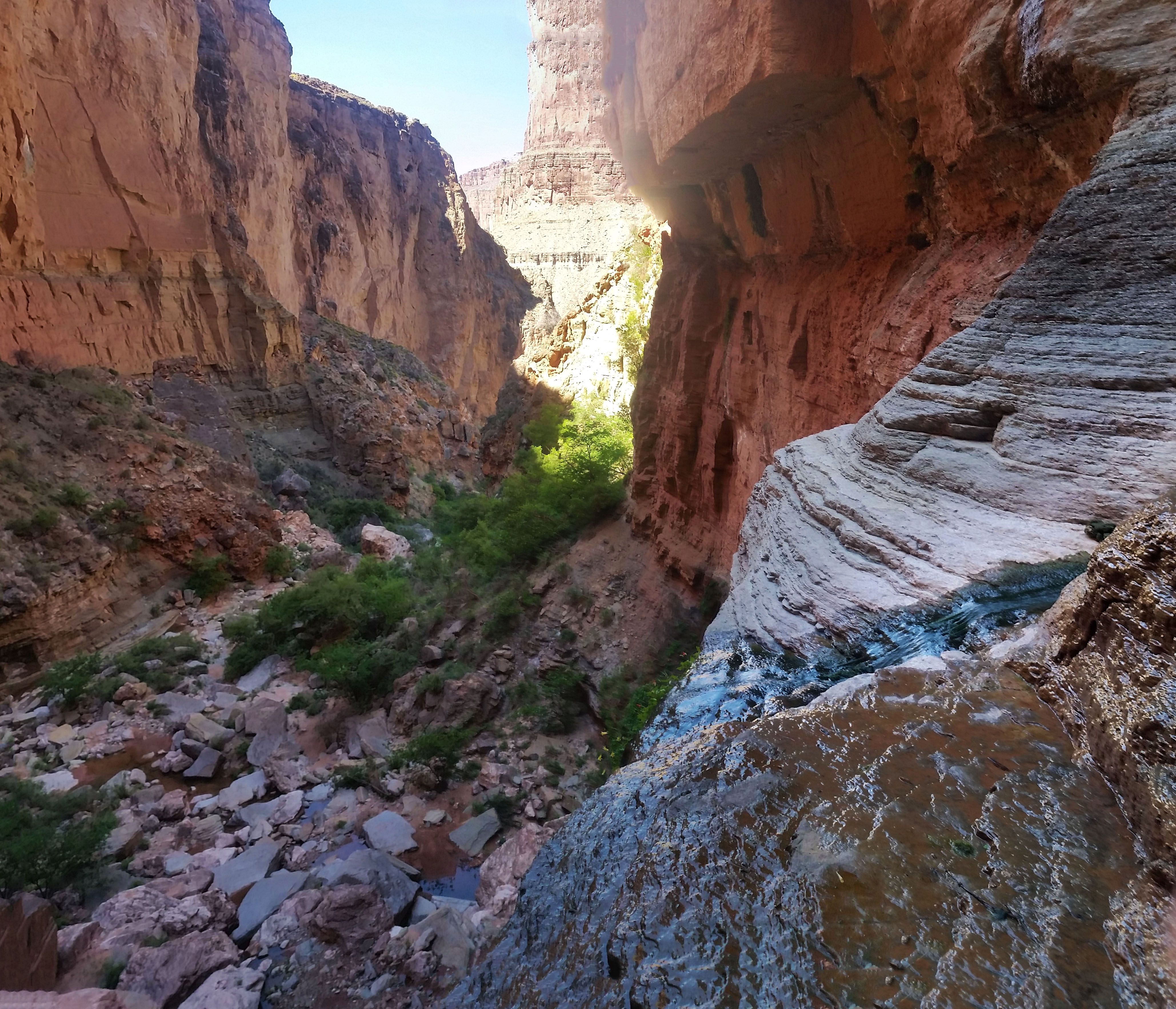
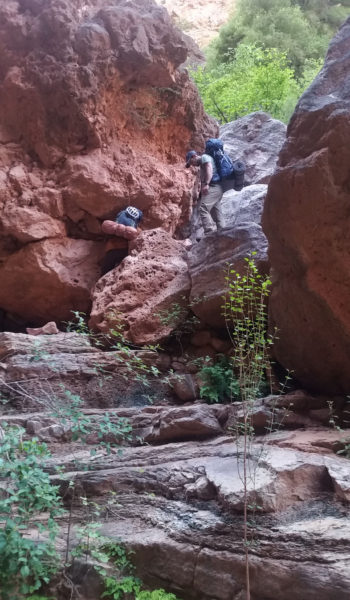
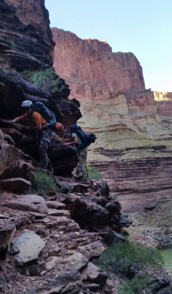
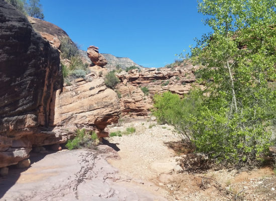
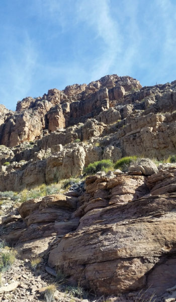
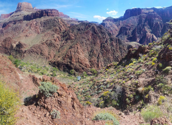
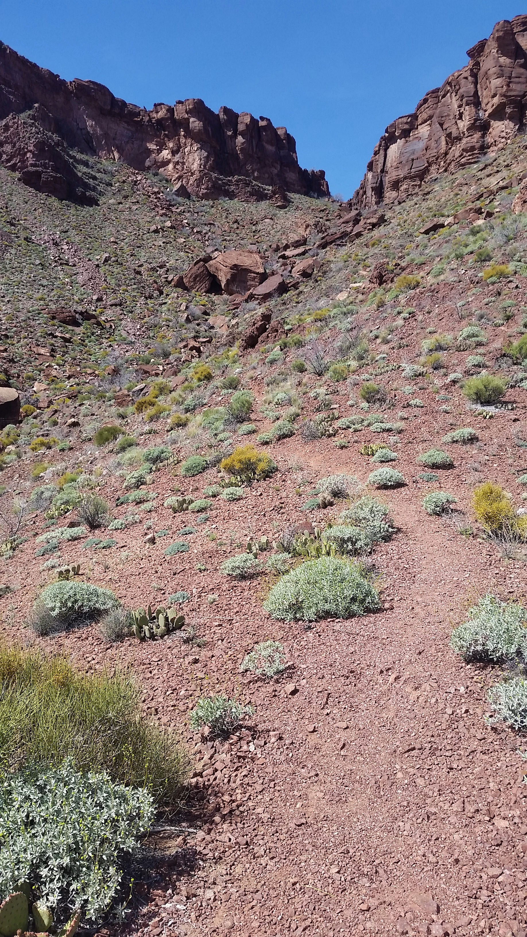
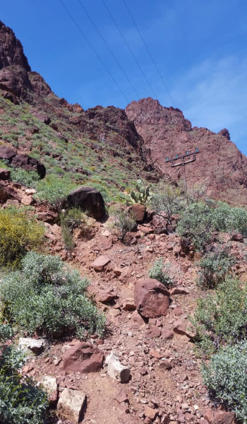
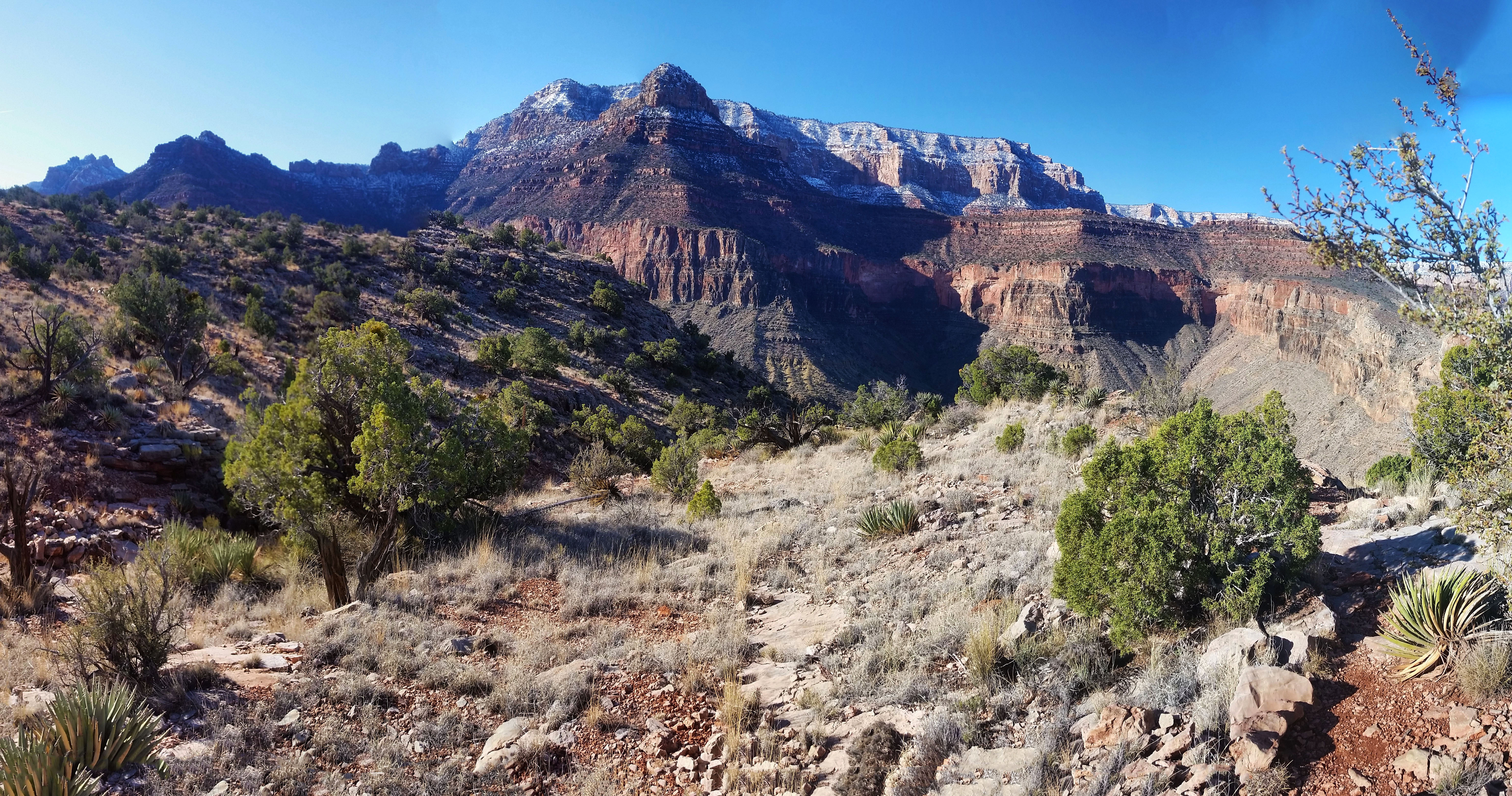
We ate breakfast, packed up camp, and before we knew it, Kari and I were taking our first steps towards the monstrous beast that loomed over our camp just as day began to break. Feet in red dirt we ascended Zoroaster’s arm, chimneying up a small obstacle and soon the next cliff bands stared us in the face. We picked our way through, shimmying up some low class 5 (C5) chimneys, handing packs as we ascended. We moved as quickly and safely as we could. A slip or mistake here would not only cost an injury, but also the goal, and not to mention the excruciatingly long rescue effort. Cliff band after cliff band we somehow found our way through. We pushed further up the arm, and finally after a long slot ascent and a large boulder shuffle, we skirted to the north and headed towards the saddle of Zoroaster and Brahma temples.
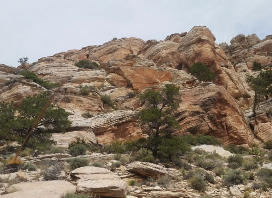
 The overscast morning seemed to start slowly
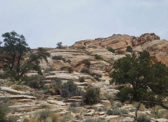
 Cliff Band obstacles
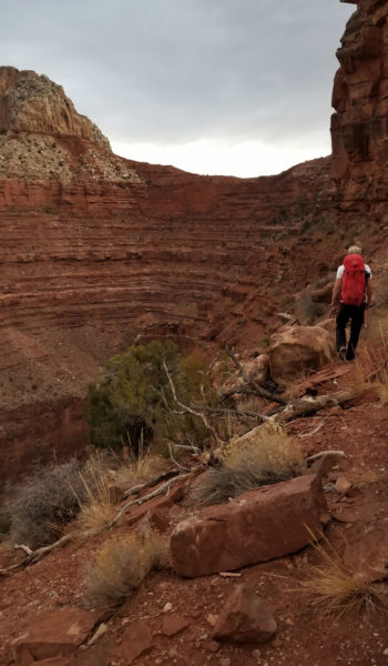
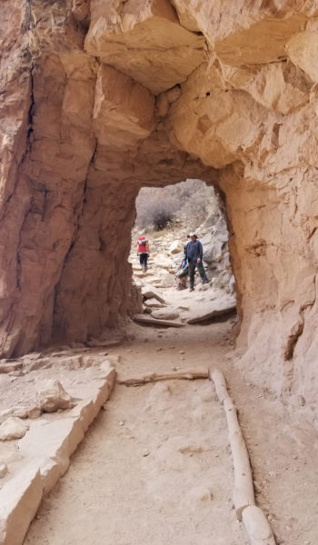
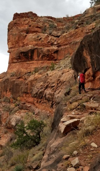
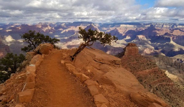
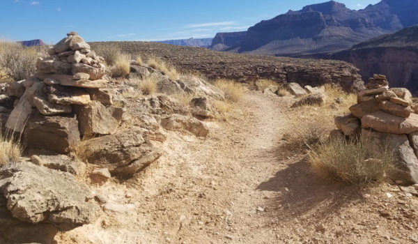
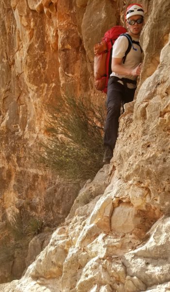
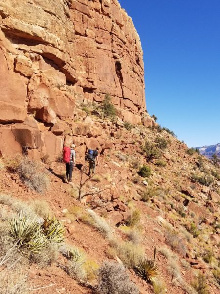
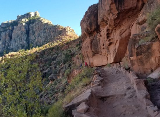
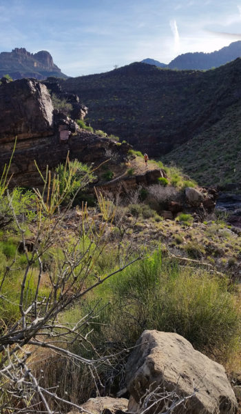
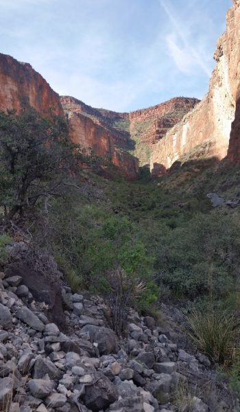
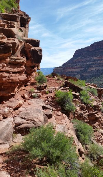
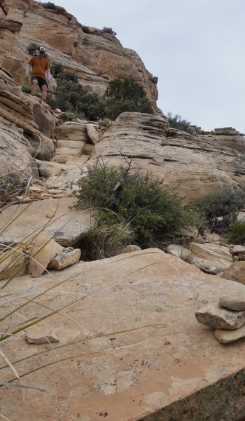
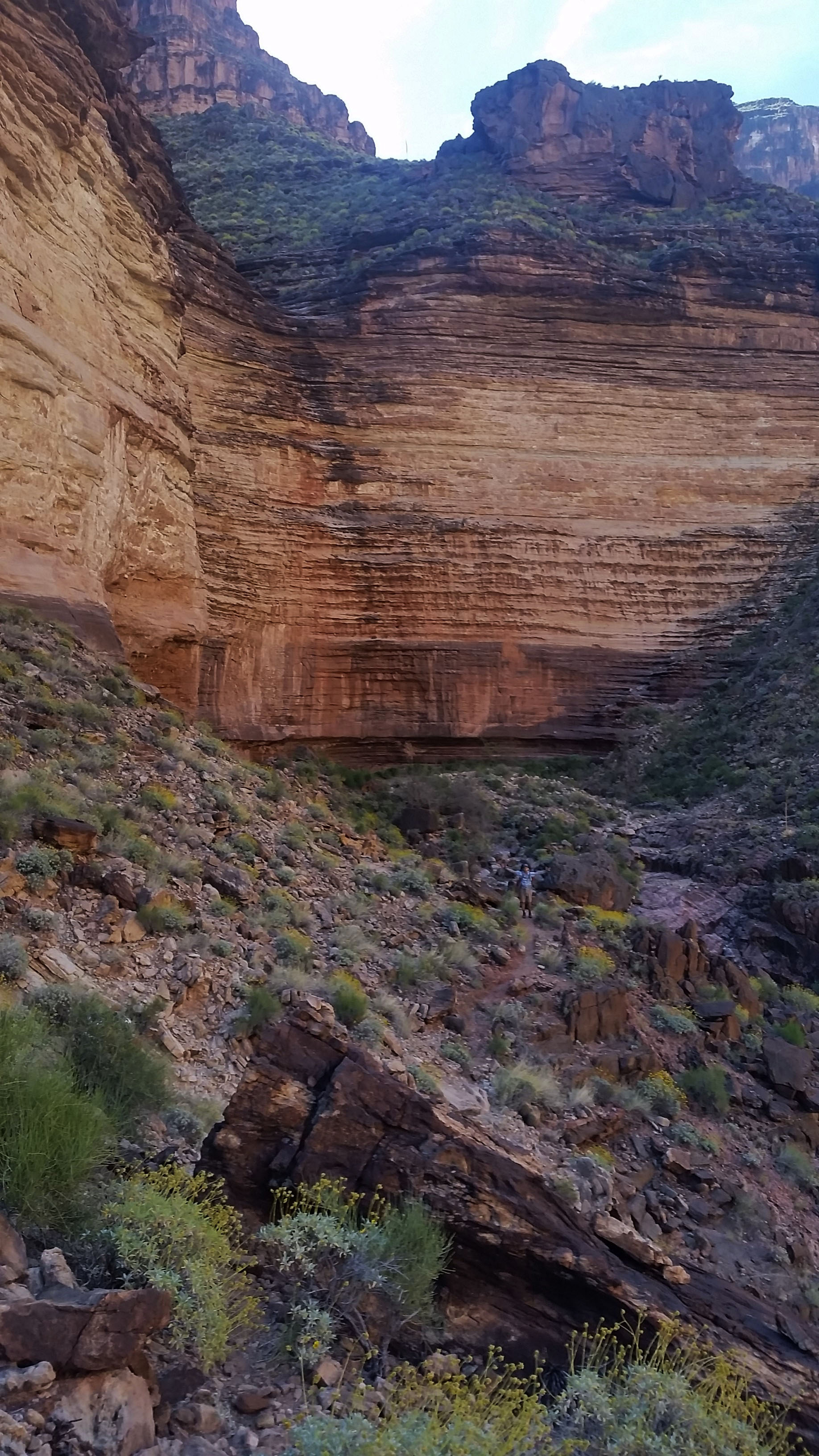
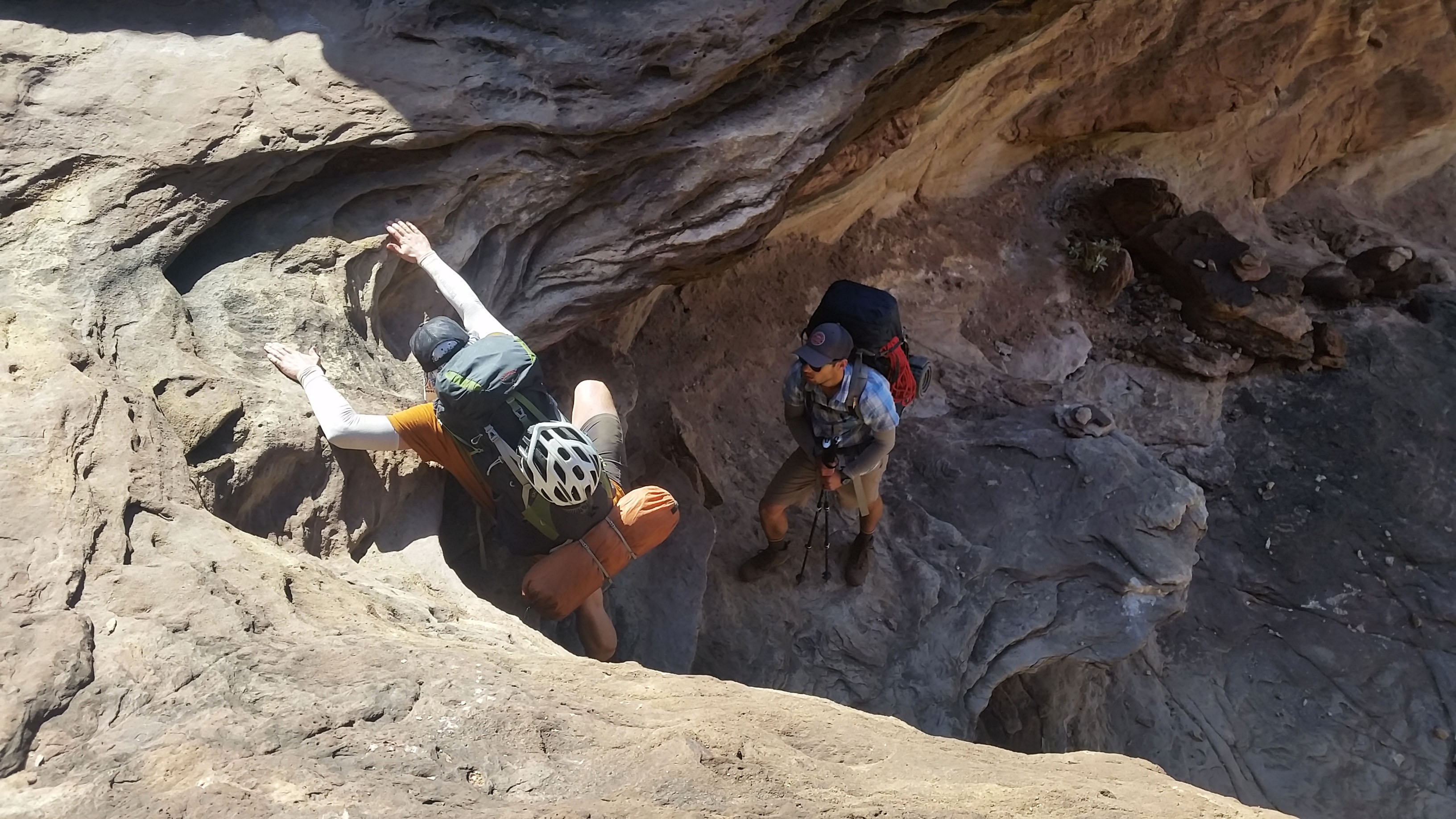
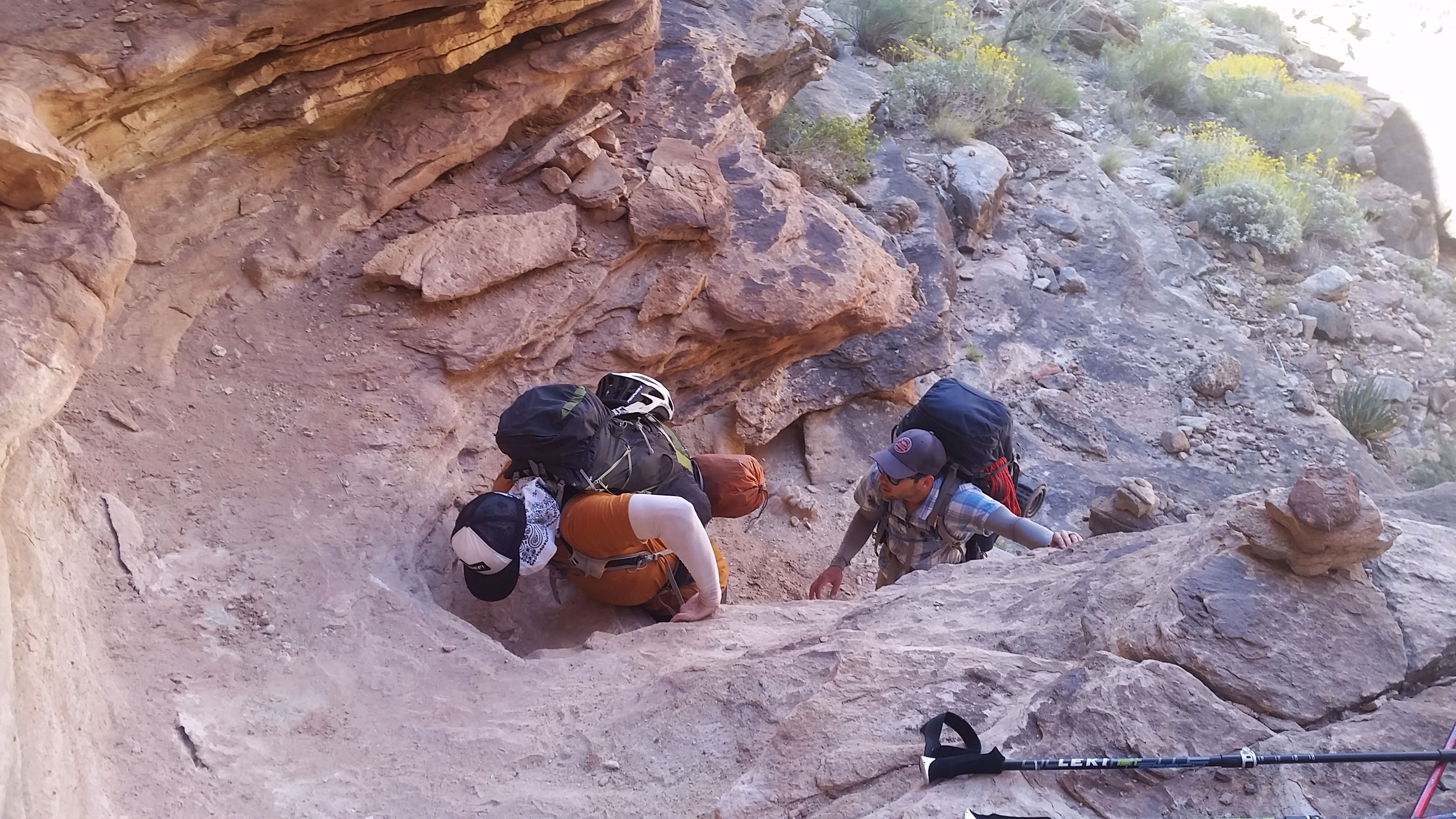
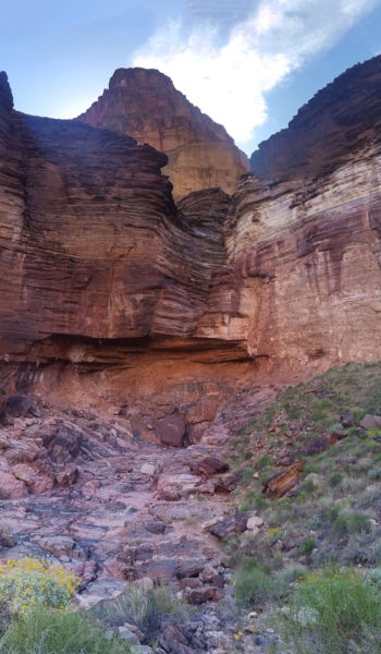
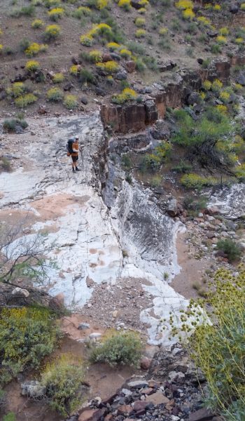
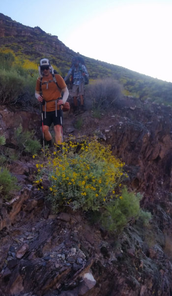
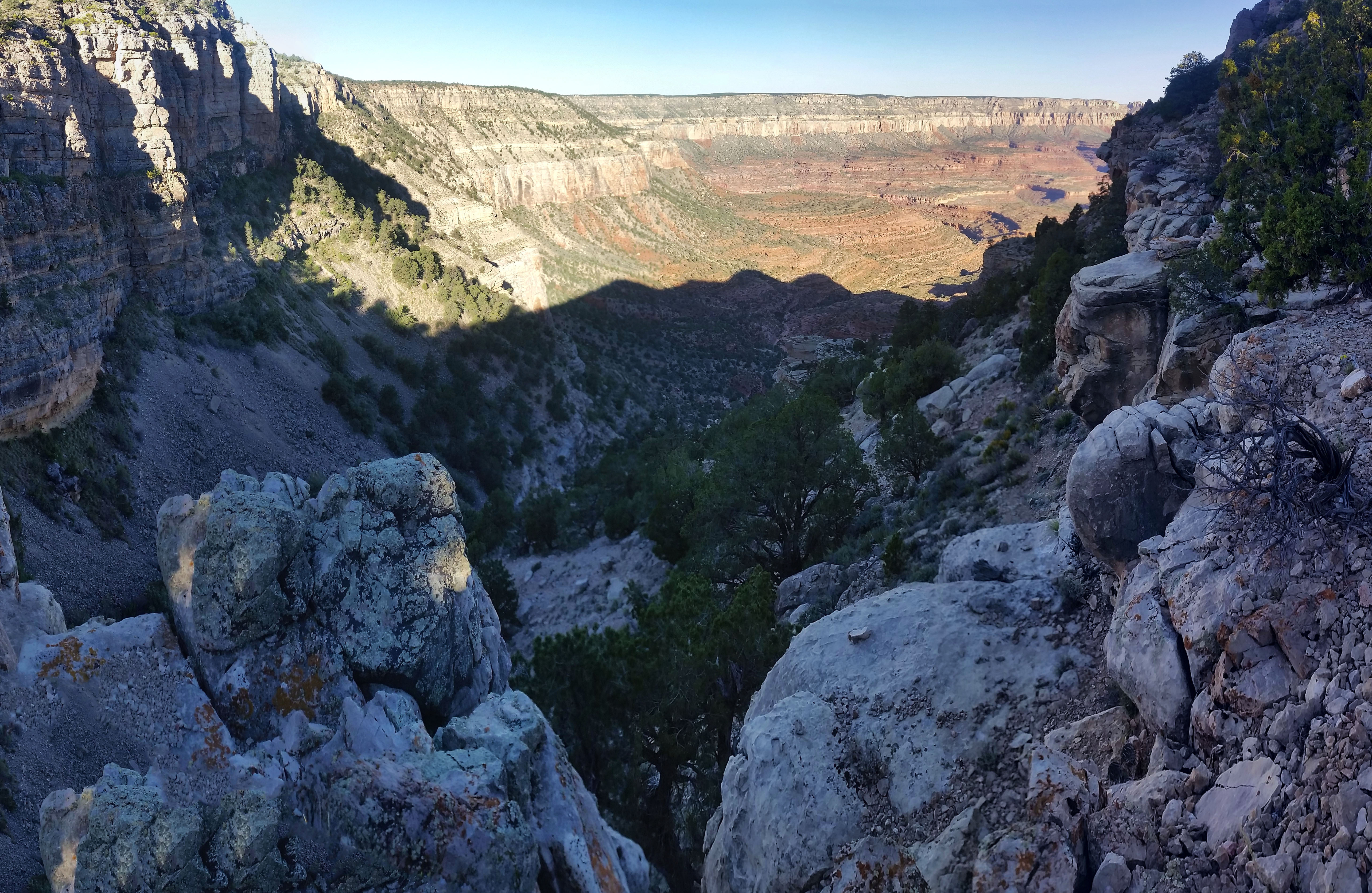
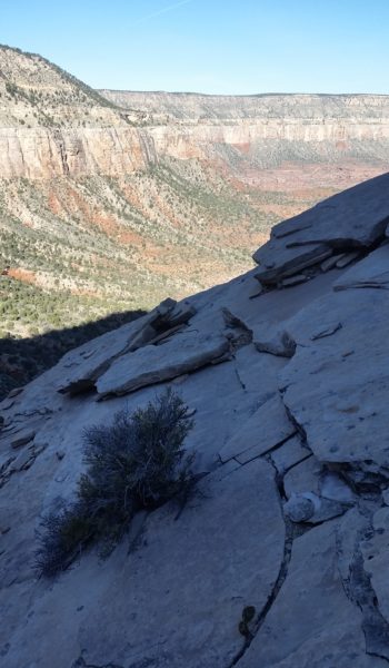
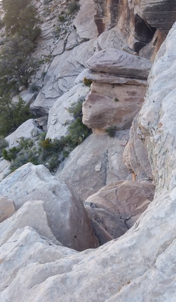
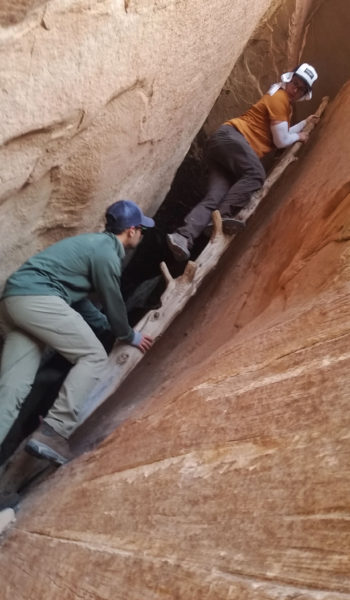
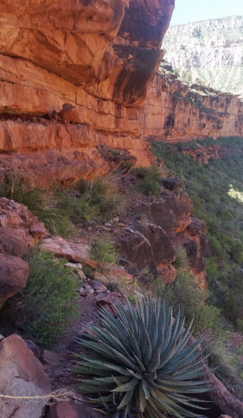
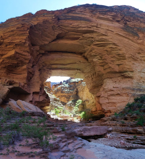
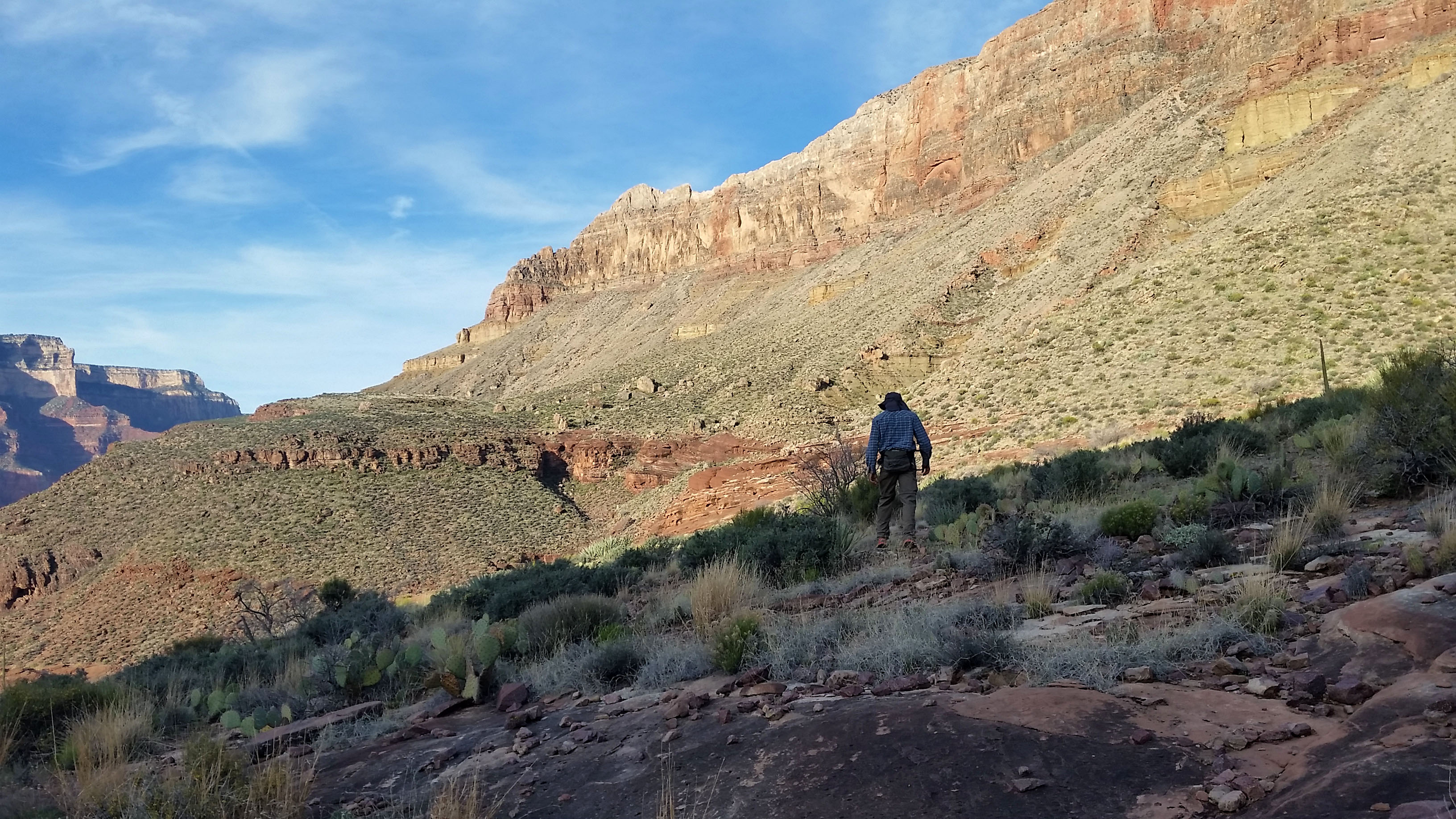
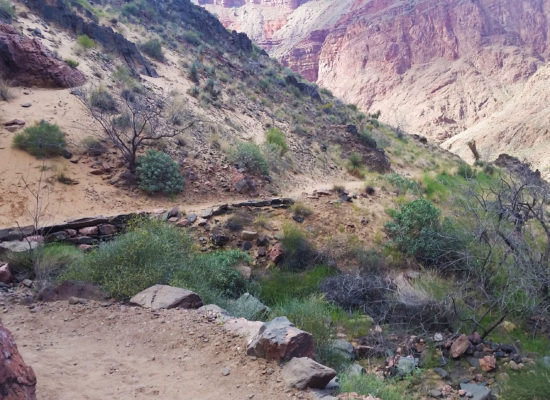
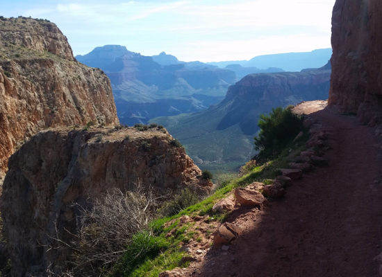
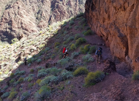
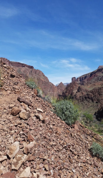
The footpath grew very narrow, vertical rockface to the right, and sloped dirt leading to a 400 foot drop to the left . . . better keep our heads on in this section! We carefully picked our way through following the footpath, cairn after cairn guided our way. Finally we found the weak spot in the headwall and started to ascend. The first obstacle was a chill class 3 scramble up to a ledge where we found a fixed rope for the next obstacle. We bat-manned up and sere soon past the next C4/C5 section. We followed the cairns as we went, across another rope less climb, up a slab, and finally to the spiciest of the obstacles. It was a good 20’ C5 climb with a fixed rope to guide us up! “How nice of someone!” I thought as we exited the obstacle.
 Kari squeezes on the small footpath between the rock face and the dropoff
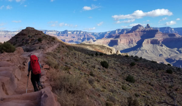
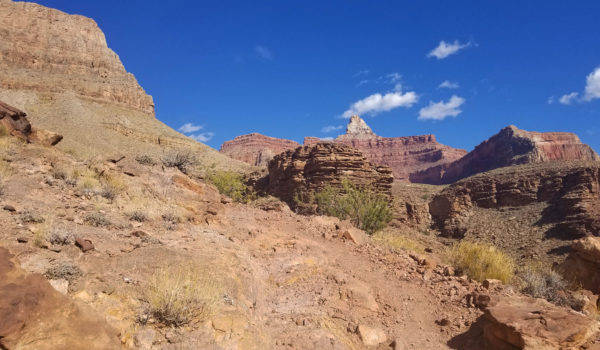
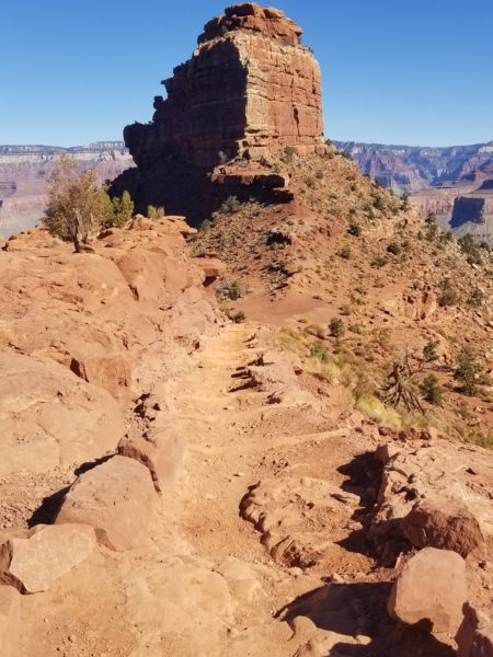
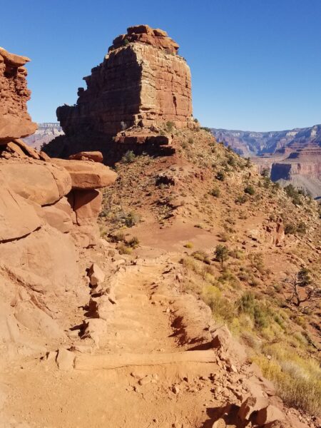
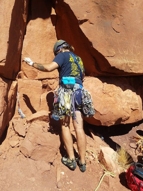
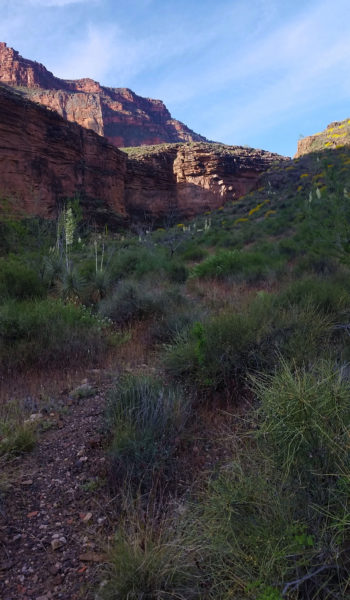
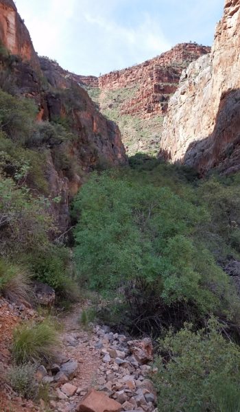
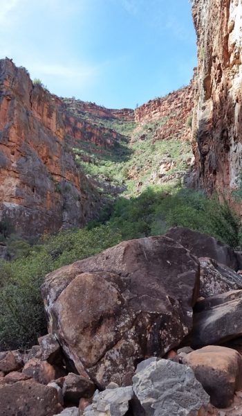
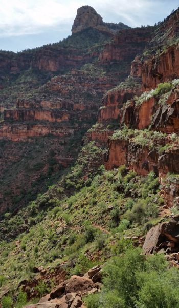
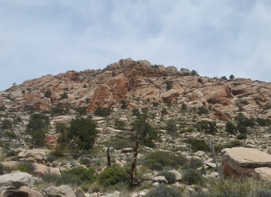
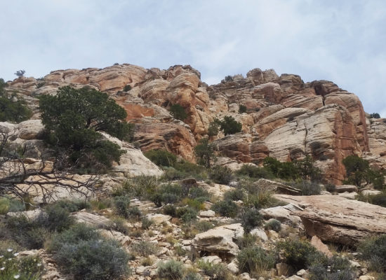
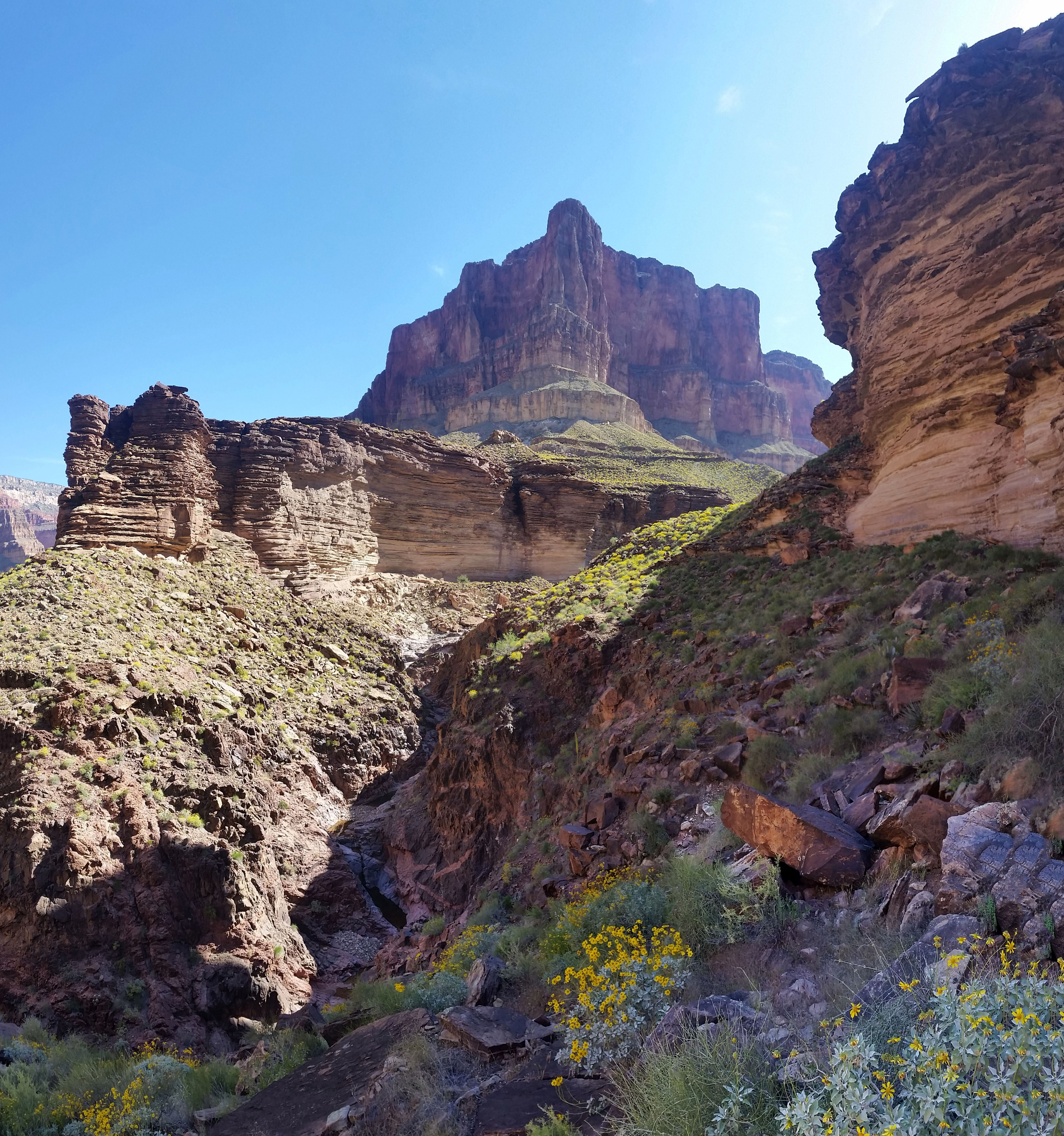
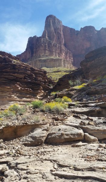
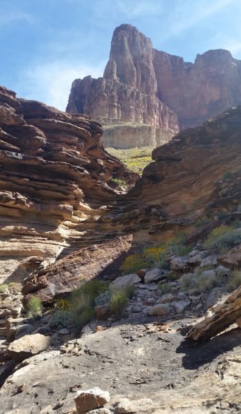
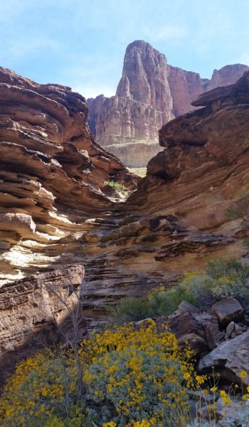
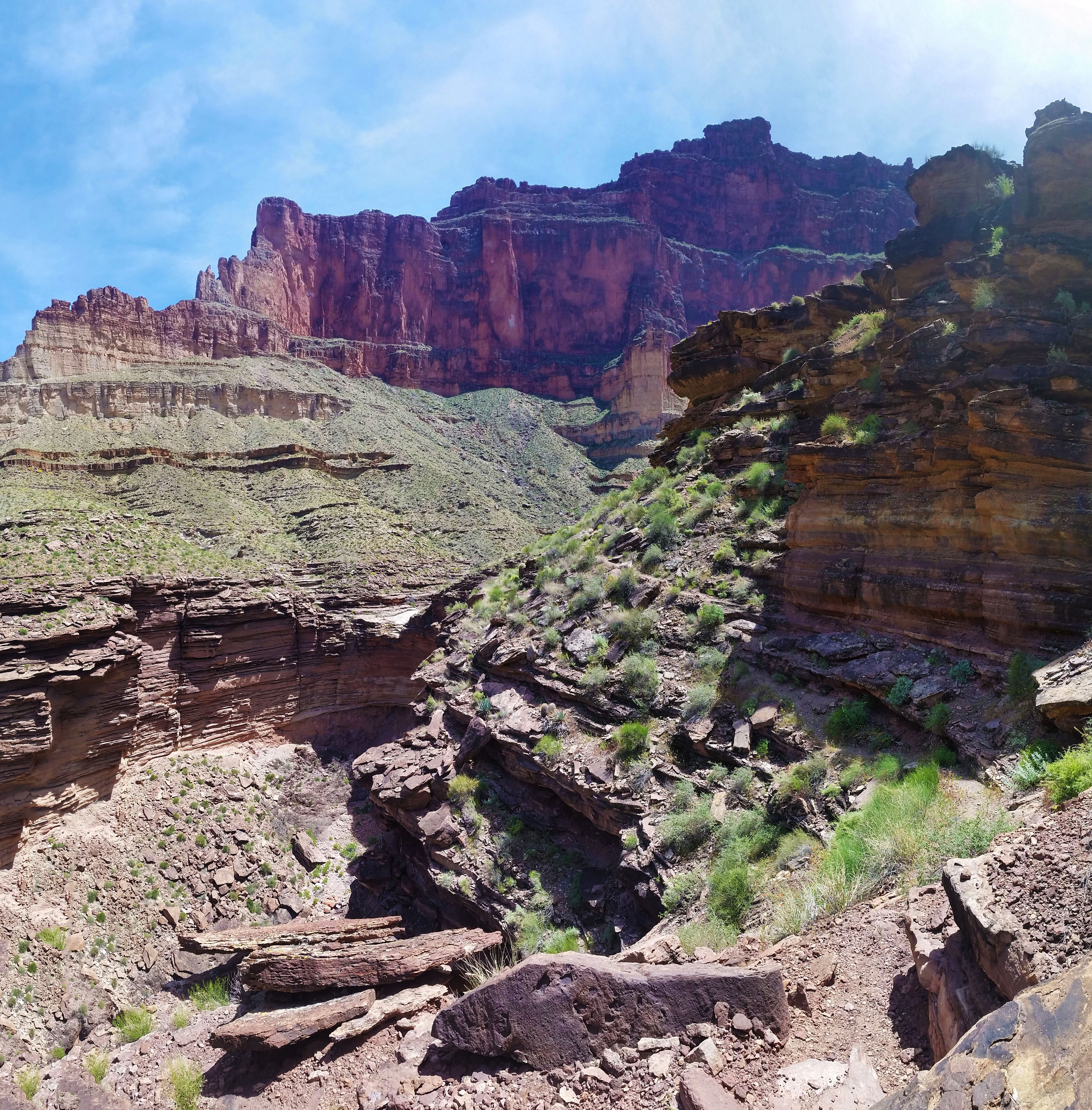
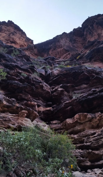
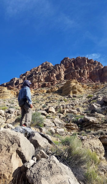
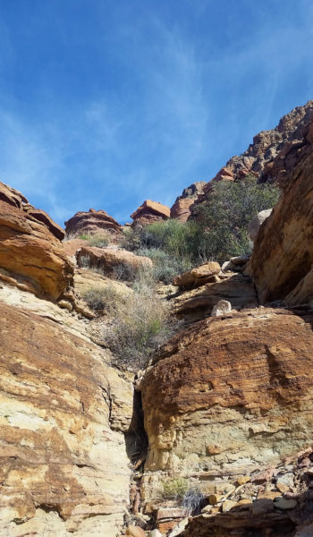
We kept pushing our way up the steep faint trail, following cairns until finally we were face to face with the sheer walls of Zoroaster. None of the faces we could see looked like our climb, so we continued to skirt east across the north face of Zoro. Walking on and on, when all of the sudden we turned right at the arête and stared at the 5.9+ NE Arete route. It was time to go to work! We racked up and Kari put me on belay as I stepped towards the start of the climb.
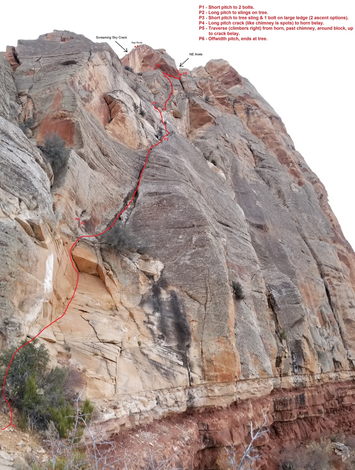
Pitch 1 (P1): My hands were sweaty as I made my first step towards the start. I plunged them into my chalk bag shaking off the jitters and stared at a large triangle roof a good 25’ up a face. I started up the sandy sandstone face reaching the clearly clean roof. I threw a #3 Camelot on the crack and inspected the face wondering how I would pull the first obstacle. I reached high, and using a nice foothold on the left face I pulled myself over the roof and was soon clipping chains just 50’ off the ground.
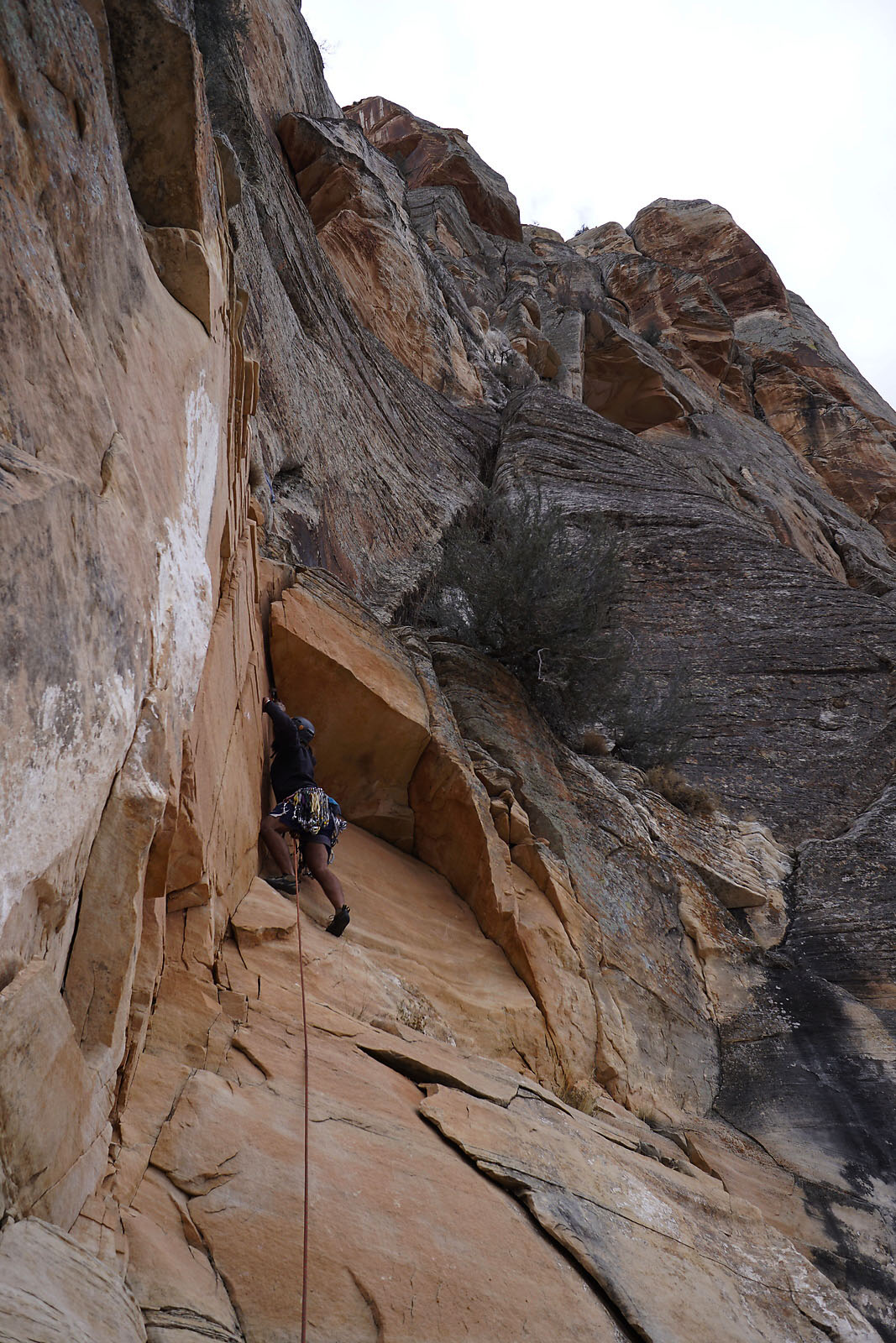
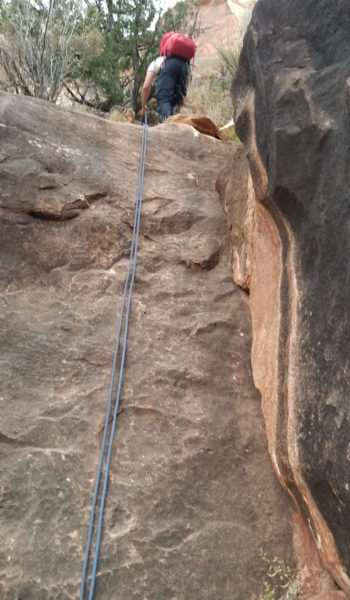
P2: The crack went up and climbers right from here and I followed. There were some fun moves, I stepped up, finding the next hold, repositioning and finding good gear placement. The long pitch meandered up right through the crack around some small trees. Move after move I ascended, sometimes being pushing onto some short slab climbs until finally I reached a tree covered in slings signifying the end of P2. Whew, made it! I threw Kari on belay and he soon followed. Trying to move quickly we spared no time exchanging gear and I set off again!
 Top of P2 - Tree belay (don't mind the guy thigh). Photo Credit: Kari Hreinsson
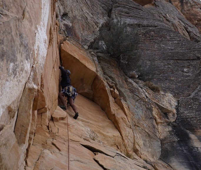
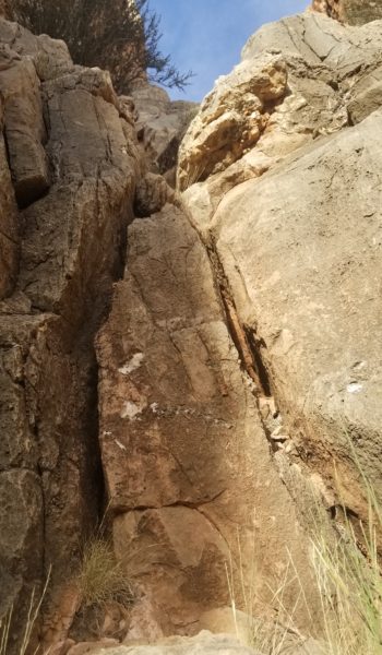
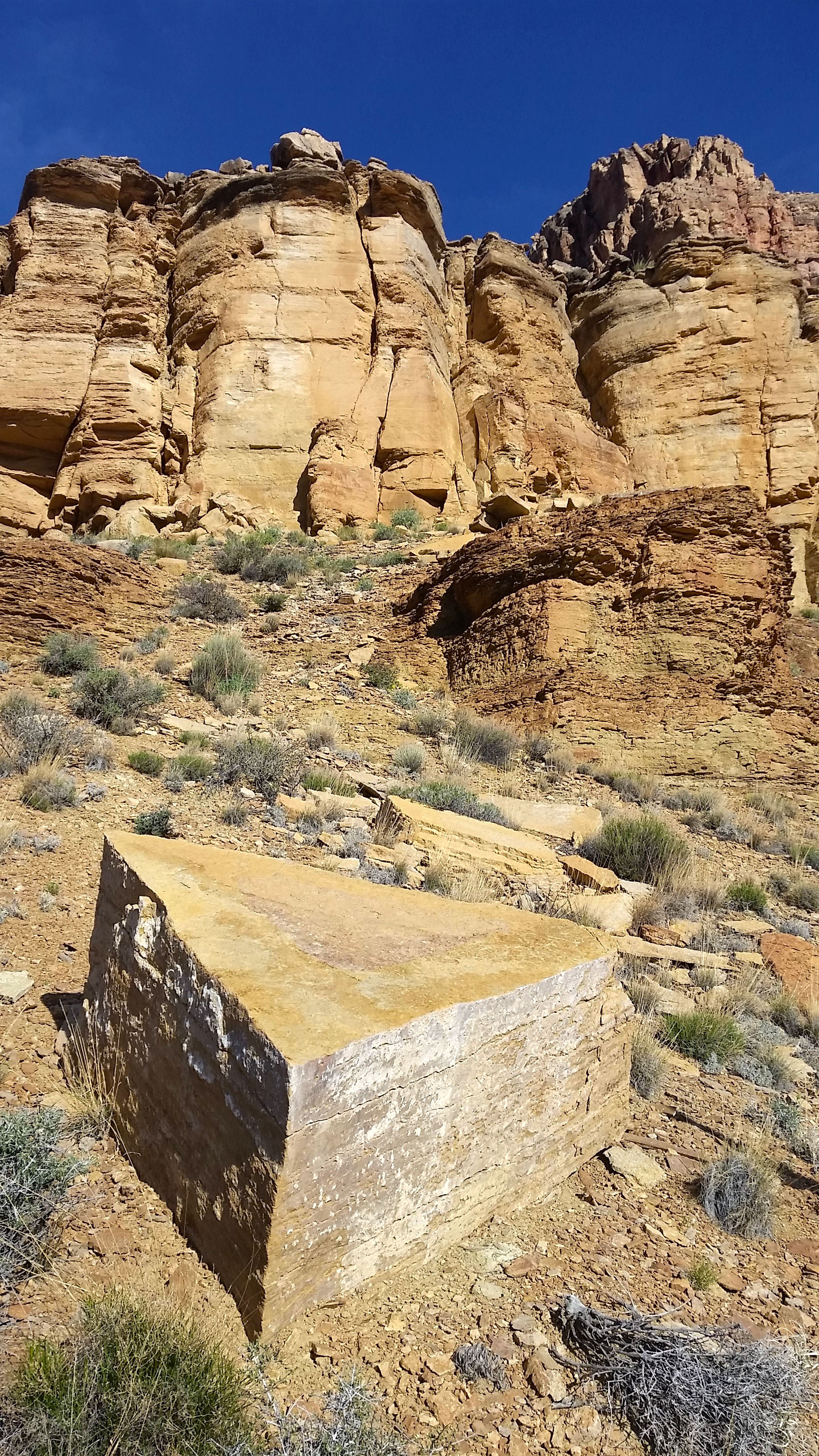
P3: The infamous “Crux Pitch”. I move up and climbers right towards a fresh rock scar where a pinnacle used to hold on, creating a chimney for the next pitch (it fell in 2004). There were now 2 options for this pitch: ascend a section of runout slab face climbing with no protection, or a vertical sandstone slopper hold climb. I chose the sandstone, heading almost vertical and slightly climbers left from the tree below. I placed a Camelot #3 deep in a hole/crack with soft sandstone edges and prayed it would hold. I moved up and left, finding a good left foot, dropped knee, intermediate sloper with my left hand, pinching a sandy sandstone shelf with my right hand . . . needless to say it was awkward . . . all of the sudden I was out of position. “Falling!” I yelled down to Kari as I blew off the face! Gravity took over and I fell for a good 20’ whipper before my #3 dug in and held me. Whew!!!! I thought to myself and let out a loud happy yelp “Wooooooo!” I grabbed my composure . . . this climb could end here. I stood back up and headed back for the same move. “Falling!!!” Boop, once again I was thrown from the face, the # 3 held, my hero!!!! I dusted myself off and looked upwards woundering if this was the end for us. I got back into the same position a 3rd time, only this attempt I threw my right hand up, blind, above the huge sloped rock in my face. To my surprise a bomber hourglass shaped hold!! I grabbed in and rejoiced as I made my next move to climbers left and safety of the next anchor. Sweat dripped from my body and I put Kari on belay.
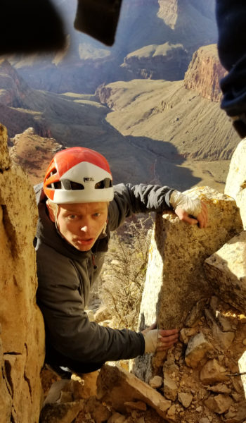
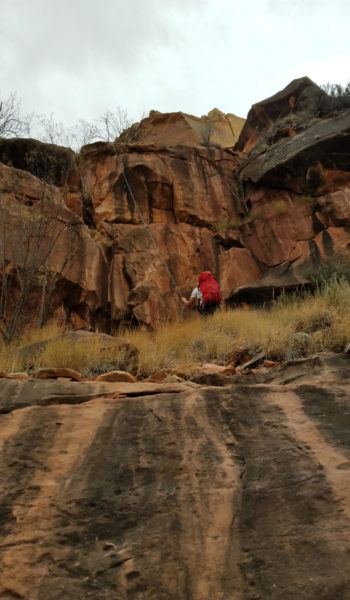
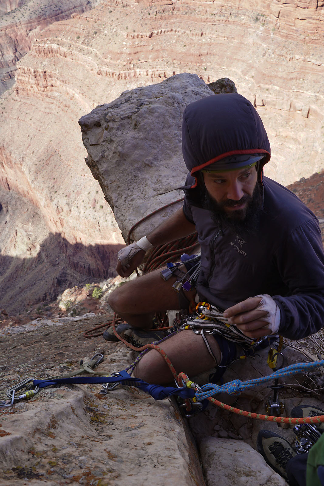
P4: I stood on a huge ledge and soon Kari joined me after enjoying the same interesting crux as I. We had no time to waste, so I geared up and headed to a crack that was just above the fresh rockscar that moved climber’s right. I continued up this chimney running it out a bit, placing gear only where I had a nice stance. Even with all the runout, I started running low on gear! I found a small tree and looked up past the next chimney and there was still about 30’ above to the infamous horn belay. I decided to just build an anchor here and belay Kari up, breaking this pitch into 2. After some “fun” chimney Kari appeared at the belay, looking a bit tired and ready to be on the horn. I collected the gear he cleaned and headed up the final section of chimney towards the horn. I popped out of the chimney only an arête that ended into a loose slab section. The next place I could throw gear in was a good 20’ away, so I carefully climbed. Smearing my feet and slowly controlling my weight. I worked my way up until I found myself grabbing a bomber hold!! I quickly pulled myself up onto the infamous horn belay with a nice set of anchors. I set the belay, and Kari began to climb, cleaning gear as he went. As he popped out onto the loose slab section, he had the same impression as me: “What is this crap?!” Kari exclaimed!
 Which way do we go?? Oh yea, up! Photo Credit: Kari Hreinsson
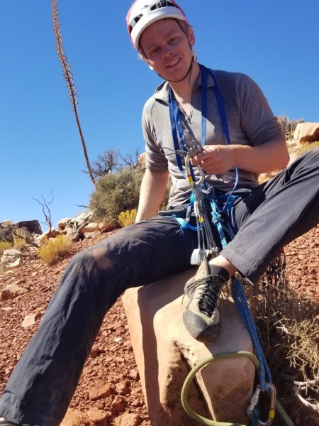
Kari joined me, as I sat straddling the horn, chilly, fully zipped up in my hoody. We had just 2 pitches left before the technical climbing was over. Although nervous, I was excited to take them on. The traverse was up next and after that the off width pitch. The traverse boasted almost no choices for protection and the offwidth pitch was some hard technical climbing. Kari but me on belay again . . . “Climb on!” he said. It wasn’t over yet!
HIKE/CLIMB INFORMATION:
- Approach: South Kaiab to Clear Creek to Sumner Wash to Zoroaster Temple via NE Arete, return via Bright Angel: https://hikearizona.com/gps=39407
- Climbing Route: NE Arete (5.9+ Trad): https://www.mountainproject.com/route/105789638/ne-arete
CLIMB/HIKE STATS:
- Weather: Hi 60s, Low 40s, Sunny
- Water: 4 liters
- Food: 1 Cliff Builder bar, 1 protein bar, 1 Nature Valley granola bar, bag of salt & vinegar, beef jerky, bag of pizza Pringles, gummy worms, orange, chicken and mashed potato MountainHouse
- Time: (Day 2) 20 hours
- Distance: (Day 2) 7 miles
- Accumulated Gain: (Day 2) 1,700 feet
- Climbing Rating: 5.9+ Trad
- Number of Pitches: 6
GEAR:
- Big Agnes Copper Spur UL2 tent
- Big Agnes QCORE SLX sleeping pad
- Cosmic Down Kelty Sleeping Bag (rated to 20 deg F)
- Jet Boil – Sol
- Black Diamond trekking poles
- SPOT Gen3 Tracker
- Sawyer Squeeze – Water Filter
- 58 liter exos osprey backpack
- Black Diamond Helmet
- Petzl Corax Climbing Harness
- 2 Black Diamond screw carabiner
- 4 Phantom DMM screw carabiner
- 6mm Accessory Chord – Anchor
- Black Diamond Camelot X4+C4 Cams – Double Rack – (2x), 0.1, 0.2, 0.4, 0.5, 0.75, 1, 2, 3, 4
- Black Diamond Standard Nut Set
- 12 Alpha Trad DMM quickdraws – Alpine draws
- Black Diaimond ATC Guide
- 70 meter 9.8mm Rope (Orange Slice)
- Webbing/7mmCord for personal anchor
- 20′ Flat webbing to leave for anchors
- Arc’teryx Chalk Bag
CLOTHING:
- Smartwool 195 weight long sleeve
- Arc’teryx Hoody
- Cotton Handkerchief
- Nike shorts
- Patagonia Pants
- Darn Tough Medium Wool Sox
- Merrell Mid Moab Hiking Boots
- La Sortiva TC Pro Climbing Shoes
Zoroaster Temple – Grand Canyon – AZ (Day 1) – 11.3.17
- Day 1: South Kaibab, Clear Creek, Redwall Notch
- Day 2 (Part 1): Redwall Notch to Zoroaster Climb P4
- Day 2 (Part 2): P5 to Summit and out via Bright Angel
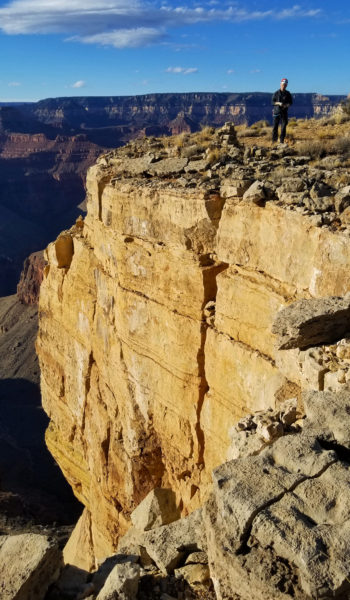
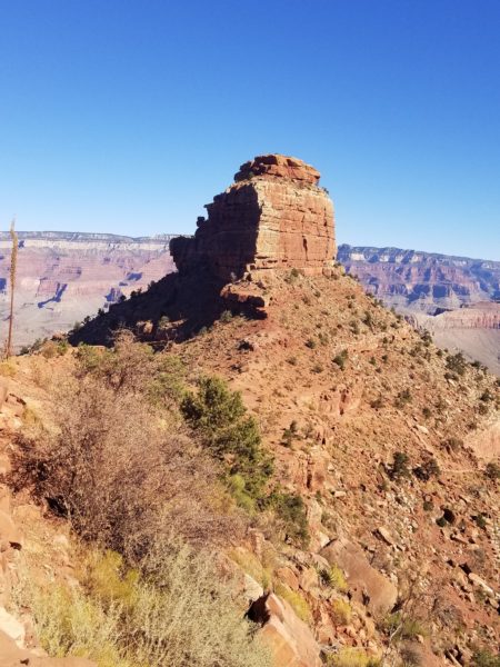
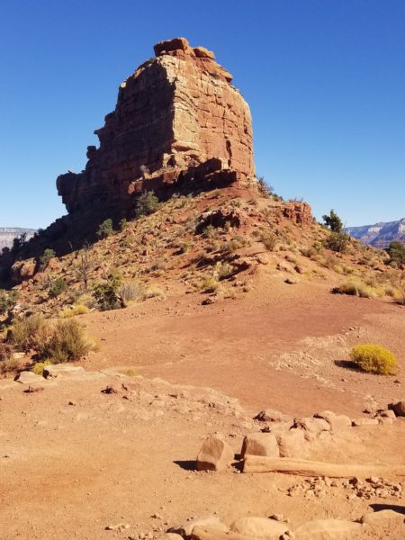
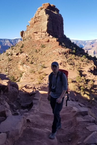
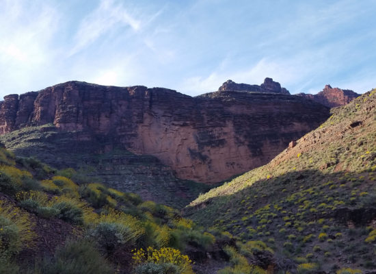
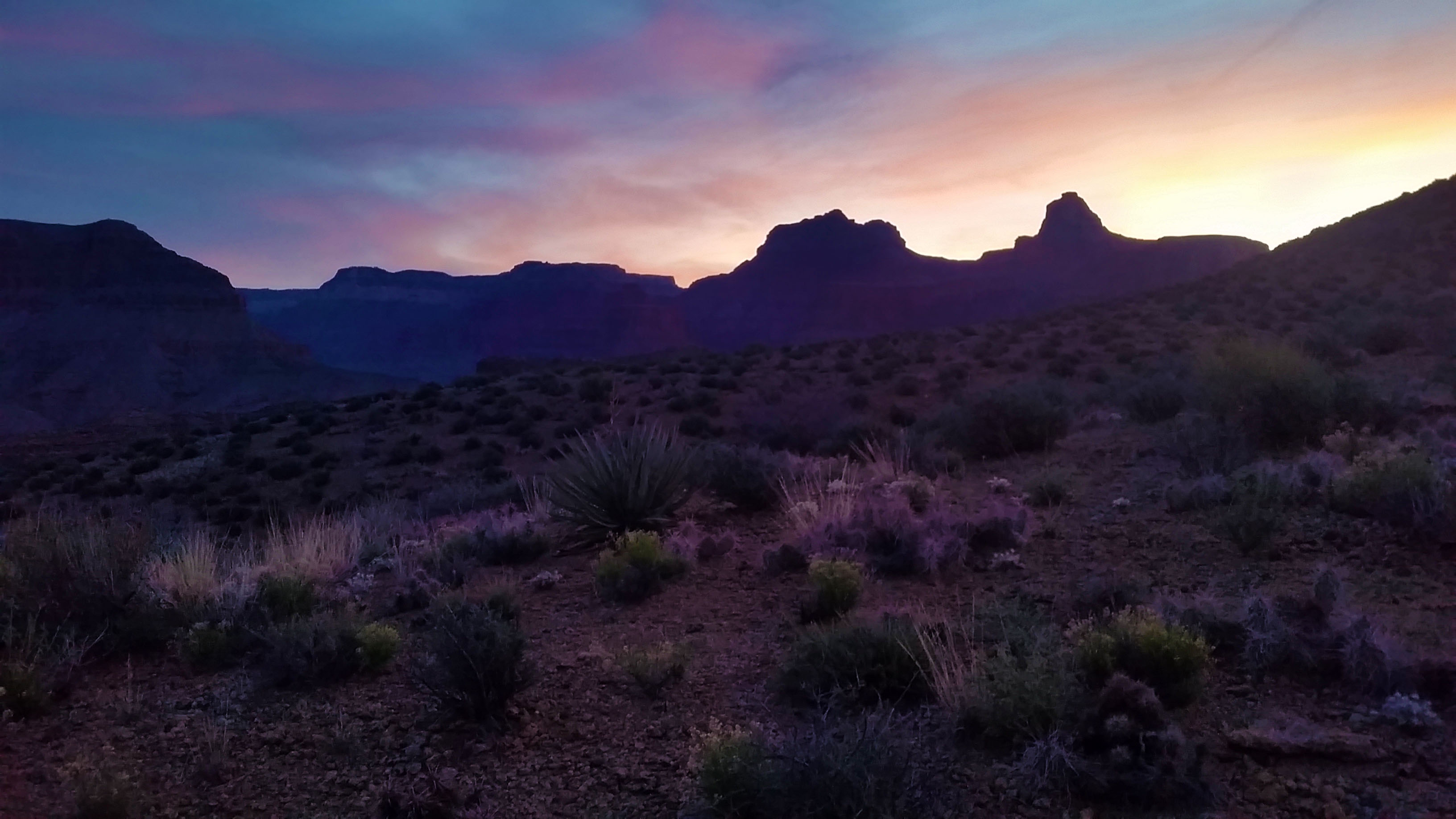
I stood there, palms sweaty, weighed down by the gear on my climbing harness, looking up at the start of a climb that took us 15 miles to approach, countless hours of training, and almost 2 years of dreaming to bring me face to face with the start of the route. My hoody was zipped up, and I could feel the chilled wind on my legs whipping by on the North face of Zoroaster Temple, deep in the belly of the Grand Canyon. I had plunged my hand into my chalk bag and took my first step towards a climb of a lifetime, and it all became real when Kari called out “Climb On!”
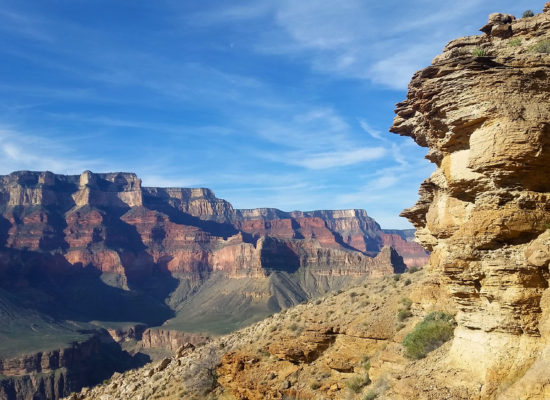
I started this climbing thing after setting my eyes on the Grand Canyon summit Zoroaster Temple. Its a magnificent formation that stands tall, guarding the Colorado River, just northeast of Phantom Ranch. All I knew at the time was that it was a technical climb. As my climbing experience increased, I found out that summiting came at the price of 6 pitches of 5.9+ trad climb; that was nothing to shake a stick at. In the Grand Canyon it’s the king of the back country rock climbs, in that to get to the top the easiest route up (NE Arete) boasts this stiff ante. After talking about this thing at nauseam to my friends for almost 2 years, finally my climbing partner Kari was available, my training seemed right, and the weather window opened for a summit attempt. This is my account of our summit attempt:
Day 1:
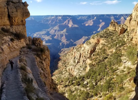
Kari and I pulled ourselves from the van, groggy and disoriented from the long drive the night before, the short sleep, and the frantic packing, before the bus came hissing to a stop just in front of the Bright Angel Lodge. We scrambled on board, and we were off! After the short bus ride to the trailhead we were finally feet on trail looking down South Kaibab trail and across the canyon to the base of the beast.
Even from Ohh Ahh point Zoroaster stood proud and bold just tempting anyone to attempt a summit bid. We kept on trekking down towards the bottom of the canyon chatting with people and taking in the views as we went. Before we knew it, 8 miles later and 4500 ft of elevation drop, we found ourselves at the doorstop of Phantom Ranch. We threw our heavy packs onto the picnic tables and headed inside to grab some postcards to send home. After a quick rest we loaded up on the 5 liters of water that would last us through the night and the entire next day.
 Kari, leading the charge, O'Nielle Butte in view, Zoro looming
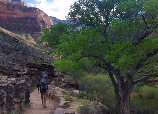
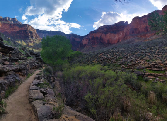
Our packs were heavier than ever, weighing in at a bolstering 53lbs each. The rope, trad rack, camping gear, food, clothes, and finally water was a tough but necessary in order to pull off our goal. We headed up the trail wincing at the weight as it cut into our shoulders. About ½ mile north of Phantom Ranch the Clear Creek trail took off right, east towards Sumner Wash where the “real adventure” began!
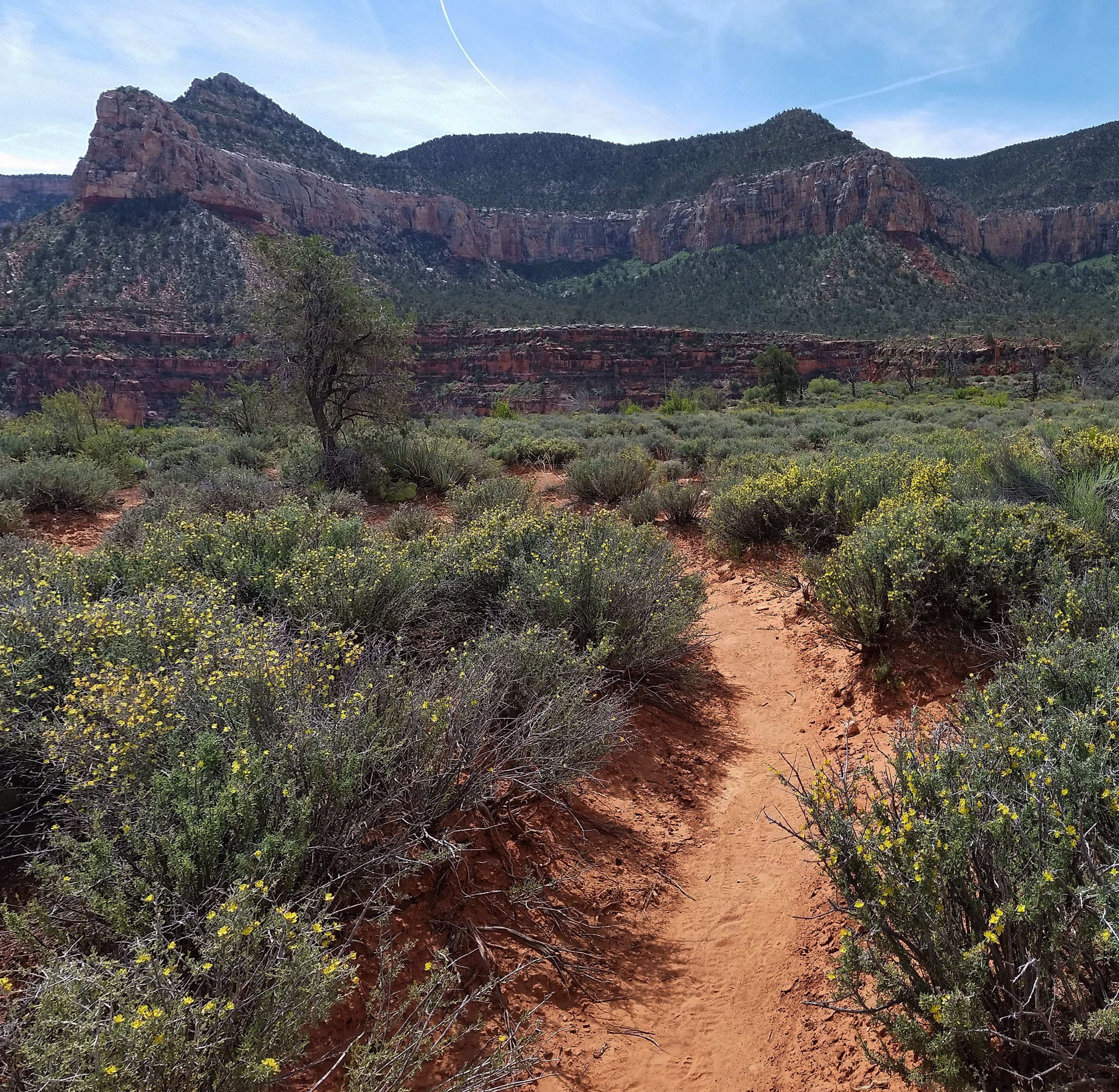
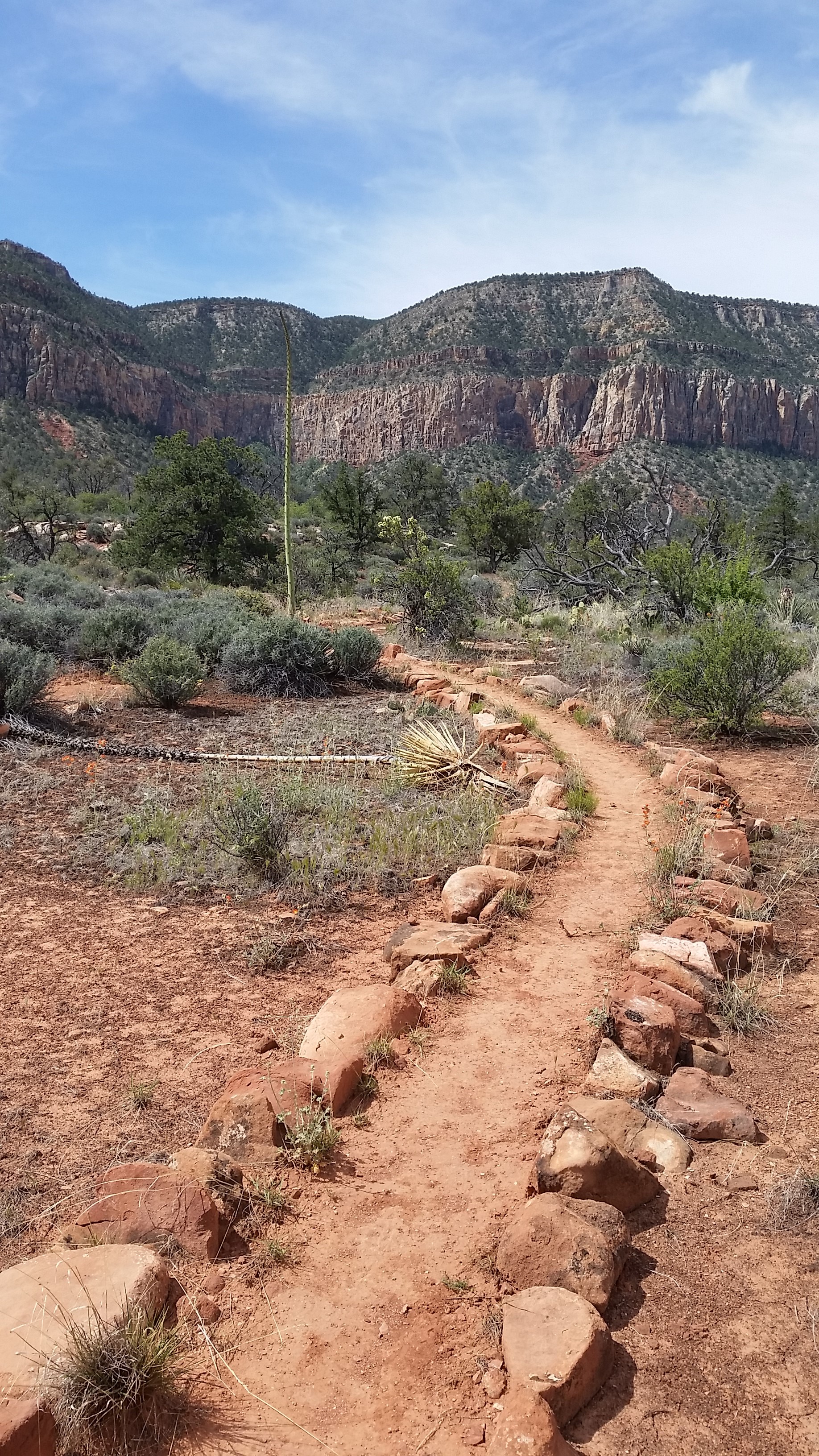
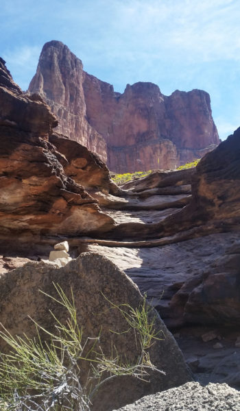
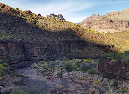
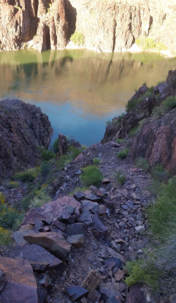
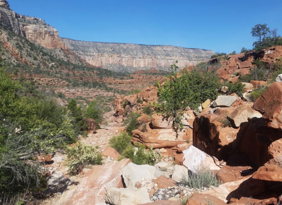
We pushed up and on as the two grueling miles gained 1500 feet towards the wash, Kari seemed un-phased by the weight. For some reason that day, it weighed heavy on me. I am not sure if I had met a weight limit that stunted my push, or if I hadn’t trained my legs enough, but I was definitely feeling it as we pressed on. Finally we reached Sumner Wash and diverged from Clear Creek trail. We headed north for the Redwall Notch which gave us access to the Lower Supai Layer and Zoroaster’s arm.
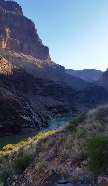
 Popping out to see the Colorado after some nice gain on Clear Creek trail
We grunted on finally reaching the base of the notch and threw packs down for a quick break. We each dropped a liter of water and stashed a little food in a tree to save weight. Soon we were on our feet again, racing against the sun, and heading out climbers right to a nice exposed class 4 climb that would circumvent a 5.7 technical climb (aint nobody got time for that!). We ascended carefully on the sharp rock, looking for the path of least resistance. Soon standing high over a sketchy down climb we looked at our options. There wasn’t much time for debate, so we de-packed and I down climbed as Kari got the packs ready to be handed down by rope.
 Grinding on! (photo credit Kari Hreinsson)
Soon after some questionable exposure we were both safe past the obstacle. We looked up the notch to see our next class 4 obstacle to navigate past. Sweaty palms, and labored backs, we carefully ascended a crack, going behind a short stubby bush, and finally taking an airy step across a death defying drop to safety. Whew! We both made it and were definite ready for safe ground. We continued up the class 3 notch towards the top out which was surprisingly tame.
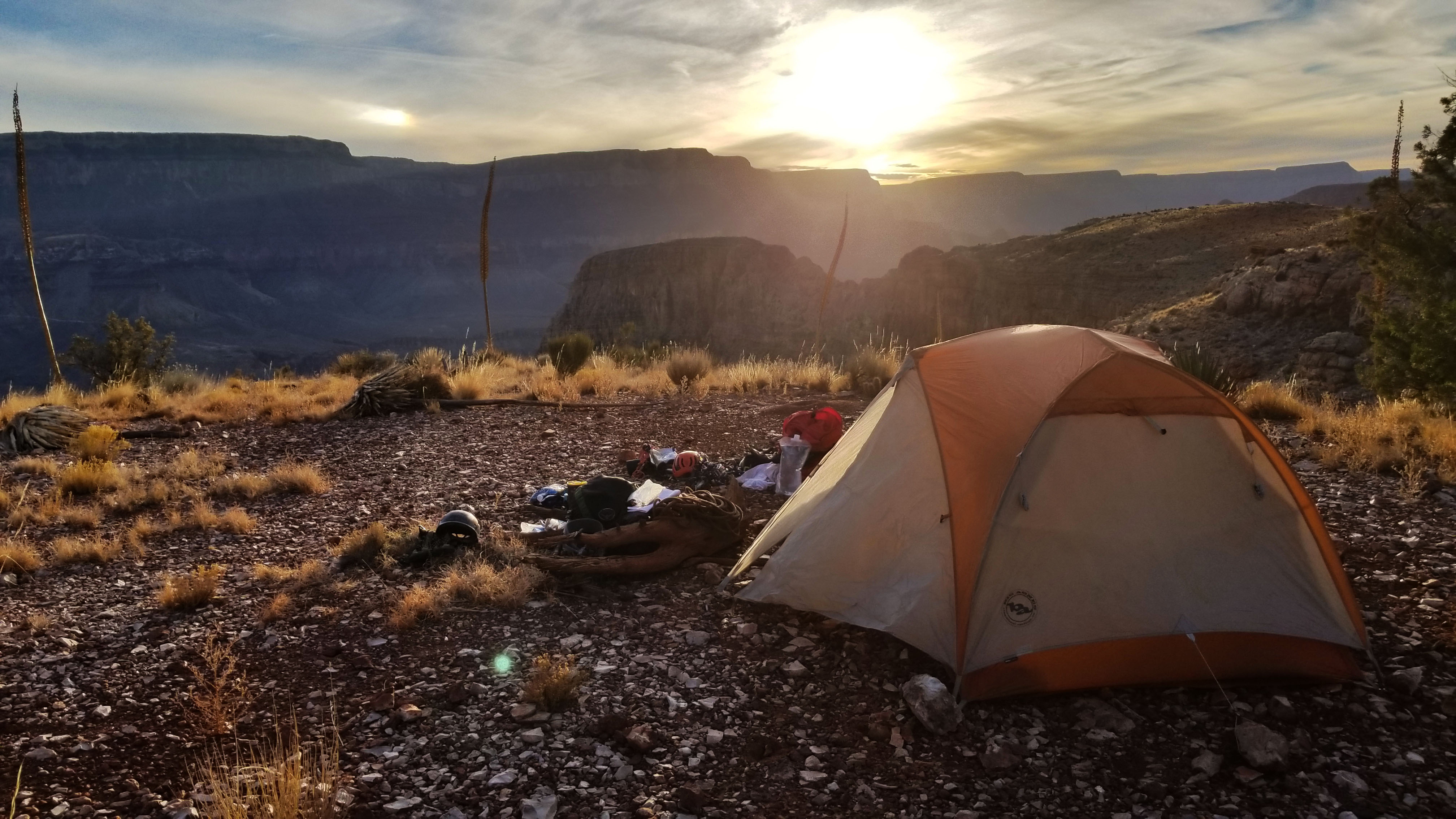
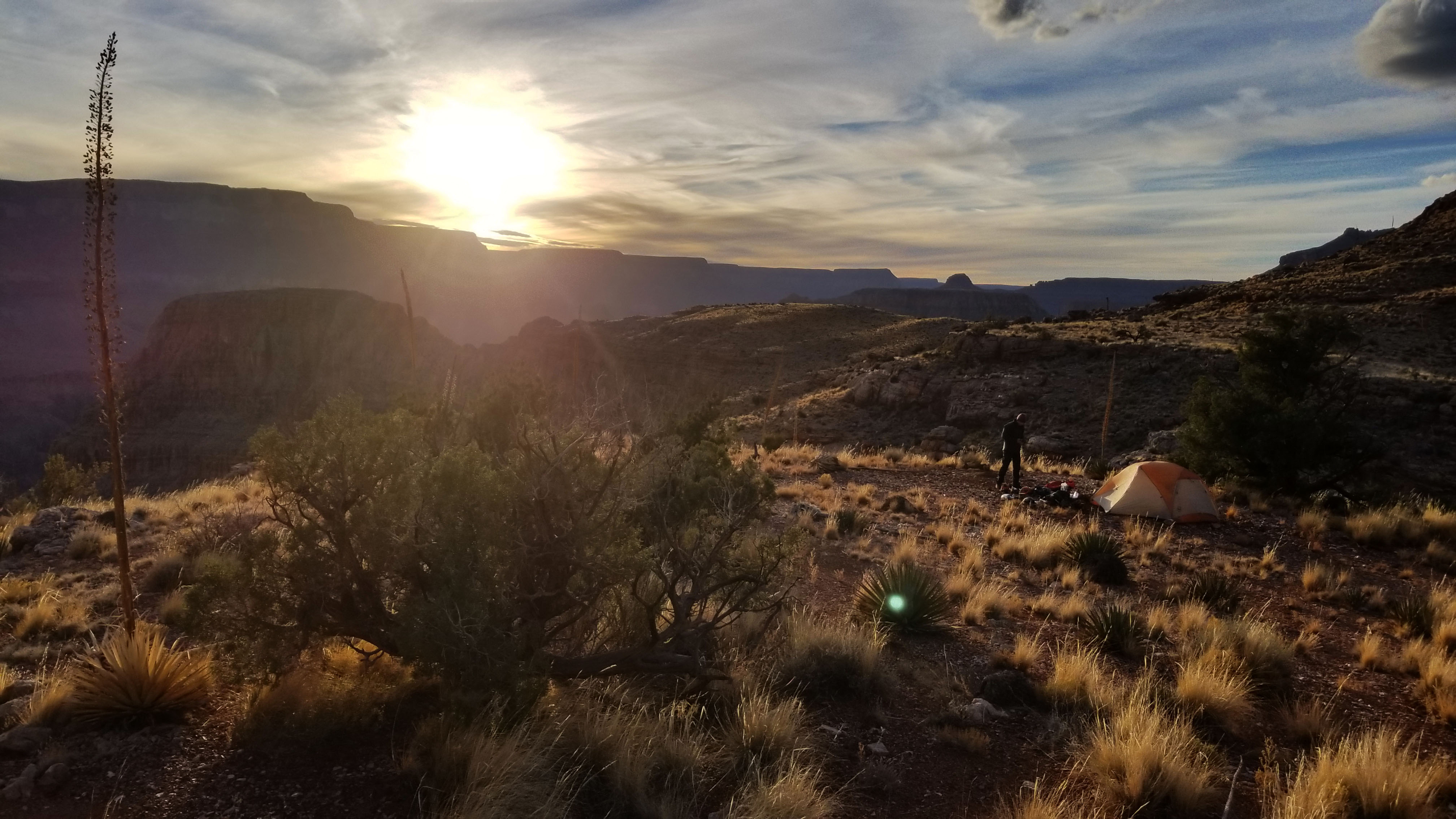
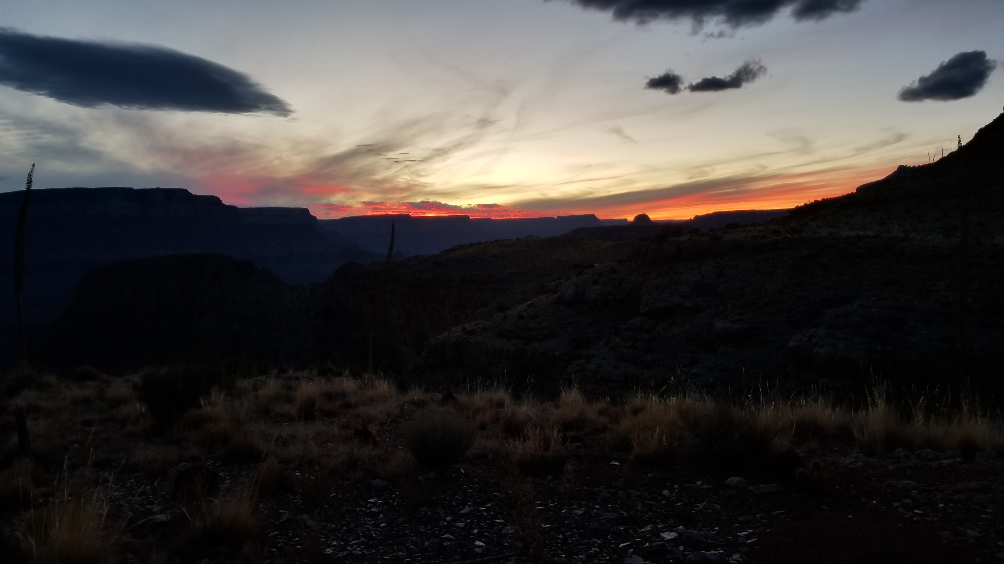
Finally we popped out and eyeballed a juniper tree with a large flat spot for a nice camp spot. We had made it safely to camp!!! I dropped my pack that had been cutting into my shoulders, with a gasp of relief! We began to set up the tent and looked south to enjoy the beautiful sunset over the Grand Canyon. Zoroaster stared down at us, and we stared back knowing the next day would hold some of the hardest trad climbing (well my limit at least) with no true promise of a summit in sight. Our work was cut out for us and we tucked into bed, trying to get as much rest as possible.
HIKE/CLIMB INFORMATION:
- Approach: South Kaiab to Clear Creek to Sumner Wash to Zoroaster Temple via NE Arete, return via Bright Angel: https://hikearizona.com/gps=39407
- Climbing Route: NE Arete (5.9+ Trad): https://www.mountainproject.com/route/105789638/ne-arete
CLIMB/HIKE STATS:
- Weather: Hi 60s, Low 40s, Sunny
- Water: 2.5 liters (5 liters packed in addition)
- Food: 1 Cliff Builder bar, 1 protein bar, 1 Nature Valley granola bar, bag of salt & vinegar, beef jerky, bag of pizza Pringles, gummy worms, orange, chicken and mashed potato MountainHouse
- Time: (Day 1) 10 hours
- Distance: (Day 1) 12 miles
- Accumulated Gain: (Day 1) 3,000 feet
- Climbing Rating: 5.9+ Trad
- Number of Pitches: 6
GEAR:
- Big Agnes Copper Spur UL2 tent
- Big Agnes QCORE SLX sleeping pad
- Cosmic Down Kelty Sleeping Bag (rated to 20 deg F)
- Jet Boil – Sol
- Black Diamond trekking poles
- SPOT Gen3 Tracker
- Sawyer Squeeze – Water Filter
- 58 liter exos osprey backpack
- Black Diamond Helmet
- Petzl Corax Climbing Harness
- 2 Black Diamond screw carabiner
- 4 Phantom DMM screw carabiner
- 6mm Accessory Chord – Anchor
- Black Diamond Camelot X4+C4 Cams – Double Rack – (2x), 0.1, 0.2, 0.4, 0.5, 0.75, 1, 2, 3, 4
- Black Diamond Standard Nut Set
- 12 Alpha Trad DMM quickdraws – Alpine draws
- Black Diaimond ATC Guide
- 70 meter 9.8mm Rope (Orange Slice)
- Webbing/7mmCord for personal anchor
- 20′ Flat webbing to leave for anchors
- Arc’teryx Chalk Bag
CLOTHING:
- Smartwool 195 weight long sleeve
- Arc’teryx Hoody
- Cotton Handkerchief
- Nike shorts
- Patagonia Pants
- Darn Tough Medium Wool Sox
- Merrell Mid Moab Hiking Boots
- La Sortiva TC Pro Climbing Shoes
O’Neill Butte – Trad Climb – Grand Canyon – AZ (10.7.17)
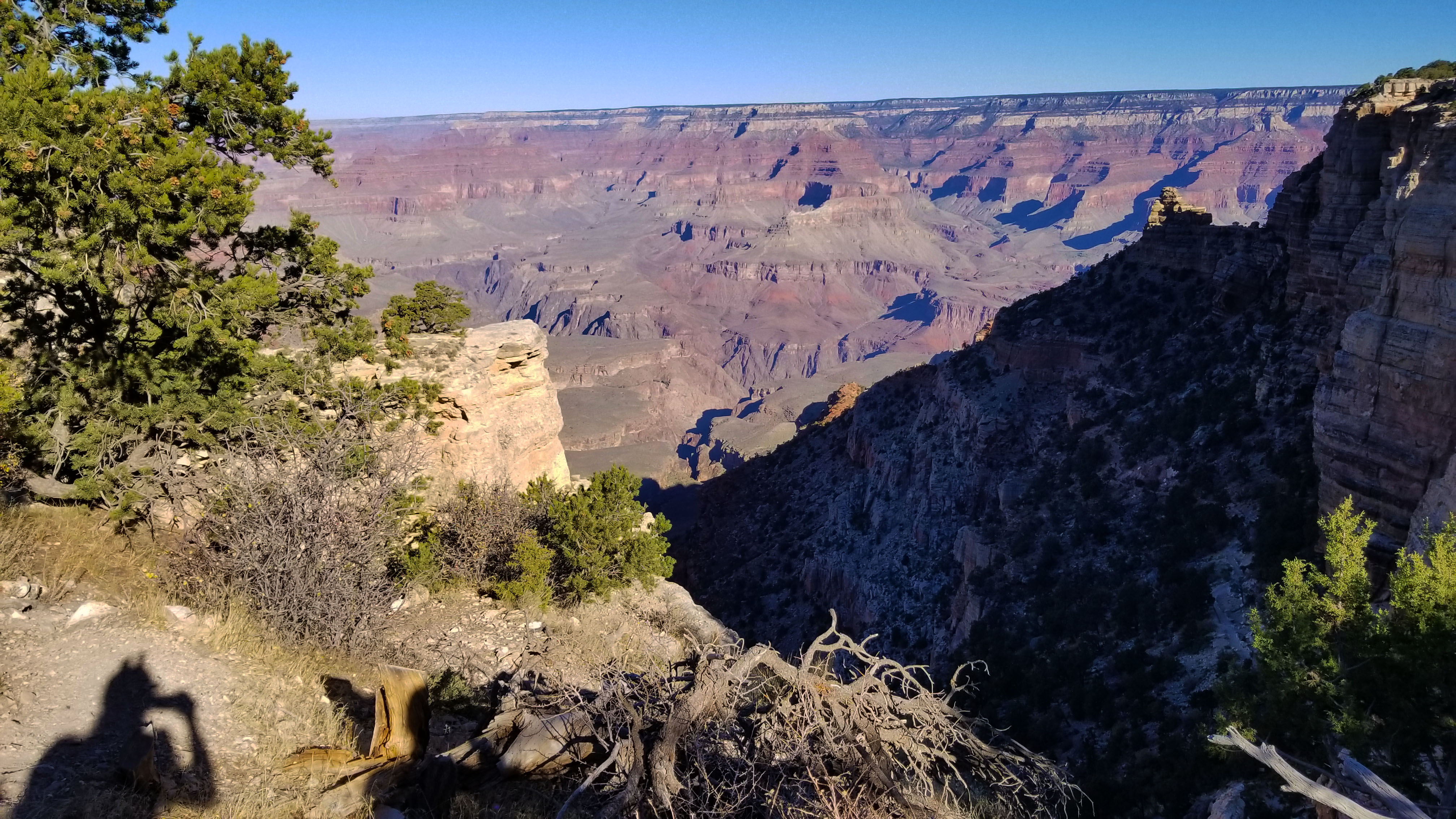
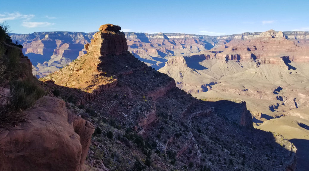
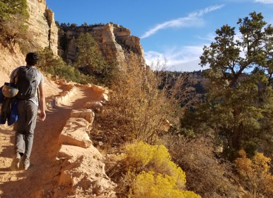
I smiles as we (Kari, Mahdi, Ethan, Tyler, and I) took the first steps down South Kaibab trail, headed into the Grand Canyon. I’m always get a little giddy going here, no matter how many times I drop in, I always feel like a kid on Christmas morning! Our target for the day was to reach O’Neill Butte, just beyond Cedar Point 2.5 miles down South Kaibab trail and 1600 feet below the rim. Everyone was all smiles, and excited as ever for the day ahead!
Packs heavy with climbing gear and provisions for the day, we trekked in taking in the sights of the vast canyon. We paused briefly at Ohh Ahh point for some pics and pointed out the buttes and temples across the canyon. What a nice day, perfect weather, great views, great company! Finally the butte came into sight. I never thought about it much before, until I started researching and found there was a 5.8 trad route on the east side that could put us ontop! It looked a bit more beastly than I remembered as we neared the base of the large formation.
 There it is!
The off trailed a bit and soon found ourselves at the base of the story book crack climb and began to gear up. We brought two 60 meter ropes and a double rack, just to account for the unknown above. There wasn’t much information on the ascent in research we did prepping for the ascent. I racked up and started to tape my hands (taping your hands helps cut down on abrasions while crack climbing), and Kari began to flake (lay out) the rope and set up to belay me. I looked up at the first 10 foot climb to a ledge which would mark the real start of the climb, it was time to get moving!
I reached up high and placed a small cam in a nice crack to get the mojo going, and I pulled a large horn to take the first ledge. As soon as I pulled up on the horn and could get eyes on the back of it, I noticed a large crack at the base of the horn. I backed off immediately! Standing back on the ground I banged on the sides of the rock again, making sure it was sold (well kind of). I once again pulled the horn and was soon standing at the base of the real climb, looking up at a 120’ crack system leading to the summit plateau just below the summit block. It was time to go to work and I jammed my fingers into the crack.
Move after move, I worked my way up the crack system. I was stitching up the line pretty good, and I could feel the weight of the double rack on my belt pulling me down. It seemed that the climb consisted of a big move across small face holds/feet with the crack to assist before you reached another good ledge and a rest. I placed a nut, and grabbing the carabiner open to release the single nut but somehow I dropped 3 other nuts!!!! They went plummeting down to the starting ledge below. I scoffed at the silly mistake, and had to choice but to keep on moving.
Finally after 60’ of good crack/face climbing (without knowing it) I found the crux of the climb, a bulge offwidth section that wanted a #4 Camelot. I looked gown and all I had was small stuff up #0.1 to a #3 on me (as research failed me). I reached far far back into the crack and placed my #3 (as it was the only place it would hold), and clipped it in. The move (“The whale move” as it jokingly became known) was to stick a right fist far far back into the crack just where the offwidth became a hand jam, get a high left foot on a small chip at shoulder height on climbers left, and flop like a freaking whale to get up and over the bulge! I let out a loud laboring yell as I grabbed my left foot, helping it high (almost shoulder height) onto the small chip and pulling with my right hand to flop myself beyond the obstacle. It was like the rocks sole job was to throw me off, and it was everything I had to hold onto it . . . this was “fun” on lead!
Finally I was up and through, and after a few other awkward moves I reached the base of a 15 foot crack with beautiful hand jams. I looked down and only had one more #3, there was no way I could protect the next section. The only choice I had was to build an anchor and break the long 120 pitch up into two. I was soon ready and yelled down to Kari “on belay, climb on!” He started climbing up, I couldn’t see where he was until finally I heard him grunting through the “whale move”. I chuckled to myself knowing he was having “fun”. He soon reached the anchors, gasping for air and clipping in. “Fun Right?!” I asked with a big smile!
There was no time to loose and we swapped over and I began leading the next section. There was a 15 foot nice hand crack to an awkward transition that spit you onto a ledge that circled climbers left (south) to the actual east face. There was still a good 30’ to climb. I kept after it, climbing on placing piece after piece and after a double gaston move at the end, I topped out and let out a loud “Woop!!!!” I set up an anchor on a large sandstone boulder towards the top and let Kari know I was safe. We then began a centipede climbing/belay style (one person belay from the top of pitch 1 (P1), then when they get there, the top belayer, belay the next climber to the top of P2) to get each climber up to the summit plateau. Tyler popped over the edge all smiles, and soon Ethan did too. Mahdi chose to take it easy and chill at the base for a nice afternoon nap.
 The end of the tech climbing, looking towards the summit block!
 Kari, excited to be on the topout!
Once the four of us were up, we headed to the north side of the plateau to reach the summit for the easy Class 3 scramble! Not too long after we were all simultaneously touching the highest rock on O’Neill Butte! With our summit complete we headed back down with hast and found a large tree to rap off of. Tying the two 60m ropes together we rappelled one at a time, quickly down almost the full length once again reaching the base of the formation. Mahdi was waiting with smiles and that fresh nap look! We threw on our packs and headed back up the South Kaibab trail for a nice sunset hike to the rim. What a gorgeous day, I couldn’t believe it, but we just finished all of our first technical summit ascent within the Grandest of Canyons!
 Rap battle!
 Kari rapping down the 120' face
HIKE/CLIMB INFORMATION:
- O’niell Butte Hike – 2.5 miles down South Kaibab – https://hikearizona.com/map.php?GPS=24472
- O’niell Butte Climb – East Face (5.8): https://www.mountainproject.com/route/107923541/east-face
CLIMB/HIKE STATS:
- Weather: Hi 70s, Low 40s, Sunny
- Water: 2 liters
- Food: 2 Cliff bar, 1 Nature Valley Granola bars, bag of salt and vinegar, gummy worms
- Time: 6 hours (we had 4 climbers)
- Distance: 5 mile RT
- Accumulated Gain: 120 feet
- Climbing Rating: 5.8 Trad
- Number of Pitches: 2
GEAR:
- Don Camelback backpack (3 liter bladder)
- Black Diamond Helmet
- Petzl Corax Climbing Harness
- 2 Black Diamond screw carabiner
- 4 Phantom DMM screw carabiner
- 6mm Accessory Chord – Anchor
- Black Diamond Camelot X4+C4 Cams – Double Rack – (2x), 0.1, 0.2, 0.4, 0.5, 0.75, 1, 2, 3, 4 [in hein sight I would have ditched smaller stuff (0.4 and below) as most of the cams were 0.75 – 4]
- Black Diamond Standard Nut Set
- 14 Alpha Trad DMM quickdraws – Alpine draws
- Black Diaimond ATC Guide
- (x2) 60 meter 9.8mm Rope
- Webbing/7mmCord for personal anchor
- Arc’teryx Chalk Bag
- SPOT Tracker
CLOTHING:
- Cotton T Shirt
- Arc’teryx Hoody
- Cotton Handkerchief
- Nike shorts
- Darn Tough Medium Wool Sox
- Merrell Mid Moab Hiking Boots
- La Sortiva TC Pro Climbing Shoes
ROYAL “PAIN IN THE” ARCH (DAY 3) – GRAND CANYON – AZ (4.21.17-4.23.17)
- Day 1: Royal Arch via Huitzil Point
- Day 2: Elves Chasm to Bass Beach Traverse
- Day 3: Bass Trail w Mount Huethawali
The alarm blasted once again. This morning was much cooler than the last. The cold air was pouring in off the Colorado River, and with nothing but silk liners for summer bags, both Mark and I were chilled. In the middle of the night I had put every piece of clothing on I had, attempting to ward off the nipping cold. It was no matter, I still woke several times in the night and was once again robbed of precious sleep. Sam was huddled up in his warm bag inside his one man, sleeping like a champ as we poured out of the tents to get moving in the twilight hour.
Today we planned to not only ascend to the south rim, but we also planned to bag Mount Huethewali, a quick side trek right off the trail! We stirred up breakfast and once again strapped on our bags for the haul out of the canyon. They were lighter than the days before but, still weighed heavy on your shoulders knowing the hard push we had ahead of us. Secretly the ascents out of the canyon are always my favorite, and I smiled as we let out from the beautiful secluded Bass Beach!
We trekked up, gaining quickly and we were soon skirting east along the inner gorge trail headed for Bass Canyon. The River Runners were leisurely having breakfast in the morning and we waved from high above the Colorado down to their position. The morning light bathed the canyon as we ascended and soon the sun once again shined on our faces. We turned up South into Bass canyon, hiding from the light as long as we could before the bake was on.
 Morning light looking west
We snaked our way back up the trail we had trekked on the day before. At almost every turn there was another breathtaking view of the canyon riddled in spring flowers. We soon reached the confluence of the Bass and Tonto trail, we had actually planned to camp here the night before but had decided to push all the way to the river. By this time we were all in our own heads, just taking in the sights, and pressing up the ascending trail. As we gained up further, the canyon once again gave us a break and shaded our trail. We knew this wouldn’t last long.
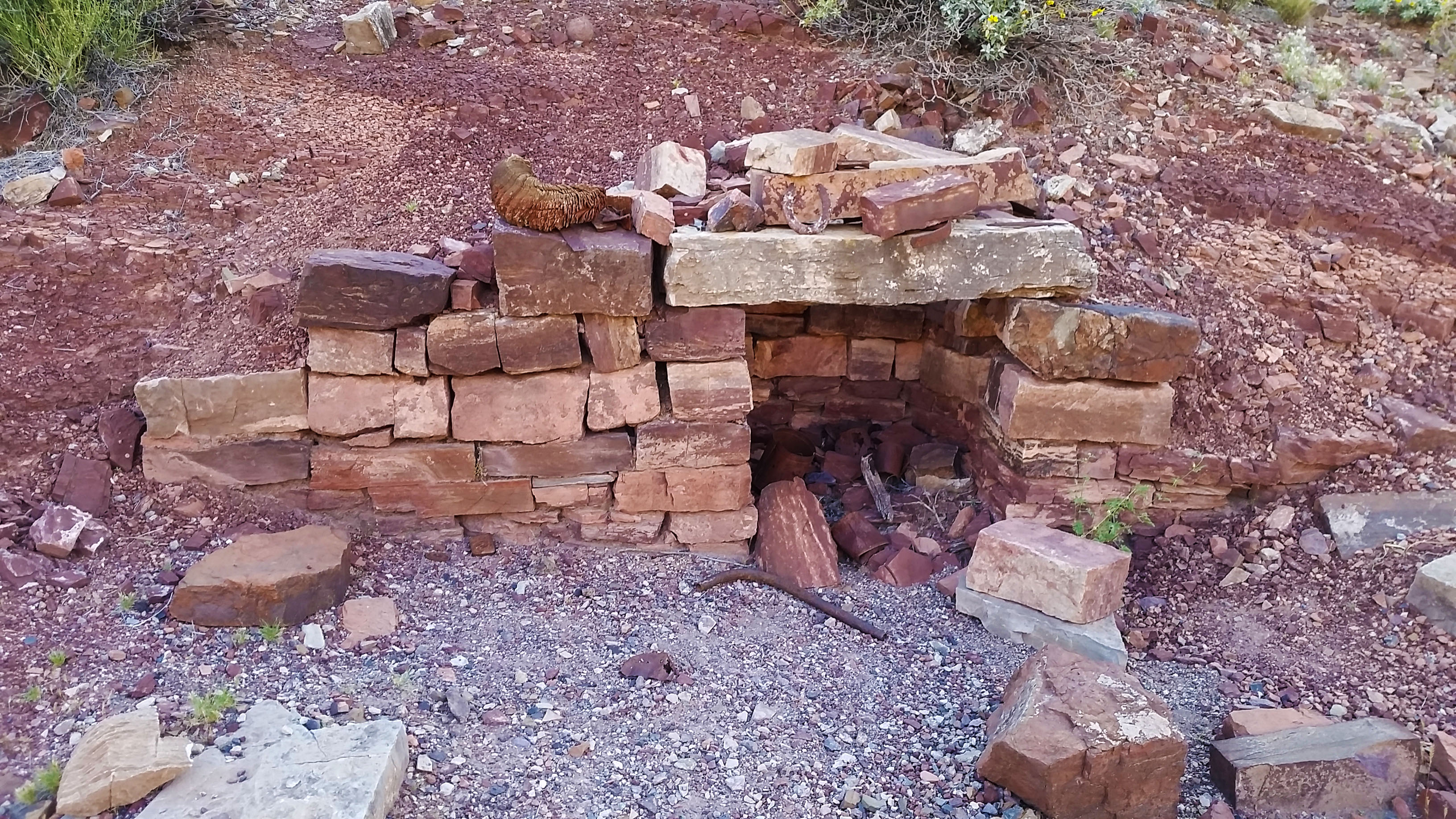
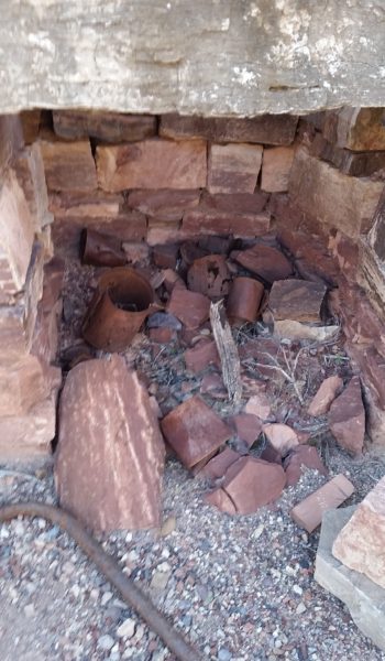
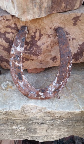
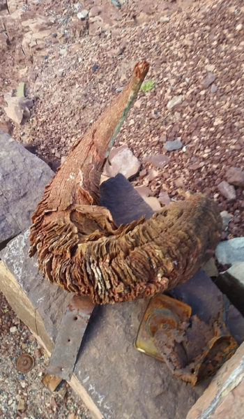 Bighorn sheep horn on the Cowboy fireplace we passed the day before . . . sooo cooolllll
Suddenly a patch of trees popped up almost out of nowhere. This signified the hard push up the switchbacks through the bush towards the sundrenched Darwin’s Plateau. Once we pushed through the trees the baking sun was on full blast, and so was the grueling ascent to the plateau. Switchback after switchback we ascended, taking in the glorious expansive views as we did. Towards the top of the climb we found a nice large boulder to have a quick rest under and replenished our tired bodies. We ran into two other backpackers going in for an eight day trek hoping to get a ride to the other side of the canyon for some cave exploration. We wished them luck and were soon strapping our bags back on and headed up.
 Girnding up the Bass Canyon
Finally after a good long push, we reached the plateau and were faced with the intimidating massive beast that was Mount Huethewali. It stood far above the plateau, looking as though there were only a few class 3 lines that would go. Sam was pretty worked and decided to stay behind as Mark and myself made the push for the peak. We dropped everything except one pack with some water and let out up the steep sandstone slopes. We trekked up quickly and found a few sparse cairns. We picked our way through as we went, every time the route looked as though it were to end, we found another cairn hiding around a corner. Before we knew it we were standing atop the huge mountain whooping and hollering and taking in the 360 incredible views!
 There she is, Mount Huethawali!
 Cairned route
After claiming the peak, we headed back down, grabbed Sam along the way and slowly trekked our way up the remaining switchbacks to the rim of the canyon. Everyone was smiles and we stopped at the trailhead for pictures and a quick snack of whatever we had left in our packs before heading back the 3.5 mile walk on a dirt road to the car.
Just before reaching our truck a wild stallion quickly crossed the road. In the distance, his mare and foal were in the field across the road. He noticed us walking and neighed back to his family who quickly trotted away from us. The stallion came blistering back to the road, looked straight at us, and took a few steps towards us as if he were going to charge. Then stopped, turned, and hauled butt towards his family. Whewwww, what an awesome finish to another crazy trek in the canyon! We soon found our way back to the truck, piled in, and drove home.
 Lets get moving up the final push!
HIKE INFO:
- GPX Track: Full loop – https://hikearizona.com/map.php?GPS=36525
-
Route Description:Royal Arch Route Loop – https://hikearizona.com/decoder.php?ZTN=813Arch Rival: Article – http://www.regionalmagazines.org/downloads/competition/AHM-2012-ctgy05-Trav-Fea.pdf
HIKE STATS:
- Weather: Hi in mid 90s, Low in upper 40s, Sunny
- Water: 6 Liters (including dinner)
- Food: 1 Power Bar, 1 Kroger Protien bars, 1 Cliff Protien Bars, 1 granola bar, 1/2 bag of gummyworms, Apple, 1 Mountain House: Chicken and Mashed Potatoes, 1/2 bag of Salt and Veinagr Chips, 1/2 bag of Pizza Pringles, 1/2 bag of trailmix, 1/2 bag Boston baked beans, 1 PB&J sandwich, 1/2 bag of Quinoa.
- Time: 8 hours
- Distance: 13 miles
- Accumulated Gain: ~4354 accumulated
GEAR:
- 58 liter exos osprey backpack
- Big Agnes Copper Spur UL2 tent
- Big Agnes QCORE SLX sleeping pad
- Cosmic Down Kelty Sleeping Bag (rated to 20 deg F)
- Jet Boil – Sol
- Black Diamond trekking poles
- SPOT Gen3 Tracker
- Sawyer Squeeze – Water Filter
- Black Diamond Helmet
- Petzl Corax Climbing Harness
- 2 Black Diamond screw carabiner
- 4 Phantom DMM screw carabiner
- Black Diaimond ATC Guide
- 60 meter 9.8mm Mammut rope
- Webbing, personal anchor
- 200 ft 6mm pull cord
- 4 rap rings
CLOTHING:
- Wool T shirt – IceBreaker
- Cotton hankerchief
- Pearl Azumi arm coolers
- Arc’teryx hoody
- Nike running shorts
- Merrell Mid Moab Hiking Boots
- Darn Tough wool medium weight socks
- Threadless hoody
Royal “Pain In The” Arch (Day 2) – Grand Canyon – AZ (4.21.17-4.23.17)
- Day 1: Royal Arch via Huitzil Point
- Day 2: Elves Chasm to Bass Beach Traverse
- Day 3: Bass Trail w Mount Huethawali

The alarm blasted, waking me from my deep slumber. The roaring of the Colorado had actually been a soothing sound for the night, the tumultuous rush of the rapids faded into a gentle roar that eased us to sleep. I was covered in the rain fly of the tent that I decided to grab around 2am once the temps decided to plummet. The clear beaming stars were starting to fade as twilight made way for the glorious impending sunrise that would drape the canyon walls in golden sunlight. It was time to move! I pulled myself from my sleeping bag and started the morning ritual of hot coffee, breakfast and packing. This morning I had both my hoodies on as it was surprisingly brisk!
 Hello there spiked friend . . . no hugs please
We really had our work cut out for us as the limiter on this entire trip was the availability of water sources. We chose to camp at the CO River both night 1 and 2 to make it easy for filtering. Unfortunately this plan required a 20 mile push across the Tonto on Day 2 until we finally reached the cool and refreshing Bass Beach. The second day was forecasted to be a warm 94 degrees and we had no choice but to push through it to reach the sweet murky water of the mighty Colorado. Heat was far from our minds as Mark, Sam, and I packed up camp in the cool shade of the canyon.
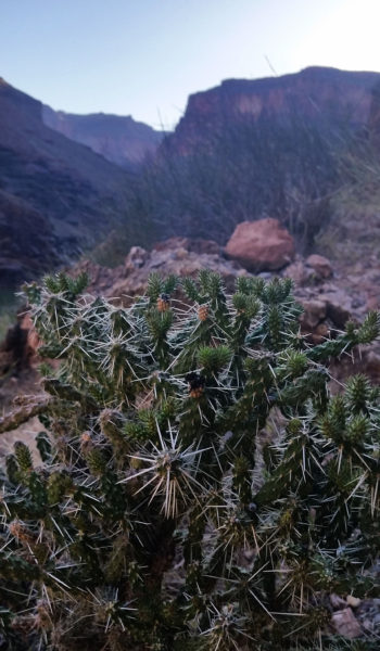
We were soon strapping on our bags and making our last touch of the Colorado for the next 20 miles before we set out from camp. We started gaining right away climbing over sharp boulders and skirting the river on a small footpath. With a backpack on, maneuvering the trail was a bit precarious, but not too bad. Scrambling up rocks, being dumped into sandy beaches, and cairn finding seemed to be the name of the game. We trekked on, racing the sun and trying to stay in the shade as much as possible, this goal would shortly be proved near impossible however. The cactus that were trailside bloomed incredible pink and yellow colors. The flowers were out and showing their stuff!
The trail wrapped the inner basin and skirted a few unnamed canyons under large dry waterfalls. In one of the washes below the dry fall, deposits of minerals and salt pooled up where the water once stood. Mark and myself threw a finger in and tasted it! Mmmm delicious, salt, I spit the rest out not knowing what was in it. We trekked on enjoying the vast and beautiful views a few hundred feet above the river. The sun had yet to start blazing on us and we were more than grateful.
We trekked on, finally reaching Garnet Wash which signified the end of the Royal Arch Route and the start of the Tonto trail at its most westerly termis. After a short break in the last shade we knew we would have for a while, we pressed on. The canyon was large and open, we tracked cairns across its wash. The cairns led us to a fin ledge scramble out onto the tonto where we would be baked by the sun the rest of the day. The scrambles were chill, but fun, and we were soon blasted with both the full sun as well as gorgeous views of the powerful canyon in front of us.
 Approaching the scramble up to the Tonto trail
We trekked on pushing through the heat for a few miles, taking in the sights as they came until finally reaching the skirt of Copper Canyon. This deep and long canyon was riddled with green rocks (oxidized copper), and green scrub everywhere. It was, of course, also a nice treat to our day. We pulled over for some much needed shade behind a boulder before pressing on once again.

Once we were spit from the mouth of copper canyon after a long skirt, we could finally see the edge of the turnoff to Bass canyon and potentially the portion of the river where we would lay our beaten feet for the night. We trekked on, under the hot sun and the miles were beginning to add up on our plumped and swollen feet. We still had work to do, so no need to complain. We pressed on trying to enjoy the views until finally we reached the cutoff for Bass Canyon. We trekked down the steep trail and were pleasantly surprised to find shade which would last the rest of the day. Whew, what a relief.
 Skirting the Tonto
We continued to pick our way down the rough and rugged use trail until we were finally dumped into the bottom of Bass canyon. Only another 2 miles to the beach! We turned North down the canyon and the views were very different from the majority of the day. Interesting black, white, grey, red rocks were all around us. We snaked down the creek bed until finally once again we were skirting the Colorado river, only this time much lower! We saw river runners camped on a beach across the river and knew we couldn’t be far.
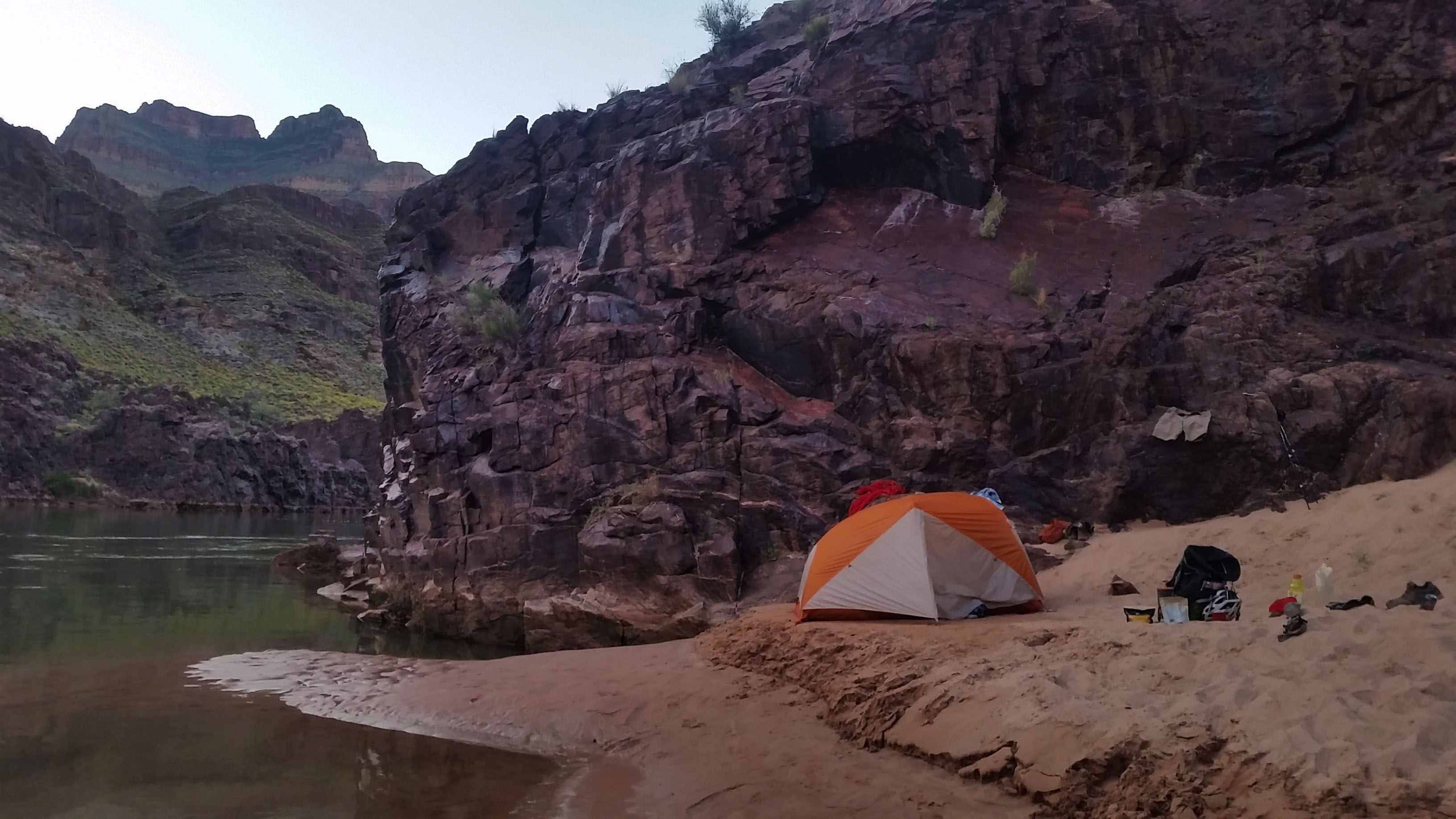
We walked the final leg of the day, tired and weary. But finally, after a short and steep switchback use trail we found ourselves at Bass beach. I could have bent down and kissed it like a lost sailor that finally reached land! We plunged ourselves in the frigid cold of the Colorado which totally revitalized our beaten feet. As the day came to a close, as we shoveled MountainHouse’s into our gullets, and thought about the next day to come. Beats being stuck at work! Another beautiful and incredible day in the Grandest of Canyons!
ADDITIONAL PICTURES:
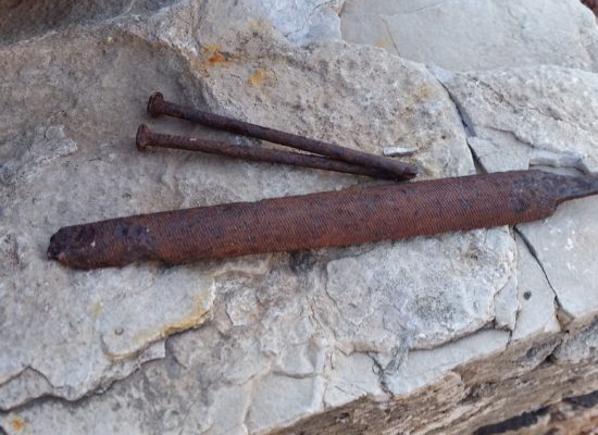 Old tools on the Cowboy Fireplace
 Salt in the pools, mmmmm salty goodness
HIKE INFO:
- GPX Track: Full loop – https://hikearizona.com/map.php?GPS=36525
-
Route Description:Royal Arch Route Loop – https://hikearizona.com/decoder.php?ZTN=813Arch Rival: Article – http://www.regionalmagazines.org/downloads/competition/AHM-2012-ctgy05-Trav-Fea.pdf
HIKE STATS:
- Weather: Hi in mid 90s, Low in upper 40s, Sunny
- Water: 6 Liters (including dinner)
- Food: 1 Power Bar, 1 Kroger Protien bars, 1 Cliff Protien Bars, 1 granola bar, 1/2 bag of gummyworms, Apple, 1 Mountain House: Chicken and Mashed Potatoes, 1/2 bag of Salt and Veinagr Chips, 1/2 bag of Pizza Pringles, 1/2 bag of trailmix, 1/2 bag Boston baked beans, 1 PB&J sandwich, 1/2 bag of Quinoa.
- Time: 11 hours
- Distance: 20 miles
- Accumulated Gain: ~1500 accumulated
GEAR:
- 58 liter exos osprey backpack
- Big Agnes Copper Spur UL2 tent
- Big Agnes QCORE SLX sleeping pad
- Cosmic Down Kelty Sleeping Bag (rated to 20 deg F)
- Jet Boil – Sol
- Black Diamond trekking poles
- SPOT Gen3 Tracker
- Sawyer Squeeze – Water Filter
- Black Diamond Helmet
- Petzl Corax Climbing Harness
- 2 Black Diamond screw carabiner
- 4 Phantom DMM screw carabiner
- Black Diaimond ATC Guide
- 60 meter 9.8mm Mammut rope
- Webbing, personal anchor
- 200 ft 6mm pull cord
- 4 rap rings
CLOTHING:
- Wool T shirt – IceBreaker
- Cotton hankerchief
- Pearl Azumi arm coolers
- Arc’teryx hoody
- Nike running shorts
- Merrell Mid Moab Hiking Boots
- Darn Tough wool medium weight socks
- Threadless hoody
Royal “Pain In The” Arch (Day 1) – Grand Canyon – AZ (4.21.17-4.23.17)
- Day 1: Royal Arch via Huitzil Point
- Day 2: Elves Chasm to Bass Beach Traverse
- Day 3: Bass Trail w Mount Huethawali
Eyes cracked open. It was cold, chilly. In a sleeping bag with a broken zipper. Alarm blasting from my phone, feeling tired after just 4.5 hrs of sleep, staring at the ceiling of a tent. Rubbing my eyes half exhausted half excited about the day to come . . . Looks like we are all set up for another sufferfest at the Grandest of Canyons! This trek brought Sam, Mark, and myself to the doorstep of the old Ranger Station above the drop-in to Royal Arch Creek via Point Huitzil. We planned to drop in, canyoneer all the way to the Colorado River at Elves Chasm, camp, traverse the Tonto trail to Bass Beach, camp, and finally hike out via Bass trail; finishing the trip off with a side trek to Mount Huethawali before closing out the loop with a nice road walk on the rim.
I shivered in the morning, throwing all my gear in the pack, making sure all the food, water and rappelling equipment was accounted for before strapping up and standing, ready to roll. I knew that once we got moving I would warm, so I stubbornly refused to put a jacket on. We let out from the old ranger station headed on an old 4×4 “road” (more like a foot trail) in the northwest direction. After the “road” ended we found an old telegraph line which would lead us to the start of the wash that would eventually dump us into the canyon (according to research). We trekked on through a juniper speckled field which made it seem like we weren’t even hiking to the canyon. Finally the route dumped us into a wash and slowly we made our way to the edge of the rim and were blasted with a gorgeous grand view of the canyon.
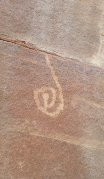
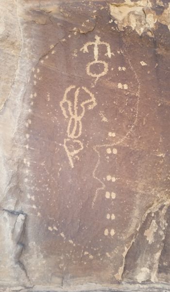
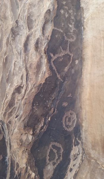
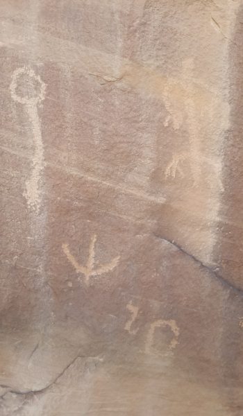
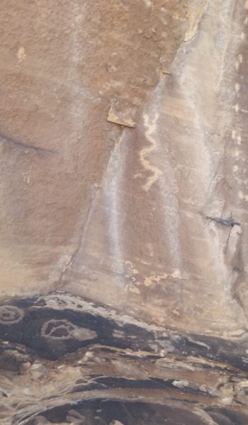
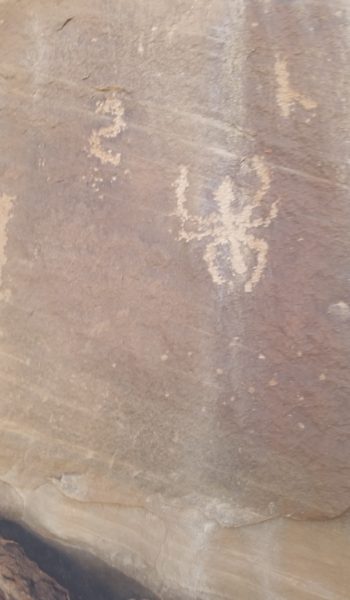
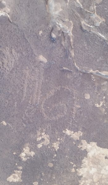
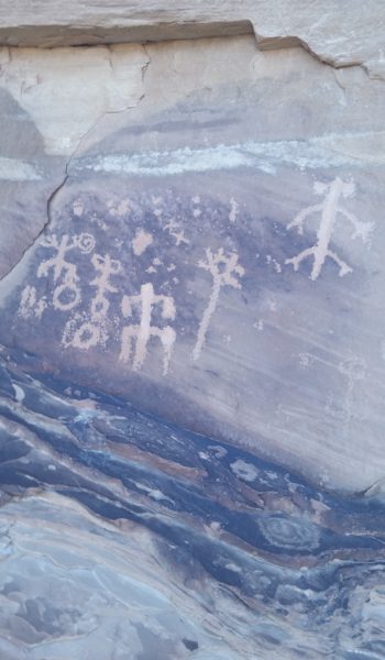
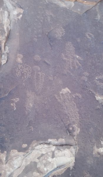
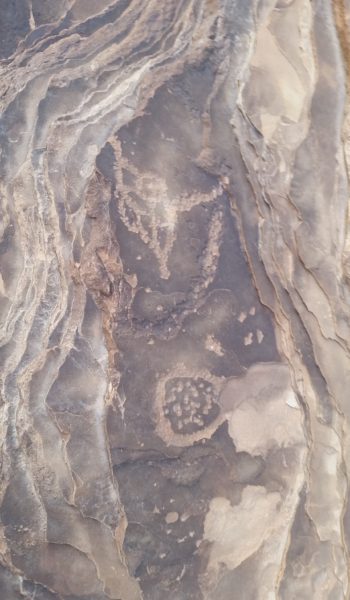
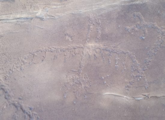
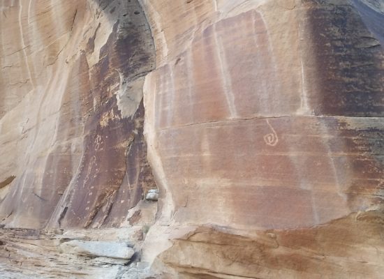
We started our way down the loose steep route, descending ledge after ledge looking for cairns as we went. The sandstone made our shoes stick like spiderman to the slanted ledges of the route. We found our first obstacle and quickly down climbed. I was fully extended in a hang when the tops of my toes landed on the stepping stone below. Whew! One down, only a ton to go! Sam and Mark quickly down climbed and we were off again. The route finding was tedious, we were skirting ledges with a beefy penalty for error. We walked toward a cairn that looked like it would lead us right off the end of a ledge. We looked right and tucked away was the crescent moon shaped rock that hid away the famous ladder climb. It was really cool, an old dead tree with branches cut for feet and handholds. I dropped down first, no issues, Sam and Mark soon followed. Just around the corner from the ladder, skirting north, we were treated with a huge panel of petroglyphs! How cool it was to be there and see something that had been there for hundreds of years!
 Cairn leading right off the edge?
We kept trekking, descending ledges, and finally found the Moki steps on a sandstone slab. The natives cut small ledges into the sandstone making some nice steps for your feet to climb up and down the slope. A little butt skirting and de-packing got us down swiftly. We continued to pick our way down the ledges and skirt across a number of exposed, but not too difficult obstacles, until finally exiting the face via an arm that dumped us into the top of the wash to Royal Arch Creek.
Let the boulder hopping begin! For the next few miles the sun went to work on us as we hopped, jumped, and scurried our way down the creek bed. Finally we came to a large pour-off (dry waterfall) which had 2 options, left to the “ledge of death”, right to the “rabbit hole” . . . “rabbit hole” just sounded too cutesy! We headed left all too curious about what this infamous obstacle had to offer. After a few minutes of skirting the side trail we finally came to the ledge. It had a nice 20 foot exposed traverse with some teared drops below that. What fun! I was first up and found that the grippy rock had some great holds and the feet weren’t that bad either! Keeping the packs on, we all traversed the obstacle with no issue! Just after the ledge, there were a few other small exposed traverses where we had to circumvent large boulders trying to push us into the canyon below. It wasn’t horrible, but deff warranted concentration with a 40lb pack on your back!
 Ahead is the "Ledge of Death"!
We continued downstream, boulder hopping once again until finally the dry creek bed was wet with a beautiful spring and a small ledgy down climb. The water looked so tasty and our parched mouths were ready for a break. As we pushed further, we turned a corner, and there, standing high above our heads was the Royal Arch. What a beautiful sight, it was enormous and demanded respect! We had a nice break in the shade under the arch, next to the creek running just below the massive rock. Just taking in the sights and replenishing our grumbling stomachs.
 Time lapse - Ledge downclimb past the spring
Fed and ready for more, we walked downstream from the arch and peered over the huge cliff into the canyon below. What a drop! We were standing 170 feet above a tiered drop-off and the bed of a nice waterfall that trickled down just next to where we planned to rappel from. We found some good webbing and a quicklink that looked solid. I put up the biner block rappel setup using Sam’s 60 meter 9.8 mil rope to a carabiner with a constrictor knot. I backed it up with a figure 8 and tied on the 200 ft 6mm pulldown cord to the biner block. We were all set to go so I threw both ropes off the cliff and they fell to the second ledge. Time to go to work! I rapped first taking on the task of rope management as the small pulldown cord got quite tangled. I threw it from the first ledge down, then the next. To my relief the main rope reached the ground, and soon after, so did I! Whew, made it!
Mark and Sam soon followed and we were all safely on the ground when I went to pull the pull cord I had set up. *Yank* nothing . . . *Yank* nothing . . . I started to get serious when I realized the rope could be stuck which would require me to either re-ascend the rope or we would be stuck in the canyon between two 100+ foot rappels. I reached high, grabbed a bite on the 6mm rope, tied an overhand knot, and clipped it into my harness. I sat my full weight on the rope and once I did it finally budged. I quickly walked back away from the cliff pulling the rope as I did to make sure it didn’t get hung again. LUCKY!!!!! I was so relieved!
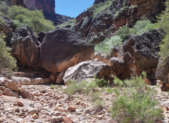
Once we retrieved both ropes and recollected our wits we headed downstream to find the second of the big rappels, a 135 foot cliff. This time our anchor was a nice tree with 3 sets of webbing wrapped around it. Another nice anchor that we could use! This rap went much smoother and was almost completely free hanging. We each made our way down the rope and into the next section of the beautiful canyon. Waterfalls and lush green plants were abound. Frogs darted this way and that in the pools as we trekked through, it was truly a hidden paradise!
Soon after the second rappel we found a nice 8-10 foot downclimb. We pulled our packs off and hurdled the obstacle before strapping up once again and letting out further down the canyon. We dodged boulders, down climbed ledges picked our way slowly down. I popped my head over a huge boulder, the only down climb led to water . . . “that can’t be right”, I thought. I poked left, poked right and finally found a small tree on canyon right with a small 20ft rap. In hindsight, we found that we were on the wrong side of the canyon and should have belly crawled a ledge on the the west side of the canyon . . . Oh well! After placing some new webbing and breaking our rope and harnesses out once again, we made the last rap of the day.
 Donw the canyon we go!
We enjoyed the rest of the canyon as we trekked on. Down climbing, shimmying over boulders and down ledges, using cairns to guide our way, until we finally reached Elves Chasm. It was a tiered waterfall with a deep crystal clear pool at the bottom. We decided to strip down and jump in; after the long exhausting day we had, it seemed like the right thing to do! After jumping from the waterfall and pulling ourselves from the cold water we trekked the rest of the way to a permissible beach where we set up camp, grubbed down, and finally, under the star lite sky, crashed out in our flyless tents. What an epic day, man I love the Grand Canyon!
ADDITIONAL PICTURES:
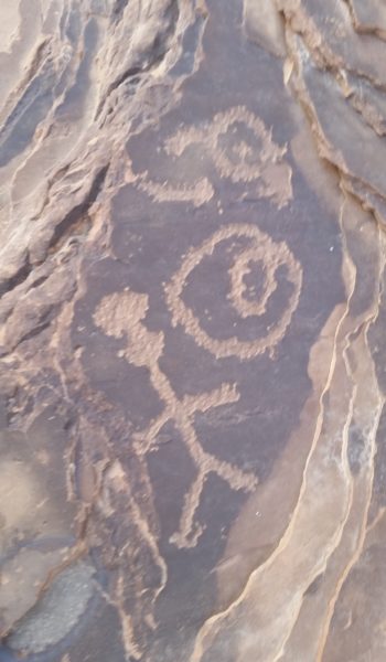
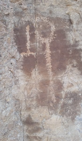
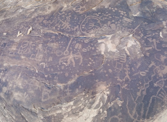
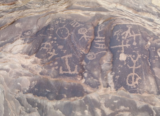
 Enter the petroglyph panel!
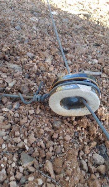 telegraph line insulator
HIKE INFO:
- GPX Track: Full loop – https://hikearizona.com/map.php?GPS=36525
-
Route Description:Royal Arch Route Loop – https://hikearizona.com/decoder.php?ZTN=813Arch Rival: Article – http://www.regionalmagazines.org/downloads/competition/AHM-2012-ctgy05-Trav-Fea.pdf
HIKE STATS:
- Weather: Hi in mid 90s, Low in upper 40s, Sunny
- Water: 5 Liters (including dinner)
- Food: 1 Power Bar, 1 Kroger Protien bars, 1 Cliff Protien Bars, 1 granola bar, 1/2 bag of gummyworms, Apple, 1 Mountain House: Chicken and Mashed Potatoes, 1/2 bag of Salt and Veinagr Chips, 1/2 bag of Pizza Pringles, 1/2 bag of trailmix, 1/2 bag Boston baked beans, 1 PB&J sandwich, 1/2 bag of Quinoa.
- Time: 12 hours
- Distance: 11 miles
- Accumulated Gain: ~ Drop 4000 feet
GEAR:
- 58 liter exos osprey backpack
- Big Agnes Copper Spur UL2 tent
- Big Agnes QCORE SLX sleeping pad
- Cosmic Down Kelty Sleeping Bag (rated to 20 deg F)
- Jet Boil – Sol
- Black Diamond trekking poles
- SPOT Gen3 Tracker
- Sawyer Squeeze – Water Filter
- Black Diamond Helmet
- Petzl Corax Climbing Harness
- 2 Black Diamond screw carabiner
- 4 Phantom DMM screw carabiner
- Black Diaimond ATC Guide
- 60 meter 9.8mm Mammut rope
- Webbing, personal anchor
- 200 ft 6mm pull cord
- 4 rap rings
CLOTHING:
- Wool T shirt – IceBreaker
- Cotton hankerchief
- Pearl Azumi arm coolers
- Arc’teryx hoody
- Nike running shorts
- Merrell Mid Moab Hiking Boots
- Darn Tough wool medium weight socks
- Threadless hoody
Cheops Plateau and Pyramid (Day 2) – Grand Canyon – AZ (3.19.17)
Alarm blasting, gahhh! We almost slept nine glorious hours in our fly-less tents. The temps were perfect for camping and star gazing. However, even nine hours of sleep didn’t seem like enough time to fully recover from our exhaustion the day prior. With a whole lot of work to go, we peeled ourselves from our sleeping bags and got breakfast rolling. Within an hour, we were all upright with packs on, ready to take on Cheops Pyramid. Even though it looked sketchier than the plateau, trip reports said it was supposed to be pretty chill Class 3 climbing.
We trekked out from camp once again, and we all knew it was going to be one long day, but hopefully a good one! We picked up the Utah Flats use trail and began hiking north once again. However, after a quarter mile or so, we left the trail and made a B line across the open desert towards the eastern wall of the Cheops Plateau. Looking like a battleship in ram mode, we covered the terrain, boulder hopping, kicking up off camber dust, and slowly picking our way towards the huge face in front of us.
We had to circumvent large sandstone dry waterfalls that would easily spell utter tragedy with one misstep. We hiked on, splitting up and rejoining, all trying to find the best way across the steep slopes on the eastern side of Cheops Plateau. Rene and myself went high while Mark and Kari stayed low. We continued to skirt the slopes and we all met up at the start of the Cheops Pyramid scramble searching for any sign of shade we could find. The sun had already started to go to work on us, warming our hat shaded faces. We sat down at the base of the climb for a quick snack and water break.
We chatted about the climb the day before and we were all curious as to what was in store for us. Soon we picked up our packs and set off again, headed up and left to circumvent a small vertical face. We encountered our first climb, which seemed a bit more difficult than described, but it went quickly. Route finding and cairn searching were back in full swing as we pressed up the face attempting to find the best way up. Some of the ledges ahead looked impossible without rope at first glance, but with a closer look we found the line, and a few faint cairns.
 Rene scopes the climb
We ascended the next ledge and headed up and out left towards a small exposed arête. “This thing was supposed to be all chill Class 3, right?!” I thought to myself. I got on another small climb with questionable rock towards the top and just made it happen. The down climb was future Mike’s problem! We all took a quick breather and looked towards the peak, it was only 50 feet away, and once we noticed it there was no more need to break! We moved swiftly up the chossy rock and soon we were all, once again, simultaneously touching the top of Cheops Pyramid!
Man what a view! The Grand Canyon is such a beautiful place, the 360 degree view that we had the privilege of enjoying was nothing less than spectacular! I once again walked towards the bridge that connects Cheops Pyramid to Cheops Plateau to have a look, and once again it seemed like such a tough undertaking. All of the rock on the bridge looked chossy and the route looked hard to protect with gear; not undoable, but it would require a full level of commitment to a climb of questionable quality.
After signing the registry, we regrouped and picked our way back to camp. It always seems to be easier on the down climb, you see a line you didn’t before, or an easier way to take on the obstacles. This climb was no different, the seemingly tough Class 3 climbs lost their bite (except for the rocks, they were sharp as hell!) as we descended. The slog back to camp was a good long one. We finally got back to Utah Flats, packed things up, and divvied up our remaining water to get ready for the steep and loose descent back to Phantom Ranch.
After descending the sun baked steep and loose Utah Flats trail, we were soon sitting at the Phantom Ranch cantina with a cool Arnold Palmer in hand. We were all trying not to think about the nine miles and 4600 feet of elevation gain that stood between us and Bright Angel Lodge.
 Coming back down from Cheops
Finally, around 2:30pm, we geared up, threw our packs on, and started our walk out on Bright Angel Trail. On every switchback that turned our gaze back to the North Rim I took a moment to look at all of the buttes, temples, and massive formations sticking above the canyon floor. It’s like inception; you may never have noticed them before, but once you know them by name, and attempt to climb them, you can never forget their existence. The Grand Canyon is an incredible place. I love it here.
 Skirting towards the pyramid

 Well hello there!
-
GPX Track:Utah Flats – https://hikearizona.com/gps=
10308 Cheops Pyramid (Day 2) – https://hikearizona.com/gps=20767 Cheops Plateau (Day 1) – https://hikearizona.com/gps=20766 -
Route Description:Cheops Plateau (Day 1) – https://hikearizona.com/
decoder.php?ZTN=1077 Cheops Pyramid (Day 2) – https://hikearizona.com/decoder.php?ZTN=1078
HIKE STATS:
- Weather: Hi in upper 80s, Low in upper 40s, Sunny/Partially Cloudy
- Water: 4.5 Liters
- Food: 1/2 avocado, 1 Power Bar, 1 Kroger Protien bars, 1 Cliff Protien Bars, 1 granola bar, 1/2 bag of gummyworms, Orange, 1 Mountain House: biscuites and Gravy, 1/2 bag of Salt and Veinagr Chips, 1/2 bag of Pizza Pringles, 1/2 bag of trailmix.
- Time: 12 hours
- Distance: 14 miles
- Accumulated Gain: ~6500 feet
GEAR:
- 58 liter exos osprey backpack
- Big Agnes Copper Spur UL2 tent
- Big Agnes QCORE SLX sleeping pad
- Cosmic Down Kelty Sleeping Bag (rated to 20 deg F)
- Jet Boil – Sol
- Black Diamond trekking poles
- SPOT Gen3 Tracker
CLOTHING:
- Wool T shirt – IceBreaker
- Cotton hankerchief
- Pearl Azumi arm coolers
- Arc’teryx hoody
- Nike running shorts
- Merrell Mid Moab Hiking Boots
- Darn Tough wool medium weight socks
- Threadless hoody
Cheops Plateau and Pyramid (Day 1) – Grand Canyon – AZ (3.18.17)
We woke to 30°F temps on the South Rim. Mark, Kari and I were stuffed into Mark’s tent and Rene was cozy in the bed of his truck. We had another “bum rush” weekend on our hands; we drove up the night before the trek, camped for the night, and would catch the 8 a.m. bus from the Bright Angel lodge to the South Kaibab Trailhead where we would dump into the Grand Canyon to start our weekend adventure. The target was Cheops Pyramid and Cheops Plateau, both standing over 5000 feet in elevation and located in the heart of the Grand Canyon. We would trek in, camp at the base of Cheops Plateau, summit the Plateau on the first day and summit the pyramid on the second day. After summiting Cheops Pyramid, we would then hike out of the Grand Canyon for the long car ride home on Sunday night. Needless to say we had our work cut out for us!
After getting our gear together, we parked the truck and caught the Hiker Express shuttle bus to the South Kaibab Trailhead. Next thing you know it, we were standing on the edge of the south rim looking at the daunting task we signed ourselves up for. Everyone was excited and in high spirits and we took off down the South Kaibab trail. There were quite a few people already trekking down the trail. We pressed on, pausing briefly for pictures and to peel off jackets as the sun hit us and temperatures began to rise. By the time we got down to Phantom Ranch, it was nice and toasty outside. We hit the water supply there and gained a good 16 pounds from loading up on 6-8 liters a piece. Weighted down and ready for the grind out of Phantom Ranch we headed back towards the small aluminum footbridge that brought us to the start of the Utah Flats Route.
The route was rarely traveled and started out with some wicked elevation gain. Full 40 pound packs pulled us down and wrenched on our backs as we gained elevation in the hottest part of the day. Pushing on and up the loose trail we were all breathing hard, dripping sweat, redlining our pumping hearts, and just trying to hold on under the blazing suns heat. We found a nice shaded boulder on the way up and decided to pull off for a quick rest. Mark piped up “Man, I’m getting hammered dude!”. We were all pretty fried from the quick ascent, but after some much needed shade and rest, we regained our spirits and pushed on. Soon we were out on the Utah Flats plateau above looking at the east side cliff faces of our targets; Cheops Pyramid and Cheops Plateau. Both magnificent Cheops landmarks looked beastly and dicey.
After searching around for quite a while, we found one of the few flat spots that wasn’t infested with cacti and threw our gear down. After setting up the tents and whittling down our packs to just day hike mode, we took off towards the North Ridge of the Cheops Plateau. We picked up a small use trail that skirted the north side of the huge plateau. We could see bright green trees drinking from the cool waters of Phantom Creek which we heard flowing in the distance. The wind finally picked up and we got our first taste of cool air for the day. What a relief!
We kept trekking on the Utah Flats Route until the North Ridge of Cheops came into view. It looked pretty intimidating from below, but like many daunting obstacles, things seem to become more doable the closer you get. We pressed up the steep loose slopes on the northeast side of Cheops until finally reaching the vertical cliff face of the plateau. Paralleling the cliff wall, we headed North along a faint use trail at a much faster pace than we had on the unforgiving slopes below. Finally, we reached the toe in point on the North Ridge of Cheops. I was excited to start climbing straight up! From our research, it seemed as though it was pretty chill except for one exposed Class 4 move just below the top of the plateau. Looking up at the rock face in front of us, the terrain looked anything but trivial. In usual fashion we slowly began picking away at it.
 lets go to work!
I headed up and soon Kari, Mark, and Rene followed. It was time to turn the lizard brain on. Our focus shifted solely to the hands, feet, and the best holds we could find. We cruised up the first few ledges. I poked my head around the face on both sides of the ridge to find the best line and took the path of least resistance. There was a small climb over black rock that I actually had to use a little body manipulation to get up. So much for the route being Class 3! We continued on. Mark, who was following closely behind me nervously awaited the moment when we would come face to face with the crux of the route. Soon I found the spot that most trip logs mention. There was a significant dropoff to the left, but the hand holds were great. The feet placements weren’t as good but they were a heck of a lot better than I thought they would be. Lets go! All four of us cruised through the crux with zero issues! “Hell yes!” I patted Mark on the back who out of the group said he was the most nervous about the route (He cruised it like a champ). We pushed on, carefully up and over a natural arch (which was a bit delicate to say the least) until finally we were standing on the much more tame and stable Cheops Plateau!
We all took the opportunity to relax knowing we would have a little time before having to head back down. We all walked to the highest point on the plateau and simultaneously touched the top before signing the summit registry in the ammo box with huge grins on our faces. Man what a day, but it was far from over! We walked to the southern end of the plateau to check out the crumbling bridge connecting the Cheops Plateau and the Cheops Pyramid that we had plans to summit the next day. I scrambled down to get a closer look at the rotten beast of a bridge. There were two large discontinuities in the knife-edge bridge and the rock quality was absolute crap. It’s not that it couldn’t be done, it would just require adequate gear, willingness to assume a great deal of risk, and nerves of steel to complete the task.
After taking it all in we turned back, retraced our steps and soon found ourselves back at camp licking our wounds. We made dinner, and prepared to crash for the night before waking up to have a go at Cheops Pyramid the next day!
 Dropping down South Kaibab
 Tipoff Point
-
GPX Track:Utah Flats – https://hikearizona.com/gps=
10308 Cheops Pyramid – https://hikearizona.com/gps=20767 Cheops Plateau – https://hikearizona.com/gps=20766 -
Route Description:Cheops Plateau – https://hikearizona.com/
decoder.php?ZTN=1077 Cheops Pyramid – https://hikearizona.com/decoder.php?ZTN=1078
HIKE STATS:
- Weather: Hi in low 90s, Low in upper 30s, Sunny
- Water: 4.5 Liters
- Food: 1 Power Bar, 1 Kroger Protien bars, 1 Cliff Protien Bars, 1 granola bar, 1/2 bag of gummyworms, Orange, 1 Mountain House: Chicken and Mashed Potatoes, 1/2 bag of Salt and Veinagr Chips, 1/2 bag of Pizza Pringles, 1/2 bag of trailmix.
- Time: 12 hours
- Distance: 14 miles
- Accumulated Gain: ~3200 feet
GEAR:
- 58 liter exos osprey backpack
- Big Agnes Copper Spur UL2 tent
- Big Agnes QCORE SLX sleeping pad
- Cosmic Down Kelty Sleeping Bag (rated to 20 deg F)
- Jet Boil – Sol
- Black Diamond trekking poles
- SPOT Gen3 Tracker
CLOTHING:
- Wool T shirt – IceBreaker
- Cotton hankerchief
- Pearl Azumi arm coolers
- Arc’teryx hoody
- Nike running shorts
- Merrell Mid Moab Hiking Boots
- Darn Tough wool medium weight socks
- Threadless hoody
Grandview Trail to Old Grandview Trail – Grand Canyon – AZ (3.1.17)
My eyes popped open. No alarm had sounded, the twilight was starting to open up in the sky. I jumped up frantically searching for my phone; it was dead as a doornail. The 10 degree temps had helped to suck whatever battery I had left and I had overslept almost an hour. I jumped up, threw on my hiking clothes, and stuffed my bag with food for the day. There was no time for coffee or a warm breakfast…I needed to finish my hike and drive back to Phoenix for work the next day. I pulled on my jacket and ski mask and let out on the trail.
The air was chilly and a few people hung about at the start of the hike, taking pictures of the sunrise. Once I passed them, there was no one else. No birds, no people, no sounds… just me and the canyon and the snow. The snow was a good 12 inches deep at the beginning of the trail. I had my microspikes on, so I trudged through the snow knowing that once I dropped low enough, it would give way to rocks and dirt again. What a peaceful sight, the canyon undisturbed in the fresh fallen snow.
The trail was steep and I quickly descended through the switchbacks on the south rim cliff. I soon skirted the arm that jetted out to meet horseshoe mesa where the most padded part of Grandview trail ended. I broke out of the shade and the sun warmed me, so I pulled off the ski mask and hoody and trekked the bridge to the mesa. As I neared the Horseshoe I noticed a sign to the right that stated that there was radioactive area nearby, the sign read “Do not enter”. Hmmm . . . I highly doubted there was actually radioactive material in there, but I knew the sign served as a deterrent to keep people out of the Last Chance Mine (founded in 1890 by Pete Berry when copper was discovered there) and it was not on my list of things to do so I trekked on.
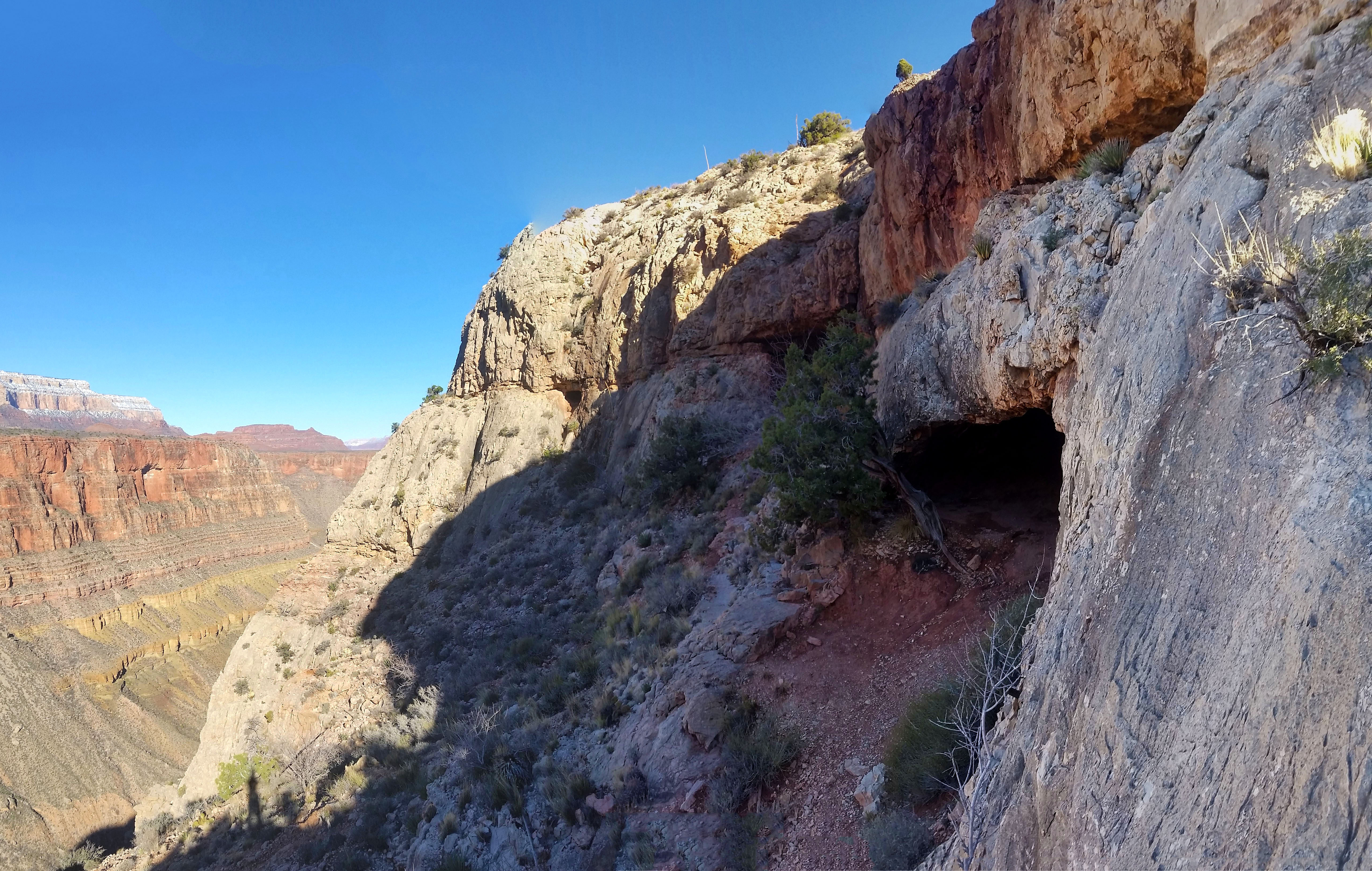
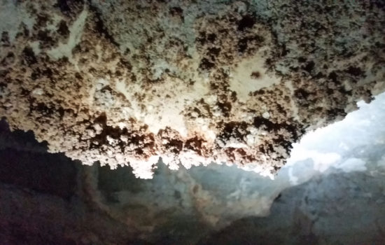
I found the mesa and the remaining foundation of what I could only imagine was a miner’s house. After a short pause and some pictures I kept trekking north. Eventually I came to a seldom used trail that went directly west. I heard that the only cave in the canyon that didn’t require a special permit was located there. I figured “why not, let’s check it out” and took the trail. Soon after the trail had walked all the way to the edge and off the west side of the cliff I found Cave of the Domes.
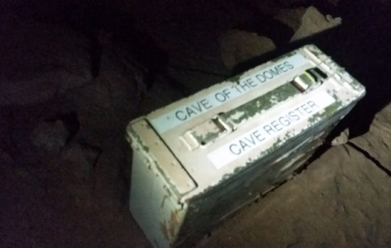 Cove of the Domes Registry
 Like Rome, columns out front!
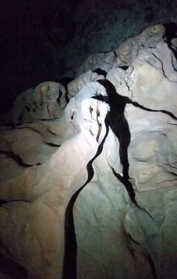
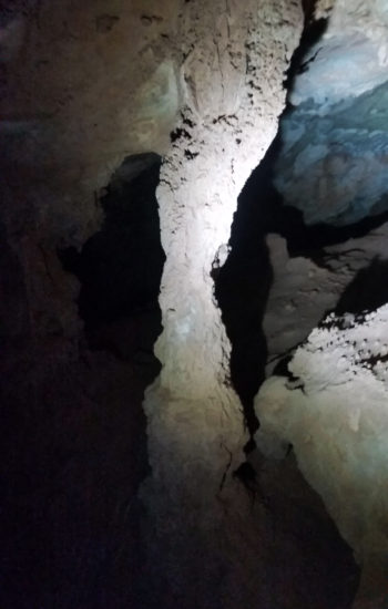
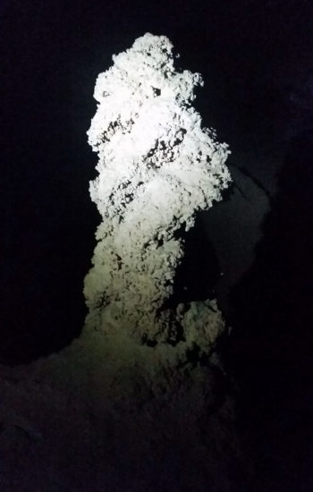
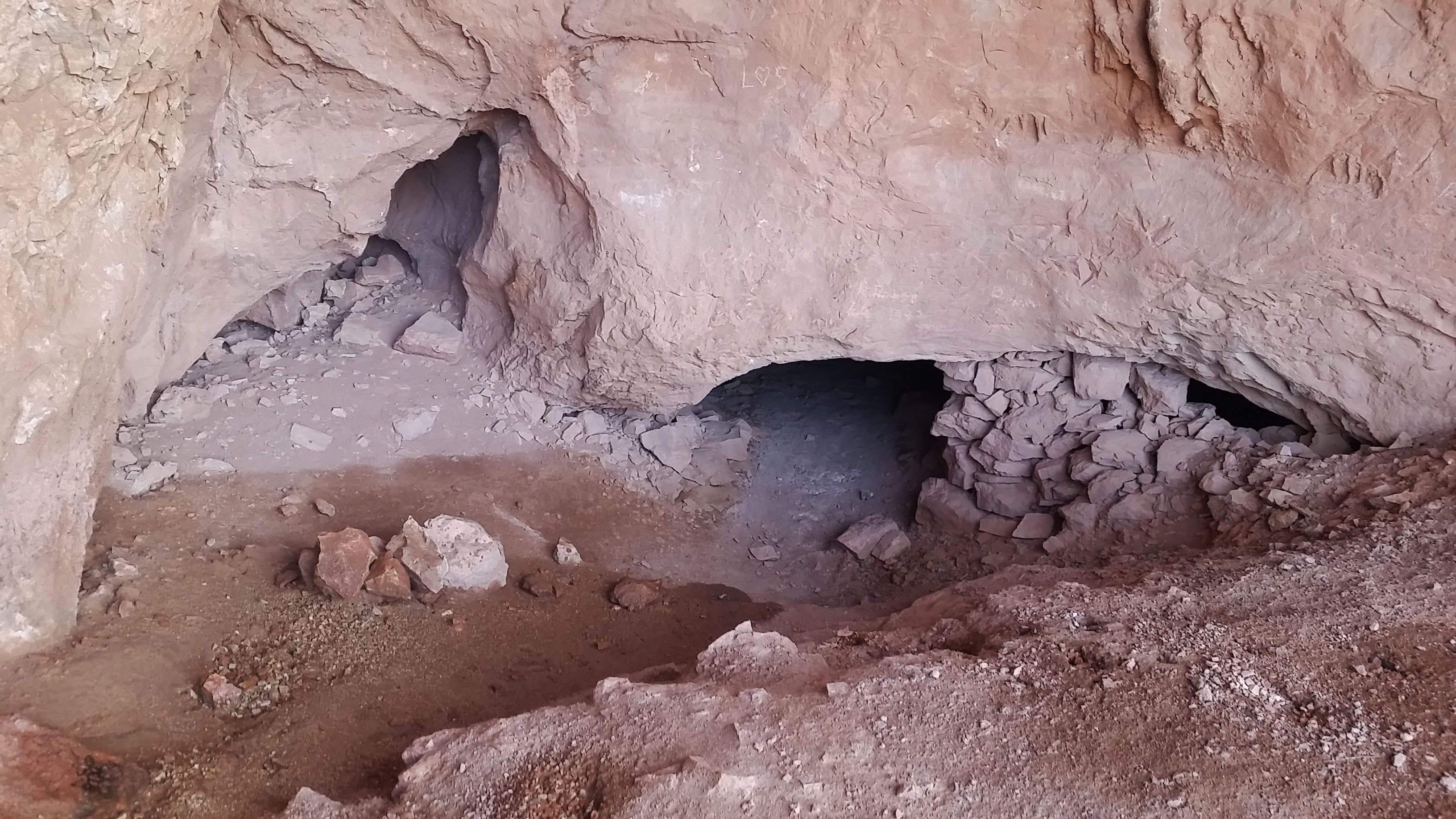
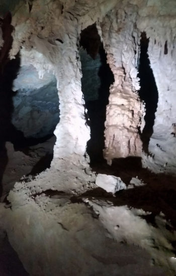
There I found a small entry to the cave. Sporting my headlamp and camera, I entered. The cave was much warmer, probably mid 50’s compared to low 40’s outside. It was also dusty and the air was a bit stagnant. I searched around and found the typical formations, stalactite and stalagmites, but also found some bacon, popcorn…a little bit of everything. I poked around the main chamber of the cove, trying to look down all the legs of the cave. I found quite a few that undoubtedly went further into the ground, warranting further exploration. Curiosity began to rear its head, but I quickly squashed the idea. I didn’t have much time, and the cave was not my primary goal of the trek. I was already breaking quite a few caving rules (running solo, with only 2 sources of light, and no helmet), so I thought it best to move on and come back another time. I emerged from the cave the same way I entered and was soon back on the trail headed towards the river.
I dumped off the front side of the Horseshoe Mesa, tying into the Tonto trail skirting west towards the Old Grandview trail. The trail down from the mesa was quite different that the beaten trail above. It was much more sparse and I had to follow cairns until finally reaching Tonto. By this time the temps were perfect… still chilly, but just right while moving with some sun on me. I rounded a corner and saw my first sign of life. A pack of small brown birds erupted in flight, all chirping and fluttering. It was such a nice day. The Tonto trail moved quickly and I pushed on passing Cottonwood creek, which to my surprise was running. It seemed like a little oasis. I could see some lush green foliage clinging to life near the small creek.
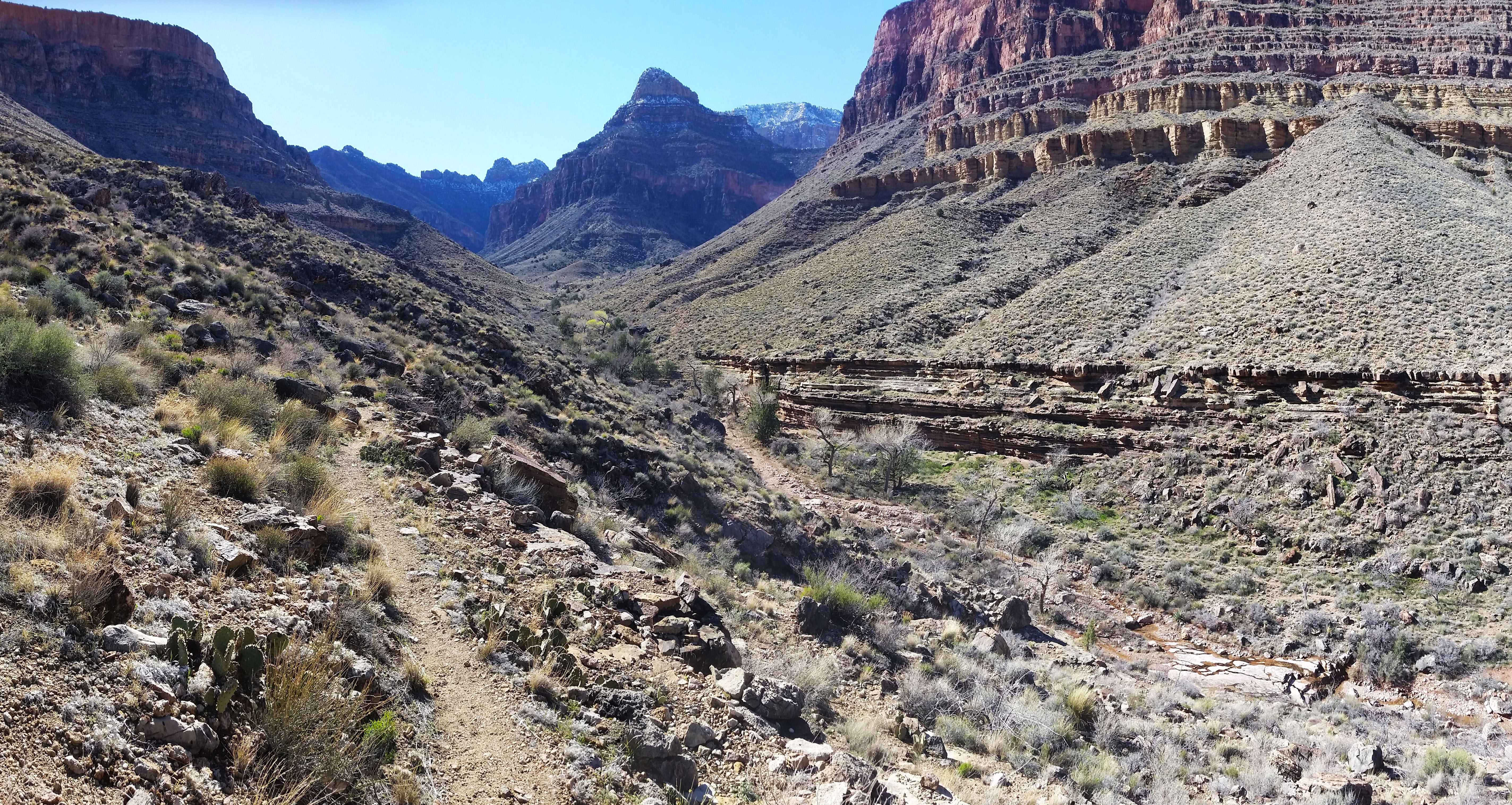
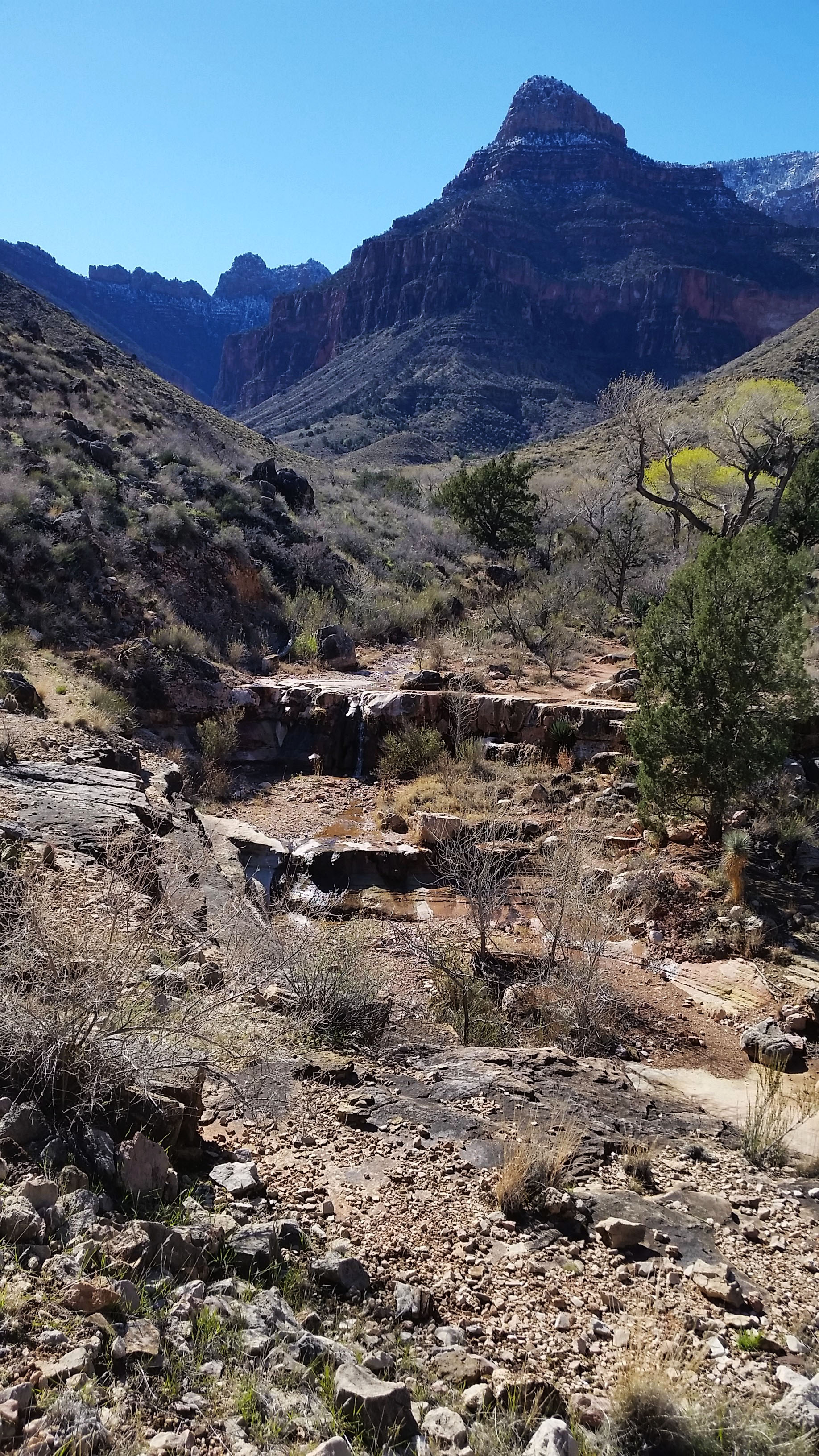
The Tonto snaked back and forth in and out of canyons until I finally reached a large cairn signifying the Old Grandview Trail. I looked down at the inner gorge in awe. The rock here was hard and impenetrable, which is why there are only a very few trails that lead all the way to the river as the rocks offered a type of protection. Skeptical of the difficulty, I cautiously proceeded down the steep embankment which dropped down to the river with 1,200 foot drop in just under half a mile. “Oh look a cairn!” I thought as I descended, and I was very surprised how good the trail was. Another cairn, and another, “Man this isn’t nearly as bad as I thought it was going to be” I thought as I pushed on. I found myself climbing over the first notch into a shadowed wash, everything was pretty smooth. I passed the second notch and entered the final wash which would take me all the way to the river. A little loose but very doable, and I hardly had to use my hand.
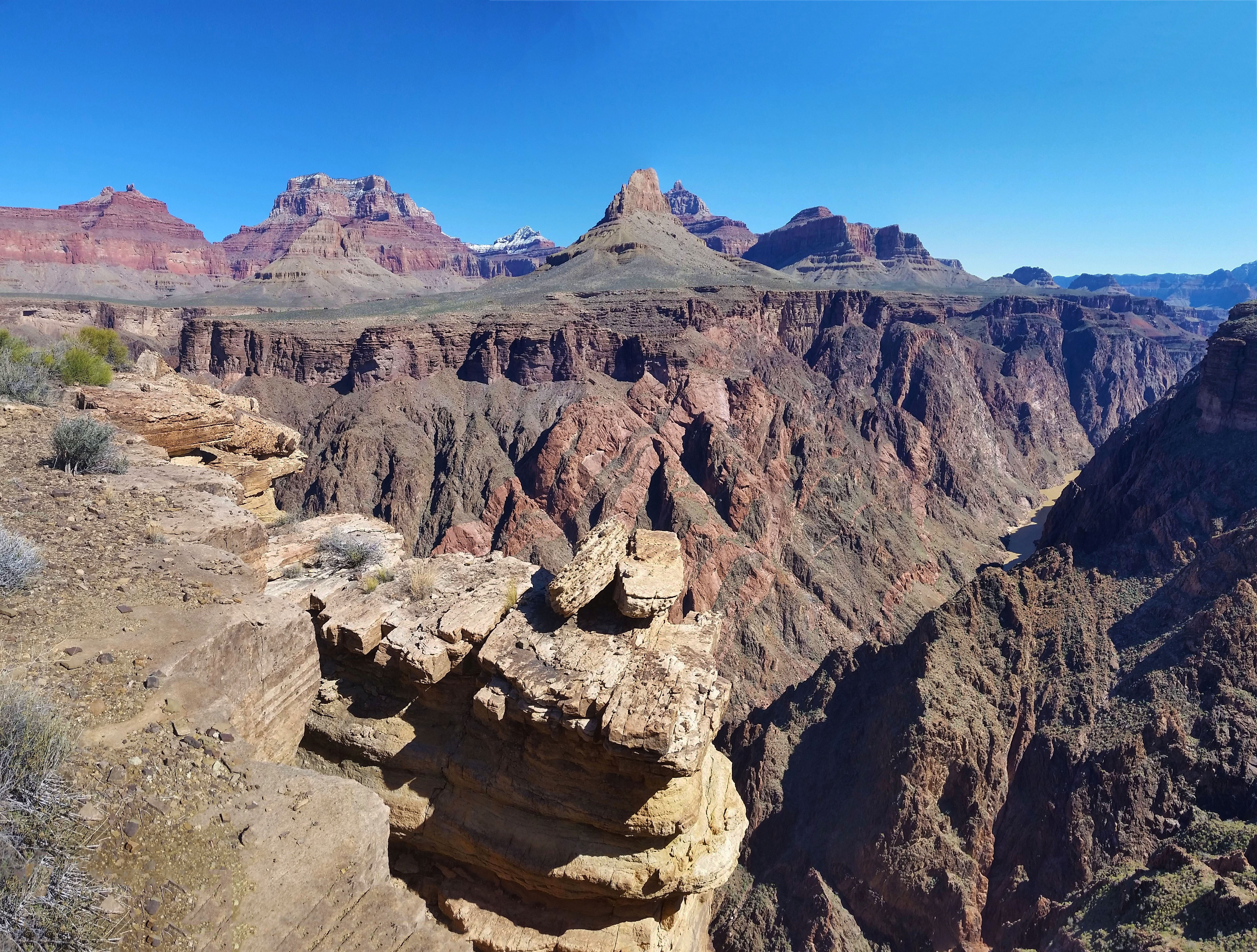
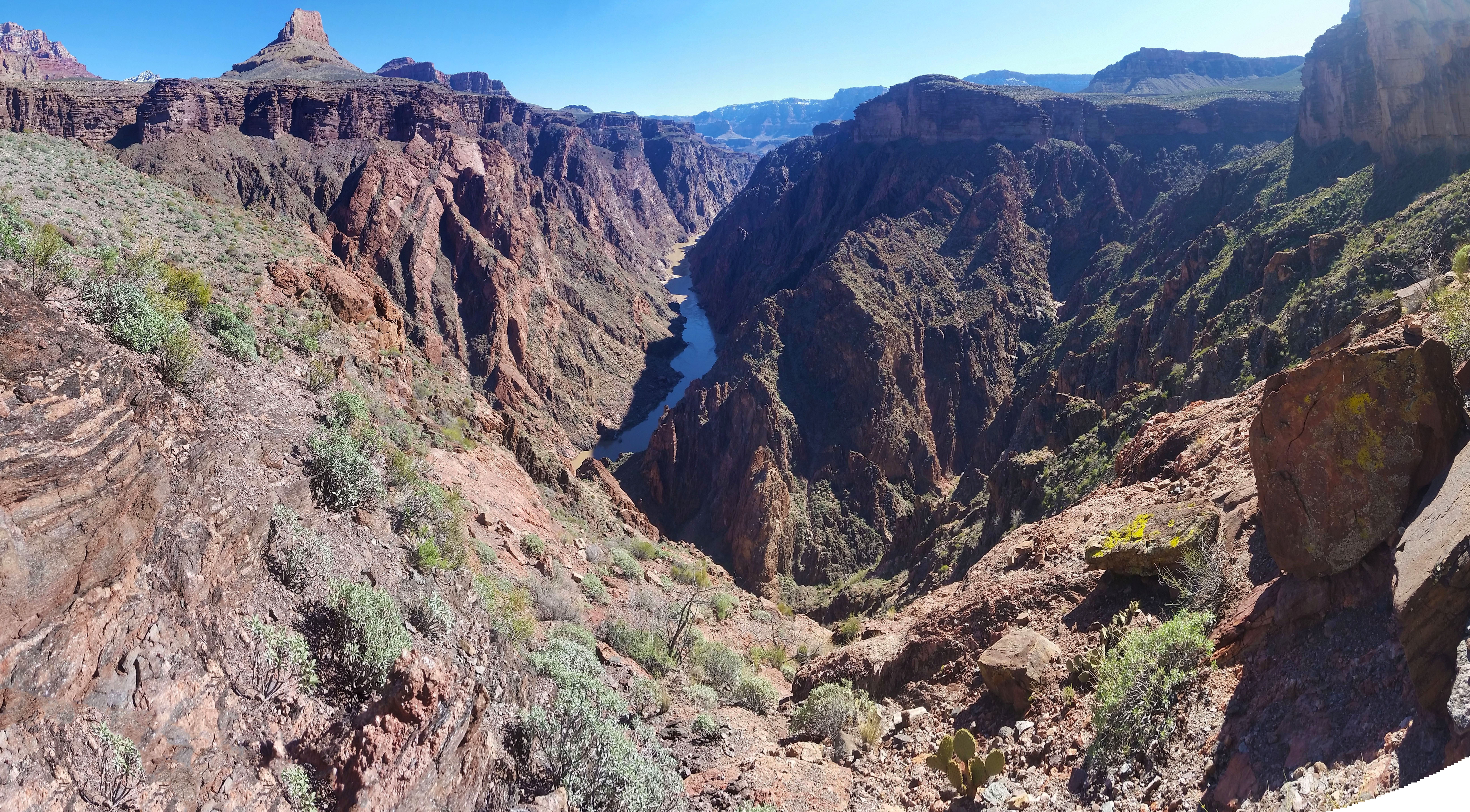
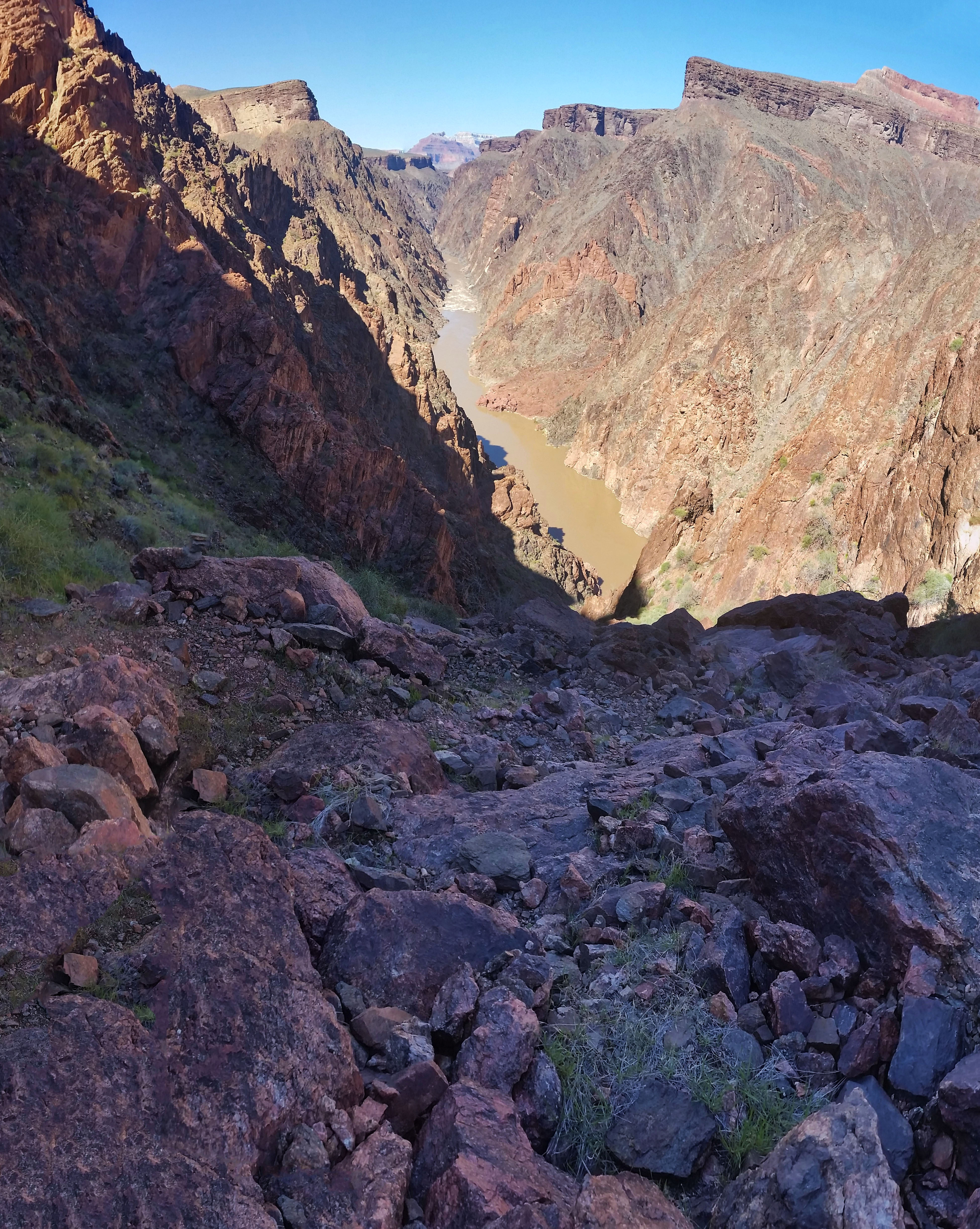
Soon enough I found myself sitting on the beach of the Colorado River. The water was murky, but powerful and cold as hell! The Colorado is always an impressive sight. I sat, ate a snack and had a nice break before finally packing up and heading back out. On the trek out I decided to take the Cottonwood Creek trail and I wasn’t disappointed. There weren ample opportunities to camp creekside, which was shaded by the namesake cottonwood trees that lined the edge. The gain was good, but it secretly became my favorite part of any trip. I pushed hard and trekked at a good clip. It was just me, so no one to catch up to or wait on. Sometimes it’s nice to have a little 1-on-1 time with the canyon. I finally pushed out and ascended the last snowy switches to find a few people at the trailhead taking in the view and taking pictures with their families. Another trek successfully completed. Man I love the canyon! I hope you will get the chance to see it too, trek on!

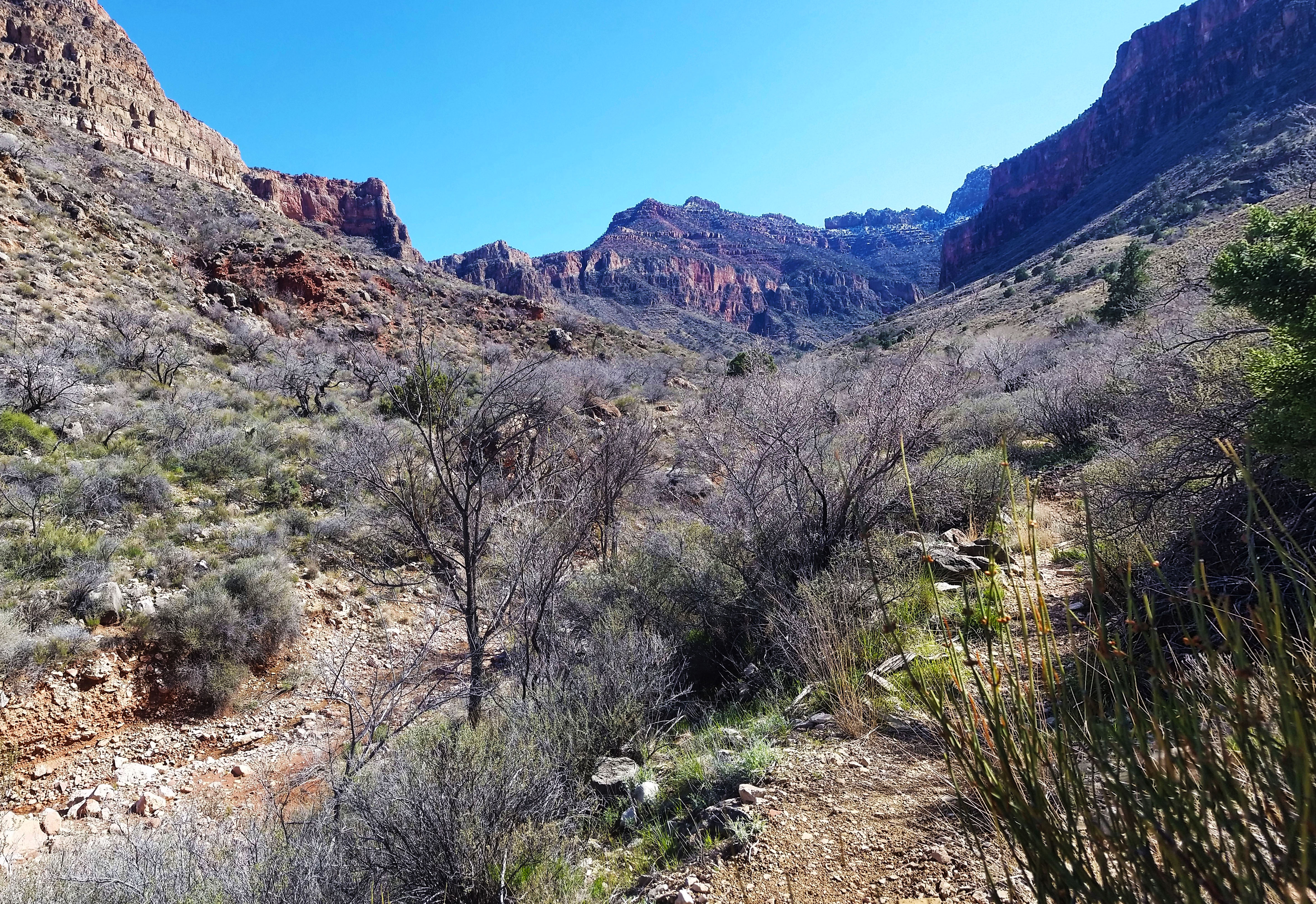
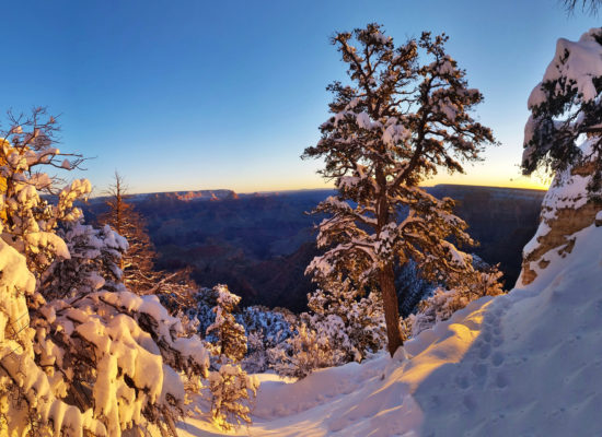 Snow?! Heck yes, gotta love that golden light!
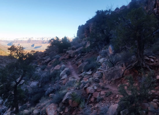
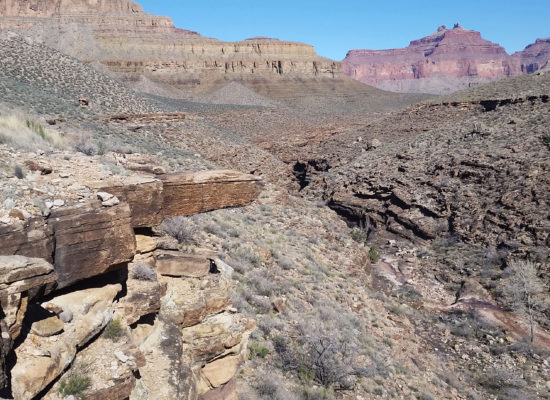
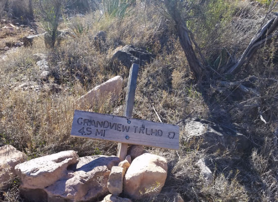
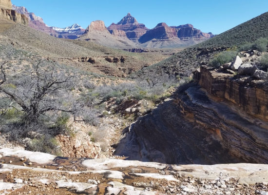
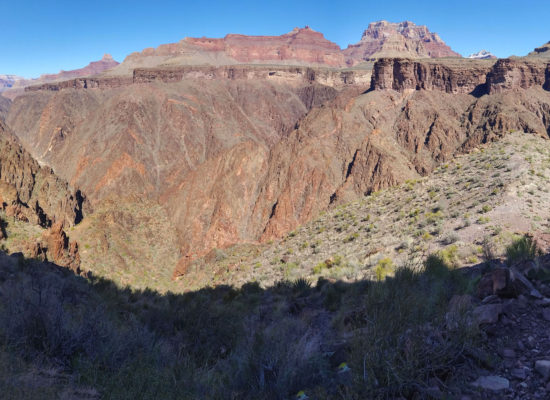
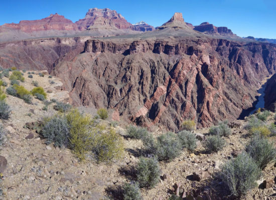
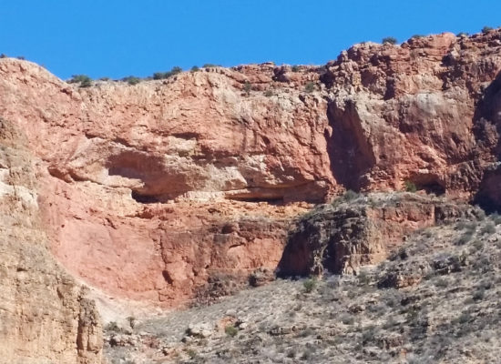
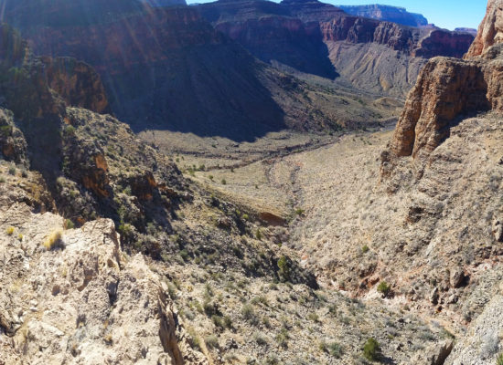
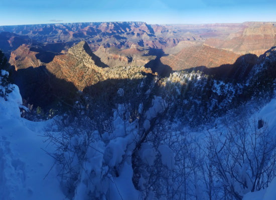
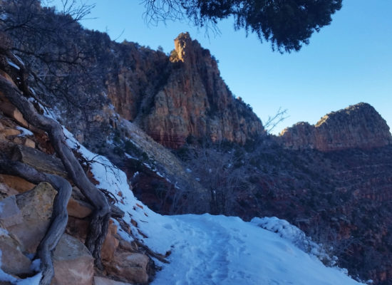
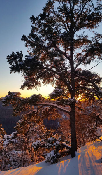 Golden goodness!
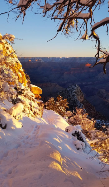
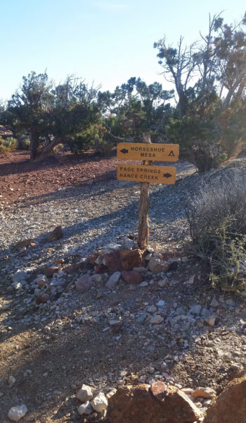
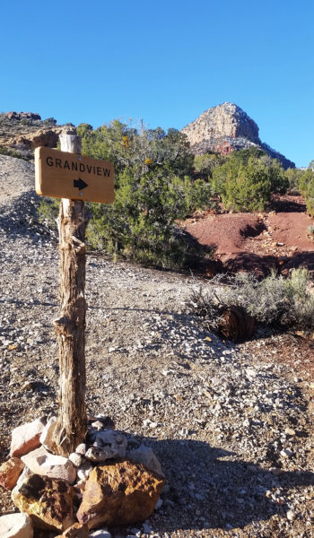
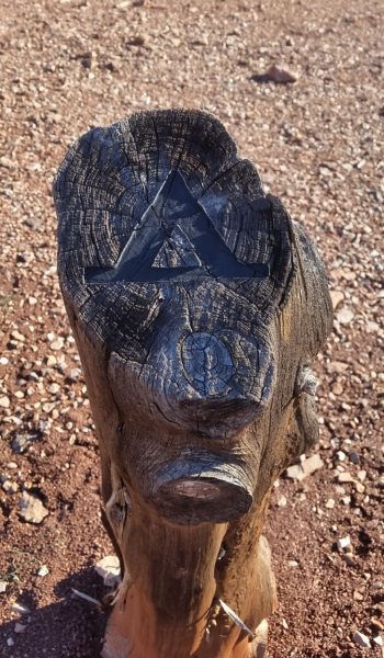
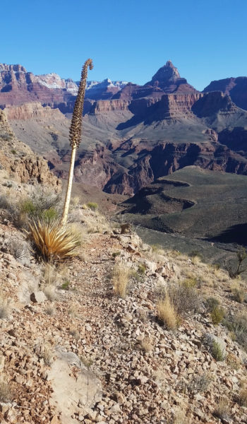
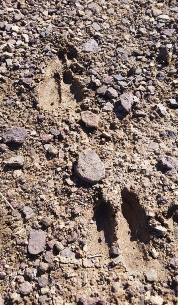
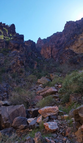
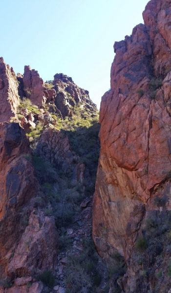
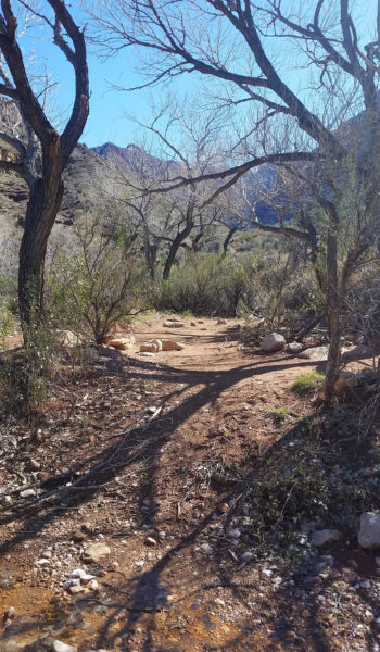
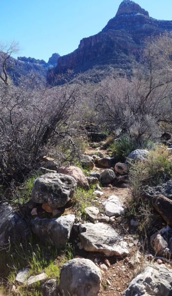
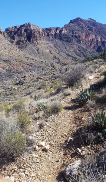
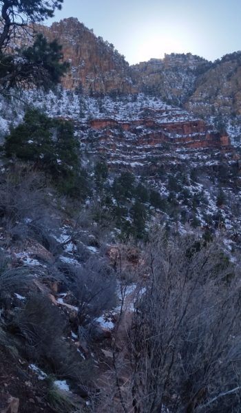
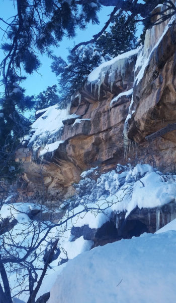
HIKE INFO:
- Grandview Trail – https://hikearizona.com/decoder.php?ZTN=227
- Cave of the Domes – https://hikearizona.com/decoder.php?ZTN=549
- Old Grandview – https://hikearizona.com/decoder.php?ZTN=17517
- Tonto Connector Trial (I only used this to get from Grandview to Old Grandview Trail) – https://hikearizona.com/decoder.php?ZTN=1449
- Cottonwood from Tonto to Horseshoe Mesa – https://hikearizona.com/map.php?GPS=35850
HIKE STATS:
- Weather: Hi 60s, Low 10s, Sunny
- Water: 3 liters
- Food: Snickers, 2 Cliff Builder Protien Bars, 2 Kroger Protien Bars, 1 apple, 1 bag of jerky, bag of salt and vennigar chips, 1 bag of cheetos, 2 granola bars, 1 bag of neon sour gummy worms
- Time: 10 hours
- Distance: 17 miles Round Trip
- Accumulated Gain: 5,000 feet
GEAR:
- Mule Camelback backpack (3 liter bladder)
- SPOT Tracker
- Black Diamond Trekking Poles
CLOTHING:
- Cotton Handkerchief
- Smart Wool Long sleeve shirt 195
- Smart Wool Beanie
- Smart Wool glove liners
- Patagonia pants
- Merrell Mid Moab Hiking Boots
- Darn Tough Medium Wool Sox
- Arcteryx Atom hoody
- Facemask
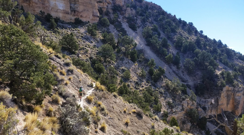
Deer Creek Thunder River Loop, Grand Canyon – AZ (Day 3 of 3) (10.17.16)
- Day 1: Bill Hall Trail head to Tepeats Cave and Thunder River
- Day 2: Thunder River to Deer Creek Traverse
- Day 3: Deer Creek to Bill Hall Trailhead
The alarm went off blasting at 3:45am, demanding we get up and get moving. The sun was far from ready to greet us and darkness didn’t provide much encouragement. Stevo was already sitting up in a crouched position gathering his thoughts and gear. “I didn’t sleep too well last night” was about the only thing he said the first 20 minutes. I don’t think any of us did…the night was warm, almost too warm for sleeping bags, and I tossed and turned several times through the night. It was tough getting going and none of us really wanted to leave yet, but there was nothing else to do but suck it up.
We went through the morning ritual of cooking breakfast and packing for the day. Night hiking is one of things you just get used to out of necessity…getting up for an early hike out, beating the heat, and getting back to Phoenix before midnight was the name of the game. We strapped on our headlamps, packs, and trekking poles and set out. I looked back one last time to admire our vacant camp and reminisced of the last time I had been here the previous year. After taking a moment, I turned and headed up the trail.
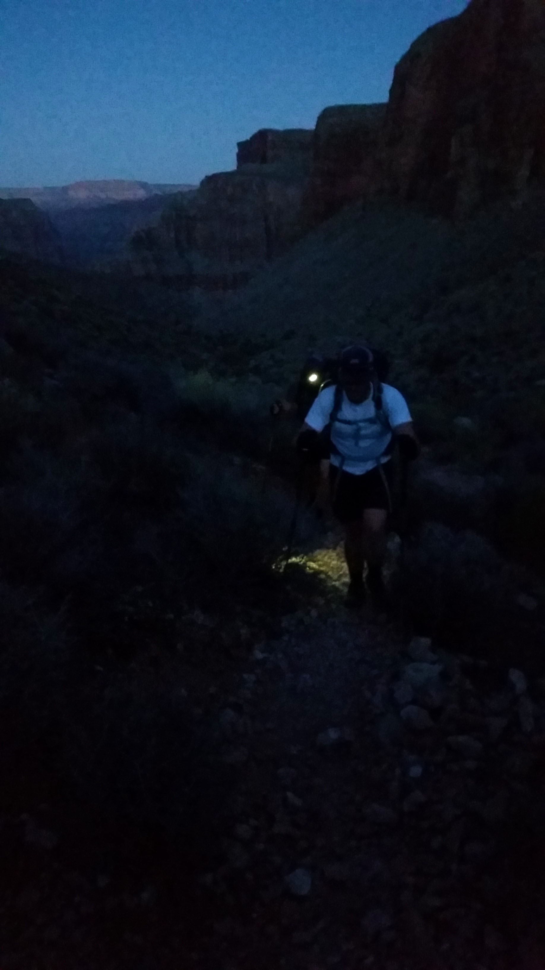
We pushed up the trail hugging the west side of the creek until finally being forced to cross over to the east. From there the trail turned away from the creek and began to climb. We pushed through reeds of the lush foliage lining the creek and were soon back in open desert with cat claw acacia and cactus pleading for us to give them a hug. Pushing on and up through the darkness we ascended the switchbacks and I really started generating heat as we climbed. Soon we hit a switchback, turned right, and began descending across a small wash. “This is strange” I thought as we descended a few more feet. We kept pushing and the hit a rock wall… no way up. We turned and pushed further down . . . cliff. “Something is wrong”, I thought as we continued walking the trail. After some searching, I realized we were at Deer Spring and had taken a wrong turn. We about-faced and headed back the way we came until we found the missing switchback. We were back on pace and back to sweating out the climb.
We were soon above the spring, skirting the wall across a narrow trail headed east to Surprise Valley. Our goal was to get out of the valley and atop the red wall before the sun peaked and turned the heat on high. We pushed up and on, hard and fast as the morning’s twilight began. Sweaty and still tired from the restless night we reached the saddle at Surprise Valley and stopped to take in the views. Pulling off our headlamps and prepping for the climb ahead, we looked up at the large amount of gain left in the day. Press on guys! Taking on big gain is almost as enjoyable to me as seeing the views at the top of a climb. We let out, switch backing up the red wall, until finally reaching the head. Out in the open the wind was whipping and as soon as I stopped I pulled my jacket out to keep warm.
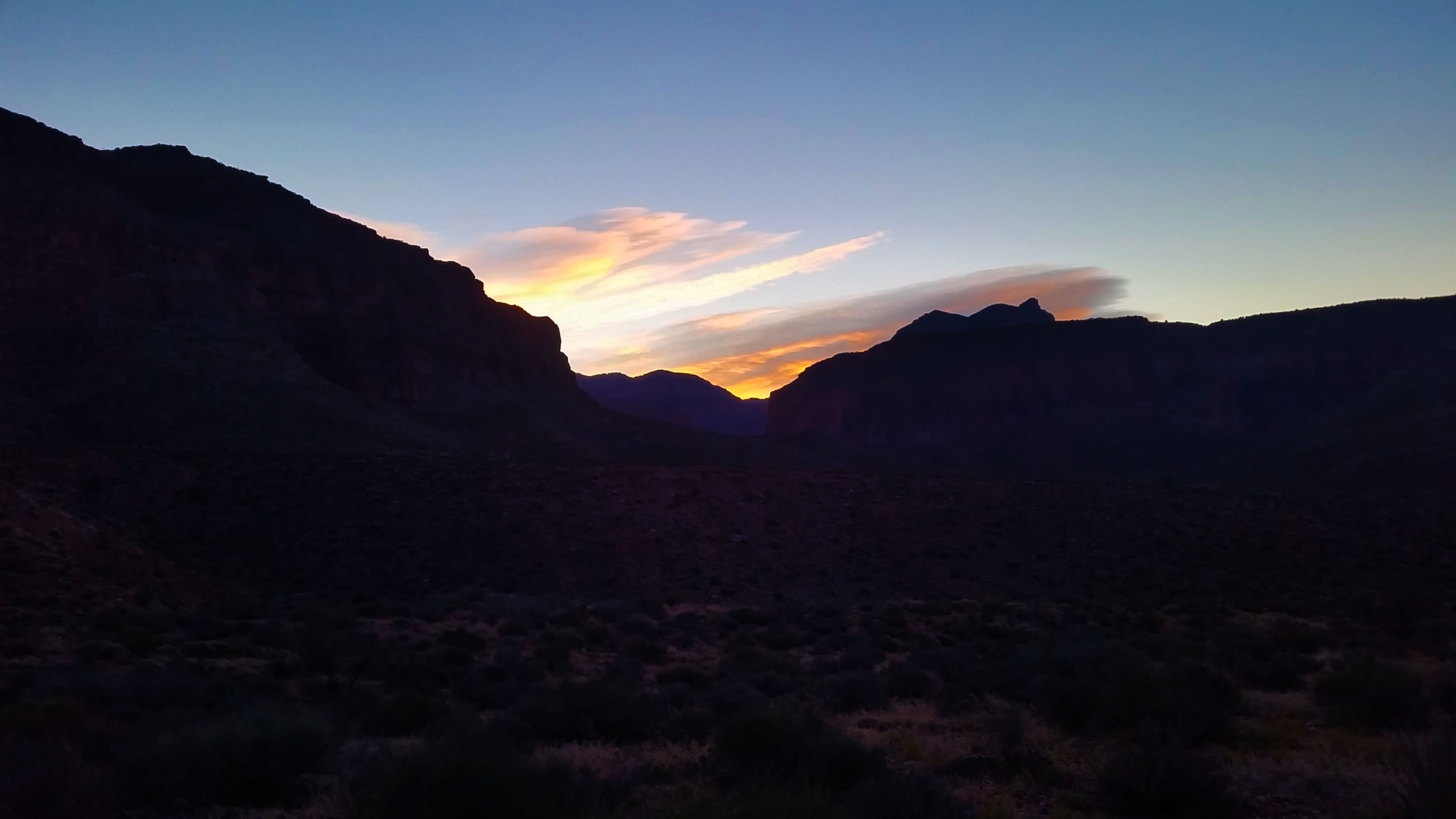
We looked over the valley below, back to the canyon where we slept, and attempted to see the Colorado River with no luck. We had a nice jump on the day by making it to the red wall before the sunlight hit us and the temperatures were good for climbing. We finished our snack break, pulled off our jackets, lathered up with sunscreen, and continued our push across the Escalante and the final ascent towards the rim.
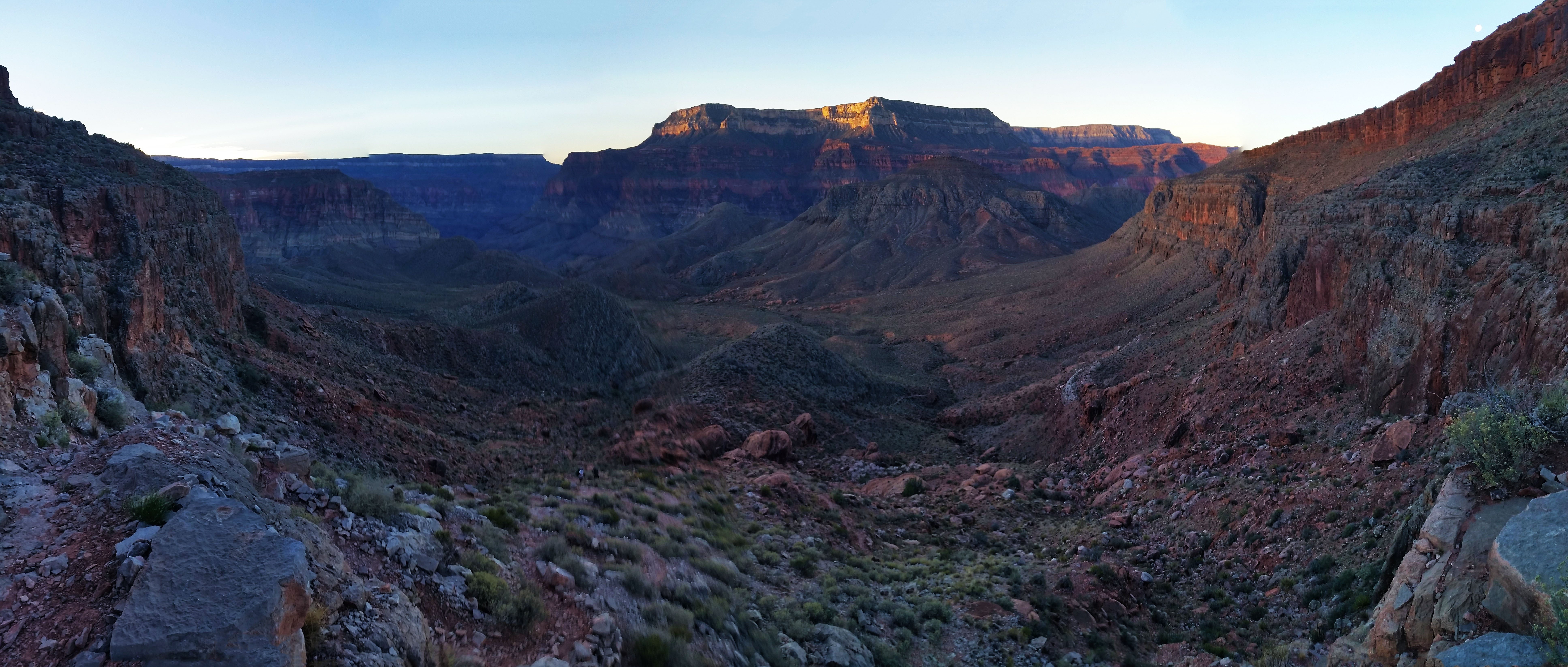
The traverse of the flat Escalante was rather quick and soon it was a trek across the open desert, checking out the sandstone formations as we went. We turned another corner on the trail and the large formation where we stashed water came into view. Breaktime! We had been pushing hard since the top of the red wall at a good clip, so everyone peeled off their bags and tossed them aside for a quick rest. Our water supply of 2 liters from Deer Creek was still going strong so we took a few swigs of our stashed water and dumped the rest. Stevo was still tired from the intermittent night’s sleep and Mark’s shoulders were rubbed red from the older Osprey pack he had packed to the gills for this trip. It seemed as if everyone was ready to just get back to the truck, but a nice 1800 foot climb up the white rocks of Monument Point up Bill Hall Trail and the final decent to the trailhead still stood in the way. We strapped up once again and headed for the final push.
Stevo took lead and started the push up to the white rock faces ahead. This was where everyone went into their suffer cave and huddled in the corner for a while until it was all over. To pass the time I started a conversation about how people have limited time on the earth and how interesting it is that some people work all week just to come outside on the weekend and suffer. There is a price for getting to see cool things like the bottom of the Grand Canyon, mainly 4500 feet of elevation gain inside 10 miles or less. We labored on, pushing hard up the switchbacks until finally reaching the face and plopped down for another quick rest. The views of course were incredible and well worth it. You could hardly make out the canyon where we had started from just hours before.

Once again we saddled up after taking in the views and completed the final push out. We skirted the thin trail on the face until finally pushing up the last set of ascending switchbacks. It was nearly 1pm when we topped Monument Point and we slowly made our way back to the truck. Packs on the ground, shoes off, water in hand, smelly, and tired, we finally made it! I looked back to the rim where we had just come to contemplate the journey we had just completed. Man I wish I had more time out there . . .
 Morning light
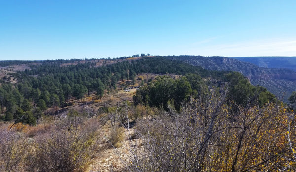
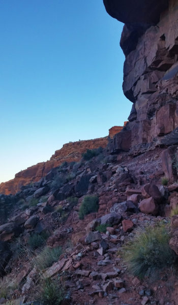 Last push out of the Red Wall
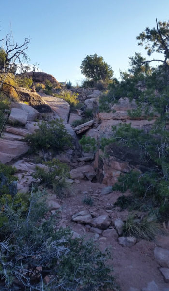
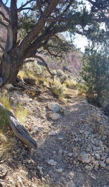
- The GPX Loop: http://hikearizona.com/
gps=25256 - Thunder River: http://hikearizona.com/
decoder.php?ZTN=1008 - Bill Hall Trail: http://hikearizona.com/
decoder.php?ZTN=612 - Tepeats Side Trek: http://hikearizona.com/
decoder.php?ZTN=19576 - Tepeats Cave – http://www.teamcrowbar.com/b82.php
HIKE STATS:
- Weather: Hi in upper 70s, Low in upper 60s, Sunny
- Water: 2 Liters
- Food: 1 Power Bar, 1 Protien bars, 2 bags of Welches gummys, 1 Mountain House Breakfast.
- Time: 6 hours
- Distance: 10.4 miles
- Accumulated Gain: ~4900 feet
GEAR:
- 58 liter exos osprey backpack
- Big Agnes Copper Spur UL2 tent
- Big Agnes QCORE SLX sleeping pad
- Cosmic Down Kelty Sleeping Bag (rated to 20 deg F)
- Jet Boil – Sol
- Black Diamond trekking poles
- Sawyer Squeeze Filter
- SPOT Gen3 Tracker
CLOTHING:
- Wool T shirt
- Cotton hankerchief
- Pearl Azumi arm coolers
- Arc’teryx hoody
- Nike running shorts
- Merrell Mid Moab Hiking Boots
- Darn Tough wool medium weight socks
- Threadless hoody
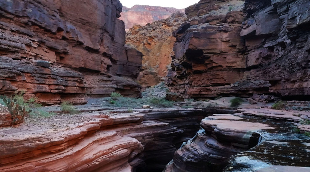
Deer Creek Thunder River Loop, Grand Canyon – AZ (Day 2 of 3) (10.16.16)
- Day 1: Bill Hall Trail head to Tepeats Cave and Thunder River
- Day 2: Thunder River to Deer Creek Traverse
- Day 3: Deer Creek to Bill Hall Trailhead
My eyes popped open and I looked up at the roof of my orange tent. I moved slowly and pulled myself into a sitting position to unzip my vestibule, and remembered I was in the bottom of the Grand Canyon. Golden light kissed the red walls, always a welcome reminder that I am somewhere special. It was time, yet again to get going. We emerged, and slowly gained motivation: boiled water for breakfast, broke down the tents, and packed the bags. Our goal for the day was to make it from Upper Tepeats camp to the Colorado River, where we would take a crosscut to Deer Creek campsite.
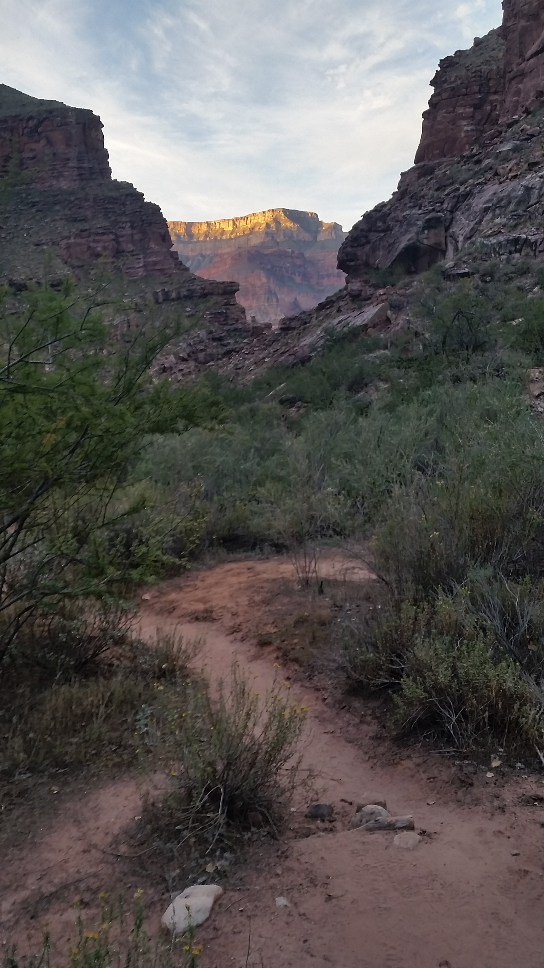
My legs actually took a bit of damage from the day before; it was a big 16 mile day. I stretched them out in between stuffing things in my pack and sipping on instant coffee. When we departed camp it was a late 8am. This would be our lightest day of the trip, but we wanted to make some good pace to spend as much time in the narrows of Deer Creek as possible. We headed south, towards the Colorado after finding a good creek crossing that took us to the east side of the canyon. With the water flowing through the bottom of the canyon, it was like a small oasis. Green lush plants clung to the creek’s side, hiding away from the heat of the desert in the open canyon. The huge cottonwoods, which had luckily survived monsoons and flash floods, stood tall and proud. We kept trekking until finally crossing back over to the west side of the canyon. From here the trail took to the cliff sides, quickly gaining elevation. The creek continued to drop below, as we skirted the impending drop-offs.
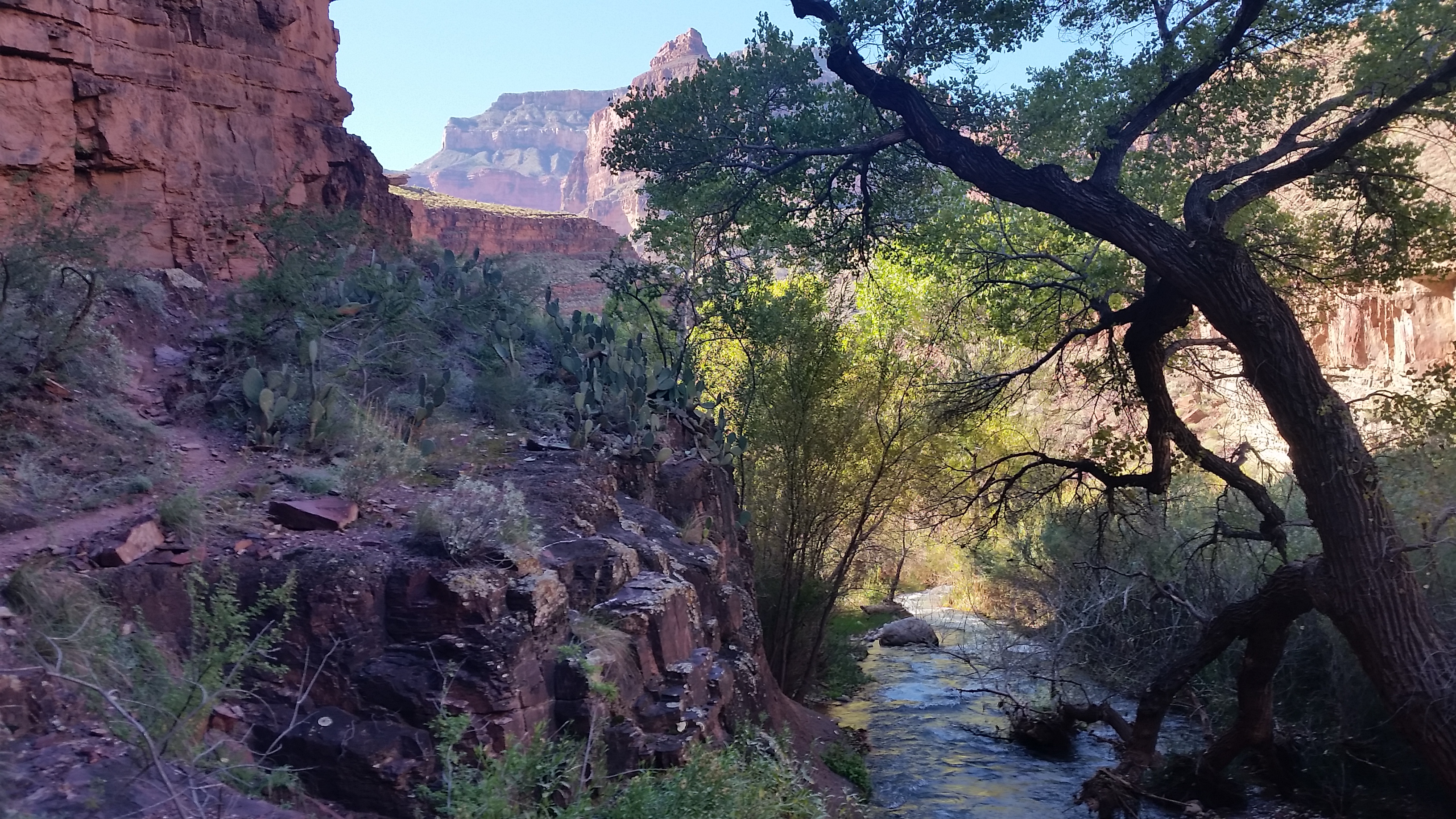
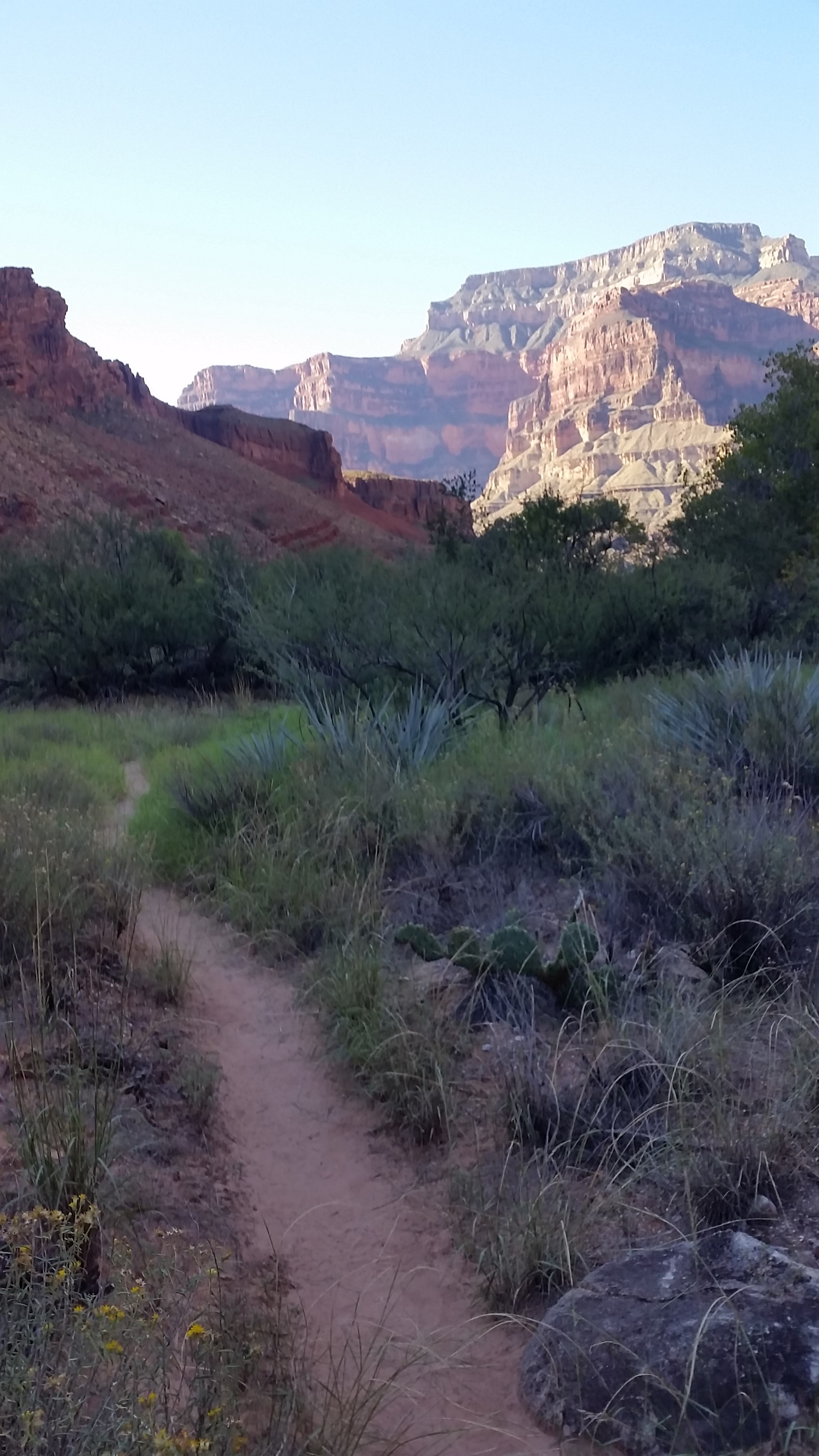
As we continued to rise out of the creek bed, the sun began going to work on us. The trail was slim and slender with a rolling drop-off at first, then to sheer cliffs which would drop you to the narrows of the creekbelow. We kept trekking, shading our eyes from the beating sun.
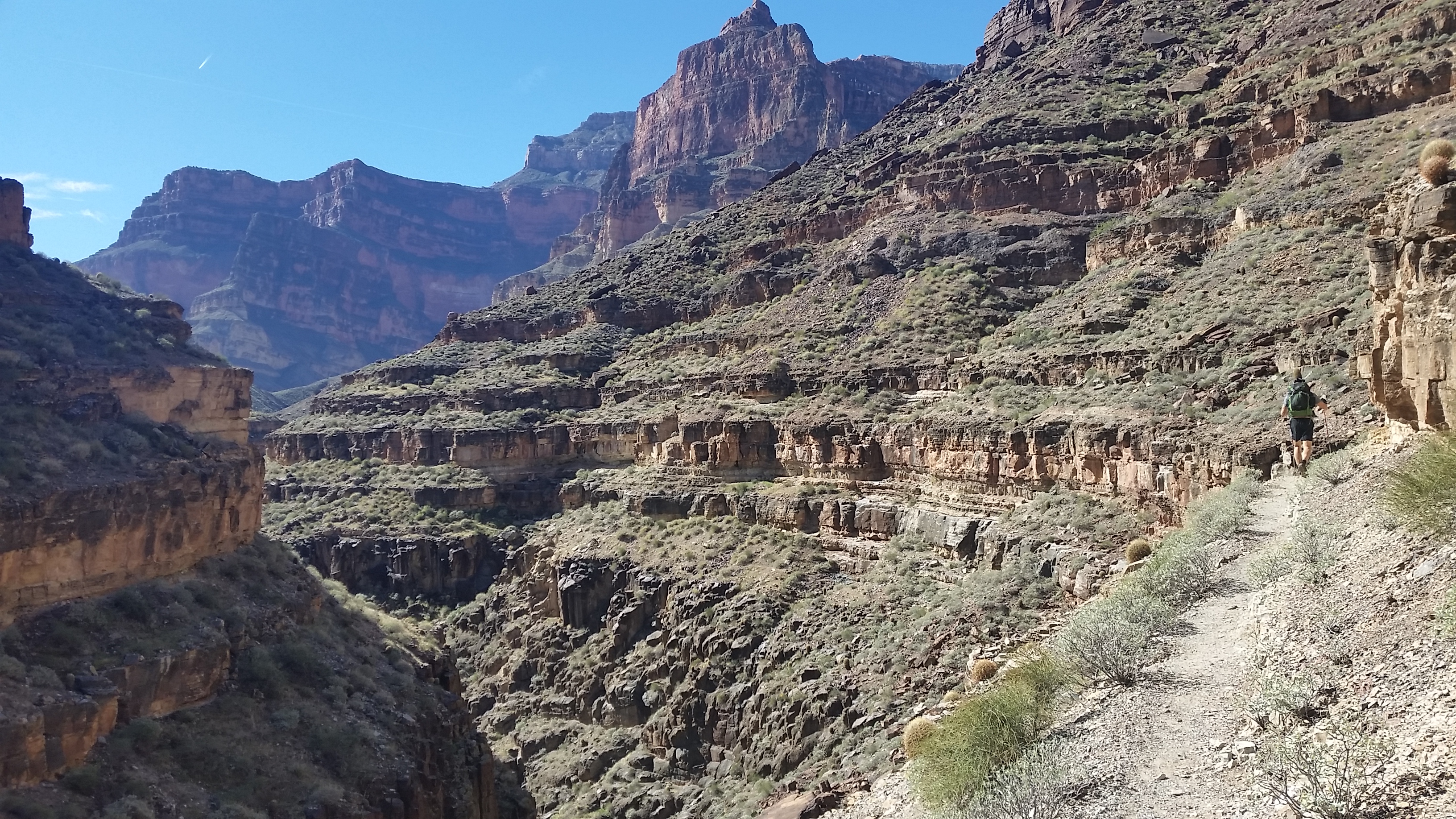
“Did you hear that?!” Stevo piped up. We all paused for a moment to listen. There were voices in the narrows, and it sounded like people were playing in the creek. Not long after hearing voices, we ran into two river rafters coming up from the Colorado. They were red from the sun and had some colorful hats, squirrely beards, sandals, and smiles. We stopped for a quick chat. They were on a 25 day self-guided rafting tour and they would stop off on side canyons on their way down the Colorado for day hikes. Their sights were set for Tepeats Cave. We warned them of the bushwhack ahead and wished them luck!
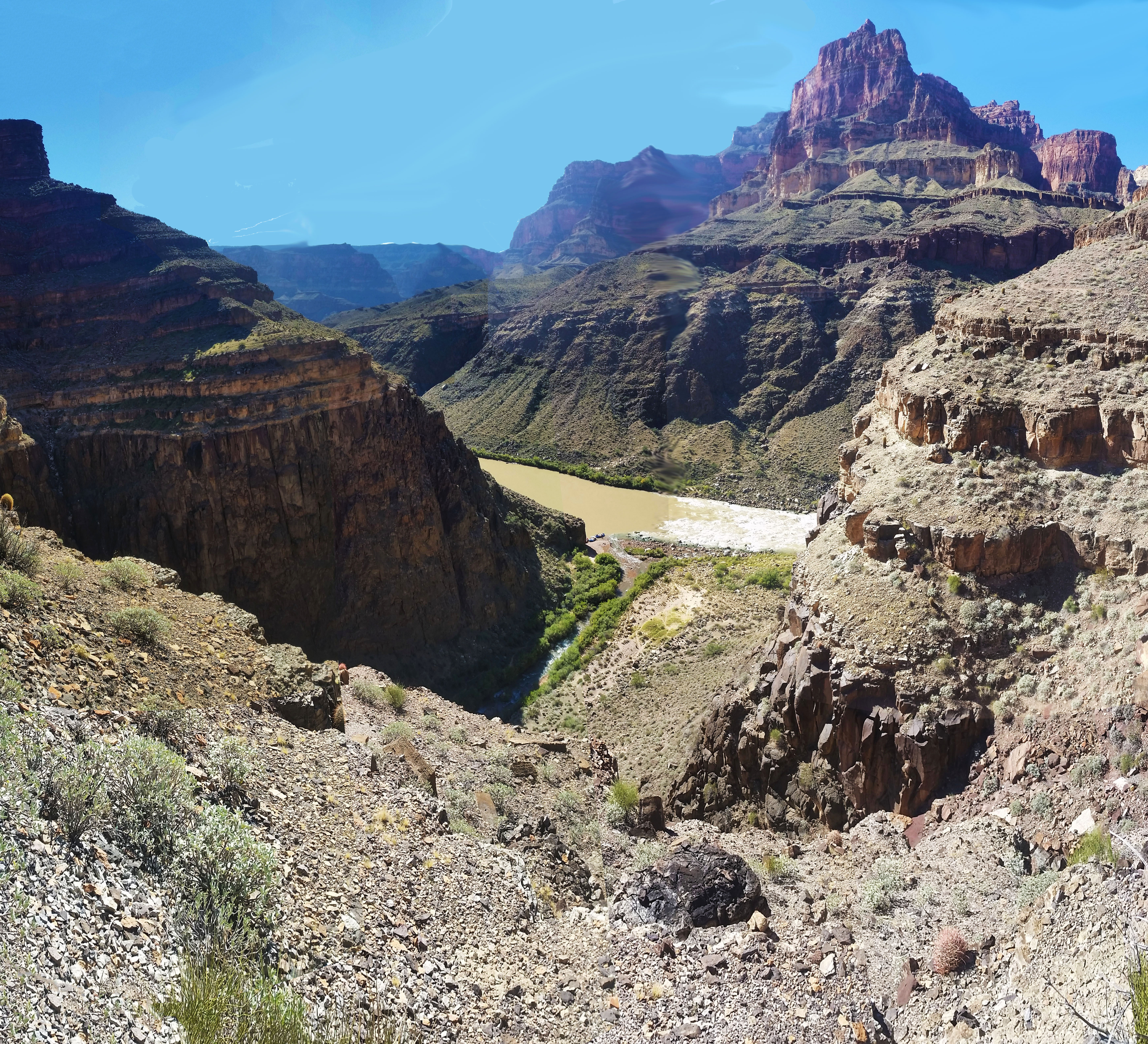
As we pushed on, we bumped into more and more rafters on their way up the Thunder River trail from the Colorado. They were all from the same crew, smiles all around. Finally we rounded the bend as saw the mouth of the canyon and the great Colorado River! We dove down the switchbacks, and before we knew it, we were slipping and sliding on the boulders leading us to the cold brown waters of the river. After resting for just a moment, one of the rafters that were ported at the confluence of Thunder River and the Colorado, headed our way. It was like some kind of dream: the gal brought us 3 fresh cold beers and we sat on the rocks in the sun by the river and enjoyed them. She let us know her husband was one of the guys headed for the cave while the rest of the group was doing a little less of an adventure day trek. We chatted for a bit, they were from an Alaskan river guide group and came to the canyon once a year for an annual rafting trip.
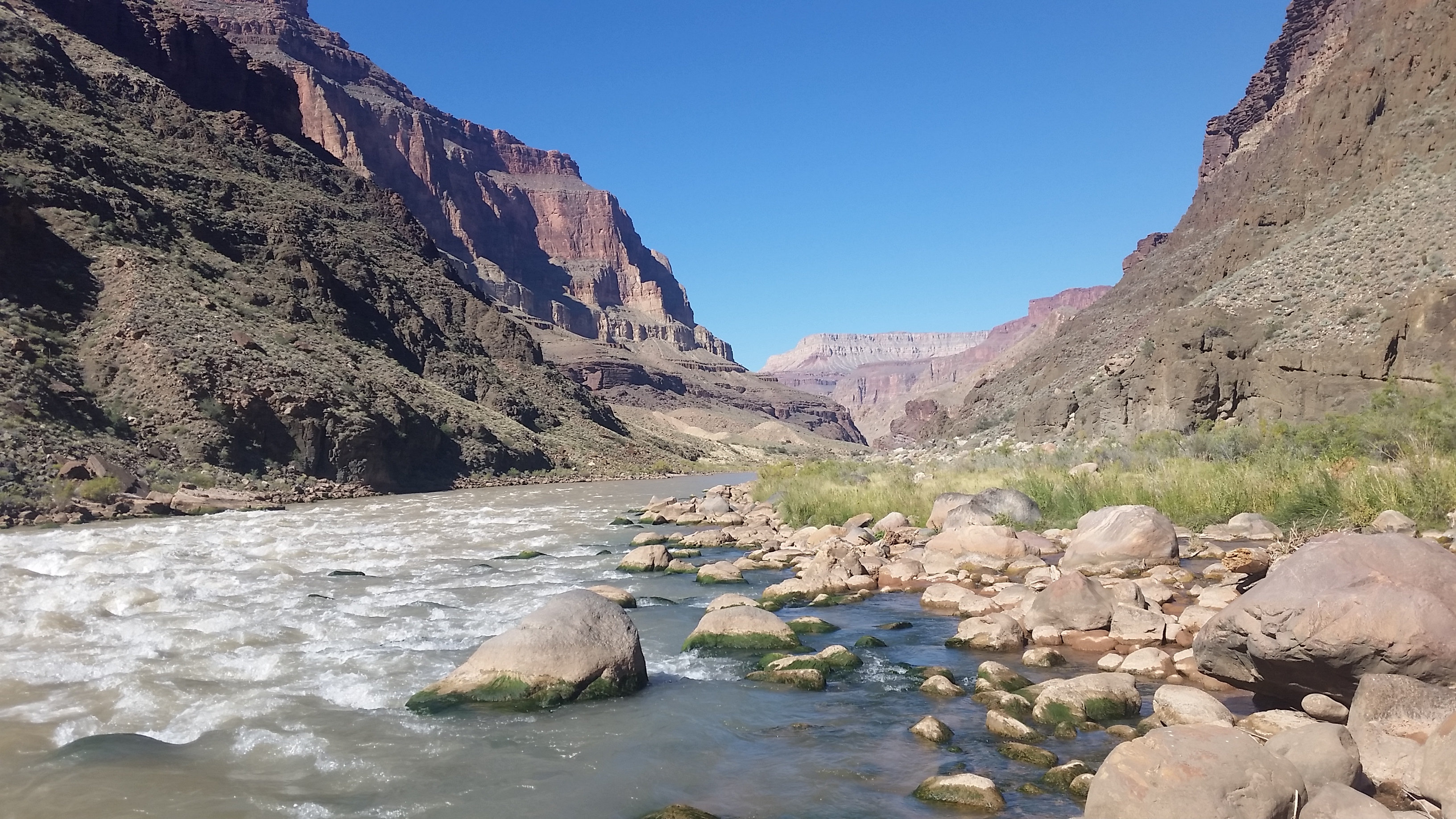
After sipping on the cool brews, we had to once again shoulder our bags and push towards Deer Creek. The 3 rafters that decided to tend to the boats offered to give us a small raft to ride it down to DeerCreek. It was an incredibly enticing offer as it would take us minutes to traverse the miles as opposed to hours. “We have to suffer!” I said as we all strapped on our gear and stood ready to traverse the miles to our next destination. They waved goodbye and we once again set out.
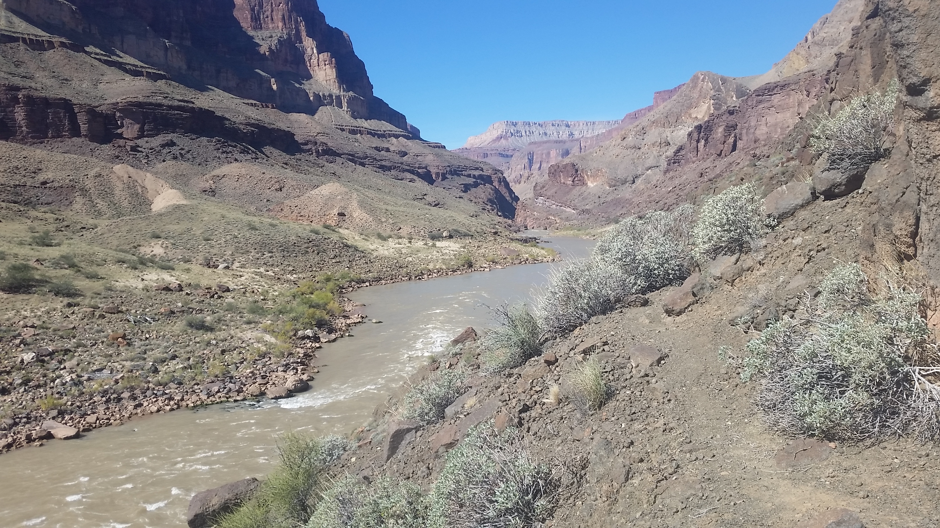
The Traverse Trail started out sandy- and wasn’t much of a clear trail at all. We bobbed in and out, high and low, following cairns and footprints further down the path. The sun was in full bear-down at this point and we felt it at the low elevation of the river. We kept trekking until finally coming to “The Notch” that everyone we chatted with mentioned being the only tricky part of the Traverse. The climb up the rock formation wasn’t too bad, down climbing, however, was loose and tedious. We blew past this obstacle and pushed on.
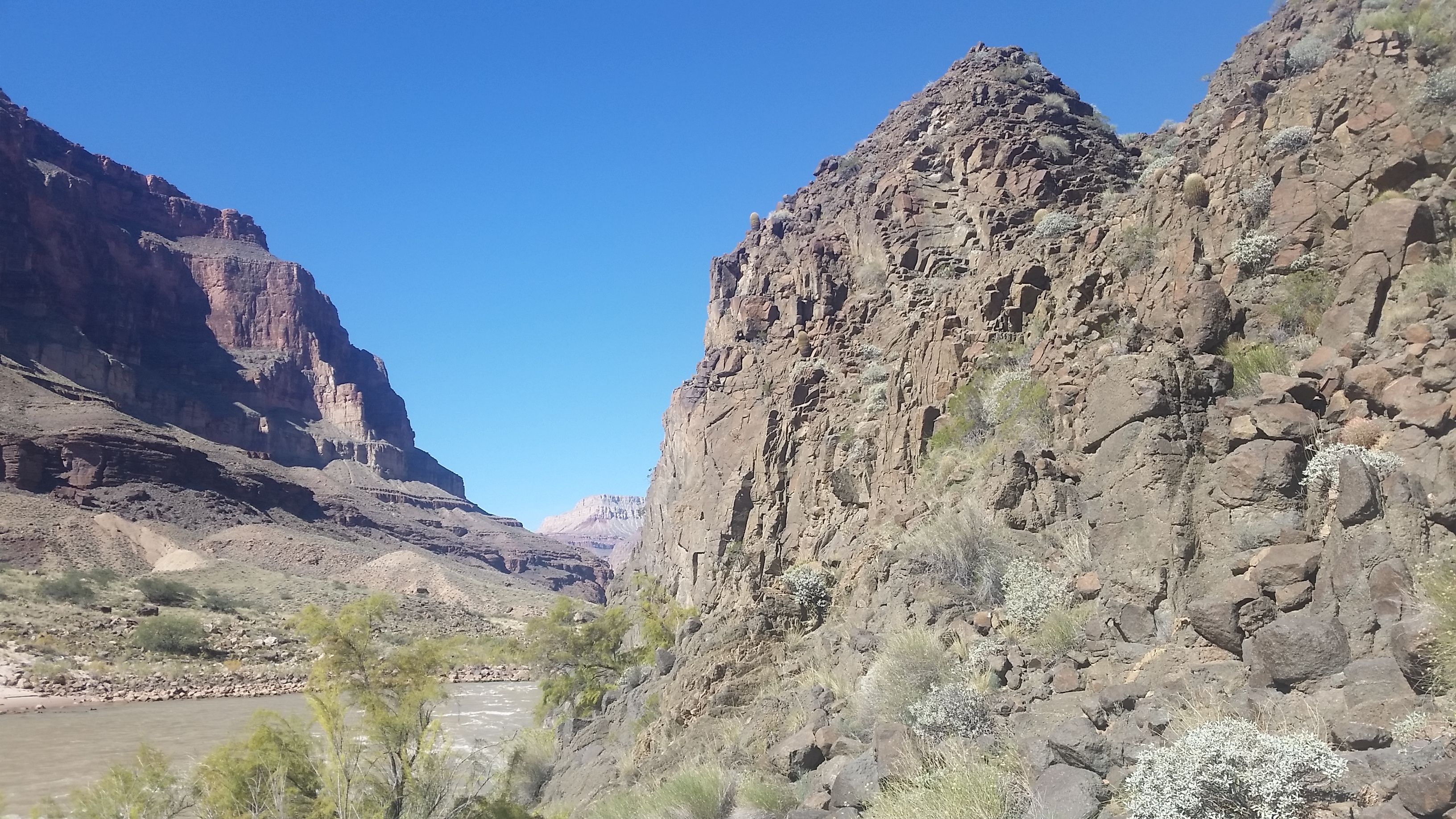
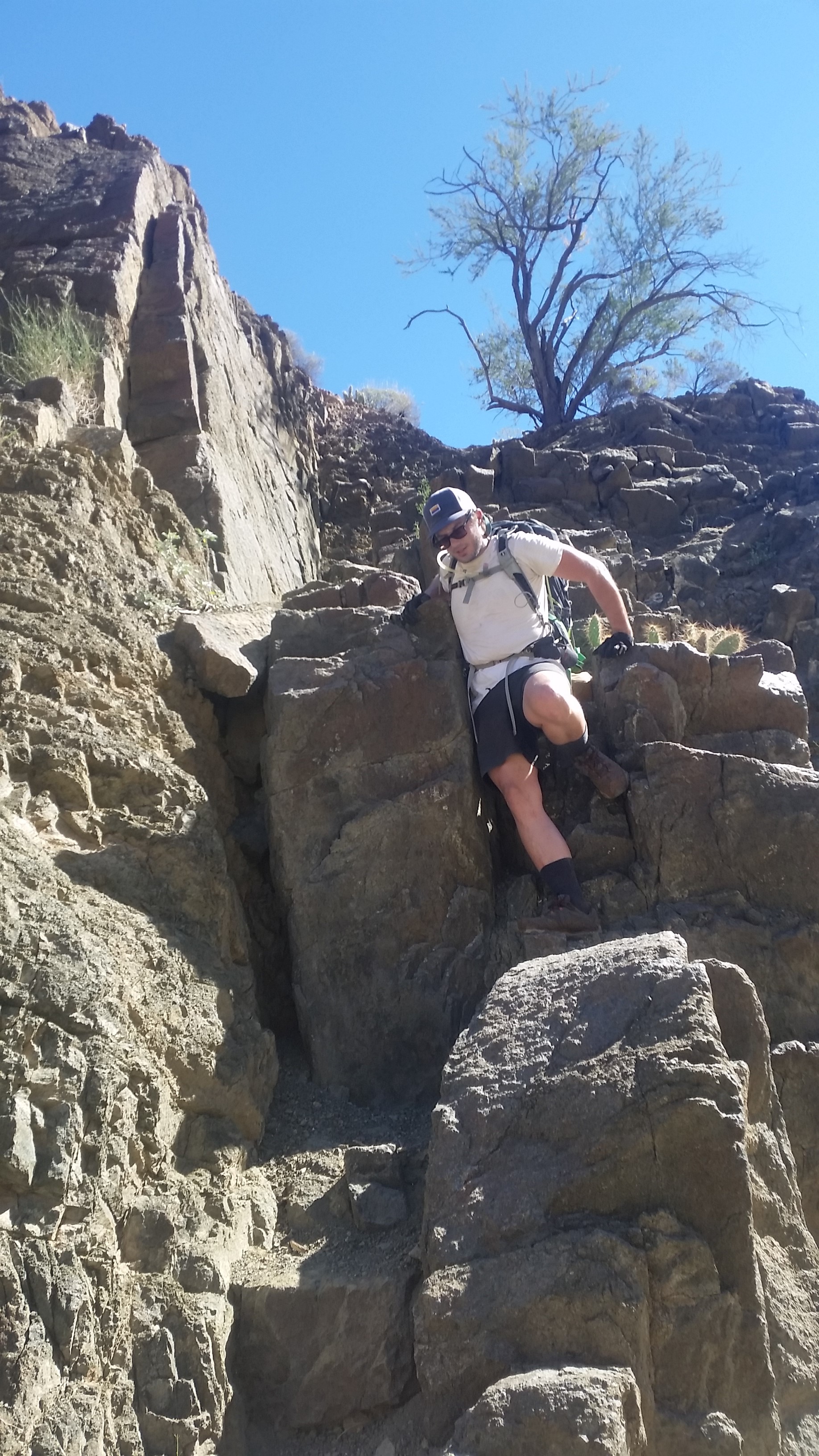
We came to a small ‘Y’ in the trail and decided to go high early. Go ahead and get the gain out of the way! It would bring us to higher elevations and slightly cooler temps (and maybe a breeze!). Up and up the warm trail we went, until we were finally a few hundred feet above the river again with great, expansive views of the canyon in the distance. The final push over to a saddle brought us just over the top of the Deer Creek campsite. We looked down at the inviting lush green oasis with relief that we were almost to camp and cool waters. “Man that looks delicious” Stevo exclaimed as he saw Deer Creek for the first time. We pushed on, found camp, set up our tent, and proceeded to sit in the creek for a half hour just to cool off and regenerate our spirits from the traverse.
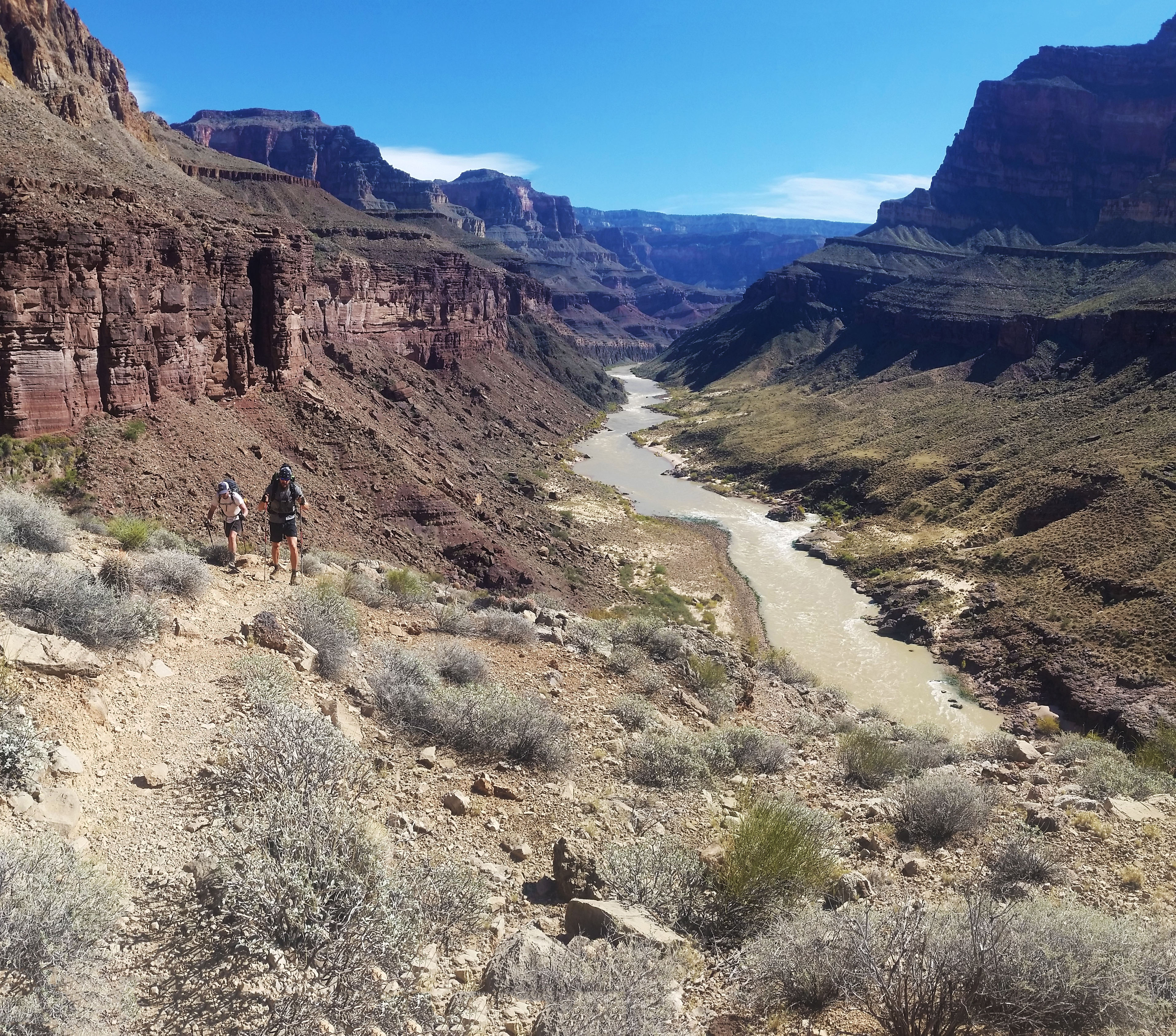
After some snacks and a good creek soak, we once again gathered our daypacks together and headed down to The Narrows. This place is absolutely incredible. Pictures don’t do it justice, words cannot describe it. It is something you must see for yourself to fully understand what it’s like. We bumped into the river rafters once again as we entered “The Patio” area (the mouth of The Narrows). The creek opened up wide, bounded by the rock faces on either side, and soon began funneling down into multiple cascading waterfalls as it descended towards the Colorado. The water had done some good work here and it was written on the faces of the canyon walls. Smooth and ribbed it looked like something from another world. We trekked on, skirting a small shelf on the west wall of the canyon headed south. When we finally reached the end of the skirt a large open area gave way to beautiful full views of the Colorado in either direction.
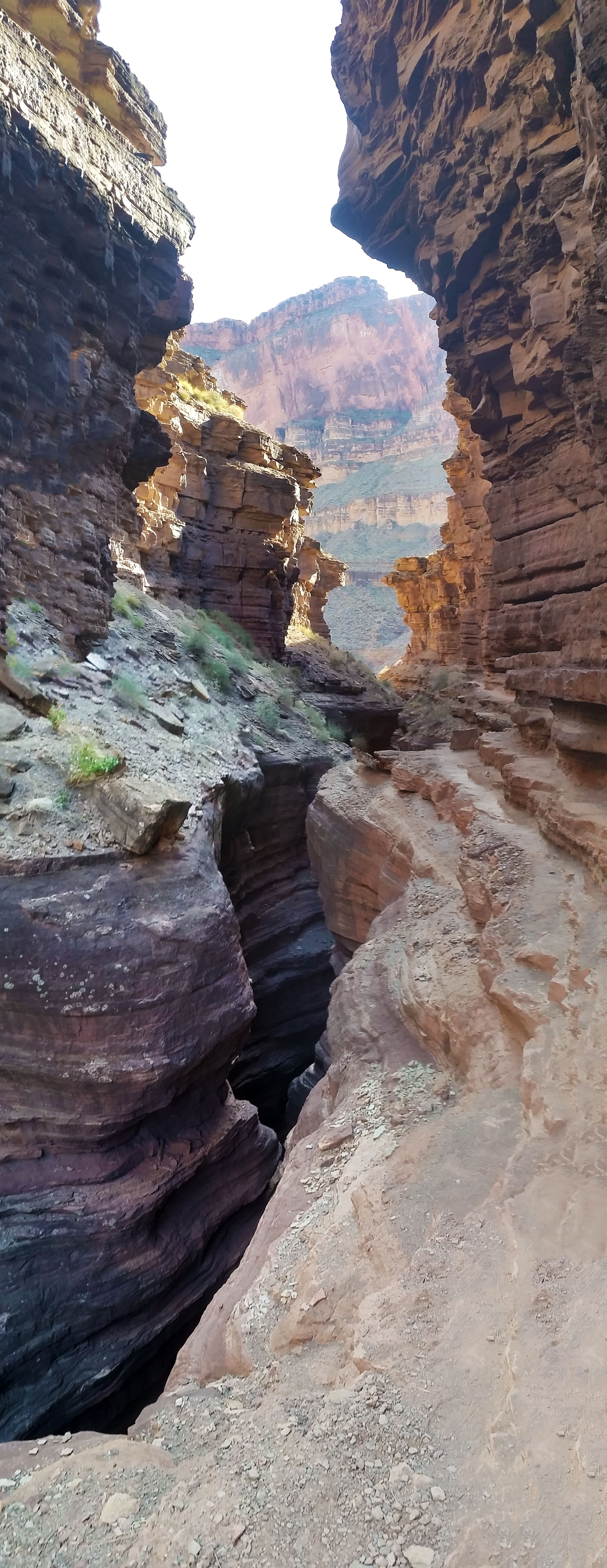
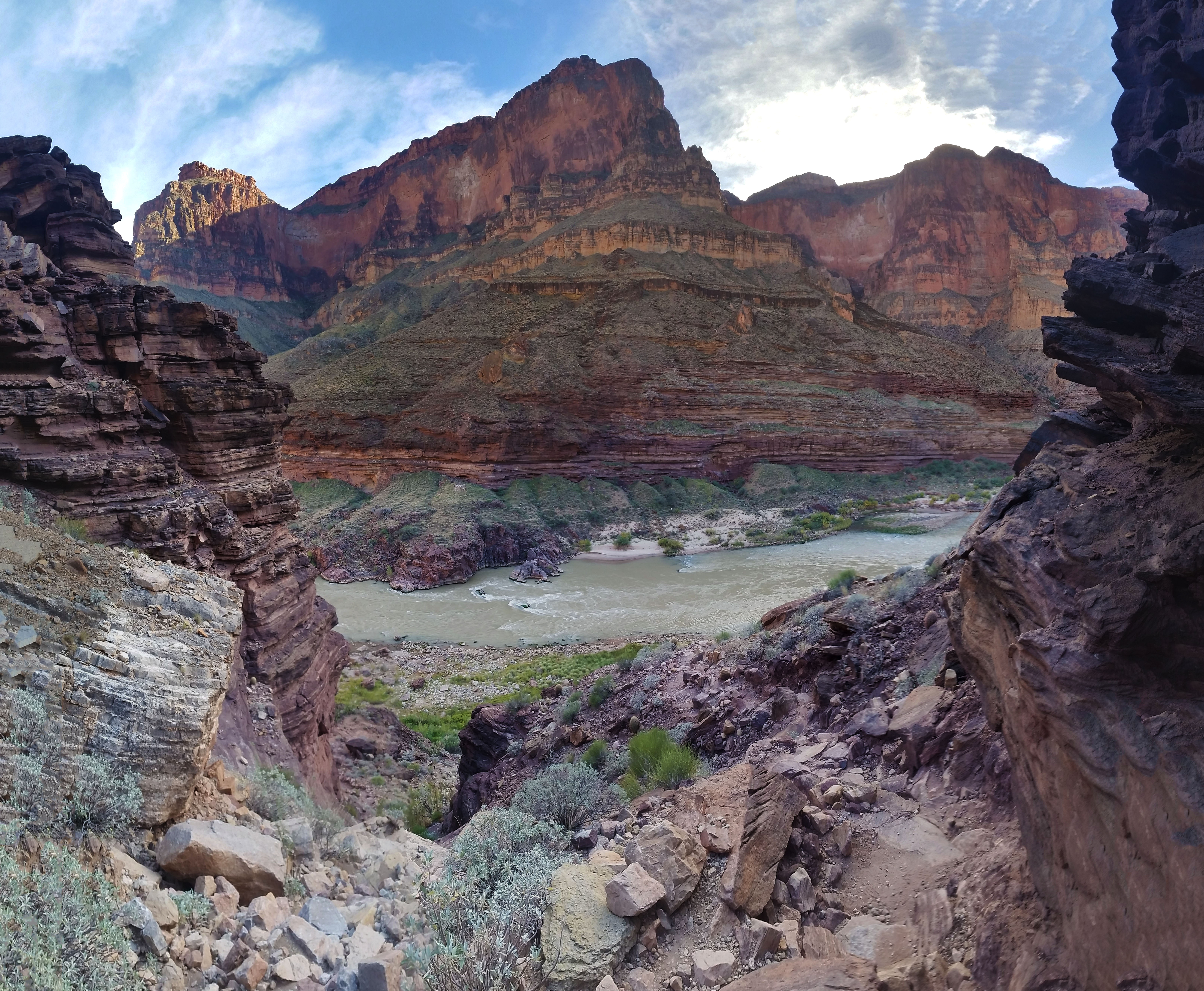
Awesome views as we descended the trail towards the Colorado
We bombed down the trail to the west switchbacking all the way until finally reaching the exit of DeerCreek, where the Narrows emptied into the Colorado. An 80 foot waterfall stood before us. It was powerful! The wind, from the water falling and colliding with the small pool below, pushed you back as you came closer. The water was brisk, cool, and clean. The mist from the waterfall covered our faces; we were so psyched, we barely noticed how cold the water was. After hanging out here for a bit and playing in the pools, we decided to push back up the narrows to camp.
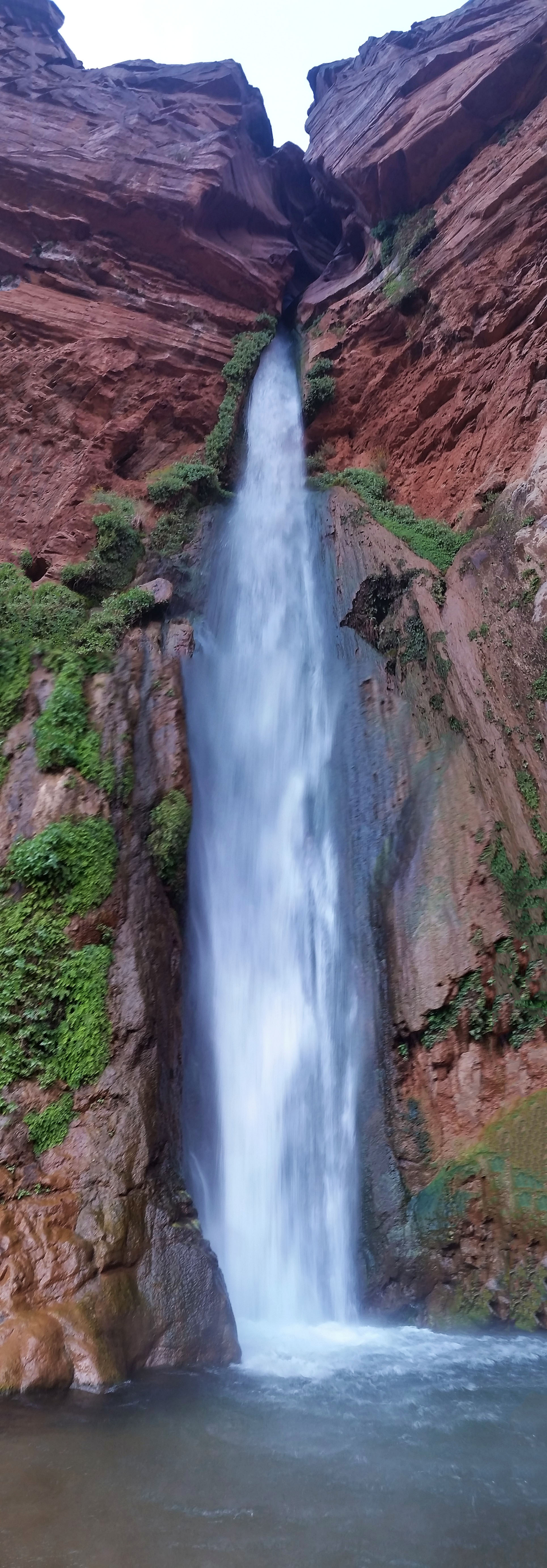
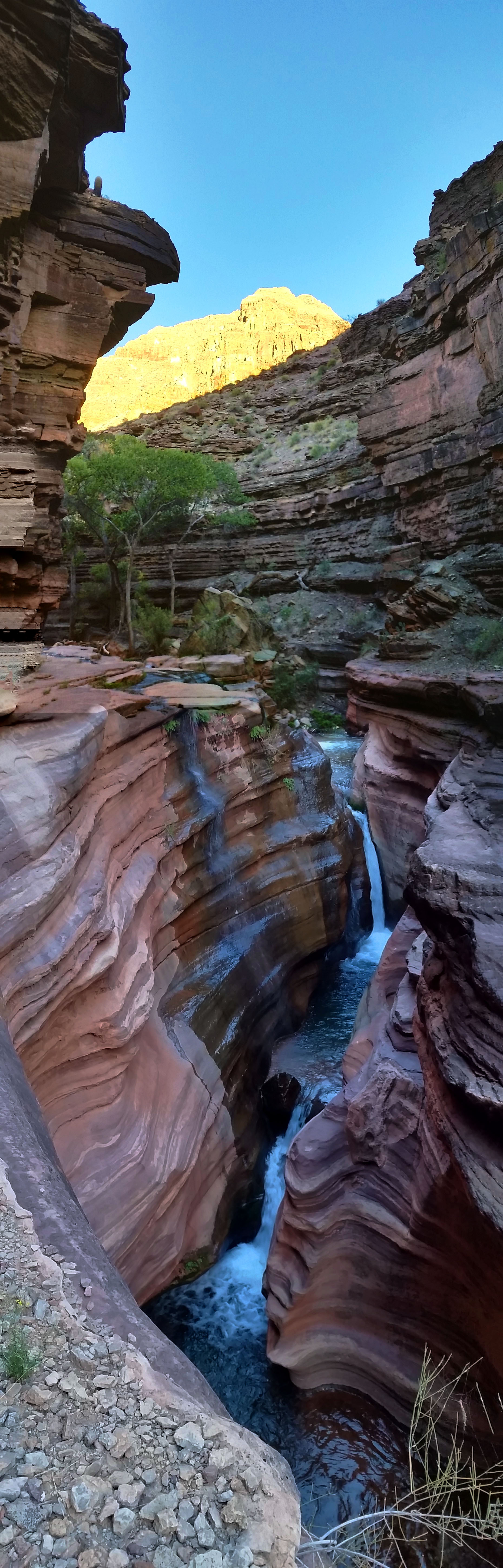
As any good backpack, we ended the day tired and ready for bed just as the sun slipped away. We filtered water and grubbed down on a few Mountain Houses before finally crawling into our sleeping bags. Moments later, we crashed out for the night. It was another great day on the trail.
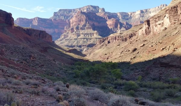 Headed south baby!
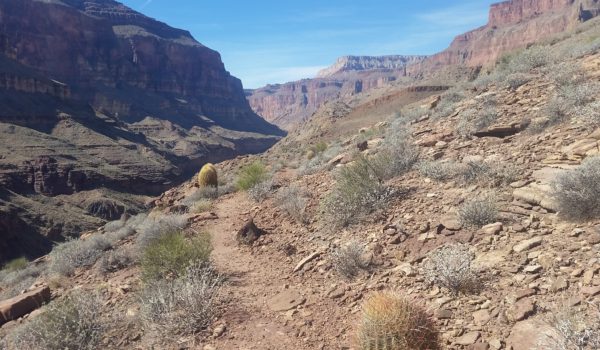
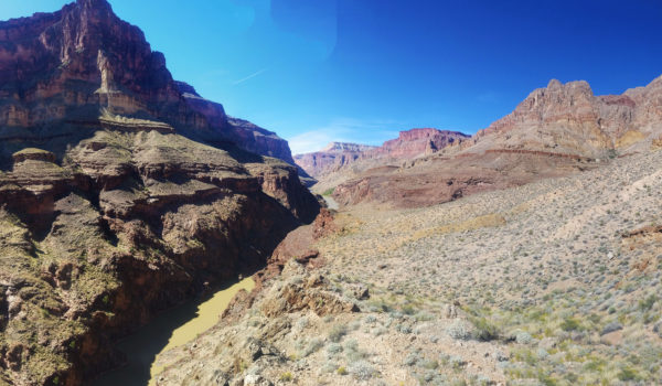
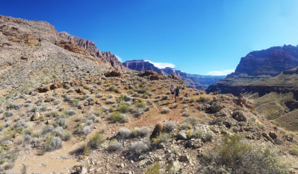
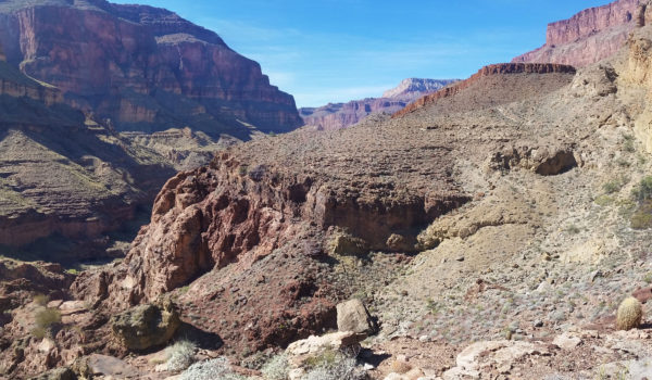
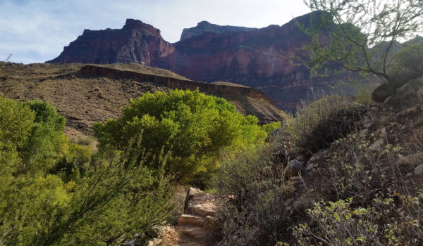
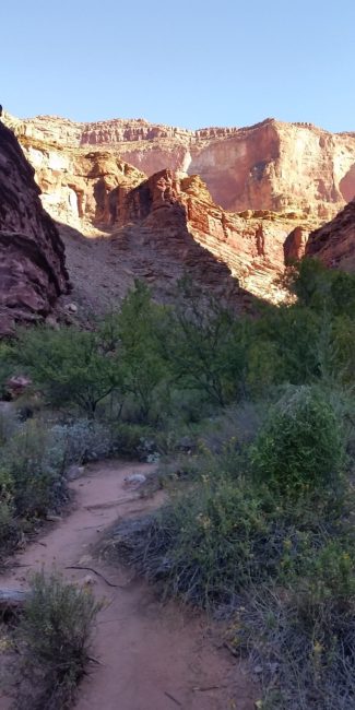 Looking back up towards the red wall on the morning of day 2
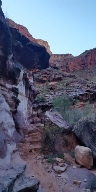
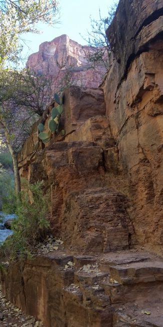
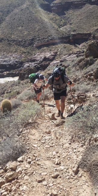
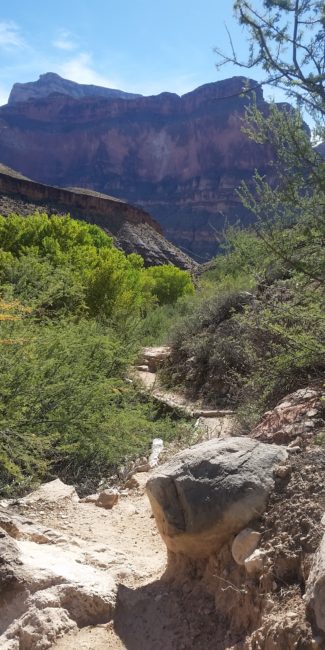
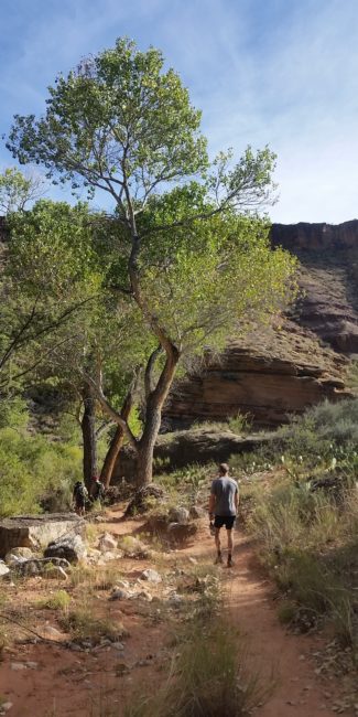
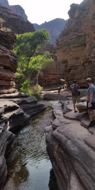
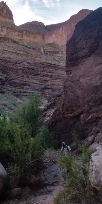
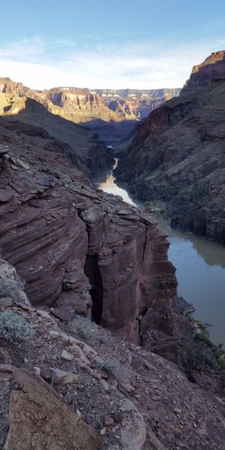
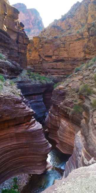
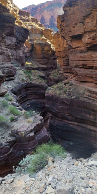
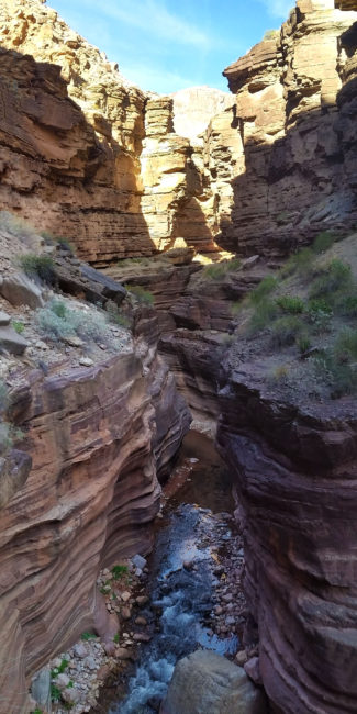
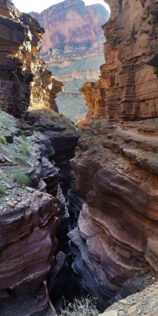
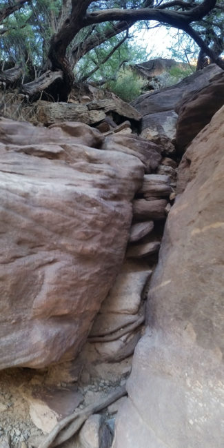
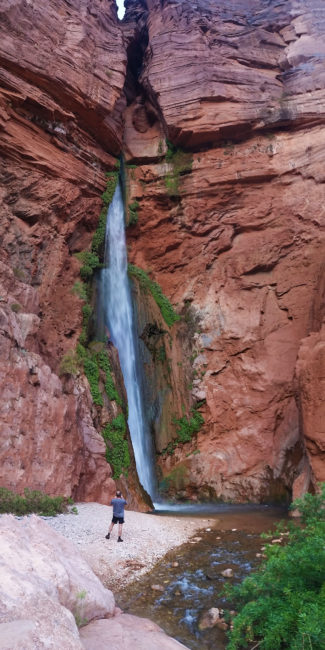
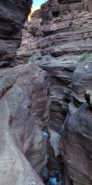
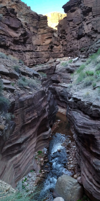
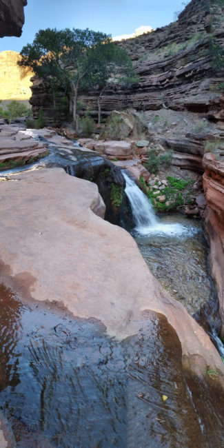
- The GPX Loop: http://hikearizona.com/
gps=25256 - Thunder River: http://hikearizona.com/
decoder.php?ZTN=1008 - Bill Hall Trail: http://hikearizona.com/
decoder.php?ZTN=612 - Tepeats Side Trek: http://hikearizona.com/
decoder.php?ZTN=19576 - Tepeats Cave – http://www.teamcrowbar.com/b82.php
HIKE STATS:
- Weather: Hi in upper 80s, Low in upper 60s, Sunny
- Water: 4 Liters (including diner)
- Food: 2 Power Bar, 2 Granola Bar, 2 Protien bars, 2 Clif Bars, 1/2 bag of Mediterranian Chips, 1/2 bag of trail mix, 1 apple, 4 bgas of Welches gummys, 1/2 bag of jerky, 1 Mountain House.
- Time: 10 hours
- Distance: Approx 8 miles
- Accumulated Gain: ~800 feet
GEAR:
- 58 liter exos osprey backpack
- Big Agnes Copper Spur UL2 tent
- Big Agnes QCORE SLX sleeping pad
- Cosmic Down Kelty Sleeping Bag (rated to 20 deg F)
- Jet Boil – Sol
- Black Diamond trekking poles
- Sawyer Squeeze Filter
- SPOT Gen3 Tracker
CLOTHING:
- Wool T shirt
- Cotton hankerchief
- Pearl Azumi arm coolers
- Arc’teryx hoody
- Nike running shorts
- Merrell Mid Moab Hiking Boots
- Darn Tough wool medium weight socks
- Threadless hoody
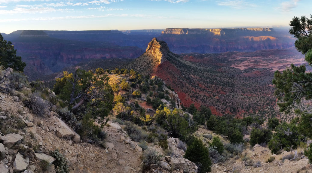
Deer Creek Thunder River Loop, Grand Canyon – AZ (Day 1 of 3) (10.15.16)
- Day 1: Bill Hall Trail head to Tepeats Cave and Thunder River
- Day 2: Thunder River to Deer Creek Traverse
- Day 3: Deer Creek to Bill Hall Trailhead
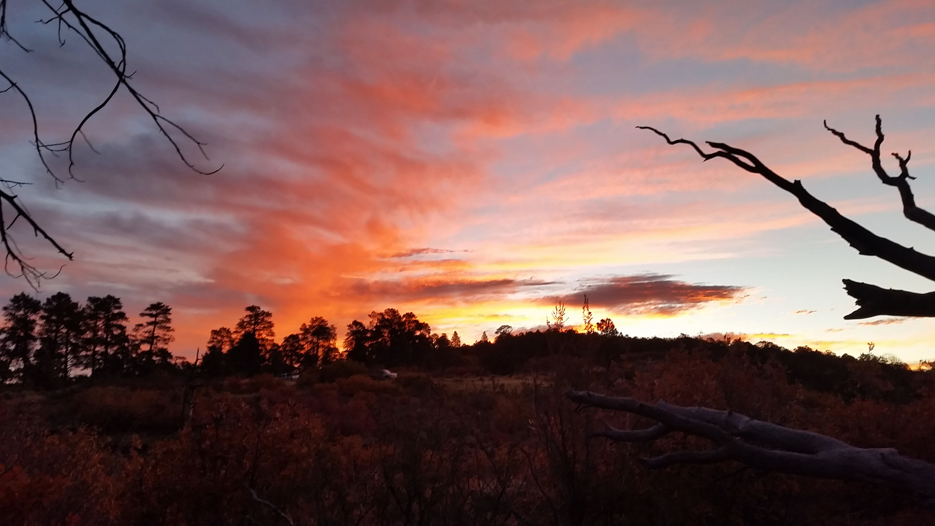
Stevo, Mark, and I stood on the edge of the enormous cliff next to a brown wooden sign that said “Bill Hall Trailhead”. We had made the long drive from Phoenix out to the west side of the North Kaibab the night before in search of adventure and a tough challenge. This Grand Canyon goal was to complete the Thunder River/Deer Creek trail with a side trek aimed for the Tepeats Cave up on the Tepeats Spring Canyon.
Packs were heavy on our backs, loaded down with supplies for the three day journey. Being as ready as we were going to be, we took our first steps towards Monument Point as the sun was rising just before bombing into the abyss of the Grand Canyon. From the top we could see Bridger’s Knoll sticking up out of the esplanade plateau like the razorback of an old dinosaur. From there, we bombed down and let me tell you, with a 30 lb pack on your back pushing you down, it wasn’t easy. The trail was loose and steep, and with trekking poles in hand we picked our way down the first set of switchbacks. Before long we were skirting the trail westward in the shade, and as we rounded the bend we found ourselves at a beautiful open vista of the canyon beyond . . . and a nice 15 foot down climb. Stevo was first up and took it in stride while Marko and I adjusted our packs. With handholds aplenty, we made quick work of the short climb and pushed on.
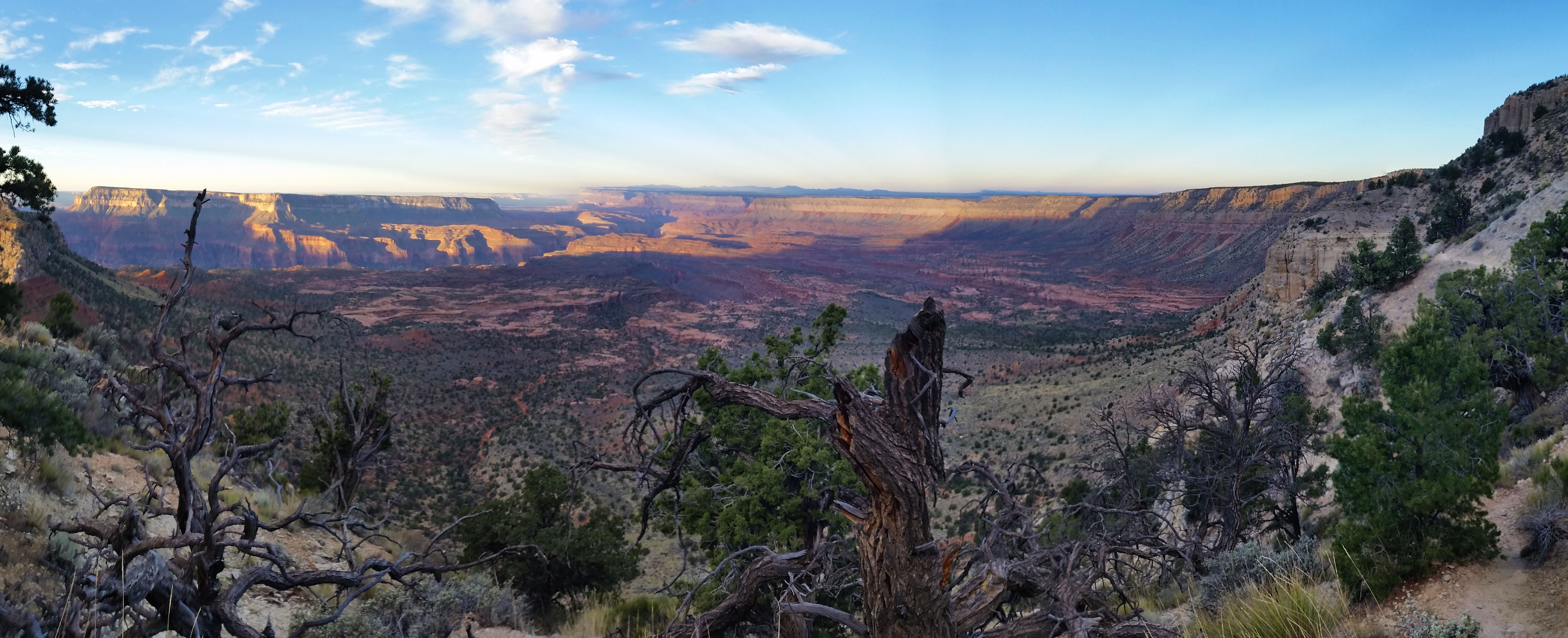
We finished the skirt and the many short, fast switchbacks which plopped us down on the esplanade plateau where the Indian Hollow trail met up with us. We strode forward amongst the sandstone formations and washed out cracks taking everything in, joking about current events, and talking about the dinners we would be downing that night. Just a few miles in, we took a quick rest and completed our water drop next to a huge sandstone formation. Knowing we had many more miles ahead we pushed on, over the open planes until finally we reached the head of the redwall. We looked down at the tiny trail below which we knew would be our ticket to Thunder river and eventually Tepeats Creek. Man what a view!
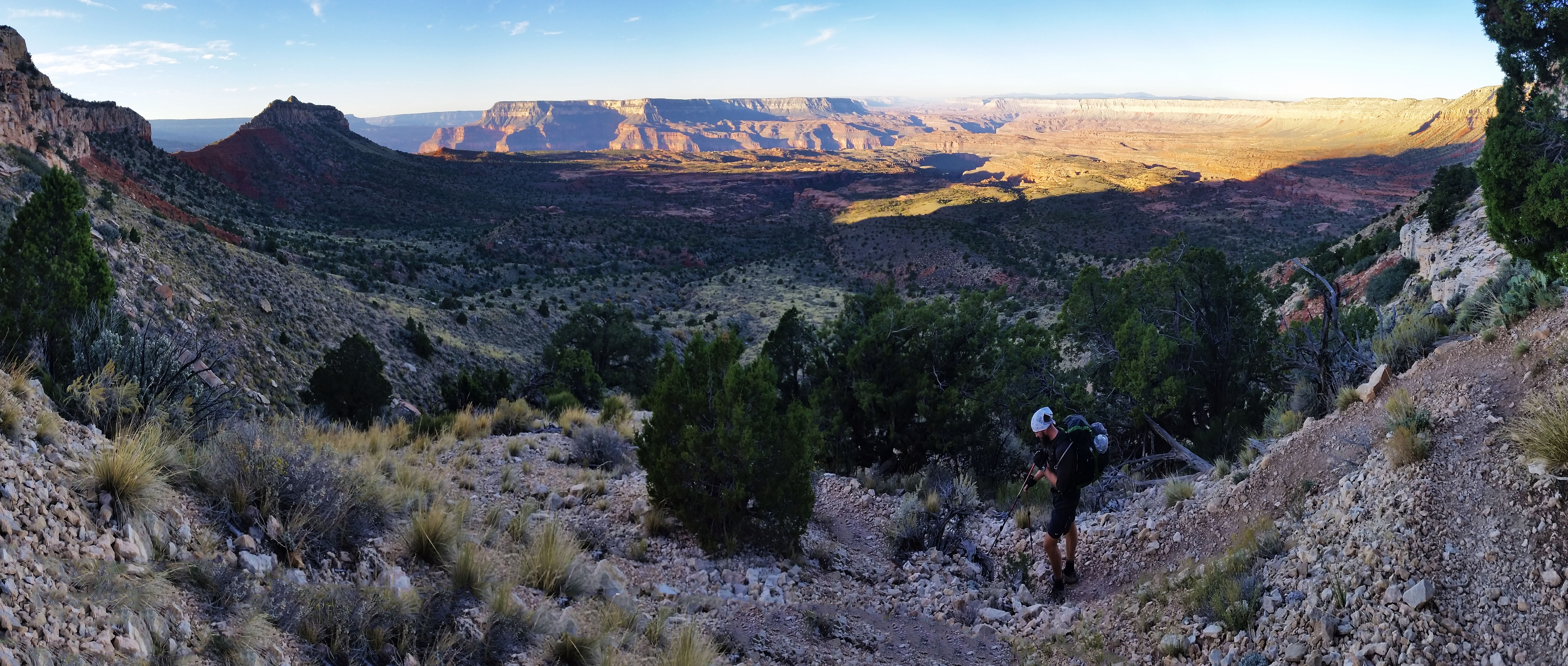
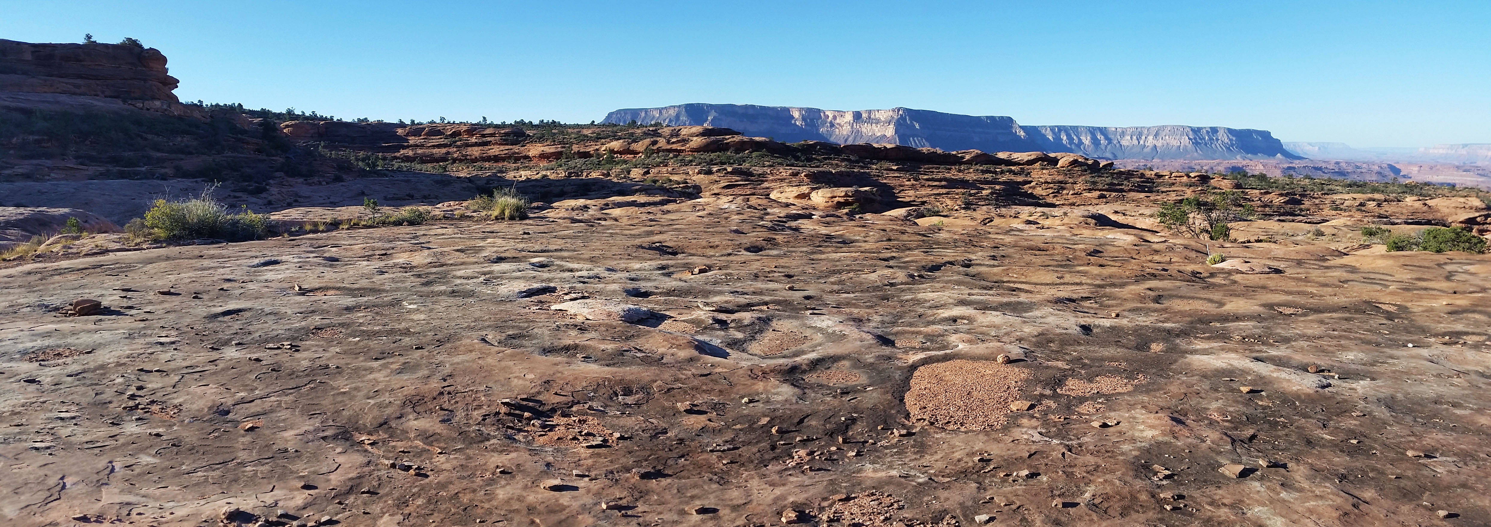
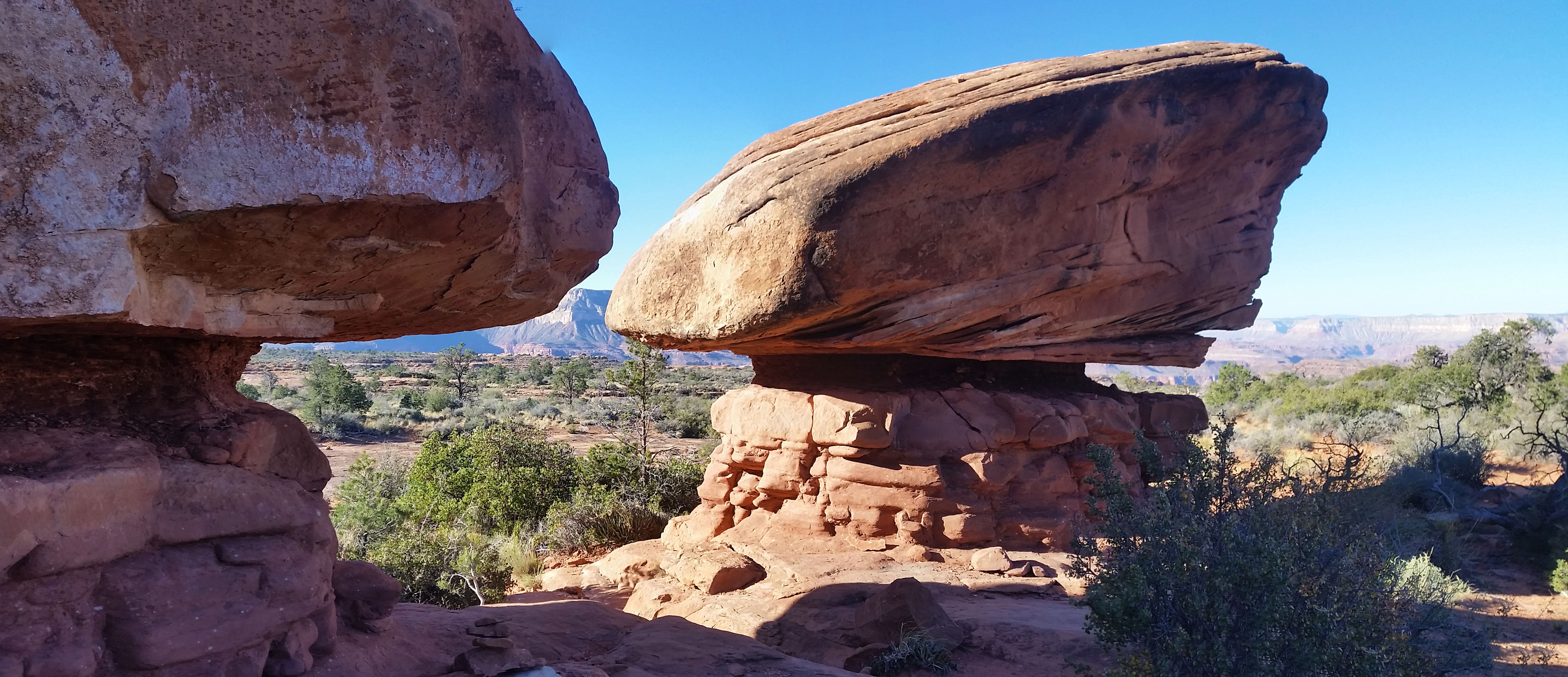
With no time to waste we bombed off again down the next dropoff. The sun had been creeping its way above our heads and as we dropped in elevation the temps began to rise. We hit the base of the redwall in a place called Surprise Valley. We joked “Surprise! It’s hot as hell!” After a short breather and a huge chug of water we headed east across the valley towards Thunder River. Up and down the small hills we climbed, the gorgeous canyon walls all around us, until finally we heard a fierce rumbling in the distance. We kept trekking closer and closer until reached the top of the canyon that fed Thunder River. A huge waterfall was just rapidly spewing gallons of water per minute from the rock face. It was hard to fathom where all the flow was coming from. An underground river riding a water table out of the wall? It’s hard to know. Like a pack of kids finding an X on a treasure map we scurried down the switchbacks and soon found ourselves at the base of the falls. The water was a crisp, clean, and cool and though we were star stuck admiring the falls, we knew we had to move on.
We dropped down further, skirting the canyons narrow west side trail until we reached Upper Tepeats camp where we would stay for the night. It was only noon, but we knew if we had any chance of getting to the Tepeats cave we would have to get a move on. We setup our tents, staking our claim, and strapped on day packs to once again hit the trail with our eyes set on the cave, 1500 feet of gain and 3 miles of a bushwhack away.
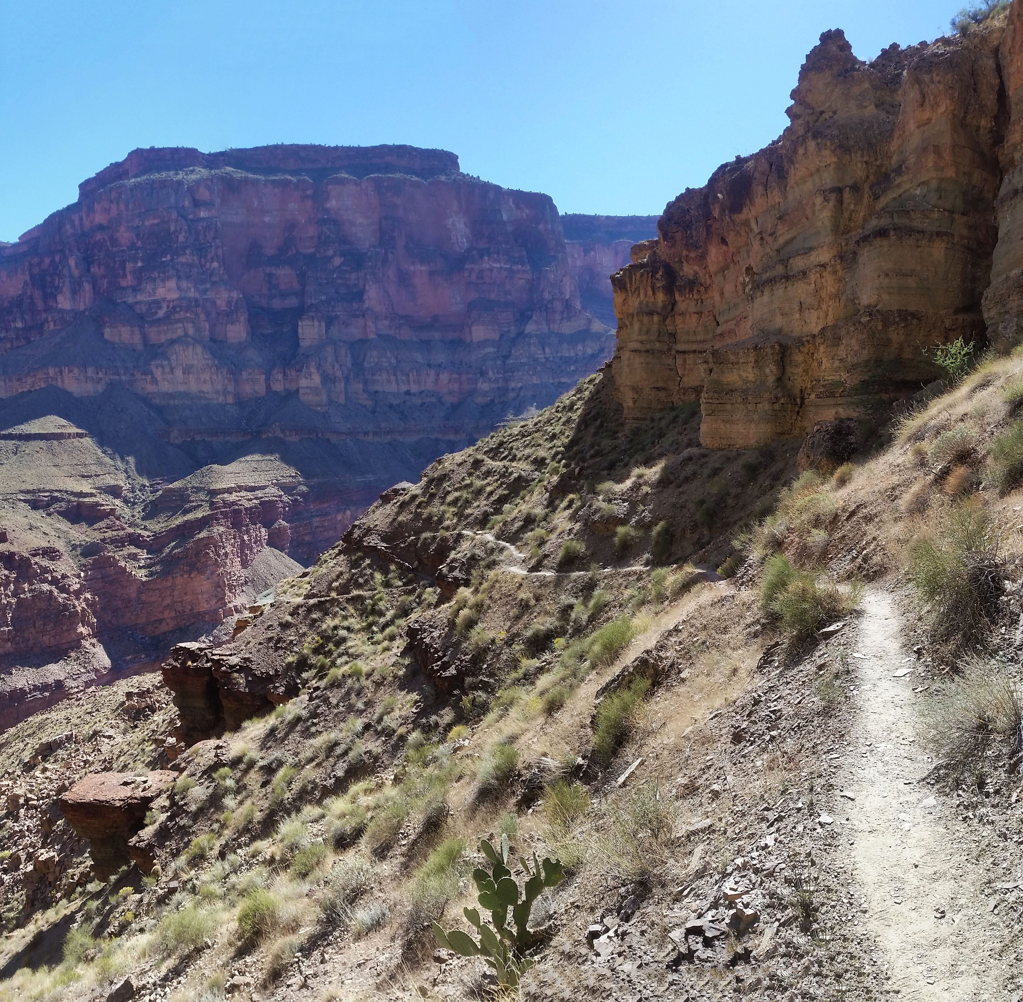
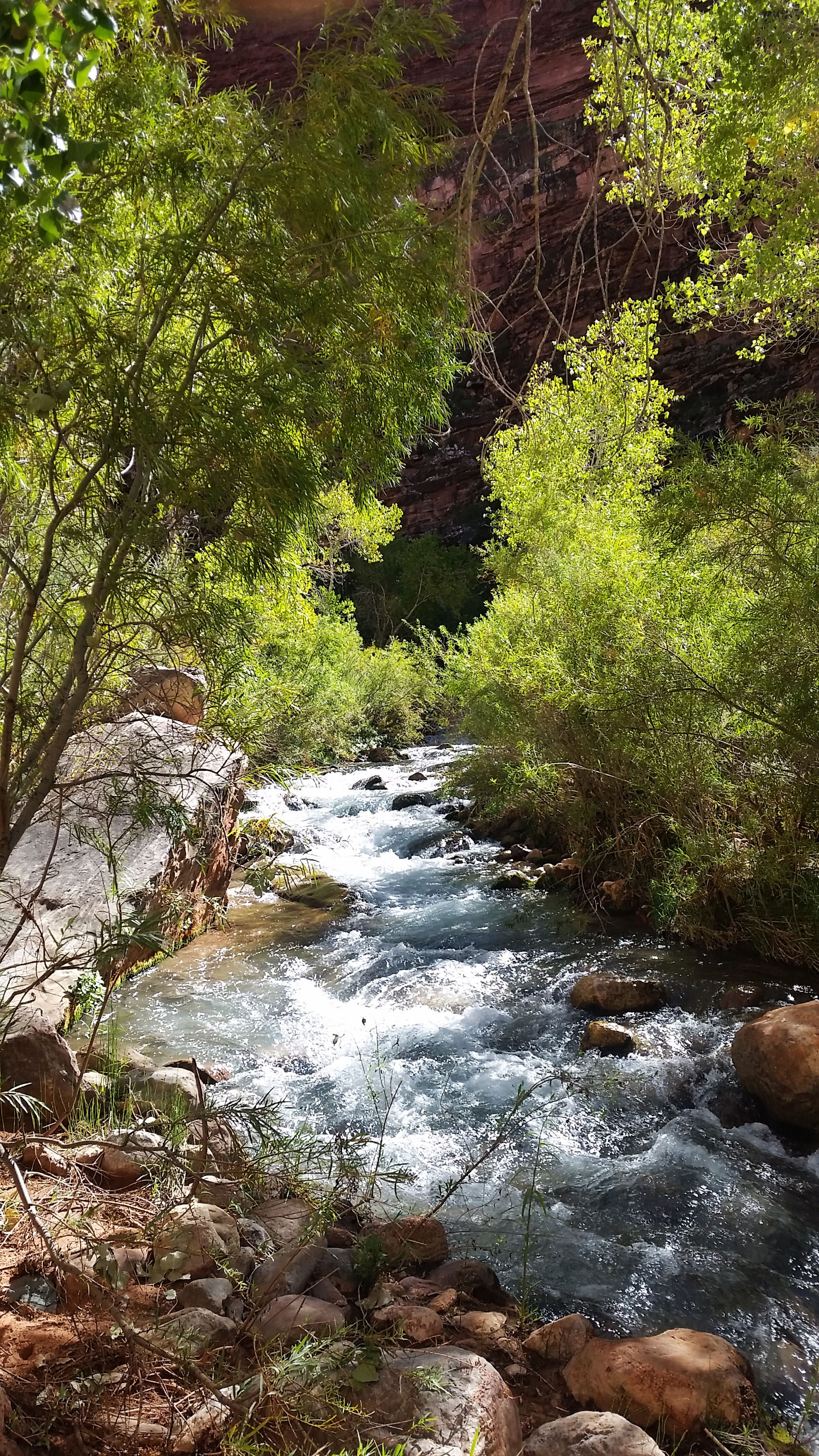
Crossing the river to the east side of the canyon we soon met the confluence of Thunder River and Tepeats Creek. Heading east, we stayed on the south bank until forced across the creekagain. Thick reeds, cat law acacia, and other brush did its best to thwart our efforts. We pushed further up the creek, hopping back and forth before finally coming to a mini-subway (rock formation in Zion). Soon after we pushed up past the mini-subway we found the mini-narrows, another formation resembling a Zion-like staple. The creek was wall-to-wall here and there was no other choice but to push up through the 50 degree waters. After 50 yeards or so we spotted a cairn sitting on a wall to the right of the creek. We decided to take that option, anything to get us out of the water for a while. We climbed up out of the riverbed to the south bank which took us skirting far above the rushing waters of the creek. This was the easiest terrain of the whole side trek to the cave, so we enjoyed it!
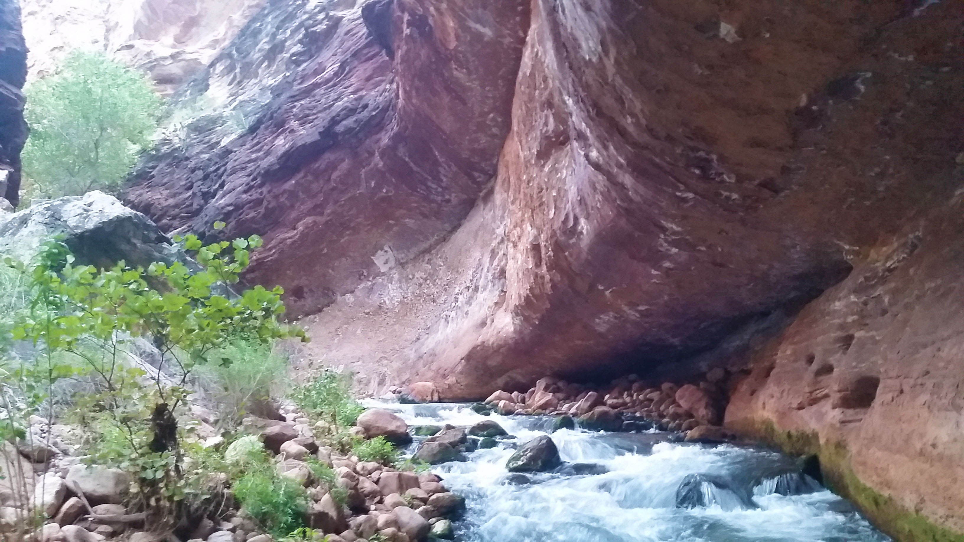
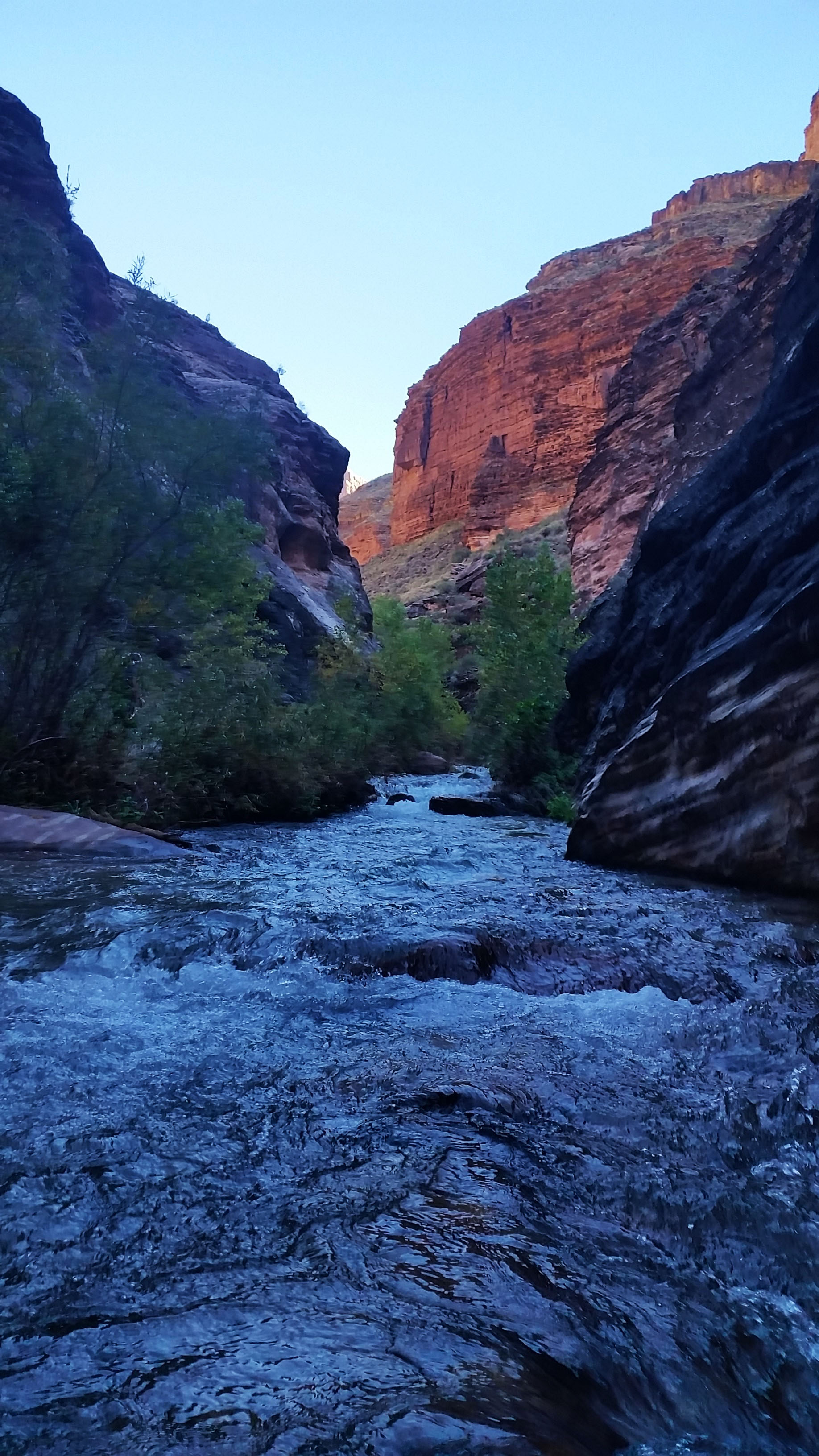
All good things come to an end, and so did our dry wall skirt as the trail dumped us back into the creek and pushed us north up the final canyon that held the cave. We were all tired by this point, but there was work yet to be done. We found a small use trail and continued to push forward, hopping rock to rock, pushing through thick brush, and skirting exposed rock faces before the mouth of the cave finally came into sight. It was on the east wall, just below the last cottonwood we could see in the canyon. We had expected the trial to become a little easier from here, but it only became harder. Marko, exhausted form the journey and coming in cold, decided to sit out the last push and replenish his batteries creekside with a water filter and a good snack. Stevo and I pushed on up the loose rock hopping back and forth the final quarter mile before reaching our goal.
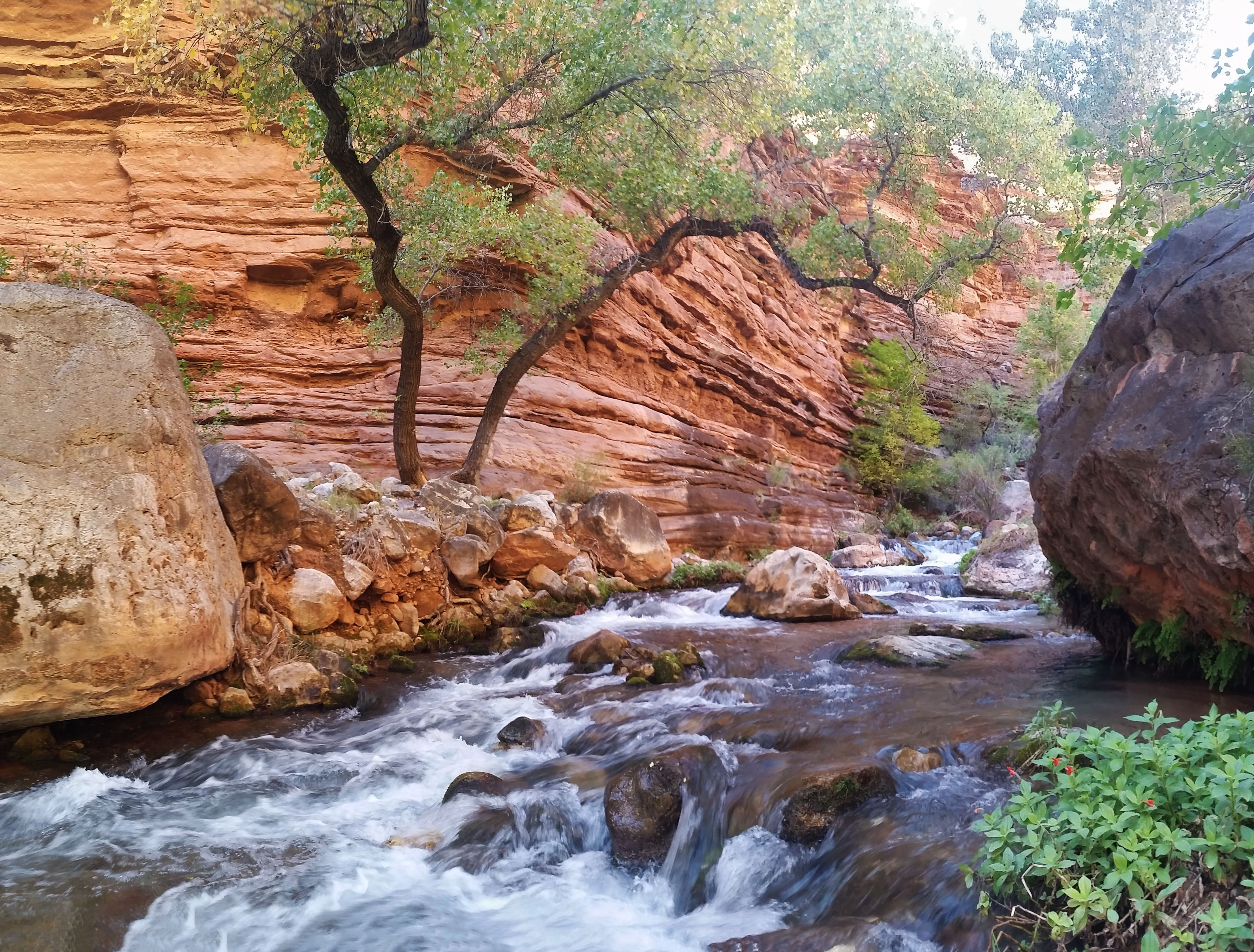
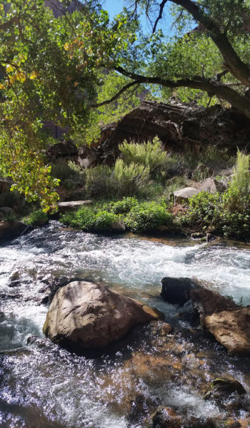 Let the bushwhack continue!
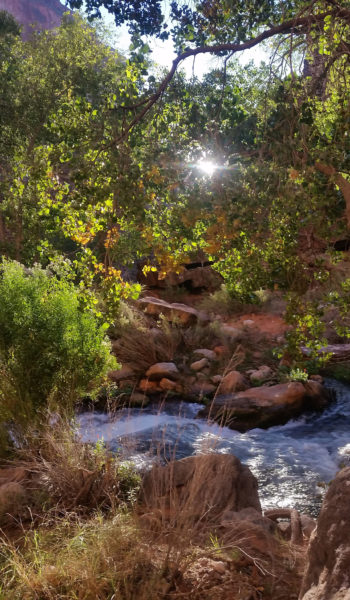
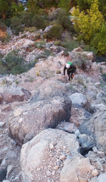
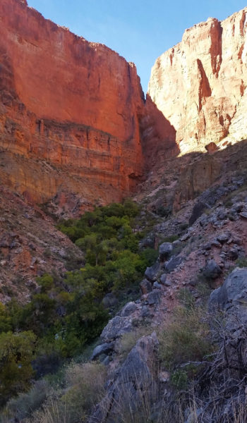
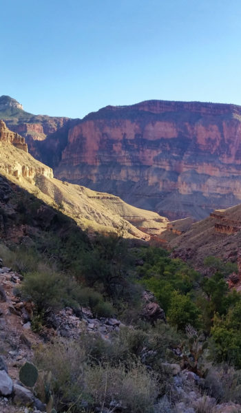
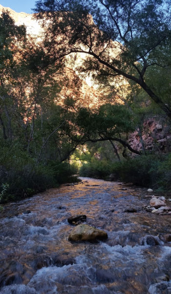
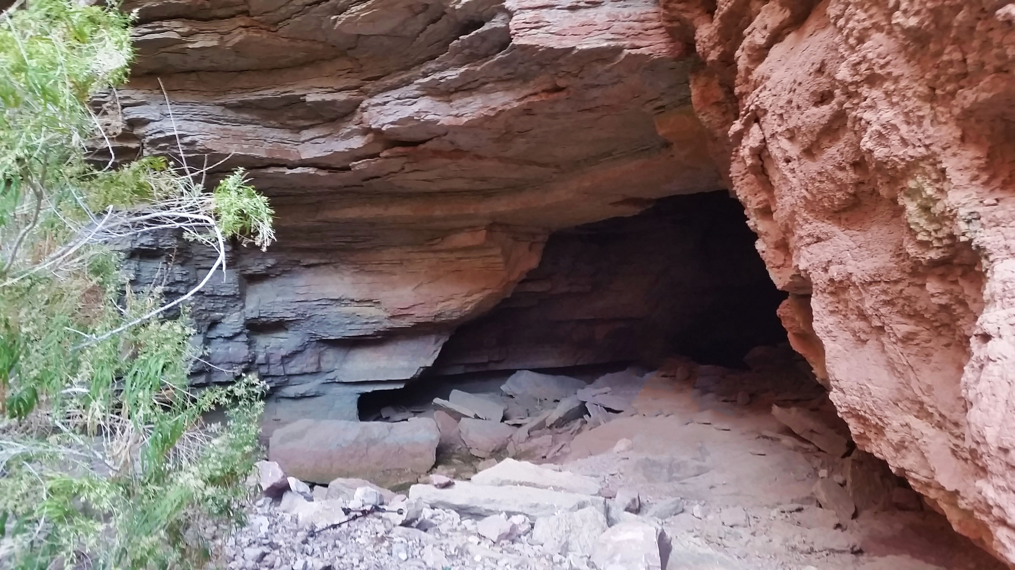
We stood at the mouth of the cave, headlamps on, uncertain of what we’d find. The air was dry and dusty as we stepped inside. Moving quickly, we pushed down the corridors and took mental notes of the rooms as we went. A beautiful stalactite and stalagmite had formed in the middle of one particular room and we paused to appreciate it. We followed a corridor to the right, up a small wall climb, and finally into a huge room with 50 foot ceilings. There was an NPS water flow sensor just across the room and at either end stood crystal clear pools of water. A few formations lined the walls and the underground river flowed in the rocks below our feet. Stevo looked at me mischievously and asked “Do you remember how to get out?!” I smiled and replied “Let’s hope so!”
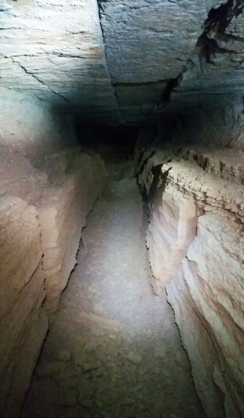 The entrance
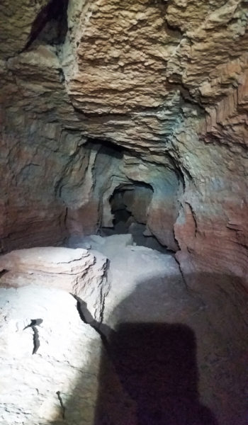
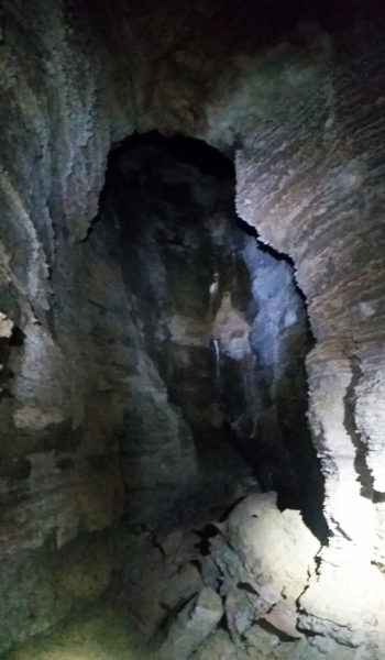
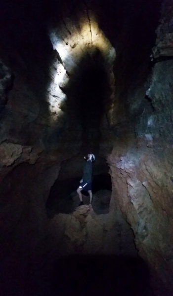
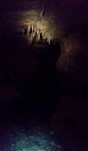
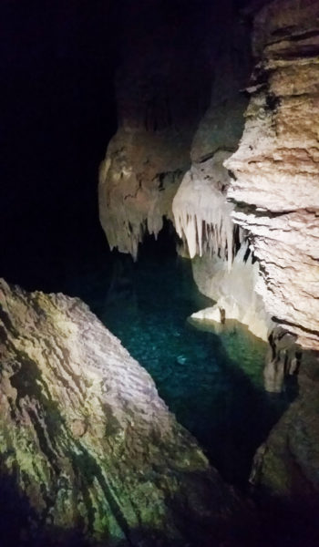
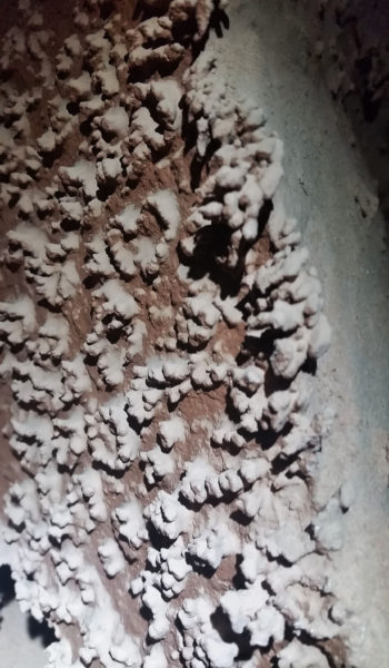
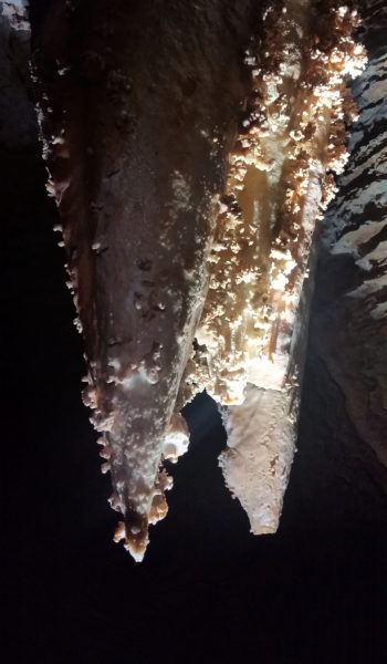
We turned around knowing time was running short and headed back the way we came. Through the maze of the cave, out the mouth, and back across the skirting exposed faces of the trail, we made our way until finally meeting back up with Mark. We could have easily spent hours in the cave checking out every crack, every room, nook and cranny. There is no telling how big the place was as some rooms were inaccessible without the proper gear. Satisfied with our journey for the day, though, we slogged back to camp tired but in good spirits. To our surprise we arrived just before the last bit of light slipped out of the canyon. As we cooked our Mountain House meals we exhaustedly reflected on the trek behind us and what was yet to come. What a great day it was, there’s nothing I love more than being outdoors.
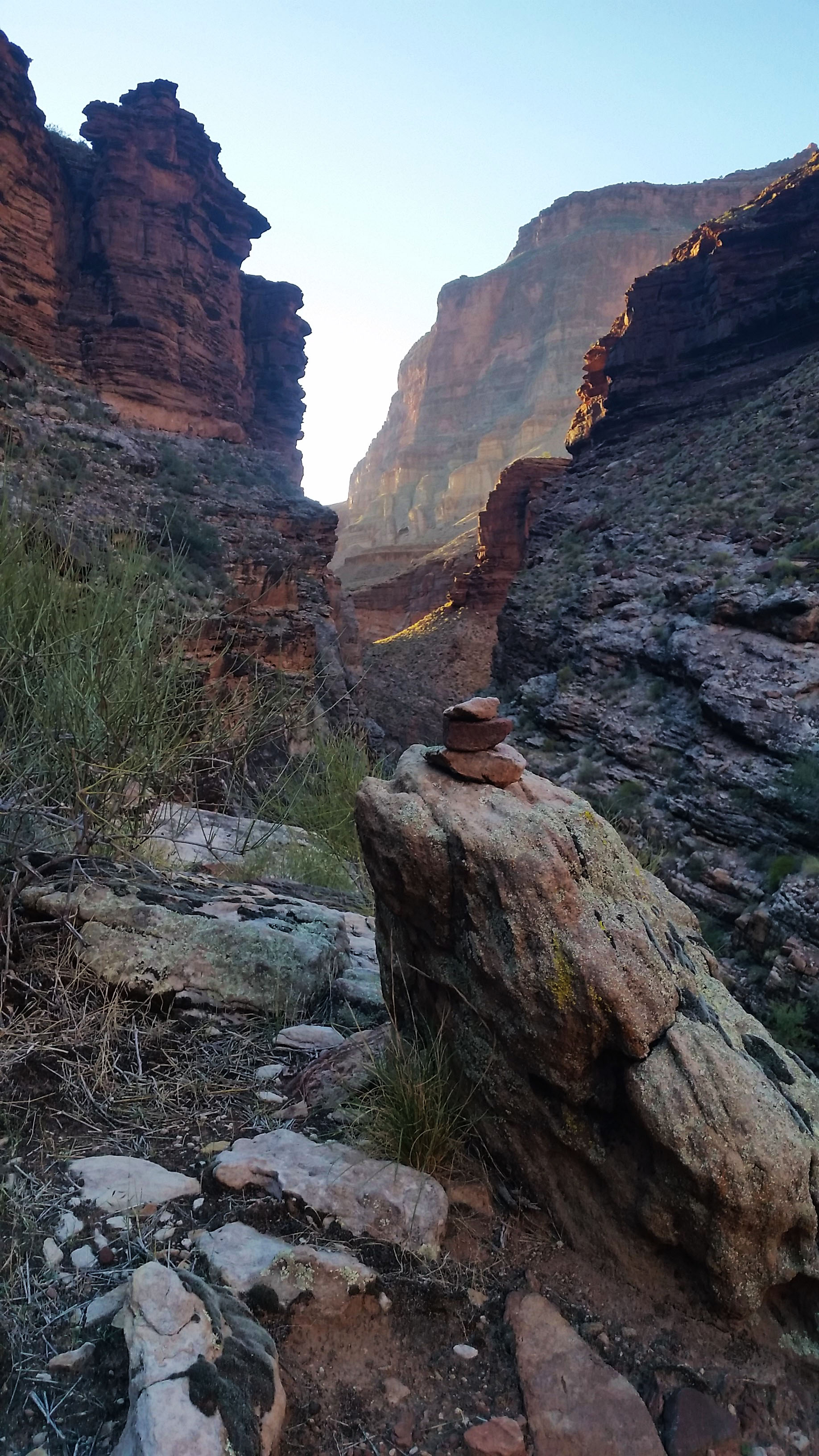
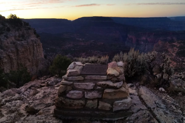 Bill Hall tribute near the trailhead
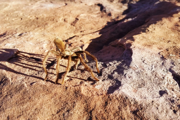
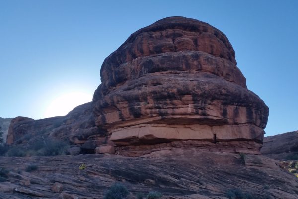
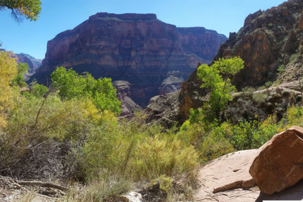
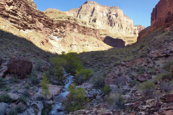
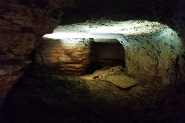
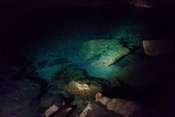
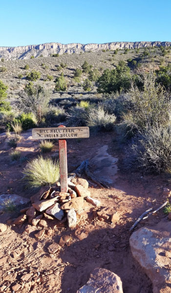 Bill Hall meets Thunder River Trail (starts at Indian Hallow TH)
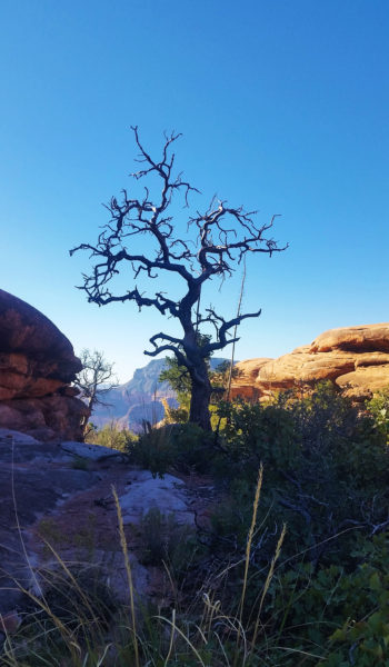
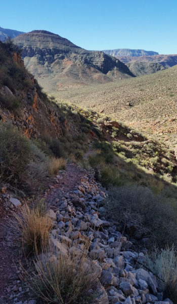
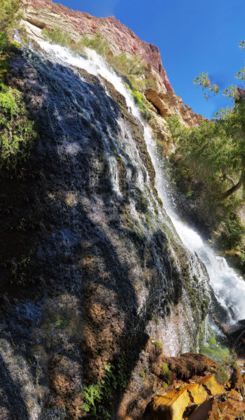
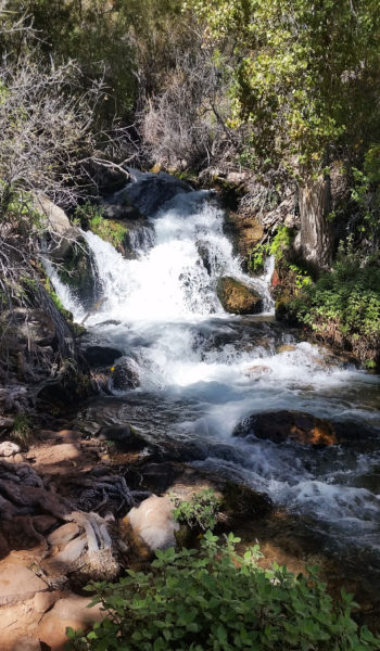
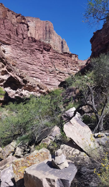
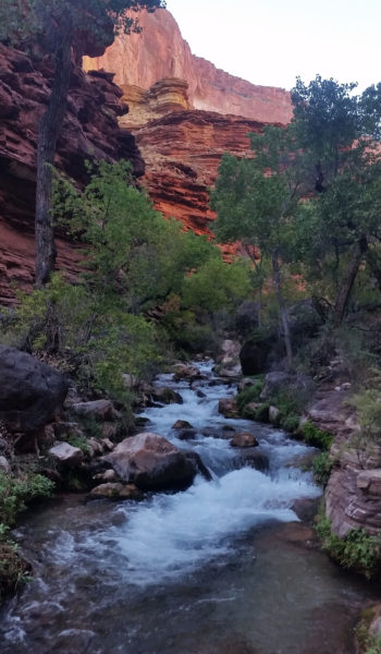
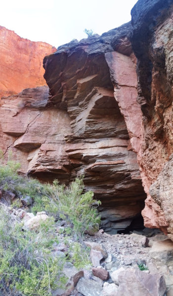
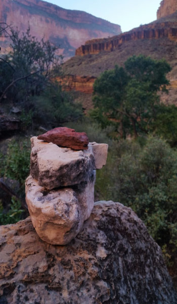
- The GPX Loop: http://hikearizona.com/
gps=25256 - Thunder River: http://hikearizona.com/
decoder.php?ZTN=1008 - Bill Hall Trail: http://hikearizona.com/
decoder.php?ZTN=612 - Tepeats Side Trek: http://hikearizona.com/
decoder.php?ZTN=19576 - Tepeats Cave – http://www.teamcrowbar.com/b82.php
HIKE STATS:
- Weather: Hi in low 80s, Low in upper 50s, Sunny
- Water: 4 Liters (including diner)
- Food: 2 Power Bar, 2 Granola Bar, 2 Protien bars, 2 Clif Bars, 1/2 bag of Mediterranian Chips, 1/2 bag of trail mix, 1 apple, 4 bgas of Welches gummys, 1/2 bag of jerky, 1 Mountain House.
- Time: 12 hours
- Distance: Approx 16 miles
- Accumulated Gain: ~1500 feet (loss of 6,100 accumilated feet)
GEAR:
- 58 liter exos osprey backpack
- Big Agnes Copper Spur UL2 tent
- Big Agnes QCORE SLX sleeping pad
- Cosmic Down Kelty Sleeping Bag (rated to 20 deg F)
- Jet Boil – Sol
- Black Diamond trekking poles
- Sawyer Squeeze Filter
- SPOT Gen3 Tracker
CLOTHING:
- Cotton T-shirt
- Cotton hankerchief
- Pearl Azumi arm coolers
- Arc’teryx hoody
- Nike running shorts
- Merrell Mid Moab Hiking Boots
- Darn Tough wool medium weight socks
- Threadless hoody
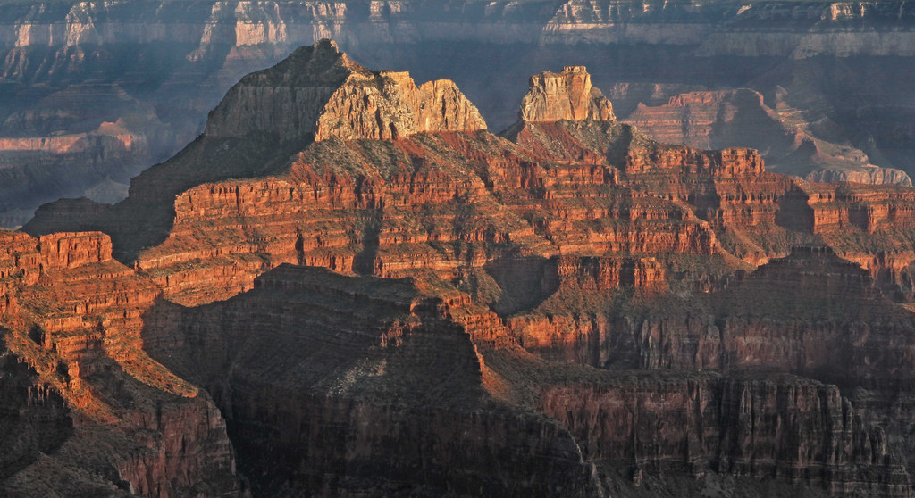
Blunt Force Brahma – Grand Canyon AZ (3.25.16 – 3.26.16) (Brahma Temple)
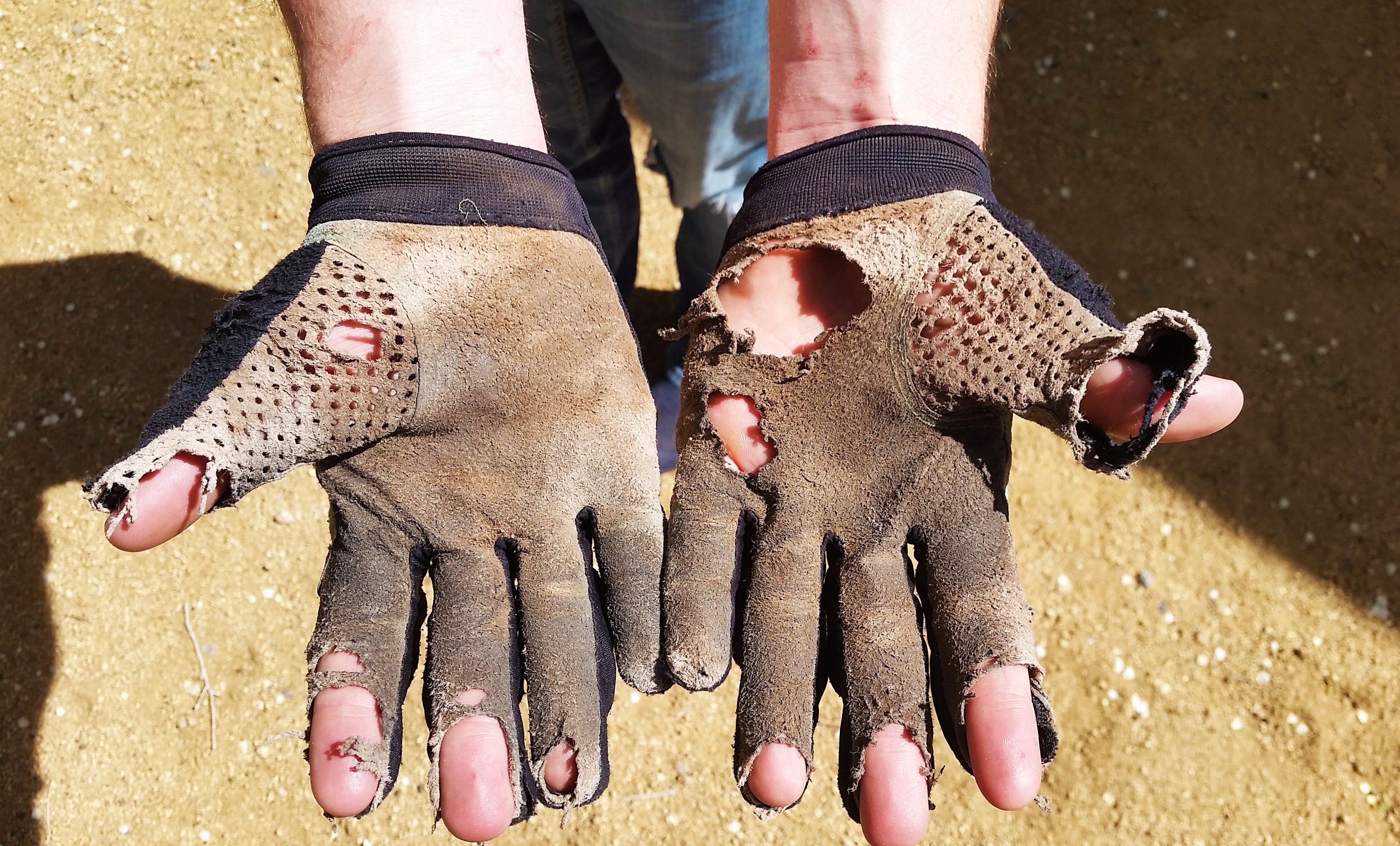
Some years ago, a few geologists (namely Charles Dutton, Charles Walcott, Ian Cambel and John Maxton, amongst others) with some extra time on their hands went about naming some of the buttes, mesas, and temples that are scattered across the Grand Canyon. For many of these rock structures, they chose to name them after prominent figures across many different religions (i.e. Vishnu Temple, Shiva Temple, Rama Temple, Isis Temple, ect). This particular adventure would take us up the Temple named after Brahma, the Hindu God of creation or birth. The hike (if you can call it that) lived up to its name because I felt like a new man after!

Mark, Rene, and I planned to take on the Temple as a one night backpack, but had no idea what was truly in store for us. We all did our research on the trek, knew it would be pushing class 4, low class 5 in places, but at the end of the day it’s like reading a book about how to ride a bike; you just have to get out there and fall over a couple of times. The plan was to hike down South Kaibab, cut across the canyon to Clear Creek trail, head north up the crack from Sumner wash through the red wall, break up through the Supai layer, and then camp on the western arm of Zoroaster. The next day we would then hike through the Hermit Shale across the Zoroaster/Brahma saddle, skirt the base of Brahma, ascend the formation from a chute on the west side, and follow the ridgeline north to the peak. We just prayed we could get down the same way unscathed by the monstrous mountain!
Friday morning was crisp and cool, just above freezing, as we prepared to drop in. I always get that Christmas morning feeling when I drop into the canyon, giddy with excitement. It’s like I’m 5 years old all over again, standing over a pile of neatly wrapped presents, blood pumping with the excitement of not knowing what’s to come. We had all hiked the canyon a few times so the descent down South Kaibab was no surprise. After a few hours, we reached Phantom Ranch and took a quick break to fill up on water that was to sustain us until the next day and into the afternoon. Sipping on lemonade from the canteen and writing some post cards to home, we were all in good spirits and ready to push onward to camp.
 First glimpse of Phantom Ranch from South Kaiab
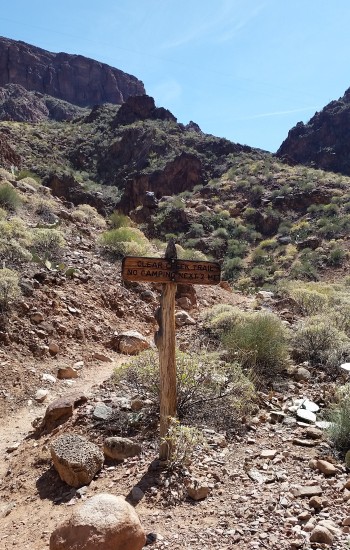
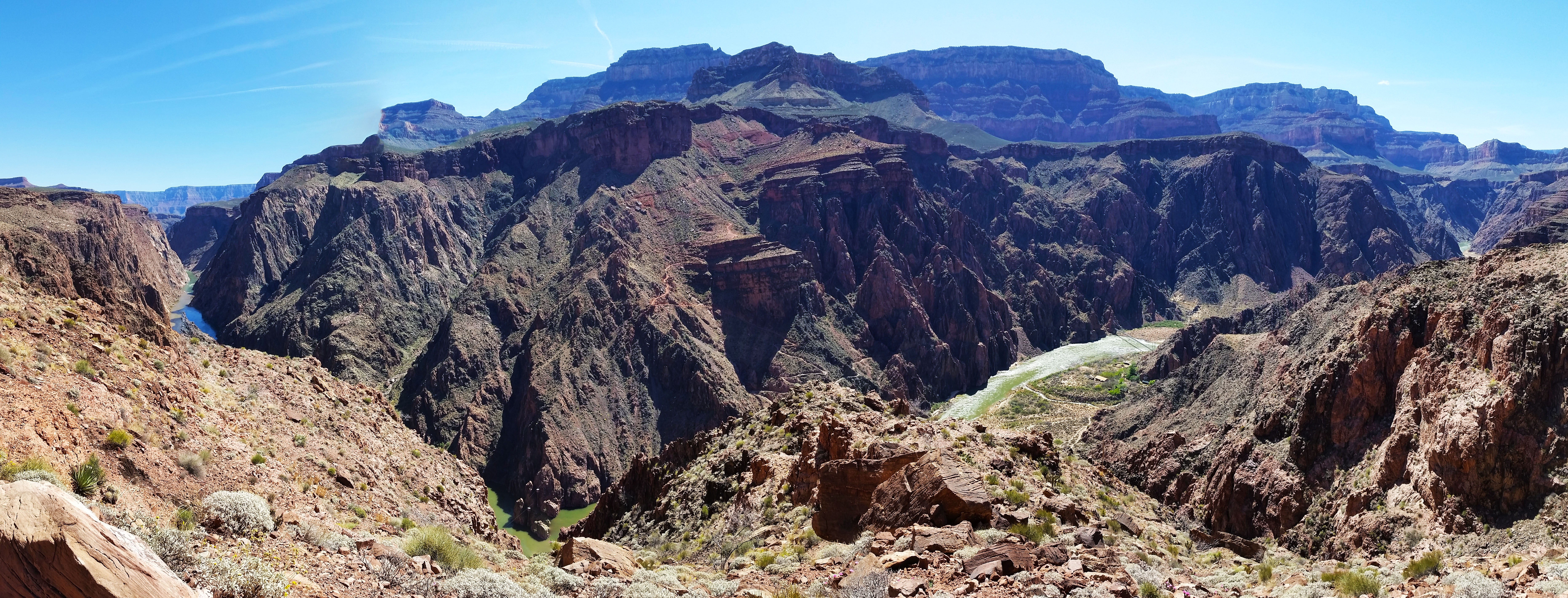
As we headed out from Phantom, the morning had finally warmed up. The added weight from the water really sunk into our shoulders as we took on the first good gain of Clear Creek trail. As we made our way up onto Sumner wash, the views from the skirting trail over the Colorado River were incredible. You could look clear up and down the river, both the black and silver bridges visible to the naked eye. After another good push, we were finally at the point to head “offtrail”. As expected the route went right to work with quick gain up the wash to the base of the crack. We were soon faced with our first obstacle: an 80 foot repel staring right back at us, daring us to climb.
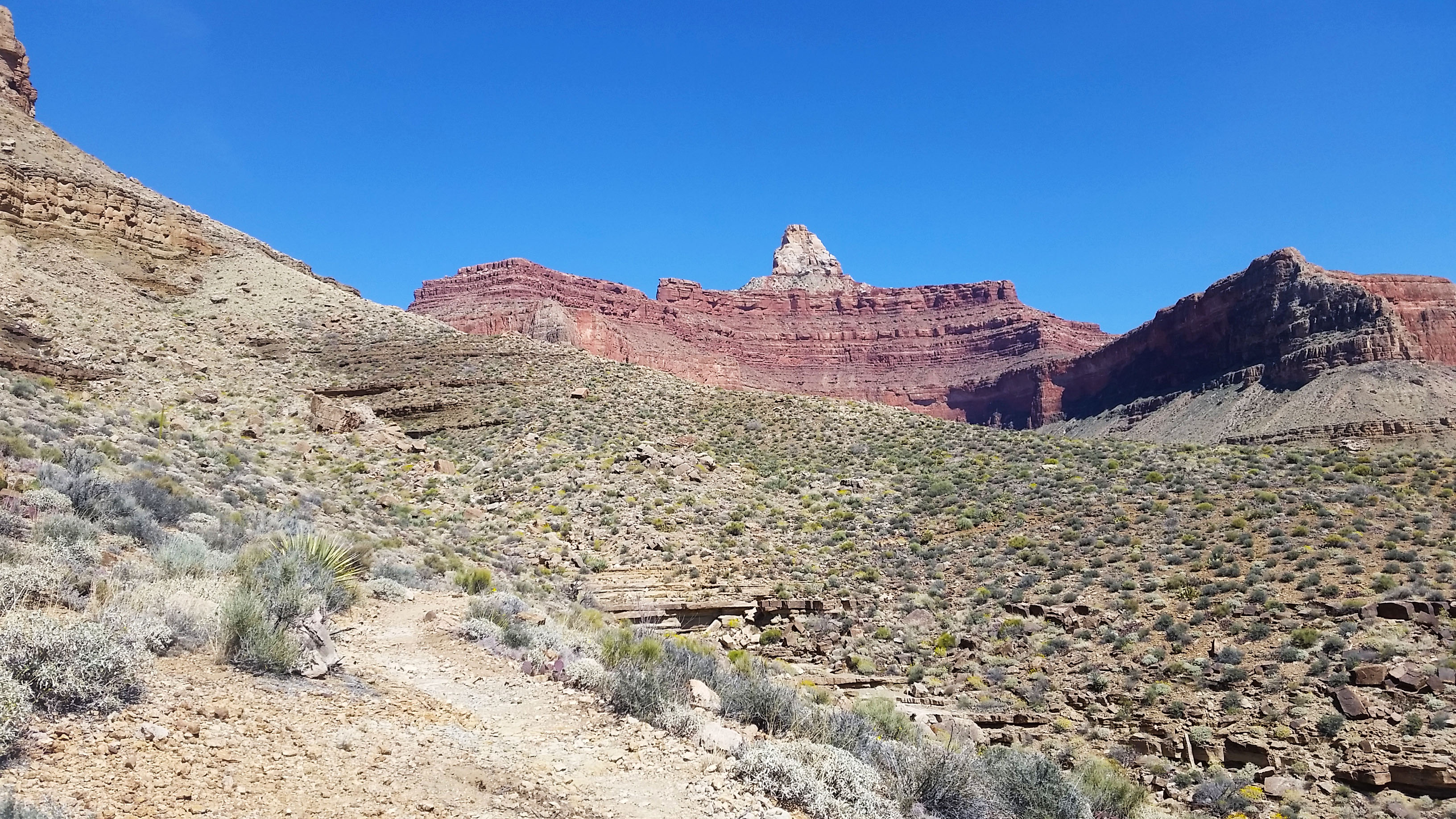
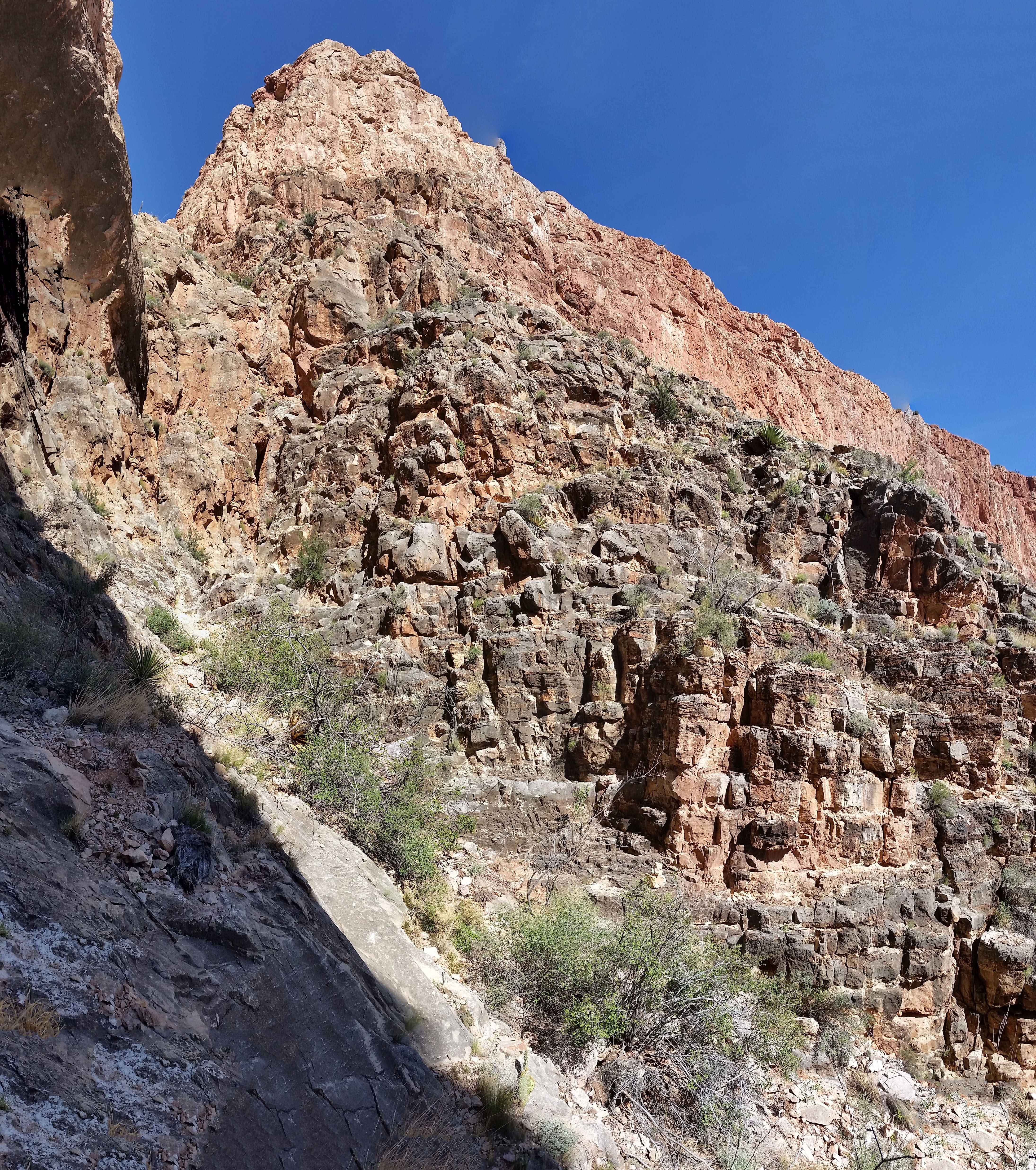
After careful deliberation we decided to take an exposed ledge, hopping to the right side of the crack (which had a skin ripping rock covered with sharp tater). At the top of the ledge, there was a small 20-foot down climb that dumped us back into the crack. Whew!! We made it past the first obstacle. After that I knew that Brahma was really going to pack a punch! Not but a short 10-foot scramble later we hit the crux of the red wall crack. It was another climb that had a few options of ascent, all with troublesome penalties for failure.
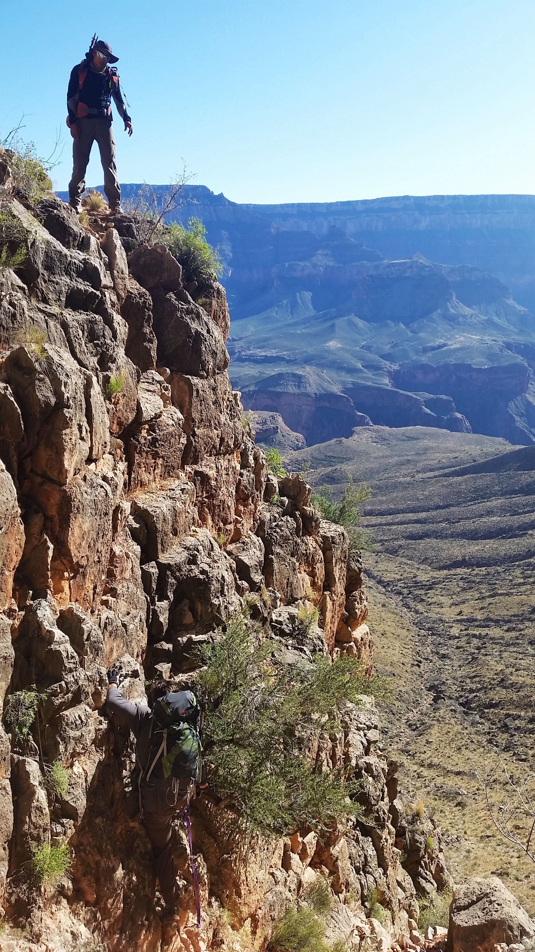
Once again we deliberated, found a route we liked, and with sweaty hands made the ascent, afterward tying off the packs and handing them up. Whew, another climb completed! After another short scramble we popped up out of the crack and made our way across the bottom side of the western Zoroaster arm. Some trail finding and a chimney crack was all that stood between us and our camp for the night. We kept reminding ourselves “slow and steady wins the race” as we methodically tackled each obstacle the climb threw at us. There was no point trying to hurry through if it meant a being taken out of commission for a while (or worse). Before we knew it we were setting up camp, boiling water for Mountain House meals, cracking jokes, and enjoying the setting sun. It was only the first day and we were all beat, ready for a good night’s sleep.
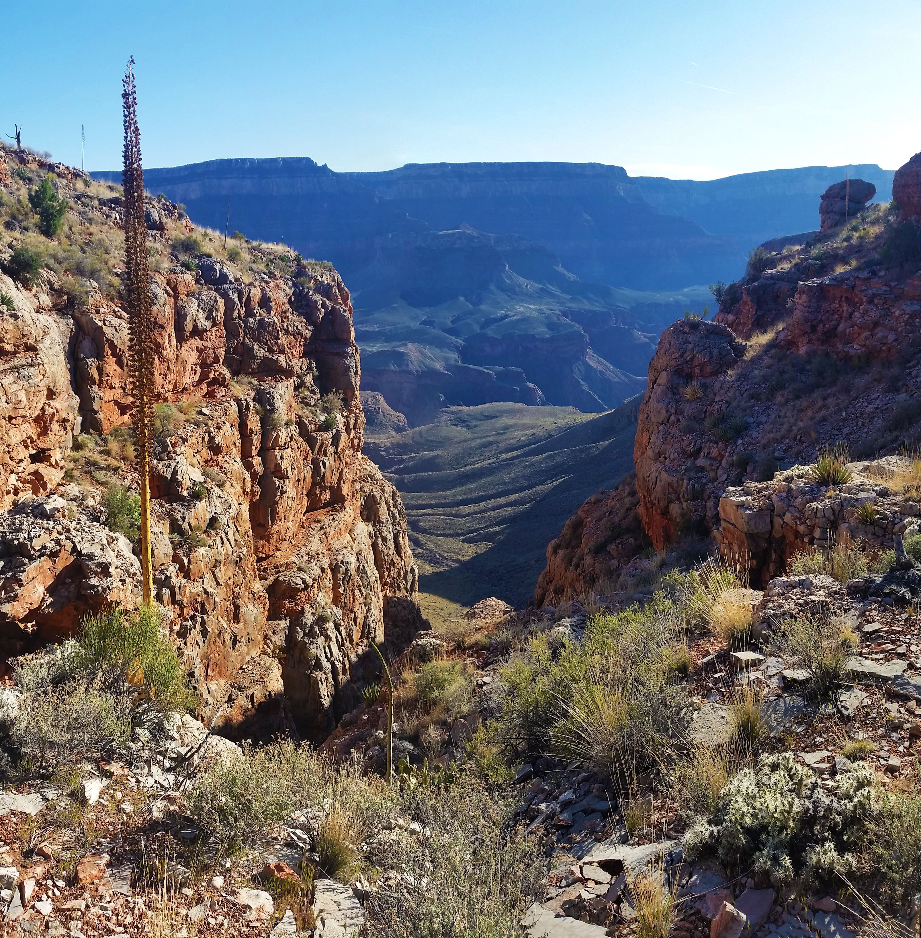
Or so I thought…I woke in the middle of the night to the sides of the tent shaking violently! The wind ripped across the open face where we were camped, but the tent was well staked and held sturdy. Just as fast as the wind had come it dissipated, and this cycle repeated itself quite a few times through the rest of the night.
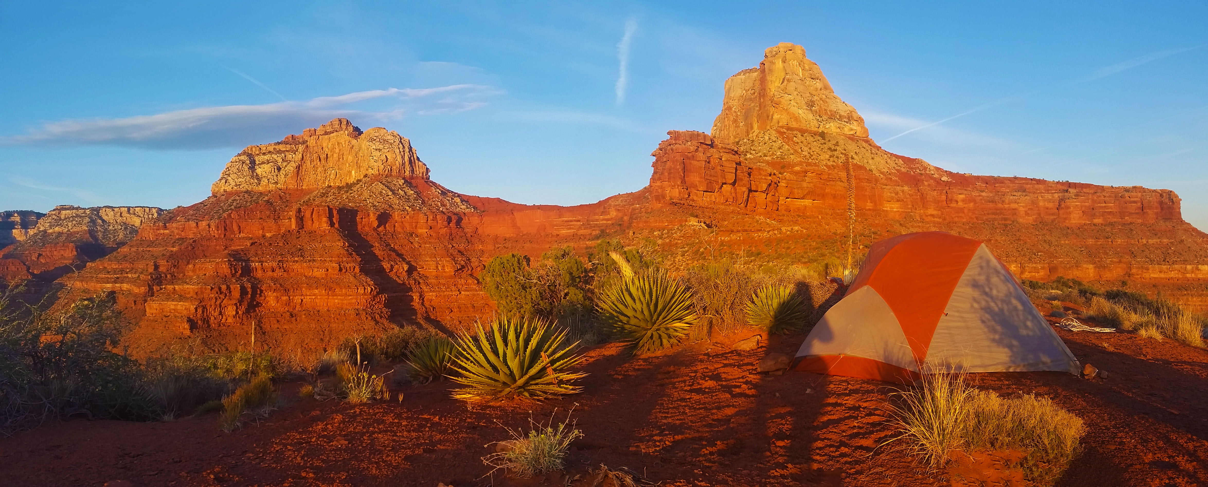
Soon, always too soon, my alarm blared, signaling the start of Day 2. Not only did we still have to summit (which was hours away from completion), but also find the energy to descend back to the river and hike out of the canyon via Bright Angel trail. We had our work cut out for us!
After breakfast and packing up camp we piled our camp gear off to the side in hopes that with lighter packs it would help us with our summit time. We quickly spanned the western arm and chimneyed up a 10 foot obstruction to start skirting the base of Zoroaster. The trail narrowed from a short 10 foot slope to a 300 foot sheer drop in some sections. I nervously placed one foot in front of the other, clutching tight to the trekking pole in my hand for balance, trying not to think about the consequences of a misstep. Not soon enough, we cleared the first section and it was on to the 3 obstacles in the Supai layer.
After quickly scaling the first two, which had seemed pretty mild even without relying solely on a rope, we came upon the third. This one was a little spicier in nature. Good footing on the right led to a slick rock face. This demanded full commitment to the rope which had been left hanging…in the sun…for god knows how long…with little way of inspection. Of the 3 of us, I was the first up and have the least upper body strength. Standing half way up the climb on the ledge my leg began to shake. At this point is was show up or go home, so I put my feet on the wall and my full weight onto the rope. I felt it stretch, along with something in the pit of my stomach. My buddies below had their hands up just in case the worst should happen, but I knew it was pointless if I actually fell. I pulled with everything I had, the knotted rope stayed true, and soon I was over the obstacle and onto the ledge.
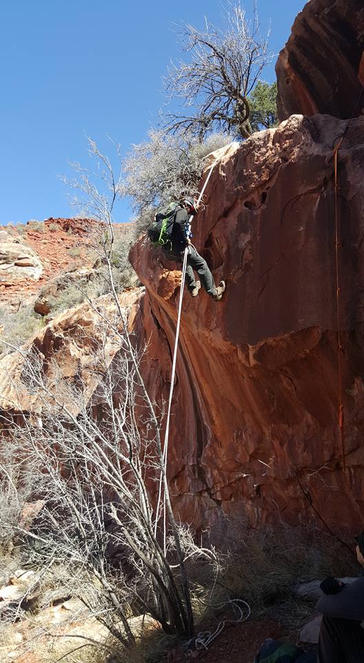
After the other two followed suit, all three of us took a moment to catch our breath, nervous and happy we had completed yet another climb. We skirted the rest of the base of Zoroaster across a long, loose sloping face which, of course as everything else had on this hike, ended in a 300 foot drop into the canyon below. Whew, the nerves were not shot but they were definitely getting their exercise. We exited onto the saddle to Brahma and after a good climb started skirting the base of Brahma. In the description it says “Easy Peasy Skirt” along the base. The wisdom, however, is that everything should be taken with a grain of salt when it comes to summiting a Temple. The skirt went up and down, but overall wasn’t too bad except for the 3 or 4 spots where the slope ended in a downward spiral to an early grave. As we reached what we thought was the end of the skirt (according to the GPS track), we looked right to find the canyon we were supposed to ascend. There was nothing in sight.
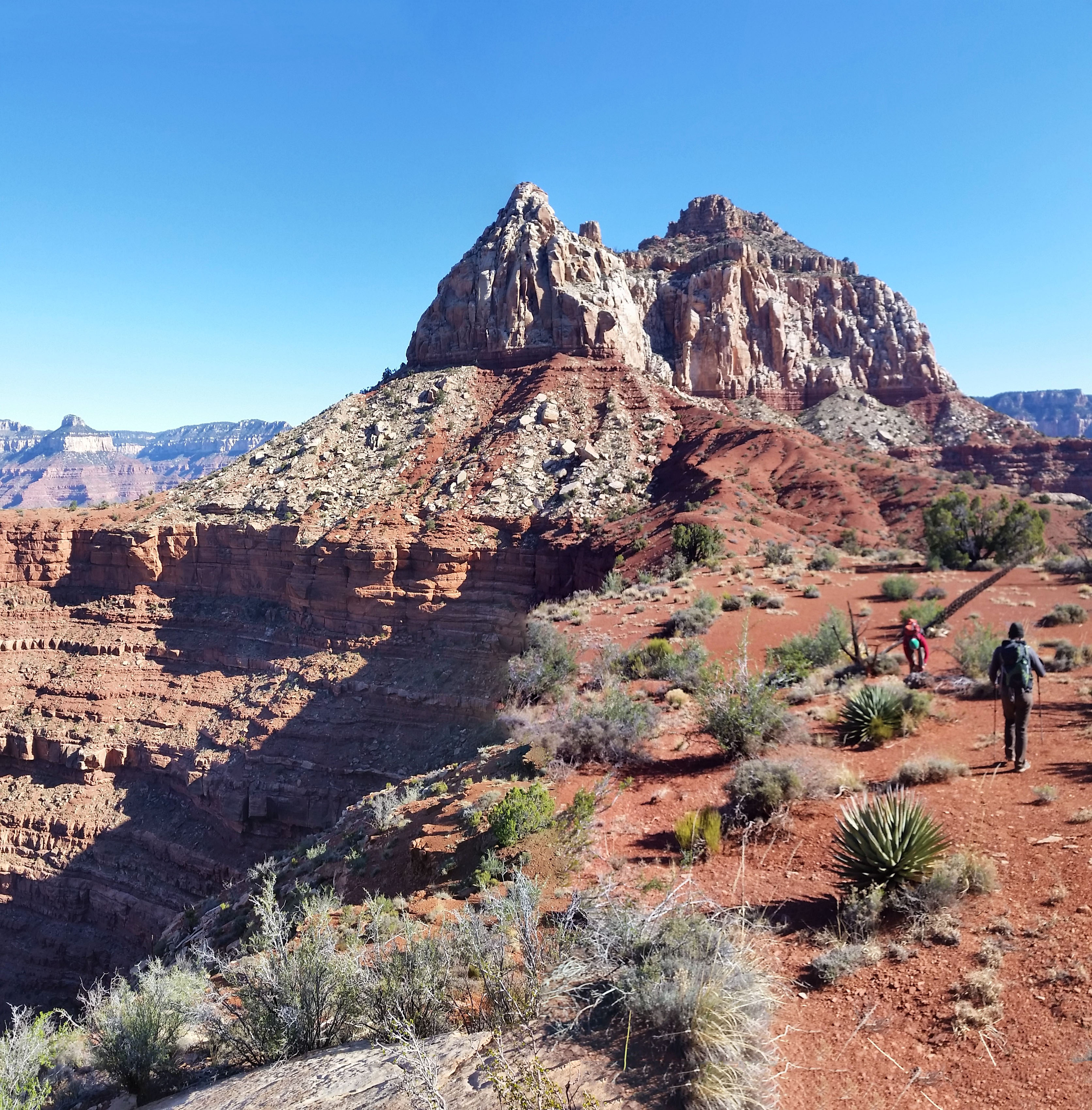
After careful consideration and close inspection, we found the only line that didn’t look like a 5.10 climb or seemed as though it could “go”. We dropped pack, chugged water, and prepped for the unknown. In all the research we did, there wasn’t much note given to the canyon that leads to the north ridge to the summit. Let’s just say that was a slight oversight! The first 15 foot climb ended in an exposed shelf skirt that the word “sketchy” cannot truly describe. After the skirt we tucked into the canyon, carefully and slowly choosing our line, ascending obstacle after obstacle, before reaching the north ridgeline and finally the sunny summit. My god what an ascent! By far my hardest to date. It definitely pushed my limits, but I couldn’t really fully enjoy it because I wasn’t actually sure if we were going to make it down safely, which of course is always the primary goal.
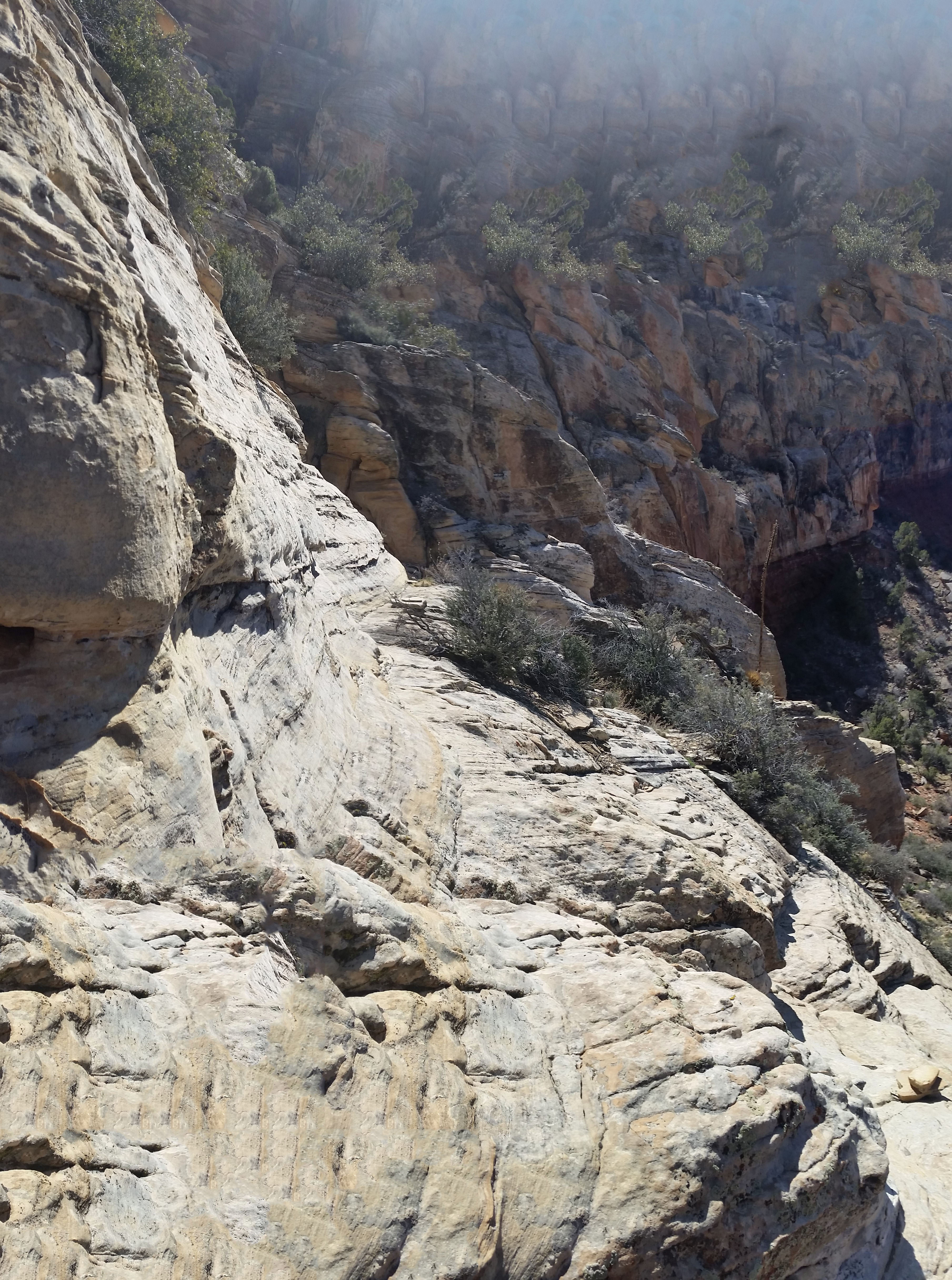
The mind is a strange thing, though. Once you challenge it, it expands. Every section where I was worried or nervous that we couldn’t return that same way felt grades lower in toughness on the return trip. Each down climb seemed doable, and repels that bypassed 2 of the hardest obstacles made the descent much more livable. After an exhausting day, we finally reached Clear Creek trail. We cracked a few brews to celebrate that the hardest part was over. It didn’t matter that we still had 13 miles to hike out in the dark, which we knew we wouldn’t complete until almost 2 am, because we had just summited our first Grand Canyon Temple. What an incredible journey, no words or pictures can begin to describe its brutal beauty. Despite the mental and physical toll the climb exacted on me, I can’t help but be excited to start planning the next one.
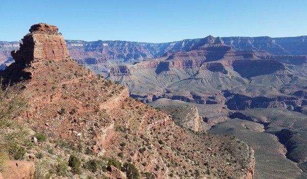 South Kaibab
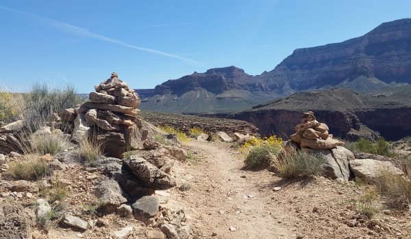
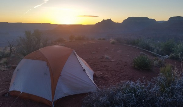
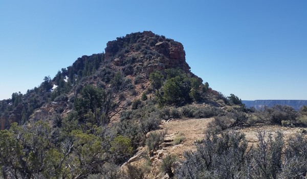
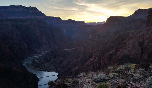
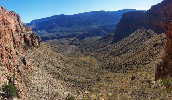
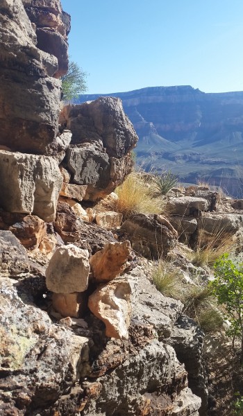 Cairn noting the exposed bypass for the fist obstacle
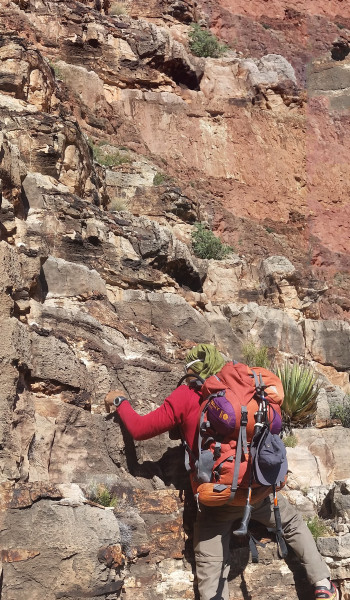
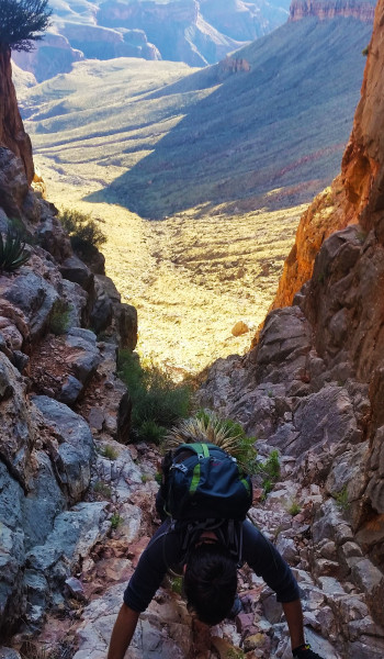
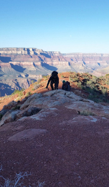
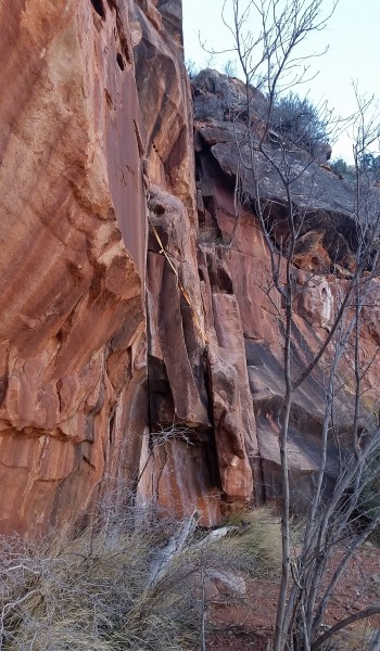
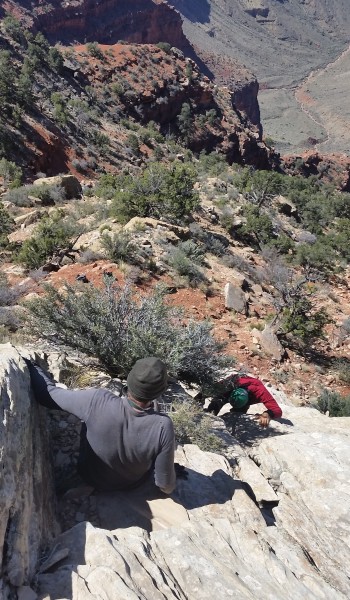
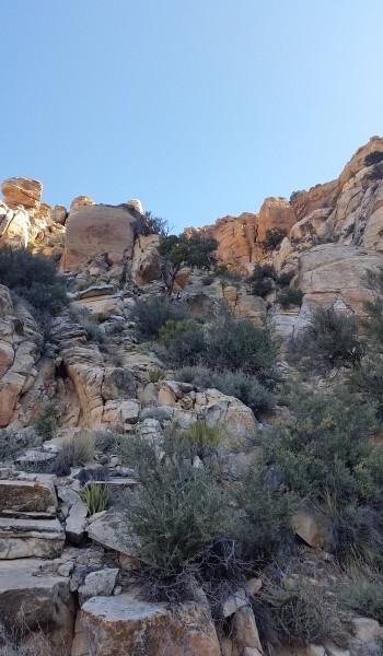
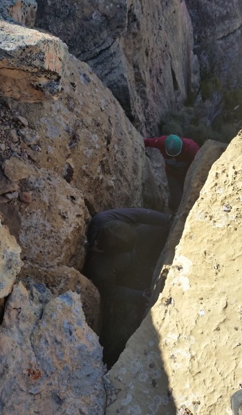
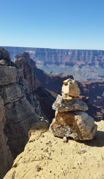
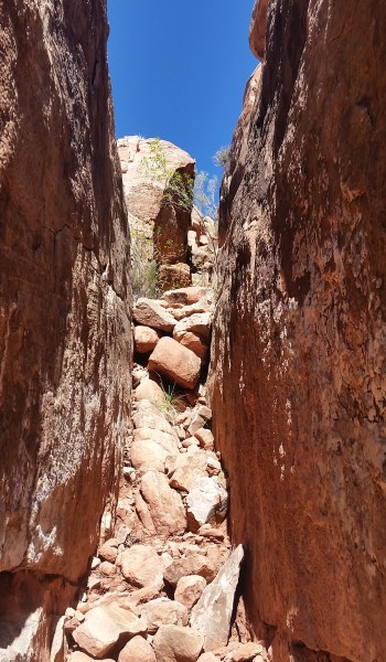
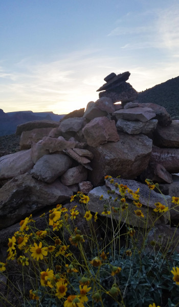
HIKE INFO:
http://hikearizona.com/decoder.php?ZTN=1070
HIKE STATS:
- Weather: Hi 60s, Low in the lower 20s, Sunny, Slightly windy
- Water: 8 liters (2 days)
- Food: 4 protien bars, 6 Clif Bars, 2 granola bars, 2 via starbucks instant coffee, 1 Mountain House, 2 bags of Quinoa, instant mashed potatoes, 1 bag ProBar gummies, ProBar Meal bar, 2 bags of trailmix, Haribo gummy bears, 2 Kind bars, bag of Pringles, bag of salt and vinegar chips
- Time: 2 Days (Hiking time – 9 hours, Day 1; 19 hours, Day 2)
- Distance: 30 Miles round trip
- Accumulated Gain: 10,700 feet
GEAR:
- 58 liter exos osprey backpack
- Big Anges Copper Spur UL2 tent
- Flash REI sleeping pad
- Cosmic Down Kelty Sleeping Bag (rated to 20 deg F)
- Jet Boil – Sol
- Black Diamond trekking poles
- Corax Harness
- ATC belay devise
- Black Diamond carabiner
- Phantom carabiner
- 10mm Rope – 60 feet
- 6mm prusik
- 2 – 180 mm slings
CLOTHING:
- Smart wool 195 long sleeve shirt
- Arc’teryx hoody
- Cloth bandana
- Patagonia Pants
- Merrell Mid Moab Hiking Boots
- Darn Tough wool medium weight socks
- Threadless hoody
