
Category Archives: Zion


Lady Mountain – Zion’s abandoned Via Ferrata Route – 6.2.19
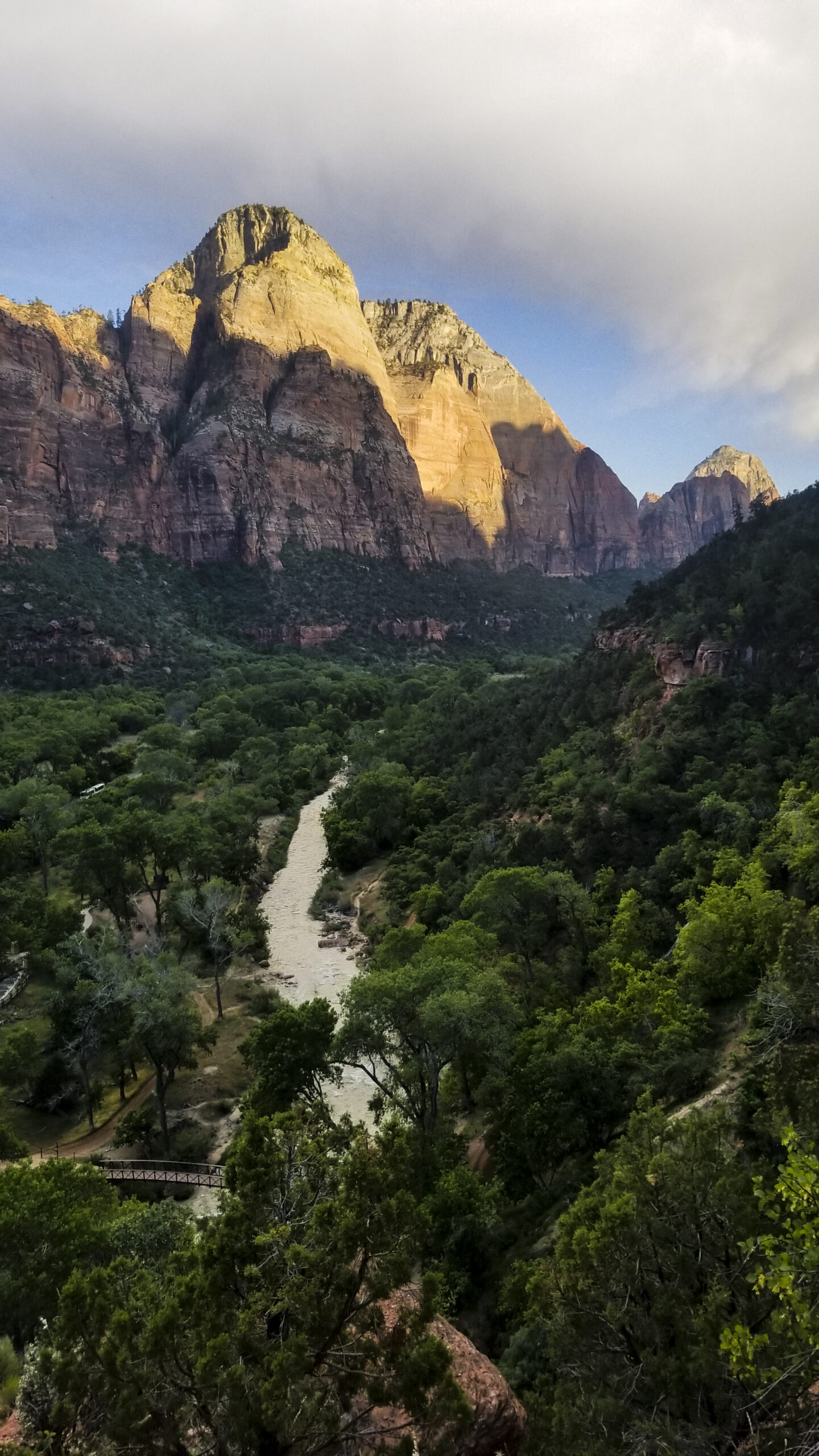
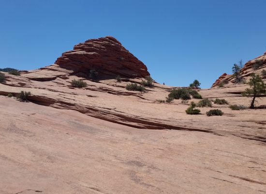
Lady Mountain
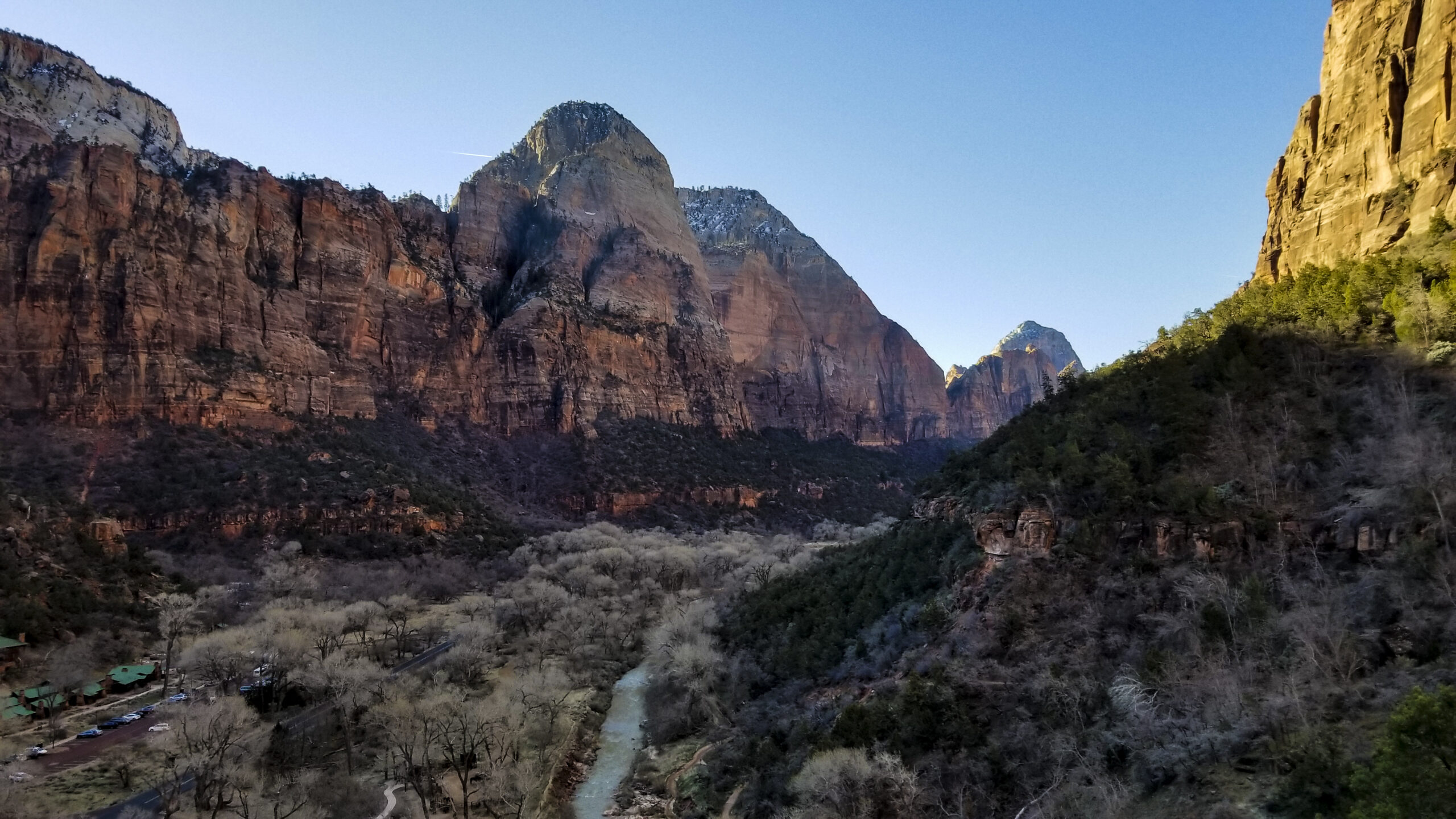
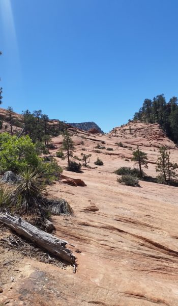
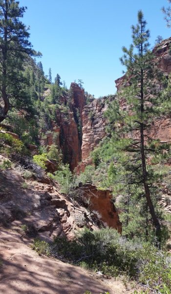
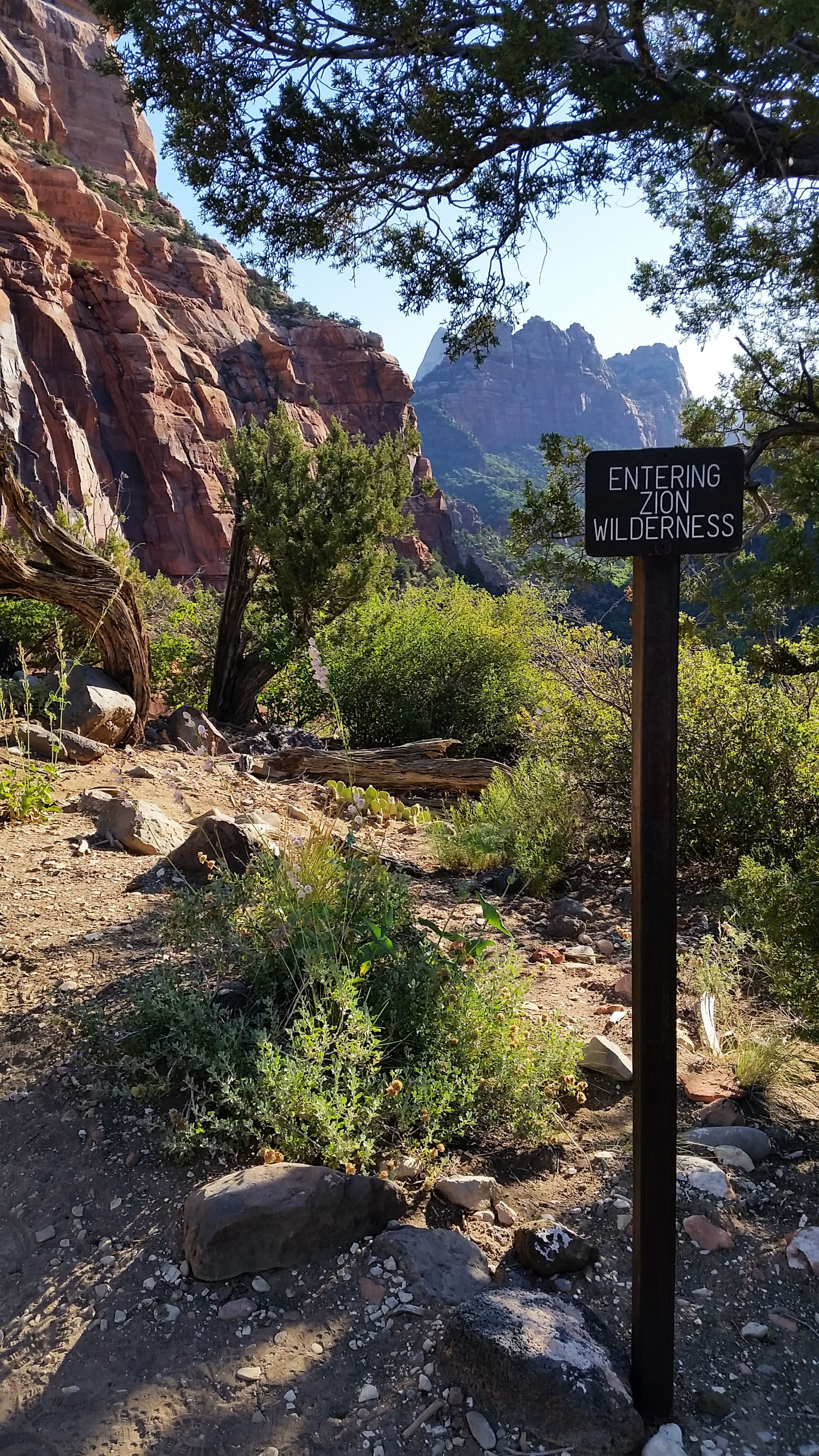
Zion has had a tough spring. The rain has been constant; the snow has capped the orange cream sandstone peaks more times and later in the season than any local has seen for quite a while. The Virgin is rushing too high for the Narrows to open, rock falls closed Observation Point, and road closures have kept visitors from Kolob Canyon. But, there are more options to this place than the highlighted dotted lines on the visitor center maps. This account is about the ascent of one of those routes.
Here’s a little back story: during the height of putting up Via Ferrata routes across the United States, Zion was no different. Completed in 1924, the park encouraged people to ascend the 2600 ft from the canyon floor to the top of Lady Mountain. After having to save several weary hikers, Zion finally abandoned the route in the 60s, taking down the cables, and cutting most of the bolts. But the route still exists as a fun, adventurous mountaineering route. It’s definitely worth the time to get spectacular views of the canyon from a different perspective, and takes you well away from the hoards of tourists on more conventional trails.
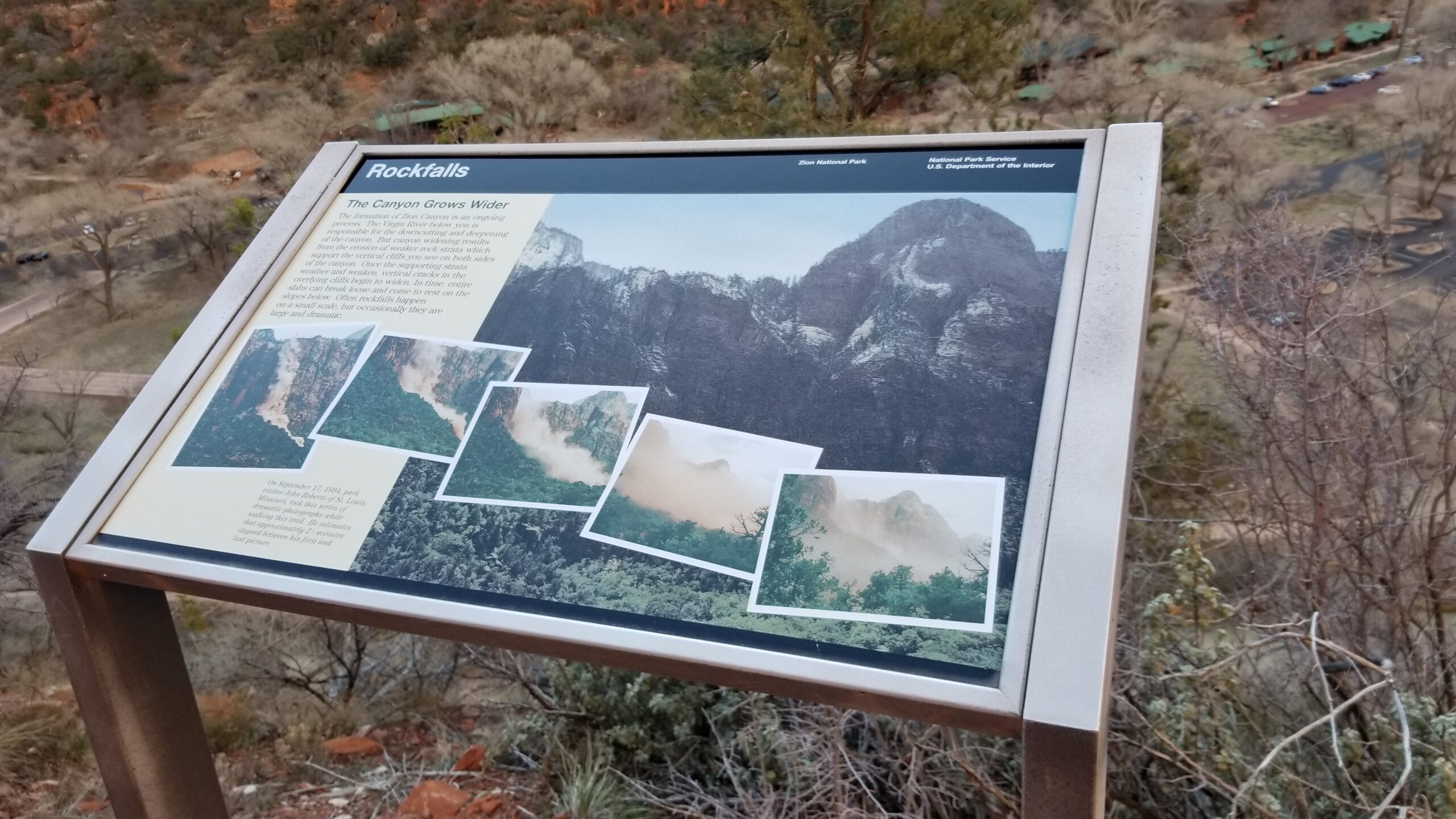
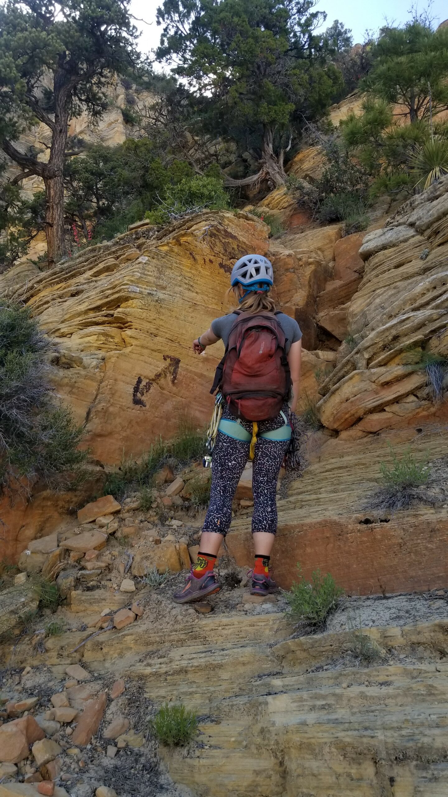
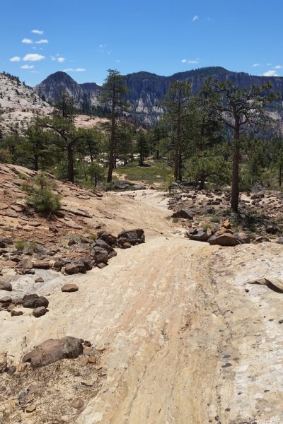
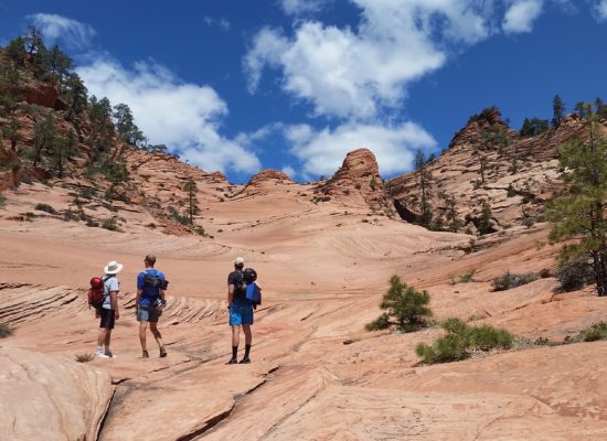
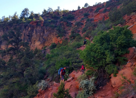
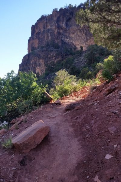
People may give you funny looks as you climb on the Zion Shuttle bus with a harness and helmet strapped to your daypack, but just a 30m gym rope and a few cams (Black Diamond 0.75, 1, 2, 3) is all you need for this adventure. The shuttle will navigate up canyon while the towering walls keep watch and the doors open and you get off at the Zion Lodge stopHead for Emerald Pools, just after crossing the Virgin River Bridge, turn left, away from the crowds and up the closed Kayaenta trail. They are working on the closure; it’s coming along and they’re doing good work. Go up the switchbacks and pass the pour offs until taking a brief moment at a sign documenting a rock fall across the canyon. Take a moment and take in the views, check out the river rolling through constantly forming the canyon around you. Don’t worry, the whole climb ahead of you will still be there after your break.
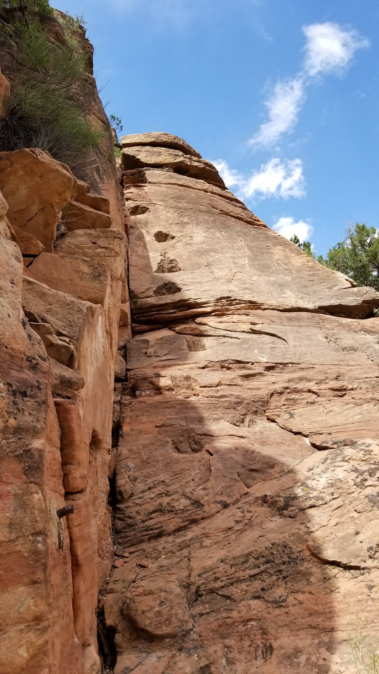
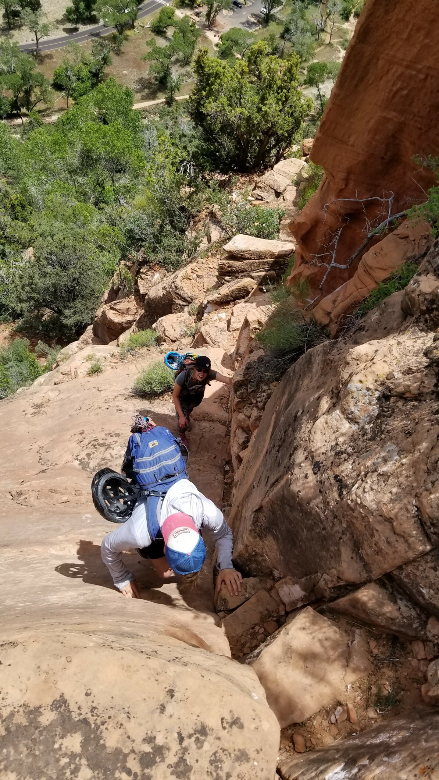
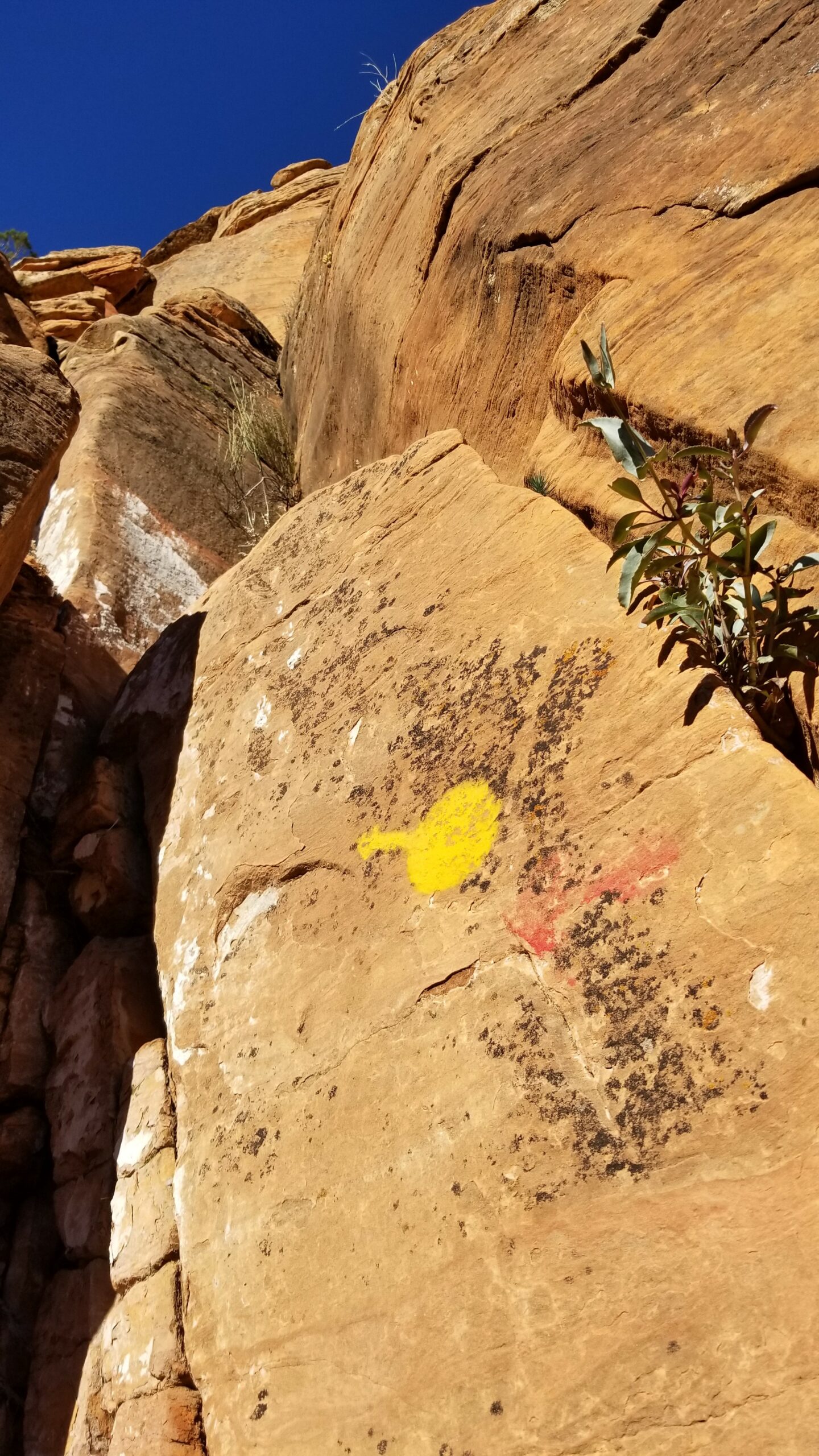
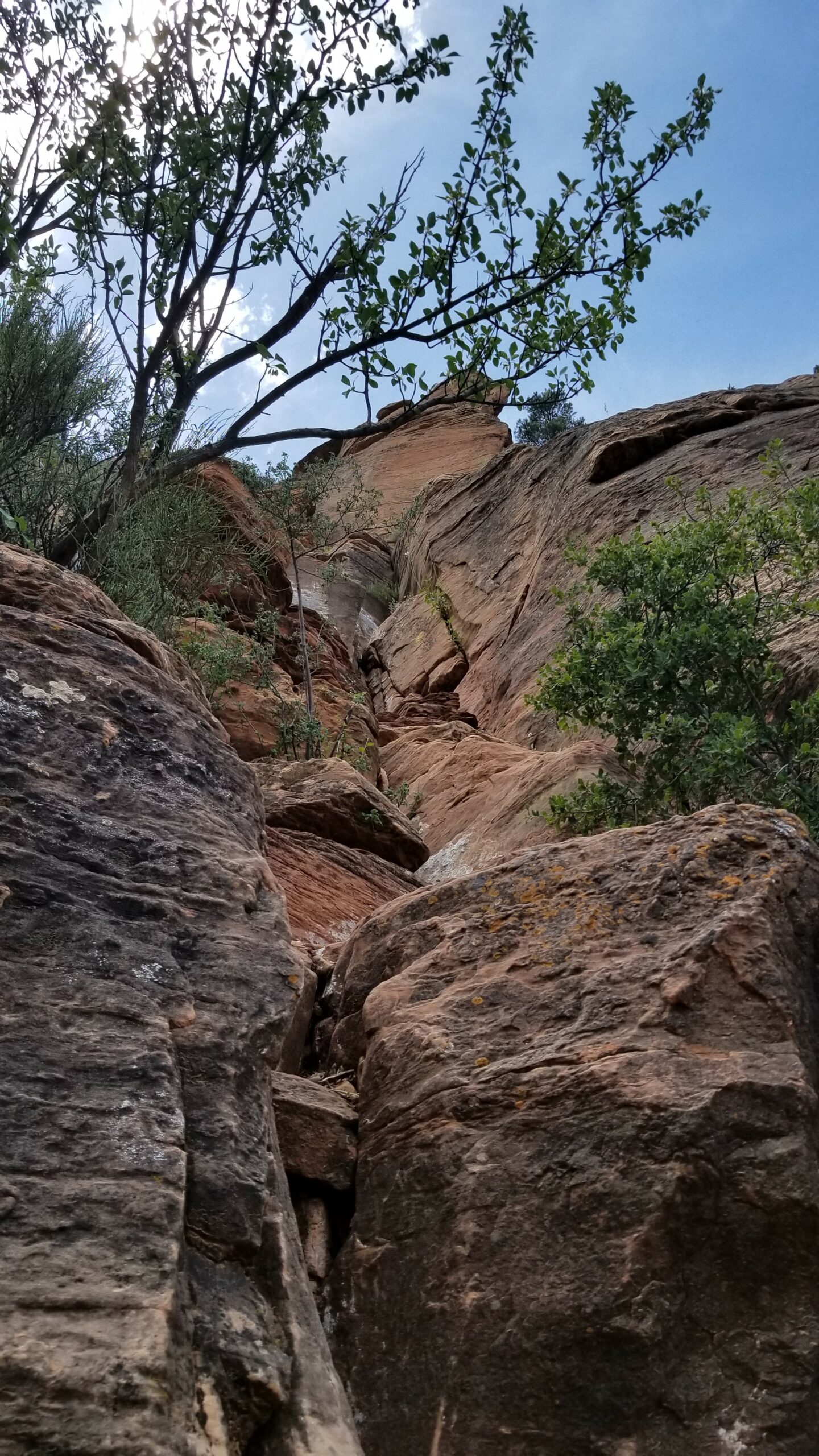
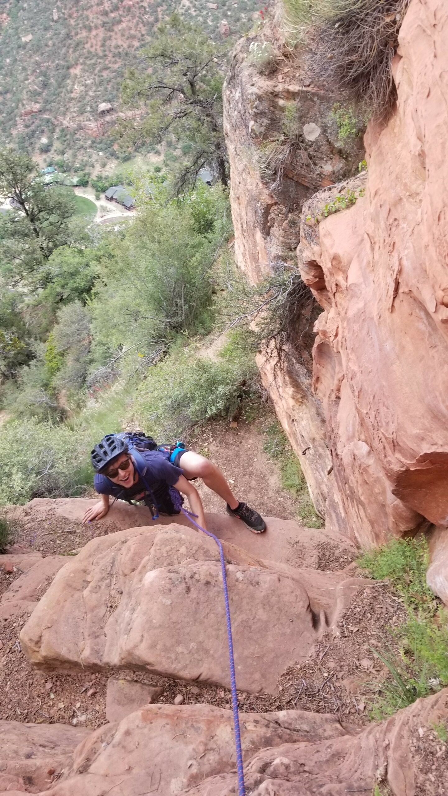
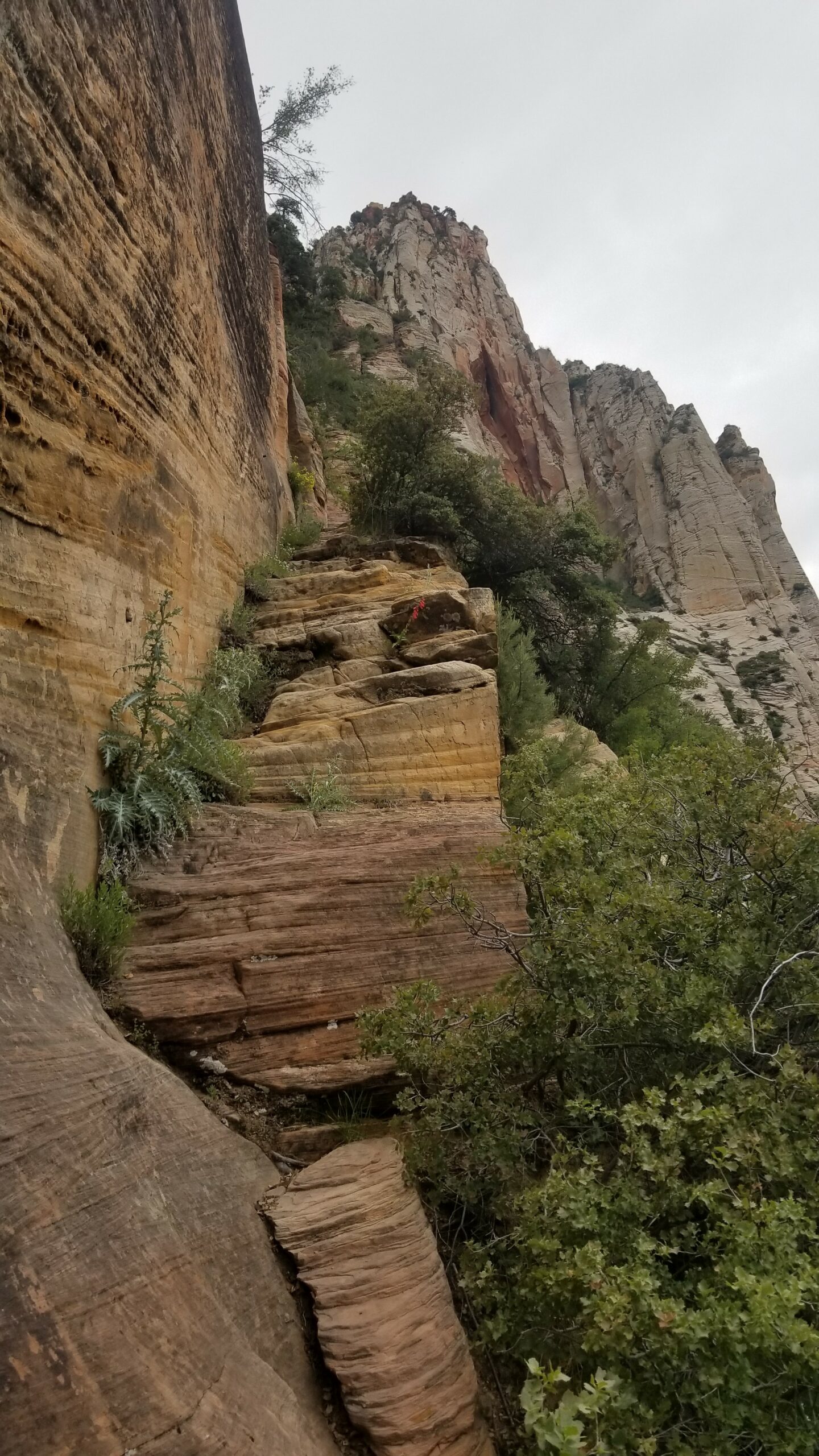
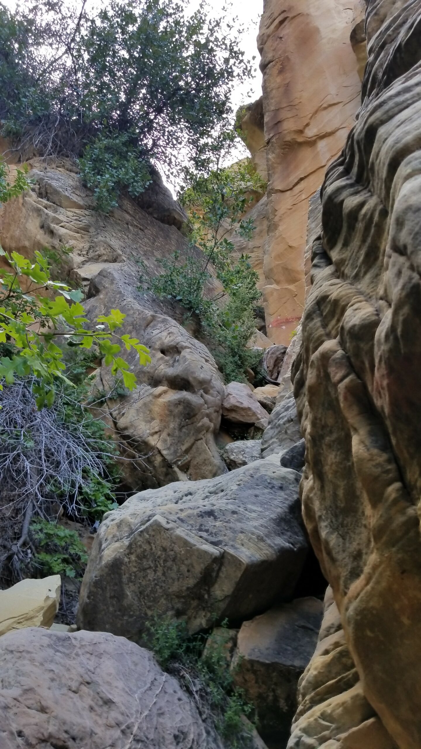
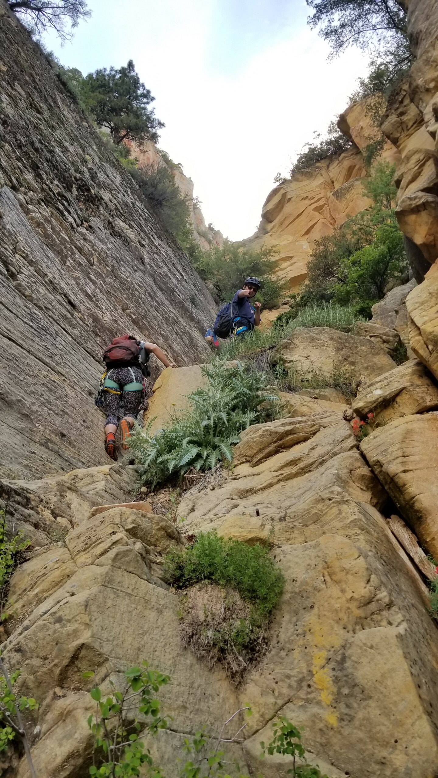
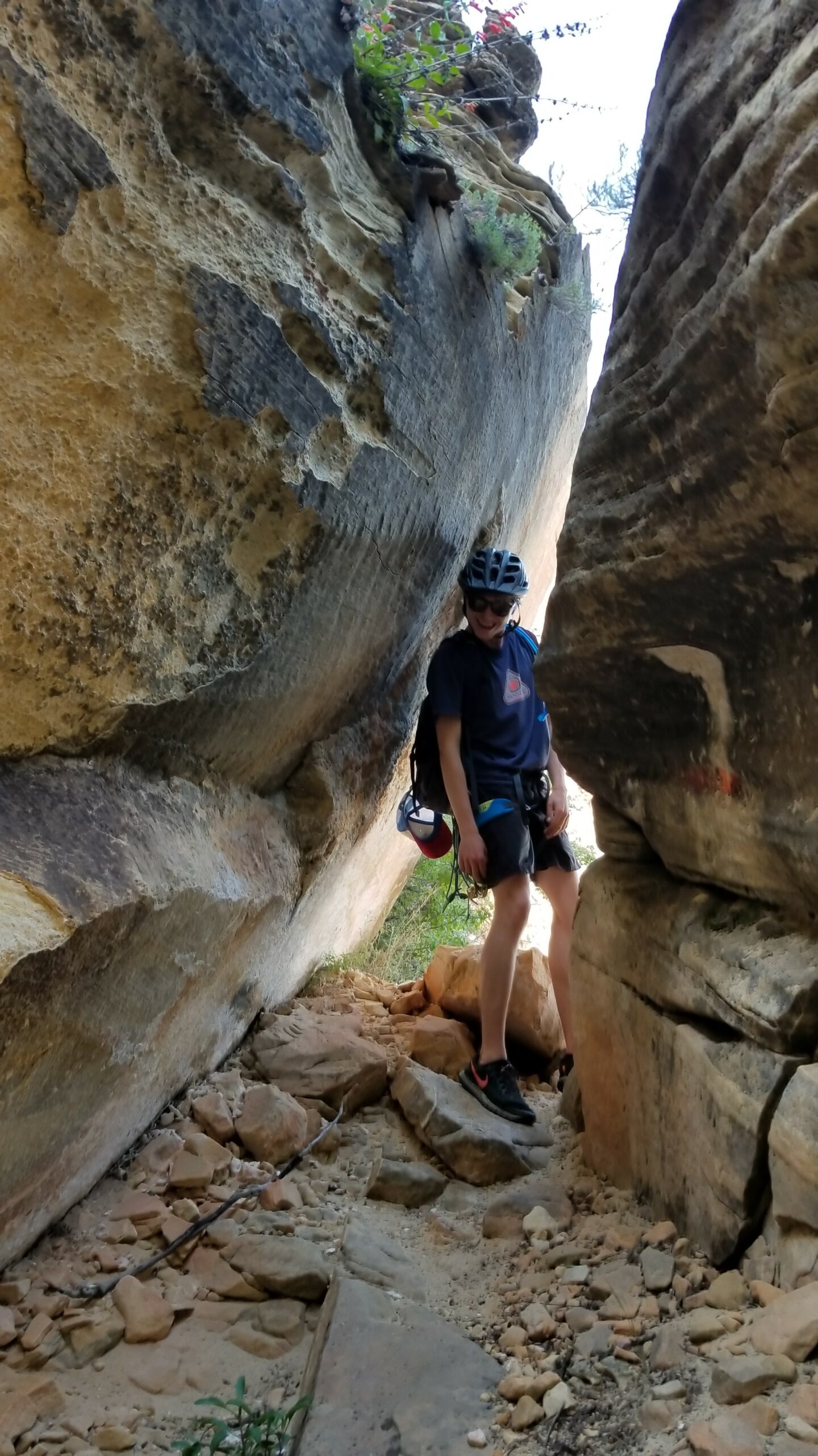
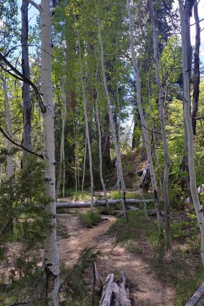
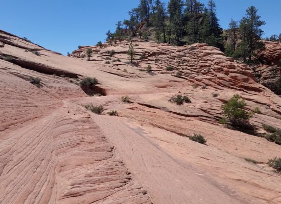
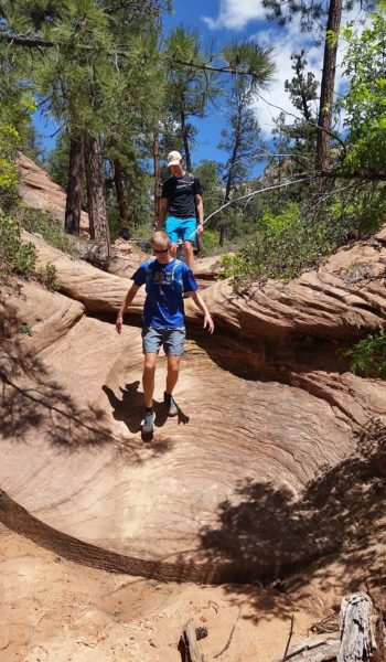
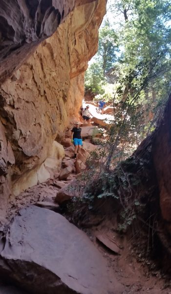
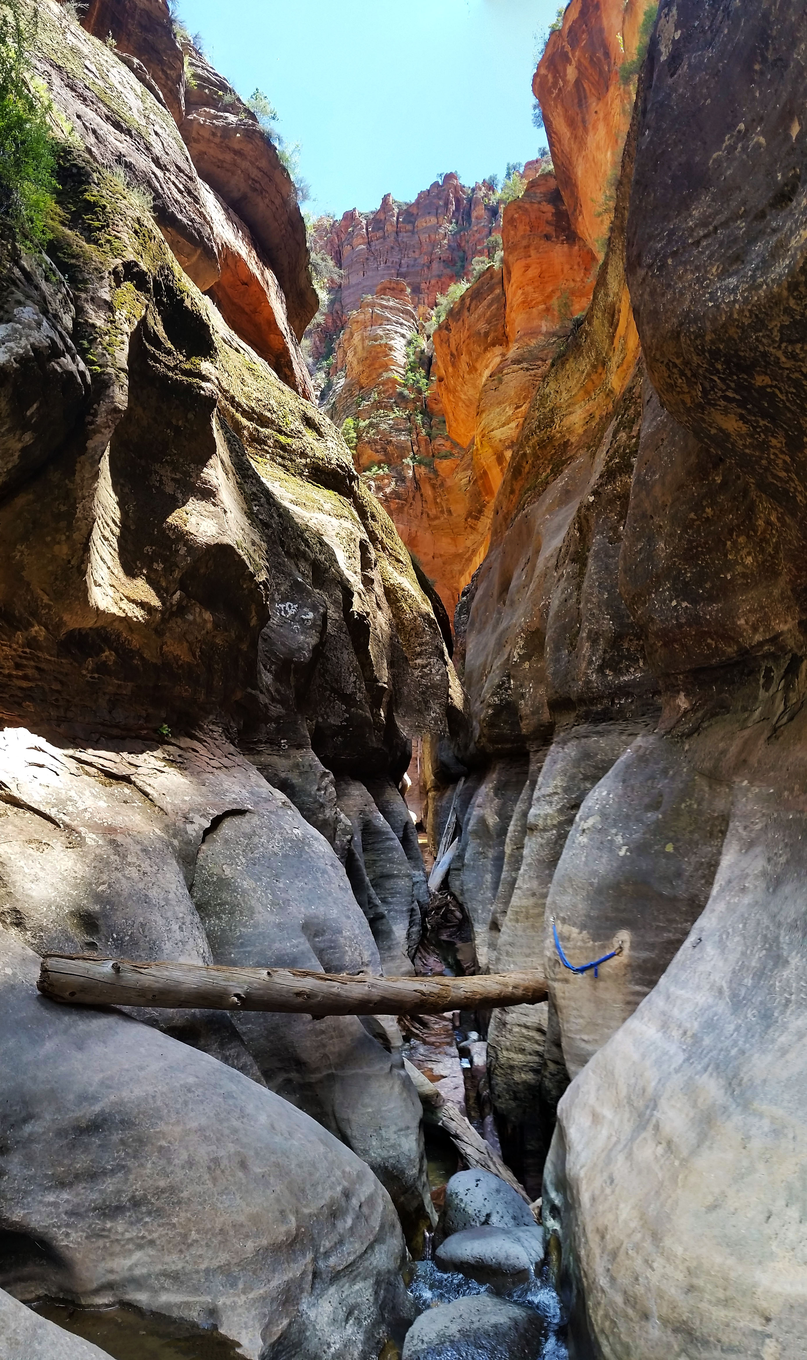
Now walk about 100 ft and find the climbers trail (it’s actually well beaten and thecairns makring its departure from the main trail may or may not be still there) on your left, hike up, trekking on, switchback after switchback, until finally you find a vertical rock face. There will be a yellow bubble with a spray painted arrow pointing up marking the start of your ascent. Take the class 3/4 up before taking a switchback to an exposed face with moki steps cut in. Scramble on (or rope up if you’re nervous), but it soon turns back to class 2/3 as it continues going up and up. Just follow the trail marked with spray paint and a few faint footprints until finally you find a short low class 5 section heading into a chimney. Rope up and place a couple of cams to protect your ascent from a 60’ drop below. It’s pretty mellow, I led it all with my tennis shoes. You can protect your second from an old but sturdy Via Ferrata bolt at the top, making for an easy belay.
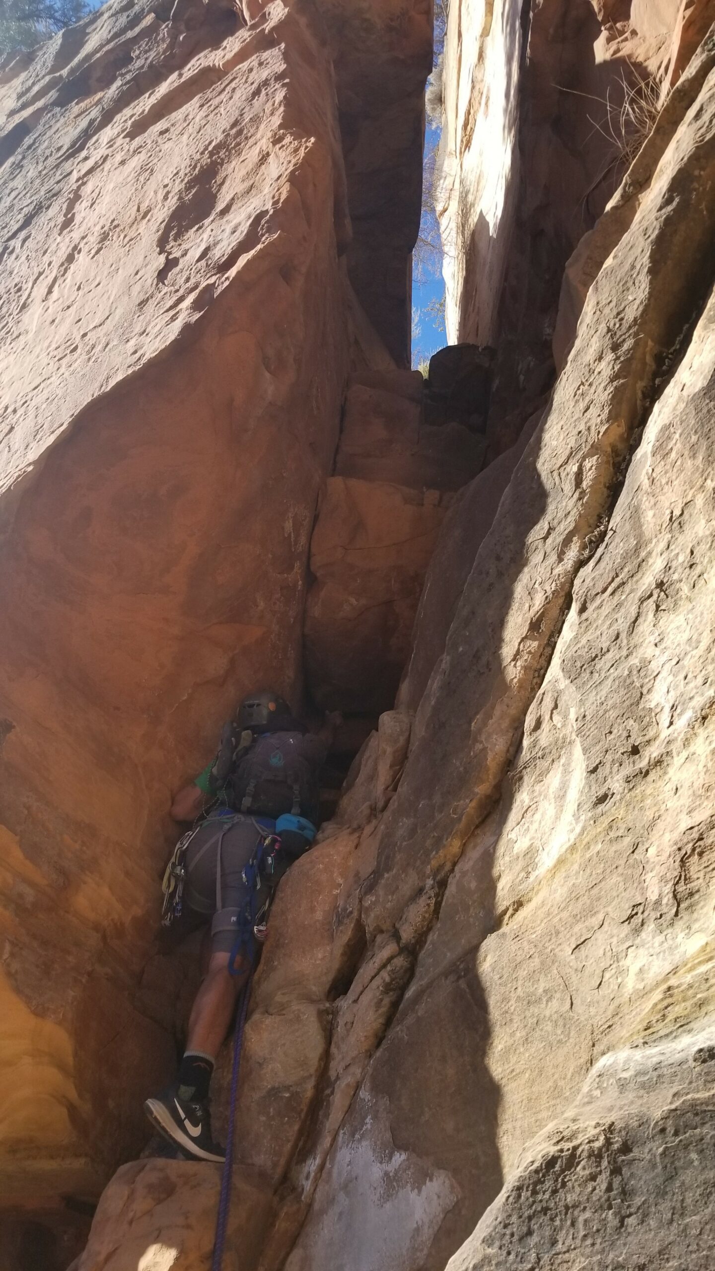
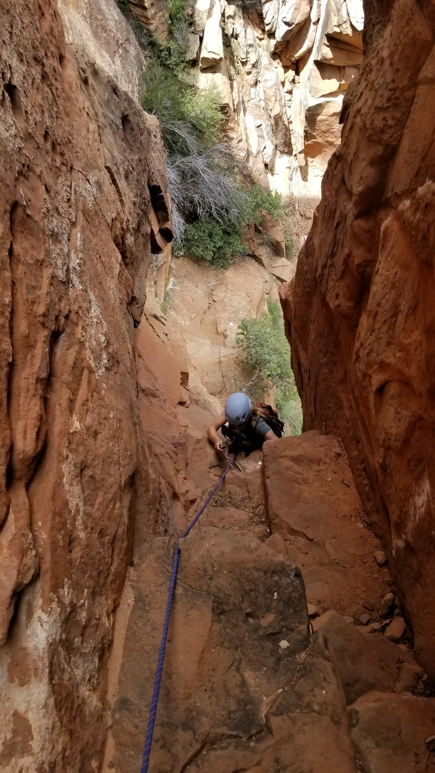
Hike on up a bit until faced with a couple of slopey Moki steps. It’s a weird start but the Moki steps get better as you go up. From here it’s a pretty easy-to-follow hike up to incredible views of the canyon. Some may want to rope up here, your choice. You’ll soon be skirting a small ledge westward following a footpath until finally needing to ascend north again. Up and on you go on a sandy slim ledge, it’s the only way to go that isn’t class 5. Soon you’ll come to a bulging sandstone face with a bolt at the bottom. This is your second class 5 rope-up point. Sure you can solo it, but who wants to make a small mistake in tennis shoes only half way to your goal?! After belaying your second over this short 20’ climb let the hiking continue. Switchbacking, scrambling, and finally you get spat into the final chute. You’ll know it when you get there!
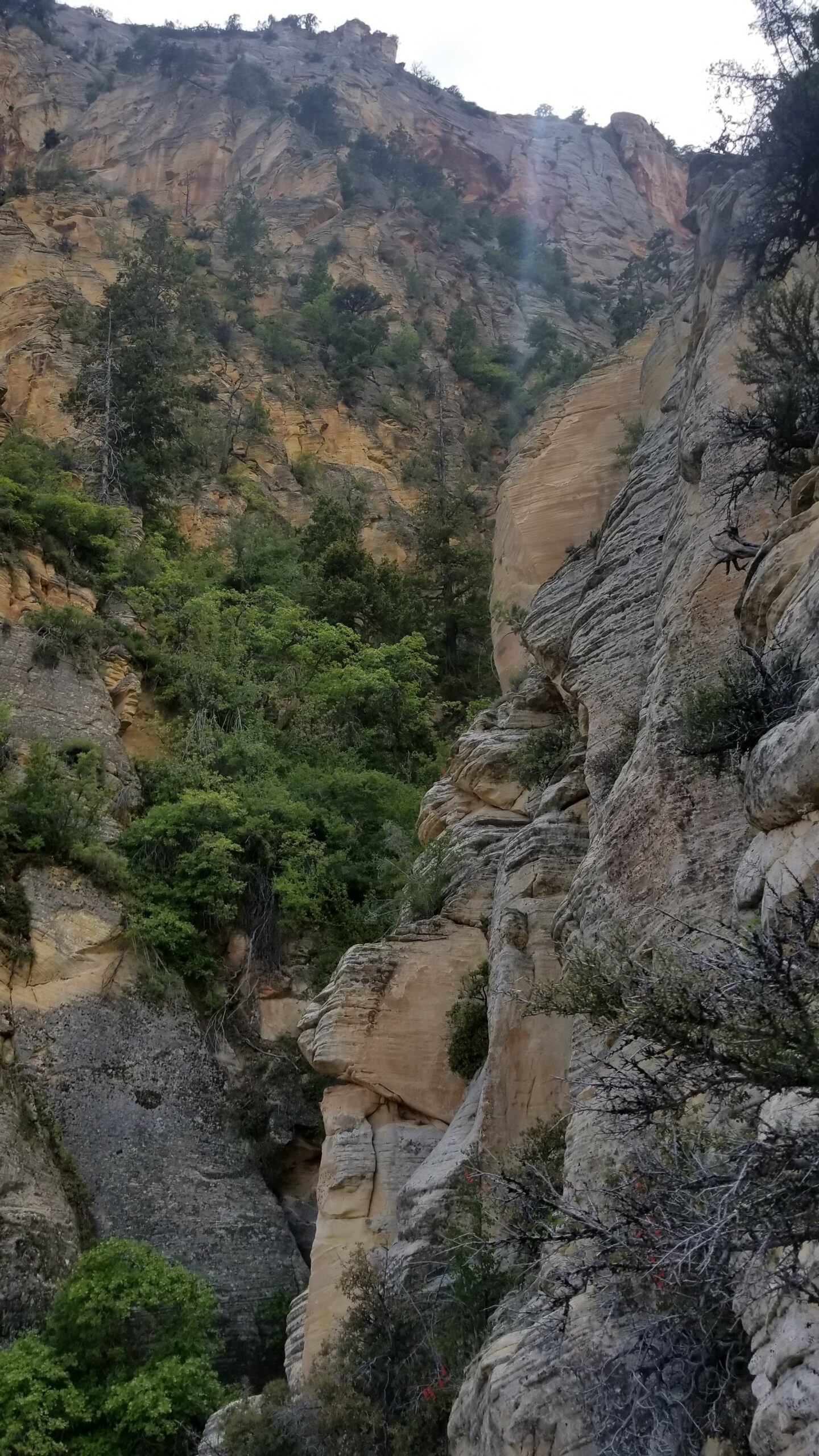
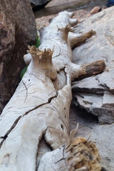
Start climbing into the chute, after about 20’ look to your left and find a small hidden climbers’ trail that ascends the left side of the canyon near some tree roots. Do not stay in the bottom of obvious chute get on the wall on climbers left. Without this trail you’ll get off route and have to do some weird sloped traversing from a tree belay to get back on (I speak from experience, we found the easier trail on our way down). Once past this obstacle, youll find a few via Ferratta bolts bent over on your left side. Just keep on up the canyon past a growing tree and a fallen dead tree until finally exiting climbers’ right on a sandy short scramble.
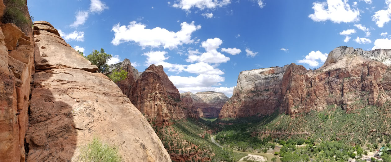
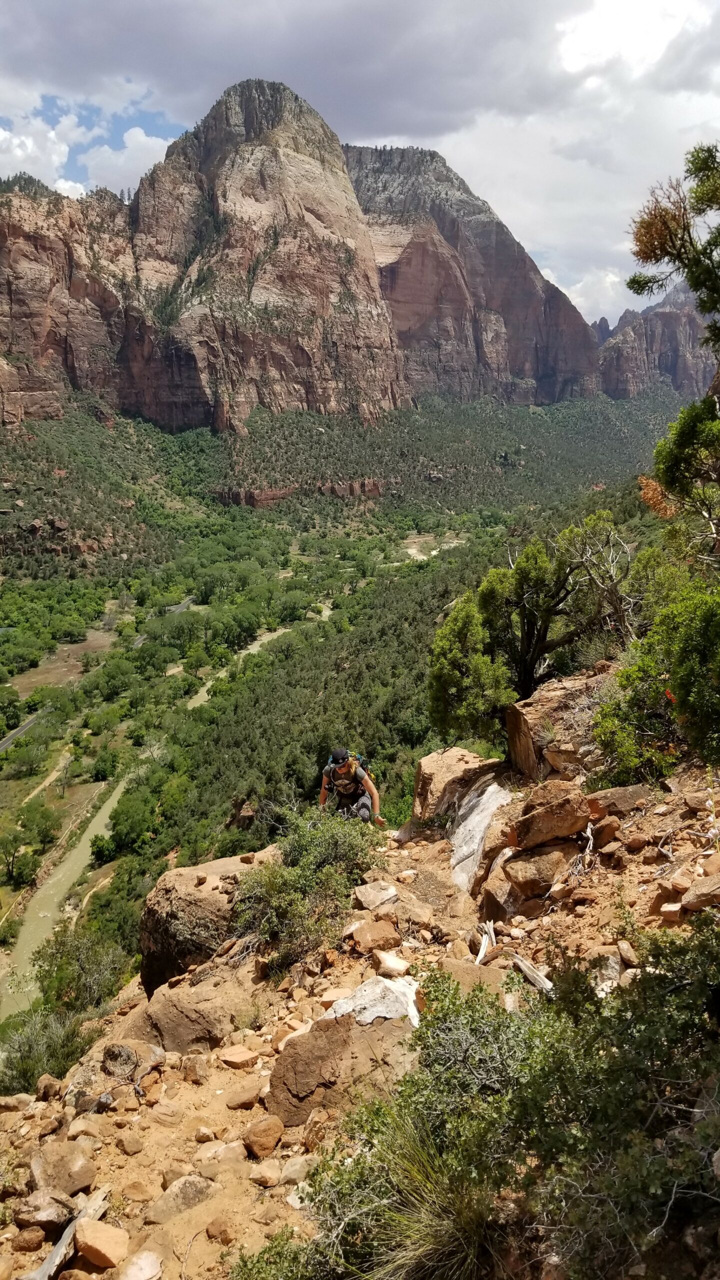
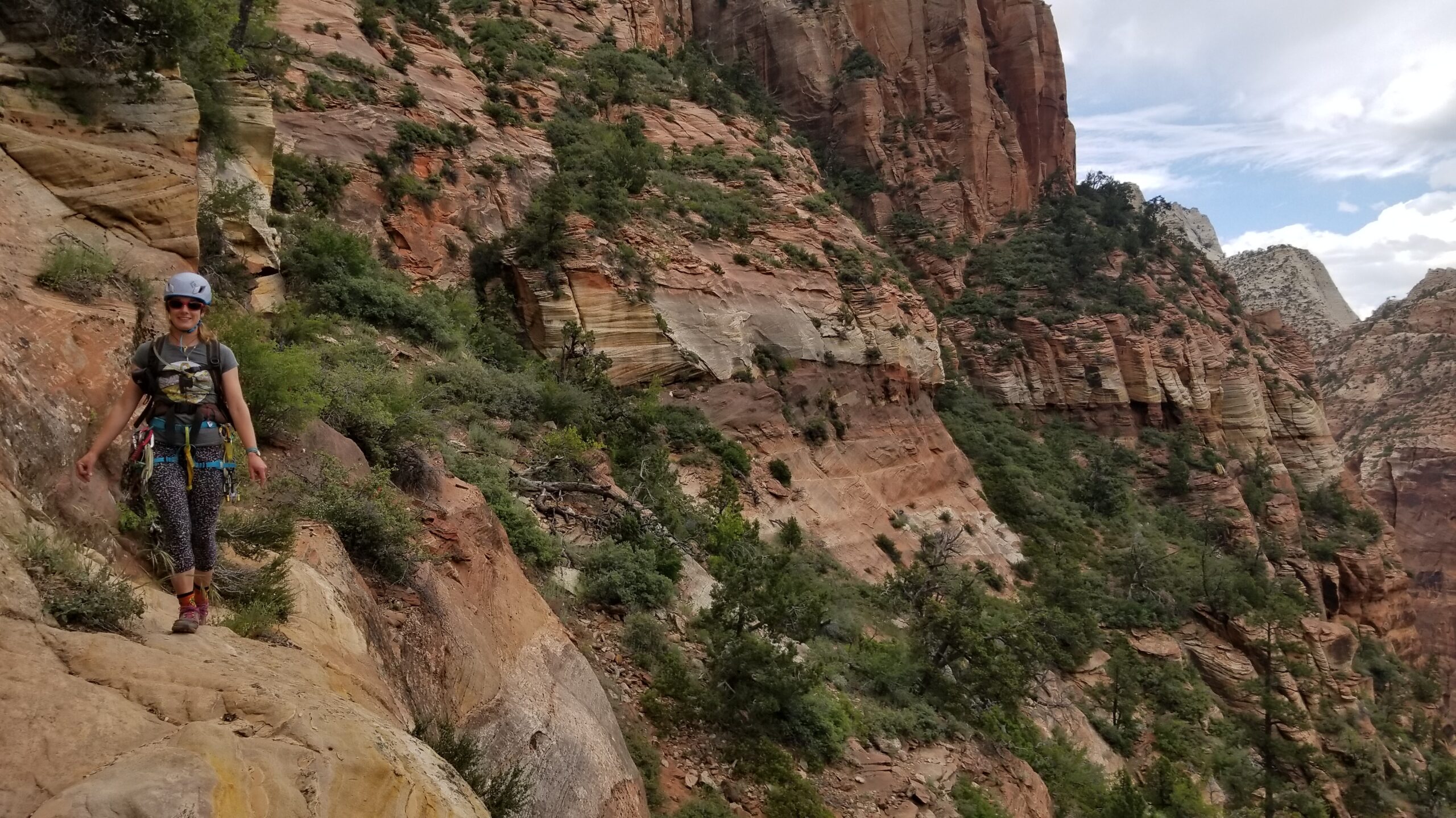
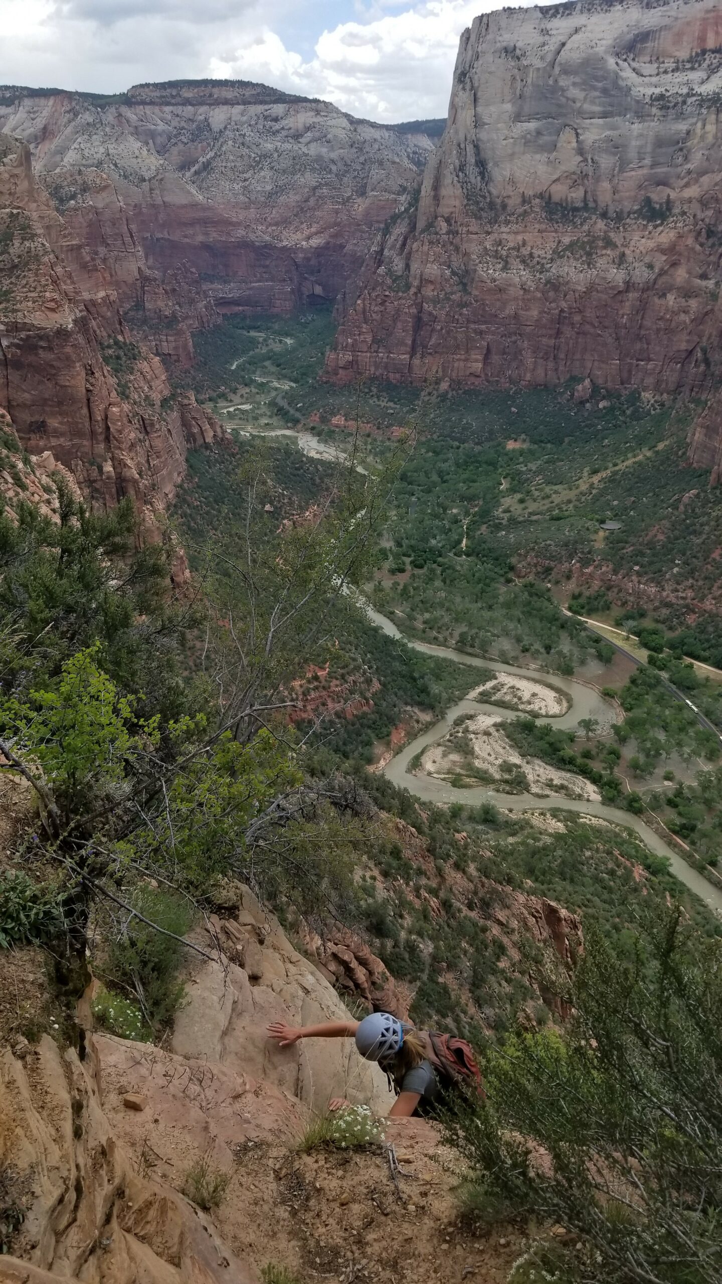
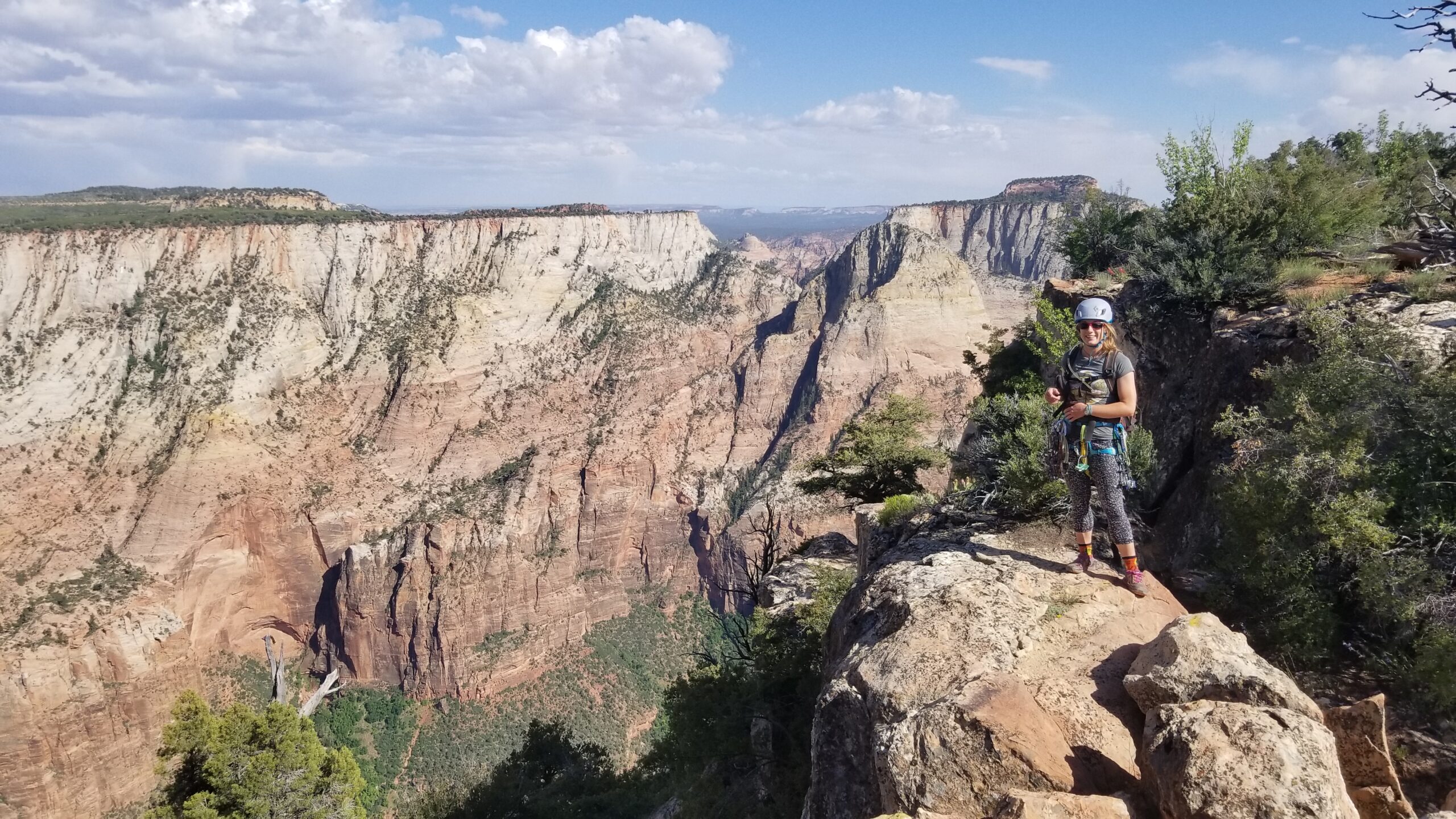
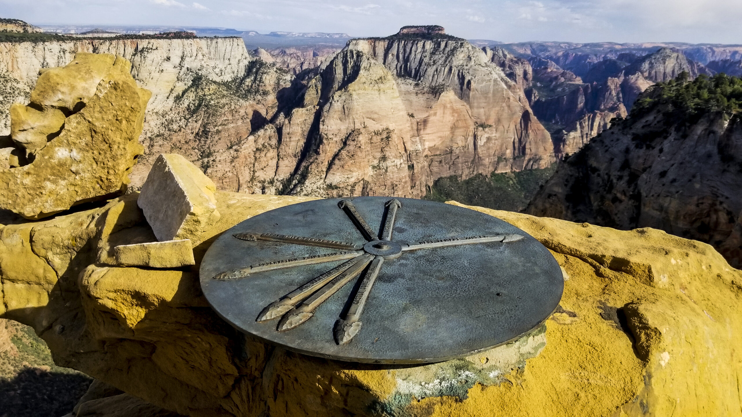
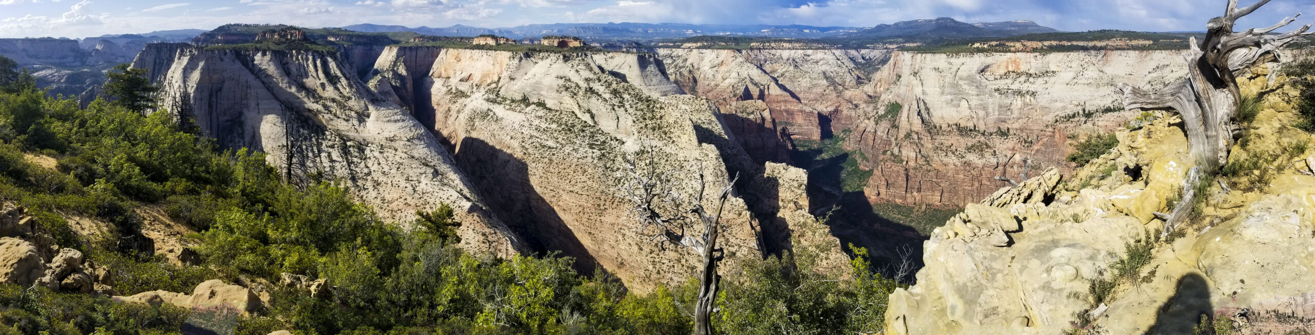
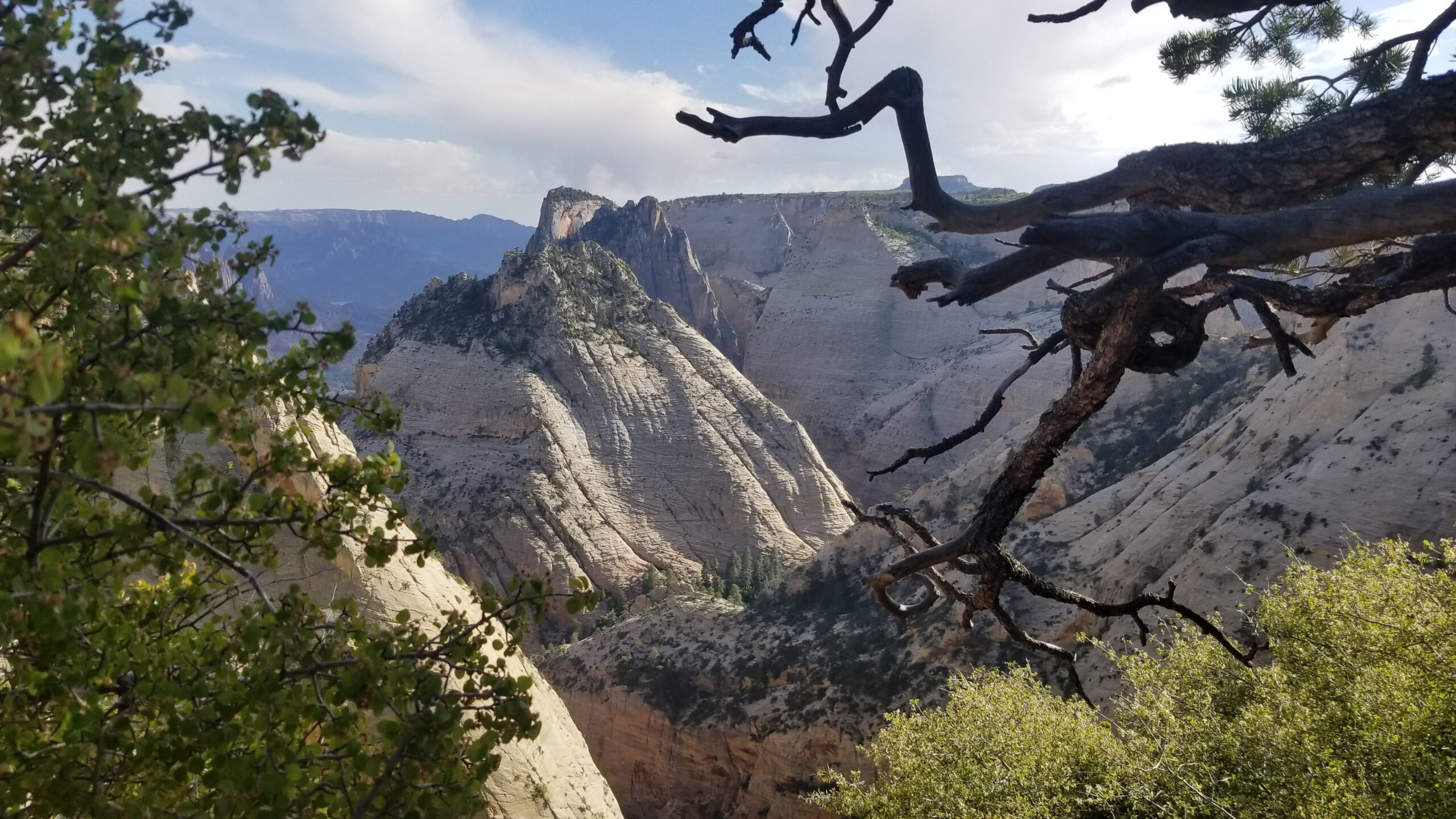
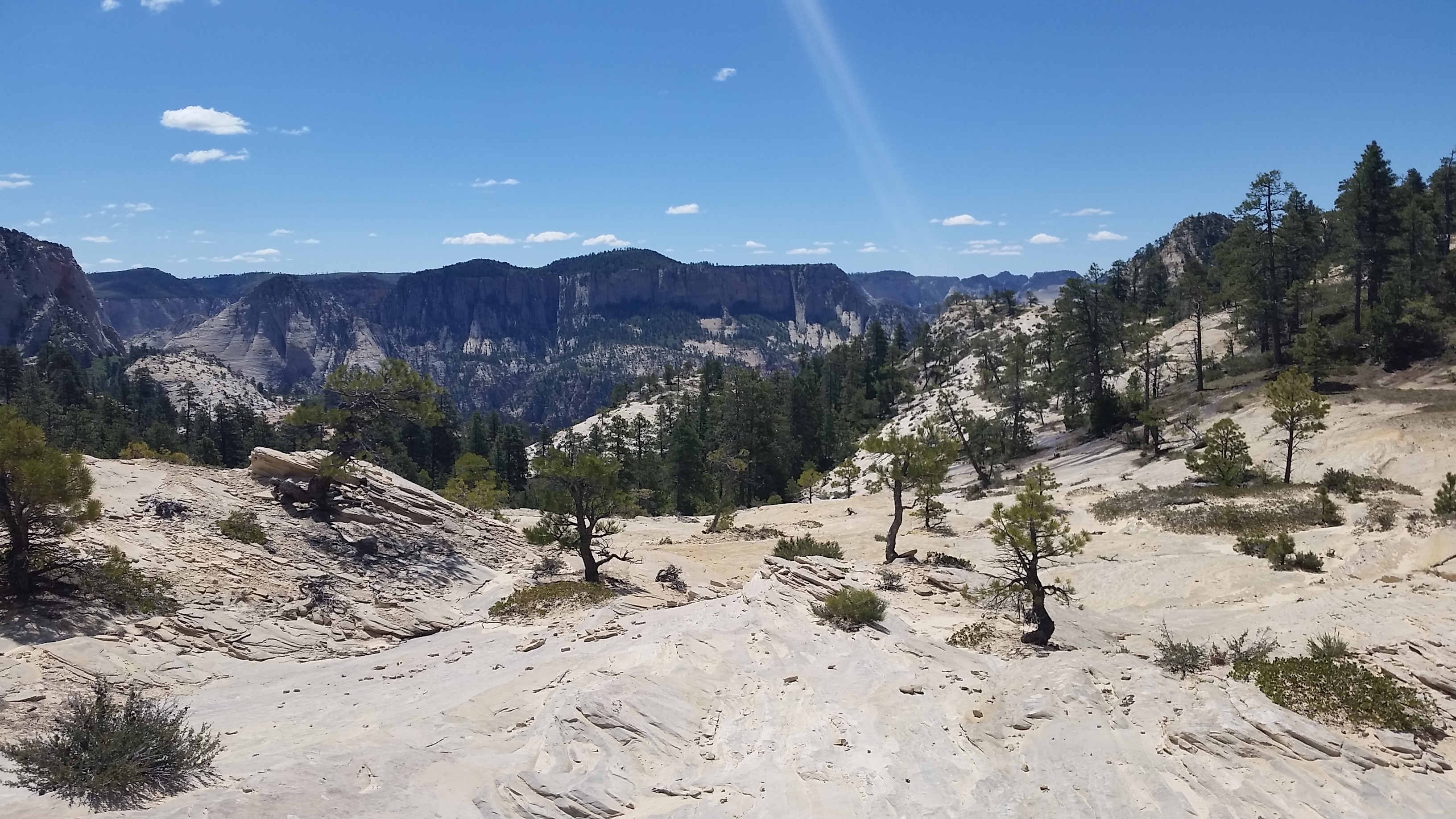
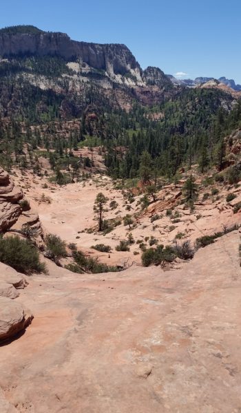
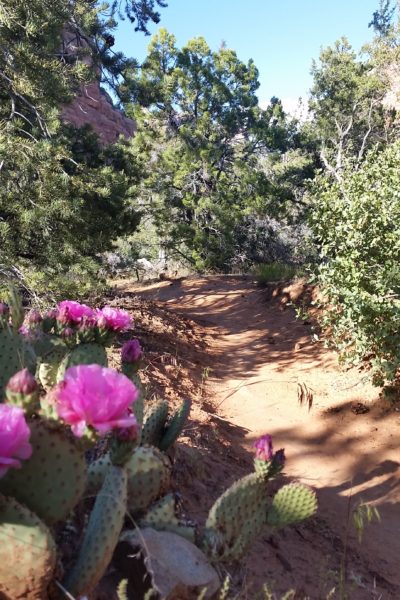
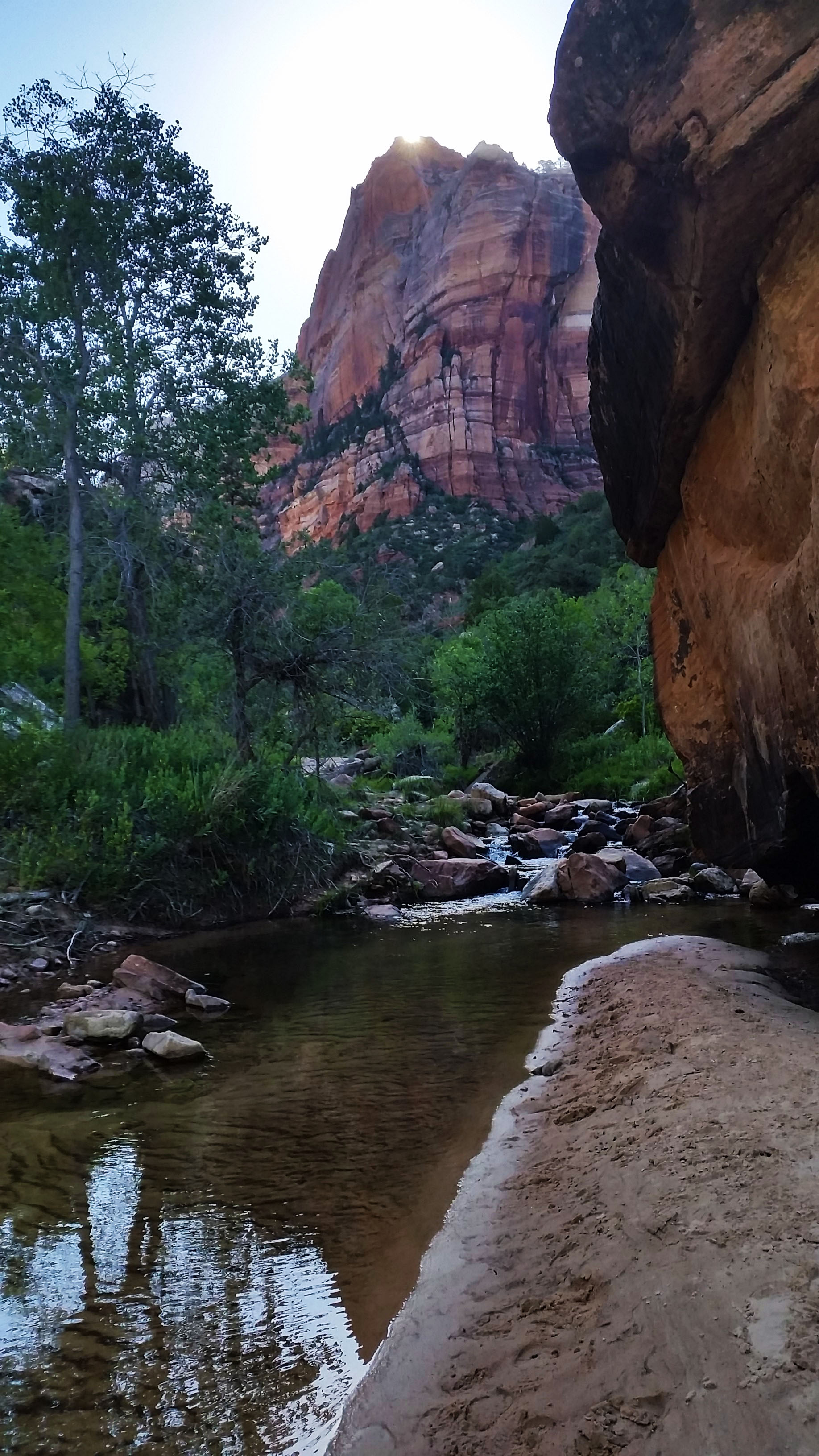
From here use your route finding skills up and through the short scrub and sandy scrambles until finally popping out on the ridgeline. The views are absolutely incredible. You realize the left cliffs of Zion Canyon are only a sliver of land that divides the canyon to the north. Keep following the trail to the north east until finally the true summit comes into sight across a ravine. Just follow the trail headed northward until finally scrambling up some easy class 3 short moves to the summit plateau. A short walk will soon blast you with incredible 360° views and a little taste of accomplishment after your fun 3 hour ascent (we took our time). Enjoy the summit and the copper plate pointing out the buttes in the distance. Take it all in along with your lunch before heading back down the trail you ascended back to the shuttle.
We rappelled in 4 places:
1) Down the final chute at a bent over Via Ferrata Bolt
2) Down the 2nd class 5 sandy bulge
3) Down the 2nd set (if counting from the bottom up) of Moki Steps
4) Down the 5th class chimney.
HIKE/CLIMB INFORMATION:
- Lady Mountain Route: https://www.citrusmilo.com/zionguide/ladymountain.cfm
CLIMB/HIKE STATS:
- Weather: Hi 60s, Low 40s, Partially Sunny
- Water: 3 liters
- Food: PB&J, 1 protein bar, 2 Nature Valley granola bar, bag of salt & vinegar, gummy worms, apple
- Time: 6 hours
- Distance: 3.6 miles
- Accumulated Gain: 2,800 feet
- Climbing Rating: 5 Easy Trad
- Number of Pitches: 2
GEAR:
- SPOT Gen3 Tracker
- Camelbak 20L Pack
- Black Diamond Helmet
- Petzl Corax Climbing Harness
- 2 Black Diamond screw carabiner
- 4 Phantom DMM screw carabiner
- 6mm Accessory Chord – Anchor
- Black Diamond Camelot C4 Cams – .75, 1, 2
- 4 Alpha Trad DMM quickdraws – Alpine draws
- Black Diaimond ATC Guide
- 60 ft 10.1mm Rope
- Webbing/7mmCord for personal anchor
- 120′ Sling for anchors
- Arc’teryx Chalk Bag
CLOTHING:
- BadHippieCo T Shirt
- Arc’teryx Hoody
- Cotton Handkerchief
- Patagonia shorts
- Darn Tough Medium Wool Sox
- Nike Running Shoes
The Subway via Top Down – Zion UT (5.20.17)
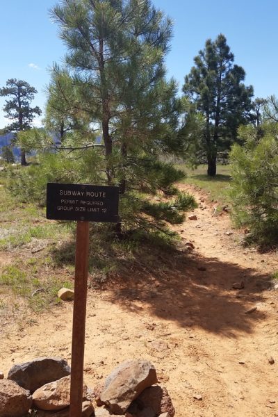
Woken once again by a Saxophone blasting “Careless Whisper” by George Michael Blasts at 4:00 am, I shifted in my bag. Déjà vu from the Buckskin trek the morning before? Nope! Now it was time to pack our things up and head into Zion to grab our permits for the top down canyoneering route called The Subway! Once again Andrew, Larry, Eric, and I woke, packed up, and got ready for the day to come.
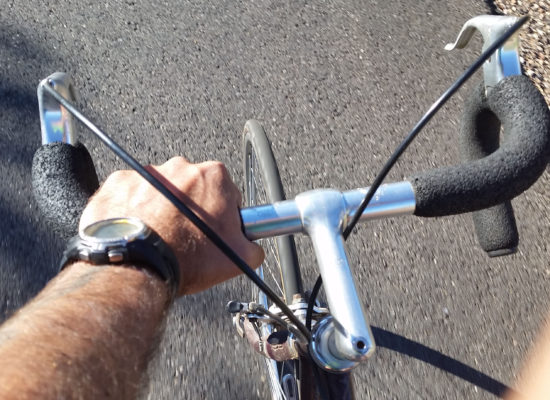
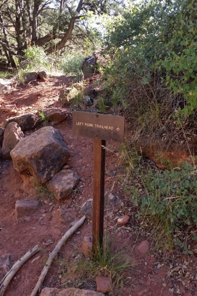
Piling into the truck with Larry behind the wheel, we headed for Zion. The miles faded pretty quickly despite a rock fall on the east side reverting us to enter instead via Hurricane UT from the west side. We soon found ourselves at the visitor center, running in and grabbing our permits before driving to the lower left fork trailhead and dropping my bike off to complete the shuttle to the start at Wildcat Canyon trailhead. The plan was to start up top, push the 9.5 miles down the technical canyon and pop out at the trailhead where, to add insult to injury, I would ride back up on my bike and grab the truck to finish the loop.
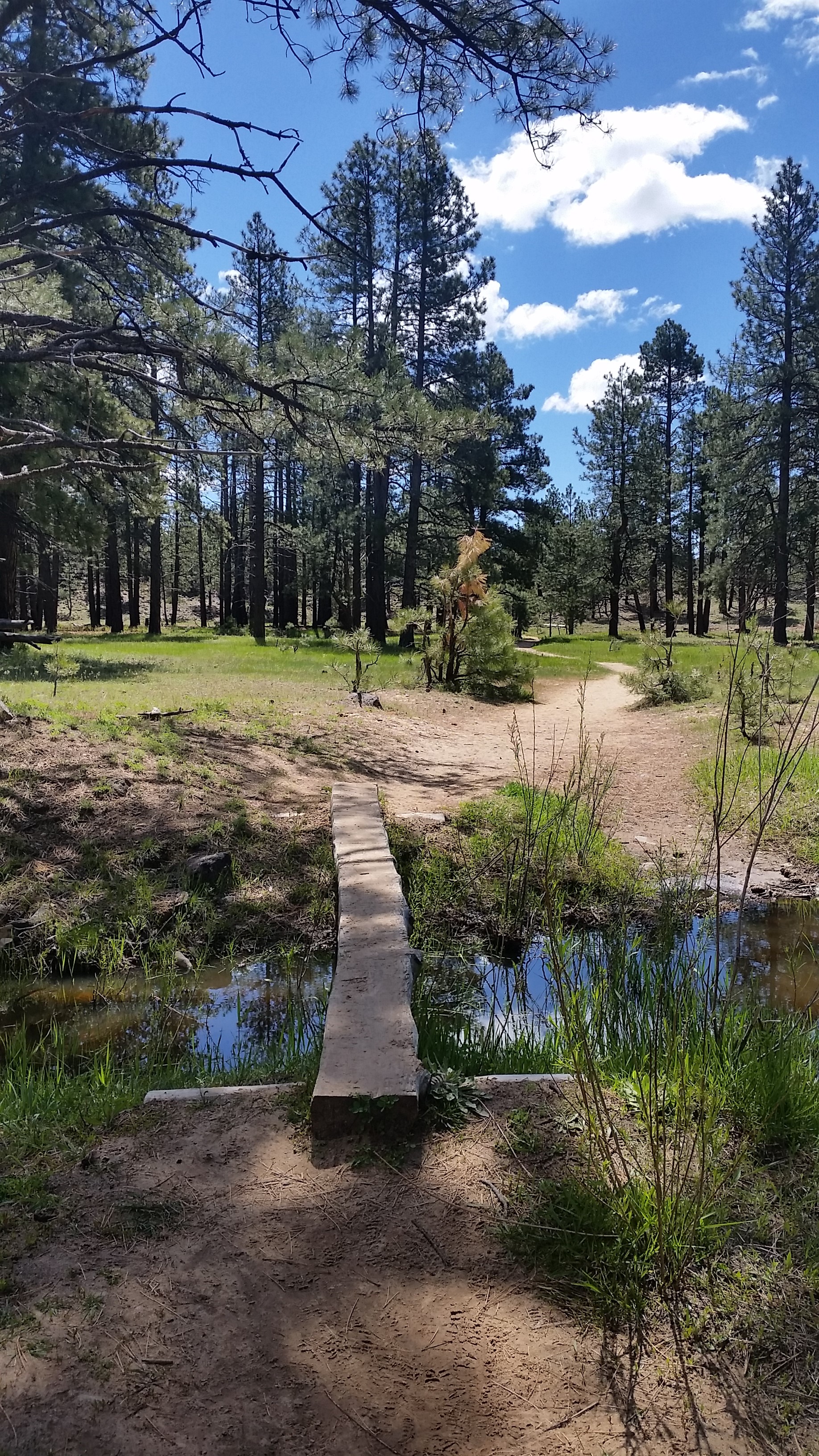
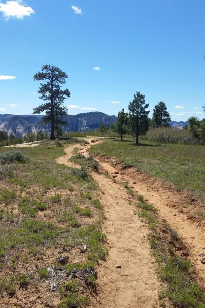
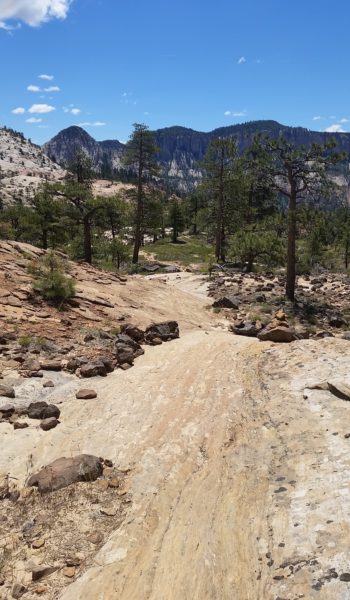
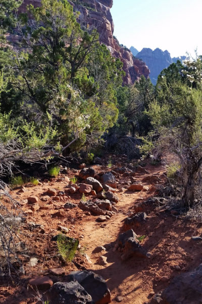
We had our work cut out for us so we stepped out of the truck and gathered our packs together. With everything in order at about 11am we set out on the wide open pine-ridden prairie down Wildcat Trail to the southeast. The bluebird skies only had a few clouds and the temps were perfect… couldn’t have picked a better day!
 Lets get moving!
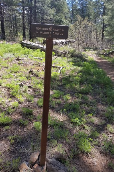
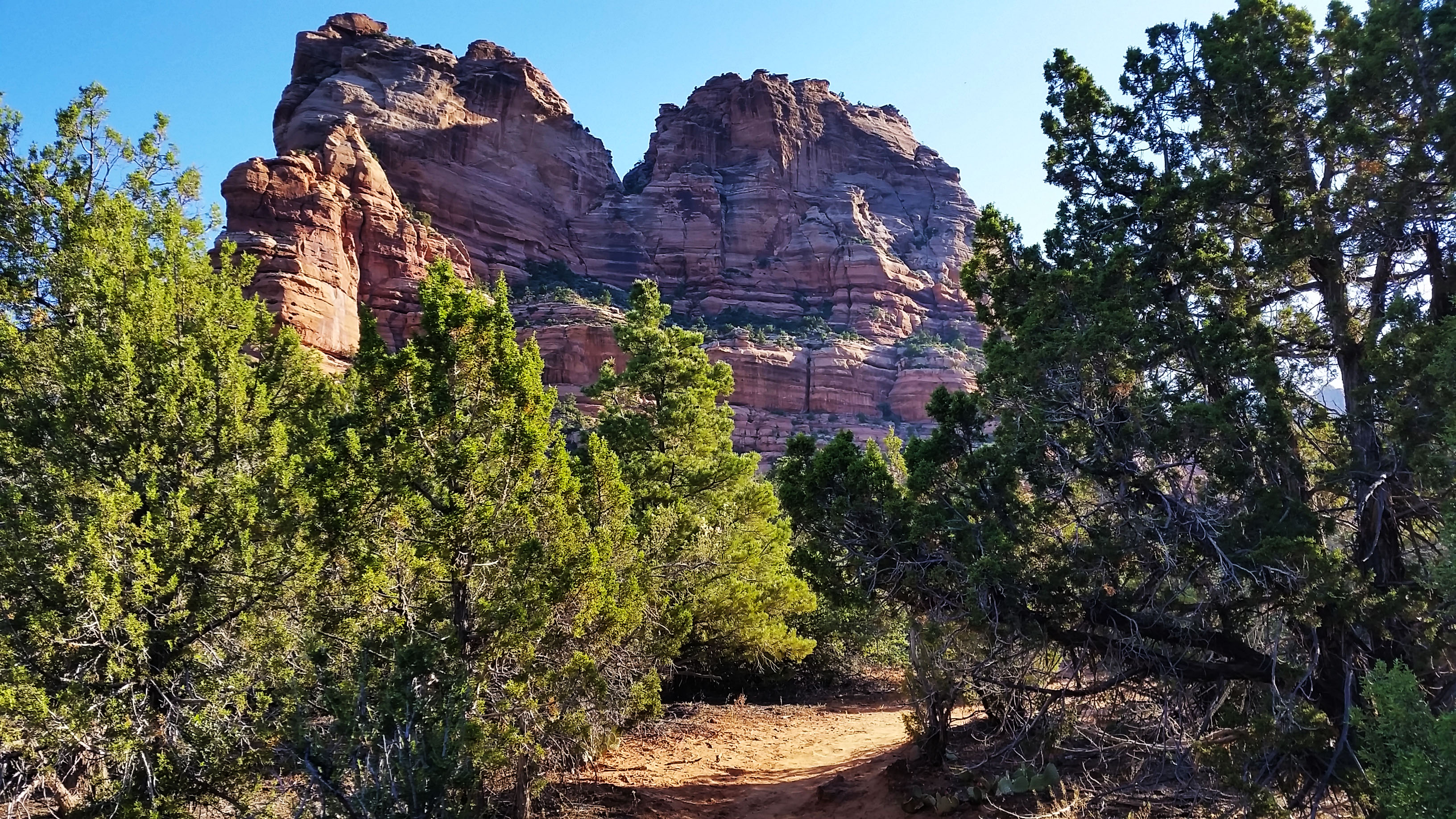
After a mile down trail, we met the Northgate Peaks Trail and turned right headed towards the lip of the dropoff. The blue sky shone through as we edged closer to the sign that was marked “The Subway Trailhead”. We were all excited and clambered on, down a cairned sandstone rock. We were spit onto a well-cairned and traveled foot trail that headed through the woods and down the slick rock. After many gorgeous open views, we found ourselves at the top of the final steep descent into the bottom of the Russel Gulch.
 Slickrock action
 Down down we go
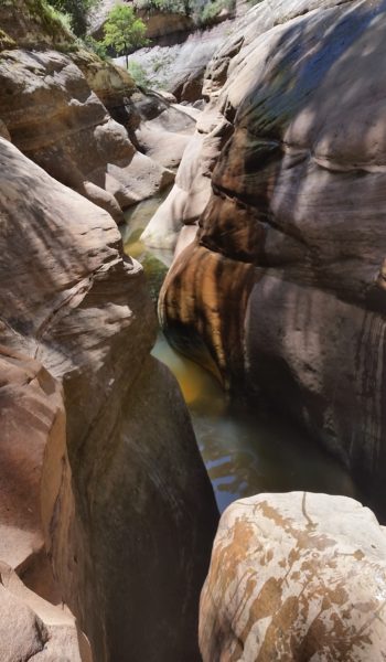
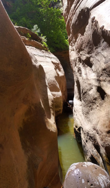
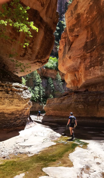
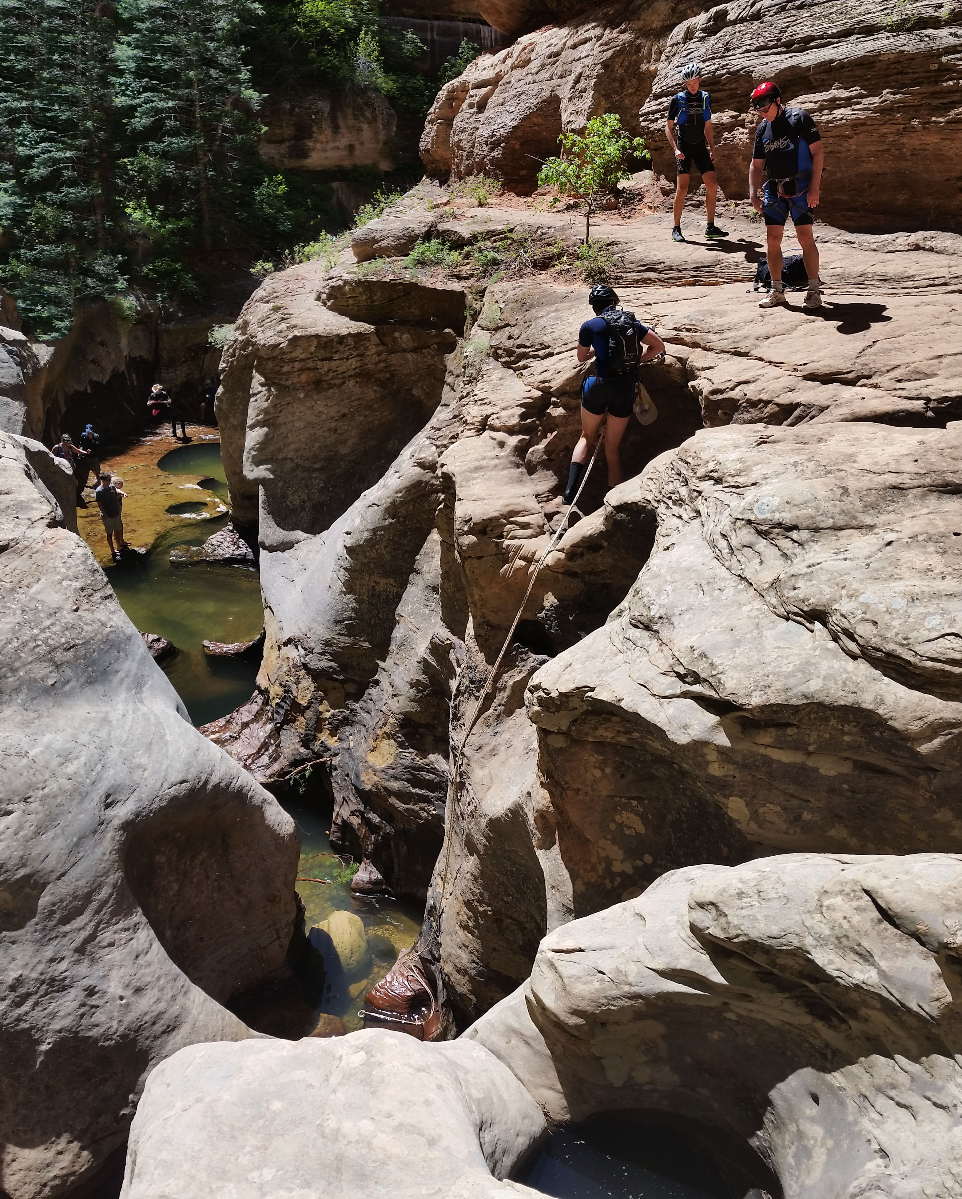
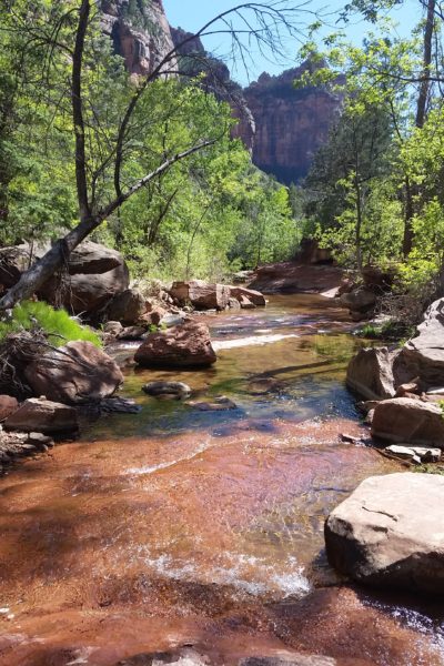
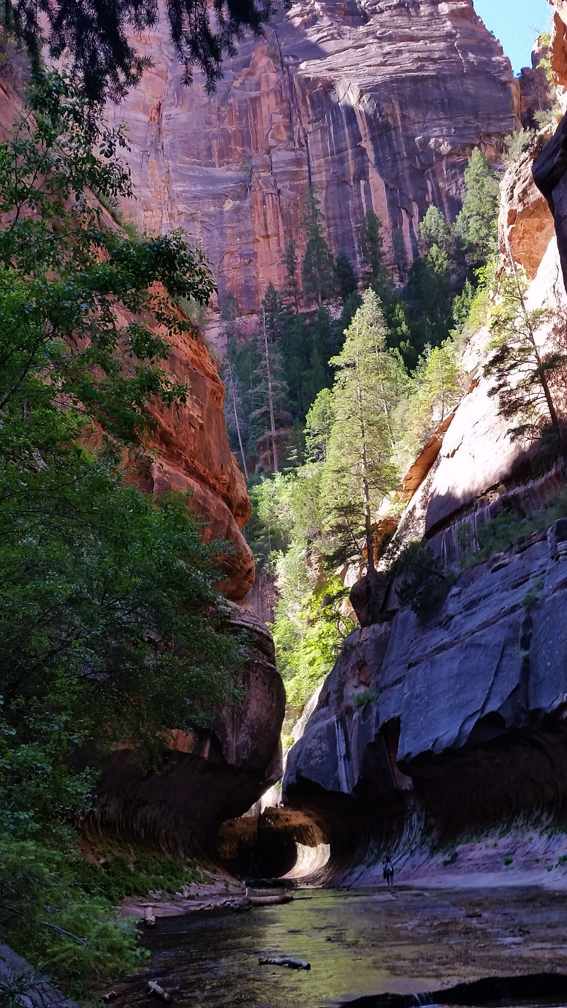
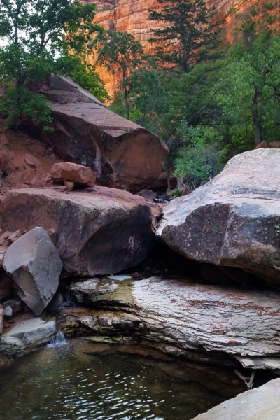
We turned southwest into the Left Fork Creek, and right away we could see the water carved walls that were reminiscent of “The Subway” formation. The canyon was gorgeous, covered in lush green foliage, cool from the shade, and stunning rocks all around. We trekked down the creek until coming upon our first rappel off a Huge VW sized boulder. When we arrived, one group ahead of us was in the middle of rappelling and another was waiting so we took a break for lunch.
 At the bottom finally
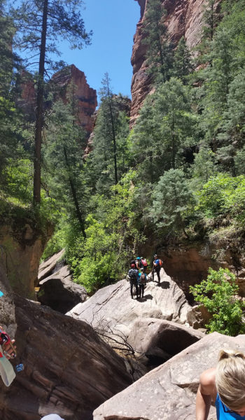
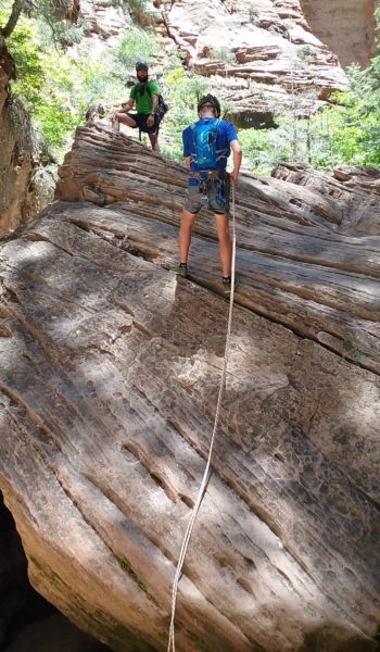
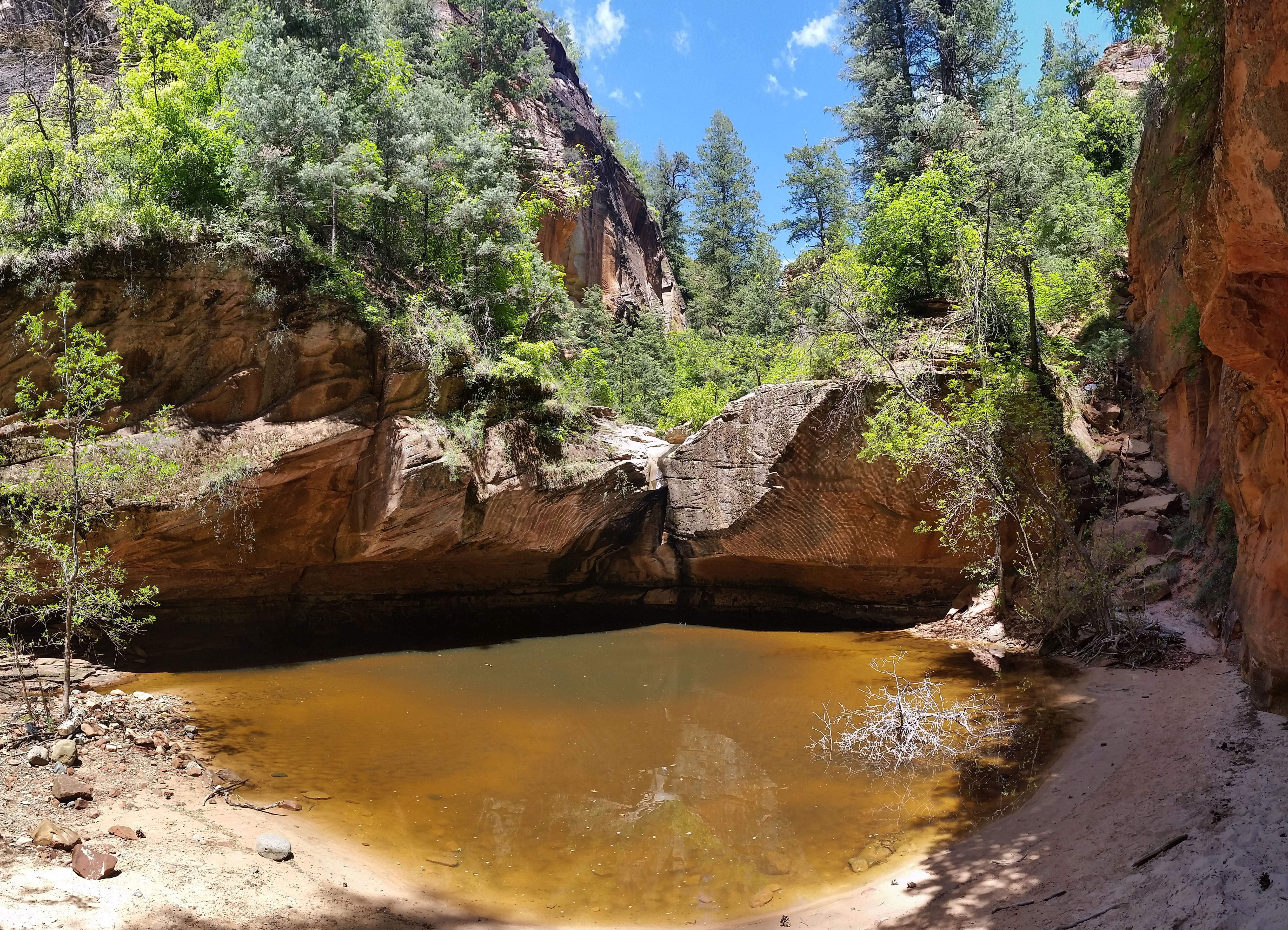
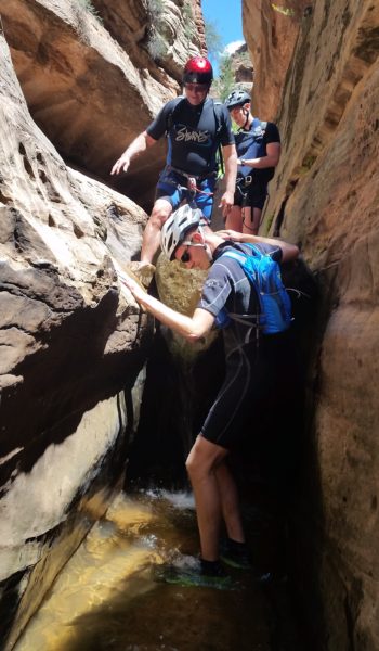
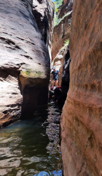
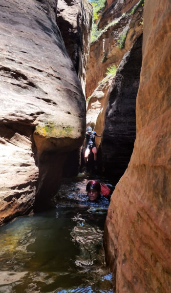
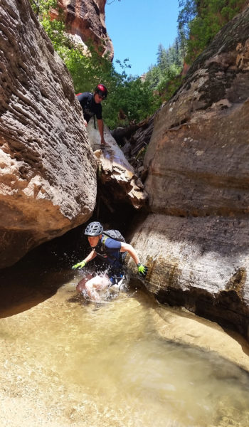
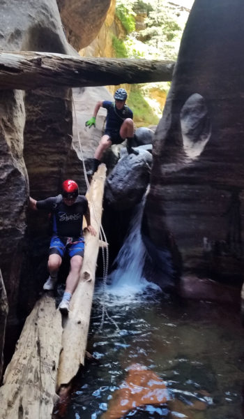
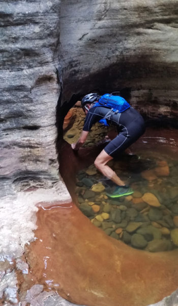
Larry, Andrew, and Eric had little rappelling experience but I walked them through the procedure. Soon we were all down safely on the ground past the first 25’ section. We once again turned downstream and after just a hop skip and a jump, we were faced with a large pool . . . welp, no more holding off the wetsuits, it was time to dawn them! We all zipped ourselves up, looking like tadpoles getting ready for our first swim, and walked into the depths of the cool, shallow pool that was only stomach deep. Not but 30 yards later we overlooked a large chalkstone into a small waterfall and our first swimmer… we didn’t put these things on for nothing!
 First swimmer
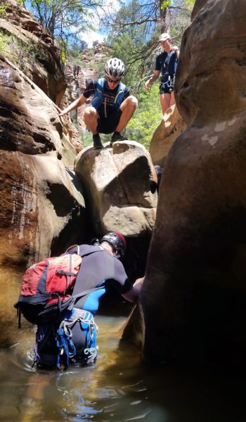
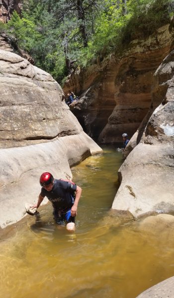
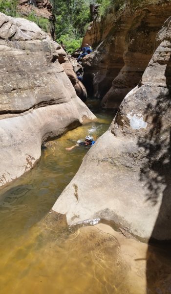
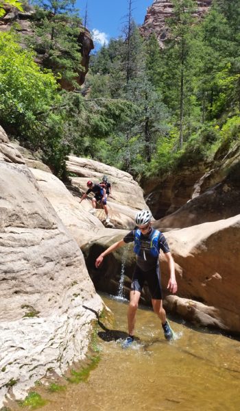
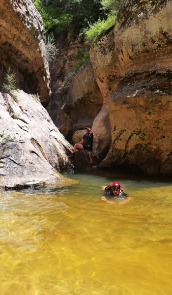
I was first to plunge in, and like a dog getting into a pool for the first time I paddled to the other side of the long slotted swimmer. Whew! Larry, then Andrew, and finally Eric all safely dropped in and were following close behind. We all laughed as we exited the pool, happy for the warm sun shining on us. It didn’t take long before we found our next obstacle, a double chalkstone drop each into swimmers. No need for a rope on these, we just slinked off the chalkstones into the cold dark water below. The second drop had a large log stuck under it which was a nice support for our feet as we got ready to plunge into the deepest, darkest pool of the day. Wheewwww if I wasn’t already awake, that pool sure did the trick! The cold swimmer began to pull my core temps down and I quickly looked for sun to snap pictures of the crew as they followed on.
 Double chalkstone Obstacle ahead!
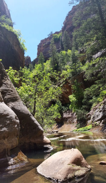
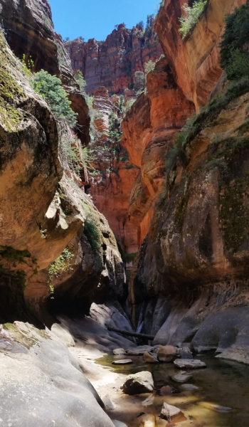
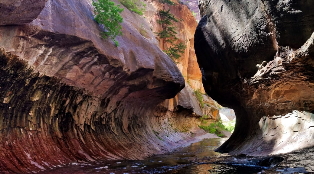
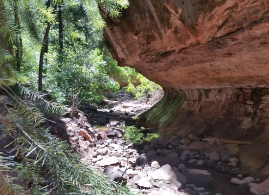
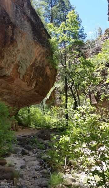
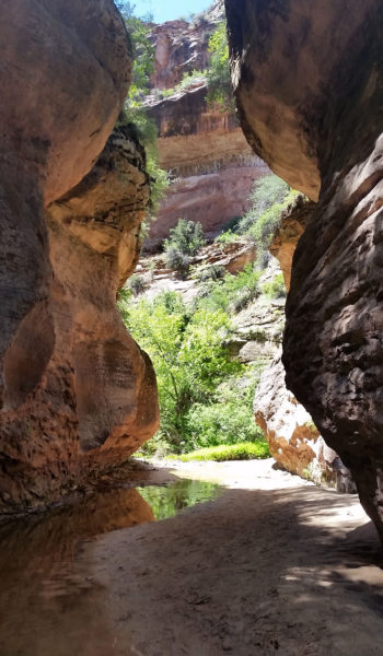
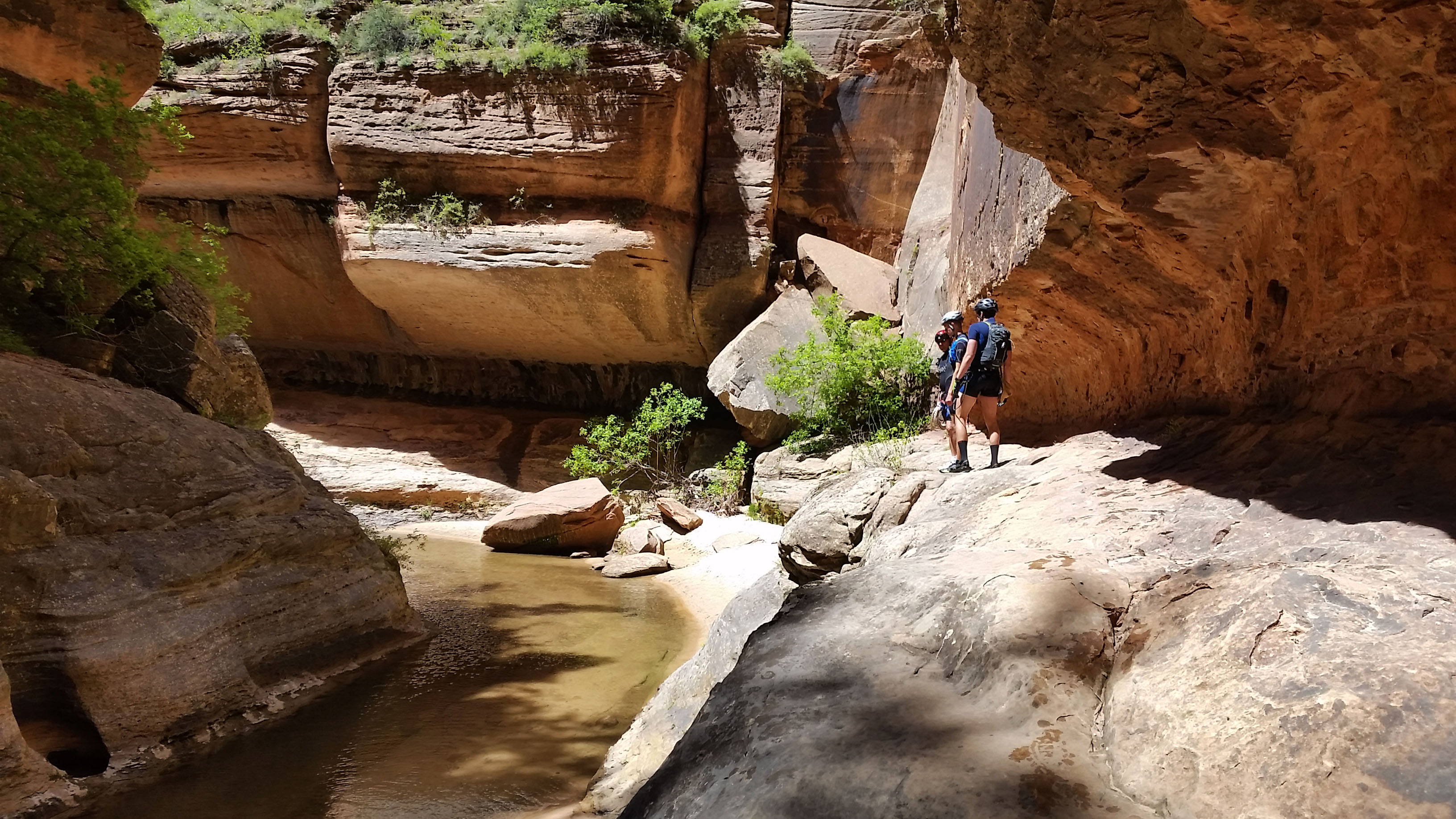
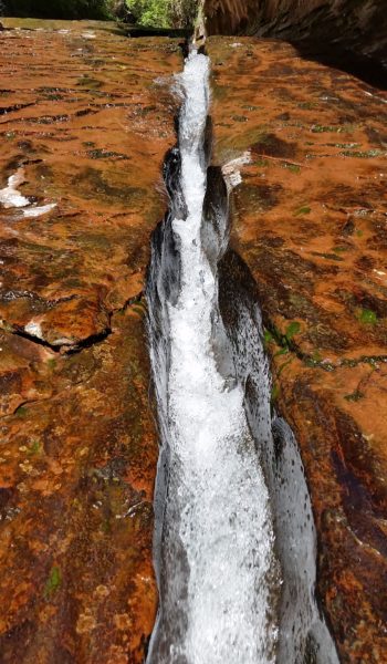
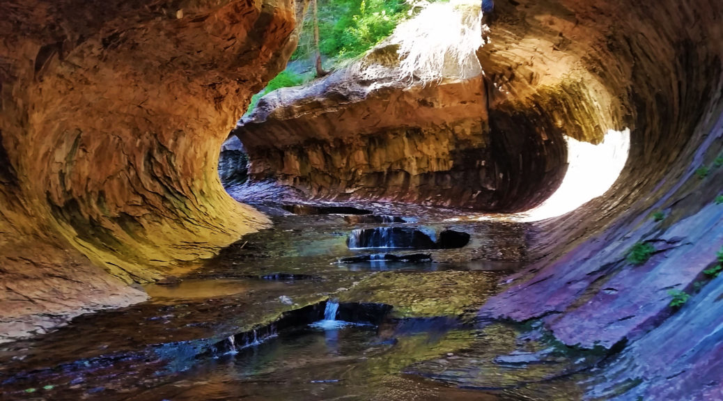
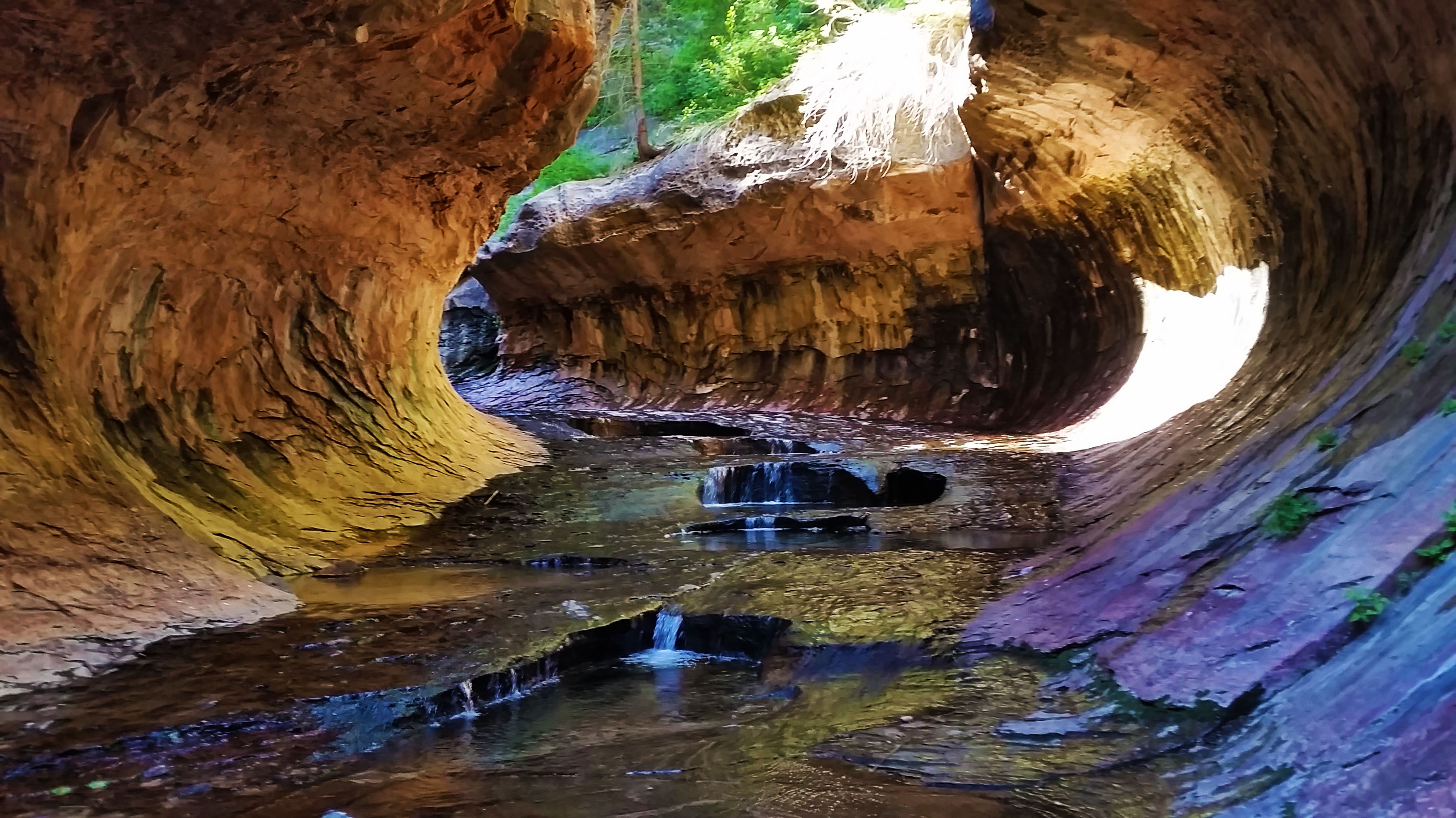
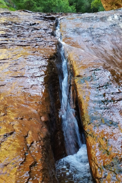
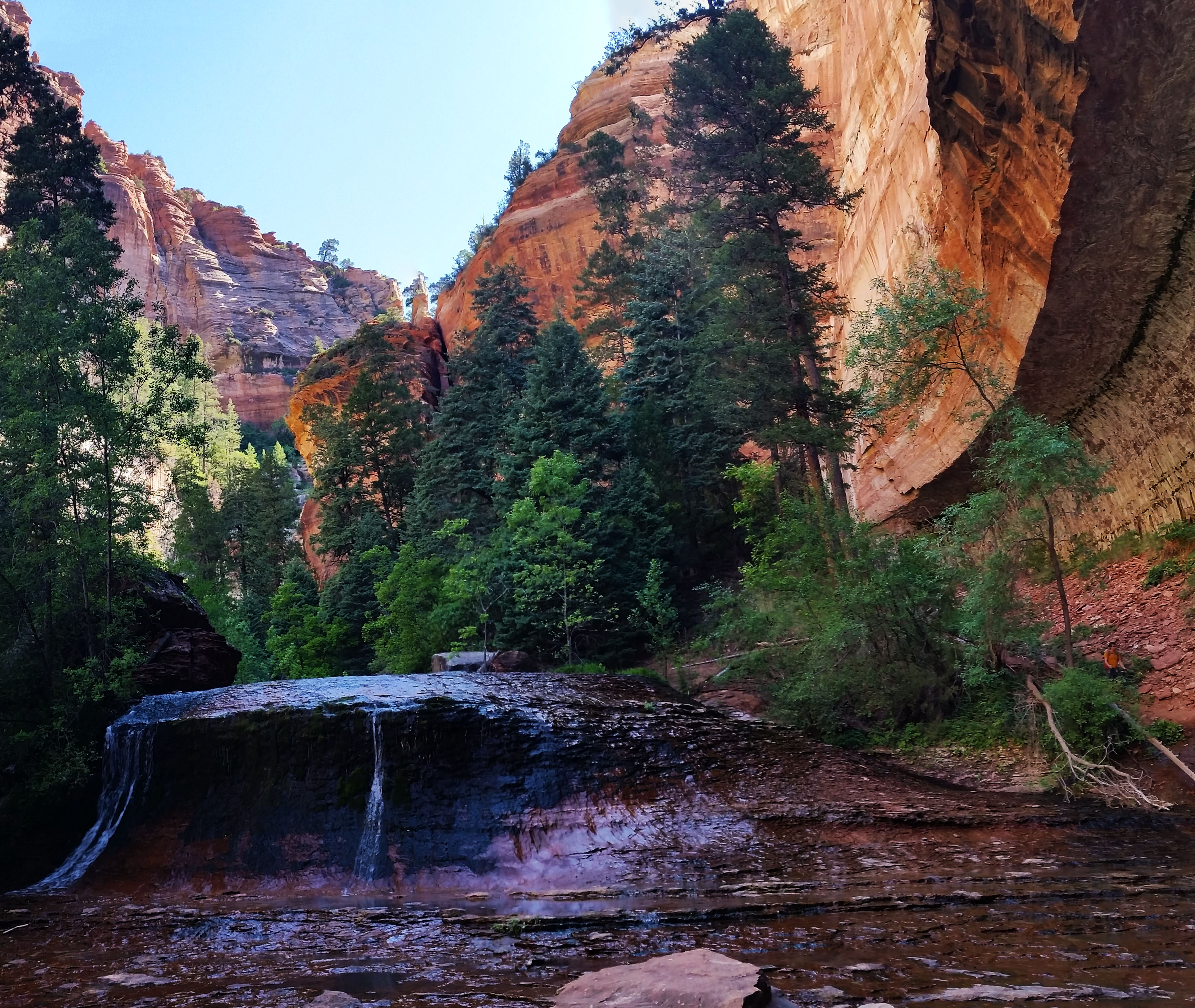
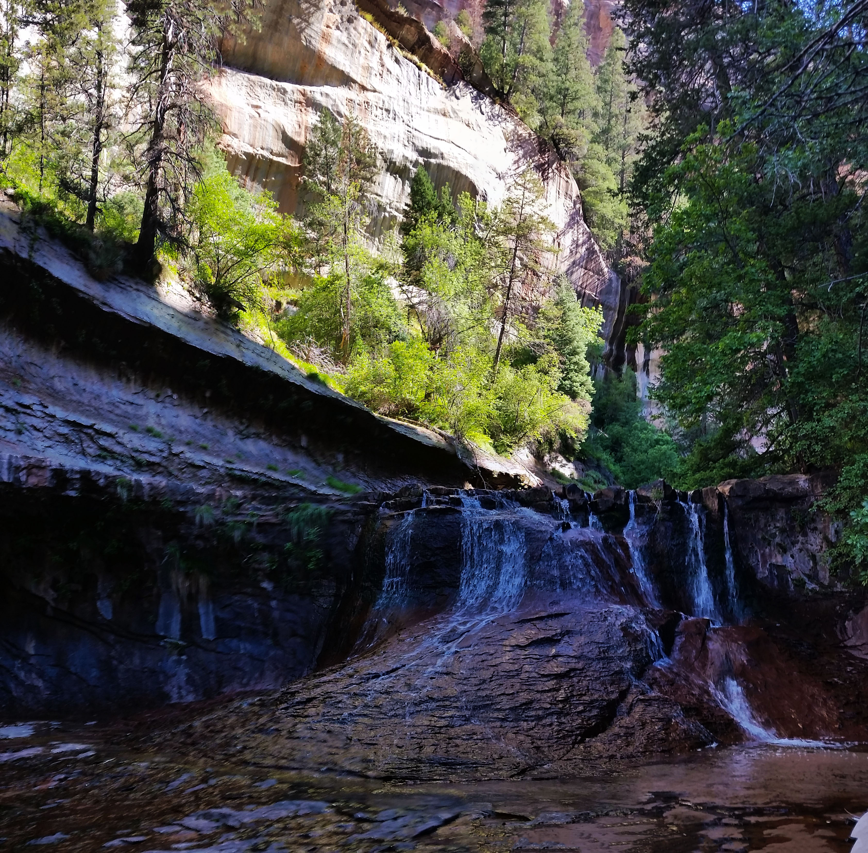
We kept trekking through the beautiful canyon and soon found ourselves at the keyhole waterfall. The keyhole waterfall is signified by a large hole that had been drilled through the sandstone by water just to the left of the waterfall. This was supposed to be the next rap, however a large log had fallen below the drop creating an easy to walk ramp. We just used the rap bolts as an anchor for a hand line and walked down. Once at the bottom we walked through a small corridor shaped like a mini subway. Logs and debris were all over the place, but they just added to the aesthetic.
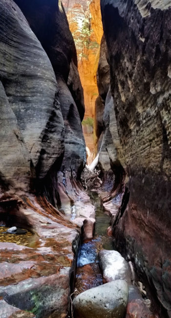 Coming down the keyhole hallway
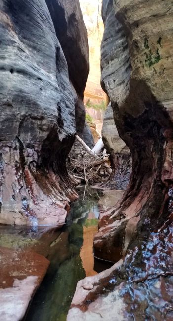
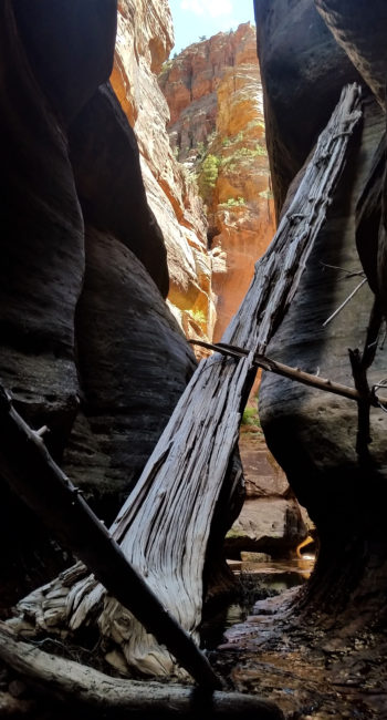
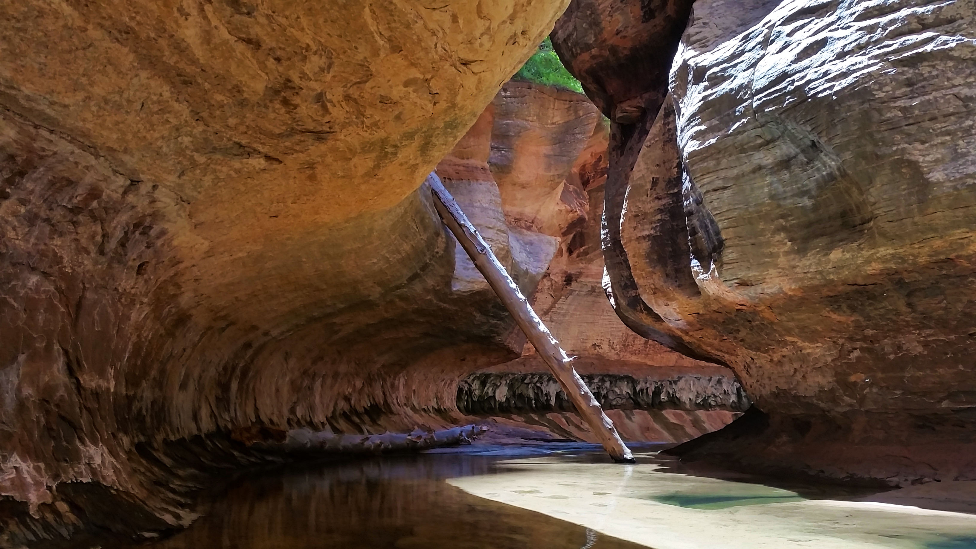
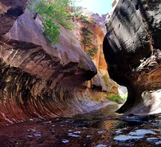
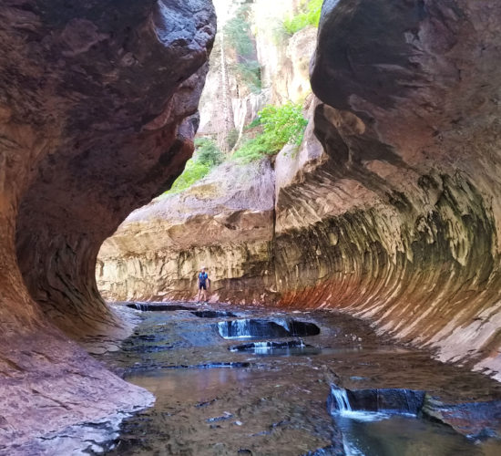
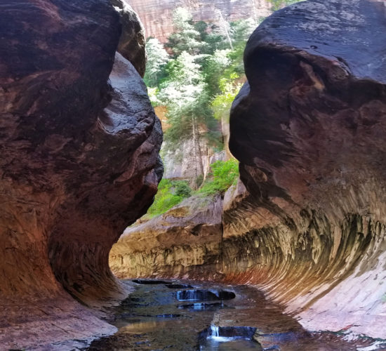
Finally we walked out into a nice open area with a vertical log wedged between the floor and the canyon wall. This was the upper subway just before the final rap into the lower subway. How nice it was to see this famously photographed sight in person. We took a final break before the long slog out, basking in the sun like lizards still trying to shake off the chill from the double chalkstone swimmer earlier in the canyon.
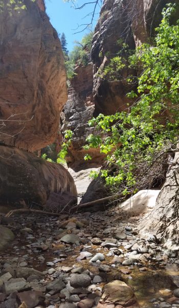
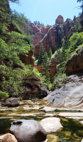
It was time to get moving again as I stuffed the final crumbs of salt and vinegar chips I had into my mouth. After a turn or two we found the final rap on canyon right to the side of a waterfall into the lower subway. We could hear a large group of “bottom up” hikers below in the pools taking in the sights of famed formation. We set up our rope and rapped the final drop and were soon stripping wetsuits. It was nice not to need the suits any further. The rest of the hike was gorgeous… beautiful slick rock, cascading waterfalls, and lush green foliage everywhere complimenting the red rocks. After a few miles we finally reached the exit canyon right. I took the keys to the truck and took off up the Cliffside.
 Pushing on
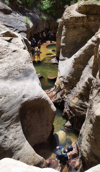
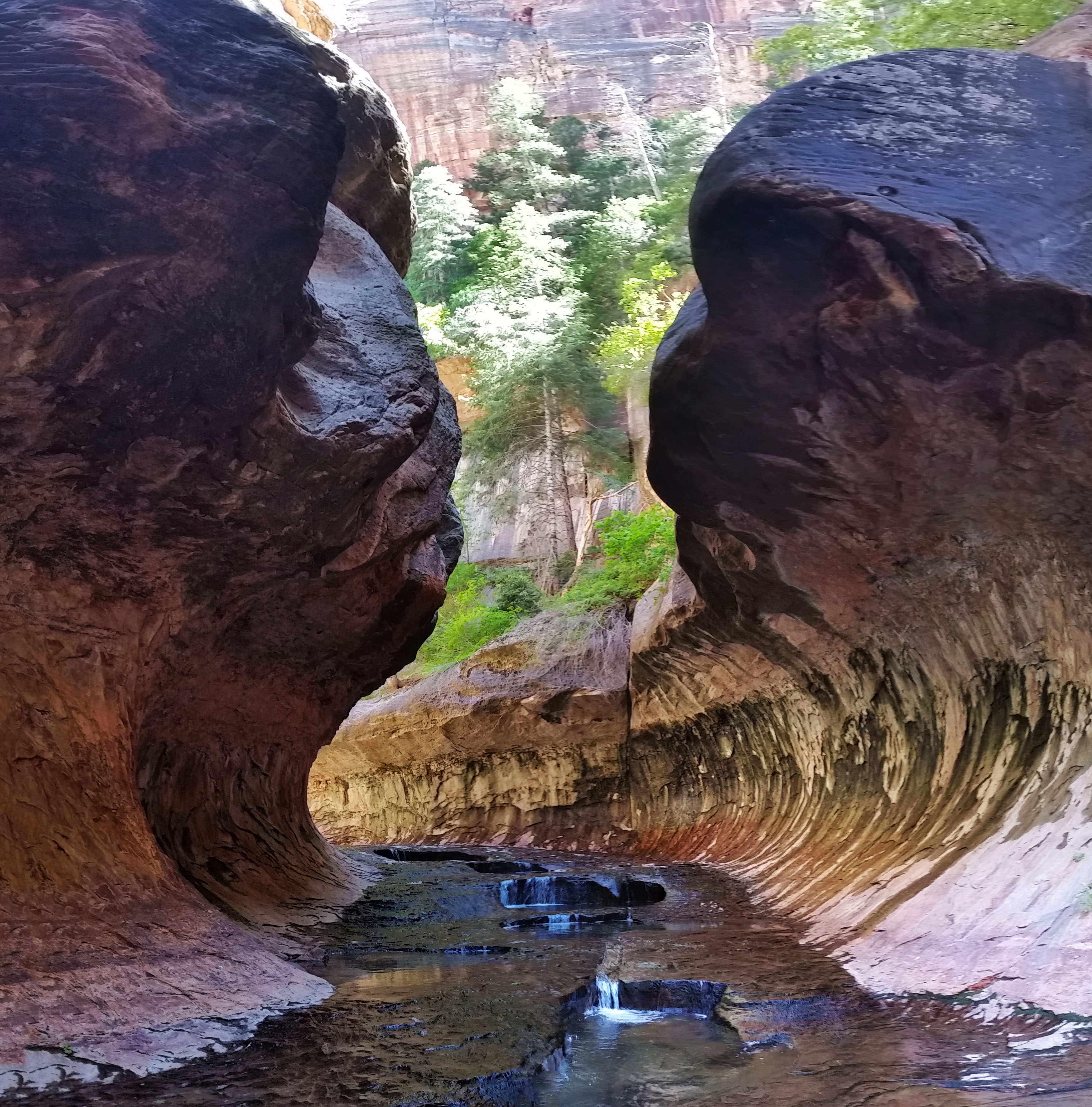
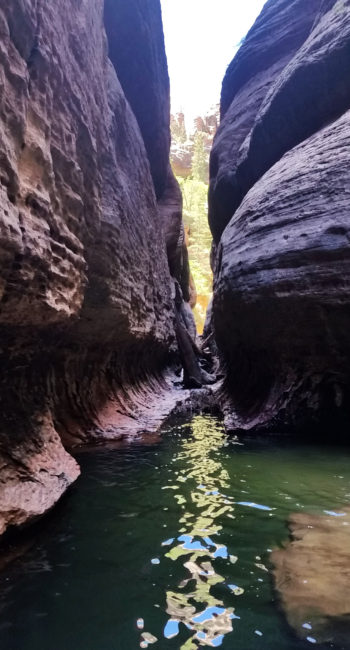
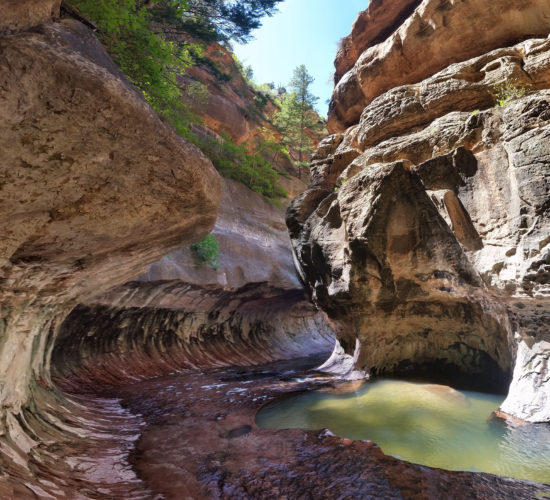 Looking downstream into the Lower Subway
I grabbed my bike from the trees where I stowed it and began to ride back to the upper trailhead. I had originally thought it was just a few hundred feet of gain in a few miles, but later research let me know that it was 7.5 mile ride with 1900 feet of gain. Let’s just say when the quad burning, calf aching, sweat pouring, beautiful view having grind was over, I was pretty happy! I drove back down, grabbed the guys and we headed back to Springdale for much deserved pizza and beer. What an awesome day enjoying Zion national park!!!
 Final push out of the canyon
 Waterfall action
HIKE INFO:
The Subway: Top Down Technical Canyoneering:
HIKE STATS:
- Weather: Hi 80s, Low 40s, Water in the 40s, Sunny
- Water: 3 liters
- Food: 2 Protien Bars, 2 granola bars, 1 Cliff Bar, 1 apple, 1 bag of jerky, bag of salt and vinegar chips, gummy worms
- Time: 7 hours
- Distance: 9.5 miles in canyon + 7.5 miles on bike
- Accumulated Gain: 2,300 feet
GEAR:
- The Don Camelback backpack (3 liter bladder)
- SPOT Tracker
- Neoprene Sox
- 3/4 Wet Suite
- Black Diamond Helmet
- Petzl Corax Climbing Harness
- 2 Black Diamond screw carabiner
- Black Diaimond ATC Guide
- 60 feet 10.2mm Static rope
- Webbing, personal anchor
- 3 rap rings (not used)
CLOTHING:
- Cotton Handkerchief
- Icebreaker wool shirt
- Nike running shorts
- Merrell Mid Moab Hiking Boots
- Darn Tough Medium Wool Sox
- Arcteryx Atom hoody
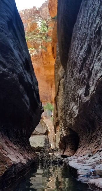
The Subway – Zion – UT (6.5.16)
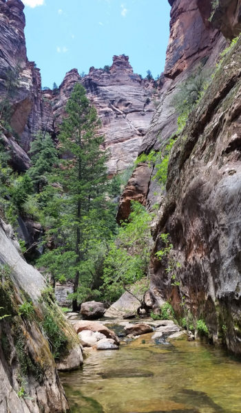
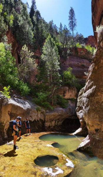
We usually save the best for last don’t we? A group of buddies (Mike, Stevo, and Adrien) and I decided to trek to Zion National Park in southwestern Utah in search for adventure. On our last day we had permits to The Subway, a rock formation on the Left Fork of North Creek residing on the west side of the park, far from the main valley of Zion. There are two ways to visit The Subway, one as a technical canyoneering route from the top down, or a non-technical hike from the bottom up. Due to time restraints for the day we decided to hike from the bottom up, and we weren’t disappointed!
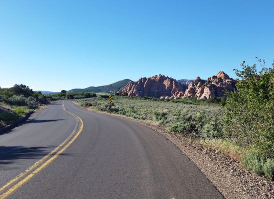
We woke early and packed our camp up, piled into our vehicles, and headed west down Highway 9 towards Virgin, where we would turn north down the open road to the trailhead. Utah is such a beautiful place. An open landscape with orange and red rock plateaus to the right, small plateau mounds to the left, and rolling hills ahead lead us to our turnoff. Bluebird, virtually cloudless skies welcomed us on the winding road through farm fields to the dirt pull off for the trailhead.
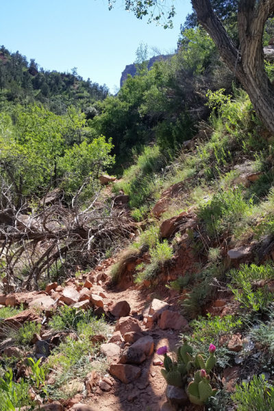
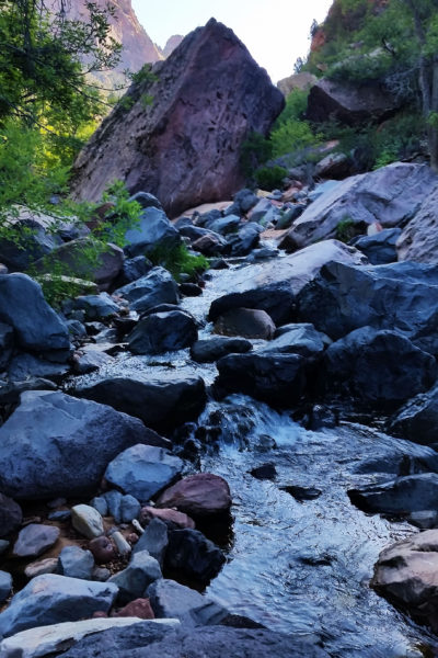
Once we pulled in there were a couple of park rangers that told us there was a guy down below that hurt his leg and couldn’t hike out so they were going to arrange a helo to come up and grab him. Little things like this always make me nervous before a hike, like bad juju or something. It didn’t help the fact that Stevo had been complaining about his knee having troubles as the weekend progressed and he put more miles on it. Brushing it off we pushed down the trail with excitement to see The Subway at the end of our 3.5 mile hike. The trail took a dive-bomb off the rim down into the canyon! Loose gravel dominated the trail as it twisted and turned dropping 600 feet to the creek below.
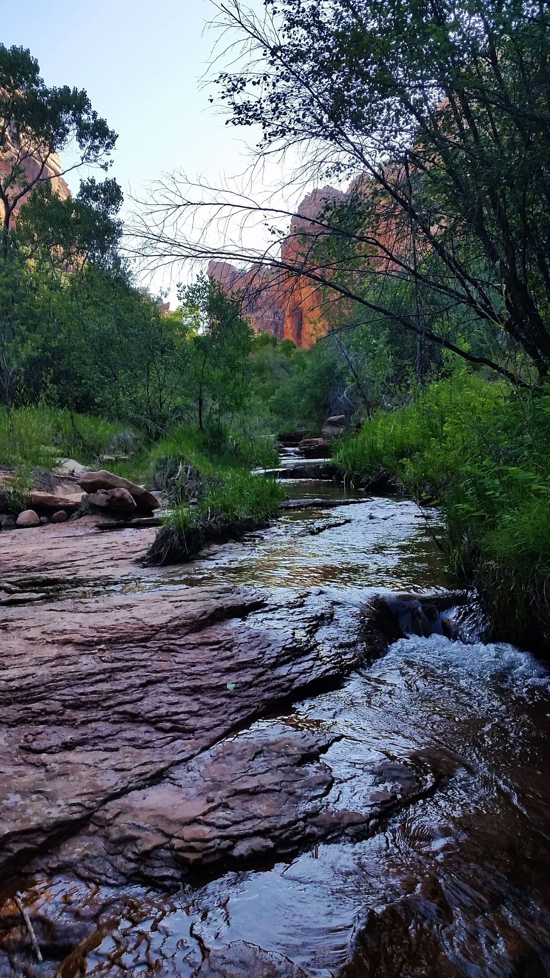
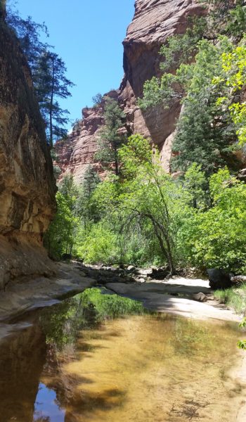
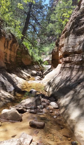
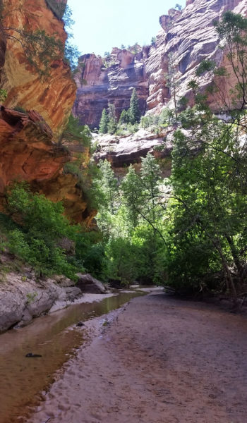
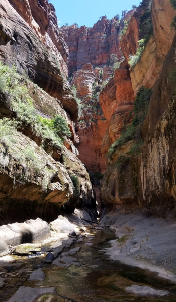
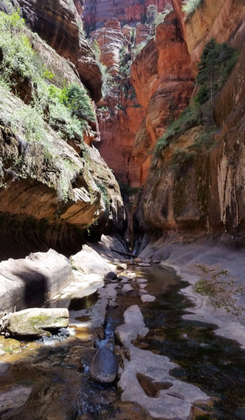
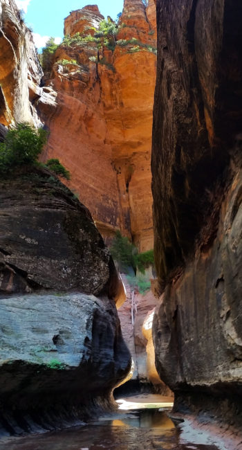
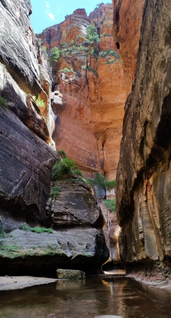
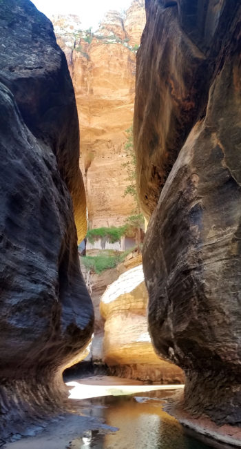
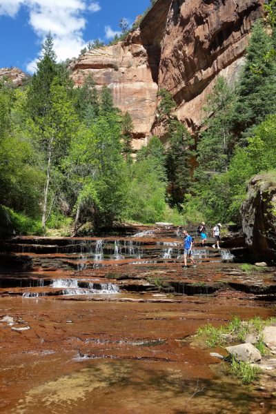
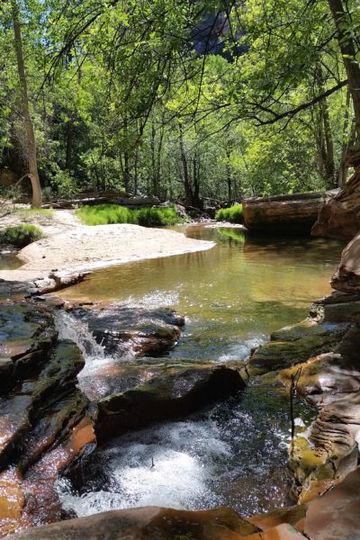
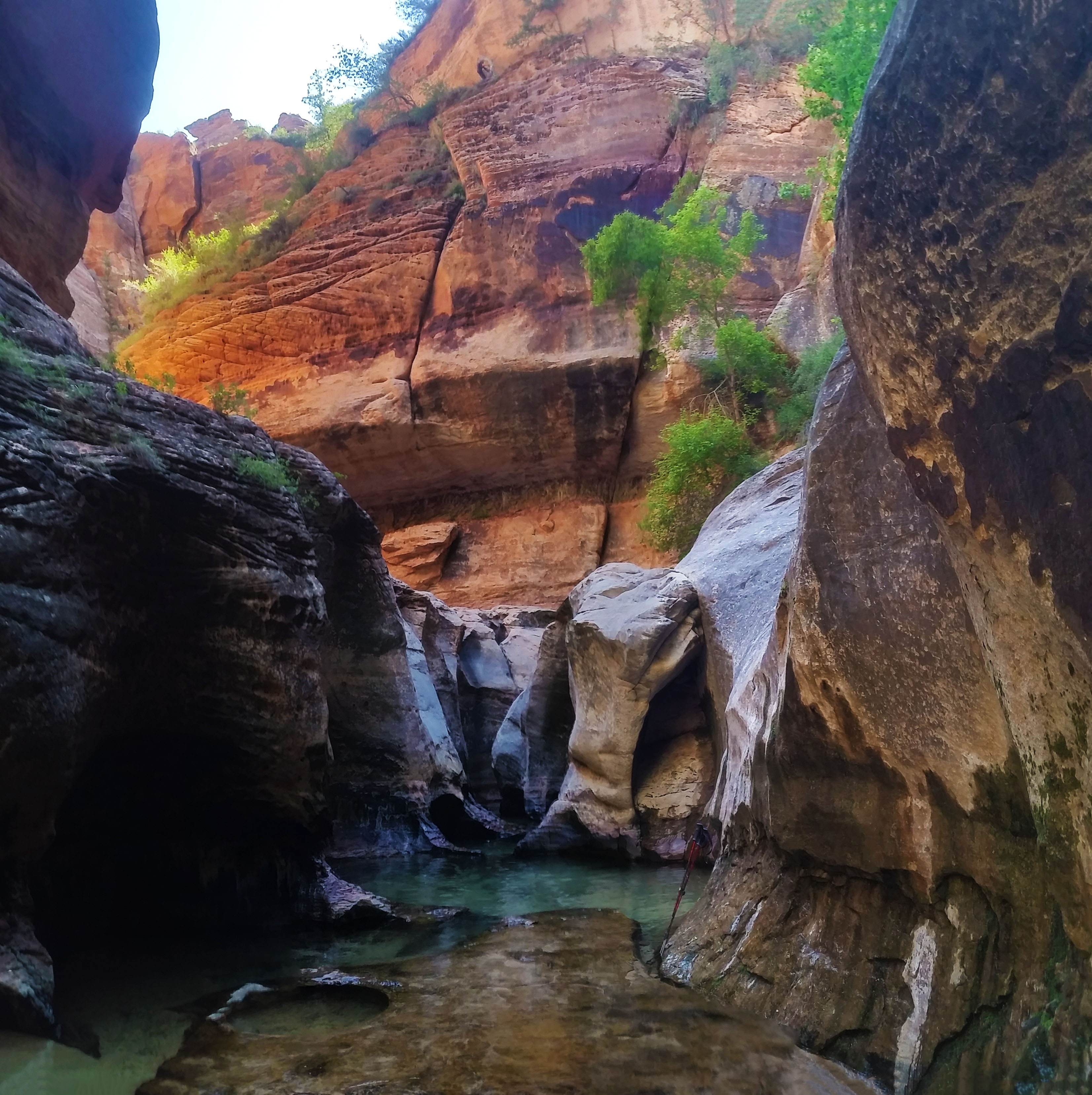
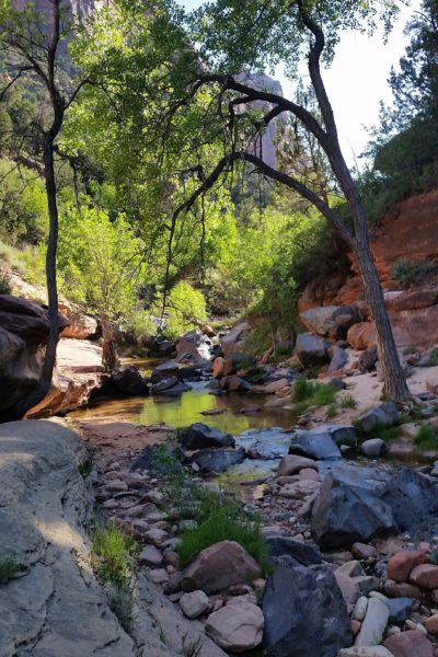
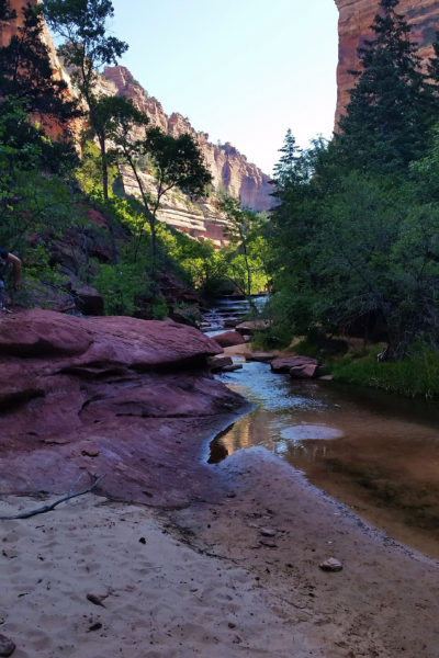
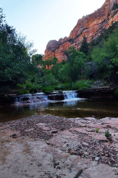
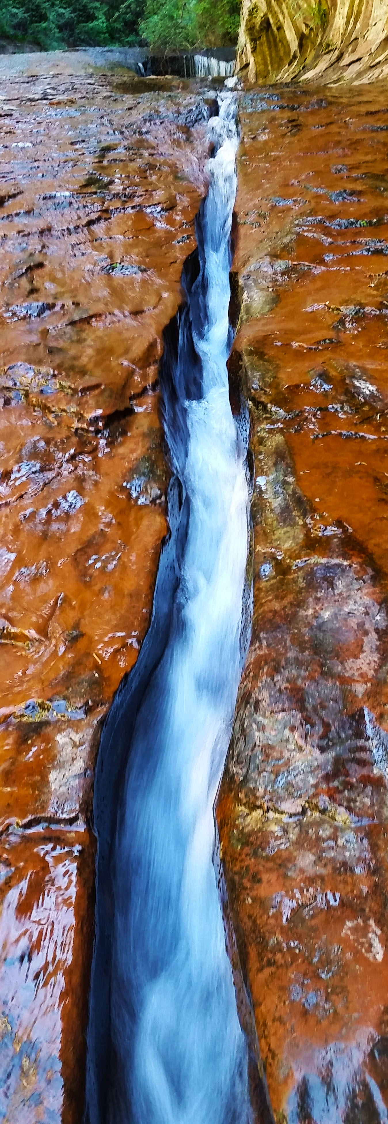
In the bottom the light was perfect. We hiked northeast up the canyon and it was early enough that the sun just lit up the canopies above in golden light. We crossed back and forth over the creek, boulder hopping, traversing sandy creek banks, and large rock faces obstacles. Turn after turn there was something interesting to see. Soon the canyon began to change. The tall walls from afar started to close in and you could see the impact of water high up from long ago where it carved the rock face smooth. Miniature waterfalls and small swimming pools dotted the landscape, and the lush green canopy continued to slowly close in to shade us from the sun above. The creek began to flow over large stepped slickrock steps, creating mini falls, and we were forced to walk down the creek in the thin layer of water over the slickrock.
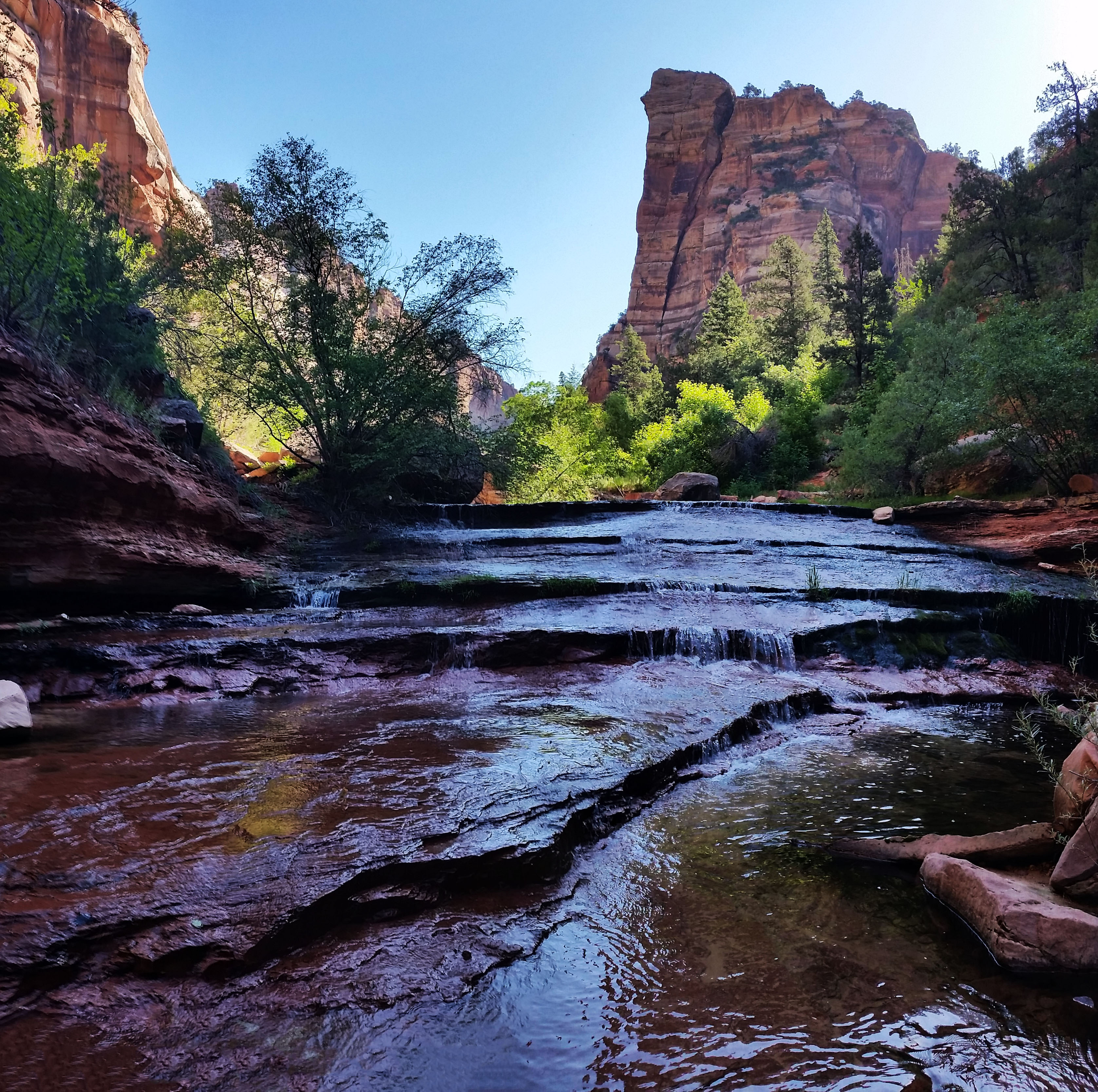
The canyon curled right and we finally entered the first area where it was no longer a typical creek bed canyon and the rock formations became more predominant. The water cut away, shaped, and formed everything around us. The small cascading falls became larger and taller causing us to climb around on the tree covered sides to bypass. Long smoothed-over cracks were found in areas of the slickrock, as well as small circular holes called potholes where the water pooled and flowed through. I can only speculate that upon formation, these areas had less dense rock which was eaten away by erosion causing the beautiful formations we were surrounded by.
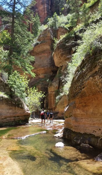
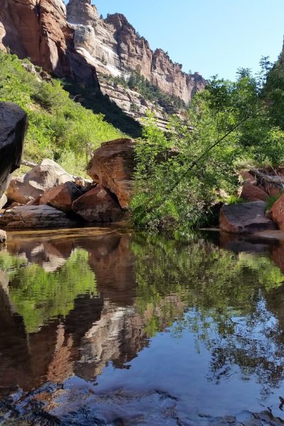
We finally reached the last turn before The Subway and we all gathered together before pushing on so we could all see it at once. What a view! It looked as though the water tunneled straight through solid rock to form a Subway tube through the bottom of the canyon. It was strange how cylindrical the formation was, nothing else around was like it except in this one tight spot in the canyon the perfect conditions came together to create this remarkable place. We pushed to the back of the Subway where a few consecutive deep pools awaited. One after another we hopped in and waded in the cold 50 degree water that came chest deep, just to make it to the Key Hole waterfall in the back. Mike jumped in, taking a brisk shower in the falls. Wheeeww boy was it cold!
Soon after we all returned to the Subway, all smiles. It’s amazing how some places can totally regenerate you. All the exhaustion of the day is just lifted form your shoulders and you are ready to get back to it. This is one of those places. Although I am not the largest fan of the permit system, I can respect it for protecting this very special place from being overrun and overused. At any rate, it was a beautiful day and we got to see something special. We returned the way we came without incident, piled in our cars, and headed home. This adventure for this weekend was over, until the next one!
 Heading down the trail from the top
HIKE INFO:
http://hikearizona.com/decoder.php?ZTN=14805
HIKE STATS:
- Weather: Hi 80s, Low 60s, Sunny
- Water: 2.0 liters
- Food: Salt and Venigar chips, 1 Cliff Builders Bar, 1 bag of Cheese-its, 1 plum, 1 powerbar
- Time: 4 hours
- Distance: 7 miles Round Trip
- Accumulated Gain: 1,200 feet
GEAR:
- Mule Camelback backpack (3 liter bladder)
- Black Diamond trekking poles
CLOTHING:
- Cotton Handkerchief
- Cotton T shirt
- Nike Running Shorts
- Merrell Mid Moab Hiking Boots
- Darn Tough Medium Wool Sox
