Tag Archives: Indian Ruins

Royal “Pain In The” Arch (Day 1) – Grand Canyon – AZ (4.21.17-4.23.17)

Share

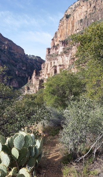
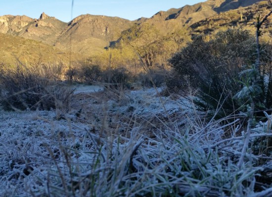
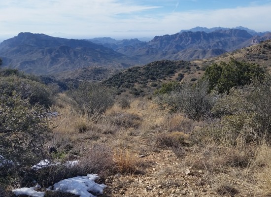
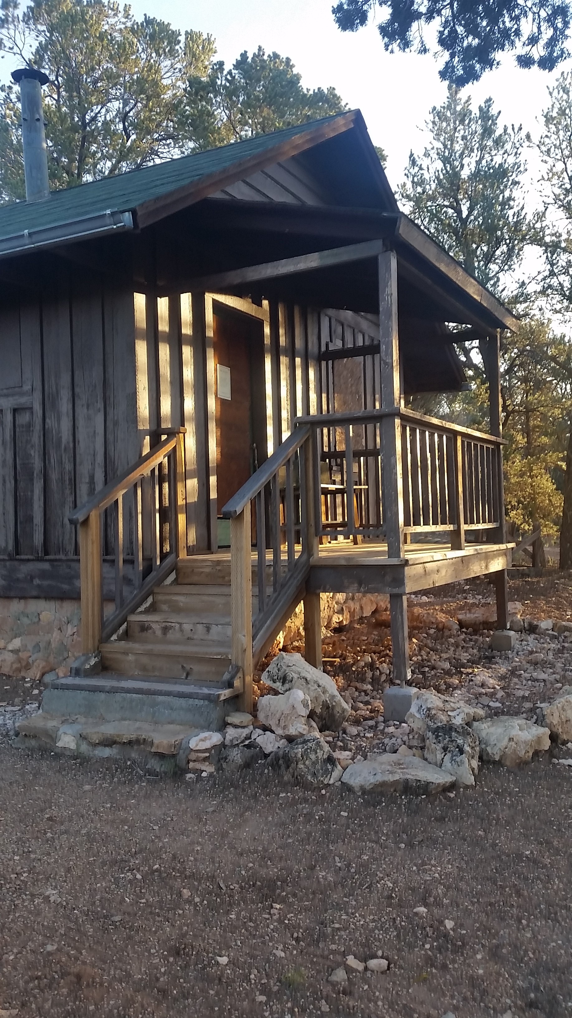
Eyes cracked open. It was cold, chilly. In a sleeping bag with a broken zipper. Alarm blasting from my phone, feeling tired after just 4.5 hrs of sleep, staring at the ceiling of a tent. Rubbing my eyes half exhausted half excited about the day to come . . . Looks like we are all set up for another sufferfest at the Grandest of Canyons! This trek brought Sam, Mark, and myself to the doorstep of the old Ranger Station above the drop-in to Royal Arch Creek via Point Huitzil. We planned to drop in, canyoneer all the way to the Colorado River at Elves Chasm, camp, traverse the Tonto trail to Bass Beach, camp, and finally hike out via Bass trail; finishing the trip off with a side trek to Mount Huethawali before closing out the loop with a nice road walk on the rim.

Old Ranger Station

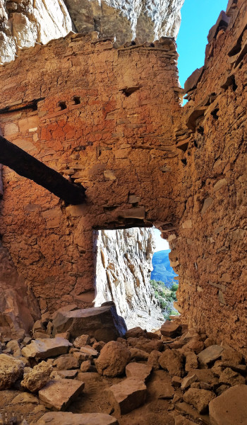
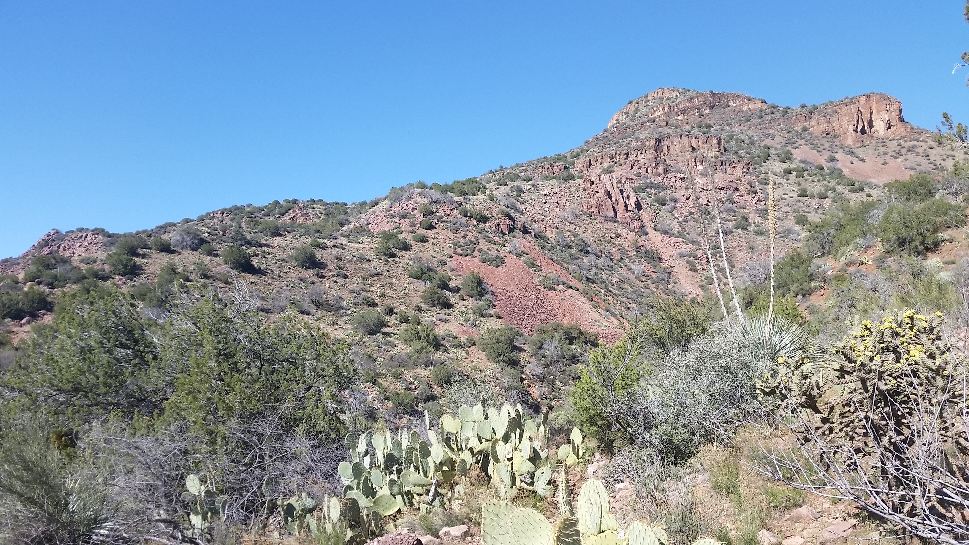
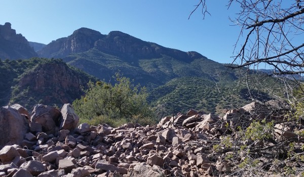
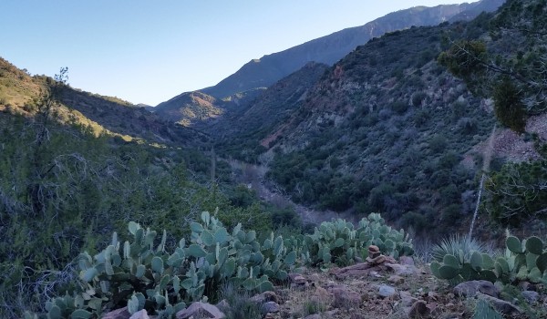
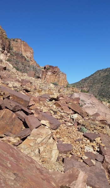
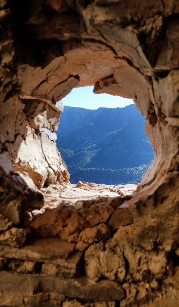
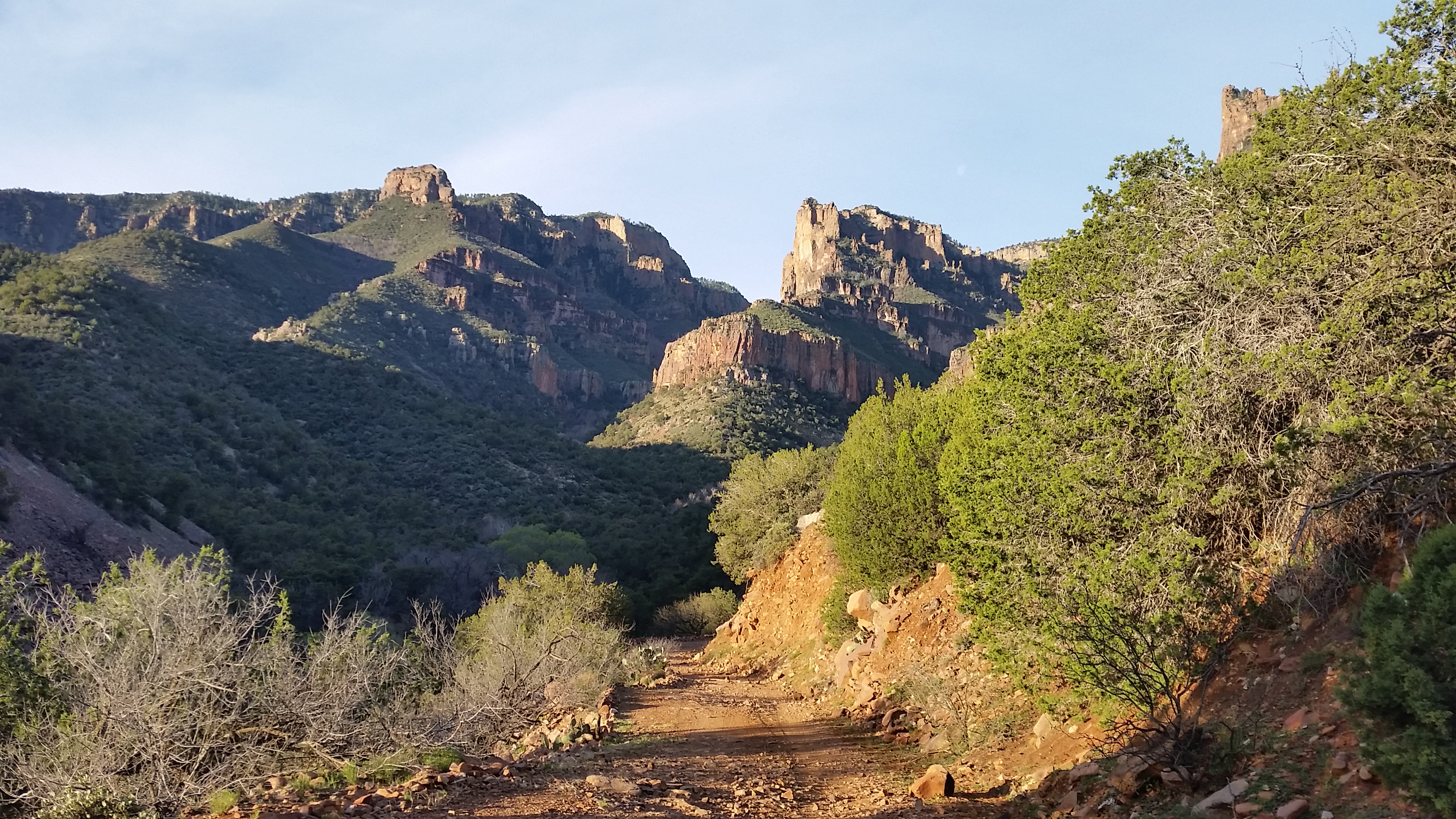
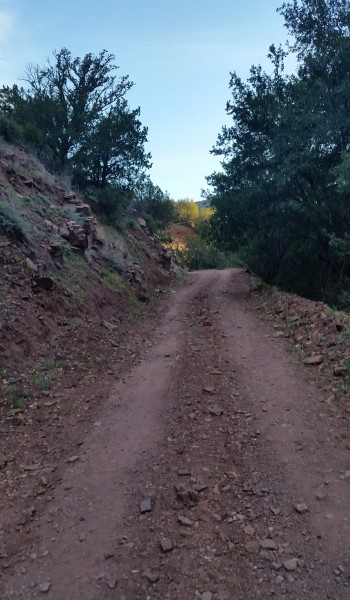
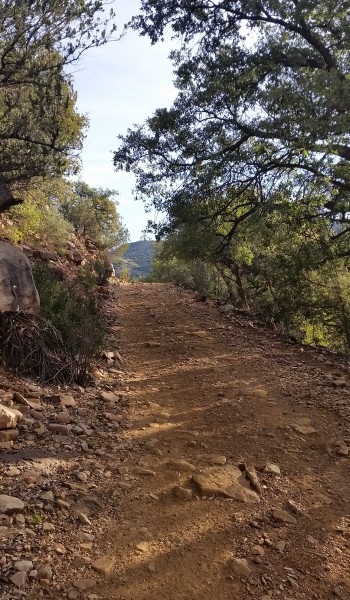
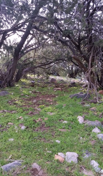
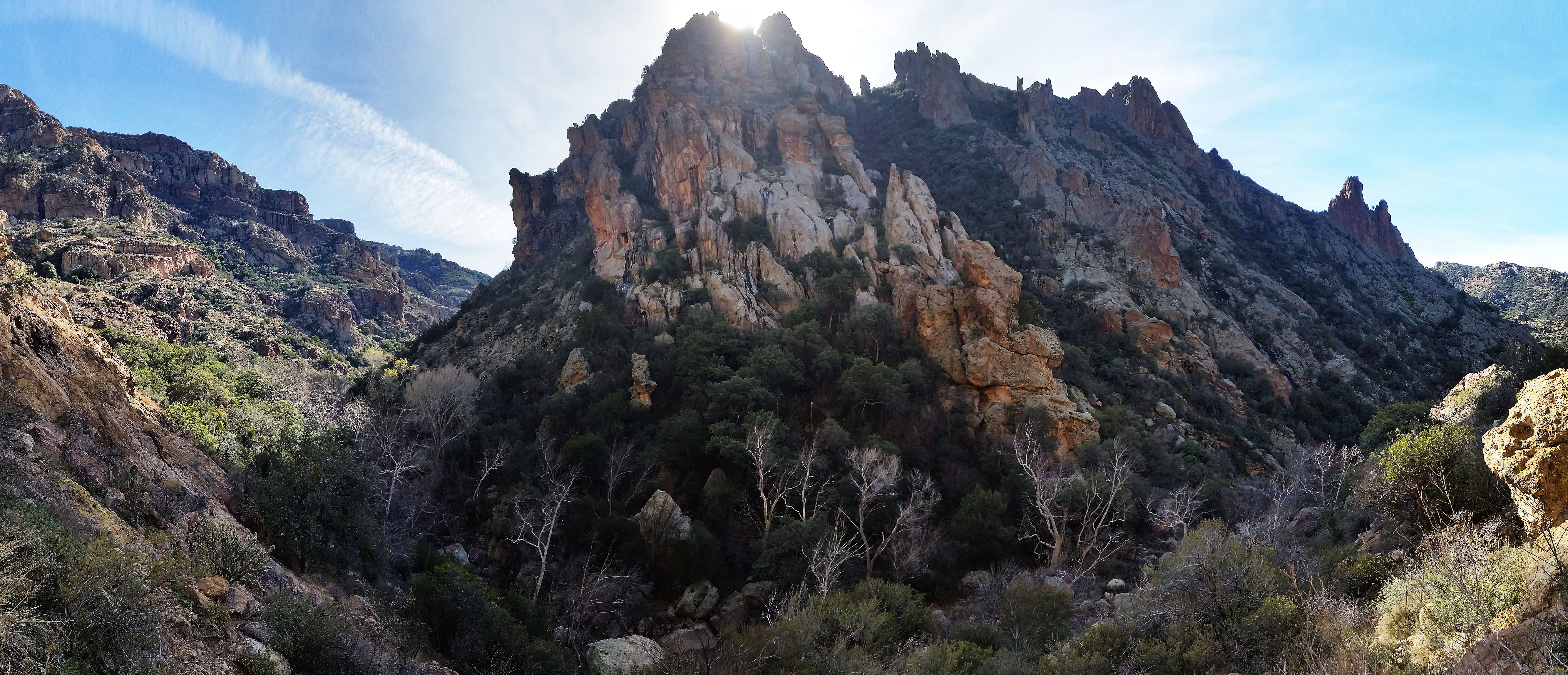
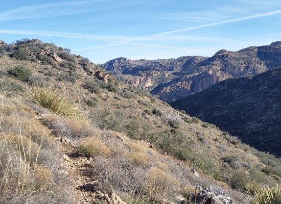
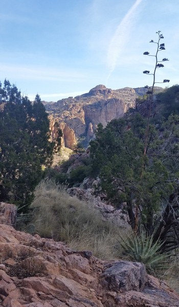
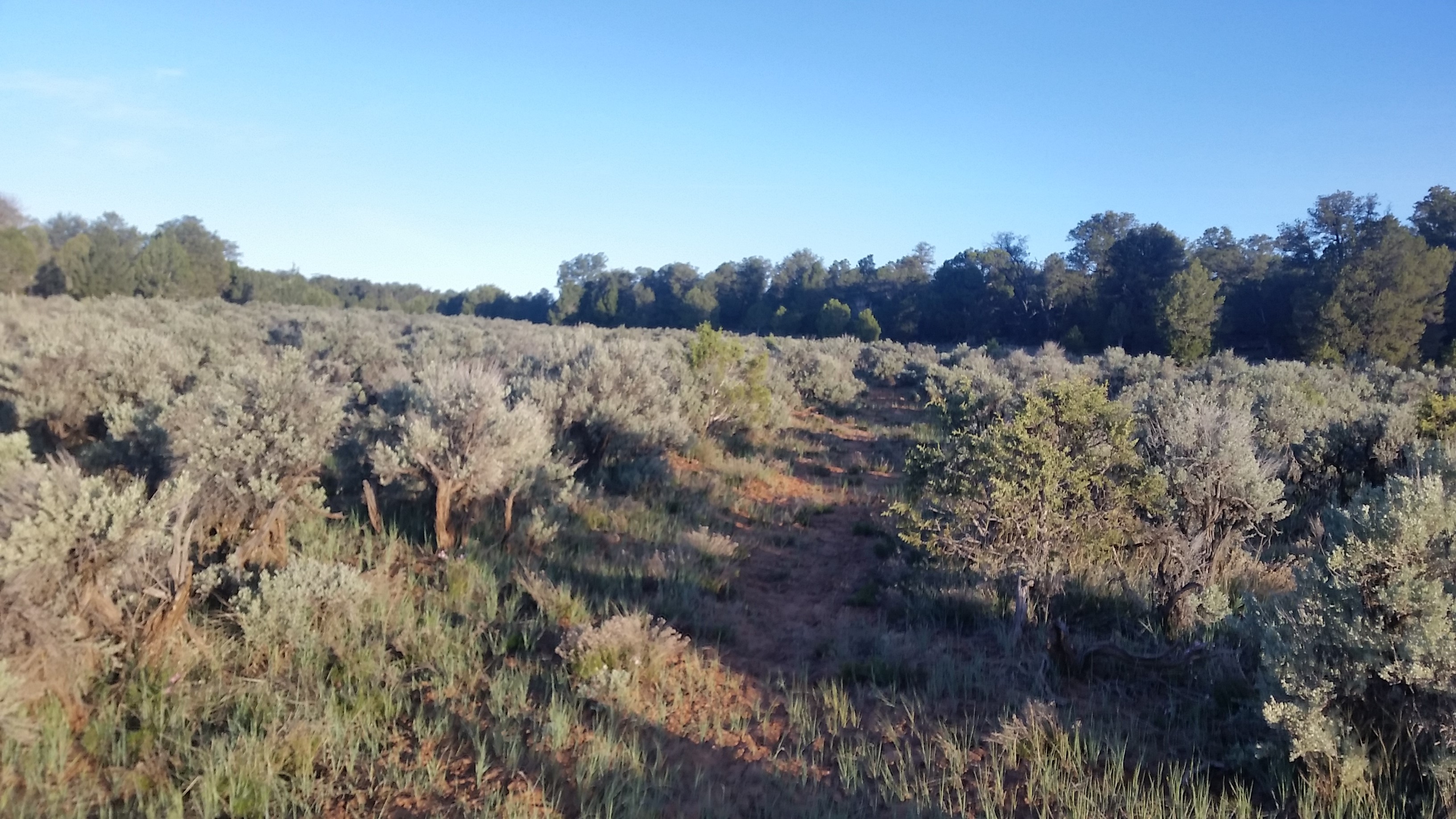
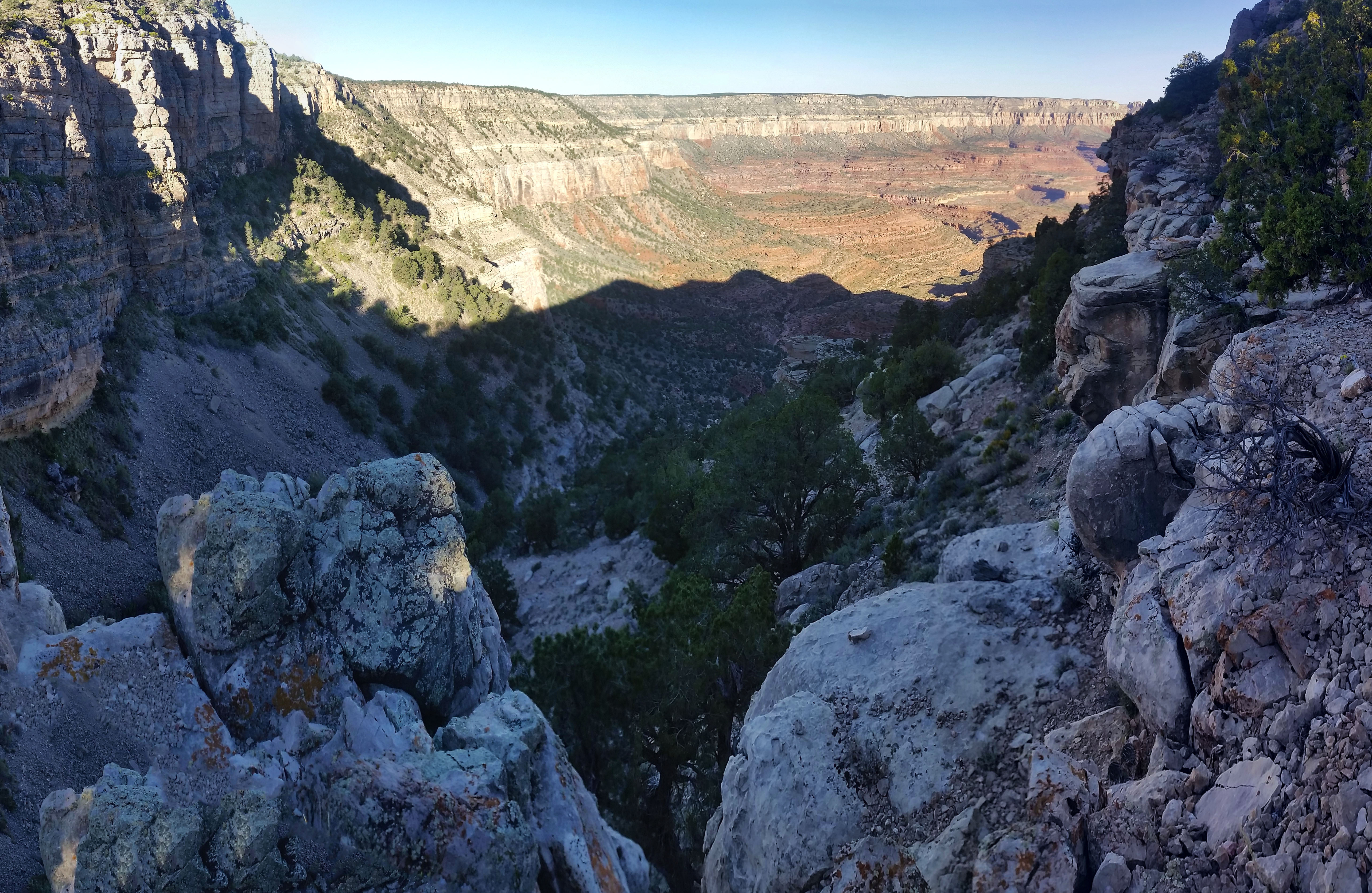
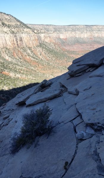
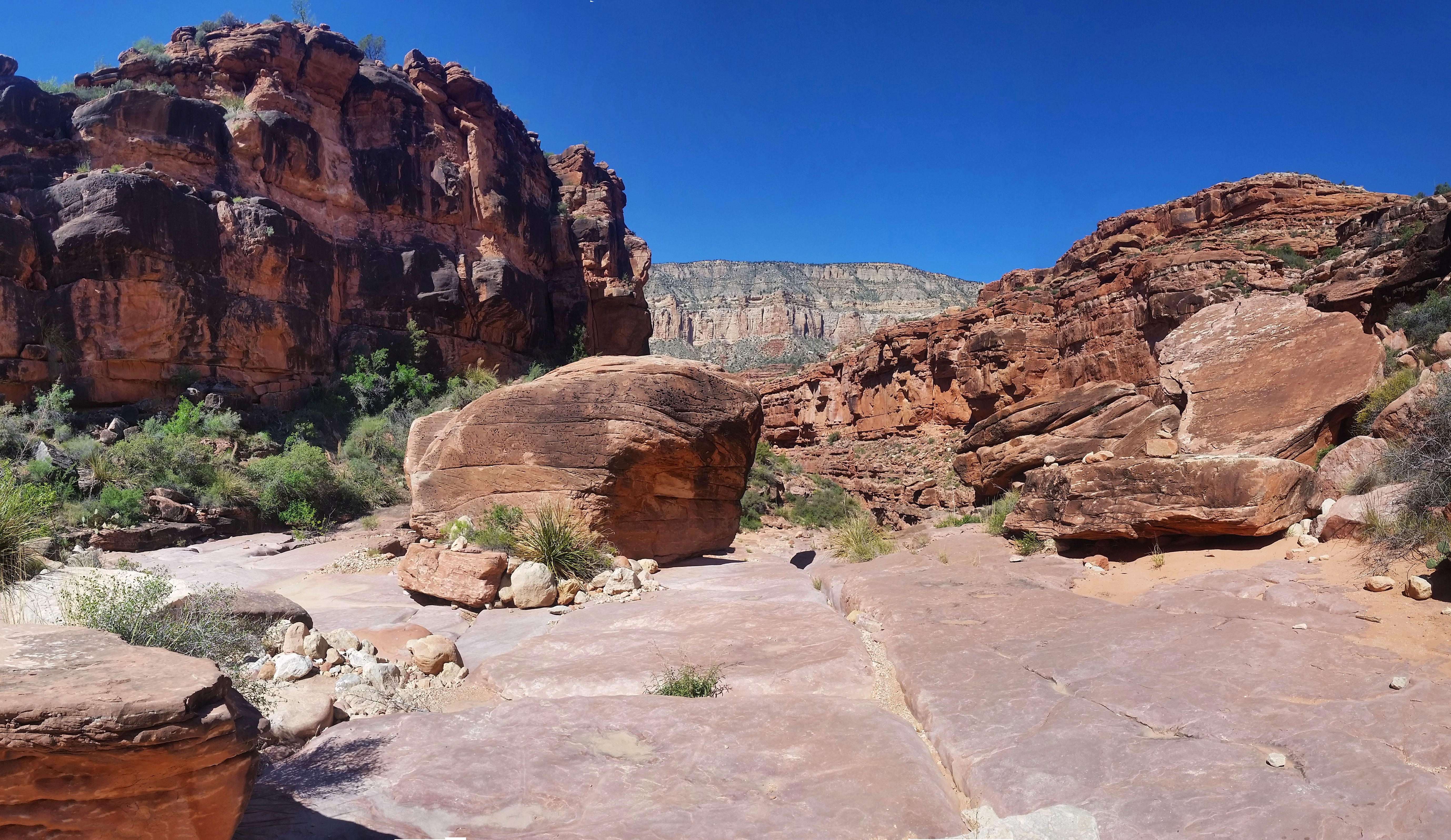
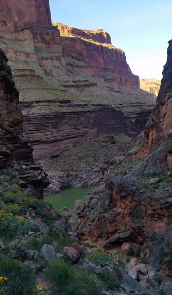
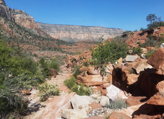
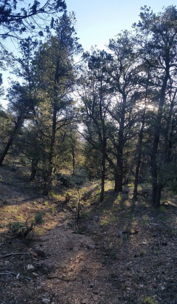
I shivered in the morning, throwing all my gear in the pack, making sure all the food, water and rappelling equipment was accounted for before strapping up and standing, ready to roll. I knew that once we got moving I would warm, so I stubbornly refused to put a jacket on. We let out from the old ranger station headed on an old 4×4 “road” (more like a foot trail) in the northwest direction. After the “road” ended we found an old telegraph line which would lead us to the start of the wash that would eventually dump us into the canyon (according to research). We trekked on through a juniper speckled field which made it seem like we weren’t even hiking to the canyon. Finally the route dumped us into a wash and slowly we made our way to the edge of the rim and were blasted with a gorgeous grand view of the canyon.

Old 4×4 “road” walk
Hello there old friend! Dump into the canyon, just South of Huitzil Point

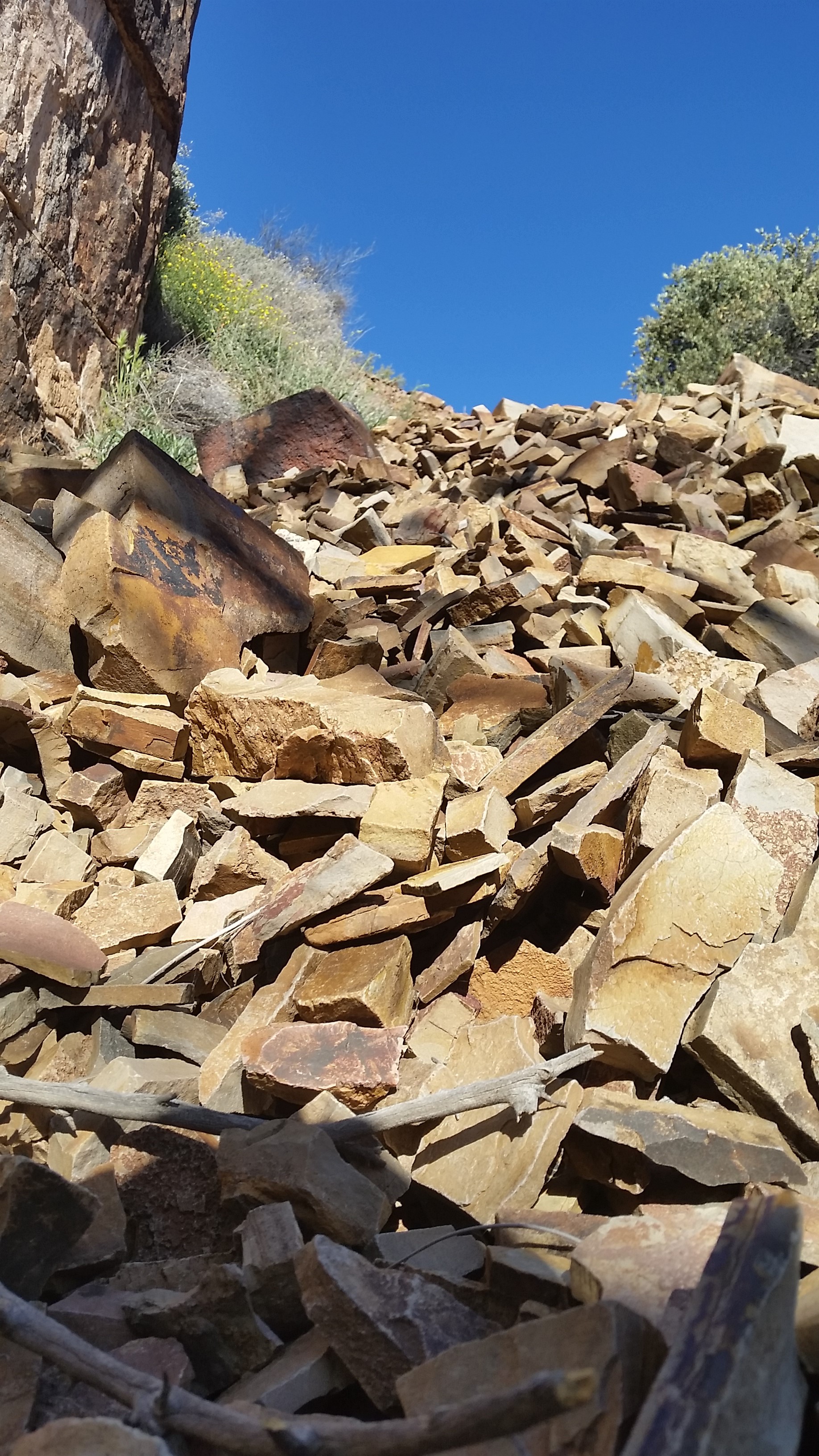
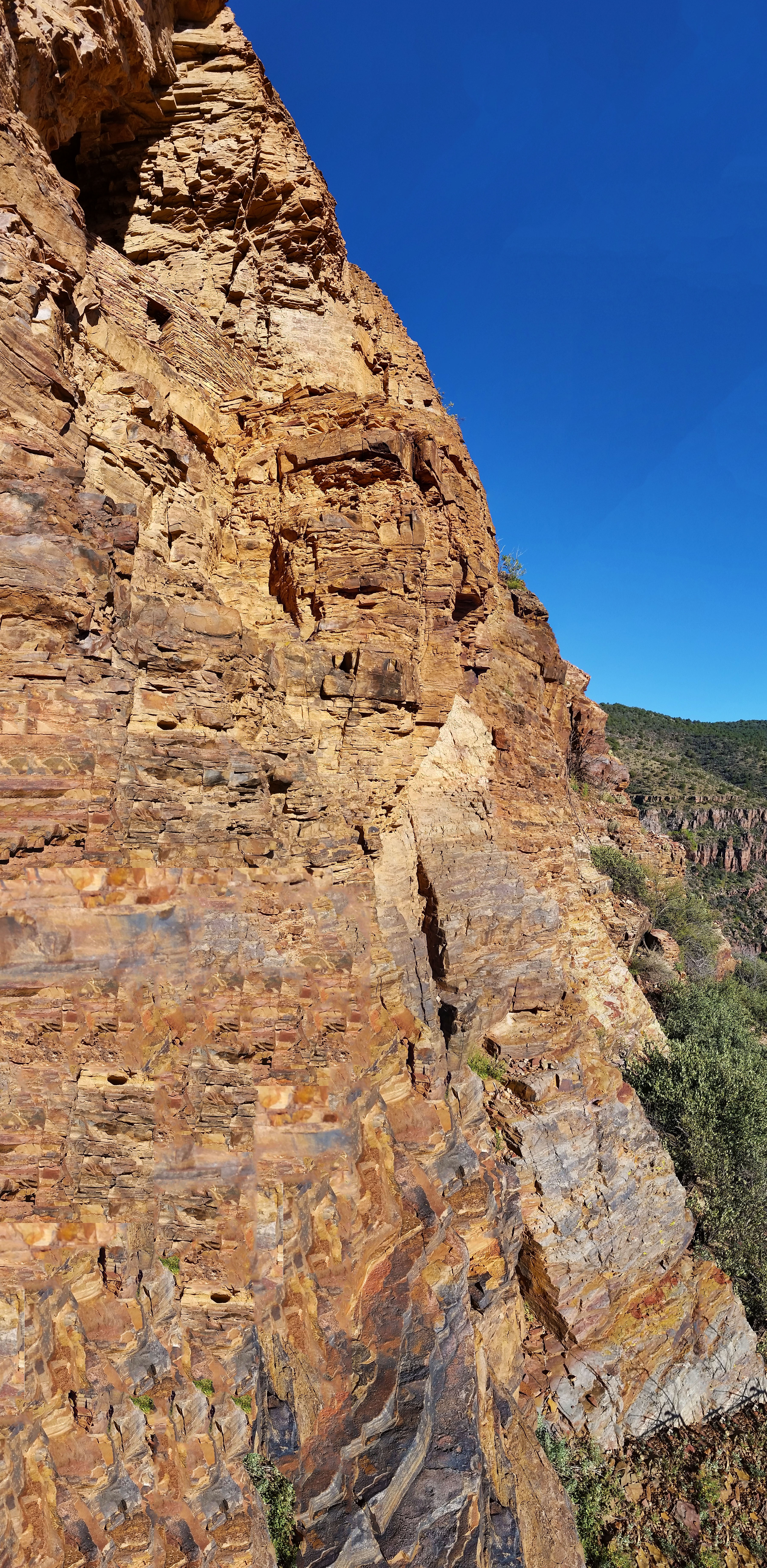
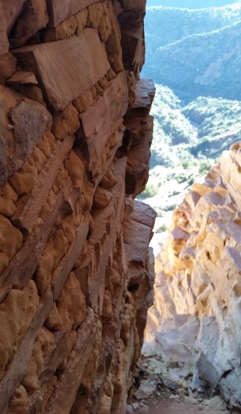
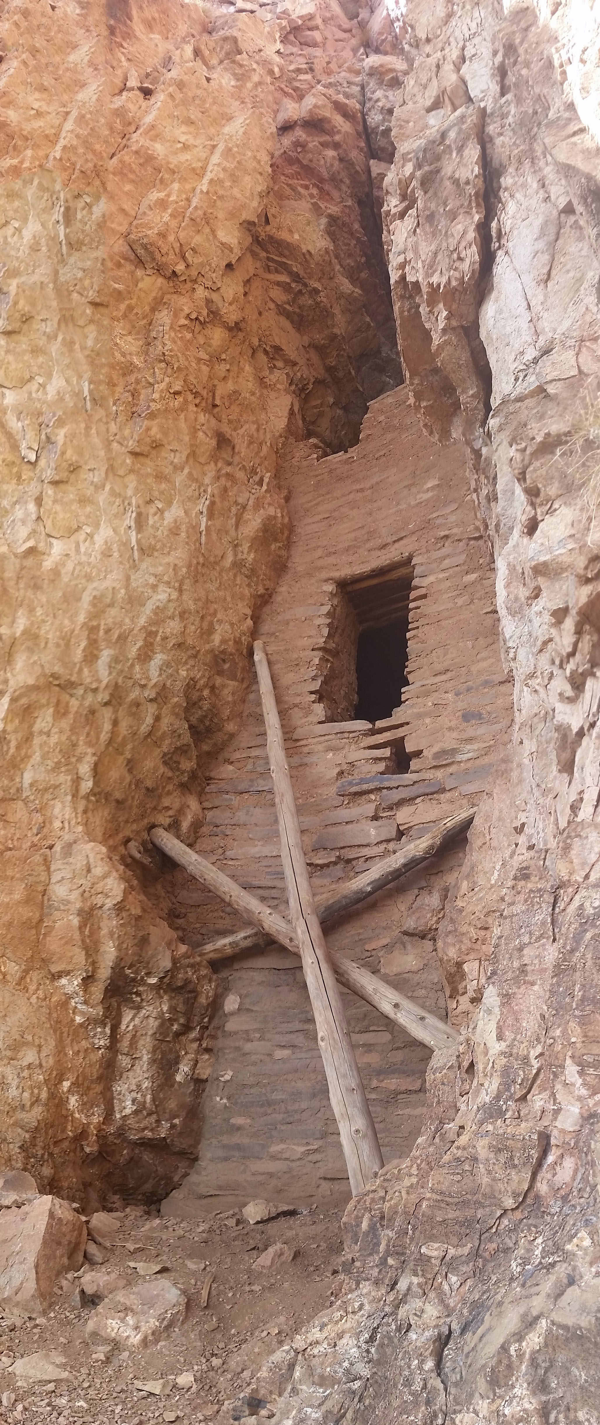
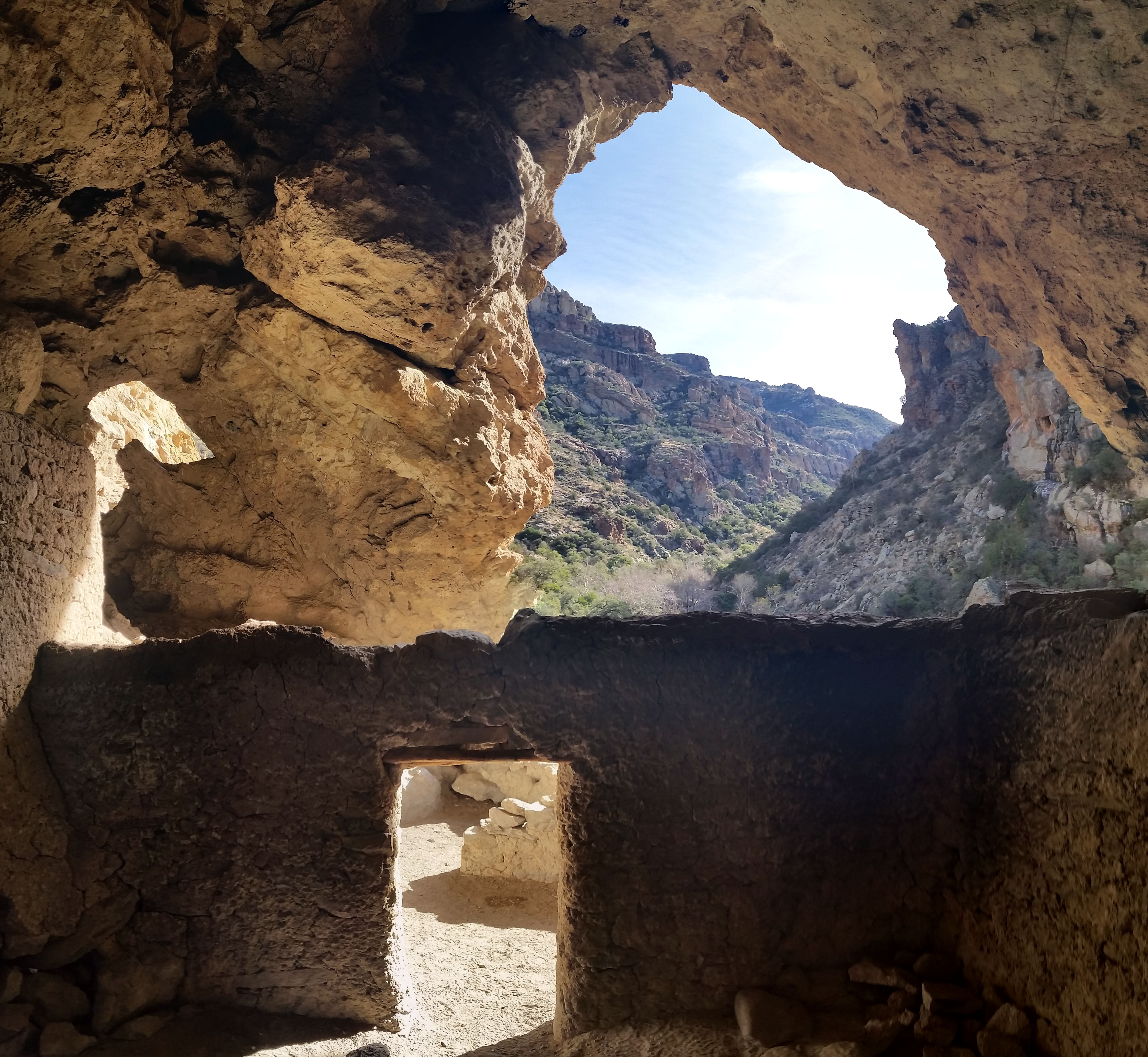
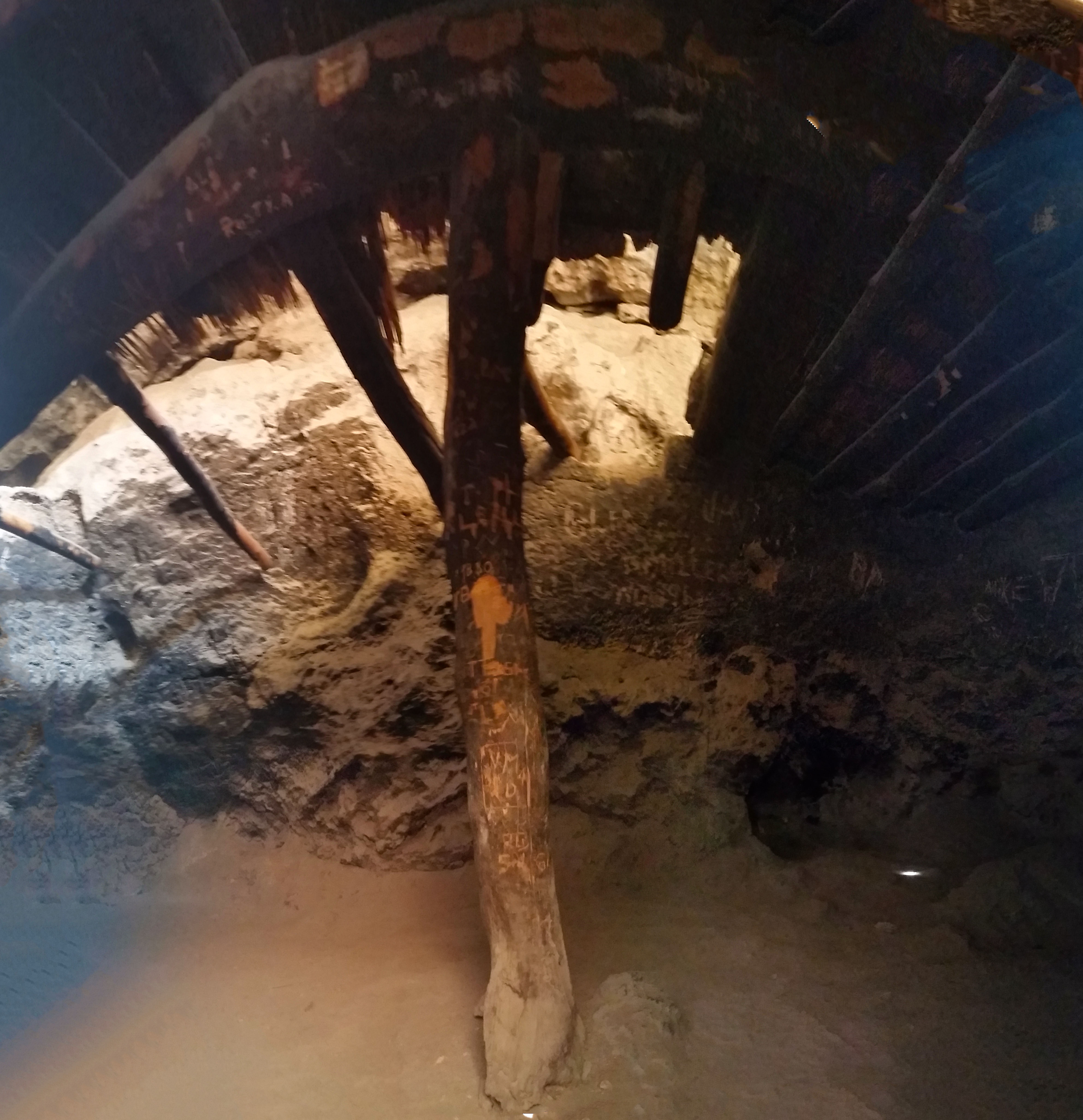
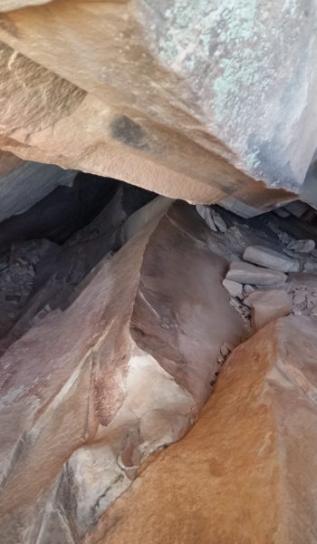
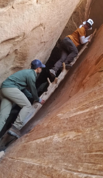
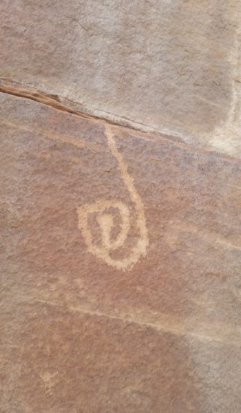
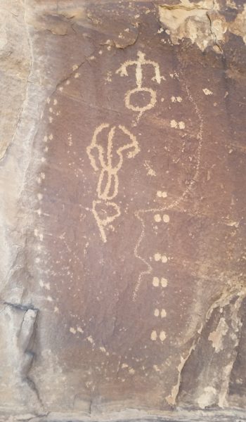
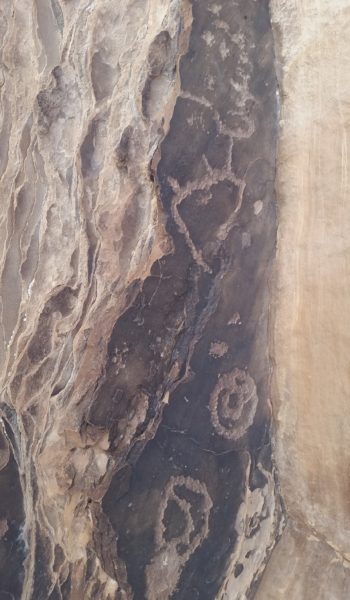
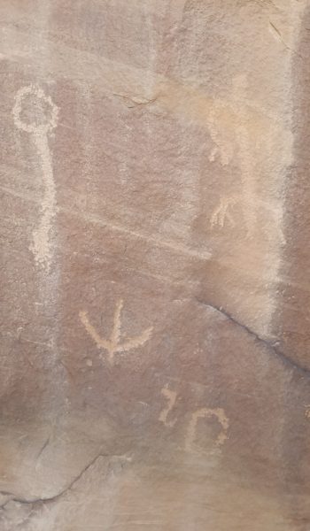
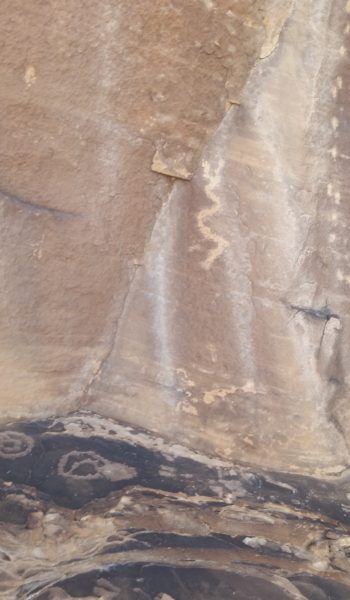
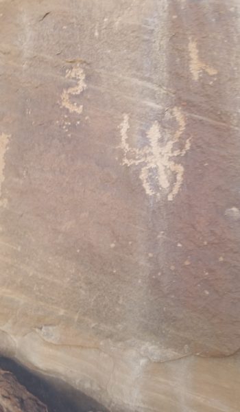
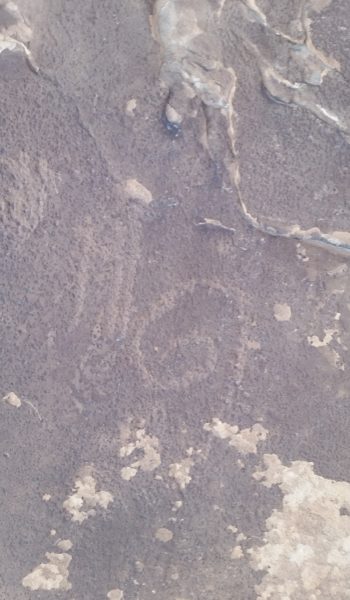
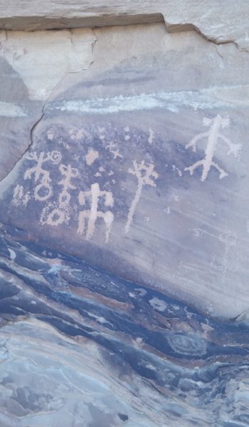
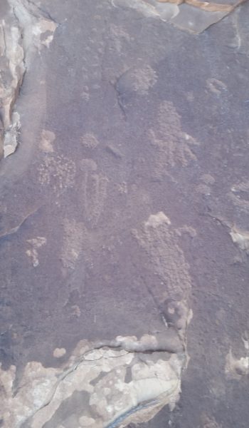
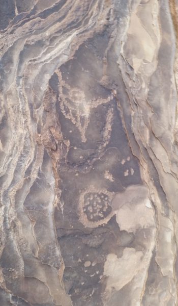
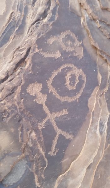
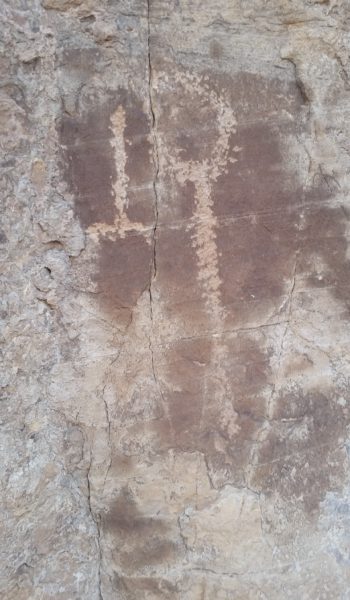
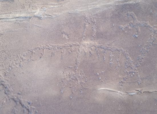
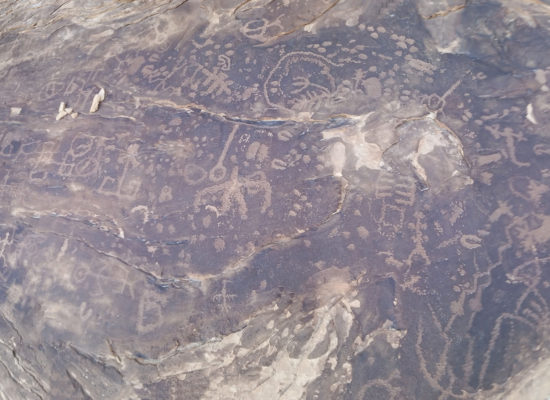
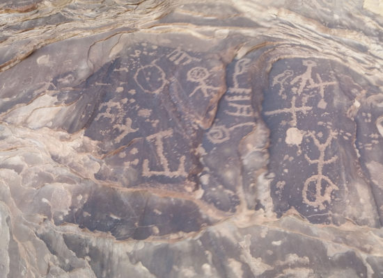
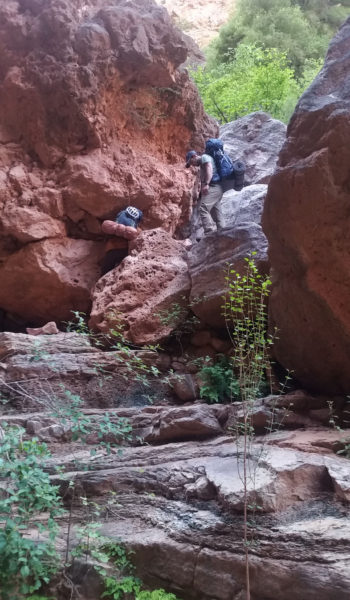
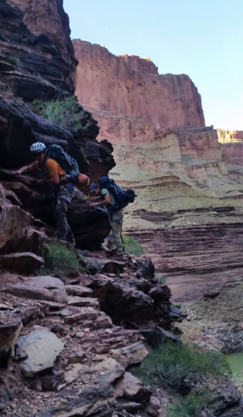
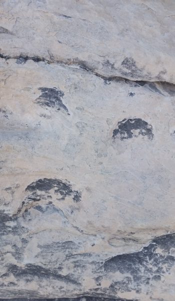
We started our way down the loose steep route, descending ledge after ledge looking for cairns as we went. The sandstone made our shoes stick like spiderman to the slanted ledges of the route. We found our first obstacle and quickly down climbed. I was fully extended in a hang when the tops of my toes landed on the stepping stone below. Whew! One down, only a ton to go! Sam and Mark quickly down climbed and we were off again. The route finding was tedious, we were skirting ledges with a beefy penalty for error. We walked toward a cairn that looked like it would lead us right off the end of a ledge. We looked right and tucked away was the crescent moon shaped rock that hid away the famous ladder climb. It was really cool, an old dead tree with branches cut for feet and handholds. I dropped down first, no issues, Sam and Mark soon followed. Just around the corner from the ladder, skirting north, we were treated with a huge panel of petroglyphs! How cool it was to be there and see something that had been there for hundreds of years!

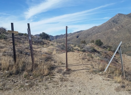
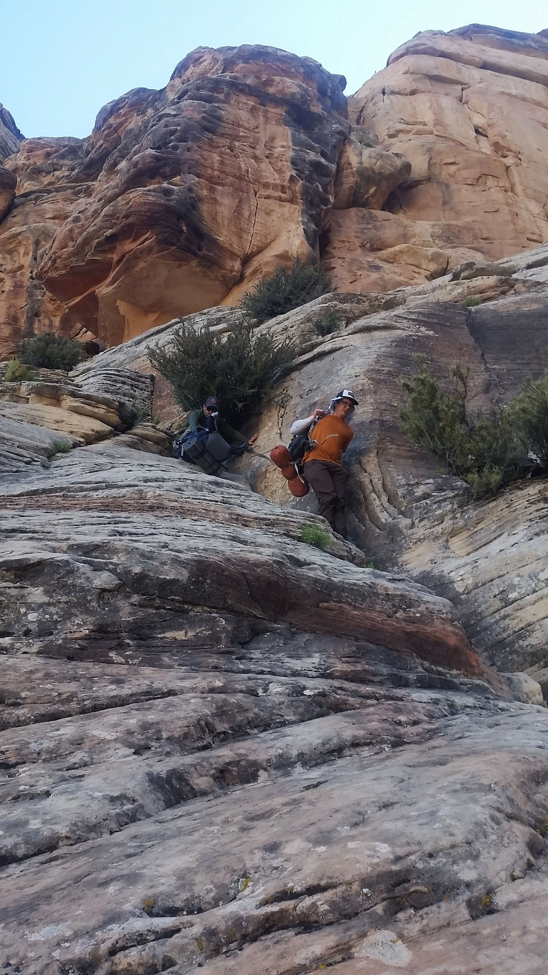
  • Cairn leading right off the edge?

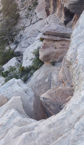
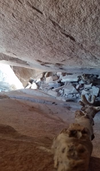
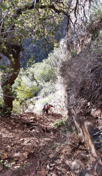
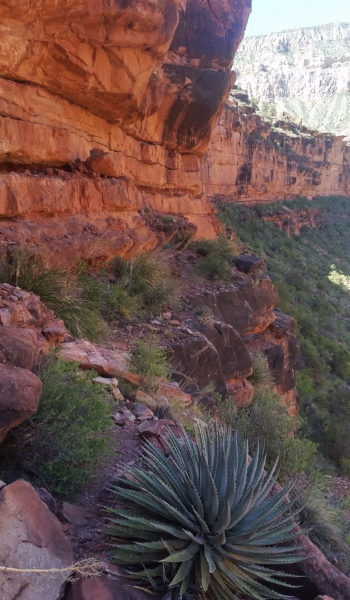
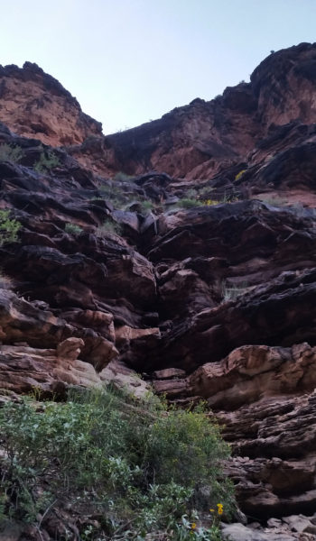
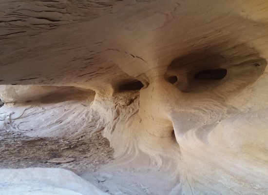
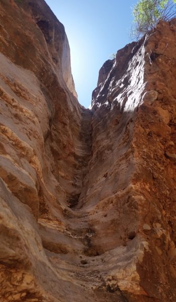
We kept trekking, descending ledges, and finally found the Moki steps on a sandstone slab. The natives cut small ledges into the sandstone making some nice steps for your feet to climb up and down the slope. A little butt skirting and de-packing got us down swiftly.  We continued to pick our way down the ledges and skirt across a number of exposed, but not too difficult obstacles, until finally exiting the face via an arm that dumped us into the top of the wash to Royal Arch Creek.

Moki steps (click to enlarge)
Downclimbing the Moki Steps (click to enlarge)

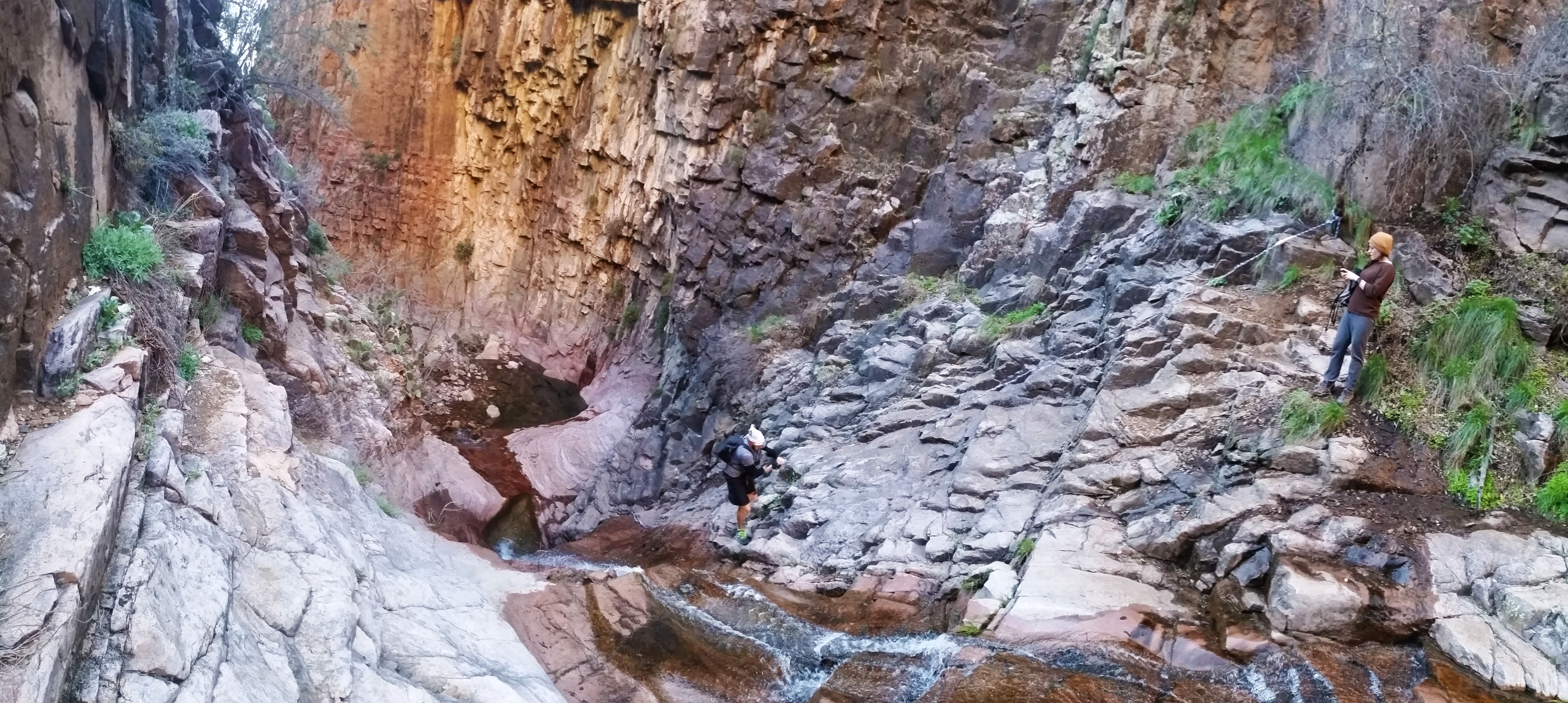
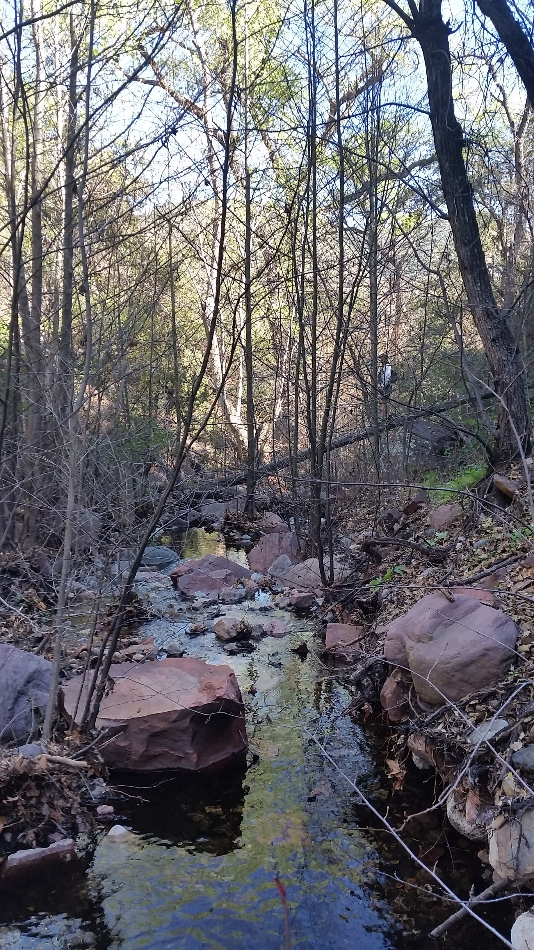
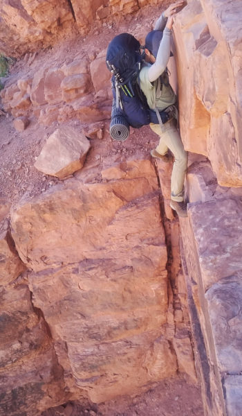
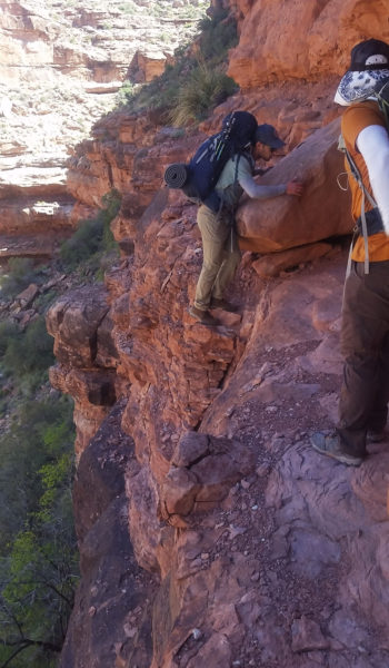
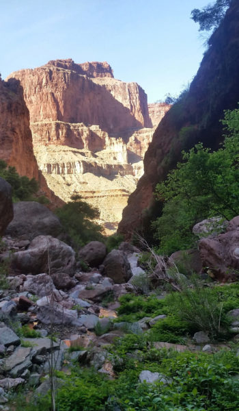
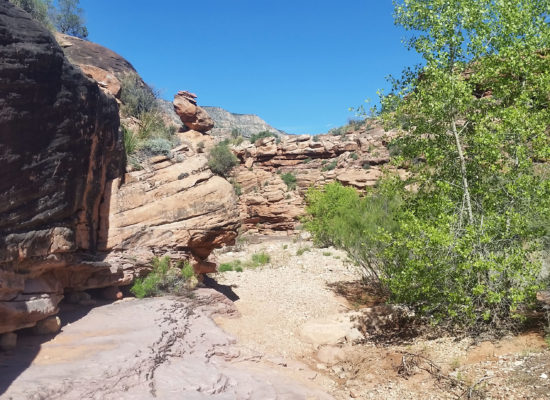
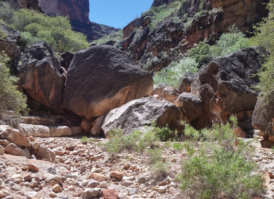
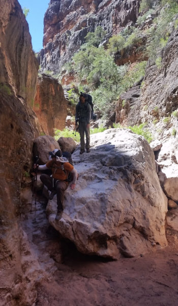
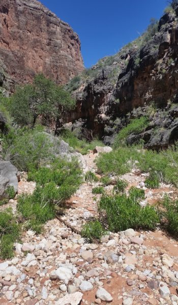
Let the boulder hopping begin! For the next few miles the sun went to work on us as we hopped, jumped, and scurried our way down the creek bed. Finally we came to a large pour-off (dry waterfall) which had 2 options, left to the “ledge of death”, right to the “rabbit hole” . . . “rabbit hole” just sounded too cutesy! We headed left all too curious about what this infamous obstacle had to offer. After a few minutes of skirting the side trail we finally came to the ledge. It had a nice 20 foot exposed traverse with some teared drops below that. What fun! I was first up and found that the grippy rock had some great holds and the feet weren’t that bad either! Keeping the packs on, we all traversed the obstacle with no issue! Just after the ledge, there were a few other small exposed traverses where we had to circumvent large boulders trying to push us into the canyon below. It wasn’t horrible, but deff warranted concentration with a 40lb pack on your back!

Enter the wash!
Left to “Ledge of Death” – Right to “Rabbit Hole” (click to enlarge)
  • Ahead is the "Ledge of Death"!

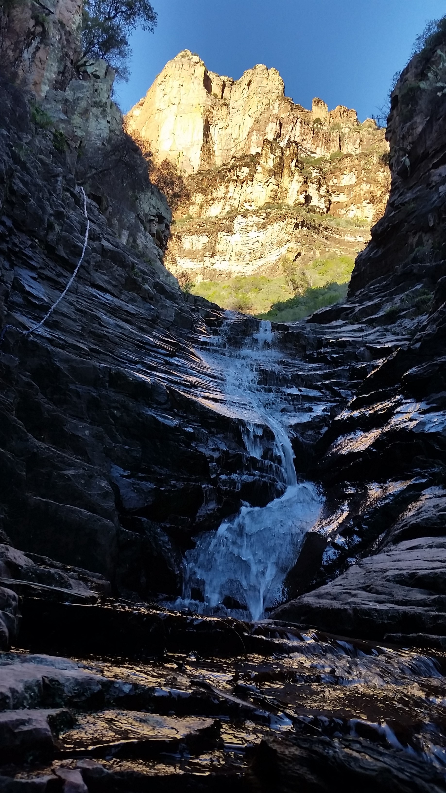
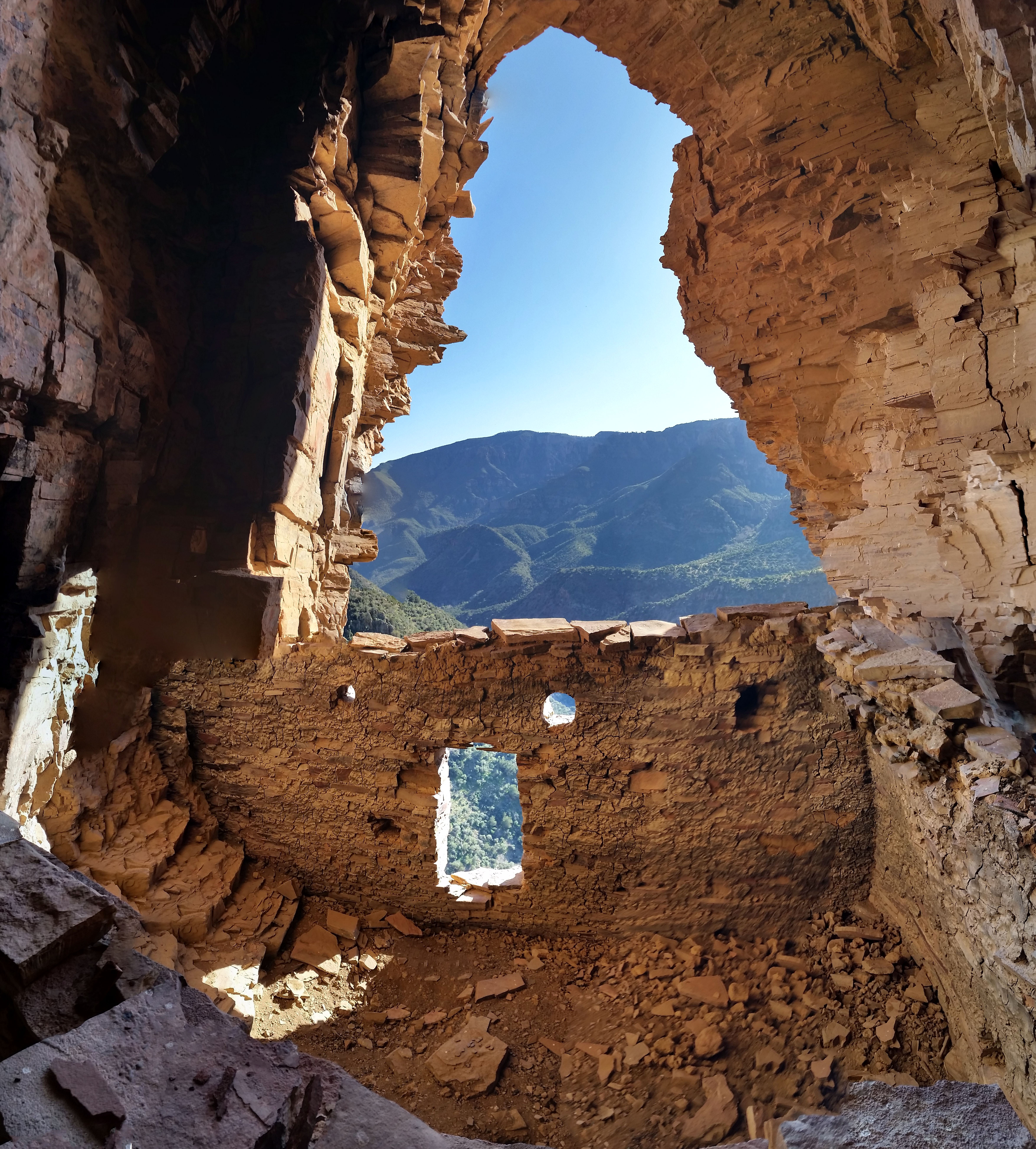
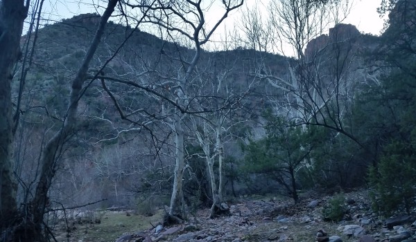
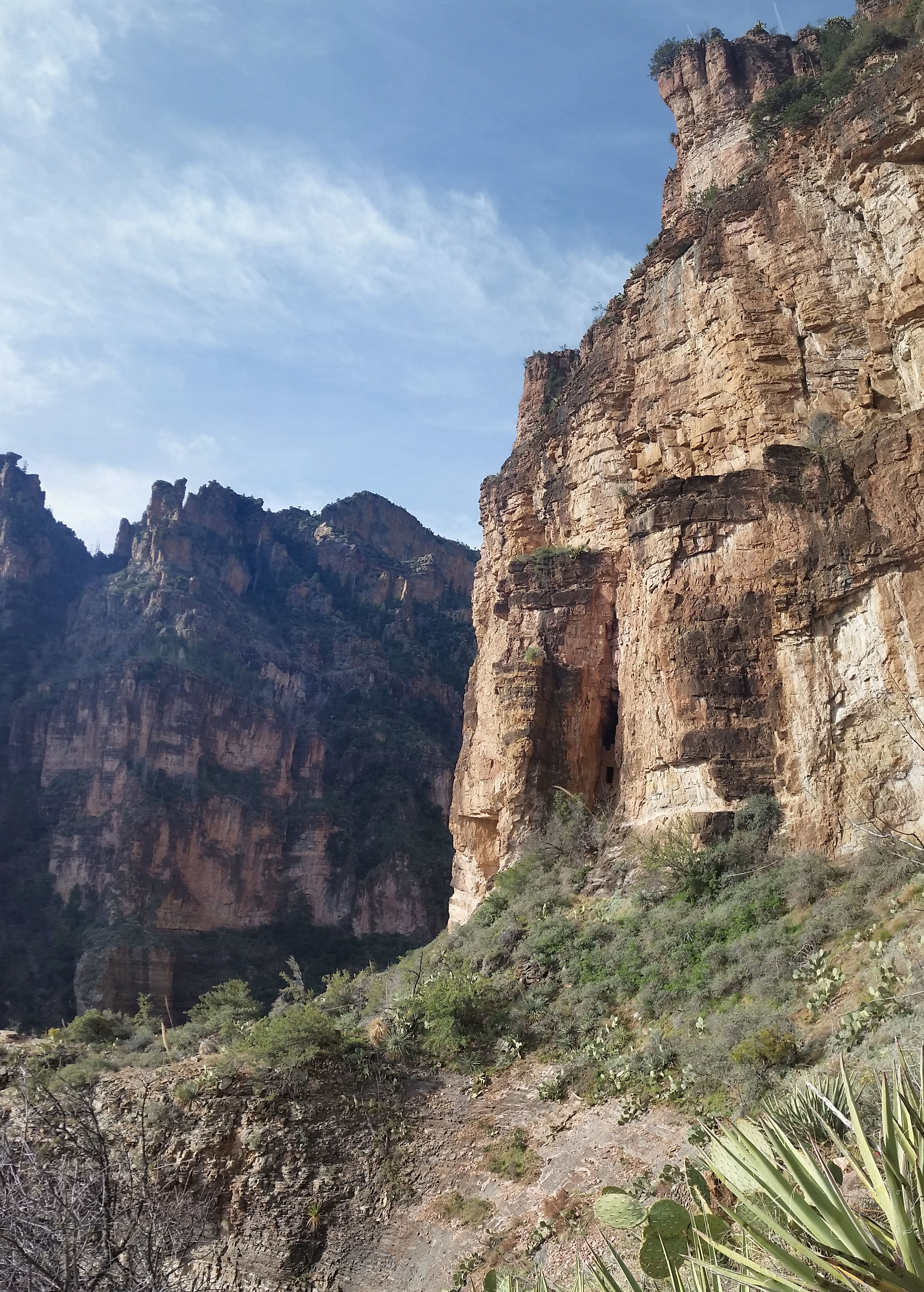
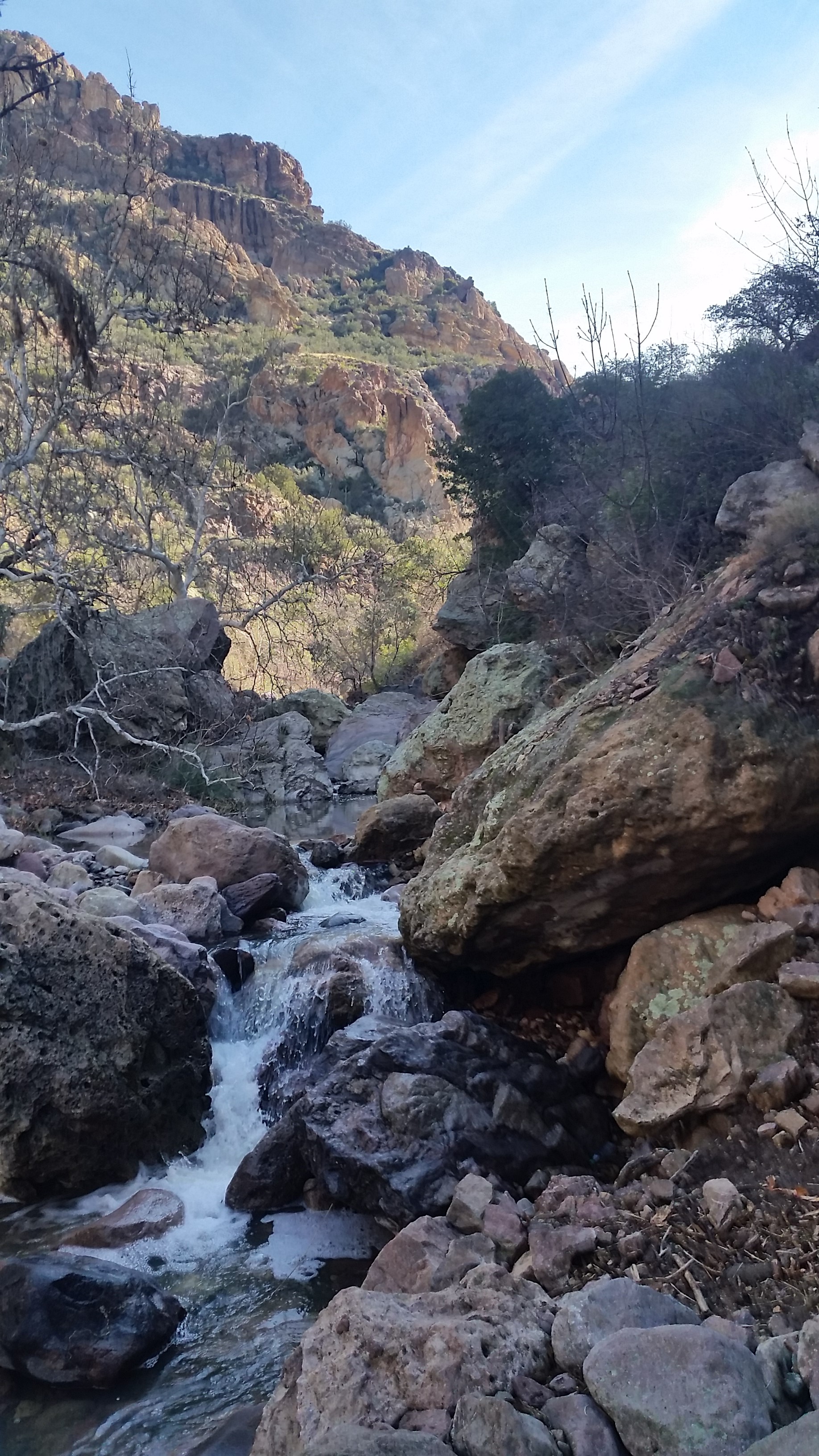
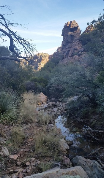
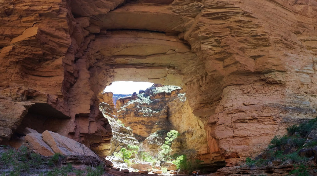
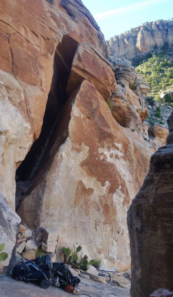
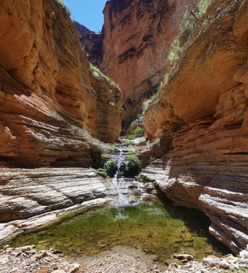
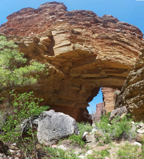
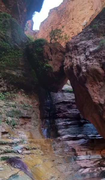
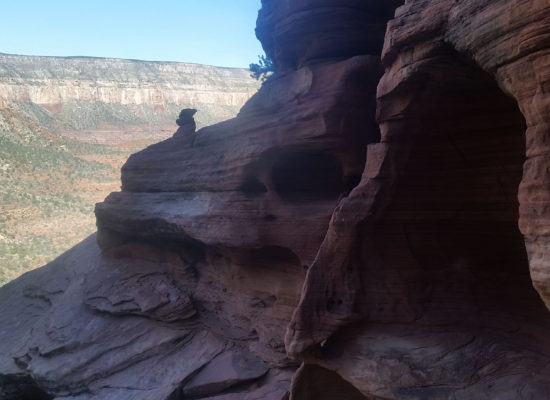
We continued downstream, boulder hopping once again until finally the dry creek bed was wet with a beautiful spring and a small ledgy down climb. The water looked so tasty and our parched mouths were ready for a break. As we pushed further, we turned a corner, and there, standing high above our heads was the Royal Arch. What a beautiful sight, it was enormous and demanded respect! We had a nice break in the shade under the arch, next to the creek running just below the massive rock. Just taking in the sights and replenishing our grumbling stomachs.

Beautiful cool spring pool
  • Time lapse - Ledge downclimb past the spring

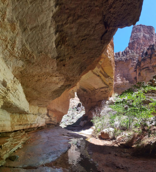
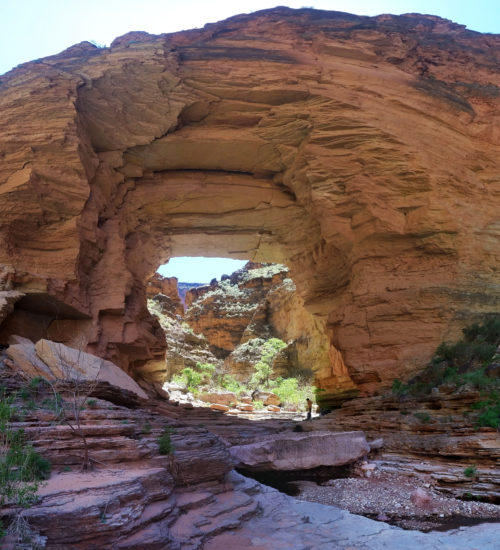
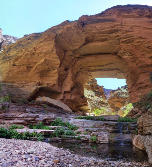
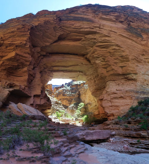
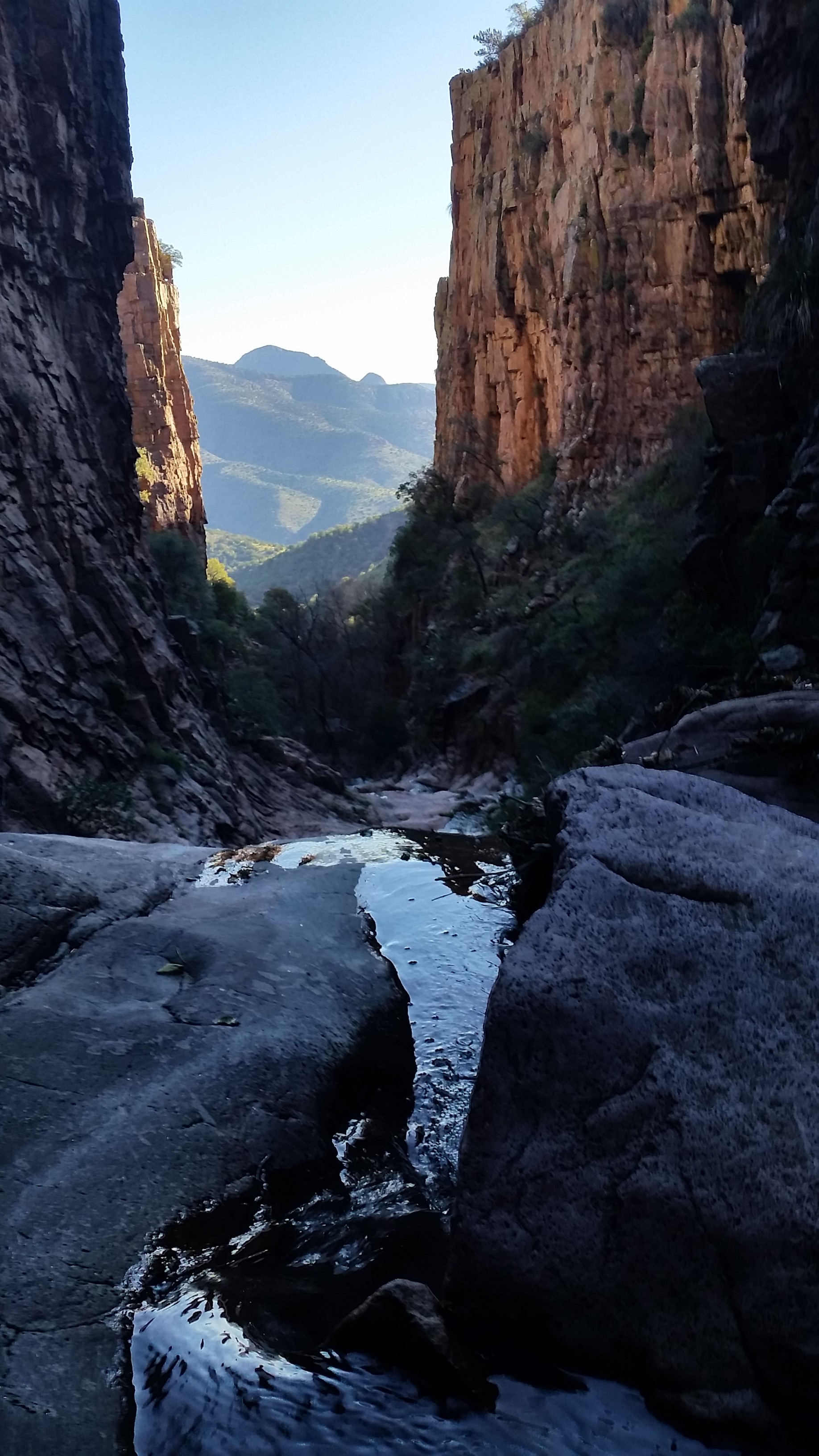
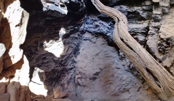
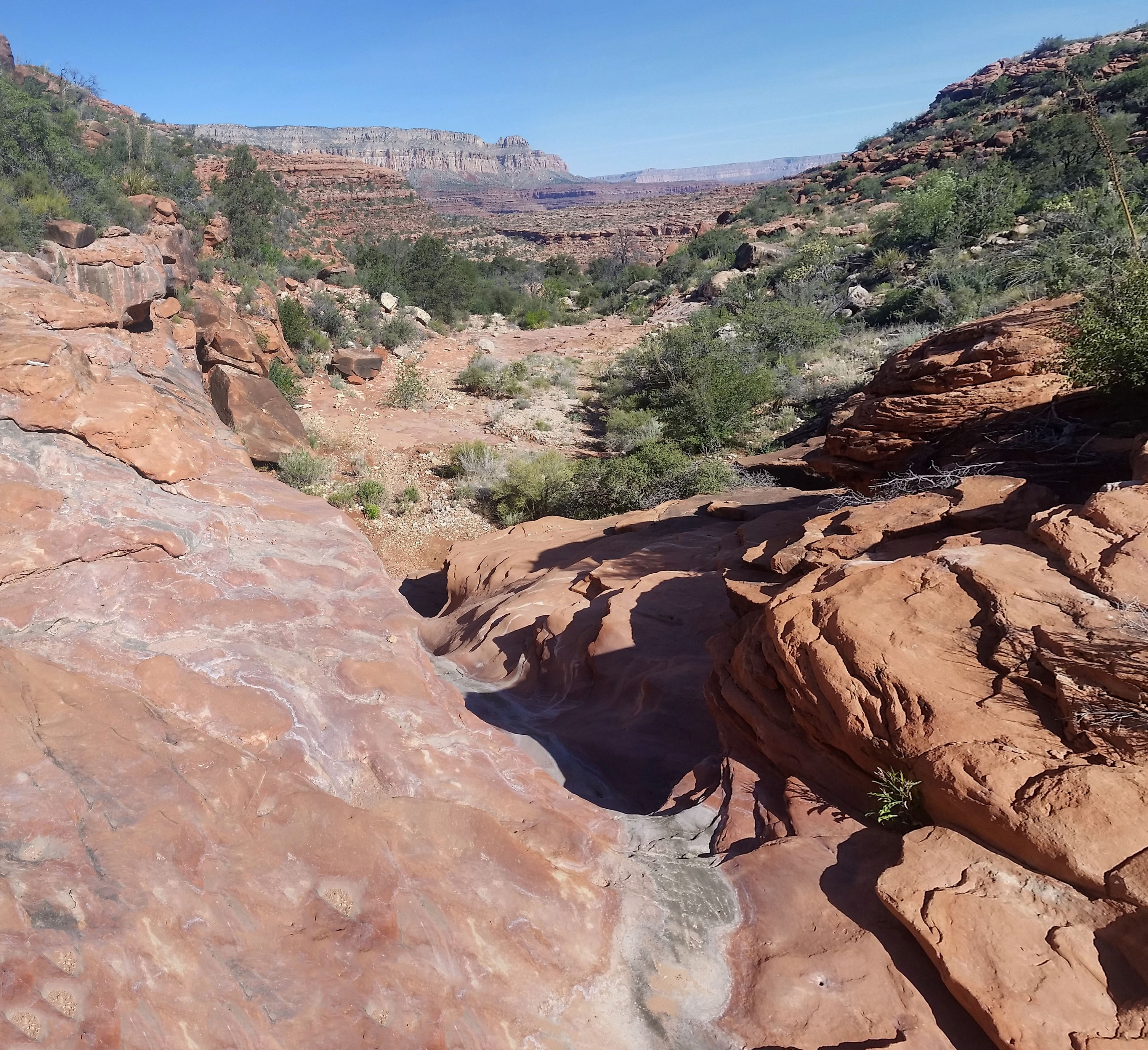
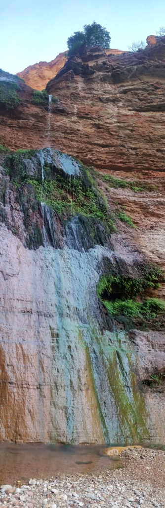
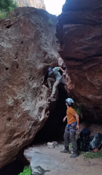
Fed and ready for more, we walked downstream from the arch and peered over the huge cliff into the canyon below. What a drop! We were standing 170 feet above a tiered drop-off and the bed of a nice waterfall that trickled down just next to where we planned to rappel from. We found some good webbing and a quicklink that looked solid. I put up the biner block rappel setup using Sam’s 60 meter 9.8 mil rope to a carabiner with a constrictor knot. I backed it up with a figure 8 and tied on the 200 ft 6mm pulldown cord to the biner block. We were all set to go so I threw both ropes off the cliff and they fell to the second ledge. Time to go to work! I rapped first taking on the task of rope management as the small pulldown cord got quite tangled. I threw it from the first ledge down, then the next. To my relief the main rope reached the ground, and soon after, so did I! Whew, made it!

I stopped half way down the first rap to take a pic =)

Mark and Sam soon followed and we were all safely on the ground when I went to pull the pull cord I had set up. *Yank* nothing . . . *Yank* nothing . . . I started to get serious when I realized the rope could be stuck which would require me to either re-ascend the rope or we would be stuck in the canyon between two 100+ foot rappels. I reached high, grabbed a bite on the 6mm rope, tied an overhand knot,  and clipped it into my harness. I sat my full weight on the rope and once I did it finally budged. I quickly walked back away from the cliff pulling the rope as I did to make sure it didn’t get hung again. LUCKY!!!!! I was so relieved!

Timelapse of Mark rappelling down the 170 ft waterfall

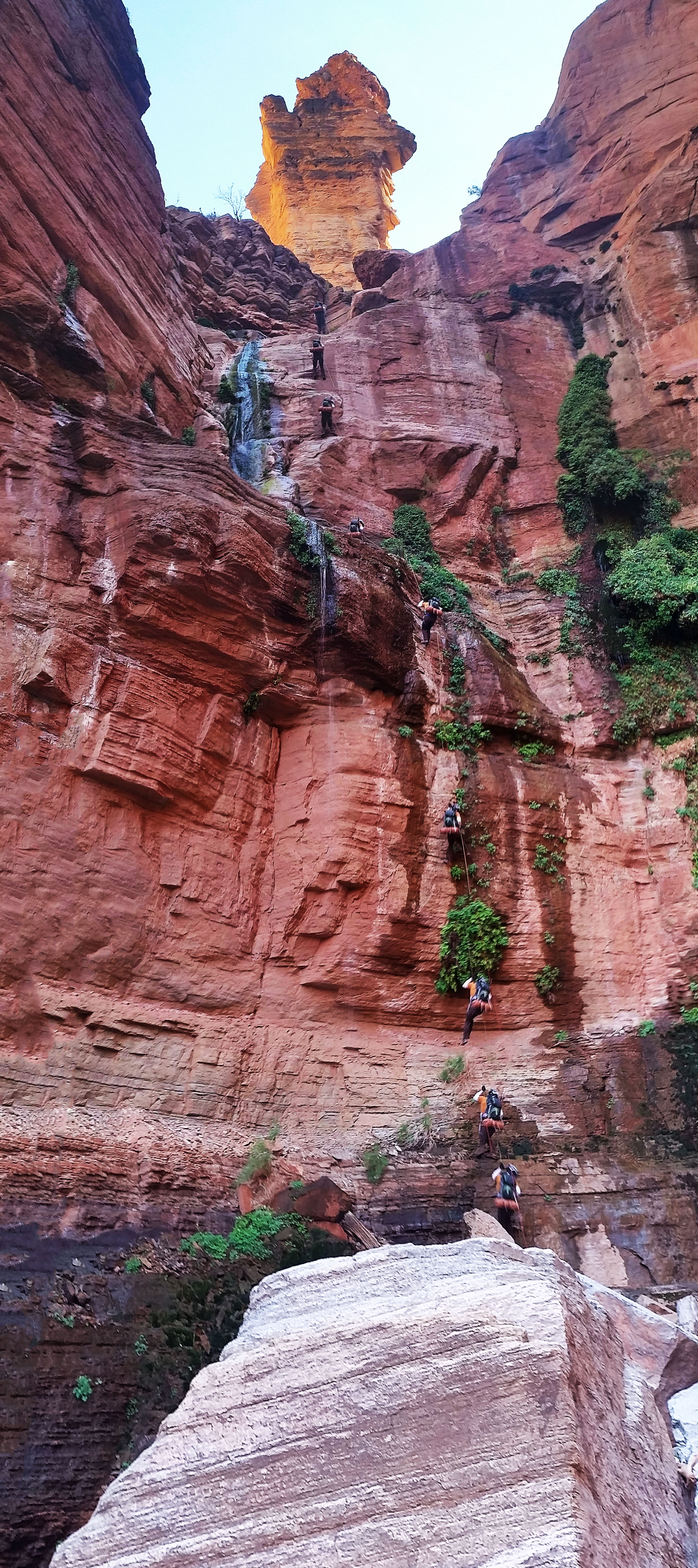
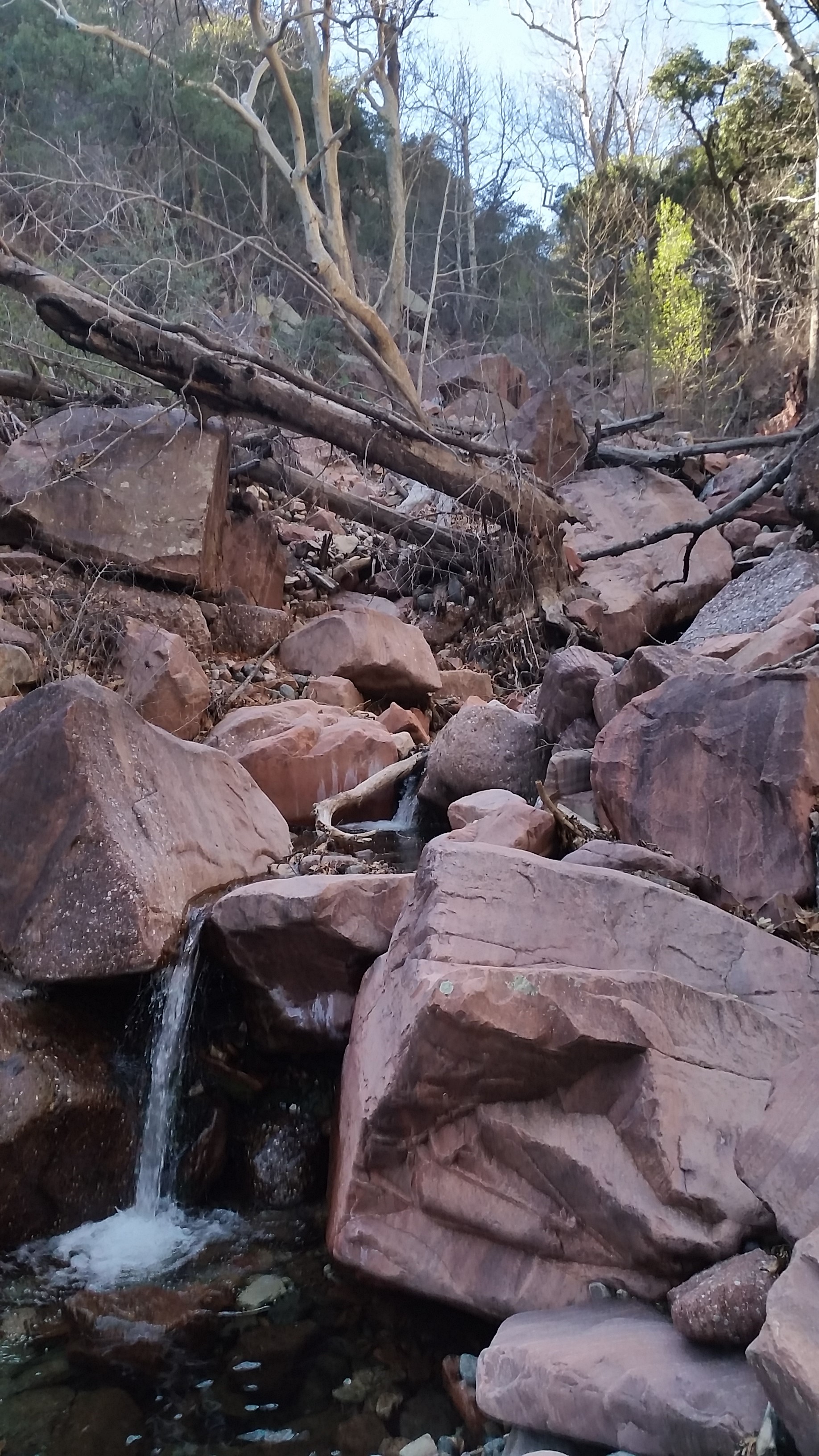
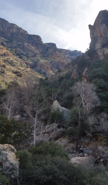
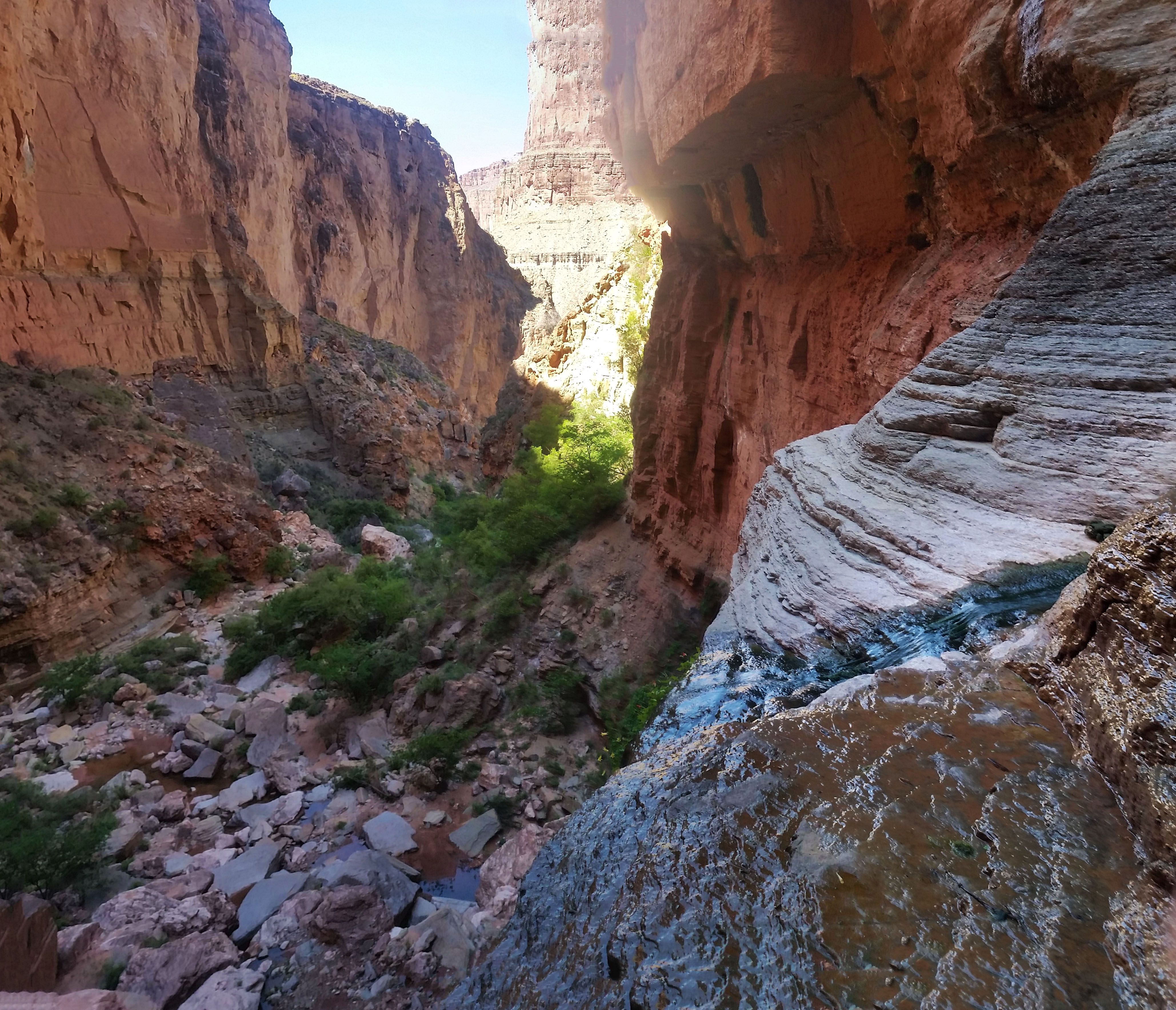
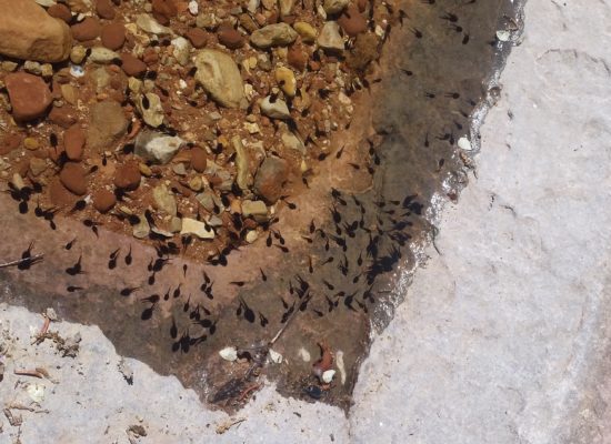
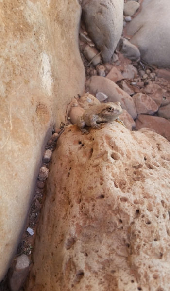
Once we retrieved both ropes and recollected our wits we headed downstream to find the second of the big rappels, a 135 foot cliff. This time our anchor was a nice tree with 3 sets of webbing wrapped around it. Another nice anchor that we could use! This rap went much smoother and was almost completely free hanging. We each made our way down the rope and into the next section of the beautiful canyon. Waterfalls and lush green plants were abound. Frogs darted this way and that in the pools as we trekked through, it was truly a hidden paradise!

The 2nd rappel – 135 foot

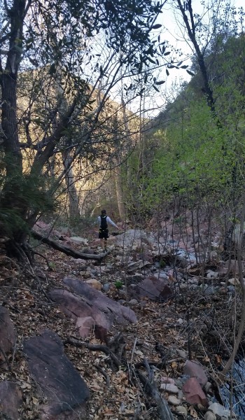
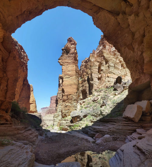
Soon after the second rappel we found a nice 8-10 foot downclimb. We pulled our packs off and hurdled the obstacle before strapping up once again and letting out further down the canyon. We dodged boulders, down climbed ledges picked our way slowly down. I popped my head over a huge boulder, the only down climb led to water . . . “that can’t be right”, I thought. I poked left, poked right and finally found a small tree on canyon right with a small 20ft rap. In hindsight, we found that we were on the wrong side of the canyon and should have belly crawled a ledge on the the west side of the canyon . . . Oh well! After placing some new webbing and breaking our rope and harnesses out once again, we made the last rap of the day.

  • Donw the canyon we go!
Elves Chasm!! Jumped into the cool pools here, how refreshing and cold as hell!

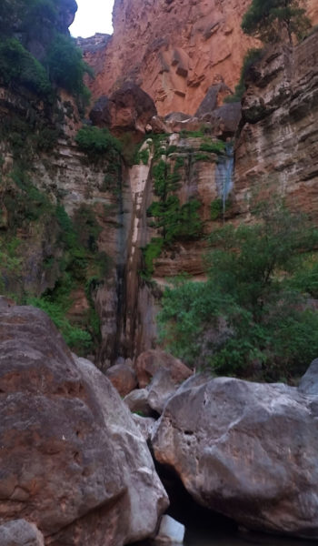
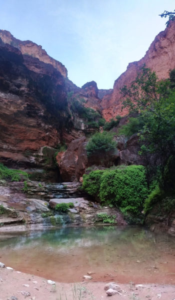
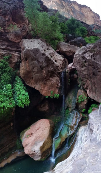
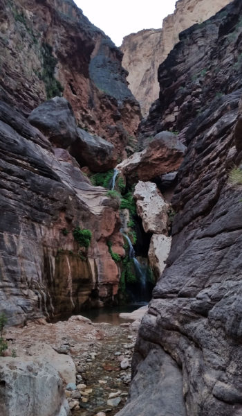
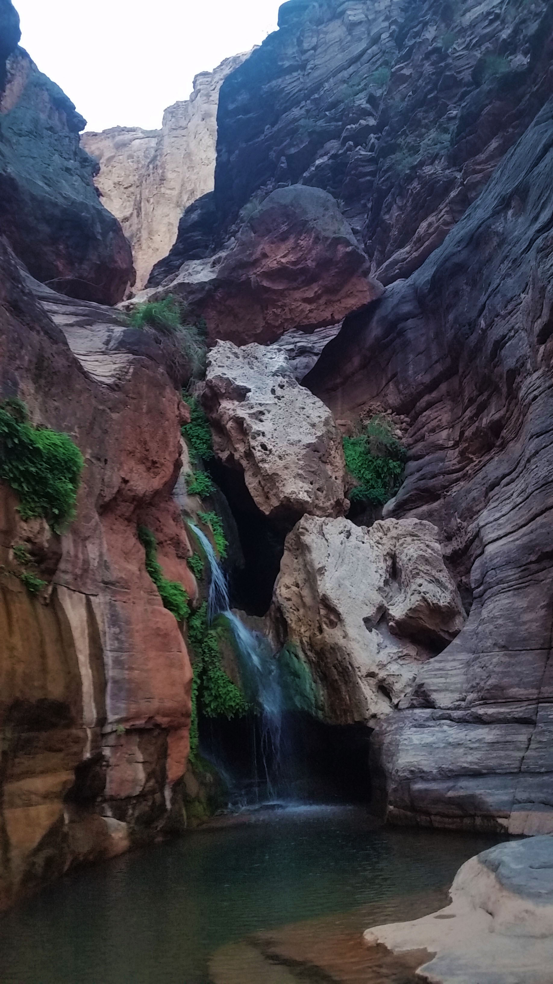
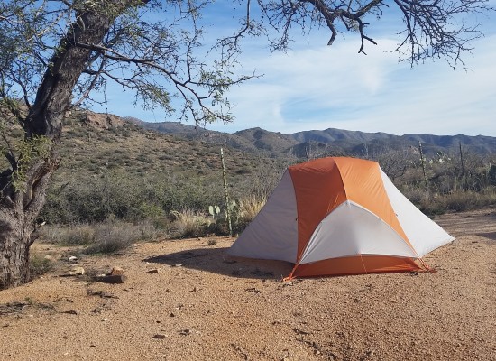
We enjoyed the rest of the canyon as we trekked on. Down climbing, shimmying over boulders and down ledges, using cairns to guide our way, until we finally reached Elves Chasm. It was a tiered waterfall with a deep crystal clear pool at the bottom. We decided to strip down and jump in; after the long exhausting day we had, it seemed like the right thing to do! After jumping from the waterfall and pulling ourselves from the cold water we trekked the rest of the way to a permissible beach where we set up camp, grubbed down, and finally, under the star lite sky, crashed out in our flyless tents. What an epic day, man I love the Grand Canyon!

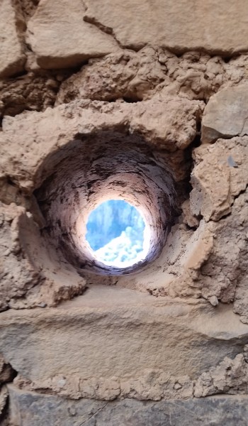
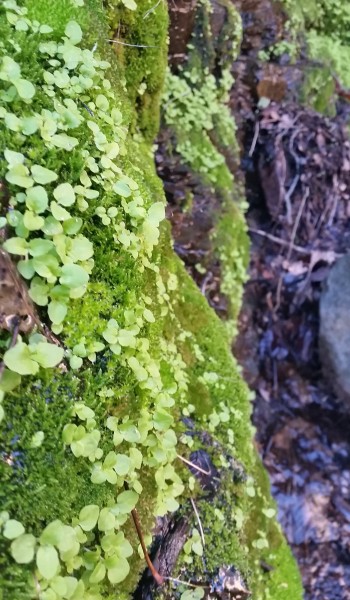
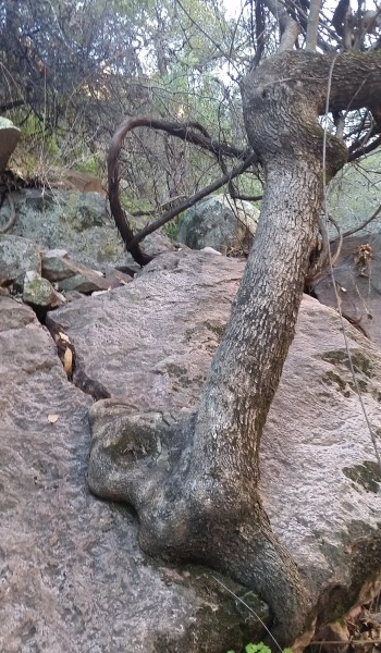
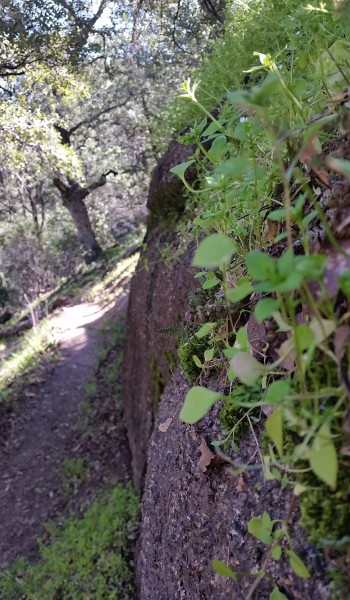
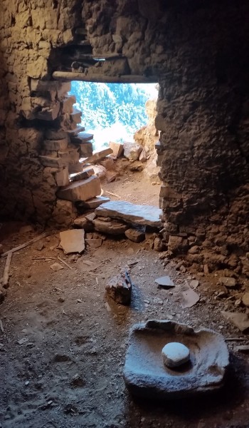
ADDITIONAL PICTURES:

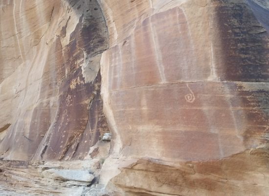
  • Enter the petroglyph panel!
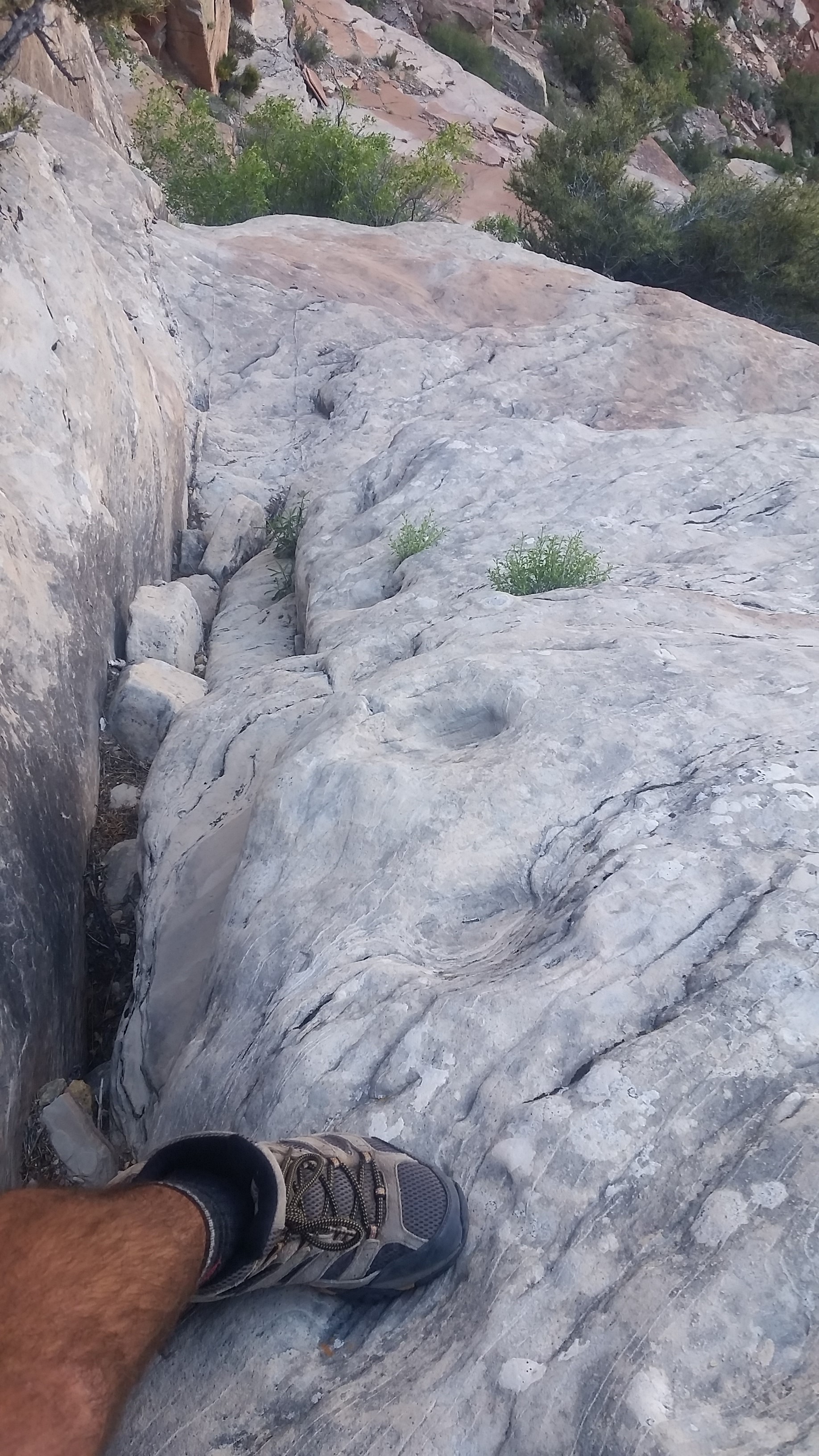
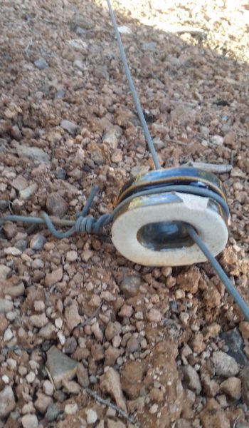
  • telegraph line insulator

HIKE INFO:

HIKE STATS:

  • Weather: Hi in mid 90s, Low in upper 40s, Sunny
  • Water: 5 Liters (including dinner)
  • Food: 1 Power Bar, 1 Kroger Protien bars, 1 Cliff Protien Bars, 1 granola bar, 1/2 bag of gummyworms, Apple, 1 Mountain House: Chicken and Mashed Potatoes, 1/2 bag of Salt and Veinagr Chips, 1/2 bag of Pizza Pringles, 1/2 bag of trailmix, 1/2 bag Boston baked beans, 1 PB&J sandwich, 1/2 bag of Quinoa.
  • Time: 12 hours
  • Distance: 11 miles
  • Accumulated Gain: ~ Drop 4000 feet

GEAR:

  • 58 liter exos osprey backpack
  • Big Agnes Copper Spur UL2 tent
  • Big Agnes QCORE SLX sleeping pad
  • Cosmic Down Kelty Sleeping Bag (rated to 20 deg F)
  • Jet Boil – Sol
  • Black Diamond trekking poles
  • SPOT Gen3 Tracker
  • Sawyer Squeeze – Water Filter
  • Black Diamond Helmet
  • Petzl Corax Climbing Harness
  • 2 Black Diamond screw carabiner
  • 4 Phantom DMM screw carabiner
  • Black Diaimond ATC Guide
  • 60 meter 9.8mm Mammut rope
  • Webbing, personal anchor
  • 200 ft 6mm pull cord
  • 4 rap rings

CLOTHING:

  • Wool T shirt – IceBreaker
  • Cotton hankerchief
  • Pearl Azumi arm coolers
  • Arc’teryx hoody
  • Nike running shorts
  • Merrell Mid Moab Hiking Boots
  • Darn Tough wool medium weight socks
  • Threadless hoody
Share

Salado Indian Ruin Hunt (3of3) Sierra Ancha – AZ (2.28.16)

Share
20150308_093518
Looking back down the canyon from the first waterfall

We save the best for last, don’t we? Our last day in the Sierra Ancha area I woke in my tent to the hue of the rising sun fighting back the darkness of night. It was time to get up, no alarm this time, just the peepers opened and the morning ritual began. With a chill and a hoody on I brewed coffee and threw the rest of the kindling and wood from the night before on the still warm buried coals of the fire. With a little coaxing, the fire lit again jumping onto the twigs and limbs heating us during breakfast. This morning Stevo, Annalise, and myself had our sights in Devils Chasm ruins. Soon after breakfast we snuffed the fire and threw our packs on heading up the canyon for our last trek of the weekend.

20150308_085541
The lower section of the trail, nice and padded

As always I was excited to get my feet on the trail. In the beginning the trail twisted back and forth on padded dirt paralleling the creek feeding the canyon. It has a pretty good climb to it and after a one good hardy pushes, we were all peeling off layers. The trail lush and green at the sides was totally different than the hikes the day before. Devils Chasm is a sheltered oasis in the high desert, lush green grass, thriving vegetation, and a cool running creek transports you miles away from any desert. We kept climbing until the trail dumped us down into the creek and the canyon walls began to close in. Let the boulder hopping begin!

20150308_092241
Lets start boulder hopping!

It wasn’t long before we came to the first of two climbs/scrambles. On the right side of the canyon a rope dangles below a chalkstone to the right of a small waterfall. The climb is easily accomplished with the aid of the rope (rope was newly replaced). Once atop the climb we turned the corner to a much larger waterfall/slick rock area. What a view! The golden sun bared down on the red rock face while the cool canyon stayed shaded and blue. The second waterfall is easily climbable to the left with aid of a rope (this rope was not as good as the first and honestly should be replaced).

20150308_093741
2nd waterfall
20150308_093957
Stevo and Annalise ascending the 2nd waterfall

After taking in the views and a few pictures we hiked on and up the canyon knowing there was a good push to get to the ruins. Boulder hopping and canyon skirting continued for a half mile or so before finally a padded steep dirt trail appeared to the right, it really took off! Talk about steep; once again we were grabbing at lodged rocks, strong branches, and roots to ascend the incredibly steep trail. We were careful to not kick dirt and rocks down on one another.

Untitled_Panorama24
Entrance from the canyon, first room

Finally we popped out from the brush letting way to high canyon walls and an enormous (and almost camouflaged) ruin on the rock face in front of us. From the face it looked as the highest wall was 30 feet tall and the entire building spanned 60 feet. Excited we pushed forward on the winding trail to the ruin. The climb is exhausting but the sight of the ruin made every step worth it! The ruin was five rooms wide, four of which still had fully standing walls, and one had a partially intact roof. The last room let out to a high exposed ledge like a side porch. Inside the rooms we found some small pottery shards and two grinding stones.

Untitled_Panorama4
Looking inside the 4rd room to the east, such a cool sight to see
20160308_093358
Looking back to the ruin from the exposed ledge

Like tourists we snapped pictures up, down, left, right, checking out every crevice of the ruin. How impressive that almost 650 years later this mud and rock structure still stood the test of time. The Salado Indians built a fortress standing against erosion, storms, and of course the most destructive force: the occasional visit from man. Places like this are to be respected and preserved, but that doesn’t mean you can’t visit them. Respect it, leave no trace, and it will be here down the road for others to enjoy too.

Untitled_Panorama123
Top view of all 5 rooms and the canyon
Untitled_Panorama11
Peering down into the 2nd room along the ledge behind the ruin

Having our fill from the journey and needing to head back to Phoenix, we turned back down the steep trail and made our way back. We didn’t see one other soul on the trail, what a nice way to spend a Sunday. On a great trail, in an incredible place, with good friends.

  • Looking back down the canyon (see Stevo?)
  • Looking down the hallway

HIKE INFO:

Sierra Anchas – Devils Chasm Ruins

HIKE STATS:

  • Weather: Hi 70s, Low 40s, Sunny
  • Water: 2.0 liters
  • Food: 1 Nature valley sweet and salty bar, mixed 1 bag of chips (Salt and Vinegar, corn chips, and pretzles), Cliff Builders bar, 1 trail-mix bag, Sun-dried Cranberries
  • Time: 3 hours
  • Distance: approx 4 miles Round Trip from camp
  • Accumulated Gain: 2,100 feet

GEAR:

  • Mule Camelback backpack (3 liter bladder)

CLOTHING:

  • Cotton T-Shirt
  • Arc’teryx Hoody
  • Arm coolers
  • Cotton Handkerchief
  • Nike running shorts
  • Merrell Mid Moab Hiking Boots
  • Darn Tough Medium Wool Sox
Share

Salado Indian Ruin Hunt (2of3) Sierra Ancha – AZ (2.27.16)

Share
20160227_141350
Tonto National Forest sign, faded form the sun

After doing some extra credit exploring up Cold Springs Canyon I returned to basecamp at the mouth of Devils Chasm. Admittedly I was ready for food and a sit down. I kicked my shoes off, grabbed some grub and cracked a brew for kicks. The campsite is shaded with these trees sipping on the canyons creek shading us from the sun. The temps were perfect and everyone was in good spirits! Annalise opted to stay at camp so Stevo and myself set our sights for the next ruin of the day: Cooper Forks Canyon Ruins. Not knowing it, Annalise did well in choosing just to hang out, because the next trek was nothing she signed up for!

20160227_142929
Its bushwacking time! Down the tributary canyon (can you see Stevo?)

We headed out from camp back up the road in the warmest part of the day. We skirted on in and out of the canyon until we finally came across an old sign from Tonto National Forest. It stated that there were Indian Cliff Dwellings nearby, lucky it didn’t give away their location! Be soon bumped off the ridge into a canyon housing a tributary creek to Cherry Creek. Let the bushwack begin! We headed doen the canon, boulder hopping, crossing logs, and avoiding getting wet in the creek. We hopped, jumped, and down climbed until finally we hit Cherry Creek. We soon found a way to cross the creek and headed upstream boulder hopping once again following a few sparce cairns. Before we know it we found a rockface jetting into the water imeding our further progression. We decided to take it up and over, the climb was on!

20160227_143729
What an awesome place!

Once we topped out the rock we weaved in and out bushes and trees, in and out finding no real trail, only sparse areas of low vegetation. We continued pushing forward and were faced with a dropoff into another tributary canyon to Cherry Creek. This bushwack was tuning out to be a little less straightforward than we planned. We bombed down steeply into the canyon and up the other side knowing this was the only way to begin the climb to the ruins.

20160227_145403
Ridge to the ruins

Once we reached the top of the base of the ridge that would lead us to the ruin, we stopped under a shaded tree and decided to grub. Stevo was starving and it was time to feast! We garbled down snacks and sandwiches, undoubtedly looking like two cavemen in the woods. Soon replenished for the hike ahead we set our sights forward up the right. Soon we found a well cairned trail that wasted no time climbing up and onward! We pushed up and on for a good ways. Just as the clear trail appeared before us, it vanished. I pulled out my GPS and found the right direction and kept pushing on. Soon the trail turned from boulder hopping to straight shale. It reminded me of being in the Sierras above treeline, only the rock here was red. Maybe that’s why they called it the Sierra Ancha (its actually Spanish meaning ‘broad range’, but what the heck I can dream).

20160227_153952
Shale city!

We pushed on and up in the beating sun, before finally skirting a large rockface to find the ruins, tucked away. This set was pretty big, I counted 3 main strictures, and 8 rooms, 4 of which were left intact. The rooms furthest west were almost completely lost with only fragments of the walls that stood. The middle set had another caved in area where the second floor finally fell against the test of time. The connecting room was fully intact and even had a grinding stone in the floor.

Untitled_Panorama2
Finally made it! Initial view of the ruins from the trail (middle right, lower left)
Untitled_Panorama4
Pano if the furthest west rooms or whats left of the rather

The last room furthest east was the most impressive of this ruin. The approach to the room had a nice exposed 10-15 foot climb with some pretty serious penalty for failure as the drop kept going eventually dropping into the canyon below. We both successfully made the careful climb and were soon in the main room taking in the incredibly impressive architecture of the Salado. It seemed as though there were main rooms for sleeping and a smaller build room towards the back where fires were burned, for food and heat we speculated.

Untitled_Panorama5
Middle ruins, still intact!
Untitled_Panorama6
View from inside, see the grinding stone?

The Indians were truly gifted, not only in their climbing skills but their resourcefulness to gather and survive such a hostile area. These special places should be shared, but above all respected. Soon after taking in the views and a few pictures we headed back for camp. What another well spent day outdoors!

Untitled_Panorama14
Nice sketchball climb to the last furthest room
Untitled_Panorama1
From the inside of the furthest east room, awesome views!
  • Looking back to the est side of Cherry Creek
  • Look a Stevo!

HIKE INFO:

Sierra Anchas – Cooper Forks Canyon Ruins

HIKE STATS:

  • Weather: Hi 70s, Low 40s, Sunny
  • Water: 2.0 liters
  • Food: 1 Nature valley sweet and salty bar, 1 bag of Salt and Vinegar chips, 1 orange, Clif Builders bar, 1 trailmix bag
  • Time: 3 hours
  • Distance: approx 5 miles Round Trip from camp
  • Accumulated Gain: 1,800 feet

GEAR:

  • Mule Camelback backpack (3 liter bladder)

CLOTHING:

  • Cotton T-Shirt
  • Arm coolers
  • Cotton Handkerchief
  • Nike running shorts
  • Merrell Mid Moab Hiking Boots
  • Darn Tough Medium Wool Sox
Share

Salado Indian Ruin Hunt (1of3) Sierra Ancha – AZ (2.27.16)

Share
?
Sierra Ancha Wilderness boundary

Cold Springs Canyon Ruins (1of3). I woke before the sun came up. The usual scenario, alarm blasting at the walls of my tent letting me know it’s time to go to work! Stevo, Annalise, and myself drove up the long road to the Sierra Anchas the night before finally arriving to surprisingly an empty campground. The camping here can be pretty sparce as there are not many flat spots just below Devils Chasm. Luckily we grabbed the primo one at the top, set up camp, ramped up a fire and crashed. Not another soul out there!

20160227_074149
Looking back from the road up Devils Chasm Canyon

Back to getting moving; I stretched my legs like a lazy cat, threw on my hiking clothes, and got breakfast brewing. Stevo and Annelise soon appeared from his trucktop tent and we got the morning underway. Once breakfast was through it was time to put feet to trail and walk the road north to the trailhead. The morning light was awesome, peering through the leaves kissing the rocks around us. Just before hitting the first turn in the road we turned and peered up Devils Chasm, what an incredible sight. It would have to wait until tomorrow, as our sights for the day were set on Cold Springs Canyon Indian Ruins.

20160227_115027
Cairn at the top of the 4 wheeler road before the wilderness boundary

We climbed on, trekking up the road until the small 4wheeler road jetted off west, turning up we trekked up the good grade to nice hidden luscious green paradise atop a saddle. If we couldn’t find the spot we did, we would most certainly camp here. Views from this saddle were incredible, looking out over the Anchas just made me think about how people could survive here hundreds of years ago. The Salado Indians got it right, what a beautiful place!

20160227_083756
Looking across the Sierra Anchas from the trail to Cold Springs Canyon

We trekked on, pausing at the Sierra Ancha Wilderness sign for a quick picture. The open pastures soon turned into a twisting and winding trail through manzanita. Signs of the cattle ranched in the area were all across the trail; footprints, cow patties, broken branches, but luckily no cattle. We trekked up and on until we got to the plitoff for cold canyon. We pushed around the ridge into the next canyon, looking up into the rocks its wasn’t clear where the ruins were at first. As we got closer we could see a crack in the rocks to the west on the north side of the canyon that could hold something promising. Hoping around manzanita, century plants, and agave that riddles the trail. Finally we were close enough to see a doorway, almost perfectly square. I pointed it out with a giddy smile. This is where the trail really started to get fun!

Untitled_Panorama3
First good view of the entrance of the Ruins from the trail

The trail jetted up right, up the side of the canyon gaining a quick 400 feet in less than 0.2 miles. I grabbed at branches, roots, wedged in trailside rocks, anything that was stable enough to hold my weight to pull up on. The trail was a slippery mess, loose rock, dirt was the bed for the ascent. Soon after some good sweat and grunting, we all topped out at the base of the ruins where we could clearly see the entrance. Approaching the ruins requires some climbing skills, but what waiting inside was truly incredible.

Untitled_Panorama4
Entrance, some light climbing required

The ruin was a triple decker. The lowest level could have been storage while the mid level and upper levels were most likely sleeping quarters. Traversing the upper level held a secret back room the a balcony facing Cold Springs Canyon, it was a special find and sights from the balcony were gorgeous. The entire ruin was built on the mouth of a large cave. The second level went back and opened up into a smaller cave like room. Fallen rocks and stalactites were on the floor, I peered my head into the thin cracks that had any chance of leading anywhere. Both of them went about 15 feet, then knife edged into a dead end.  Satisfied we had exhausted exploring the extents of the ruin we headed back for the downclimb out of the exit.

Untitled_Panorama1
Once inside, looking out from the mid level, incredible views!

What an awesome day! Stevo and Annalise headed back to camp as I did a little more exploration up Cold Springs Canyon. The walk back was nice, temps were perfect, sky was clear and blue. I couldn’t ask for a better way to spend a Saturday! Soon after my solo exploration journey a few miles up the canyon I found my way back to camp for lunch and a quick rest before the next trek out into the Sierra Anchas in search for more Salado Indian Ruins!

20160227_092311
Secret balcony at the back of the upper level
  • Road walk from camp

HIKE INFO:

Sierra Anchas – Cold Springs Canyon Ruins

HIKE STATS:

  • Weather: Hi 70s, Low 40s, Sunny
  • Water: 1.0 liters
  • Food: 1 bag of Salt and Venigar chips, 1 apple, Clif Builders bar, 1 trailmix bar
  • Time: 3 hours
  • Distance: approx 6 miles Round Trip from camp
  • Accumulated Gain: 1,500 feet

GEAR:

  • Mule Camelback backpack (3 liter bladder)

CLOTHING:

  • Cotton T-Shirt
  • Cotton Handkerchief
  • Nike running shorts
  • Merrell Mid Moab Hiking Boots
  • Darn Tough Medium Wool Sox
Share

JF Trail to Rodgers Canyon – Superstition Mountains AZ (1.16.16)

Share
Untitled_Panorama1
View from the top of the hill just up from the trailhead (click to enlarge)

My breath spewed from my mouth like smoke in the cool crisp morning air. Before sunup I woke in my tent to my alarm signaling the start of the day. My morning ritual began; throwing on hiking cloths, making breakfast, and boiling water for coffee. This morning there was an additional excitement in my step due to not only putting my feet on new dirt, but also the expectation to find Salado Indian ruins on the rout I selected for the day.

20160116_080423
JF / Woodbury Juntion

The Superstition Mountains are a rough rugged area unforgiving to its visitors, much like the drive I made to the trailhead the night before. From the trailhead, chilled in the morning air, I turned up the first hill to get moving. Rising up to the hilltop I could see across the vast Supes, the sun was just peaking over the hills and the trail was still frosted over in areas. I pushed on arriving at a standing windmill which I could only imagine was still working, however you could never tell by the absence of cattle, or farmhands.

20160116_080619
Windmill of an old ranch

From here the cactus lined trail narrowed and dove down to the creek coming up the other side gaining elevation towards the far off saddle. In the sunlight it was warm enough not to shiver, but in the cool of the shade where frost clung to the plants and any standing water was a frozen slate of ice. Buckhorn cholla grew here like someone was regularly watering it with fertilizer! I trekked on heading up and up, until finally I found the first sign of life I saw on the trail. A fella covered from head to toe in camo just getting ready outside his trailside tent for what I could only imagine to be a hunt was putting camo face paint. I wasn’t sure what he was hunting, but like me was too busy to chat and I headed about my way.

20160116_080756

I trekked up and out finally re20160116_095222aching the saddle before diving down into the shaded canyon to the north. Here manzanita reigns supreme, it is everywhere. As I trekked down towards the creek the rocks started jetting up and trees shaded the frost covered trail. Heading down I found an old rusted horseshoe at trailside. It was a cool find, I left it for the next hiker to stumble across.

Soon I found my way among the rocks to a wooden sign that stated the Salado people inhabited the area nearly 600 years ago. In the rocks above I found their dwellings. This find made the trip well worth the trek. The first visible dwelling is a rock wall covering a natural short cave where signs of fire on the cave roof can be seen. A much larger cave has a less impressive rock wall, but well visible black marks on all the walls and roof where massive fires were undoubtedly built. After snapping a few pictures and taking in the sights form what the Indians would see I decided to turn and leave. As I walked down I glanced back up to the rockface housing the dwellings to see a larger cave up above the two I just explored.

Untitled_Panorama7
View from inside the room without a roof
Untitled_Panorama13
Stitched together picture of inside the partially roofed room. Notice the marked walls and wood? This is a No No. Leave no trace

Curiosity of course got the better of me. I approached the face of a seemly climbable rock and went to work. Before I know it (without having any idea of how to get down) I found myself standing in the third cave. The dwelling here was by far the most impressive of all three. Fully intact walls and most of a roof of the enclosed in the largest room. In the mud used to cake the walls, fingerprints of the Indians could be seen, it was incredibly impressive.

20160116_110632
Entrance to the roofed room in the back, notice the craftsmanship!
20160116_110642
You can see the finger impressions from the Salado, incredibly preserved

Happy with my find I decided to trek on back to the trailhead. I climbed down from the rocks and started boulder hopping along the creek bed under the shade of the trees back up the canyon in an easterly direction closing out the loop I started.

Untitled_Panorama10
Back out into the beautifully lit canyon
20160116_113538
Water in the Supes, always a welcome sight!

I trekked on enjoying the light passed through the trees, crossing the creek, trekking the sparse trail, really enjoying being there, imagining what it was like when those Indians inhabited the canyon. How long were they there? Was the climate the same? How hard was it to find/gather food in this remote area? What adaptive skills did they use to survive while being impacted by the seasons? What an incredibly special place; to be shared, but most of all respected, leave no trace.

  • Frost on the ground
  • Ice in the puddles

MORE PICTURES:

Untitled_Panorama2

Untitled_Panorama3


Untitled_Panorama11b

Untitled_Panorama5

HIKE INFO:

Superstition Mountains – JF Trail to Rodgers Canyon Loop

HIKE STATS:

  • Weather: Hi 65s, Low 28s, Sunny
  • Water: 2.0 liters
  • Food: 1 Clif Builders bar, 1 trailmix bar, almonds, Apple,
  • Time: 7 hours
  • Distance: approx 14 miles Round Trip
  • Accumulated Gain: 2,900 feet

GEAR:

  • Mule Camelback backpack (3 liter bladder)

CLOTHING:

  • 195 Smart wool long sleeve shirt
  • Cotton Handkerchief
  • Nike running shorts
  • Merrell Mid Moab Hiking Boots
  • Arkteryx Hoody
  • Darn Tough Medium Wool Sox


Share