

Cold Springs Canyon Ruins (1of3). I woke before the sun came up. The usual scenario, alarm blasting at the walls of my tent letting me know it’s time to go to work! Stevo, Annalise, and myself drove up the long road to the Sierra Anchas the night before finally arriving to surprisingly an empty campground. The camping here can be pretty sparce as there are not many flat spots just below Devils Chasm. Luckily we grabbed the primo one at the top, set up camp, ramped up a fire and crashed. Not another soul out there!
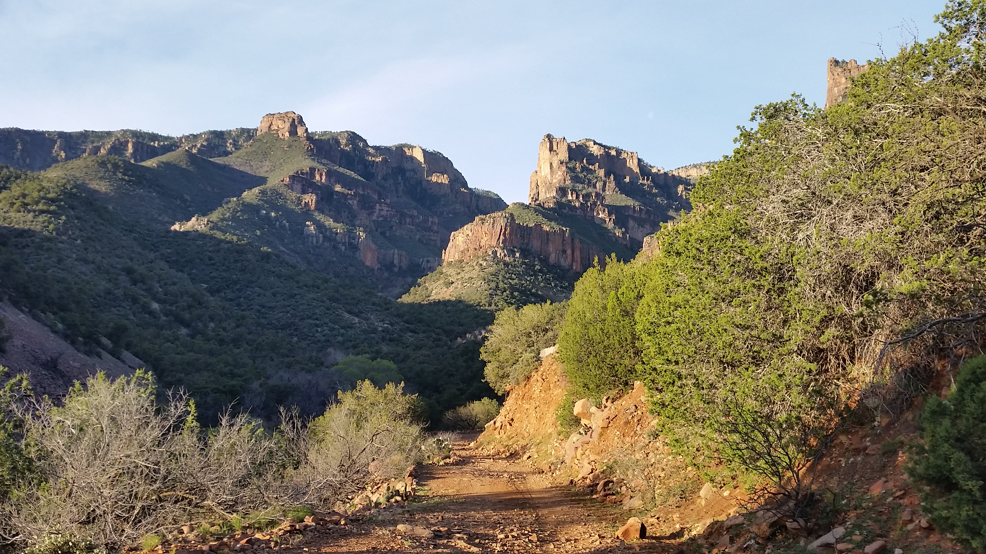
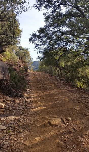
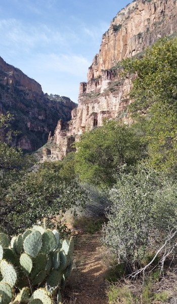
Back to getting moving; I stretched my legs like a lazy cat, threw on my hiking clothes, and got breakfast brewing. Stevo and Annelise soon appeared from his trucktop tent and we got the morning underway. Once breakfast was through it was time to put feet to trail and walk the road north to the trailhead. The morning light was awesome, peering through the leaves kissing the rocks around us. Just before hitting the first turn in the road we turned and peered up Devils Chasm, what an incredible sight. It would have to wait until tomorrow, as our sights for the day were set on Cold Springs Canyon Indian Ruins.
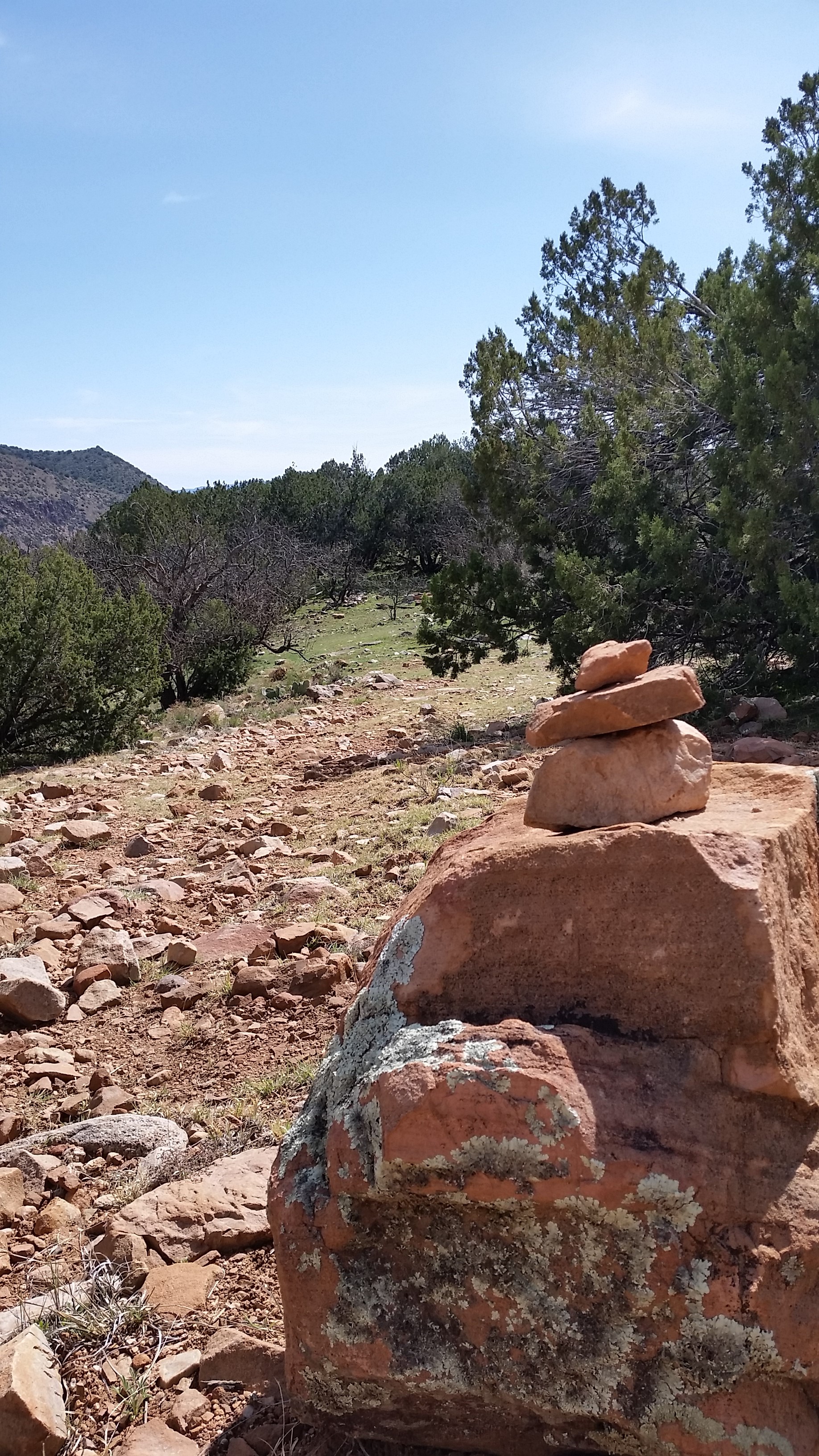
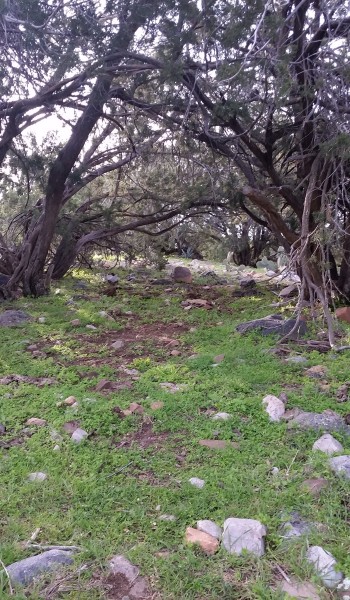
We climbed on, trekking up the road until the small 4wheeler road jetted off west, turning up we trekked up the good grade to nice hidden luscious green paradise atop a saddle. If we couldn’t find the spot we did, we would most certainly camp here. Views from this saddle were incredible, looking out over the Anchas just made me think about how people could survive here hundreds of years ago. The Salado Indians got it right, what a beautiful place!
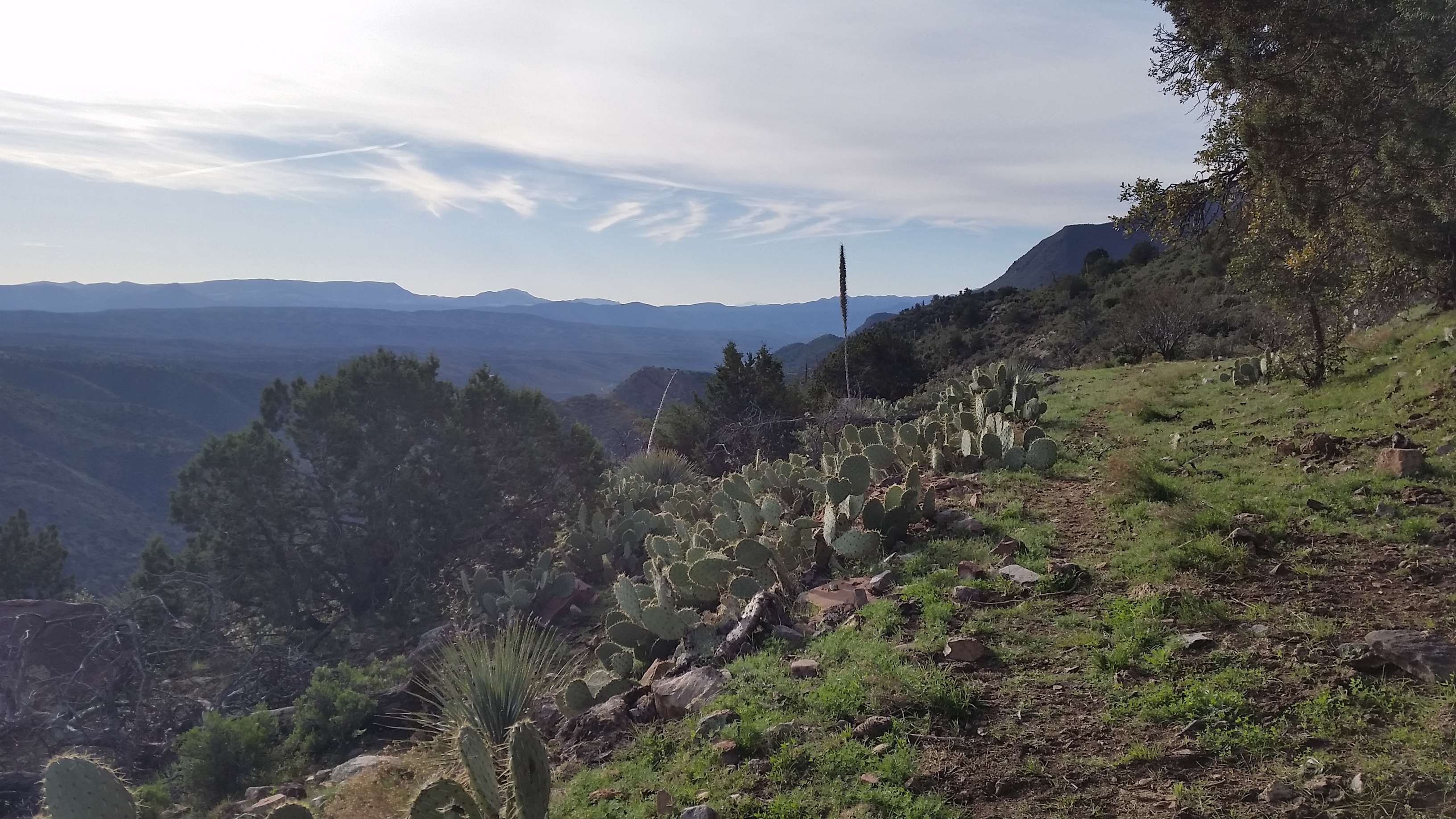
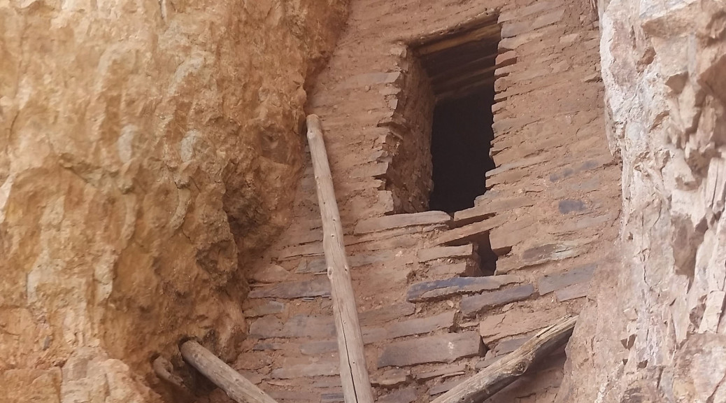
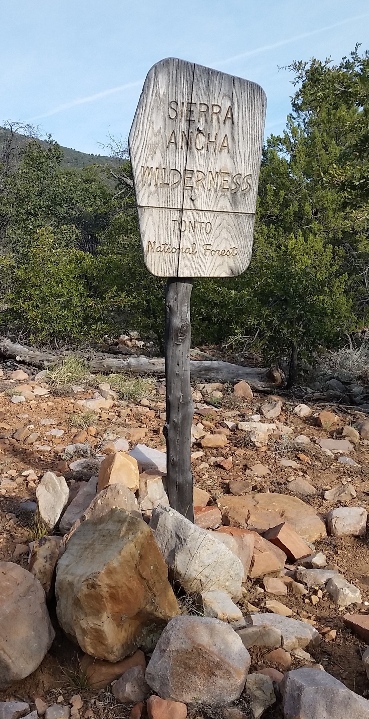
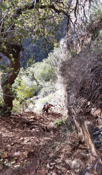
We trekked on, pausing at the Sierra Ancha Wilderness sign for a quick picture. The open pastures soon turned into a twisting and winding trail through manzanita. Signs of the cattle ranched in the area were all across the trail; footprints, cow patties, broken branches, but luckily no cattle. We trekked up and on until we got to the plitoff for cold canyon. We pushed around the ridge into the next canyon, looking up into the rocks its wasn’t clear where the ruins were at first. As we got closer we could see a crack in the rocks to the west on the north side of the canyon that could hold something promising. Hoping around manzanita, century plants, and agave that riddles the trail. Finally we were close enough to see a doorway, almost perfectly square. I pointed it out with a giddy smile. This is where the trail really started to get fun!
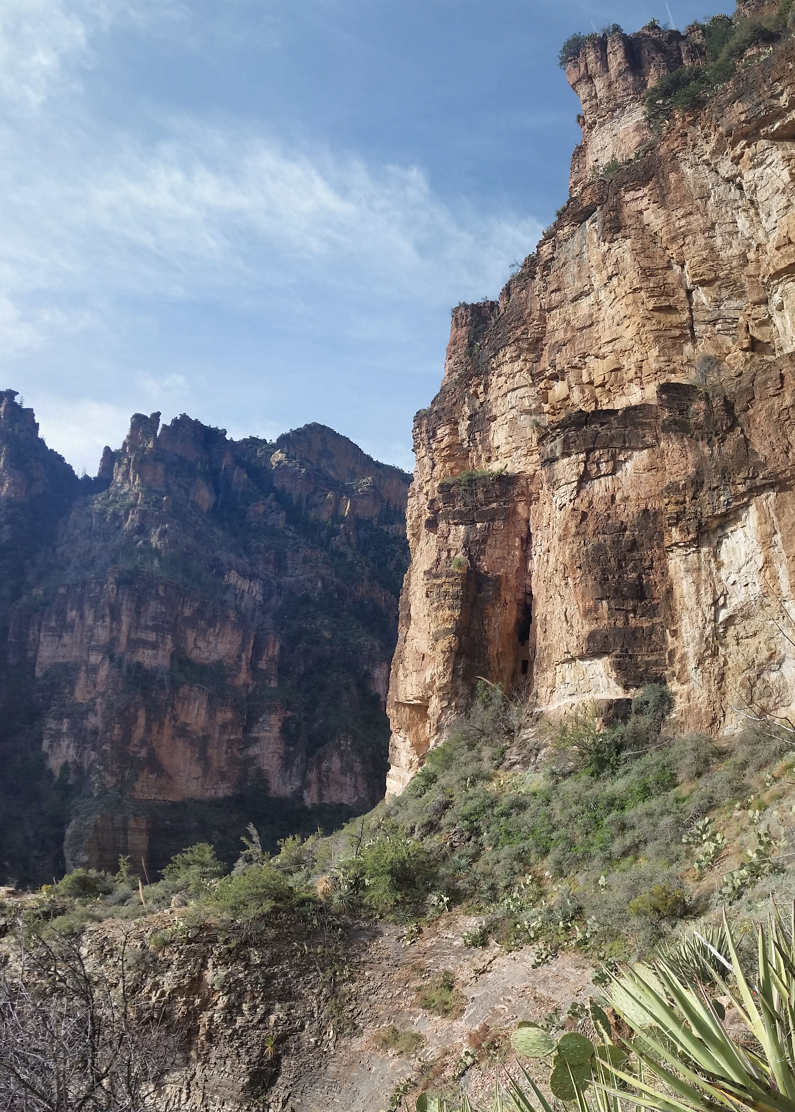
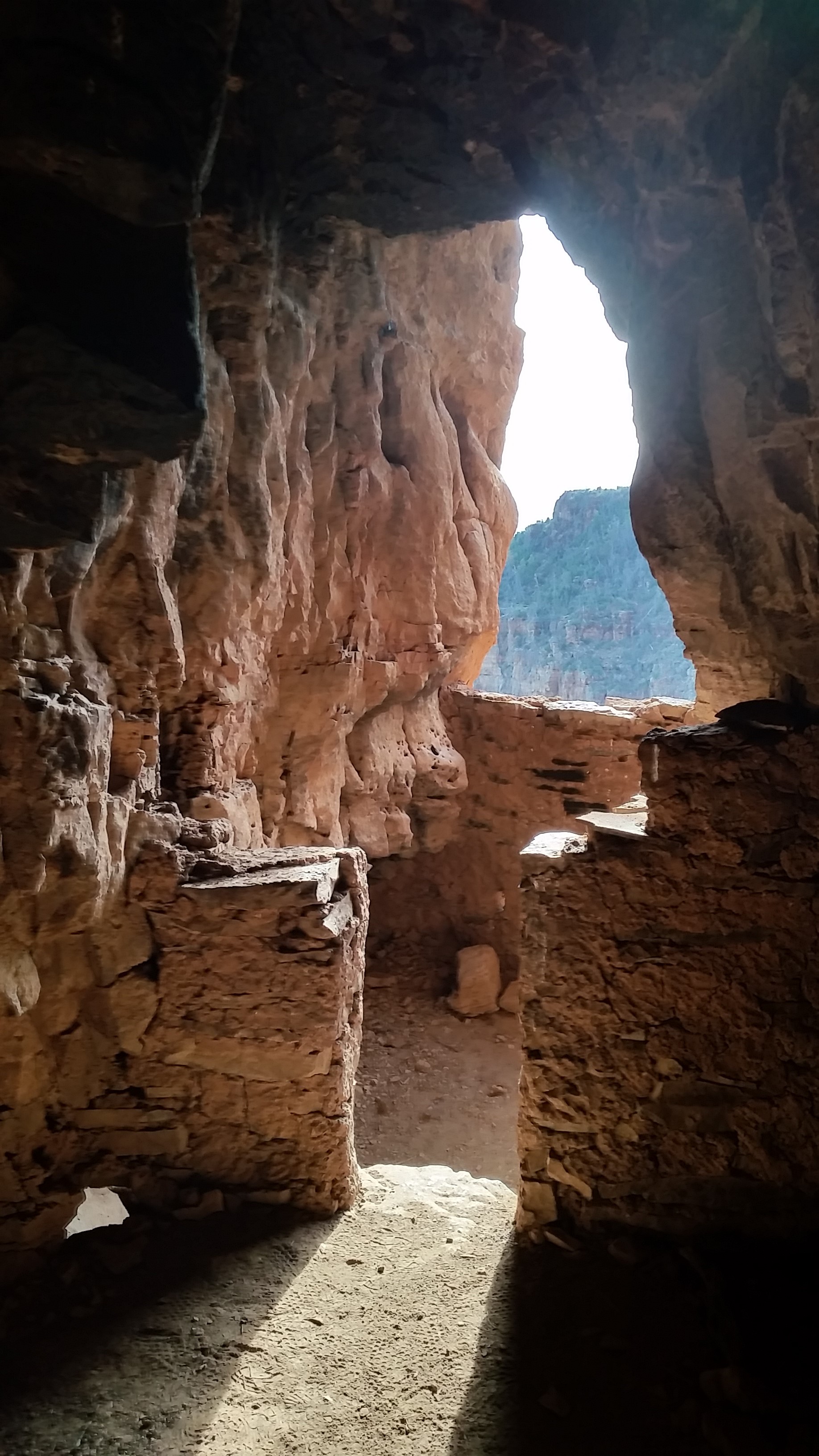
The trail jetted up right, up the side of the canyon gaining a quick 400 feet in less than 0.2 miles. I grabbed at branches, roots, wedged in trailside rocks, anything that was stable enough to hold my weight to pull up on. The trail was a slippery mess, loose rock, dirt was the bed for the ascent. Soon after some good sweat and grunting, we all topped out at the base of the ruins where we could clearly see the entrance. Approaching the ruins requires some climbing skills, but what waiting inside was truly incredible.
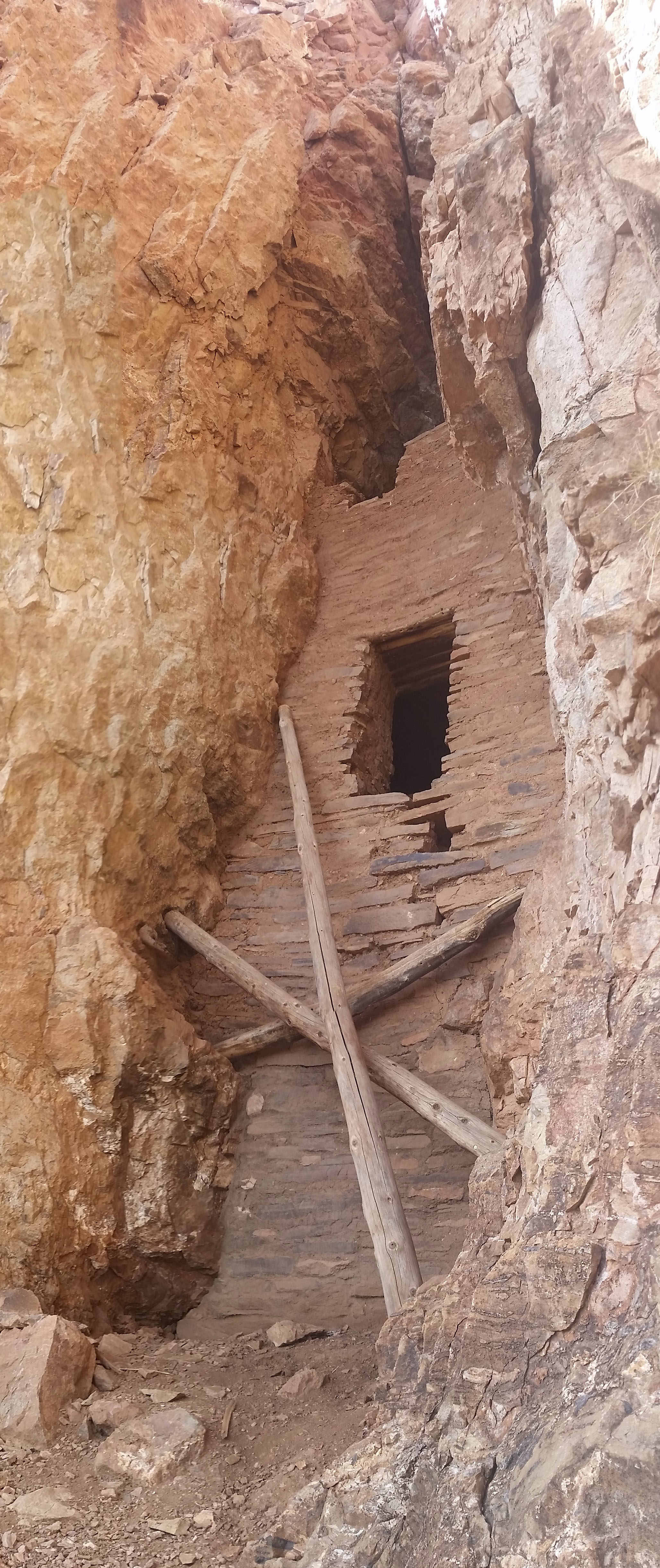
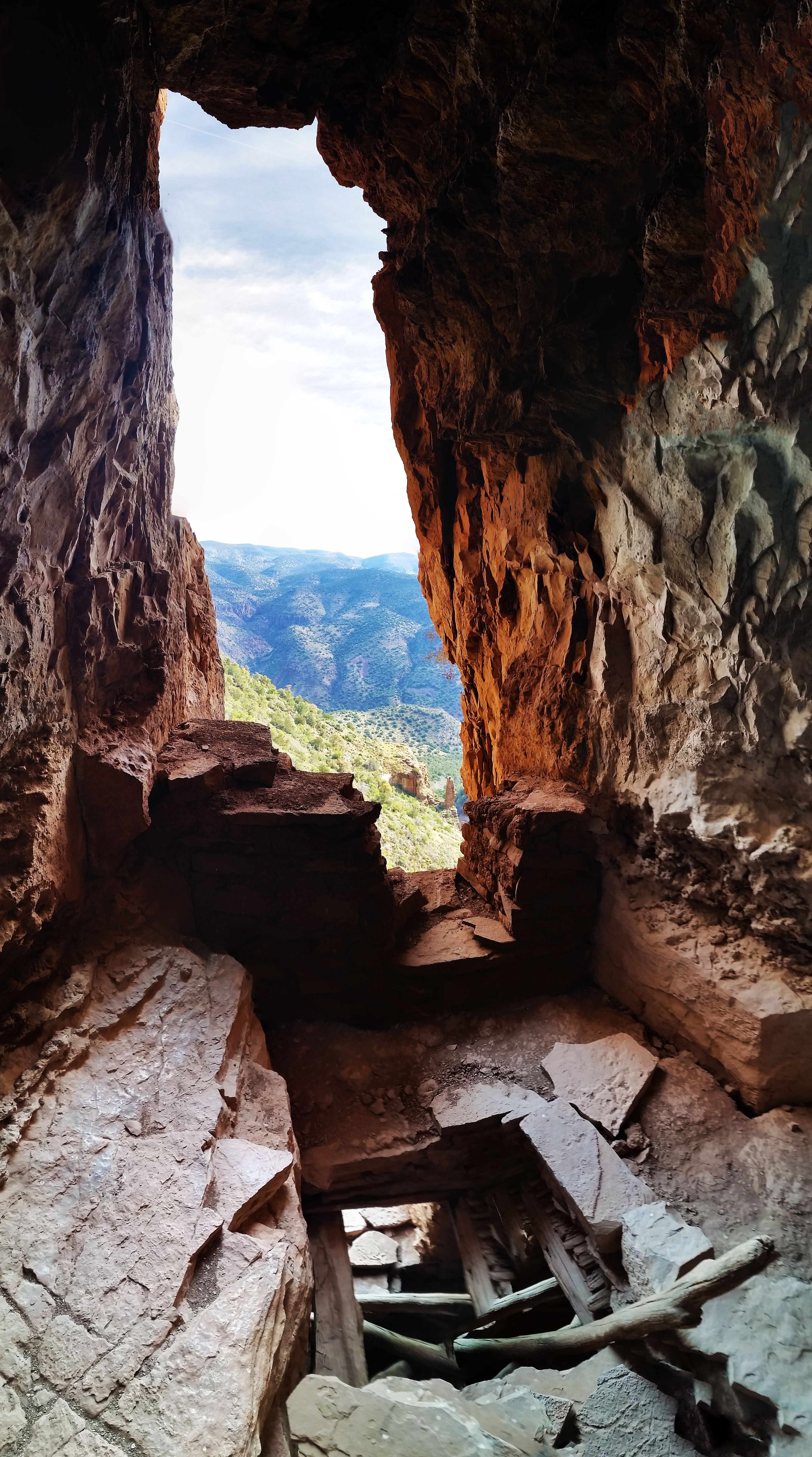
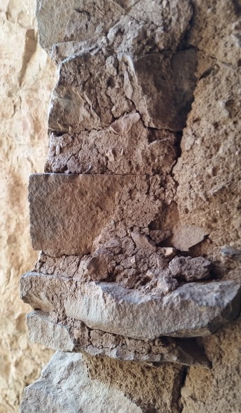
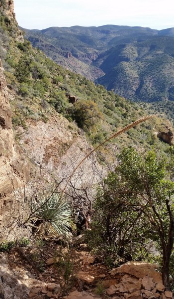
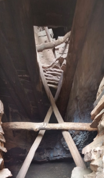
The ruin was a triple decker. The lowest level could have been storage while the mid level and upper levels were most likely sleeping quarters. Traversing the upper level held a secret back room the a balcony facing Cold Springs Canyon, it was a special find and sights from the balcony were gorgeous. The entire ruin was built on the mouth of a large cave. The second level went back and opened up into a smaller cave like room. Fallen rocks and stalactites were on the floor, I peered my head into the thin cracks that had any chance of leading anywhere. Both of them went about 15 feet, then knife edged into a dead end. Satisfied we had exhausted exploring the extents of the ruin we headed back for the downclimb out of the exit.
What an awesome day! Stevo and Annalise headed back to camp as I did a little more exploration up Cold Springs Canyon. The walk back was nice, temps were perfect, sky was clear and blue. I couldn’t ask for a better way to spend a Saturday! Soon after my solo exploration journey a few miles up the canyon I found my way back to camp for lunch and a quick rest before the next trek out into the Sierra Anchas in search for more Salado Indian Ruins!
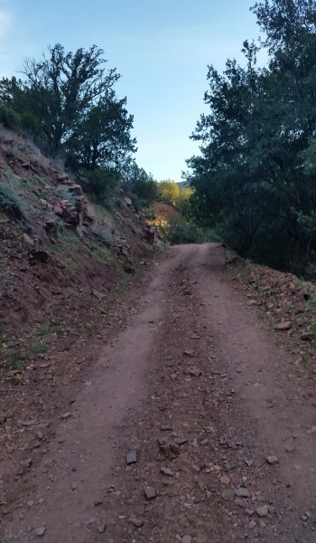 Road walk from camp
HIKE INFO:
Sierra Anchas – Cold Springs Canyon Ruins
HIKE STATS:
- Weather: Hi 70s, Low 40s, Sunny
- Water: 1.0 liters
- Food: 1 bag of Salt and Venigar chips, 1 apple, Clif Builders bar, 1 trailmix bar
- Time: 3 hours
- Distance: approx 6 miles Round Trip from camp
- Accumulated Gain: 1,500 feet
GEAR:
- Mule Camelback backpack (3 liter bladder)
CLOTHING:
- Cotton T-Shirt
- Cotton Handkerchief
- Nike running shorts
- Merrell Mid Moab Hiking Boots
- Darn Tough Medium Wool Sox
