

- Day 1: Bill Hall Trail head to Tepeats Cave and Thunder River
- Day 2: Thunder River to Deer Creek Traverse
- Day 3: Deer Creek to Bill Hall Trailhead
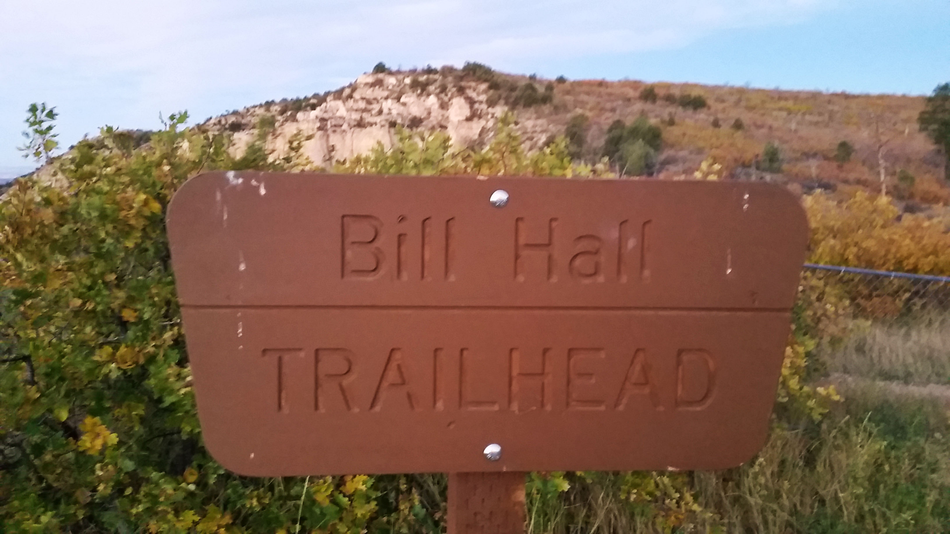
Stevo, Mark, and I stood on the edge of the enormous cliff next to a brown wooden sign that said “Bill Hall Trailhead”. We had made the long drive from Phoenix out to the west side of the North Kaibab the night before in search of adventure and a tough challenge. This Grand Canyon goal was to complete the Thunder River/Deer Creek trail with a side trek aimed for the Tepeats Cave up on the Tepeats Spring Canyon.
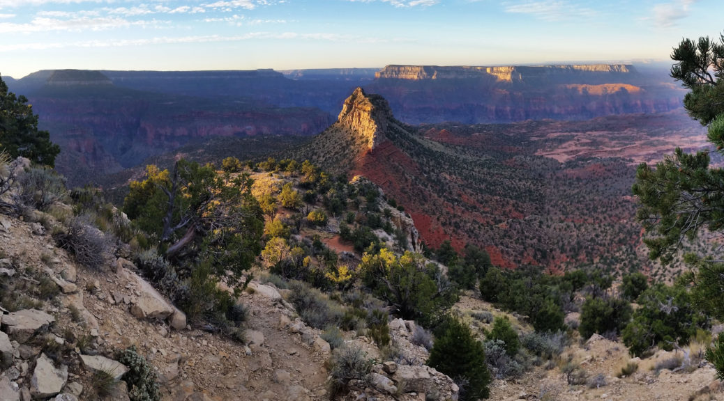
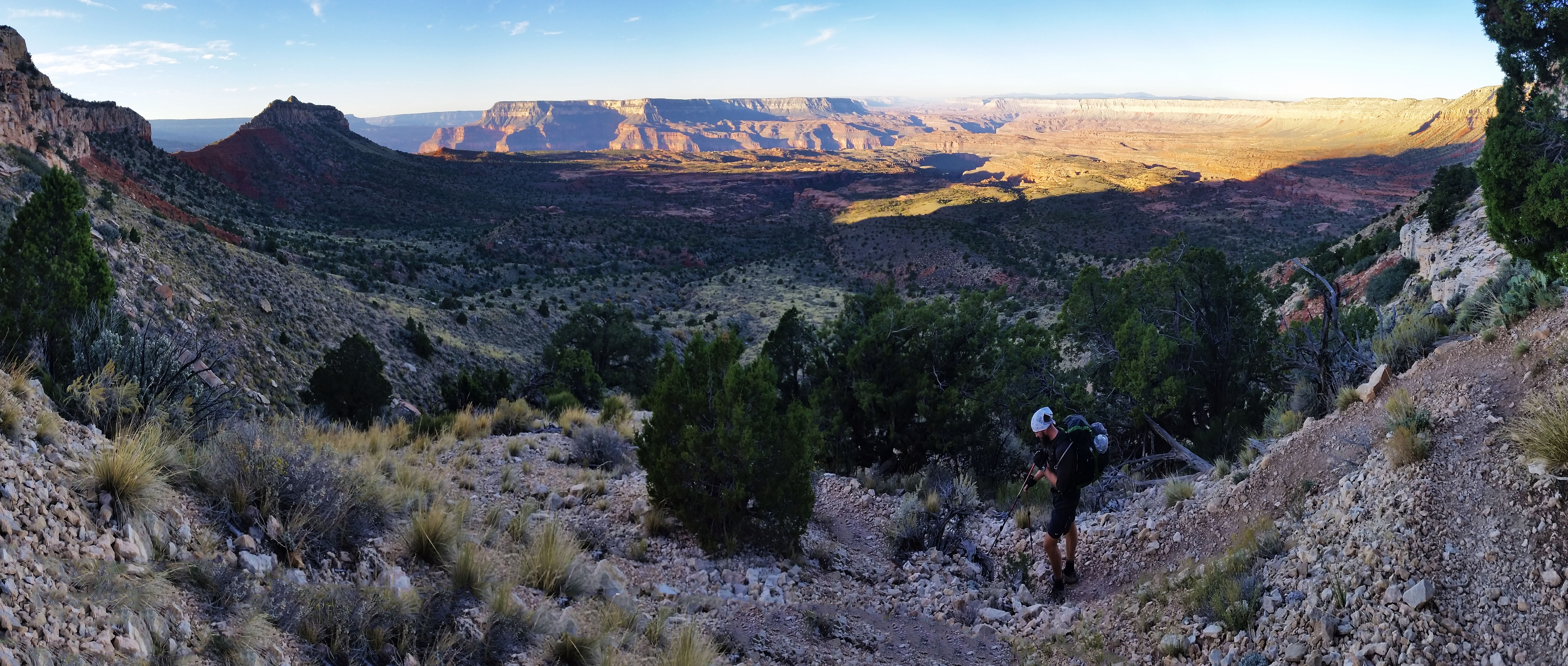
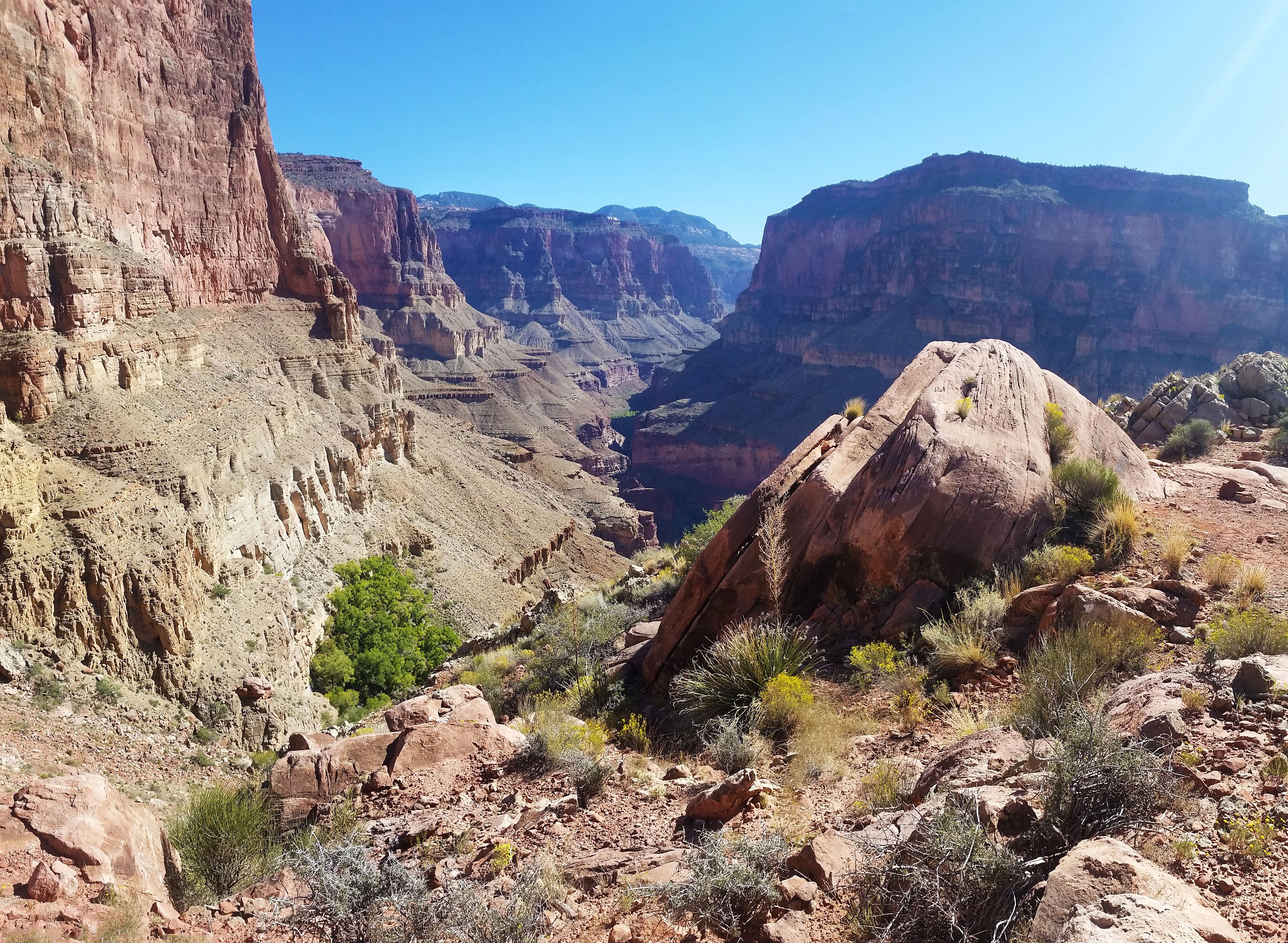
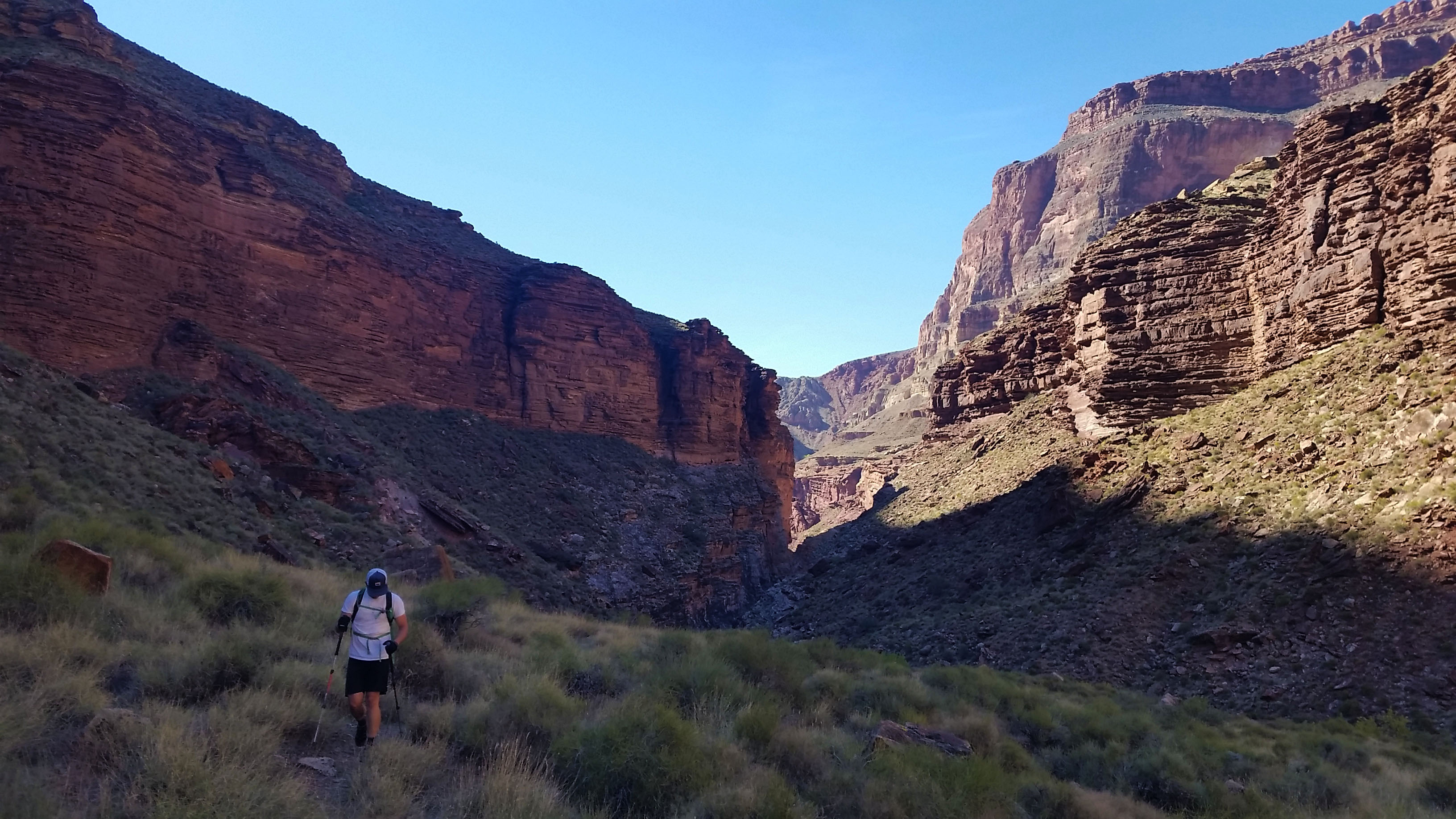
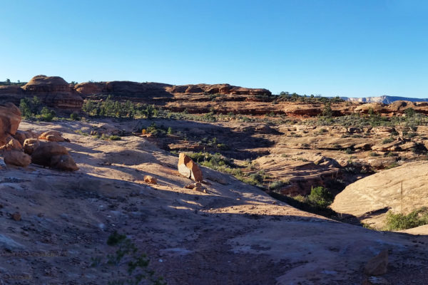
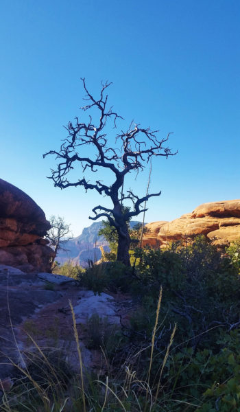
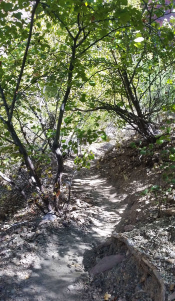
Packs were heavy on our backs, loaded down with supplies for the three day journey. Being as ready as we were going to be, we took our first steps towards Monument Point as the sun was rising just before bombing into the abyss of the Grand Canyon. From the top we could see Bridger’s Knoll sticking up out of the esplanade plateau like the razorback of an old dinosaur. From there, we bombed down and let me tell you, with a 30 lb pack on your back pushing you down, it wasn’t easy. The trail was loose and steep, and with trekking poles in hand we picked our way down the first set of switchbacks. Before long we were skirting the trail westward in the shade, and as we rounded the bend we found ourselves at a beautiful open vista of the canyon beyond . . . and a nice 15 foot down climb. Stevo was first up and took it in stride while Marko and I adjusted our packs. With handholds aplenty, we made quick work of the short climb and pushed on.
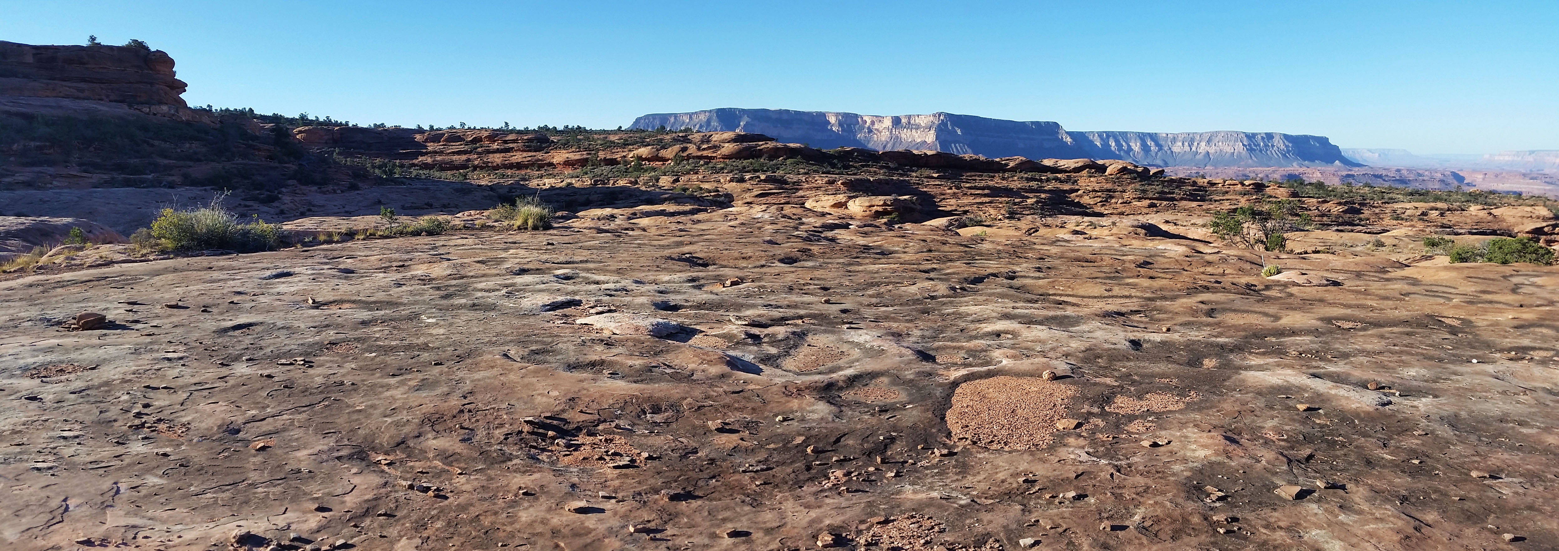
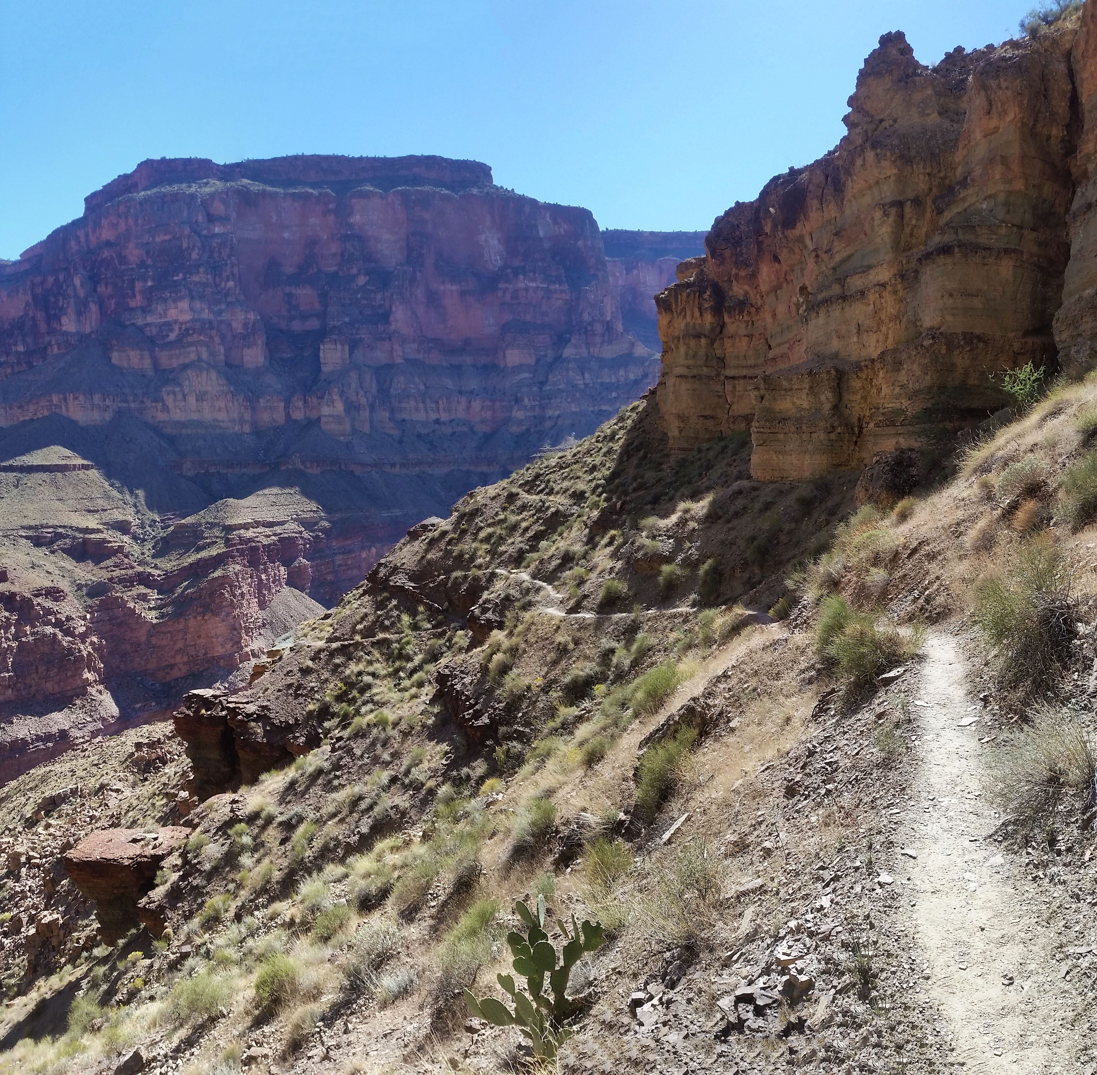
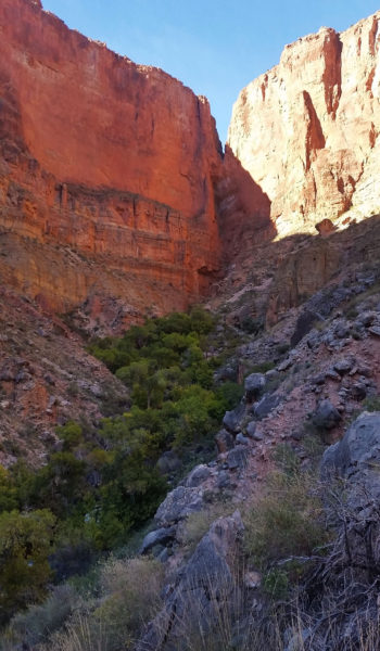
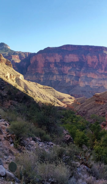
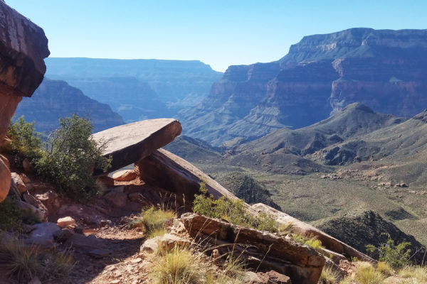
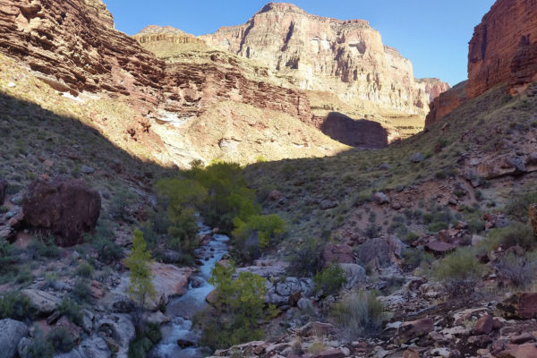
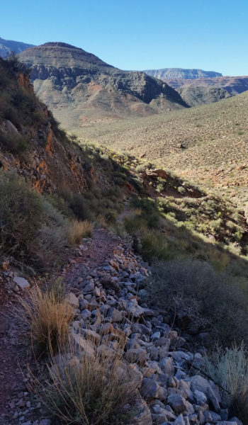
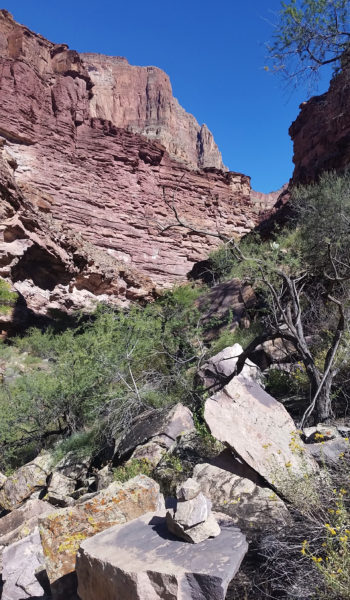
We finished the skirt and the many short, fast switchbacks which plopped us down on the esplanade plateau where the Indian Hollow trail met up with us. We strode forward amongst the sandstone formations and washed out cracks taking everything in, joking about current events, and talking about the dinners we would be downing that night. Just a few miles in, we took a quick rest and completed our water drop next to a huge sandstone formation. Knowing we had many more miles ahead we pushed on, over the open planes until finally we reached the head of the redwall. We looked down at the tiny trail below which we knew would be our ticket to Thunder river and eventually Tepeats Creek. Man what a view!
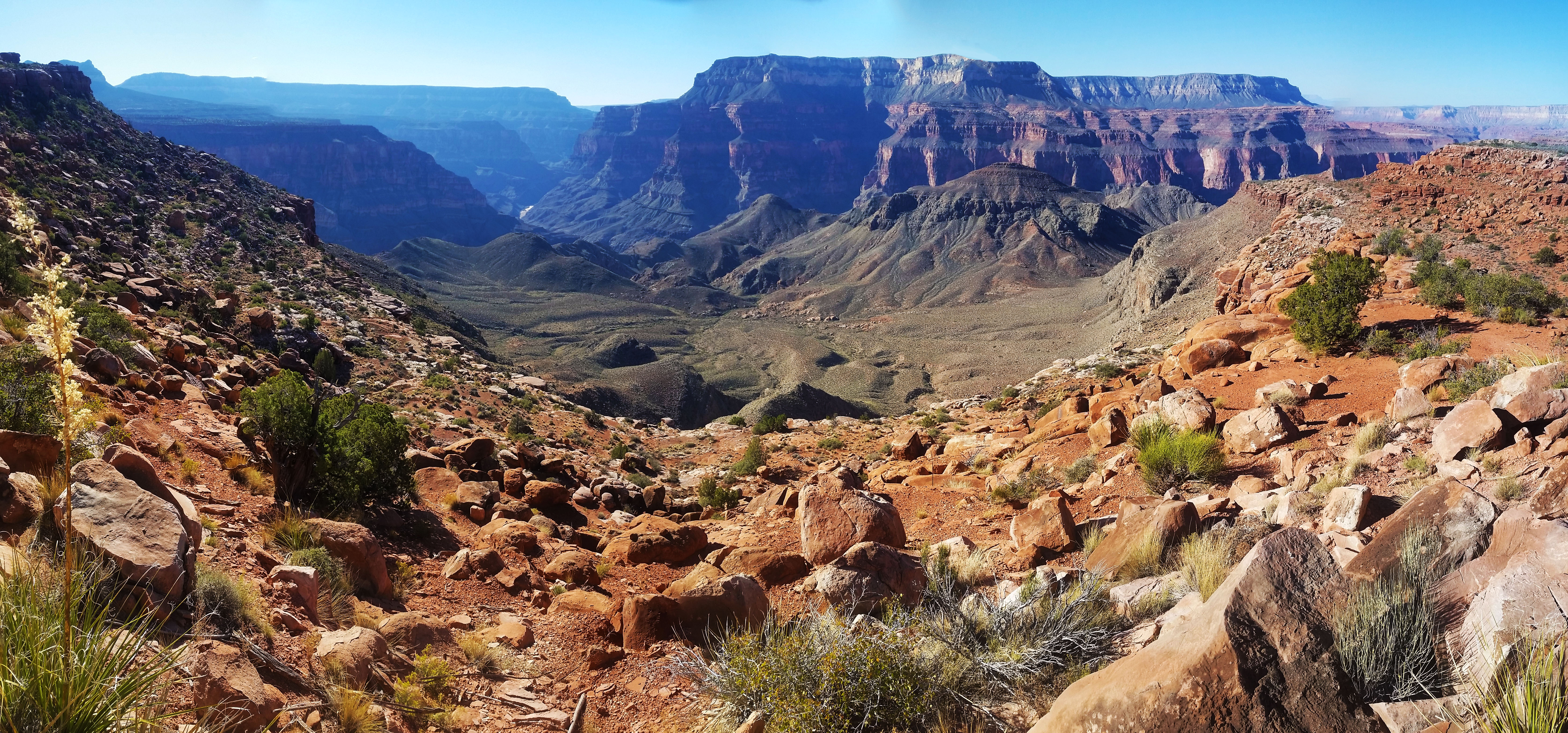
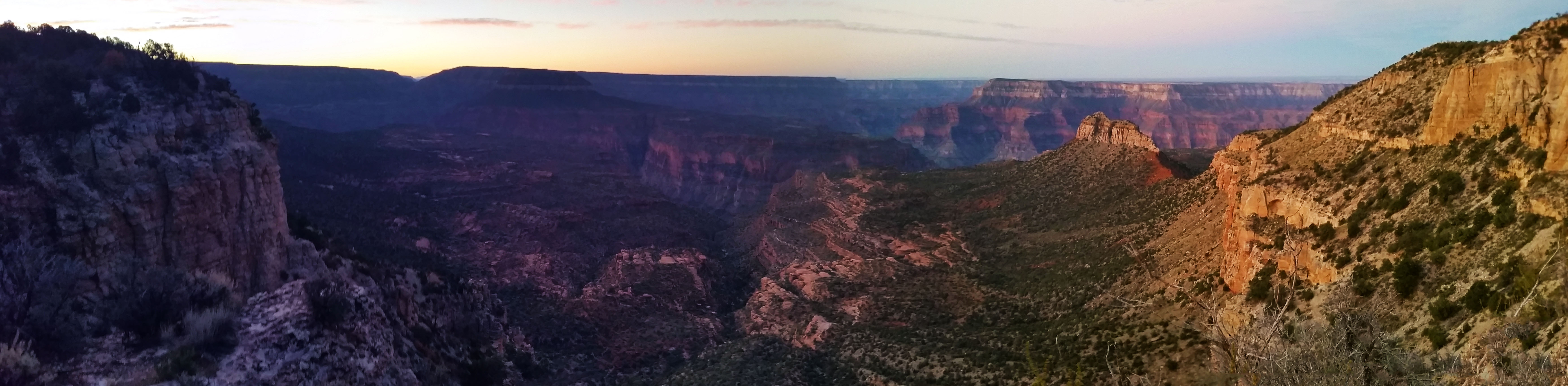
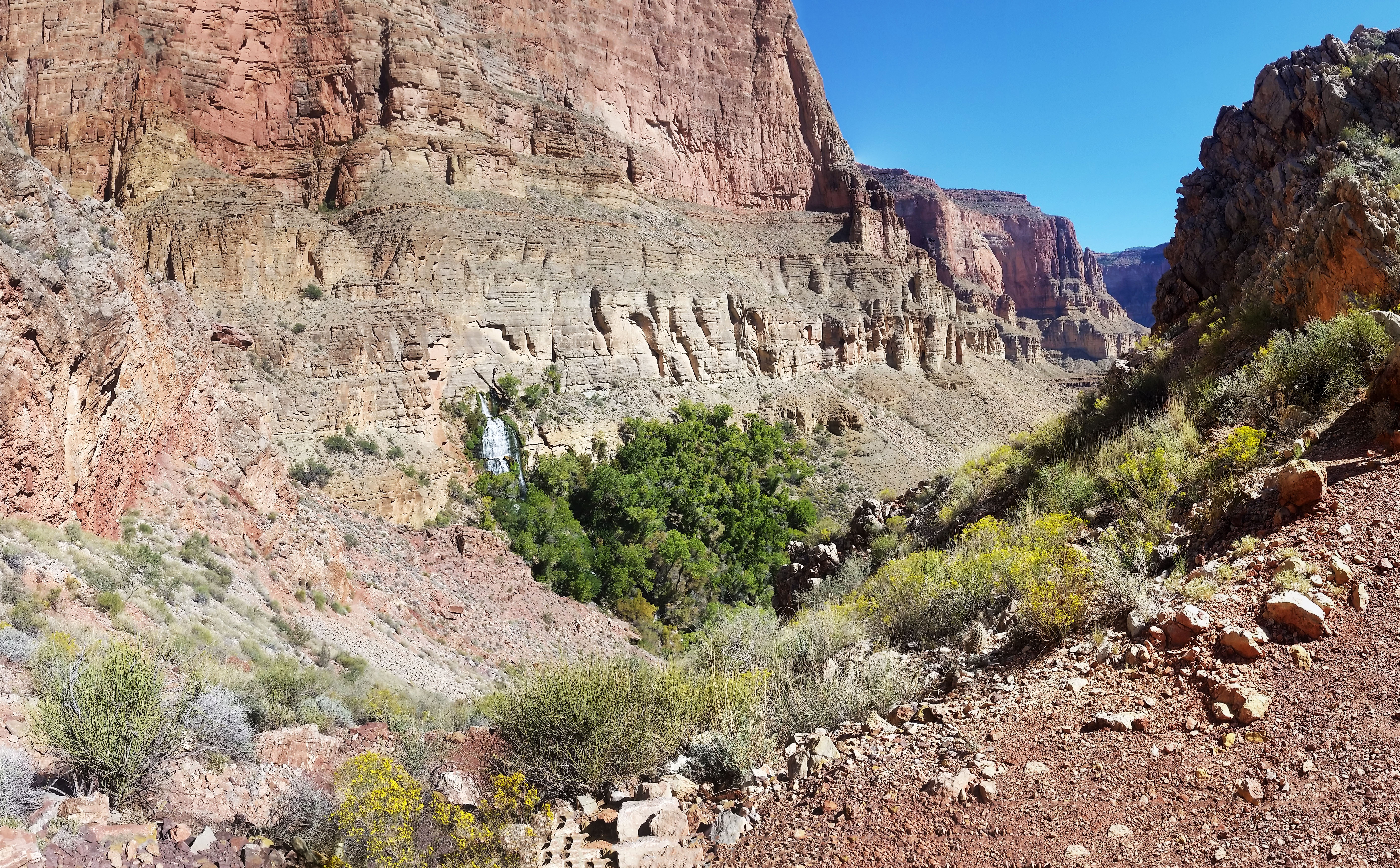
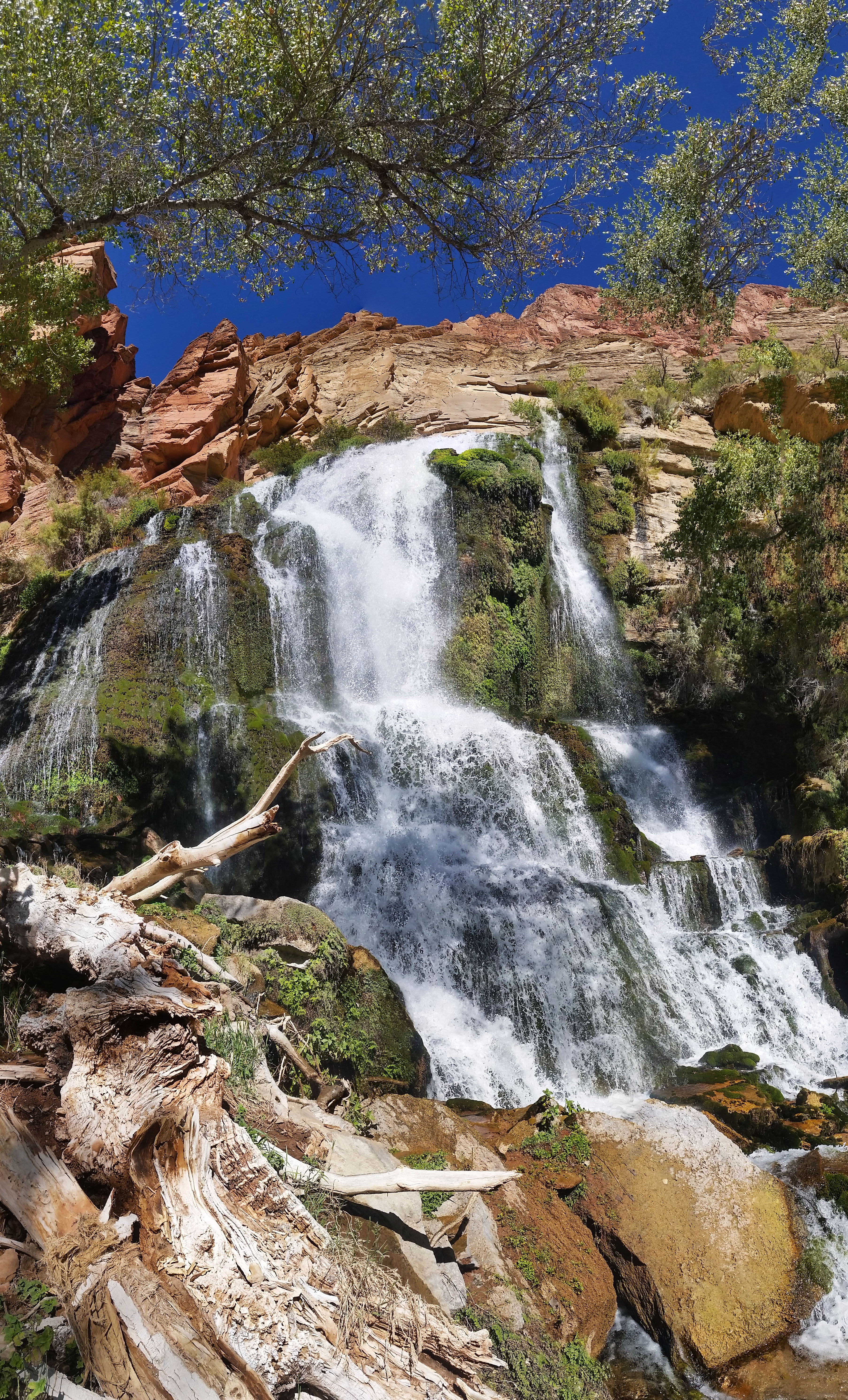
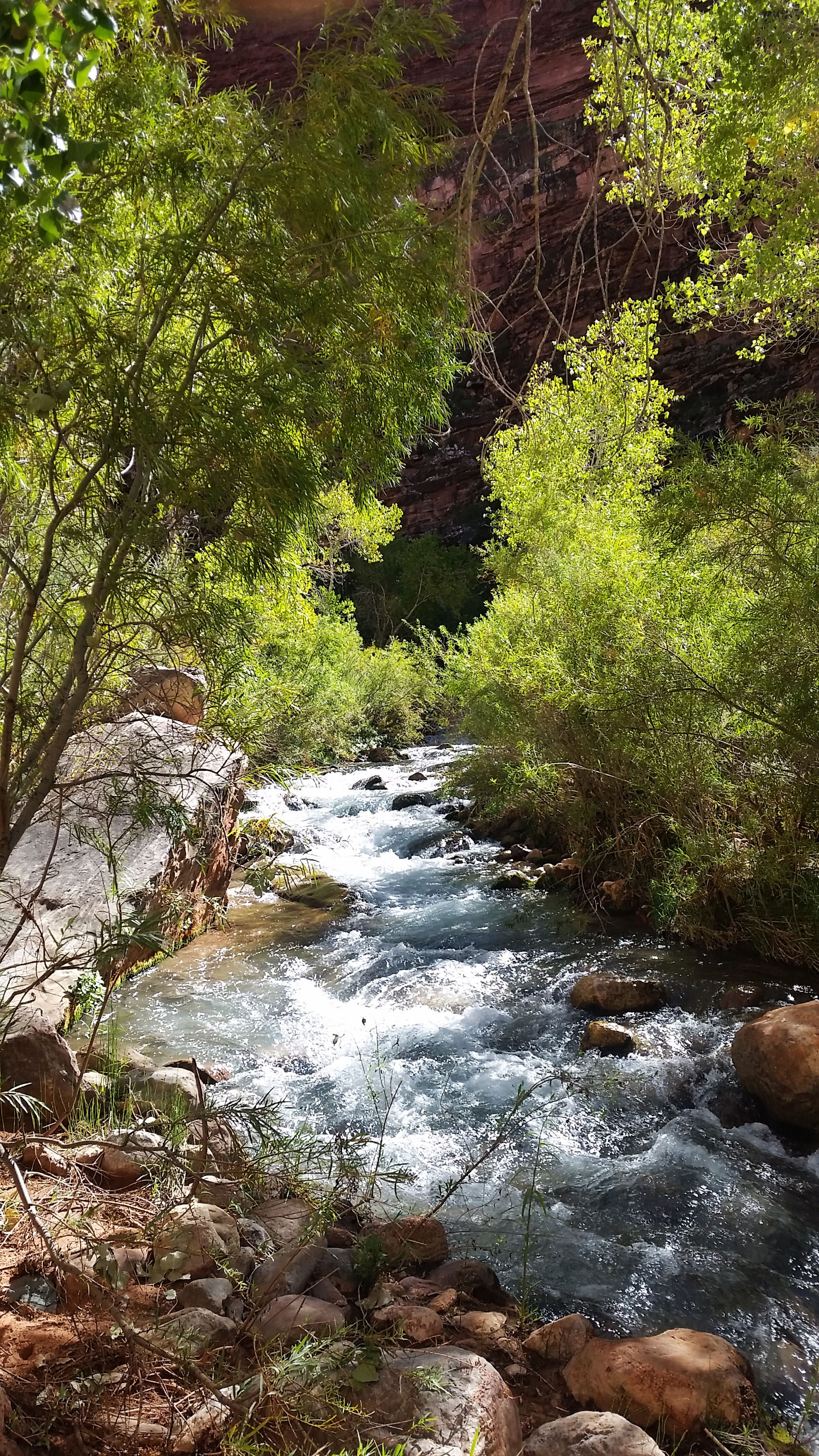
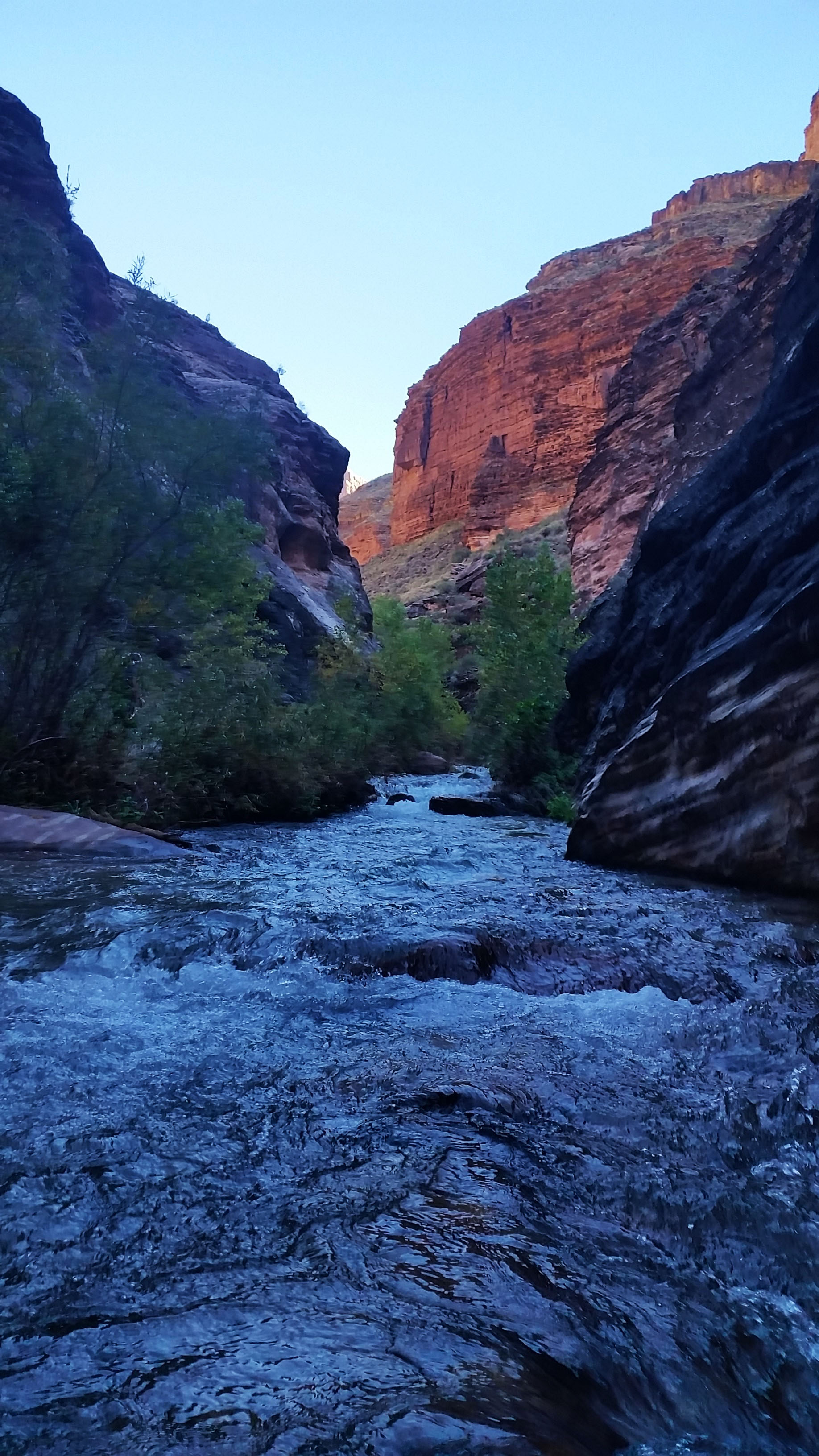
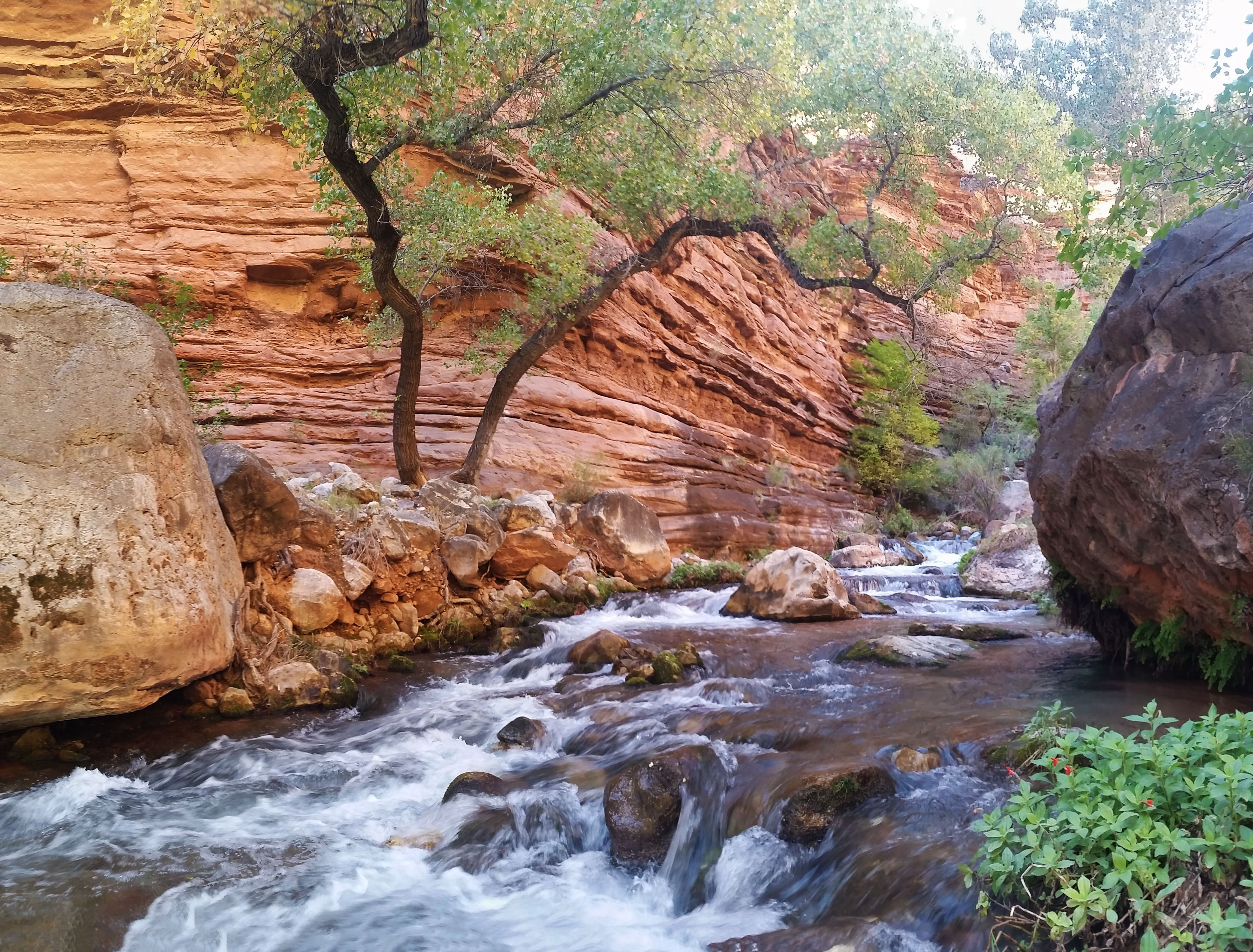
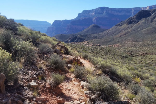
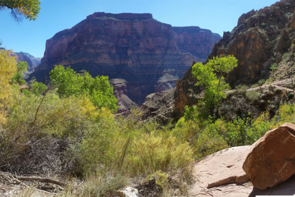
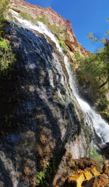
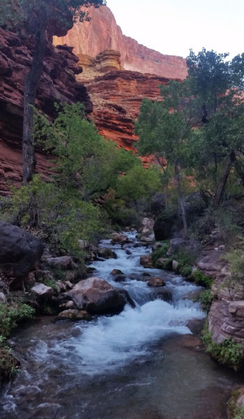
With no time to waste we bombed off again down the next dropoff. The sun had been creeping its way above our heads and as we dropped in elevation the temps began to rise. We hit the base of the redwall in a place called Surprise Valley. We joked “Surprise! It’s hot as hell!” After a short breather and a huge chug of water we headed east across the valley towards Thunder River. Up and down the small hills we climbed, the gorgeous canyon walls all around us, until finally we heard a fierce rumbling in the distance. We kept trekking closer and closer until reached the top of the canyon that fed Thunder River. A huge waterfall was just rapidly spewing gallons of water per minute from the rock face. It was hard to fathom where all the flow was coming from. An underground river riding a water table out of the wall? It’s hard to know. Like a pack of kids finding an X on a treasure map we scurried down the switchbacks and soon found ourselves at the base of the falls. The water was a crisp, clean, and cool and though we were star stuck admiring the falls, we knew we had to move on.
We dropped down further, skirting the canyons narrow west side trail until we reached Upper Tepeats camp where we would stay for the night. It was only noon, but we knew if we had any chance of getting to the Tepeats cave we would have to get a move on. We setup our tents, staking our claim, and strapped on day packs to once again hit the trail with our eyes set on the cave, 1500 feet of gain and 3 miles of a bushwhack away.
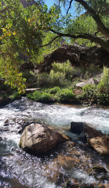
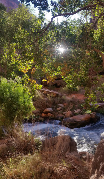
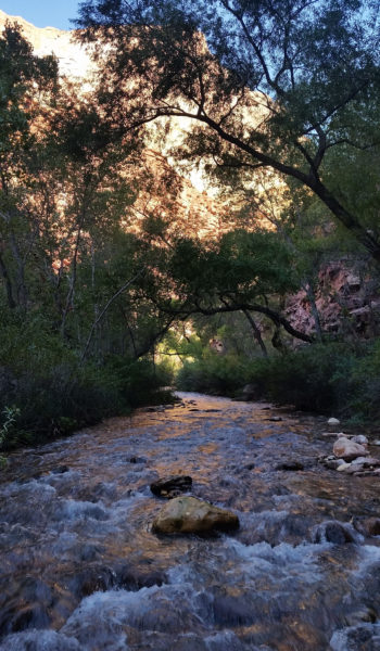
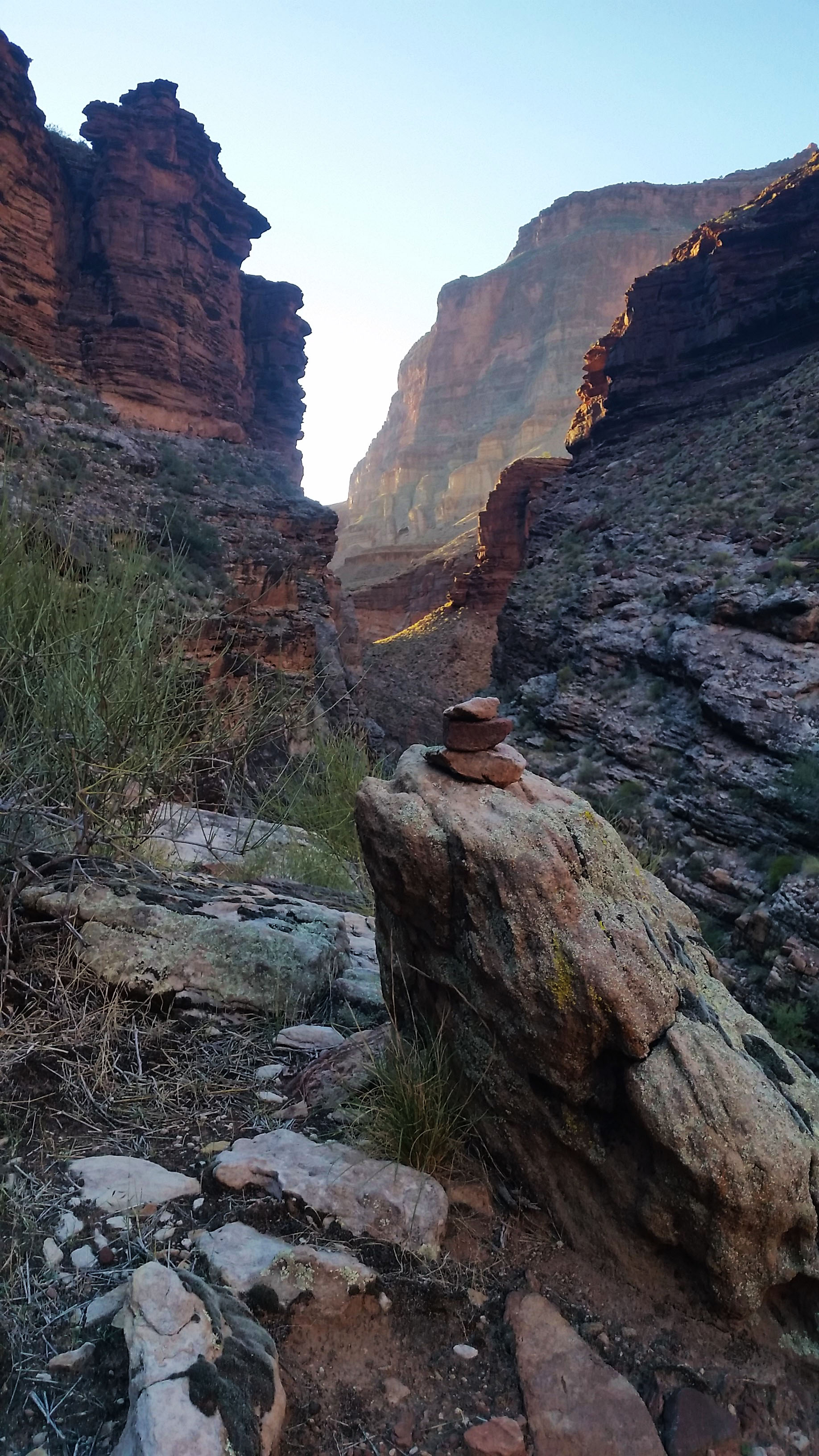
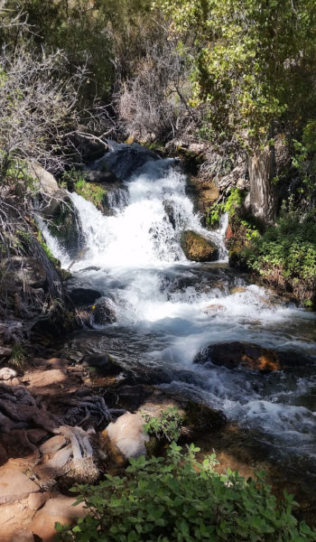
Crossing the river to the east side of the canyon we soon met the confluence of Thunder River and Tepeats Creek. Heading east, we stayed on the south bank until forced across the creekagain. Thick reeds, cat law acacia, and other brush did its best to thwart our efforts. We pushed further up the creek, hopping back and forth before finally coming to a mini-subway (rock formation in Zion). Soon after we pushed up past the mini-subway we found the mini-narrows, another formation resembling a Zion-like staple. The creek was wall-to-wall here and there was no other choice but to push up through the 50 degree waters. After 50 yeards or so we spotted a cairn sitting on a wall to the right of the creek. We decided to take that option, anything to get us out of the water for a while. We climbed up out of the riverbed to the south bank which took us skirting far above the rushing waters of the creek. This was the easiest terrain of the whole side trek to the cave, so we enjoyed it!
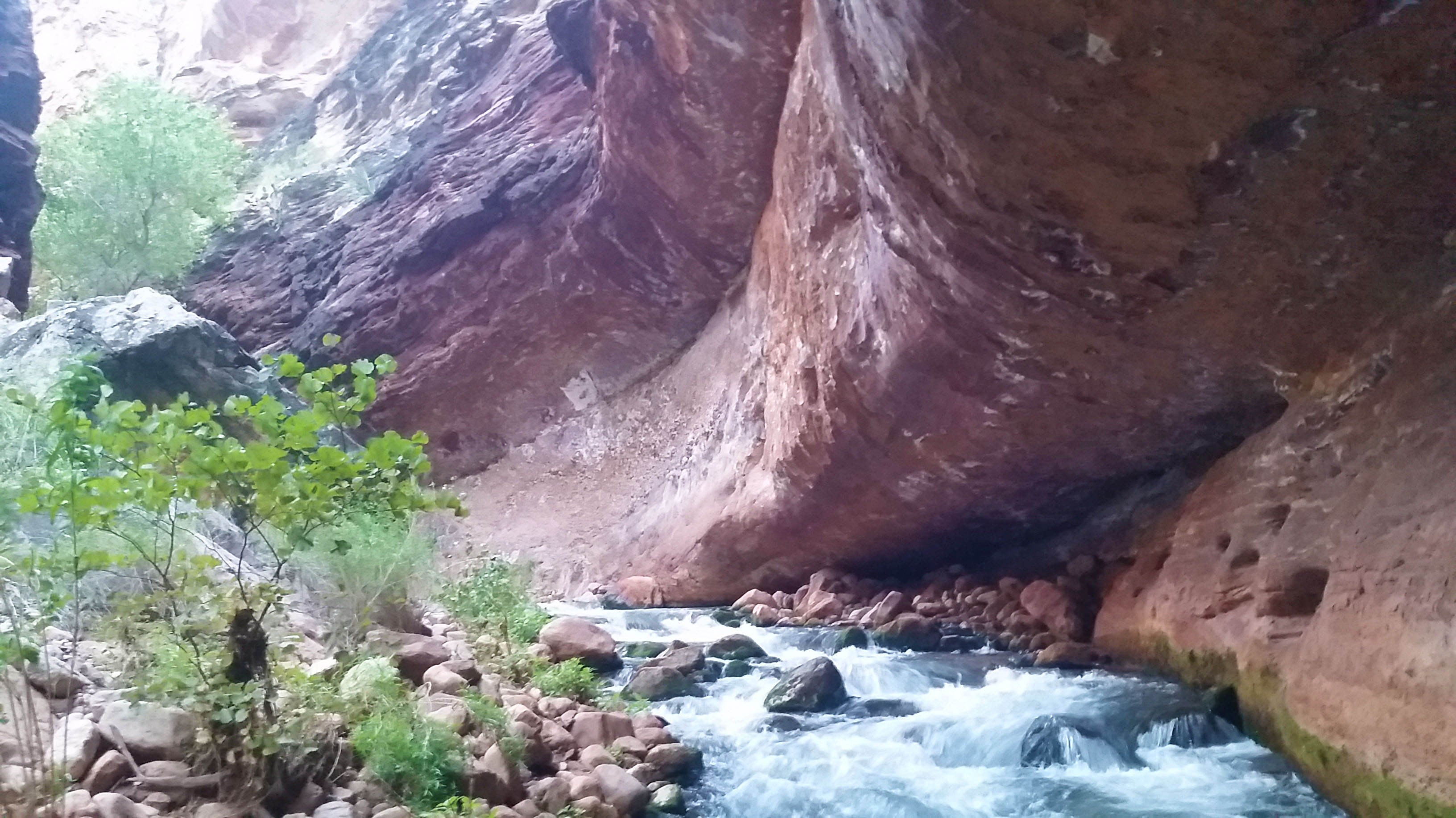
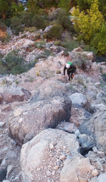
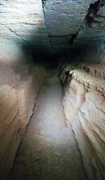
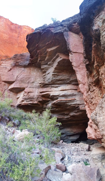
All good things come to an end, and so did our dry wall skirt as the trail dumped us back into the creek and pushed us north up the final canyon that held the cave. We were all tired by this point, but there was work yet to be done. We found a small use trail and continued to push forward, hopping rock to rock, pushing through thick brush, and skirting exposed rock faces before the mouth of the cave finally came into sight. It was on the east wall, just below the last cottonwood we could see in the canyon. We had expected the trial to become a little easier from here, but it only became harder. Marko, exhausted form the journey and coming in cold, decided to sit out the last push and replenish his batteries creekside with a water filter and a good snack. Stevo and I pushed on up the loose rock hopping back and forth the final quarter mile before reaching our goal.
 Let the bushwhack continue!
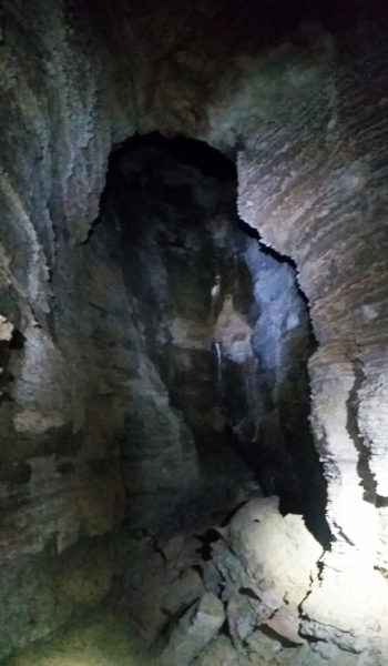
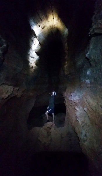
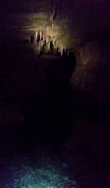
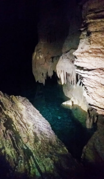
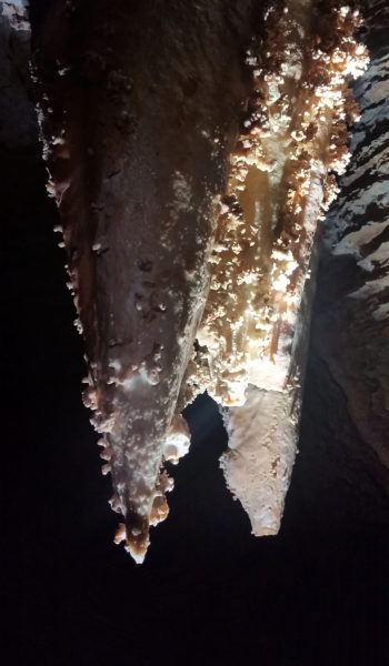
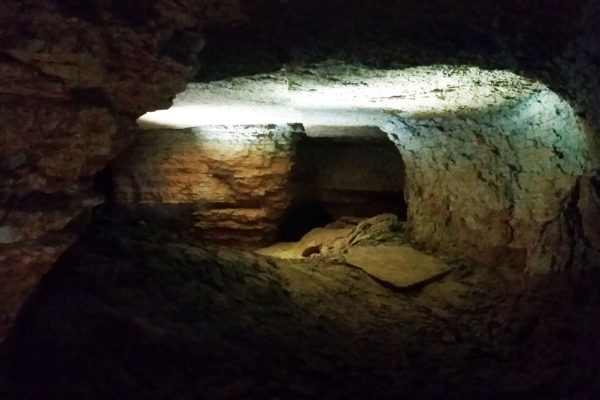
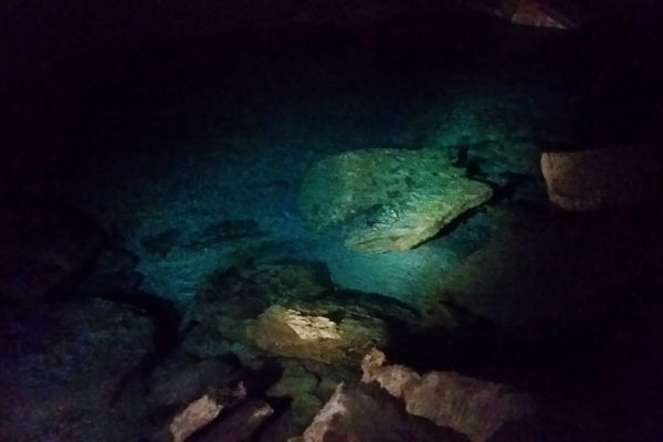
We stood at the mouth of the cave, headlamps on, uncertain of what we’d find. The air was dry and dusty as we stepped inside. Moving quickly, we pushed down the corridors and took mental notes of the rooms as we went. A beautiful stalactite and stalagmite had formed in the middle of one particular room and we paused to appreciate it. We followed a corridor to the right, up a small wall climb, and finally into a huge room with 50 foot ceilings. There was an NPS water flow sensor just across the room and at either end stood crystal clear pools of water. A few formations lined the walls and the underground river flowed in the rocks below our feet. Stevo looked at me mischievously and asked “Do you remember how to get out?!” I smiled and replied “Let’s hope so!”
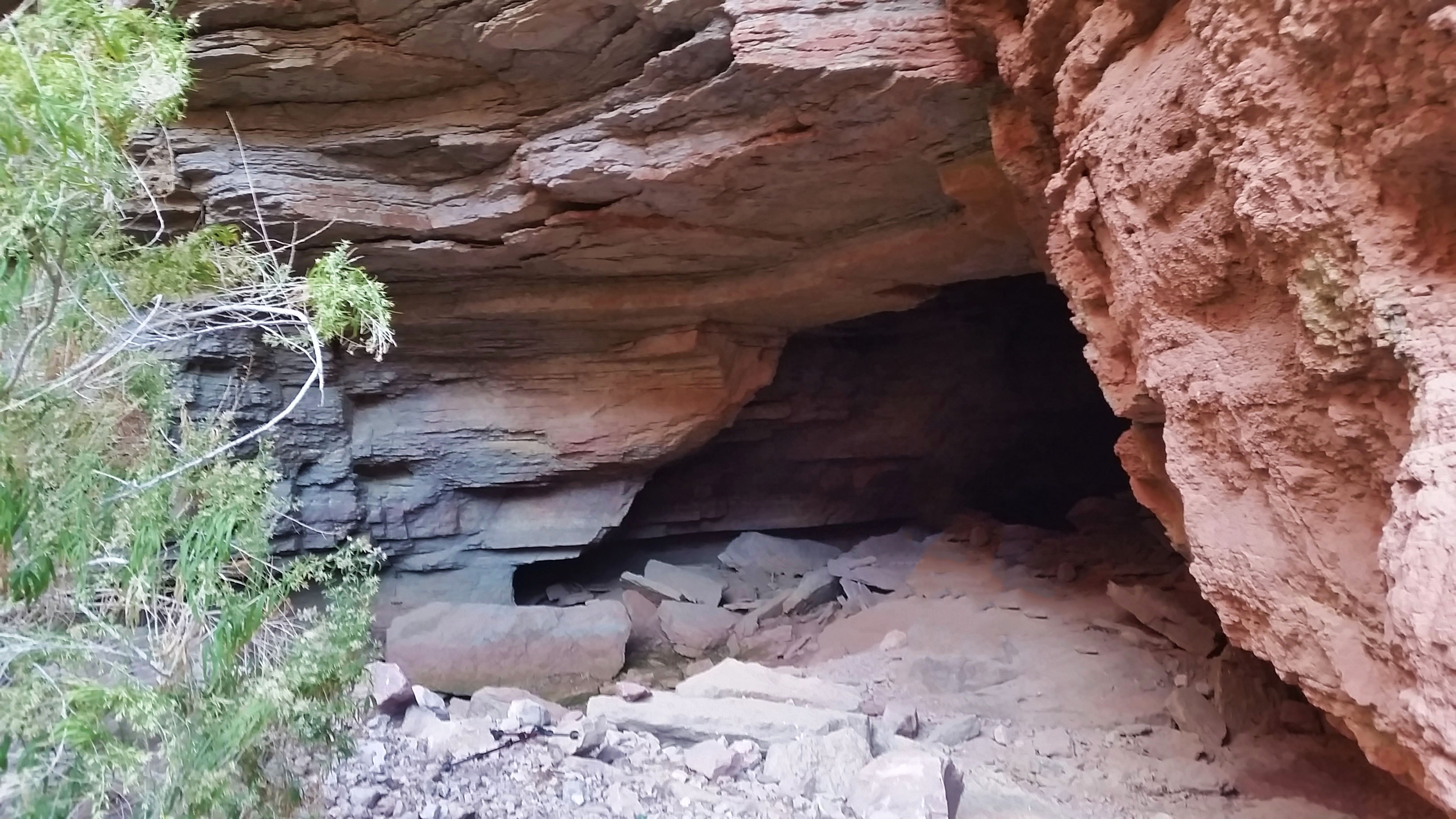
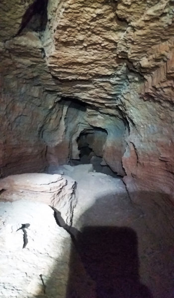
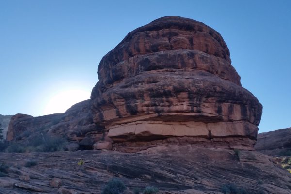
 The entrance
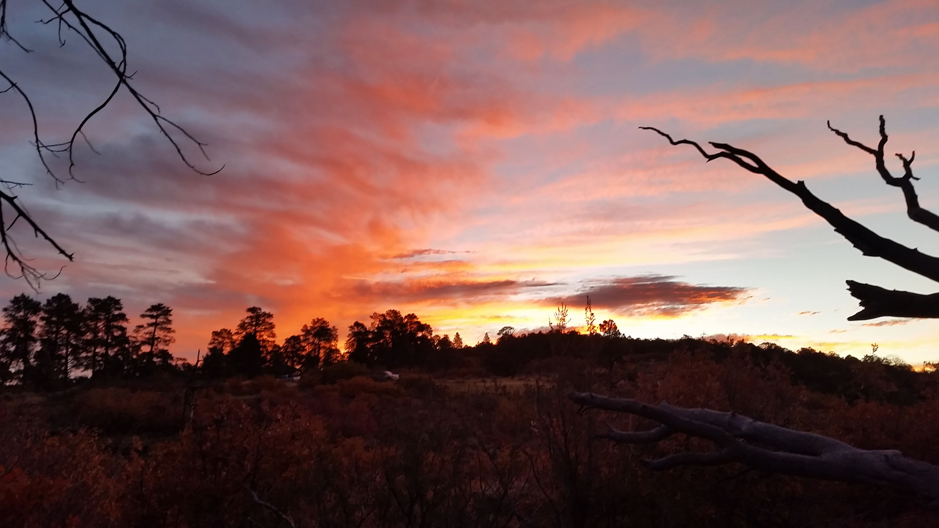
We turned around knowing time was running short and headed back the way we came. Through the maze of the cave, out the mouth, and back across the skirting exposed faces of the trail, we made our way until finally meeting back up with Mark. We could have easily spent hours in the cave checking out every crack, every room, nook and cranny. There is no telling how big the place was as some rooms were inaccessible without the proper gear. Satisfied with our journey for the day, though, we slogged back to camp tired but in good spirits. To our surprise we arrived just before the last bit of light slipped out of the canyon. As we cooked our Mountain House meals we exhaustedly reflected on the trek behind us and what was yet to come. What a great day it was, there’s nothing I love more than being outdoors.
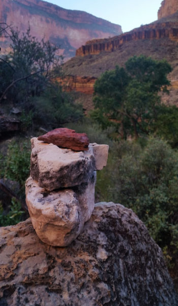
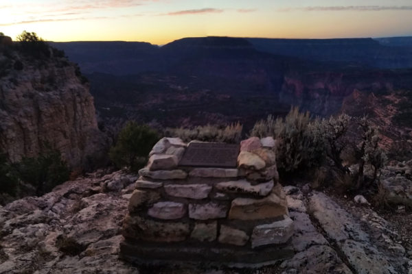 Bill Hall tribute near the trailhead
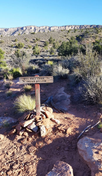 Bill Hall meets Thunder River Trail (starts at Indian Hallow TH)
- The GPX Loop: http://hikearizona.com/
gps=25256 - Thunder River: http://hikearizona.com/
decoder.php?ZTN=1008 - Bill Hall Trail: http://hikearizona.com/
decoder.php?ZTN=612 - Tepeats Side Trek: http://hikearizona.com/
decoder.php?ZTN=19576 - Tepeats Cave – http://www.teamcrowbar.com/b82.php
HIKE STATS:
- Weather: Hi in low 80s, Low in upper 50s, Sunny
- Water: 4 Liters (including diner)
- Food: 2 Power Bar, 2 Granola Bar, 2 Protien bars, 2 Clif Bars, 1/2 bag of Mediterranian Chips, 1/2 bag of trail mix, 1 apple, 4 bgas of Welches gummys, 1/2 bag of jerky, 1 Mountain House.
- Time: 12 hours
- Distance: Approx 16 miles
- Accumulated Gain: ~1500 feet (loss of 6,100 accumilated feet)
GEAR:
- 58 liter exos osprey backpack
- Big Agnes Copper Spur UL2 tent
- Big Agnes QCORE SLX sleeping pad
- Cosmic Down Kelty Sleeping Bag (rated to 20 deg F)
- Jet Boil – Sol
- Black Diamond trekking poles
- Sawyer Squeeze Filter
- SPOT Gen3 Tracker
CLOTHING:
- Cotton T-shirt
- Cotton hankerchief
- Pearl Azumi arm coolers
- Arc’teryx hoody
- Nike running shorts
- Merrell Mid Moab Hiking Boots
- Darn Tough wool medium weight socks
- Threadless hoody
