

I have a friend, his last name is Medal, that enjoys taking “the road less traveled” on pretty much every hike he goes on. Most of the time I stick to the trail, not even a fan of cutting switchbacks or disturbing wildlife, but I do love a true ascent to a peak. I had the chance to be invited to join a friend up a “route” in the Superstition Mountains from Hieroglyphic trailhead to the 5057 peak via the West ridgeline. I had hiked a nearby frequented trail to the peak up the canyon (which to be honest really isn’t much of a trail either in spots) to eyeball the route he proposed. There we a few spires that could pose a challenge in the ascent, but I said to heck with it lets roll!
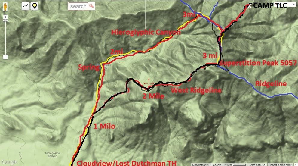
A group of us met in the parking lot, ponchos and rain jackets on to combat the sprinkling rain, and shining headlamps to light the way. A large portion of the group would head up the more frequented trail up the canyon while a smaller group planned to split off to take on the west ridgeline about a mile into the hike. I was using a topo map and an aerial picture of the drawn route on a map to navigate the turnoff. Once I got there, as expected, it didn’t look like there was a trail. We busted up the initial ascent which didn’t wait in giving us some good laboring elevation gain right off the bat. Climbing up and up dodging barrel cactus, wet slick boulders, ocotillos, and a number of other brushes we pushed forward to reach the ridge. Along the way water trickled down the mountain off the rock faces in streams and sometimes small waterfalls. The sun, hidden by the clouds, slowly lit the sky enough to kill our headlamps. Soon after turning off the headlamps the heat from the climb and the breaking rain warranted a poncho peal.
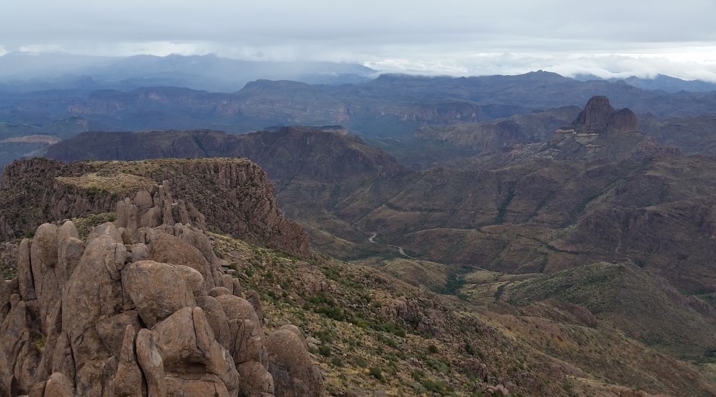
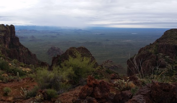
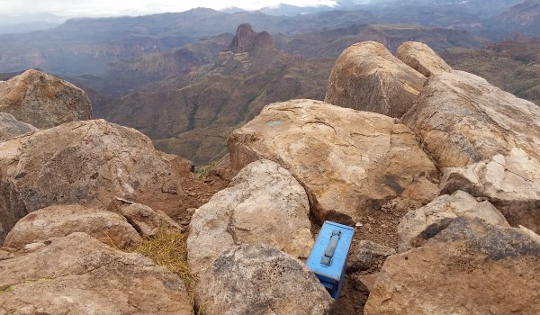
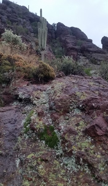
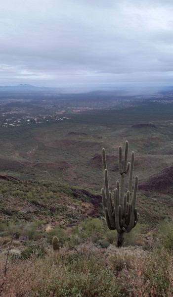
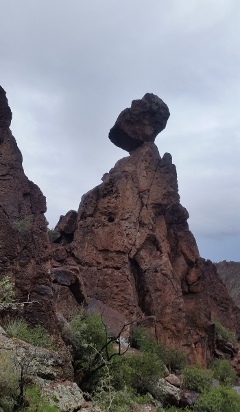
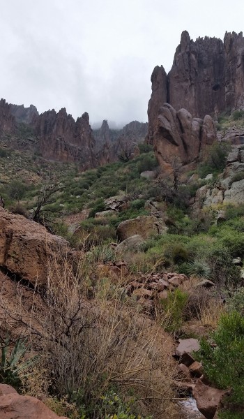
We climbed until hitting a vertical rock face. I followed the aerial topo (see HIKE INFO at bottom of post for aerial map) and we skirted north until finding a small gap that was well cairned that we climbed up and over. Dropping down on the North side of the gap and we saw a passable incline to the east to and made a final boulder hop (passing the teetering boulder) to the crest of the west ridgeline. Once we climbed on top of the west ridgeline it was surprisingly well cairned and the path was not too hard to follow. Absolutely incredible views! There is little that pictures could ever do to describe it. Peering in for miles every direction yielded awesome sights; the flat valley below, the gnarly jetting rock faces of the mountain ridges in the distance, much worth the climb.
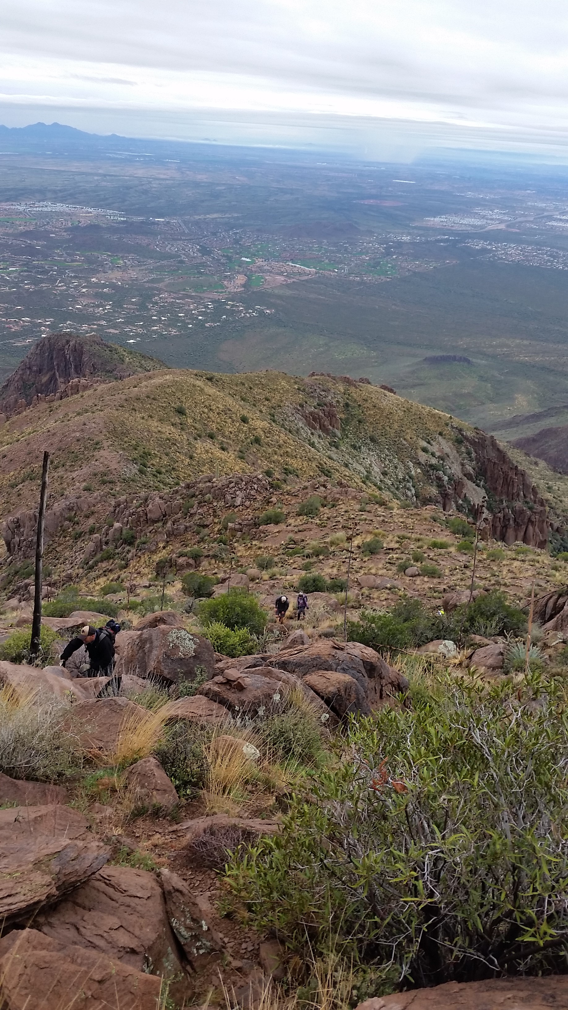
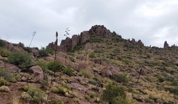
We continued to climb until finding another group of spires standing in our path. After some quick cairn searching we found the path dropping to the southeast side of the jetting rocks. Following the cairns and some old use paths we found a way to circumvent the massive spires. Climbing up and up on the ridge I was suddenly was overtaken by the overwhelming feeling of joy. Just being out there, on a ridge, in the middle of nowhere, with good people and breathtaking views all due to the effort I put into climbing that mountain: A cost well worth the prize. We kept trekking up the ridge with only one small 8 foot climb that all in our group easily surpassed (even Medals dog Tyson). After the climb the peak was in sight and we pushed on. Once we peaked I was surprised to see that only moments later the second group that took the main trail met up with us. Good timing!
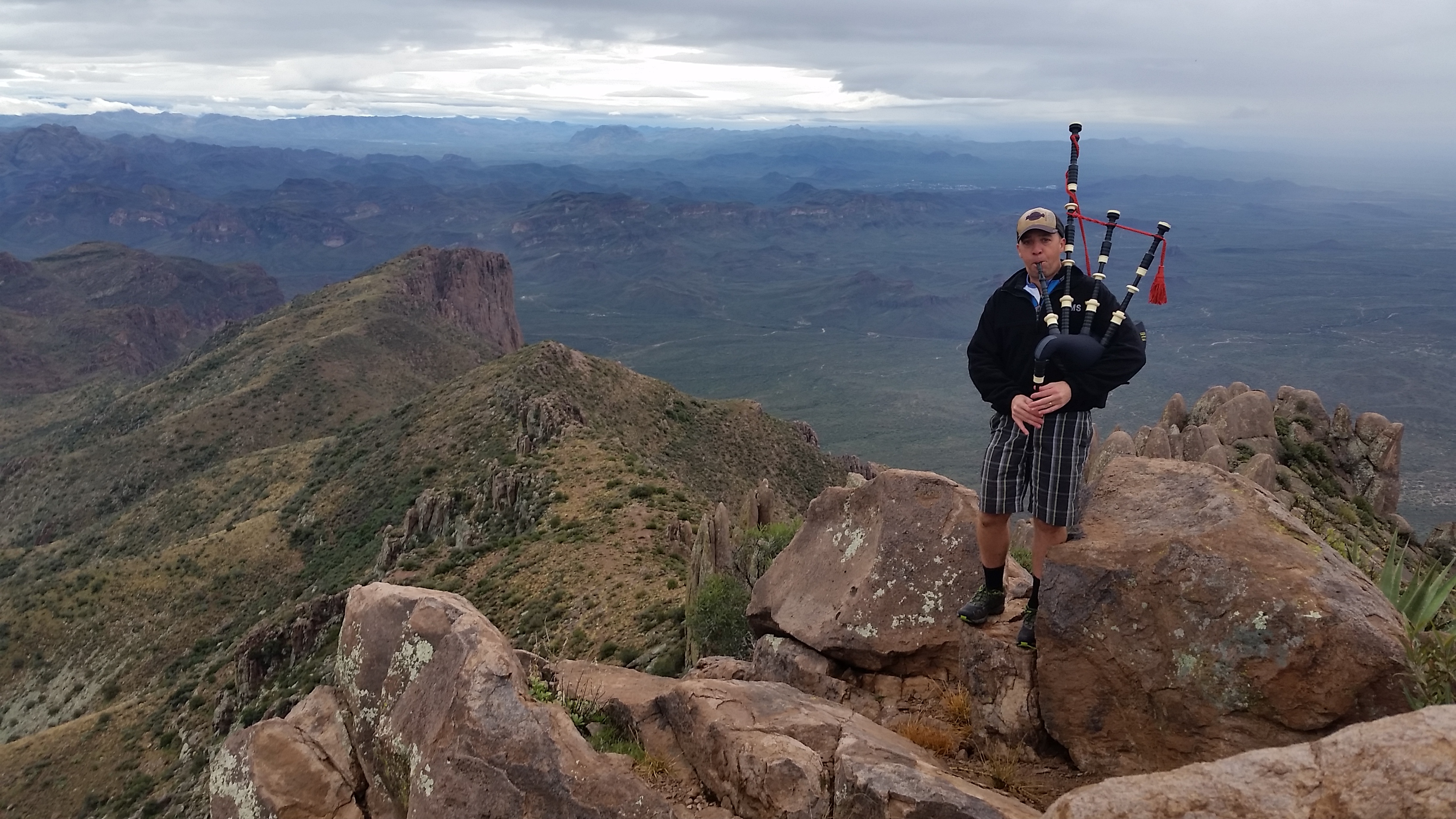
Once taking in the views at the peak and listening to my buddy Marks bagpipe session (unbeknown to any of us he lugged the things up there, sounded awesome, thought I was in a scene of Braveheart) we headed down the main trail towards the trailhead. Although the rocks were wet it wasn’t too slippery but caution was definitely needed.
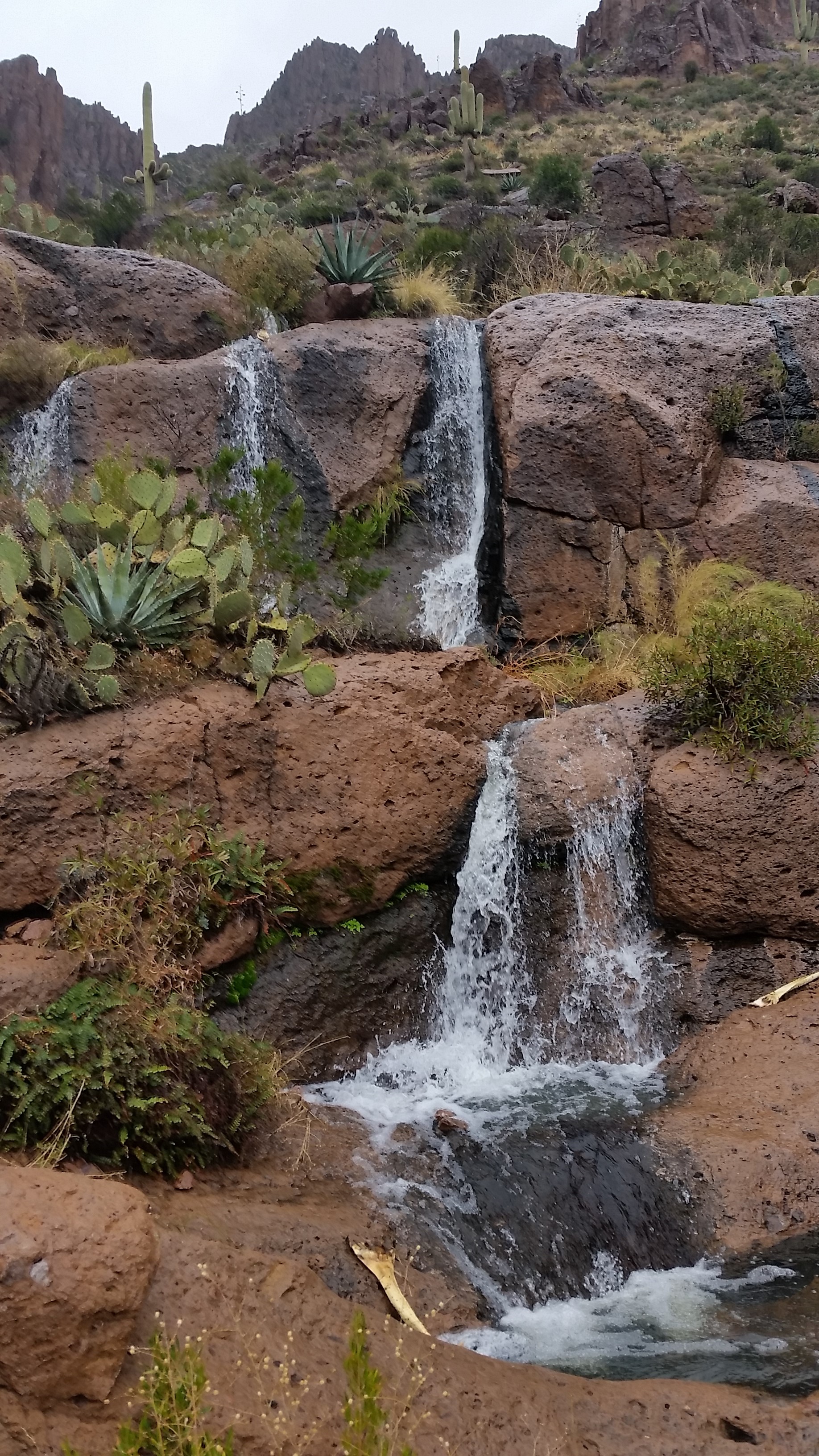
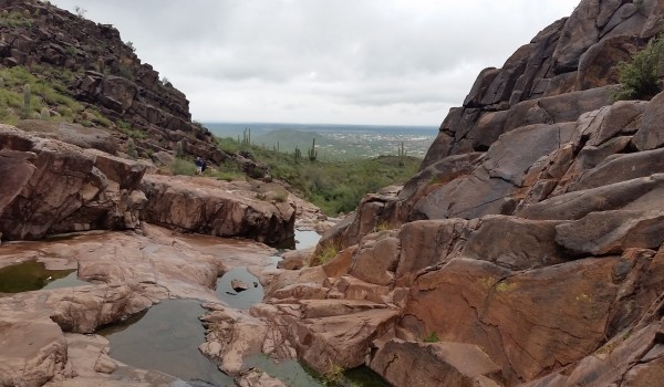
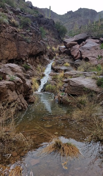
We dumped into the main canyon to find rare waterfalls running due to the past two days of rain in the area. This much water in the Superstitions was a real treat to see indeed. We kept descending down the faint cairned use trails, finally hitting the well worn trail at a confluence of two canyons. We took the trail down, around the bend of the canyon, past the petro glyphs (where most patrons stop climbing), and the down last mile to the trailhead. All the while we trekked down the mountainside a thick cloud descended on the mountain as if to chase us out of the wilderness. The weather was certainly kind to us and the prize of the views and rare sight of waterfalls in the Superstitions was well worth the price of a little sweat and effort. Another successful gorgeous trek!
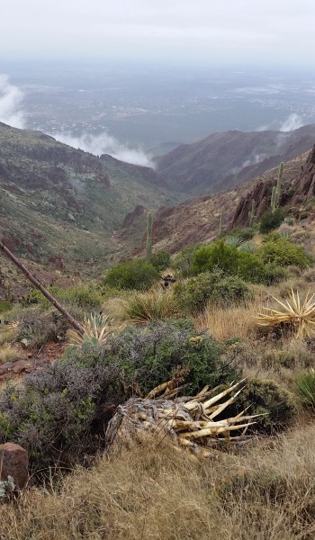
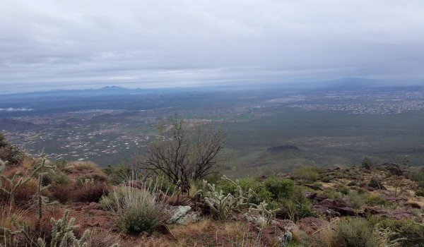 Looking over the valley from the west ridge
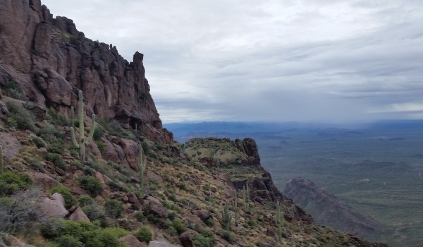
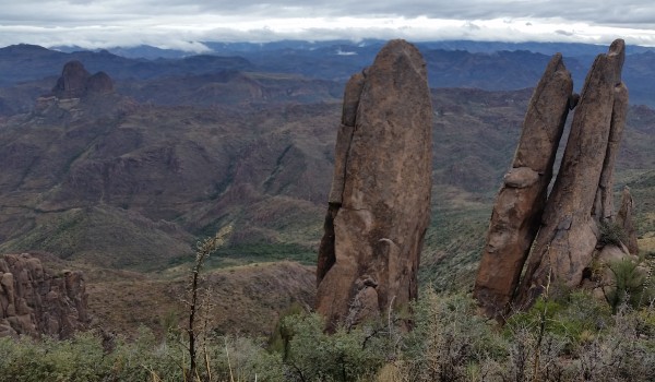
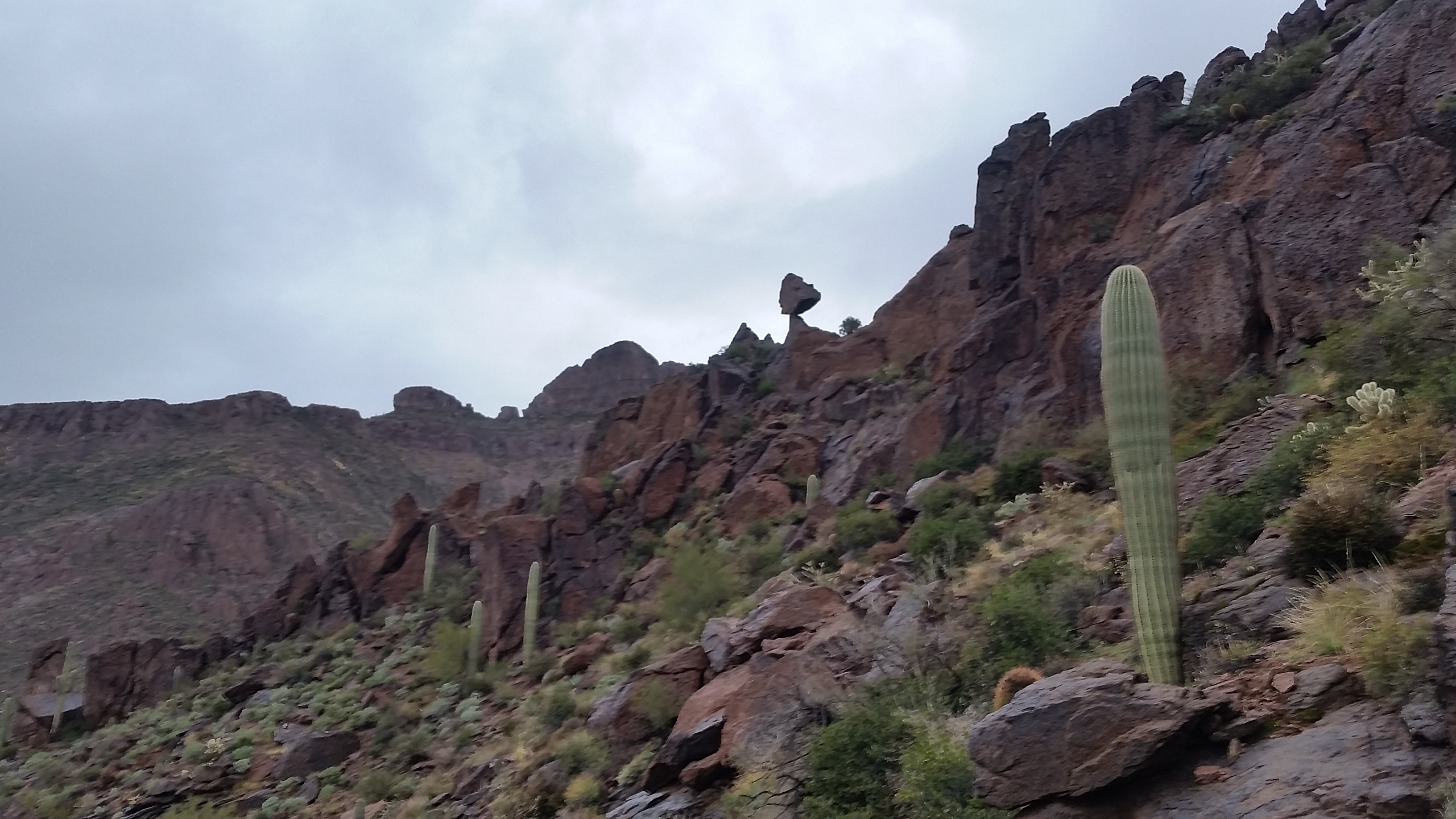
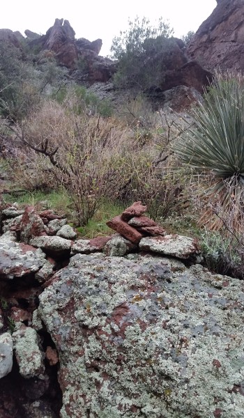
 Views of the initial ascent up to the west ridgeline
HIKE INFO:
Main Trail: http://hikearizona.com/decoder.php?ZTN=17340
HIKE STATS:
- Weather: Hi upper 60s, Low in the lower 50s, Cloudy, overcast, sprinkling, foggy in the afternoon
- Water: 2.0 liters
- Food: 2 Clif Bars, 1 Clif Builders bar, 1 Nature Valley peanut butter granola Bar
- Time: 5 hours
- Distance: approx 7.5 Round Trip
GEAR:
- Mule Camelback backpack (3 liter bladder)
CLOTHING:
- Smart wool 195 long sleeve shirt
- Cotton Handkerchief
- Basketball shorts
- Merrell Mid Moab Hiking Boots
- Smart wool medium weight sox and liners
- Giro Mountain Biking Gloves
