

Killed my blasting alarm, grabbed my pack, and hopped in the truck to meet the Arizona and Beyond Backpacking group at Target in northern Scottsdale to coordinate a carpool to the Cave Creek Trailhead. The plan was to trek in through Tonto National Forest to Skull Mesa, crash for the night, wake up in the morning to see some rarely seen Indian ruins, then loop back safely to the trailhead the next day. I did my diligence in mapping the trials, checking the weather, and making sure I had enough water to get through until the next day. What I wasn’t prepared for is some of the condition of the less traveled trails, and the fun it would take traversing them to our destination!
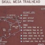
Ten of us started out that morning heading towards the mesa. This was my first outing with the group so I wasn’t sure what to expect. Everyone was pretty cool and I soon fell into place, we trekked on at a pretty decent pace. The plan on Day 1 was to head south on Cave Creek Trail #4, tie into Cottonwood Trail #247 to Skunk Creek Trail #246 to Quien Sabe Trail #250 and finally Skull Mesa Trail #248 which lead up to the Skull Mesa where we would camp for the night. Day 2 consisted of traversing the Skull Mesa to the North West where we would see the Indian ruins just before diving off a rock wash and jumping back on Cave Creek Trail #4 back to the trailhead. (See map in Slideshow Pics)
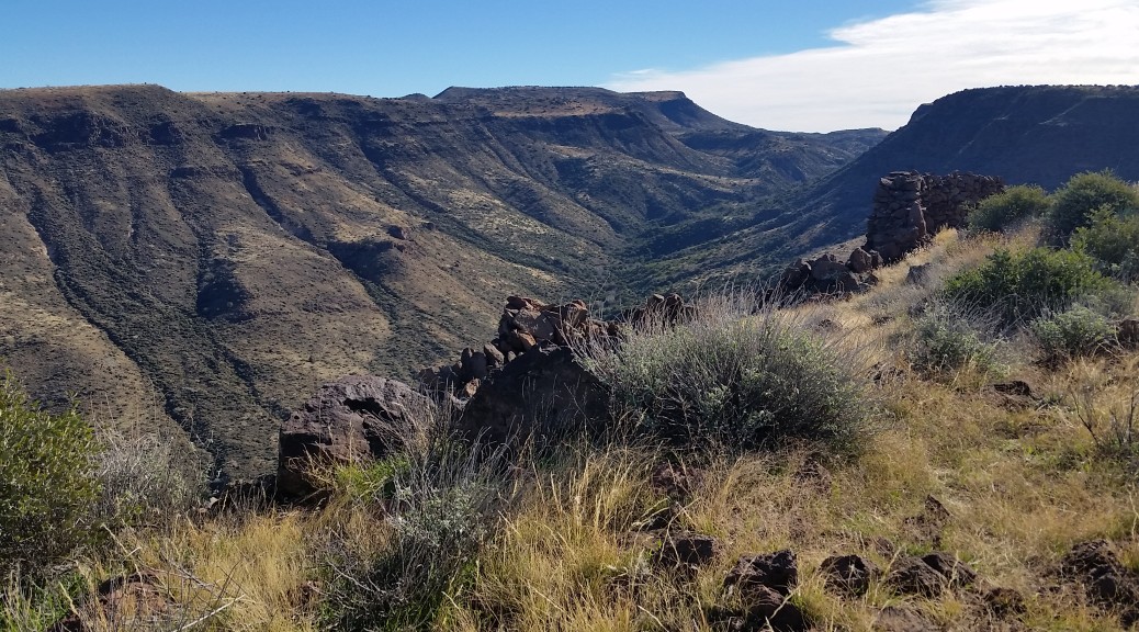
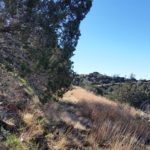
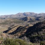
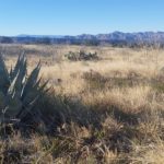
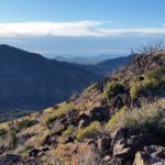
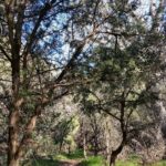
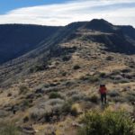
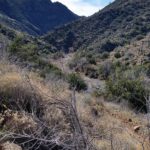
The group headed south along Cave Creek #4 which seemed pretty straight forward. At the junction where Cottonwood Trail #247 tied in we crossed Cave Creek and it became a little less intuitive. With the help of a PGS and some pink tape we found the trail and kept on trekking. The trail opened up from the tree canopy near the creek bed as we ascending. Open views of canyons and the mountains ahead were all around. Soon we tied into trial #246 and as we pressed on I could see the separation in the group for different pace packs. It wasn’t until we hit trail #250 that things got really interesting. It seemed that the trail was an old mine road that nature reclaimed and covered in cacti and prickly bushes! There were baby boulders everywhere just waiting to claim an ankle. Three of us had gained a little time on the main group and decided to take a quick off trail trek to claim Quien Sabe Peak. The initial grind was formidable not lacking any rock, cactus, or bush dodging. We finally peaked, pausing to snap pictures and take in the landscape before turning back.
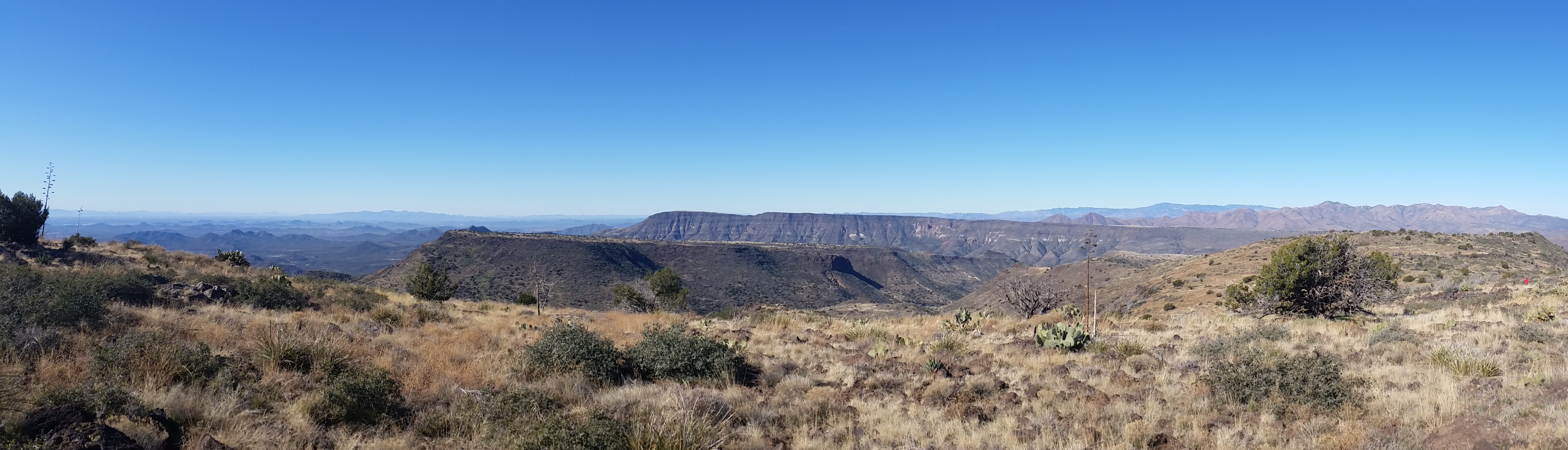
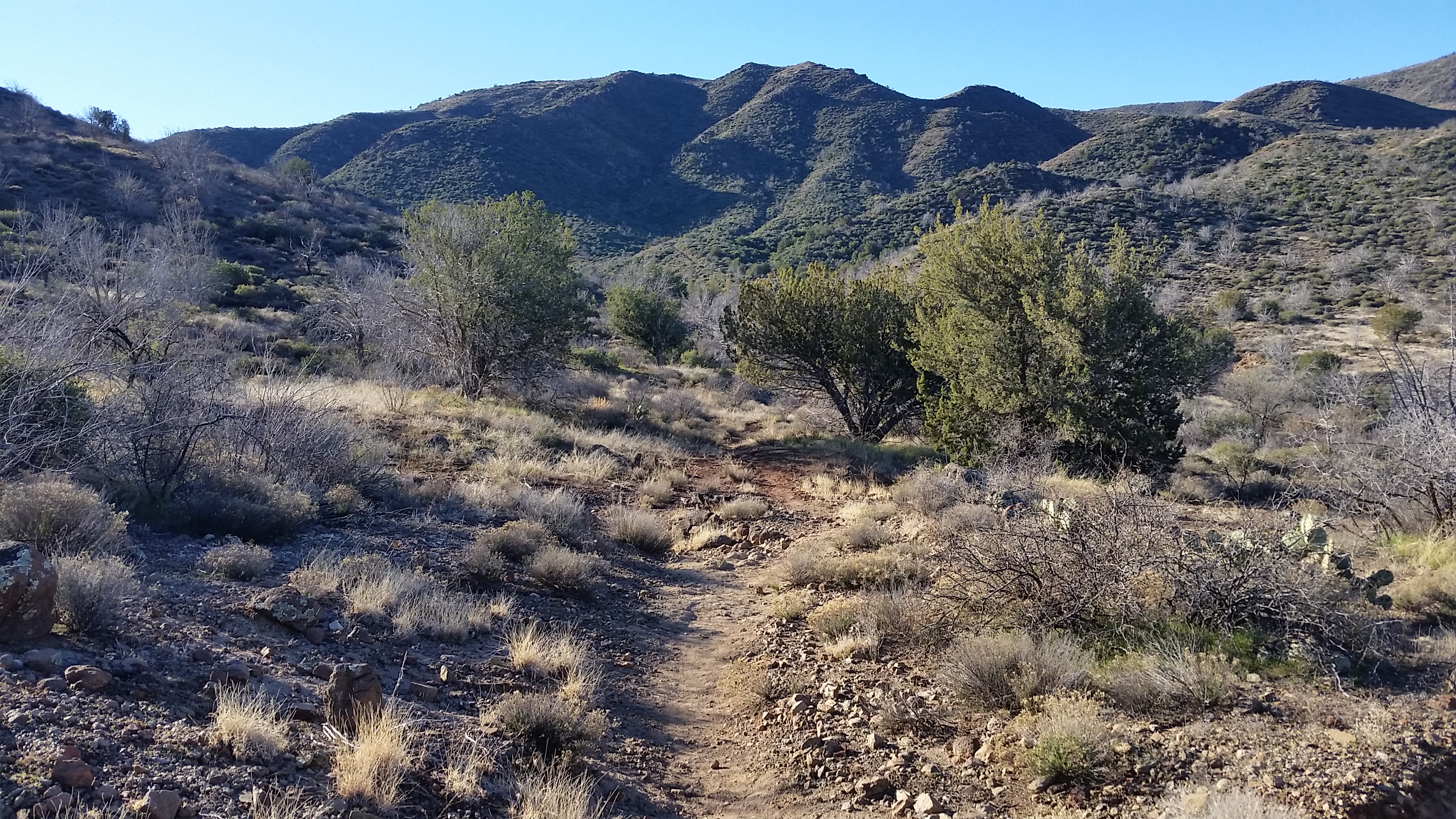
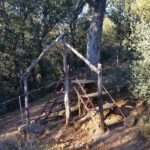
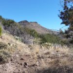
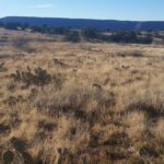
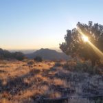
We hit the trail once again, surprised not to see the rest of the group, but decided to press on to the Mesa and meet them there. Quien Sabe Trail #250 didn’t look like it has seen trail maintenance in quite some time and I wasn’t even sure we could call it a trail much longer in a few places. We pressed a hard grind up to the saddle and eventually the Mesa where we scoped out for a campsite. The rest of the group caught up and we set up camp. After a quick chill session, I caught a second wind and wasn’t ready to just settle in for the evening. So with a few hours left of daylight I decided to make a push for the Indian Ruins at the north end of Skull Mesa and check out the down climb we would have to traverse the next day.
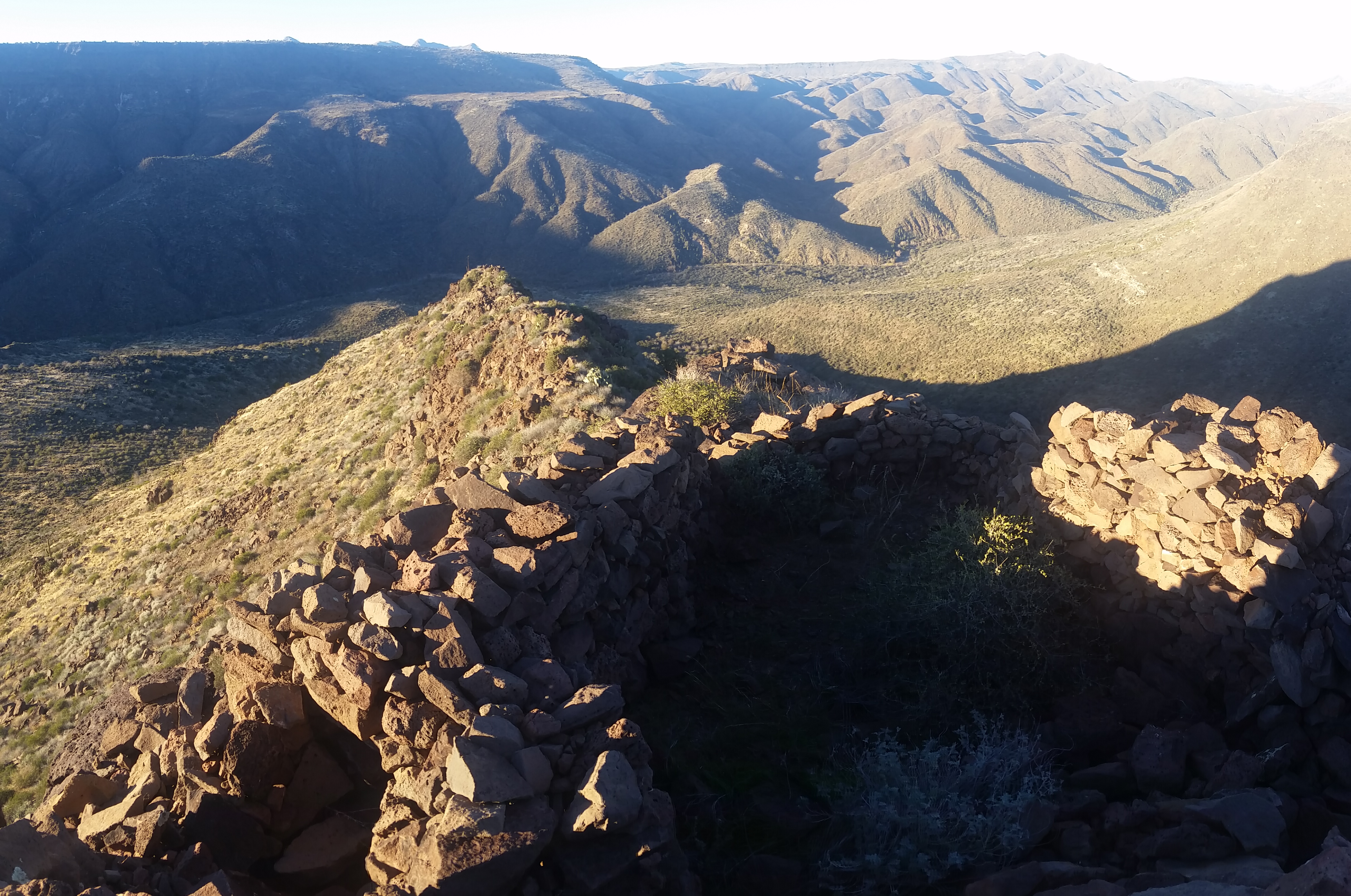
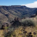
I headed out at a quick pace with a mostly empty pack and a hankering to get some good pics of the ruins in the golden light. The mesa is large and flat, sometimes it was hard to get my bearings in the open fields. The pancake cacti were waiting like landmines to remind me it wasn’t just a walk in the park. After an hour I reached the ruins after traversing 2 miles of mesa and two surprisingly steep hills on the ridge line walk. I snapped pictures, looked at the super sketch (looking) wash we would have to descend the next day (with 30 lbs packs), and headed back for camp to try and beat the onset of night.
I reached camp, told everyone what we would be facing the next day and proceeded to make dinner and chill out just before crashing for the night. As light faded Brian (physics teacher) schooled us on the constellations and locating the North Star. Was nice just hanging out a chatting with almost strangers all out there for the same reason, to enjoy nature. I called it early and crashed out.
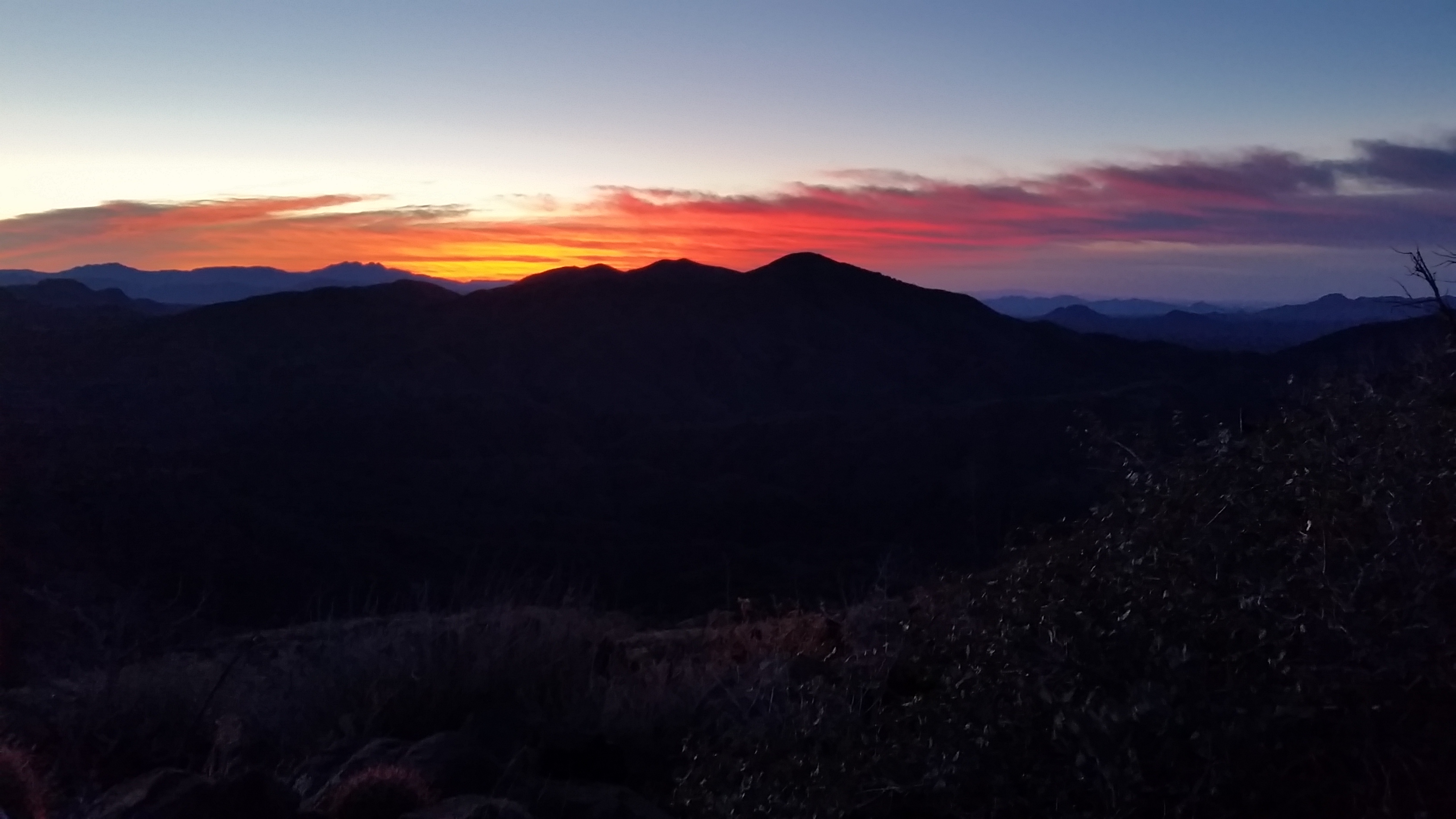
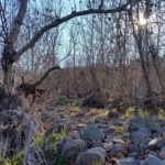
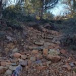
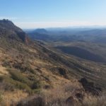
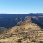
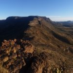
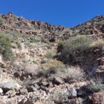
The next day I woke early with coffee in hand and met Vince and Brandon (2 of the trip coordinators) at the edge of the Mesa to catch the sunrise and talk about the days journey ahead. After a while the troops were gathered and we set out, traversing the mesa, checking out the Indian ruins, and finally descending the rock was on the west side of the ridge just before the ruins. The rock wash was a bit tricky, and definitely had the looks of doom at first glance. It took some vigilant navigation and shore footing to get us down safe, but we all made it (with a few extra cacti spines that we started with).

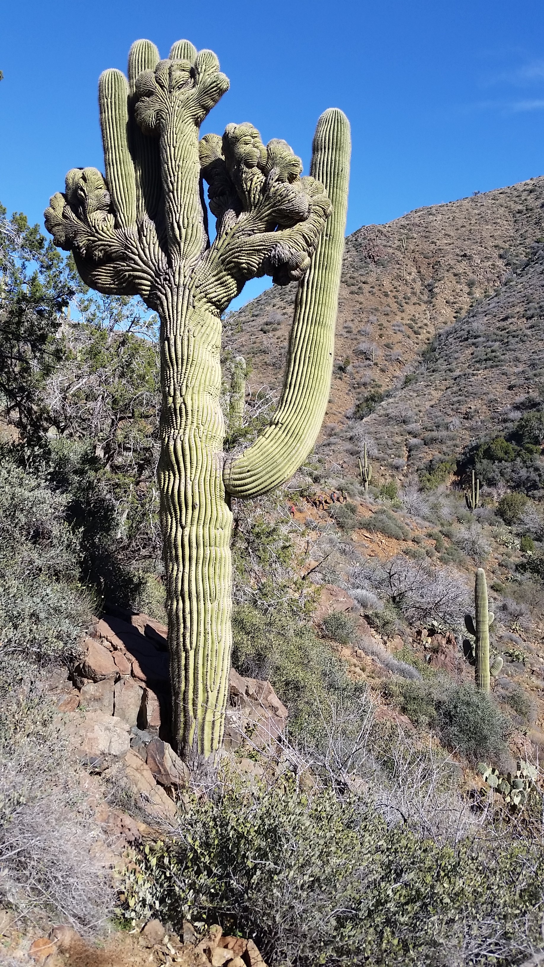
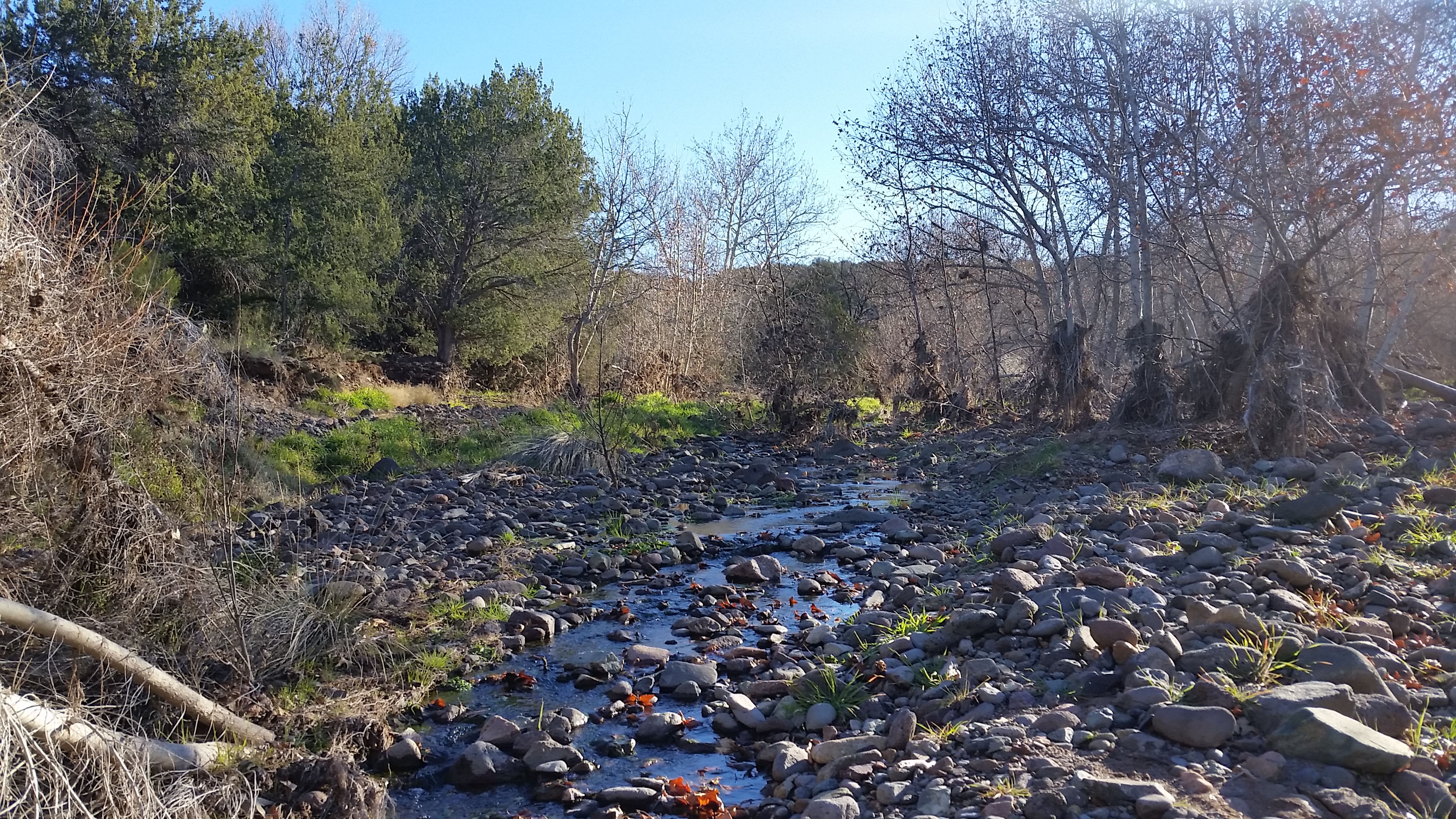
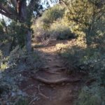
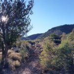
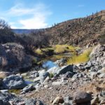
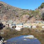
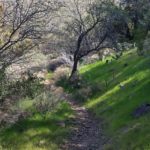
We tied back into the Cave Creek Trail #4 and headed back for the trailhead. After a mile we hit the creek, took a break for food and to filter water. The trail seemed to wind alongside the creek for the most part. I was really interested by the Cave Creek Trail #4; it had some very unique (especially in Arizona) qualities. Inviting swimming pools, green lush trees, fresh flowing creek water, and a very cool crested saguaro were all trailside. The trail rolled in and out, up and down the canyon, through some very green grassy canopy areas, and finally back to the trailhead. Two days outside with nothing but fresh air and plenty of dirt to put beneath your boots, what could you want more?!
HIKE INFO: See Post for Trail Selection + Galley for Map Reference
Extra Map info: http://hikearizona.com/t2010/01/17/O_10667-9850_1263744502-14.jpg
HIKE STATS:
- Weather: Hi in the low 70s, Low in the upper 40s, Sunny
- Water: 5 liters (day 1), 3 liters (day 2)
- Food: 4 Nature Valley Peanut butter granola bar, 4 Clif Bars, 2 meal replacement protien bar, 1 bag of beef jerky (6oz), avacodo, 1 ziplock sandwich bag of peanutbutter pretzels, 1 via starbucks instant coffee, 1 Quaker Real Medleys Oatmeal, 1 Mountain House Beef Stew, Pizza Pringles, gummys worms
- Time: 12 hours 13 miles day 1; 9 hours 7 miles day 2
- Distance: 13 miles (Day1) to Skull Mesa + Daytrek to and back from Indian Ruins
- Distance: 7 miles (Day2) from Skull Mesa to Cave Creek Trailhead
GEAR:
- 58 liter exos osprey backpack
- Big Anges Copper Spur UL2 tent
- Flash REI sleeping pad
- Cosmic Down Kelty Sleeping Bag (rated to 20 deg F)
- Jet Boil – Sol
- Black Diamond trekking poles
- Sawyer Squeeze Water Filter
CLOTHING:
- Smart Wool 195 Long Sleeve Shirt
- Cotton Hoody
- Cotton Handkerchief
- Patagonia Pants
- Merrell Mid Moab Hiking Boots
- Smart wool medium weight sox and liners
- Giro Mountain Biking Gloves
