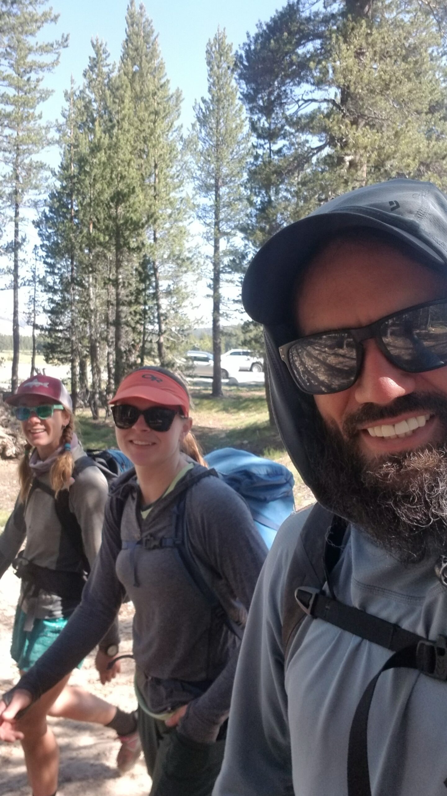
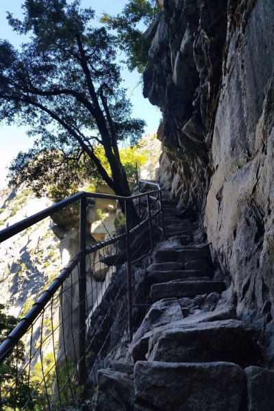
As a bonus, we met up with our friend Lis at the end of the trail in Tuolumne Meadows. We had just finished a 2 week push across the Sierras, and Lis was nice enough to take us up Cathedral Peak for a quick finale romp! Our trail legs were strong, but our climbing skills were a bit rusty, good thing we had Lis at the helm as our Rope Gun!
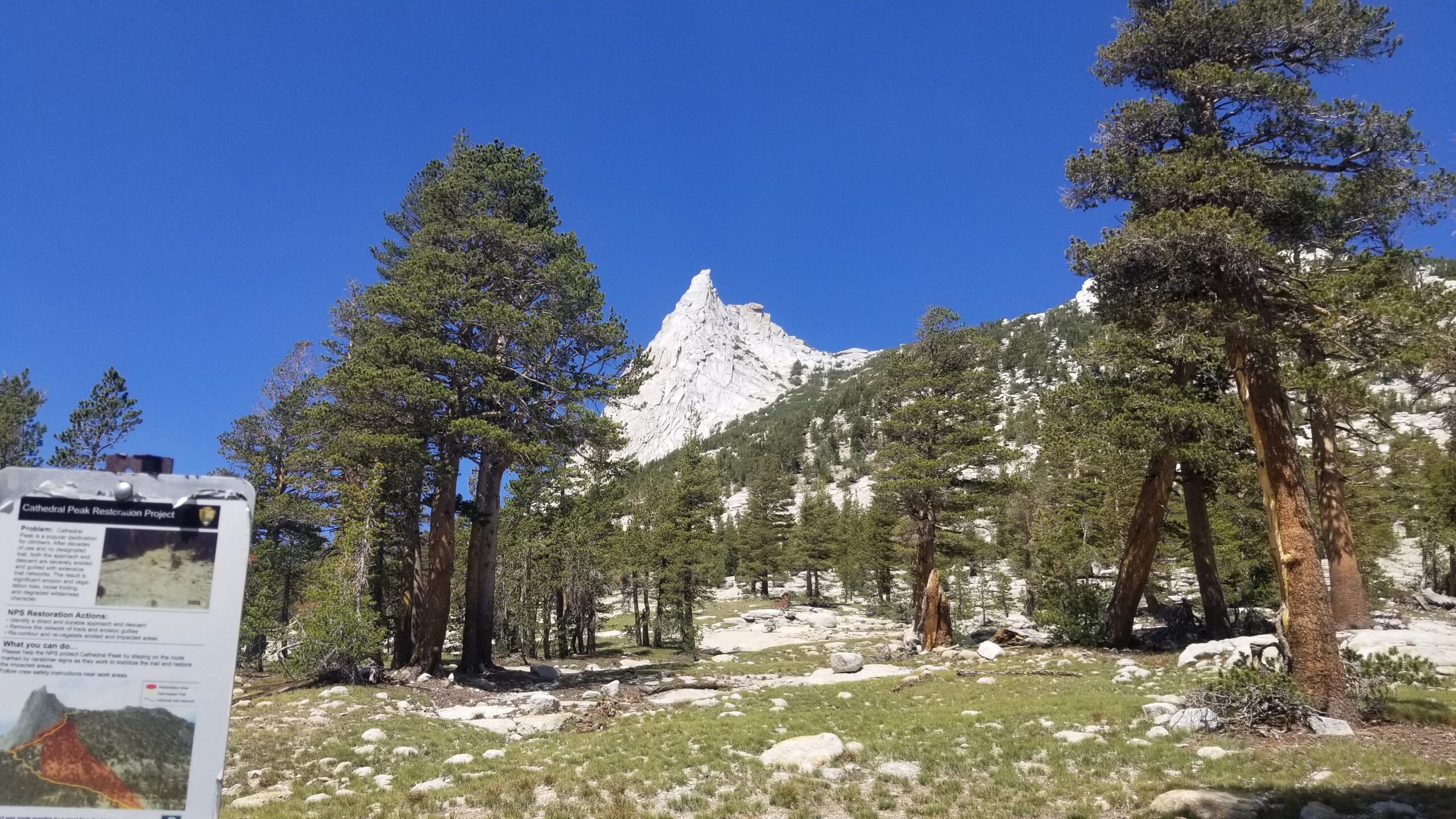
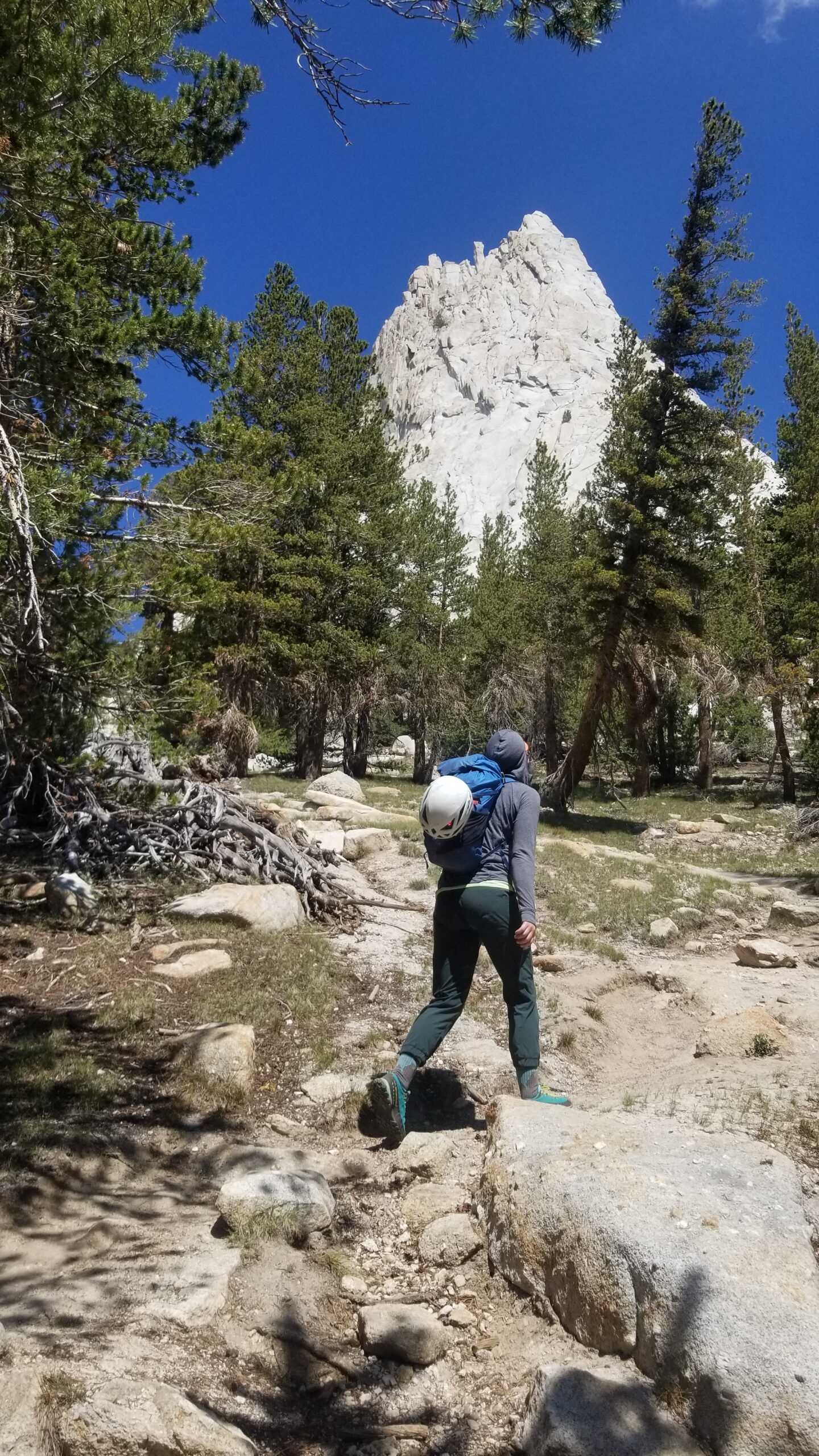
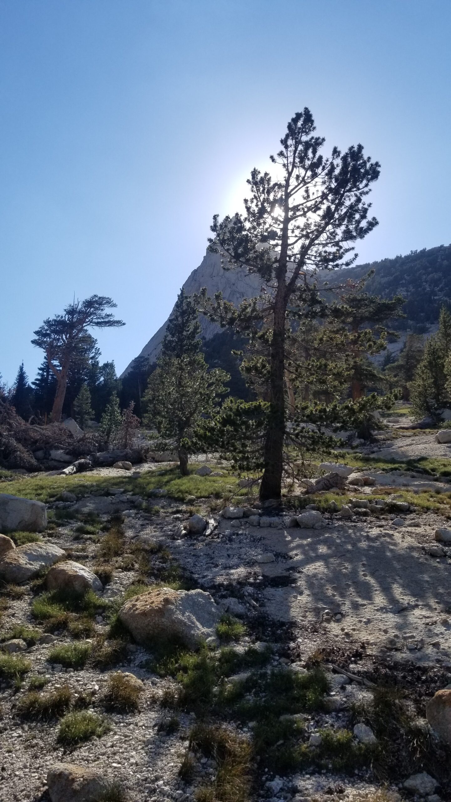
We left our camp early and headed towards the trailhead of the Cathedral Peak nestled in the heart of Tuolumne Meadows. We could see the large peak jutting into the sky from a long way off, it looked like a white pyramid beckoning all climbers in the immediate vicinity towards it. We made quick work of the approach across creek-laden meadows and soon found ourselves on the final push to the base of the huge granite peak. We could already see quite a few parties on the wall, plus some commotion at the start of the climb.
As we made our way closer, we realized there was a Search and Rescue (SAR) event unfolding before our eyes. A young lady had fallen on the first pitch, and broken her ankle. Already on the stretcher, being tended to by the medical personnel, we decided to push on and try not to let it rattle us on the climb.
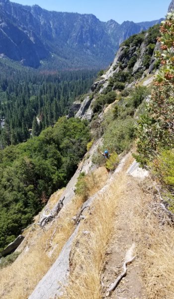
Objective spotted!Rolling strong on the approach
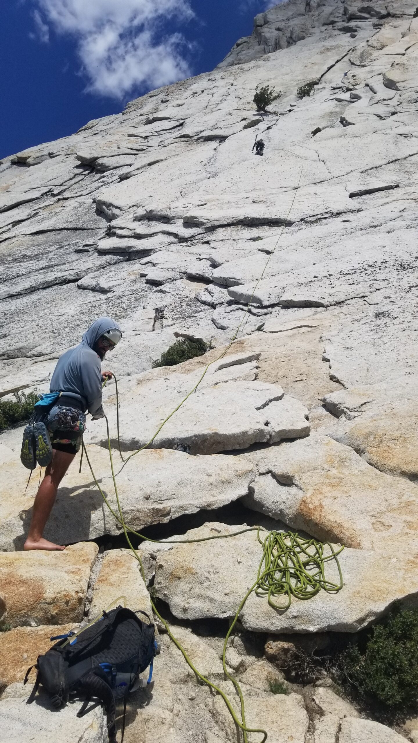
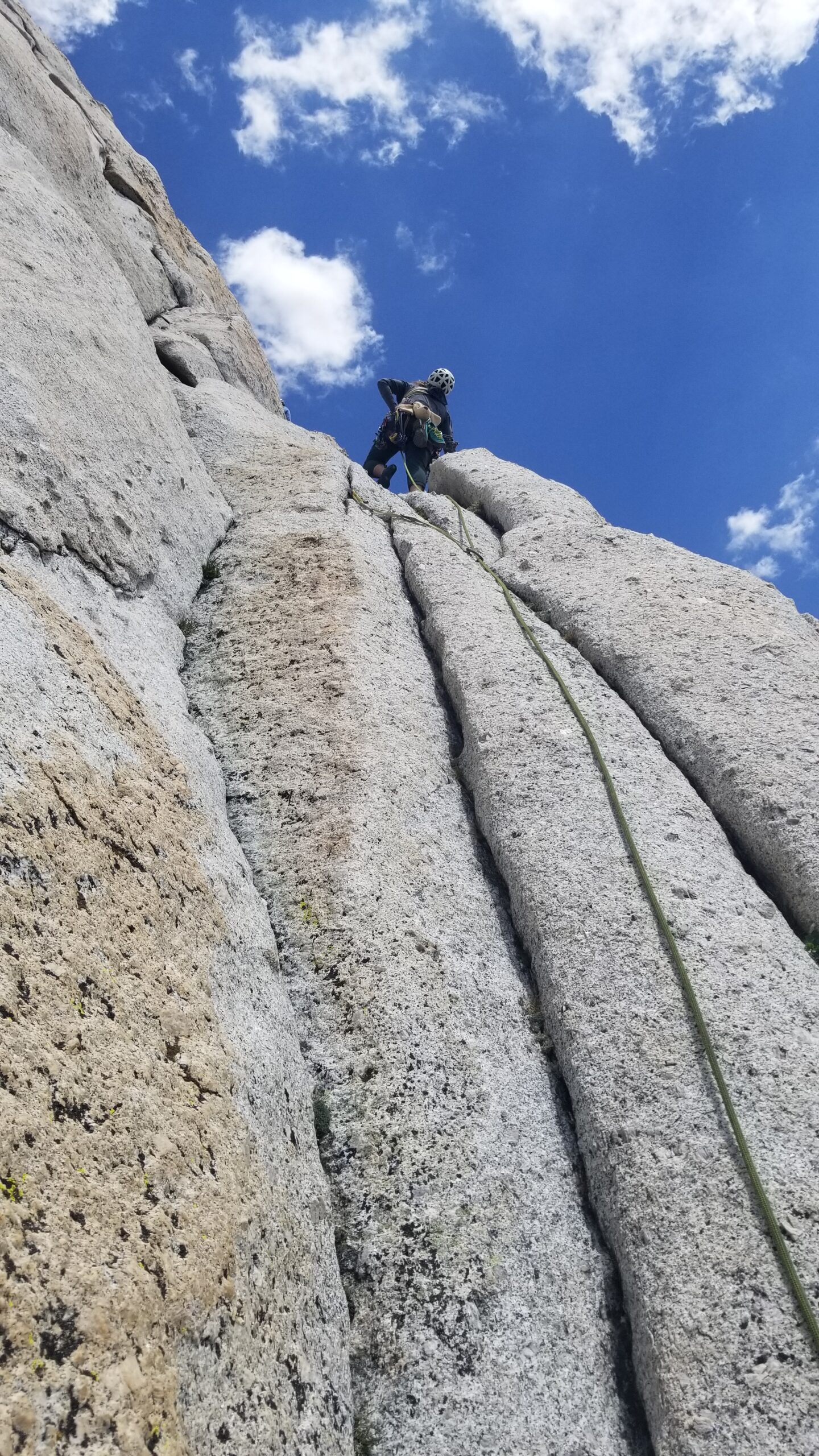
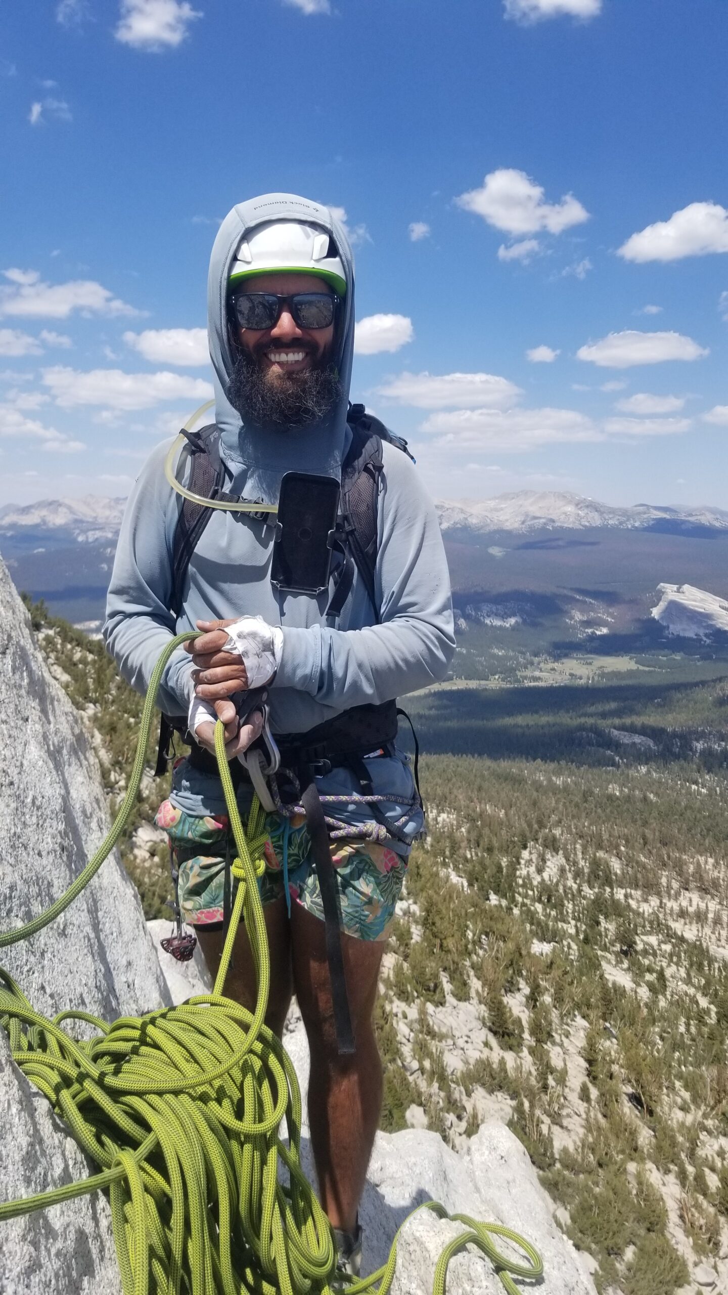
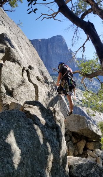
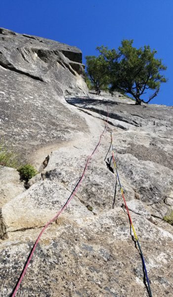
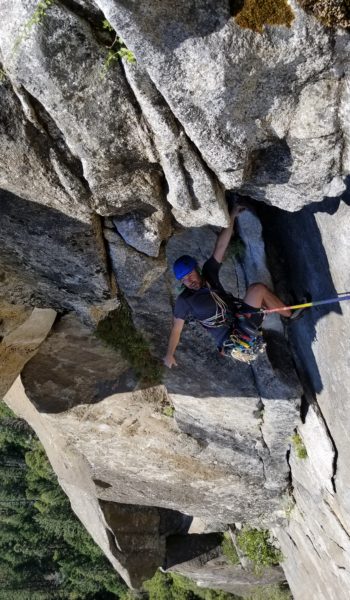
We flaked the rope, tied in, and Lis was off! She made quick work of the run out protection of the first pitch, found a good ledge, made a gear anchor, and yelled down “Off Belay!” It was time for Izzie and me to get to work. Izzie tied in short, just 15 feet before the end of the rope, and I followed tied in at the end. It had been a while since either of us had climbed, so we were both very focused and moving slowly over the fine granite face. This was a wonderful way for Izzie and me to experience the climb together, supporting each other as we ascended the huge granite monolith.
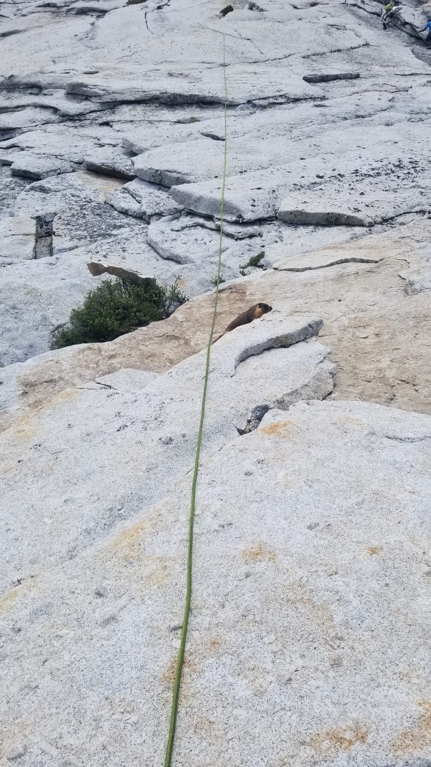
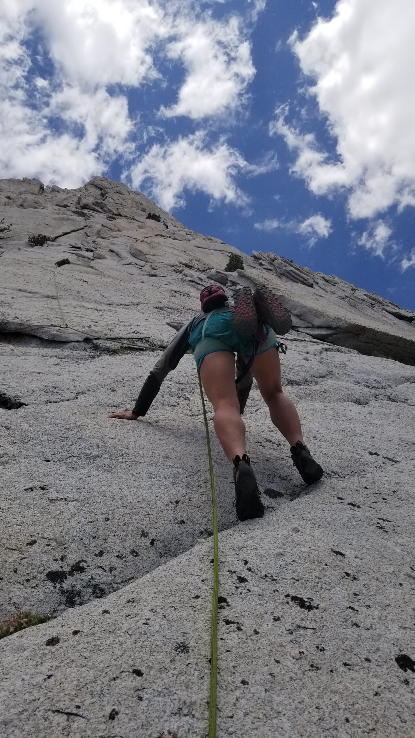
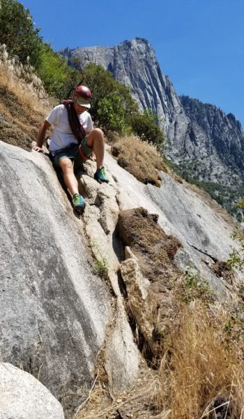
Belaying Lis up P1Marmot having not a care in the worldIzzie taking off, making the slabs look chill.Not a ton of crack training on the JMT, but we were loving the movement in the vertical terrainTo the next belay!
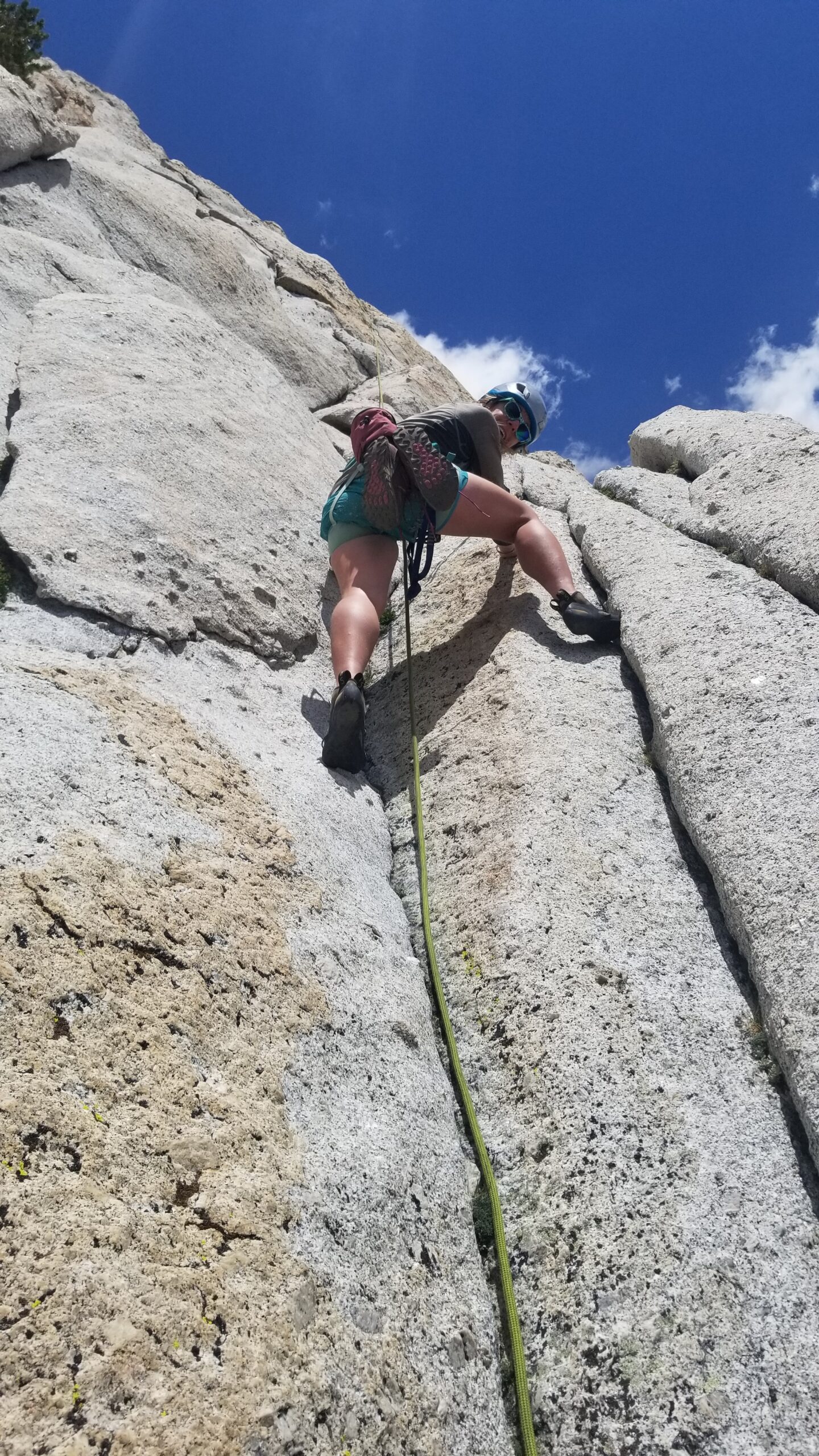
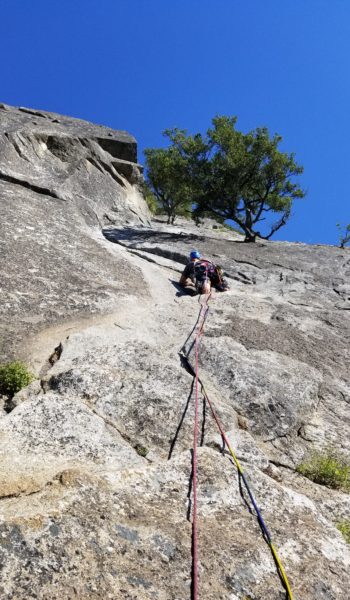
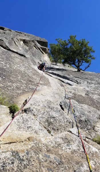
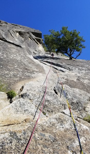
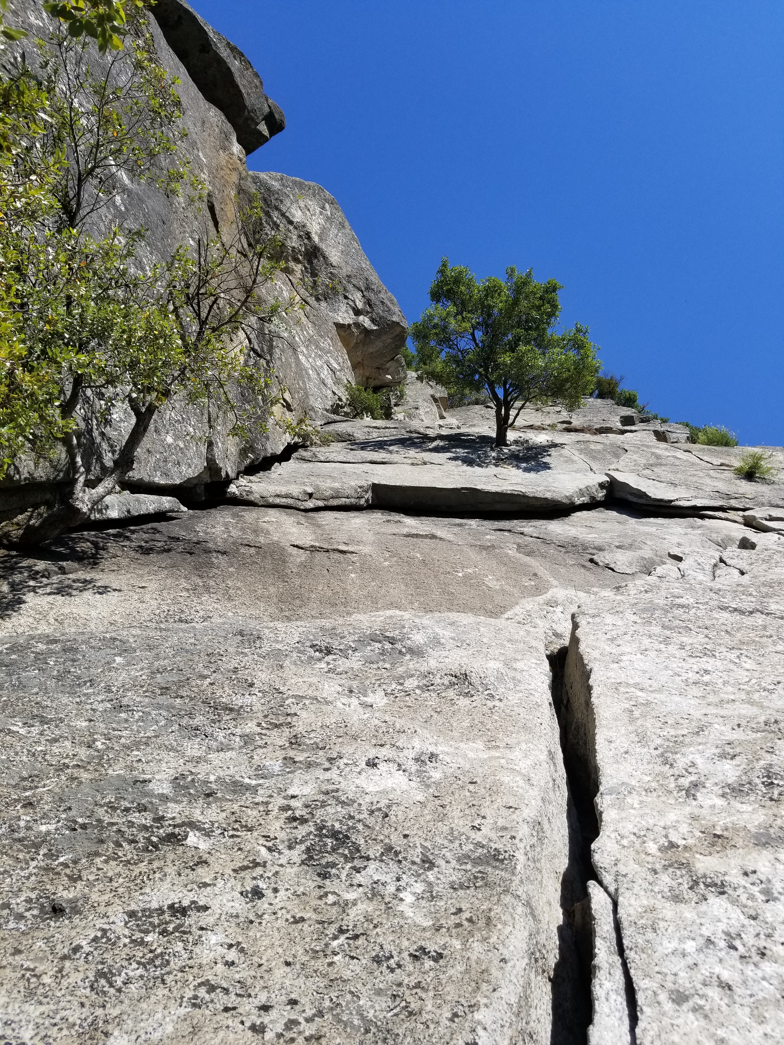
After we reached the next belay, Lis gathered the gear and took off again! We were flying up the peak despite waiting for other climbing groups to make their way up the face. Lis picked different lines than most, really charging the lead, making the run out pitch look effortless as she danced up the endless grey face of rock.
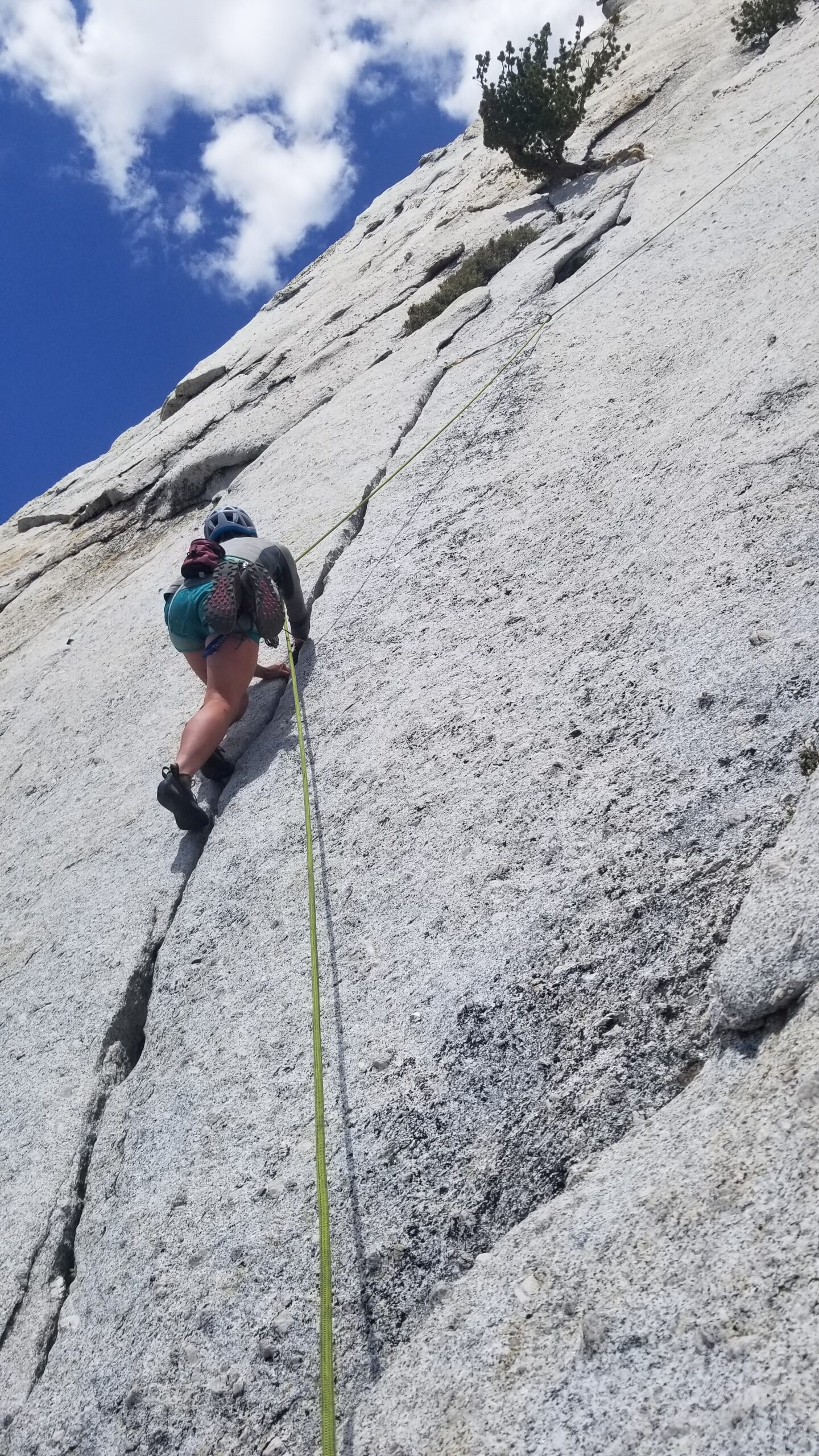
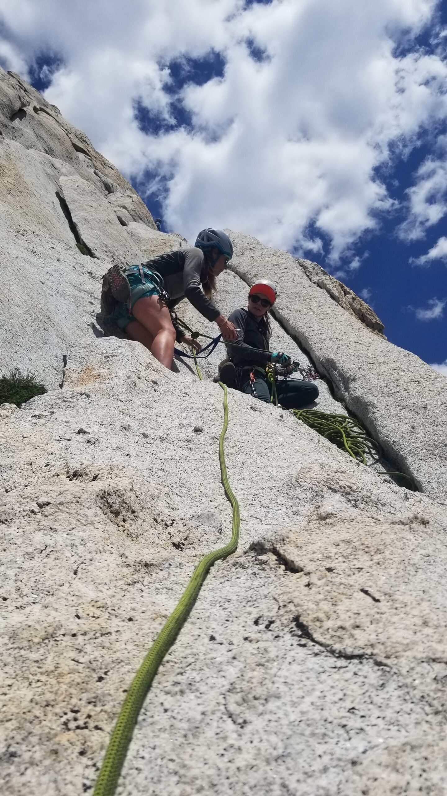
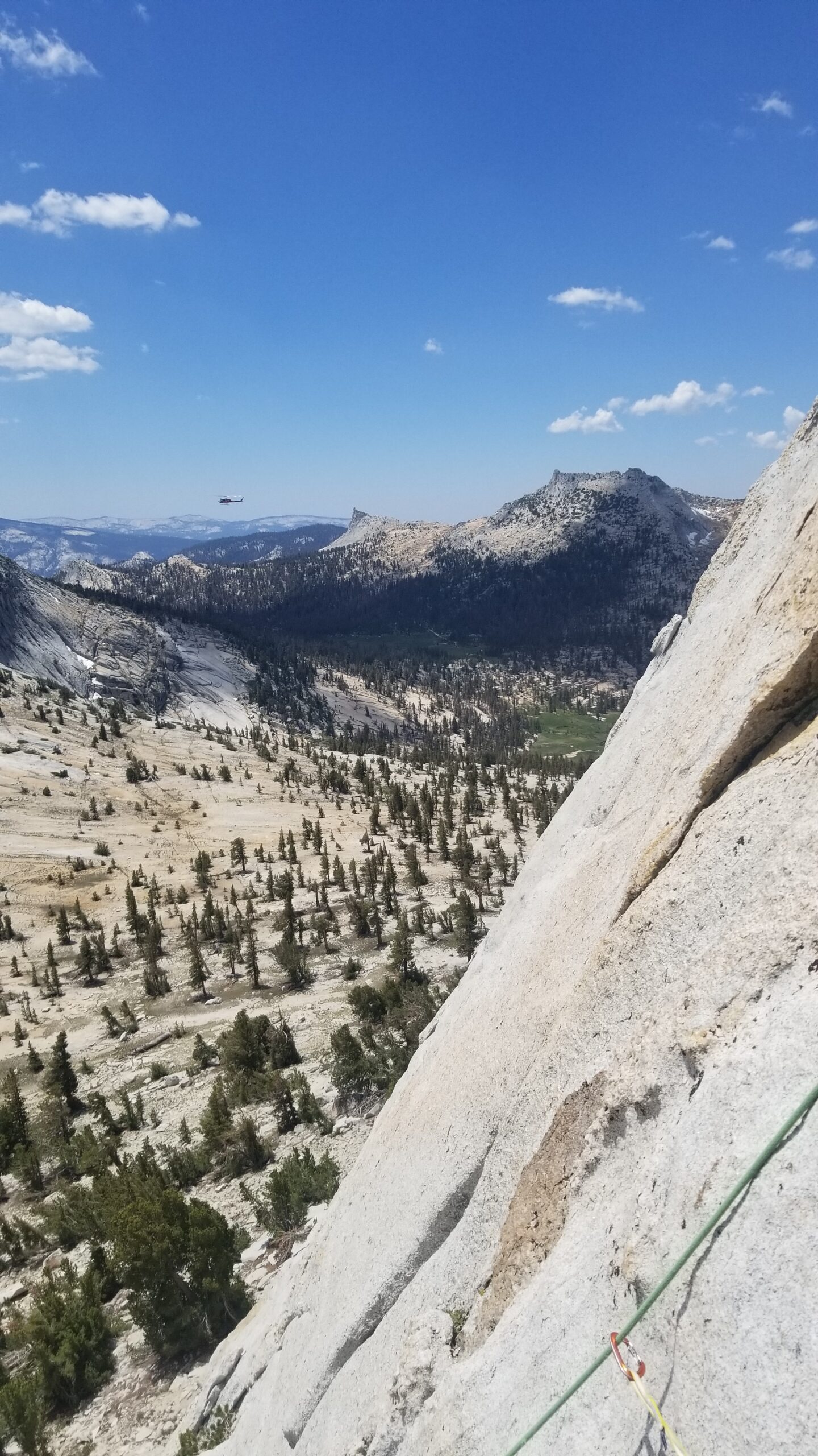
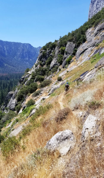
Off Lis goes for another pitch!Izzie soon following behind LisBeautiful views and a large mechanical bird on patrolThe Crew taking a short beak waiting for the next party to move upwardsBelay on P3
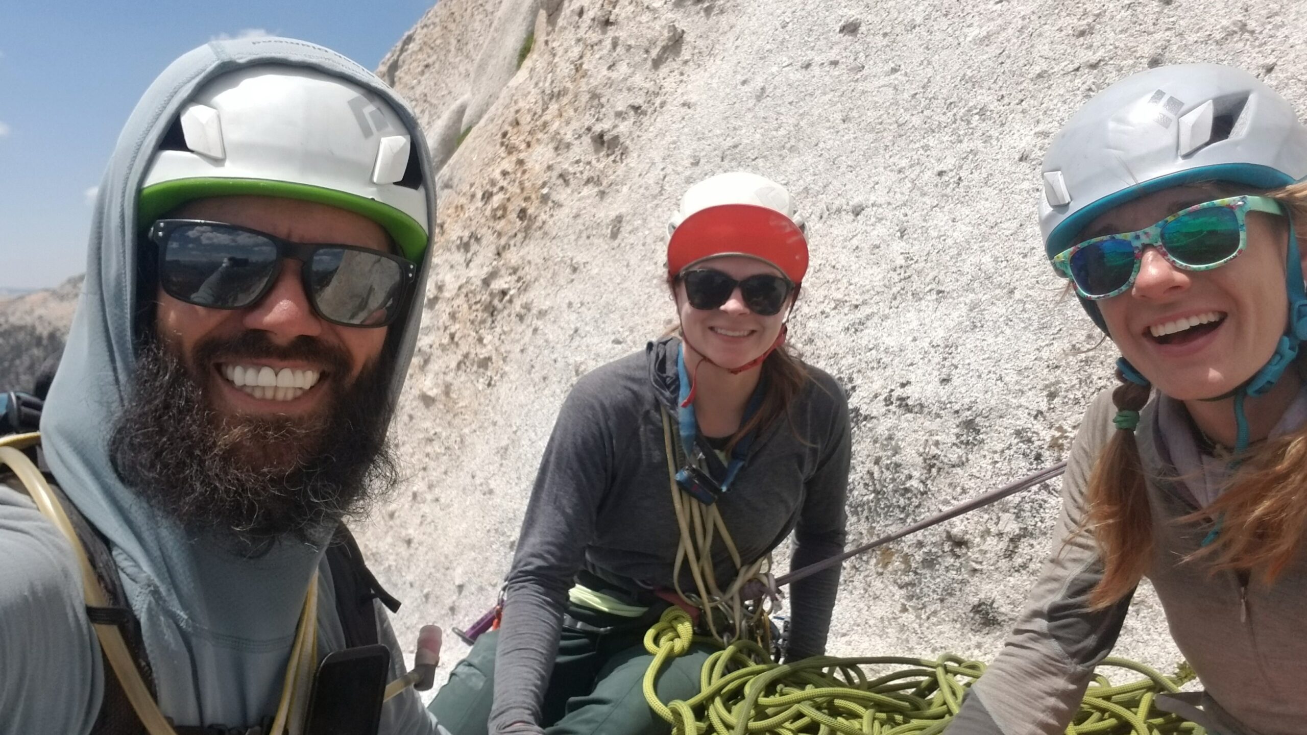
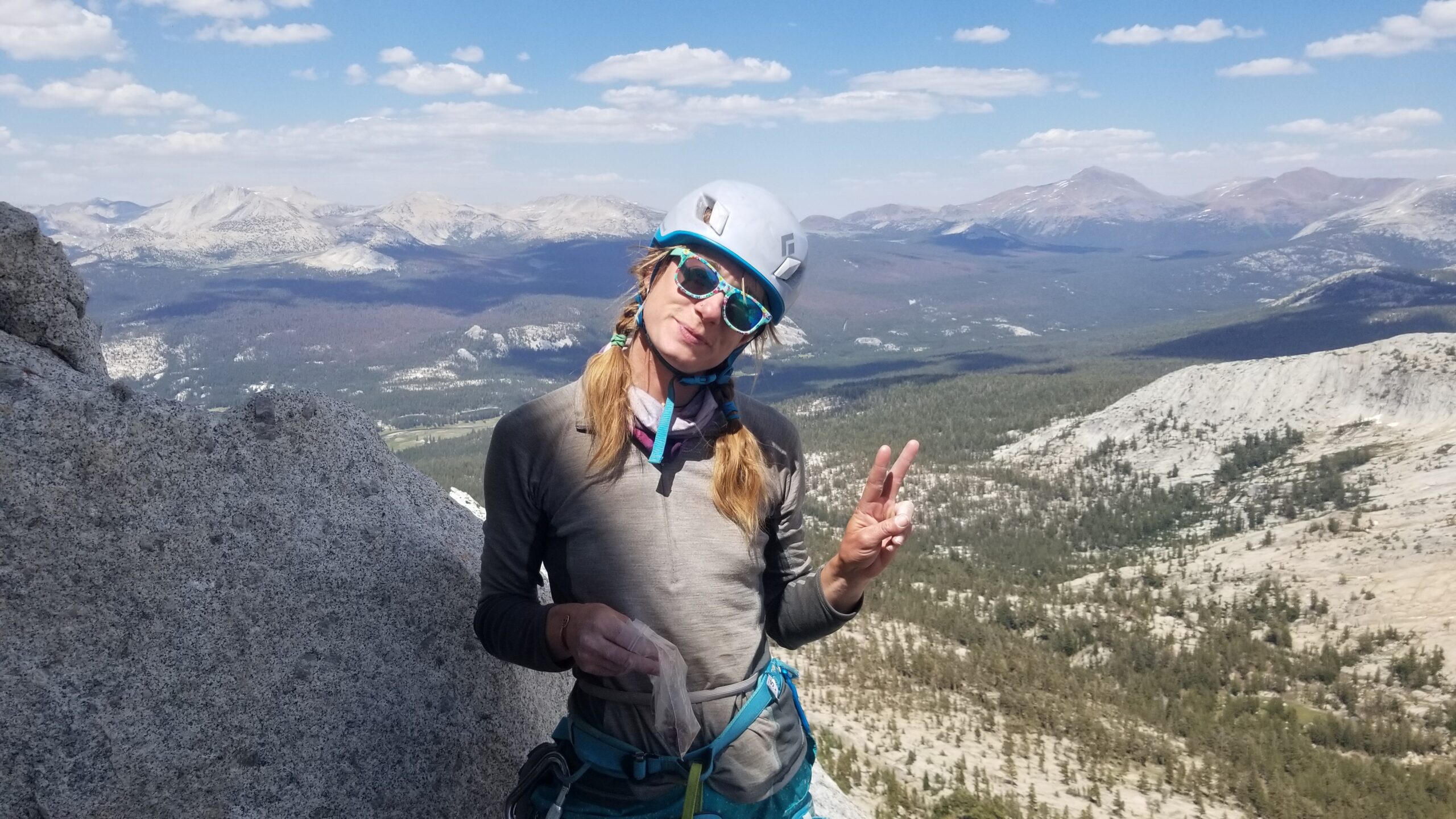
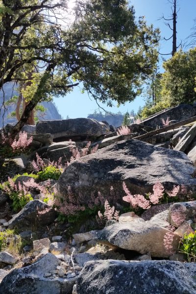
We were chatting as we went and really taking in the views at the belays; this was a great way to spend our last day of the trip. Climbing in the Sierras feels like your swimming in a sea of grey rock. Granite everywhere! It can be good and grippy in some places, and slippery as a wet snake in others. It definitely keeps you on your toes, even on an entry grade such as the south face of Cathedral. While waiting on the final pitch for the group ahead of us to summit the peak, we took a moment to snap a few pics before Lis took off for the final pitch to the top.
Straight chillin!Summit selfie!
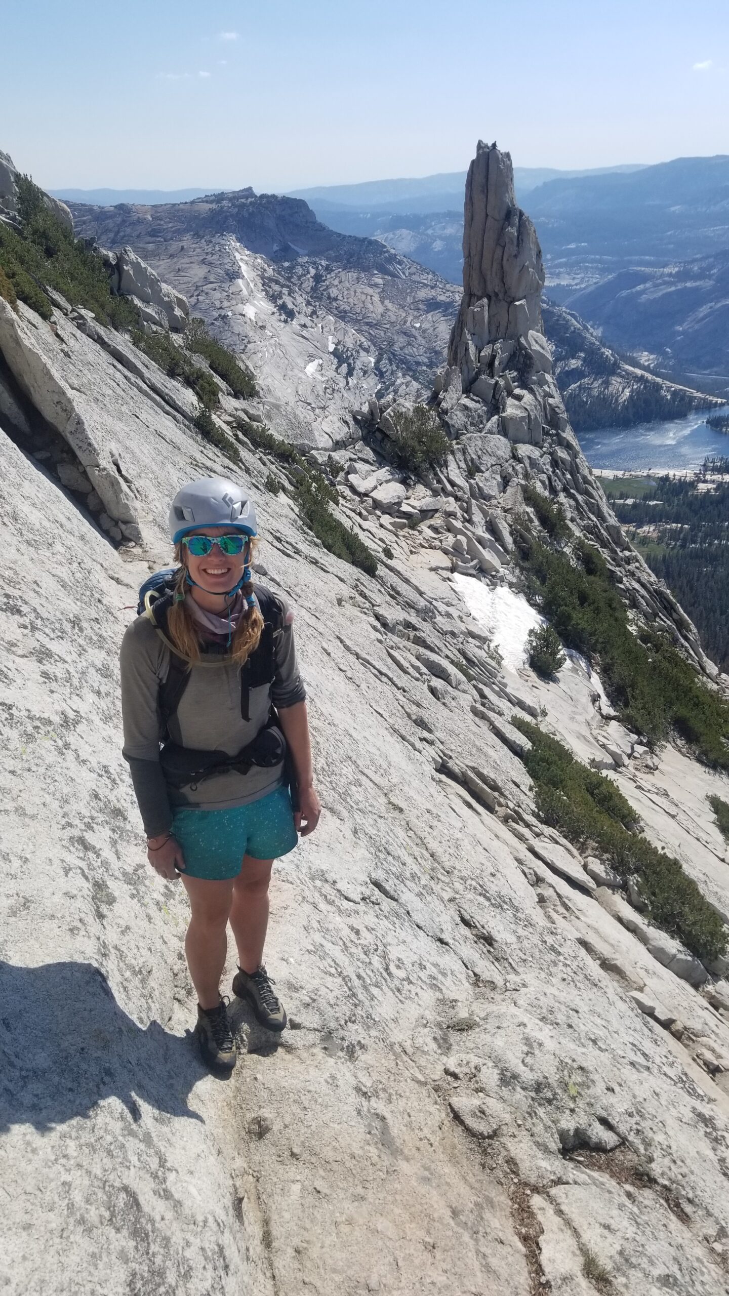
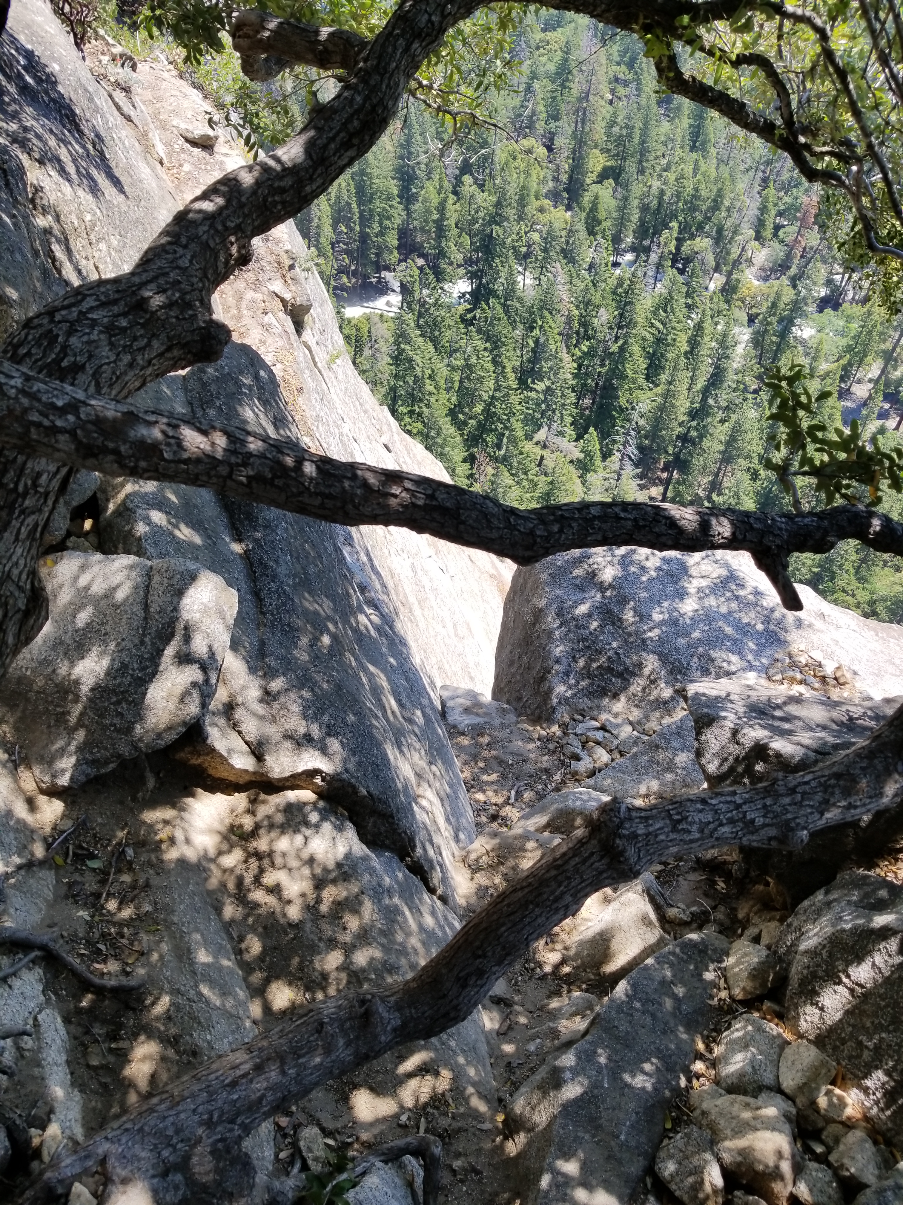
Once on top we took a moment to call Christian, Lis’s partner to tell him we’d made the summit. After some pictures and appreciating the Sierras in the far distance, we packed up and headed down the north face of the mountain. Picking our way down slowly through a few technical scrambles, we quickly found the top of the climbers’ path headed down to the valley below.
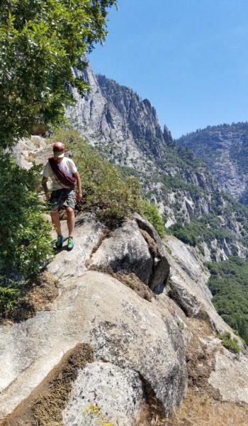
Time to descend, enjoying a beautiful backdropAfter a short scramble we find the decent trailThanks for the good times Cathedral Peak!
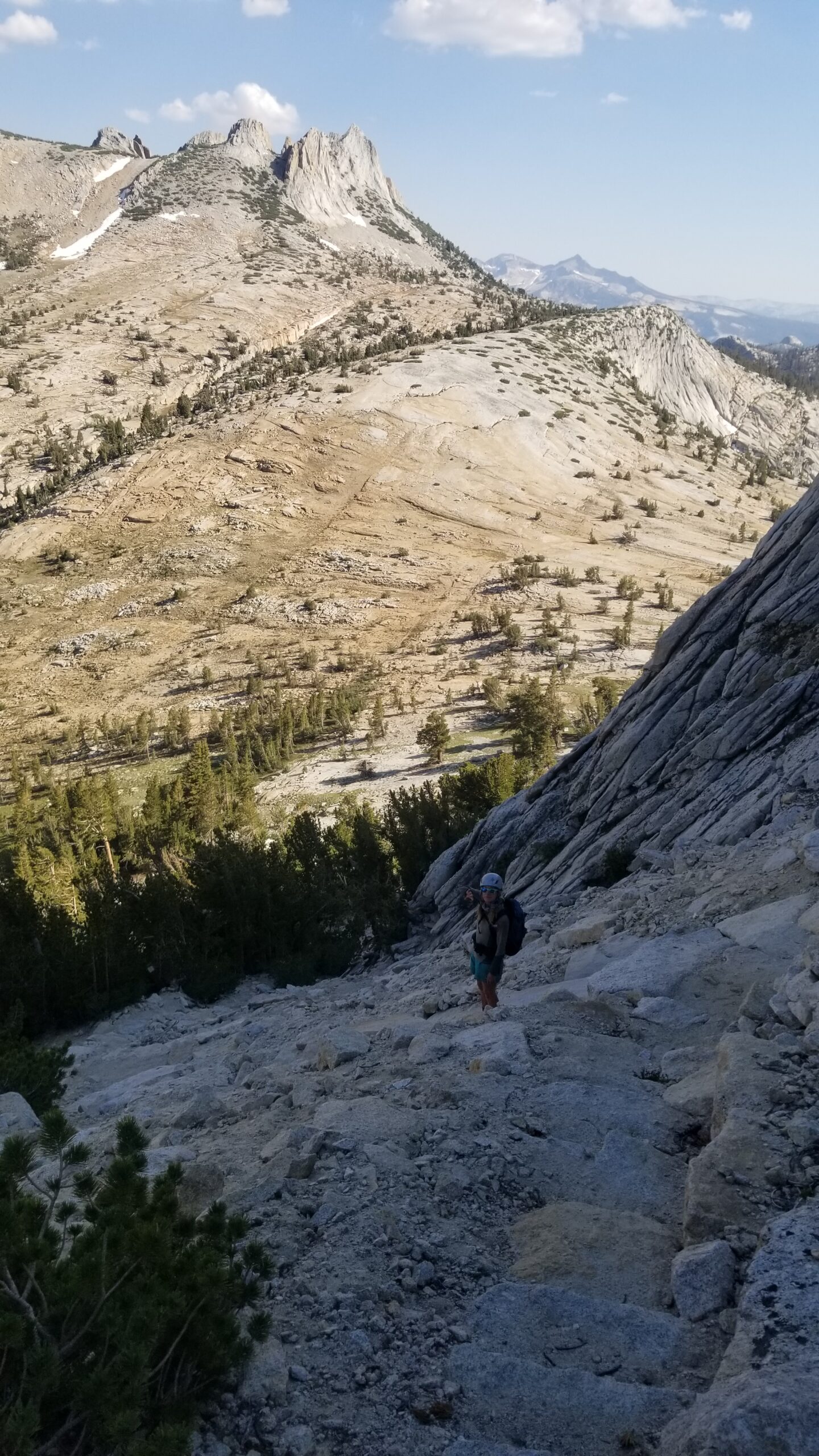
We soon found ourselves back in the valley below, peering back to the peak from which we had just descended. Man, what a good way to put the cherry on top of an incredible journey across the Sierras! Nothing left to do but grab some food at the Whoa Nelly Deli and head home!
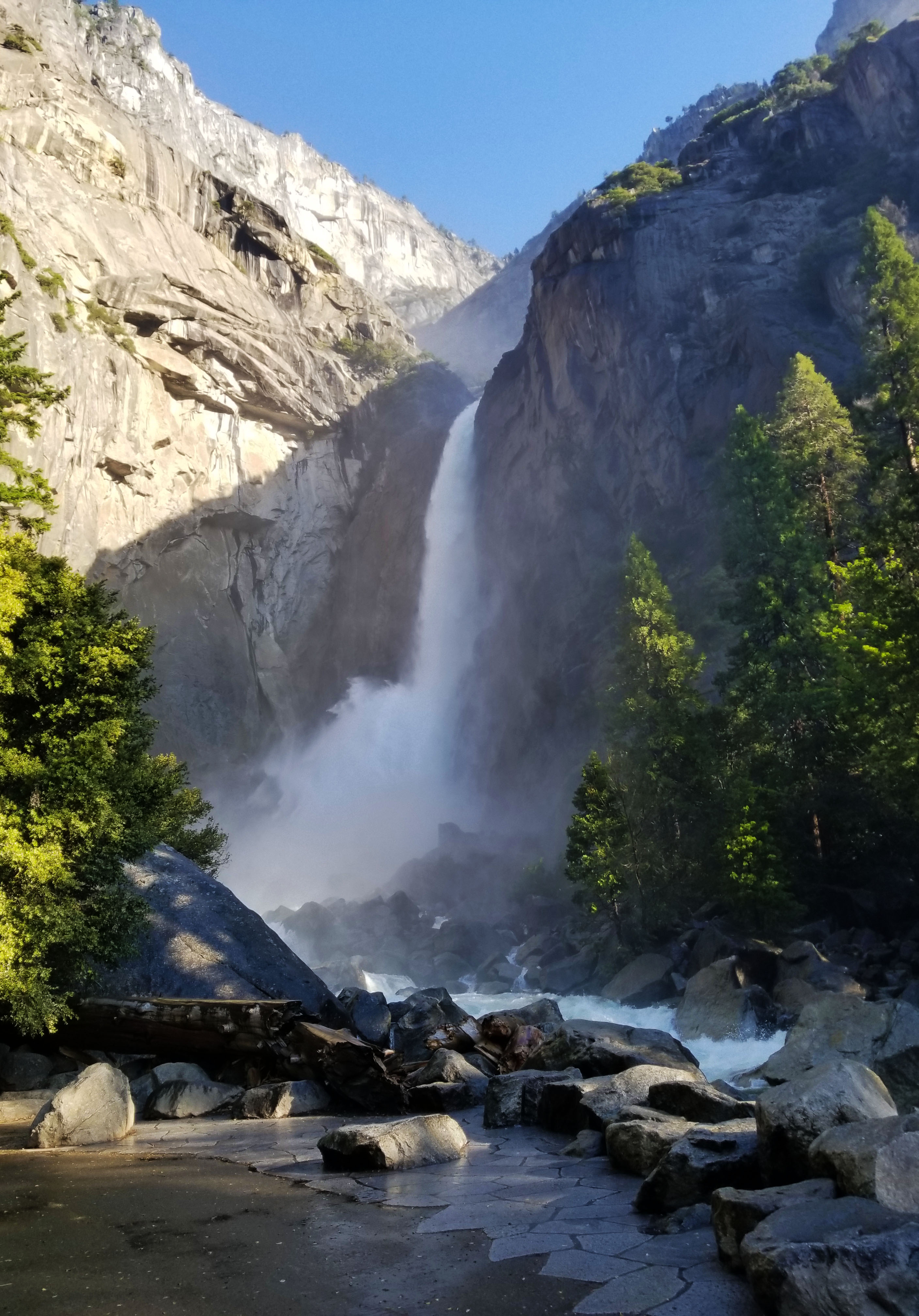
I met my buddy Chris in the parking lot just near Yosemite Falls, waiting with a big smile! There I met Jeff, a new friend, as we gathered our gear. We initially planned to climb a fun multi-pitch traditional (trad) route called Sunnyside Bench near Yosemite Falls. We racked up in the parking lot, grabbed our ropes and packs and headed for the base of the climb. As we approached the falls we noticed the water was raging! This was a record year for snow and thus the flow was on epic proportions. The huge waterfall thundered down before us and its spray covered a huge area around the base. We walked across the bridge, getting wet as we did, towards the base of the climb.
Crossing the bridge, the falls were raging!
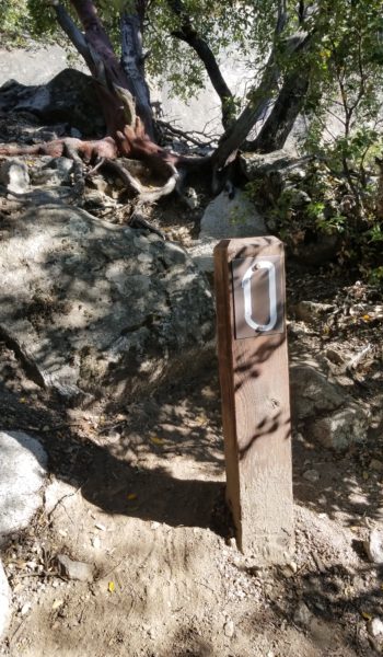
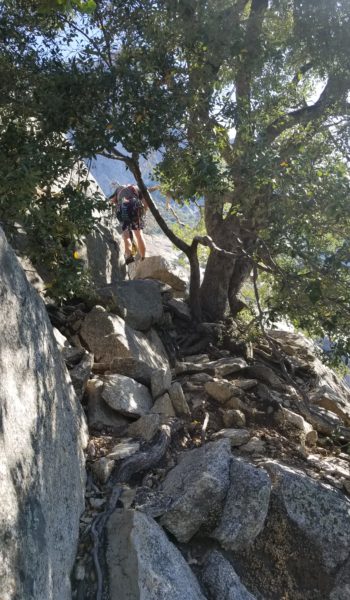
We reached the start and noticed the entire first pitch was drenched in water. Let down, but not beat, we went for plan B just on the other side of the falls, called Munginella. It was a fun trad route (5.6), and a good introduction to Yosemite multi-pitch climbs – and a chance to get my feet wet on Yosemite granite rock. We took off up the climber trail and soon found ourselves at the base of the first pitch zero (P0 – scramble pitch) of the climb. We tossed anything we didn’t plan on carrying with us in the nearby trees, threw our helmets and climbing shoes on and headed up the chill class 3 scramble to the base of P1, signified by a nice large tree.
Start of climbers trail
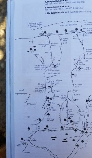
Munginella Topo
Chris, starting up P0 scramble to start of P1
Chris at the base of P1
Setting up getting ready for some fun!
The sun was already beating the climb as we sorted the rope in the shade of the base of P1. Chris was first up to lead, I would belay him from below and once Chris reached the top of P1 he would belay both Jeff and myself as we simul-followed, leaving me to clean all the trad gear from the route and take the next two leads. We double checked each other’s knots and gear before Chris took off on the first pitch!
Chris starting Up P1
and Up
and Up
and Up some more!
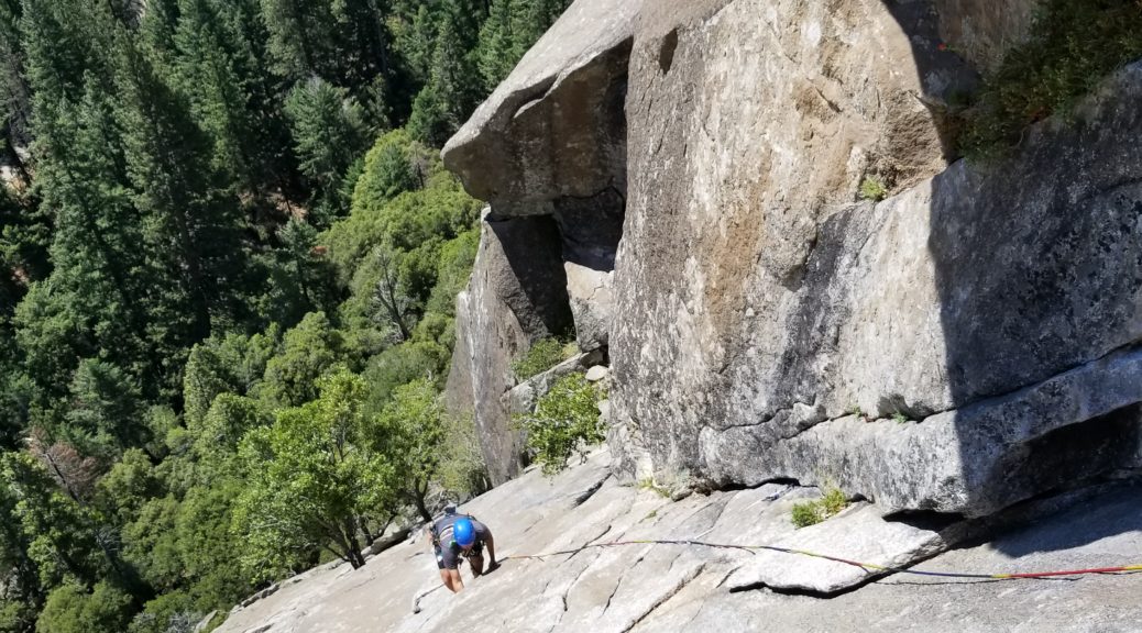
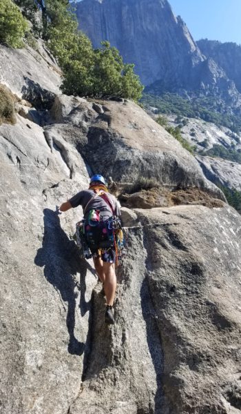
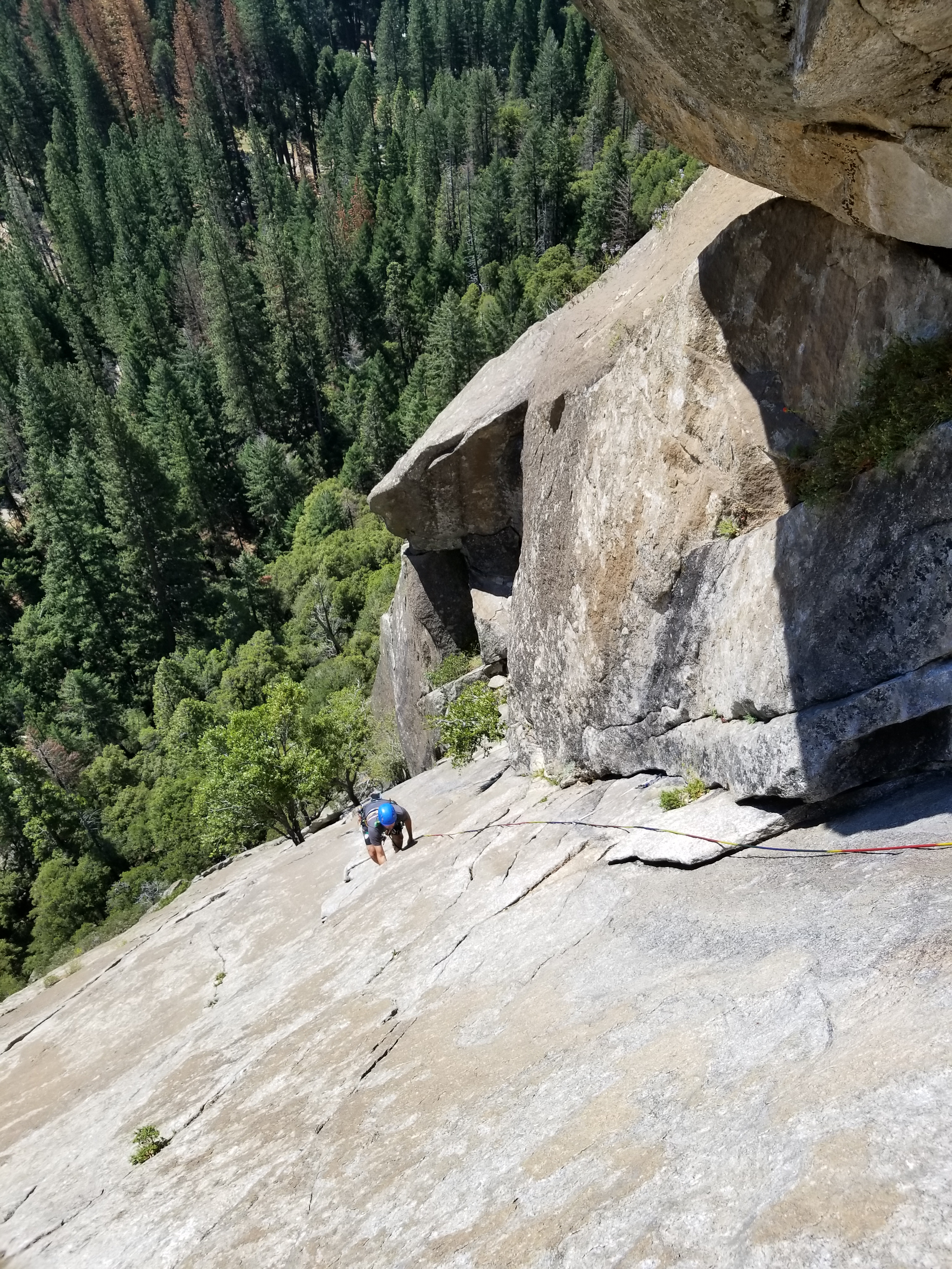
Methodically and quickly moving up and over the rock, Chris climbed on. He would pause every few feet to place a solid piece of protection (pro), clip in an alpine draw and then his rope, before moving on and up the route. Making it look like cake as he took down the first pitch, me and Jeff chatted on about what we did and what brought us to the valley. To ensure we wouldn’t run out of gear, we were carrying a double-rack. It was a bit heavier but we just rainbowed up the route, practicing good placement on the fun climb. It wasn’t long before Chris was at the top of P1, anchor set up, hanging from his belay, with both ropes through his ATC guide, calling down for Jeff and myself to start climbing.
Here we go! The first pitch was fun, the rock was warm form the sun but it was cool to the touch in the shade. It seemed very porous, ready to suck up any drop of sweat from your hands, so we chalked well as we climbed. I paused at each piece of pro, retrieving it from the rock and clipping it to my harness. It just kept getting heavier as I climbed. I grabbed the tree and climbed up to the right of Chris, clipped into the anchor and took the sights in. As soon as I got there we began the changeover and Chris started loading me down with the doublerack. I tightened my harness tighter as the weight started pulling down on me.
Looking up at P2Chris ascending P2
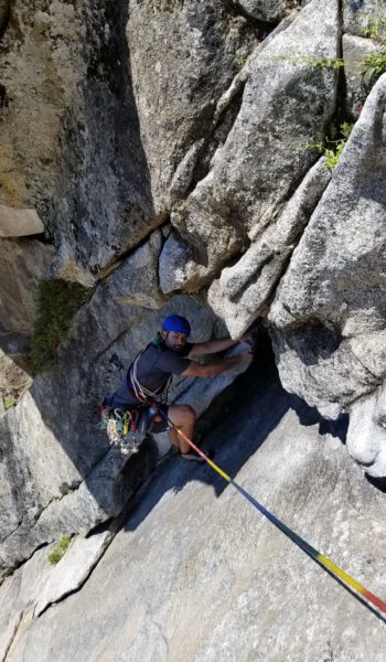
It was time to roll, I lead out trailing a second rope behind me to belay Jeff once I reached the top of P2. The handholds were great and movement over the rock was really fun! I reached the first crux and placed a solid piece below a first baby V notch roof and moved under it. A crack ran through the small roof, just perfect for a handjam. I reached up with my chalk-covered right hand and slid it into the crack. Man it was bomber! I wedged it in further, flexed my hand, pulled my feet up and pulled up and over the roof. I placed my next piece around a nice bomber tree and continued up the face, moving left before the next crux – a larger slippery roof.
Chris on the crux roof on P2
Spice Girls!!!!
I placed pro, moved my hands up, and finally found a nice chip out right to place my foot. I pulled my weight out right and stood on the foot to find some nice jugs. Past the roof was a nice wide ledge just below an old beat up piton that had been hammered in years ago. I threw in a cam, nut and slung the piton to create an anchor. Soon I had Jeff and Chris set up on top belay and they began to climb up the face. We were soon all smiles at the top of P2. I snapped pictures of Chris just below the roof making it look bit spicier than it was just for fun. I was thirsty form belaying in the sun drenched anchor, so as soon as Jeff reached the P2 topout I chugged water from my bag he was carrying for me. Wasting no time, I set lead out on P3.
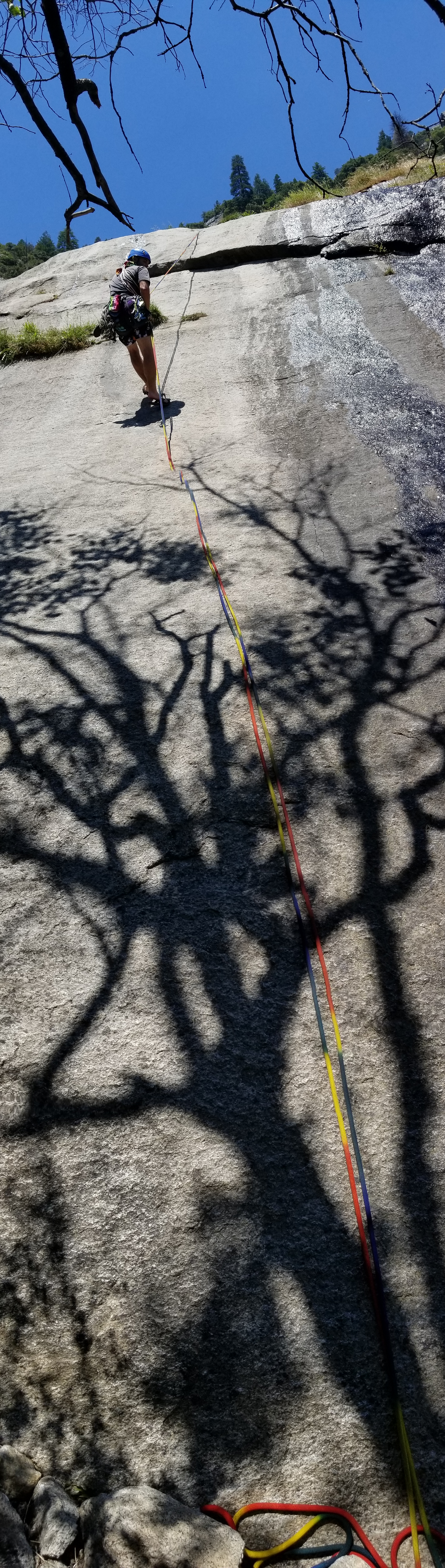
Looking down from the belay station at the top of P3
P3 was an interesting, short climb. I moved up the face and left into a protectable corner and placed a large #4 half way up the corner. This area got a bit funky and the body movement seemed a little awkward. Like anything, working one bit at a time, soon had me pulling the top pf P3 and setting up a belay. Jeff and Chris warned me that there was a bunch of loose stuff at the top of the climb and to be especially careful. The head-sized boulders teetering on the top of the pitch were a menacing bunch. I belayed from a solid tree and soon both Jeff and Chris were above the final corner, all smiles about the warm climb.
Nasty loose rocks at the top of P3
Jeff on the walkoff
Chris hiding in the weeds!
Jeff, makin moves!
Walkoff time, gorgeous views all around
Man, what a good initiation to Yosemite! We soon cleaned up all our gear and took a nice walkoff/rap to get back to the start of P0 and retrieve all our gear that we left behind. I was so happy to be there, in the climbing Mecca of the US, where it all started. So excited for the climb we just finished and all the climbs to come this week, this was just the beginning! Thanks Chris and Jeff for my first taste of trad-multipitch in the valley!
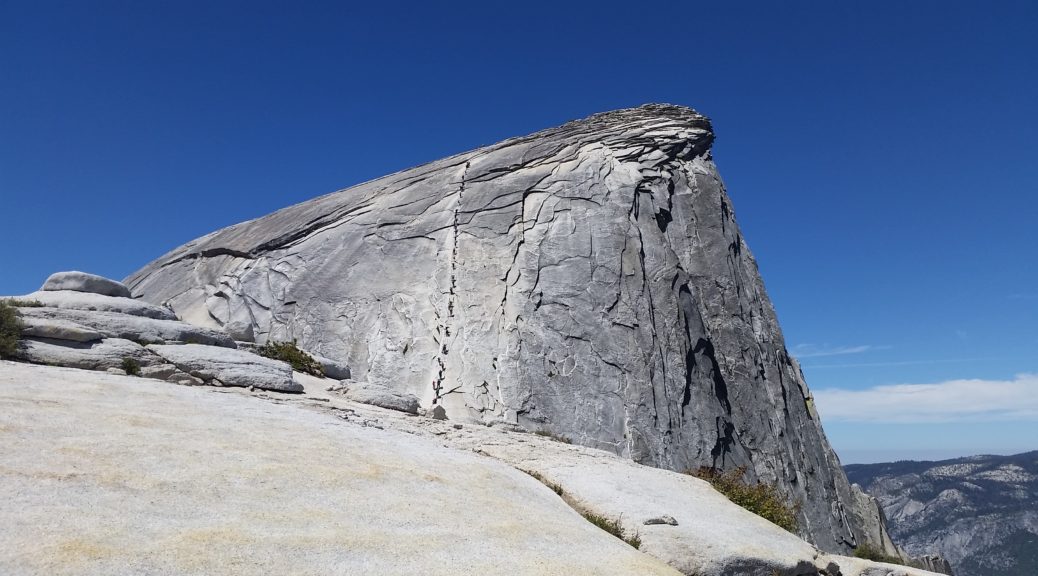
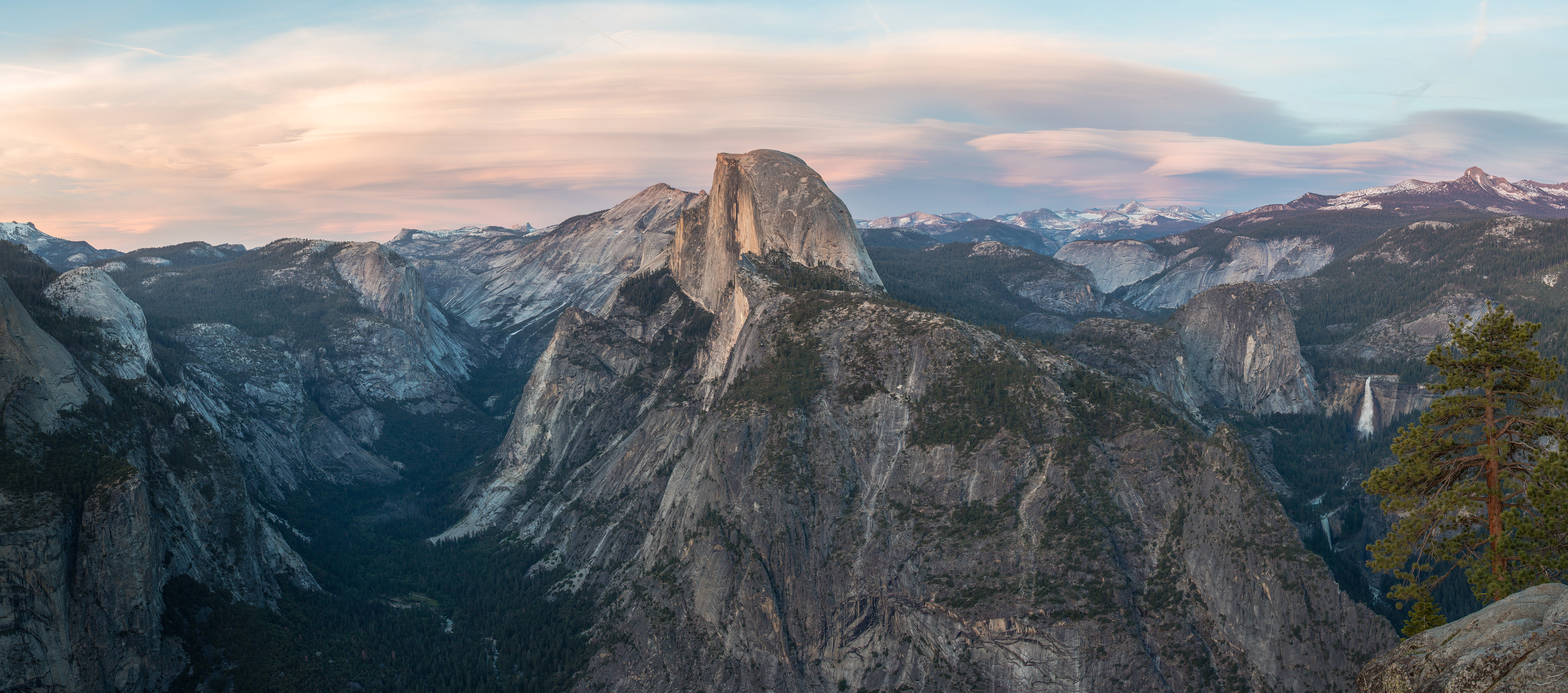
Half Dome viewed from Glacier Point, photo credit: wikipedia – https://en.wikipedia.org/wiki/Glacier_Point#/media/File:Glacier_Point_at_Sunset,_Yosemite_NP,_CA,_US_-_Diliff.jpg
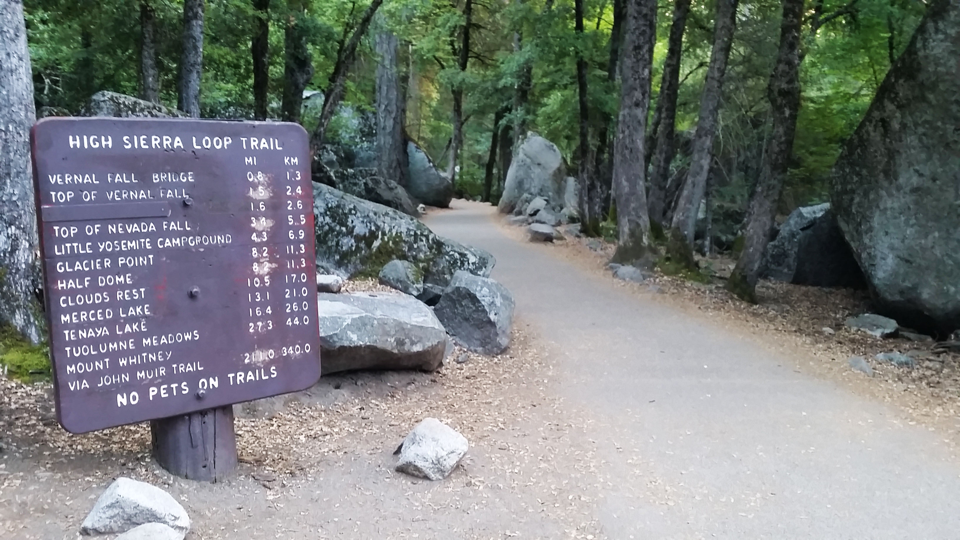
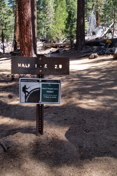
We woke early, just before daybreak, and started stoking a fire for breakfast. A few friends (Mike, Kenneth, Eroica, Greg, Thomas, Manuel, and Jake) and I had decided to take a weekend of exploration in Yosemite. For me, Yosemite was a bucket list item and I was super excited to finally have the opportunity to experience it. This day was especially exciting as we planned to hike to the top of Half Dome, the most recognized formation of the valley.
Lets get started!
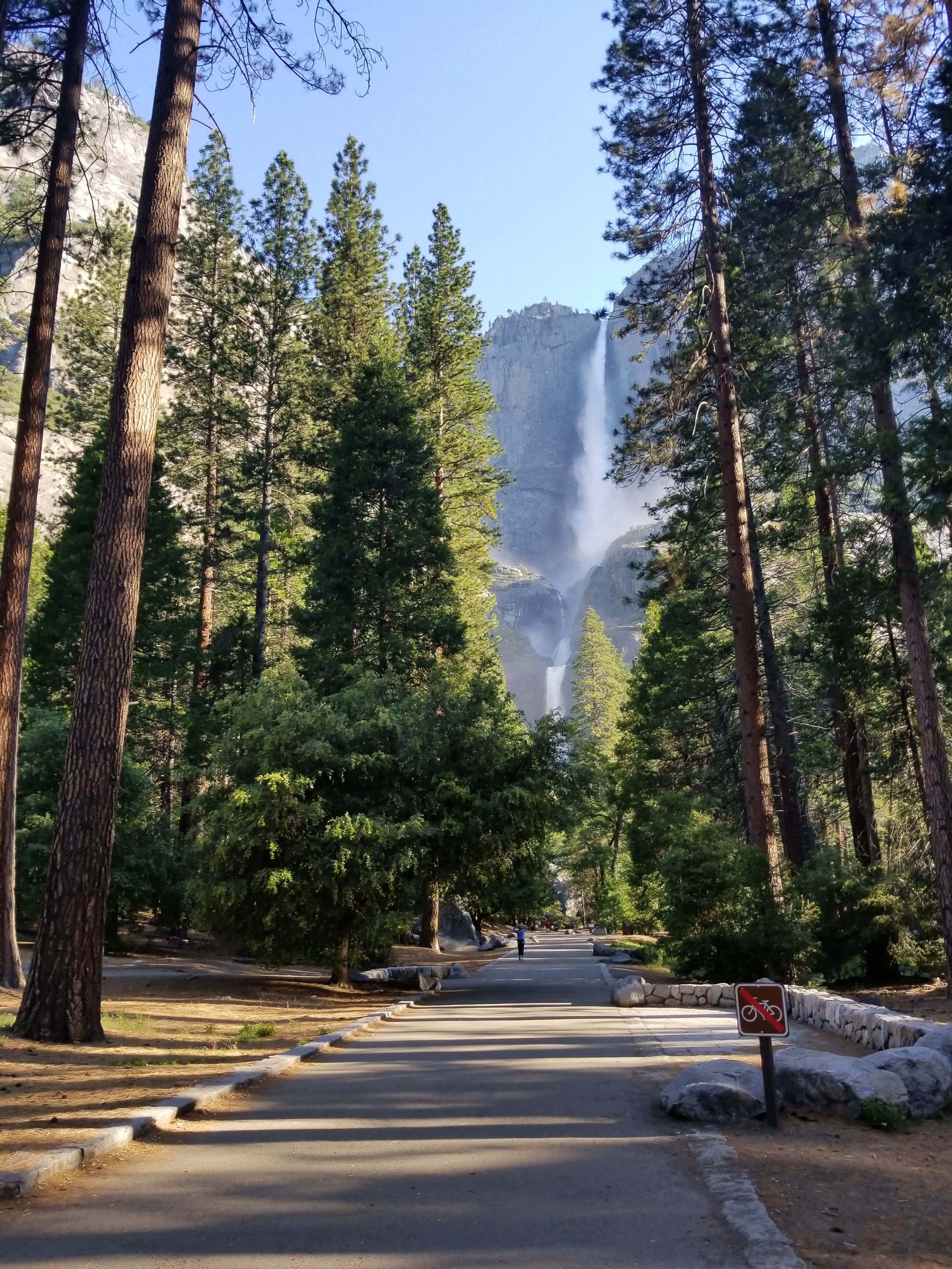
Master Chef Mike got on the grill and before long we were all fed, dressed, and packed up for the day’s hike. We were camped just outside the park so we all piled into a couple of cars and took off towards Half Dome trailhead for our 16 mile round trip journey to the summit. Driving into the park took some time, winding in and out on the entrance road until the views finally opened up to huge granite walls bathed in morning light and lush green foliage lining the roadside. We pulled in and grabbed the first open spot we could. In the shade the temps in the bottom of the valley were cool, and in my shorts and t-shirt I moved quickly to fight off the chill.
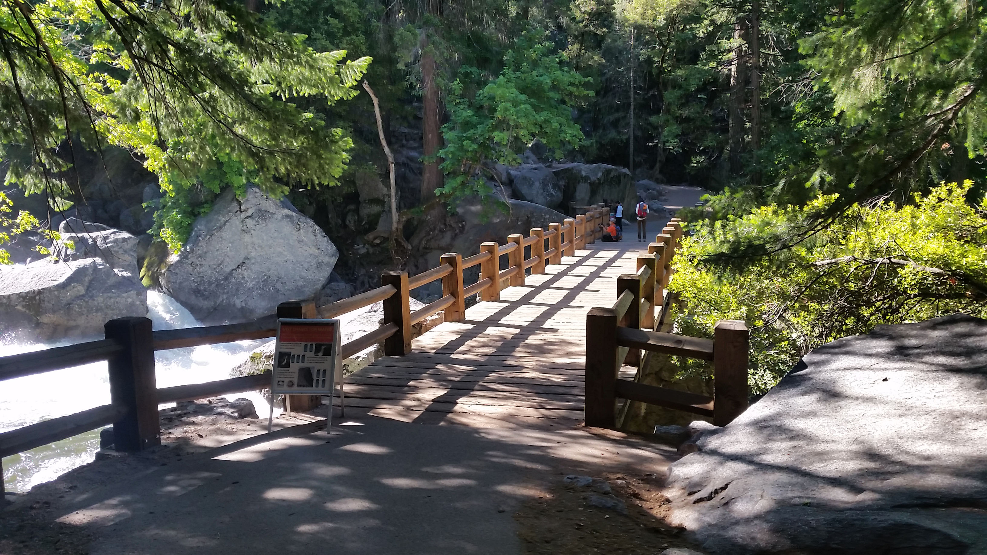
Next footbridge past Happy Isles, the river was crashing hard here!
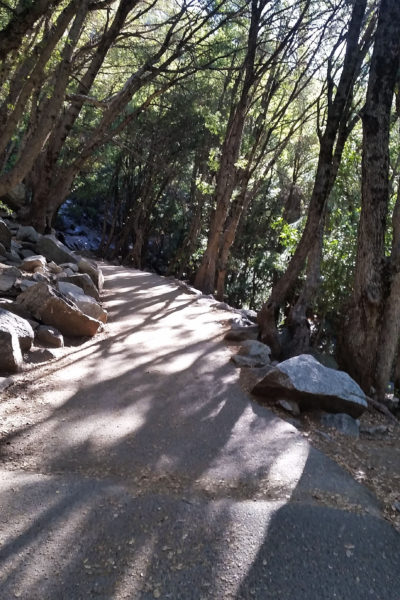
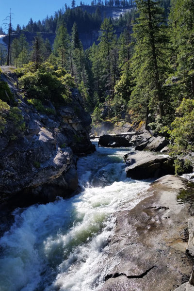
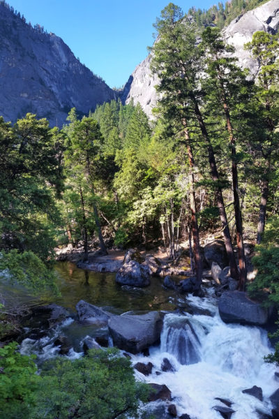
Soon we walked over the Happy Isles Bridge crossing the Merced River that feeds the valley. This also just so happened to be the start of the JMT, let’s just say I was really excited all around! We crossed another foot bridge and paused for a moment to stare upstream in awe. The river was fierce and crashed down the sides of the riverbank with a violent force that demanded nothing but respect for its pure power. We trekked on and, as always, the group of 8 began to slowly string out. As we all stopped for a quick water refill and a bathroom break before really getting into the hike, Greg said he has going to trek ahead. Off he went, and before long we soon followed.
View from the footbridge above, nature is such a beast!
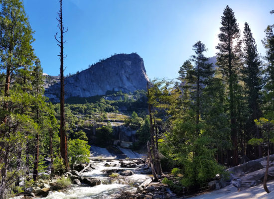
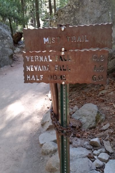
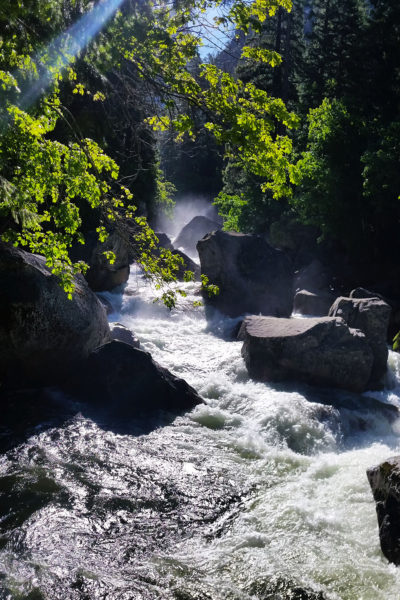
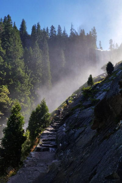
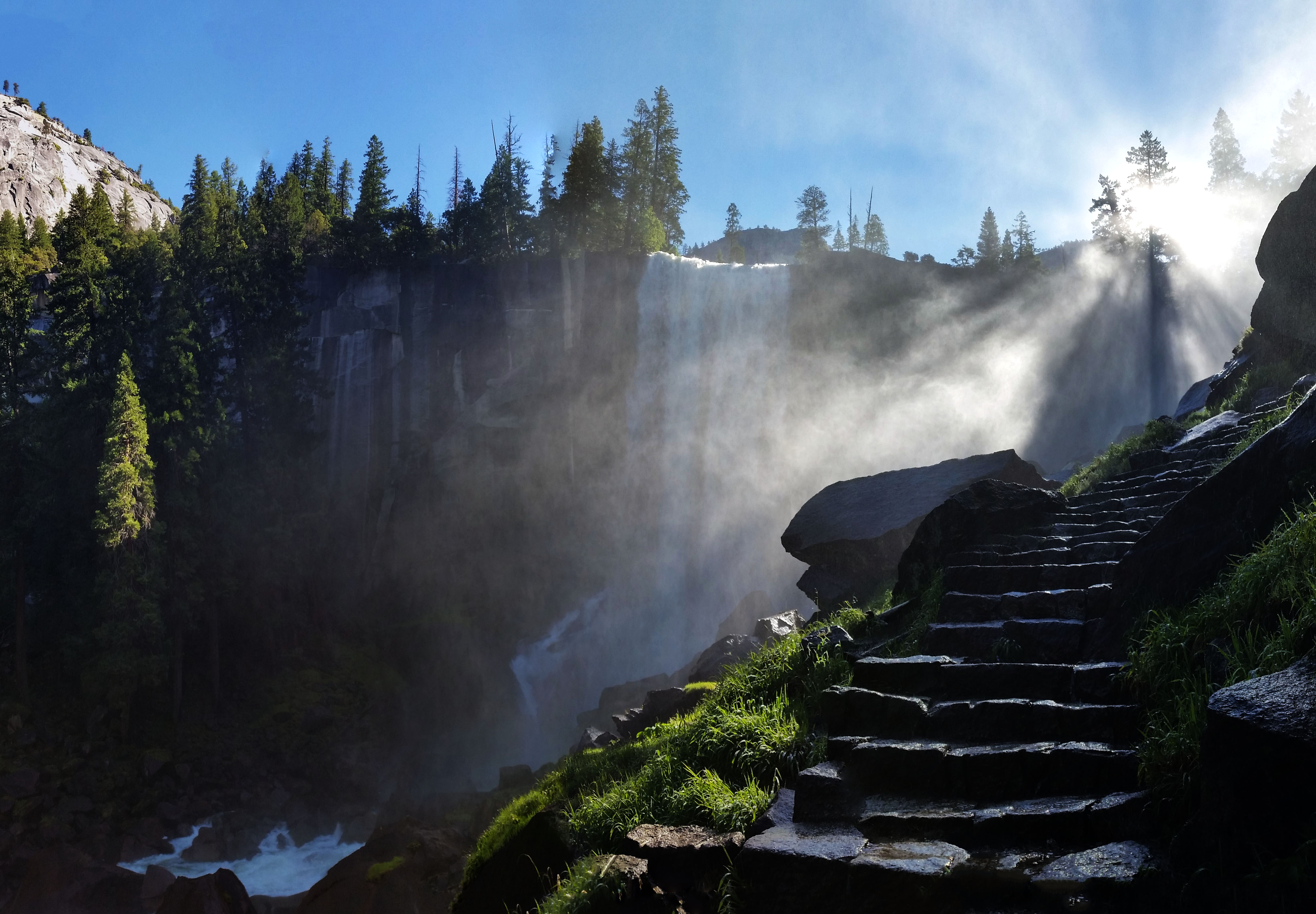
Mike and I soon pulled away from the group too as the incline began to increase, but we didn’t notice as we were both too awestruck by the views of the woods around us and the river flowing nearby. We took a slight divergence from the JMT to go up the Mist Trail. We trekked on and up the granite steps and were soon blasted with a huge mist from Vernal Falls. The sun was shining through and creating a breathtaking rainbow making the whole experience that much more surreal. We stopped and just took the whole thing in as we were getting sprayed by the falls above. The trail really went to work after this, almost going straight vertical to climb above the falls. Up and up we went until one last switchback brought us to the head of a gorgeous fall. Mike said, “I’ll wait here on the others as they don’t have a map and don’t know the way.” All smiles as usual I headed on alone.
Vernal Falls from Mist trailPushing up to the top of Vernal Falls
I’ve always enjoyed hiking in groups, but sometimes it’s nice to just pull away and enjoy the trail on your own. I pressed on, up the Mist Trail, through the cool forest until I came upon another set of falls; Nevada Falls. Turn after turn the beauty of this place was unquestionable. That matched with the challenge of the hike really kept be going until finally I reached the junction where I would rejoin the JMT to find Greg chilling out on a rock on the entrance of Little Yosemite Valley. Like a lizard he was just zenning out, having a nice little rest before taking on the next leg of the trek. I plopped down and grabbed a quick snack and we chatted about the trail below.
Little Yosemite Valley . . . hmm which way to go?!
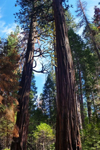
Greg, like me, really likes to get after it on the trail and we decided to press on, knowing the group would eventually catch up at Half Dome. Through the flats of Yosemite Valley, the foliage and terrain began to change. We were above 5000 feet now and as we got away from the river we entered an area where pinion pine reigned supreme. The tall red barked trees sparkly shaded us from the sun as we pushed quickly towards the base of Half Dome. A new turn would open up to the valley below or views of the snow-dusted Sierras peaks in the distance. We took a few moments to take in each new view before pushing on and up. We were both ready to get to the top as the sun beat down on our heads.
The trees were gorgeous, light hitting the moss, was just spectacular!
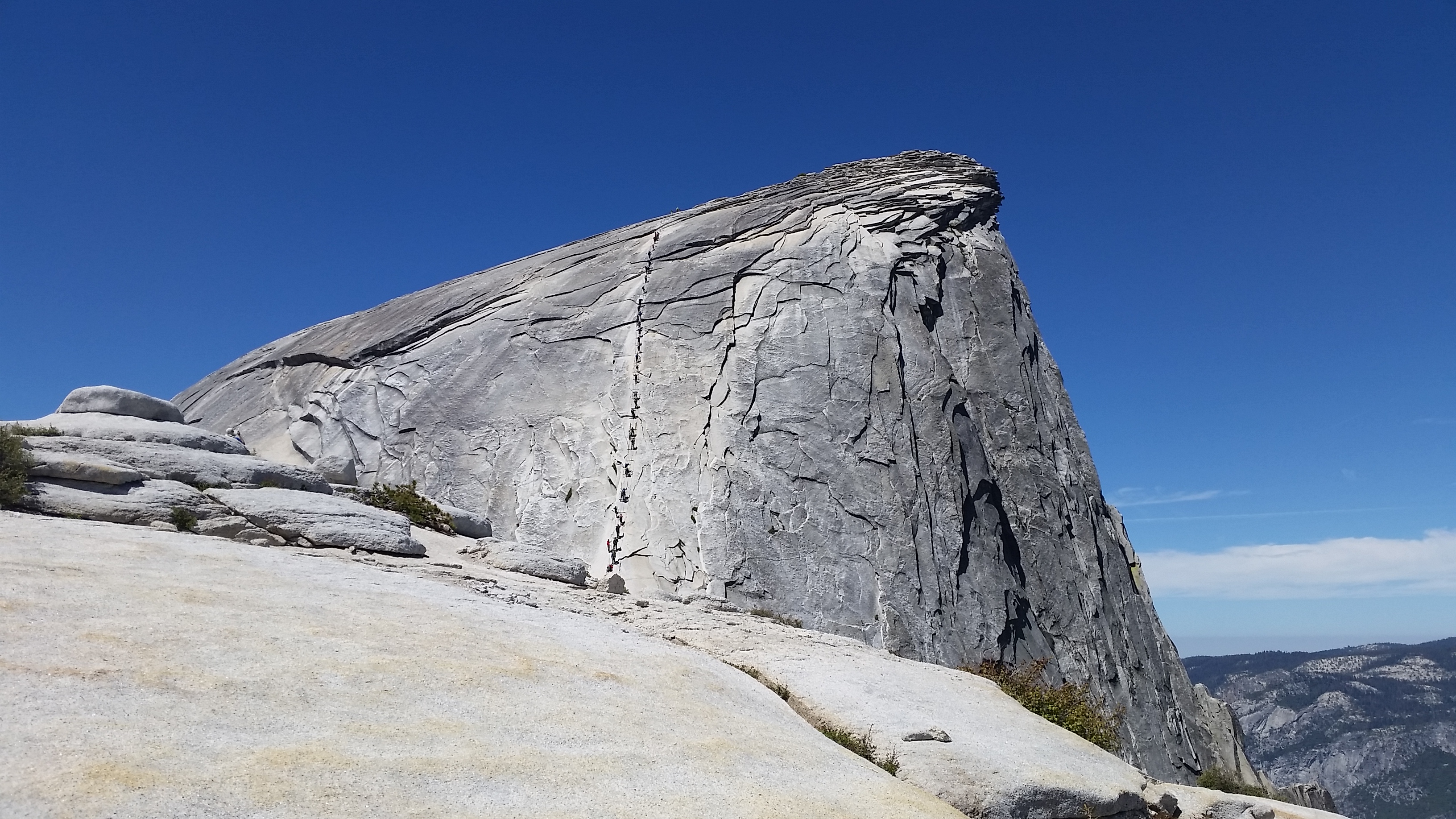
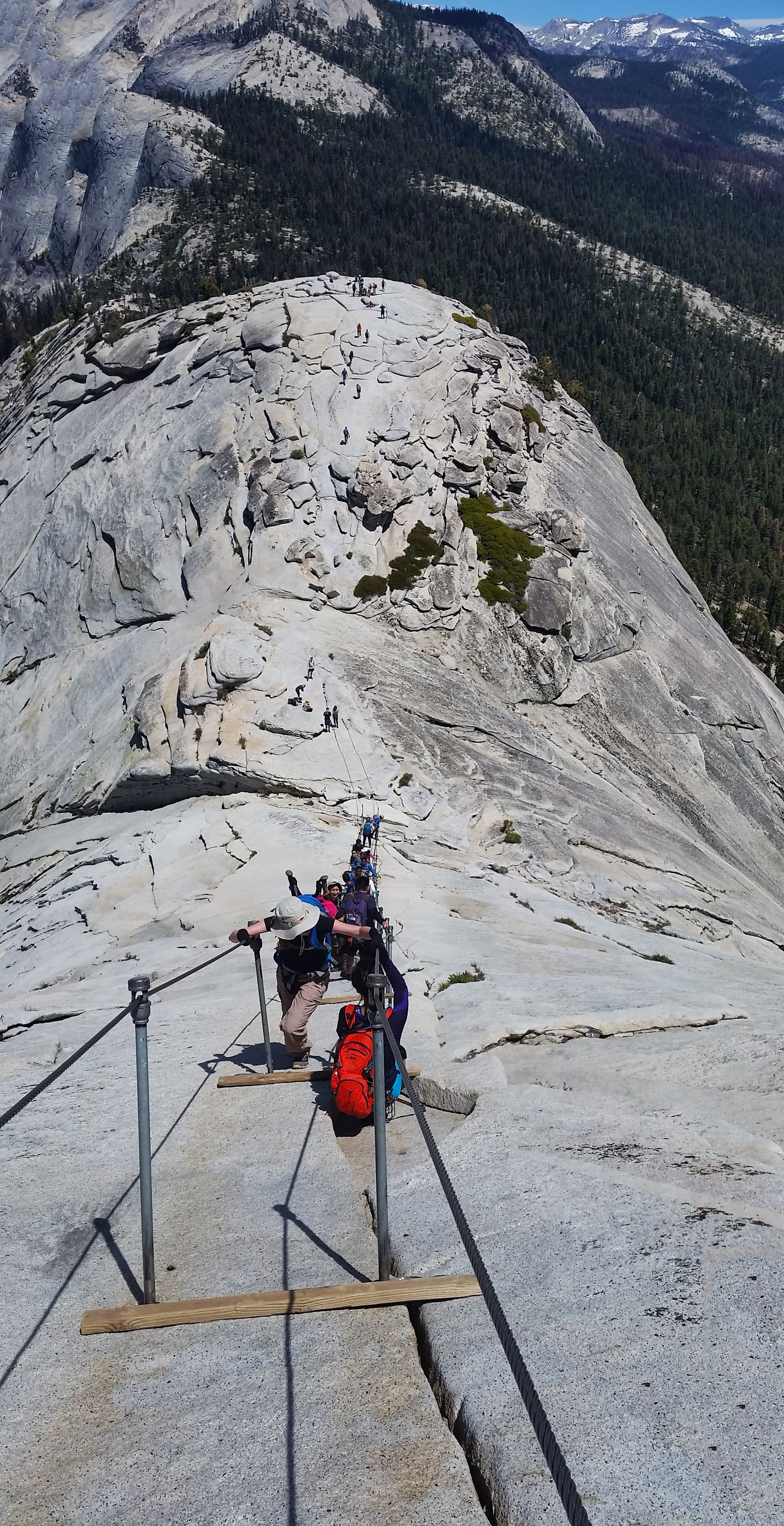
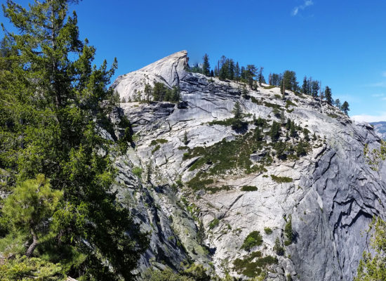
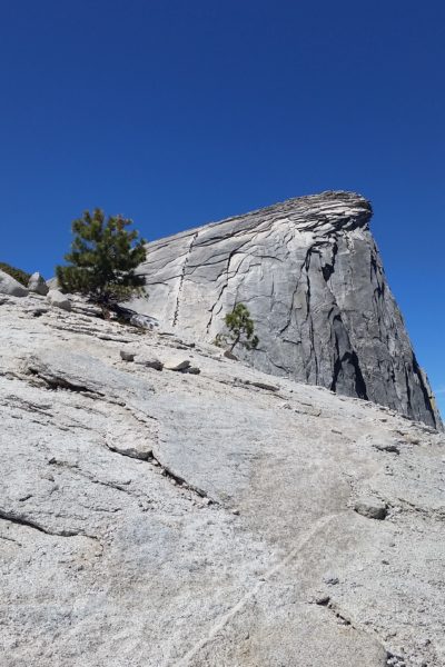
At the base we encountered 2 Park Rangers with an iPad checking permit holder names like a couple of bouncers at a club. My name was on the list and we grinned as the red rope was taken back and we pressed hard up the steep backbone of the dome. Steep and fast our hearts were thumping at full throttle when the infamous “chains” came into view. The line of people looked like ants in the distance and I was excited to take on the last extremely steep and slick 400 foot climb to the summit of the dome. The line was almost stagnant between the chains; some clutching the metal bars holding up the chains, other stalled waiting for someone to pass or move forward.
Half Dome! Those are not ants, they are people!Clutching to the chains like life depended on it . . . well it kind of does here
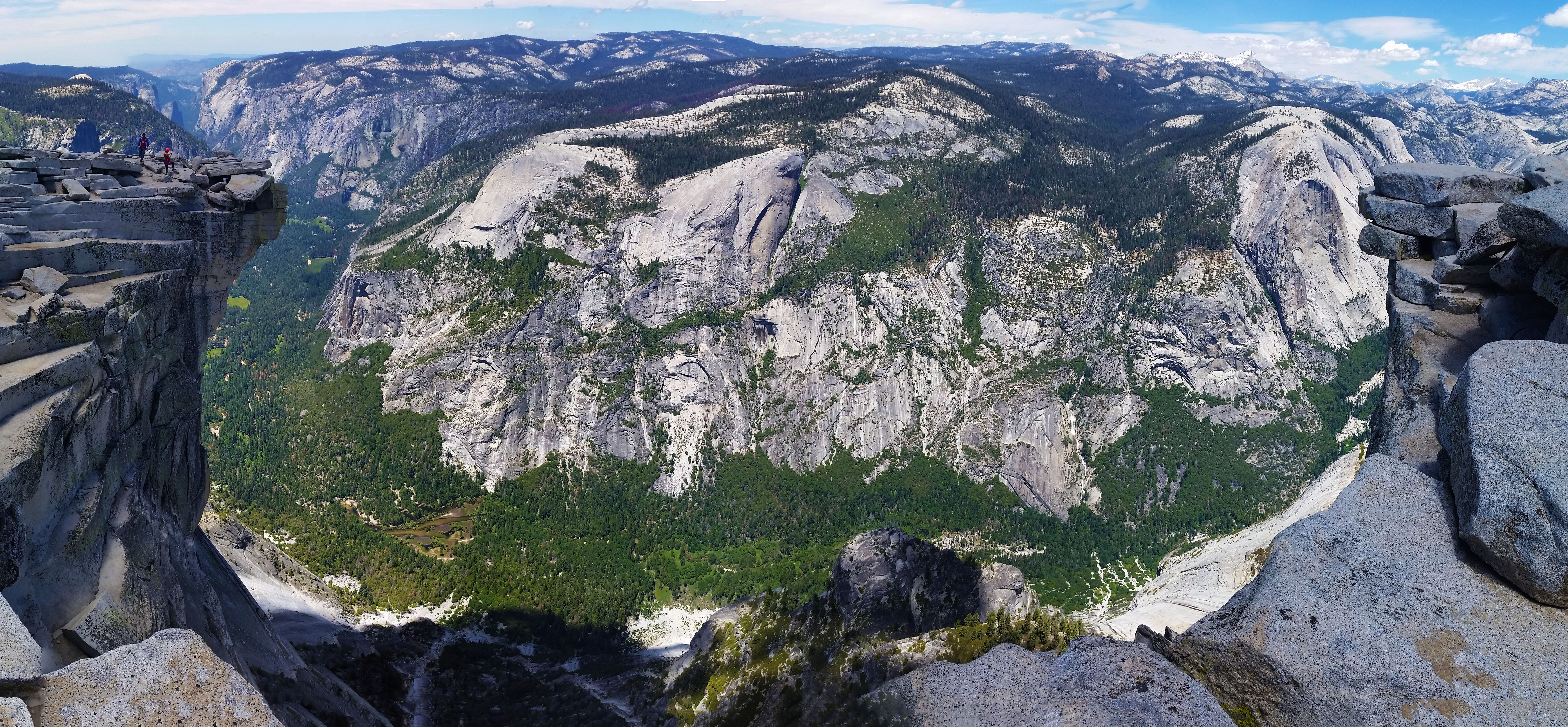
Greg looked at me and said “man, let just go, popping his head under, pulling up and climbing on the outside of the chains to gain summit. People looked at us like madmen as we passed, some full of fear in their eyes and others with frustration for the wait ahead, but they all were too cautious to take to the outside of the chains. Light lightning we were up, politely excusing ourselves to the climbers stuck between that chains as we bypassed them, all until the crowd grew thin and the grade finally flattened out. We were only steps from the summit! Touching the top at the same time we claimed summit and took in the incredible views. Of course it was picture time, we took turns, walking to the edge, climbing out on diving board rocks and staring down the sheet walls of the front of Half Dome at the valley below.
Views from the top! What an awesome sight!
After the picture session was over, we both chilled out and had a nice 20 minute nap before finally heading back down to the base. On our way down we ran into the rest of the group on their way up. Greeting them with smiles we encouraged them that the chains ahead were not too bad and the sights at the top were pure beauty so they headed on. At the base Thomas and Mike waited for their chance to summit as they were short 2 permits. Mike found a permit opportunity, and soon after Thomas did as well. I headed back up once more with Thomas to make sure the last of our group could enjoy the views at the top.
Views of the river upstream of the falls before it turns into a raging washer machine, Thomas did a little swimming here on our way back!Nevada Falls on the return hike down the JMT
Once down, we regrouped and headed back the way we came back to the trailhead where our cars waited on us. What a beautiful day! Any day spent outside in the beauty of nature really makes me appreciate and enjoy the opportunities I’ve been given, especially at such an incredible place as Yosemite. Get out there, and if you do, it will blow your mind!
Food: Salt and Venigar chips, 2 PowerBar, 1 Cliff Builders Bar, 1 Nature valley Protien batr, 1 apple, 1 PB&J (Thanks Mike), 1 bag of gummy worms
Time: 10 hours
Distance: 16 miles Round Trip
Accumulated Gain: 5,050 feet
GEAR:
Mule Camelback backpack (3 liter bladder)
CLOTHING:
Arc’teryx Hoody
Peal Izumi arm coolers
Cotton Handkerchief
Cotton T shirt
Nike Running Shorts
Merrell Mid Moab Hiking Boots
Darn Tough Medium Wool Sox
Seeking Outdoor Adventure
Find an Adventure
There are TONS of resources out there. Books, websites, word of mouth. These are just a few Go To sites I use to find hike, climbs, and all around adventure.
Do your research on your hike! ALWAYS bring a paper map, do not EVER solely rely on a GPS track to get you there. Alright, now that the “spiel” is out of the way . . . here is how you create some killer custom GPS tracks for yourself that you cannot already download online (and just straight up don’t want to pay for).
Put your GPS tracks to work. You should technically use an actual GPS devise for your tracks. Garmin’s are super solid, accurate, waterproof, and wont break when you drop them. If you don’t have $300 to drop on a GPS, and you are just hiking around town, there are a few good phone Apps will serve the same purpose. The following Apps will allow you to pre-download maps and overlay both GPS tracks and your current GPS location (you don’t need a cell signal, just a clear view to the sky for GPS):
Go prepared! Places like slot canyons or river crossings could quickly swell, or turn into flash flood areas, leaving you stranded or worse. As a part of prepping for your trek, choosing the appropriate gear for weather is critical so you aren’t caught with your pants down.
I like to use a few different sources to cross reference. Here are some great sites I use regularly to check for weather: