

A saxophone blasted “Careless Whisper” by George Michael at 4:00 am AZ time . . . I’m up, I’m up! My buddy Andrew silenced the saxophone on his phone just before my watch blasted off the wake up alarm. Man, looks like it’s time to move! That night the temp had dropped into the 30s and the other fellas in the tent (Andrew, Larry, and Eric) weren’t exactly ready that kind of chill. As we packed up the camp they complained about getting only four or so hours of sleep. I was alright, but didn’t want to just come out and say I slept like an angel! Soon after packing up camp, an older fella in his 60s pulled up to the Whitehouse Trailhead ready to pick us up for the shuttle to Wirepass trailhead down House Rock Road in southern Utah.
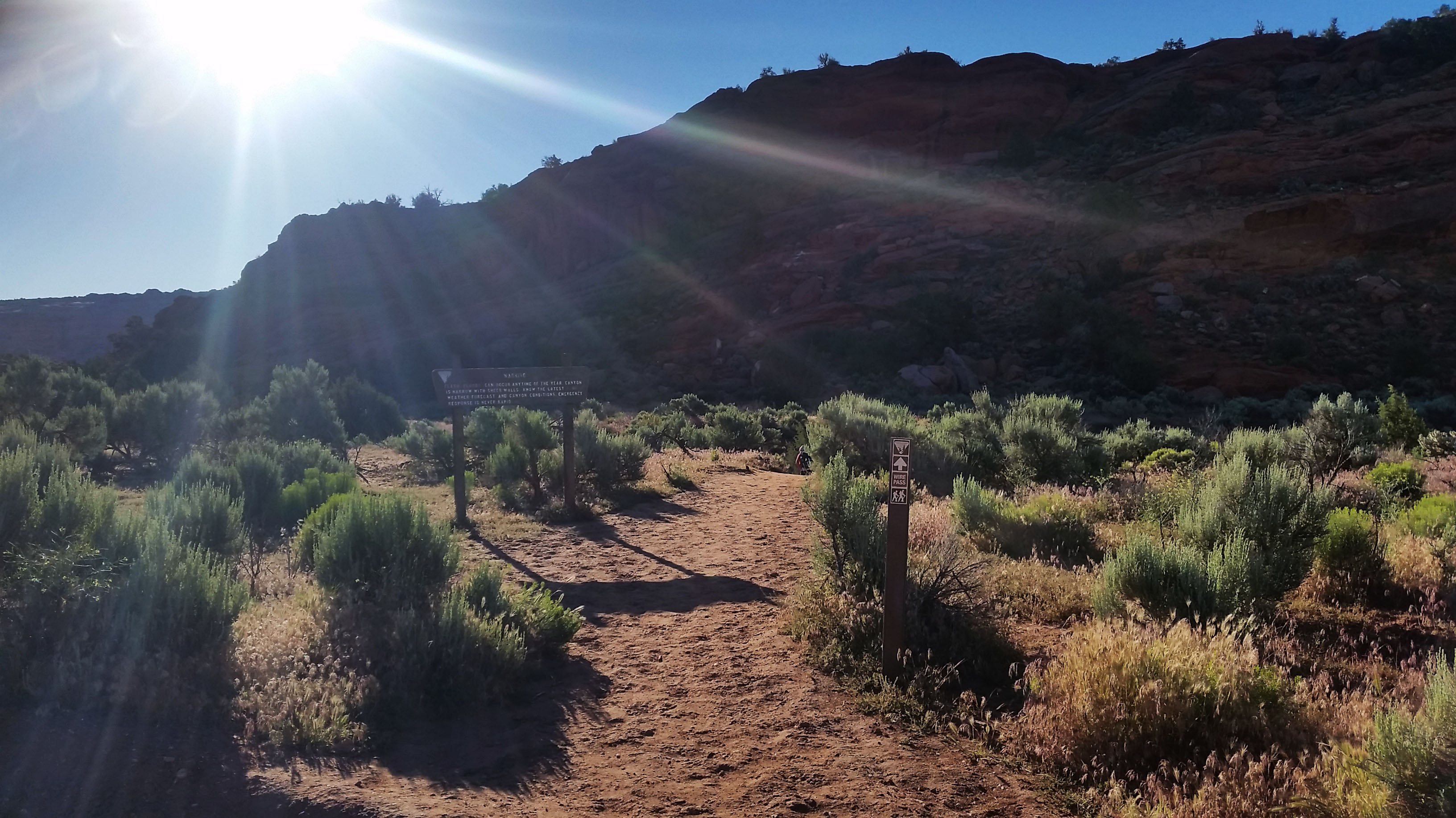
Out target for the day was Buckskin Gulch. We aimed to complete the 21 mile trek from Wirepass back to Whitehouse trailhead via a 13.7 mile trek down a portion of the longest slot canyon in the world (Buckskin Gulch), finishing with a 7.1 mile trek along the Paria River to our base camp. We were dropped at the trailhead and hit the bathroom for one last stop before the long push.
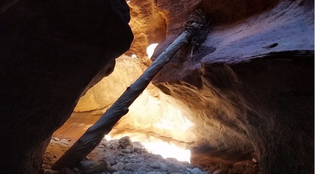
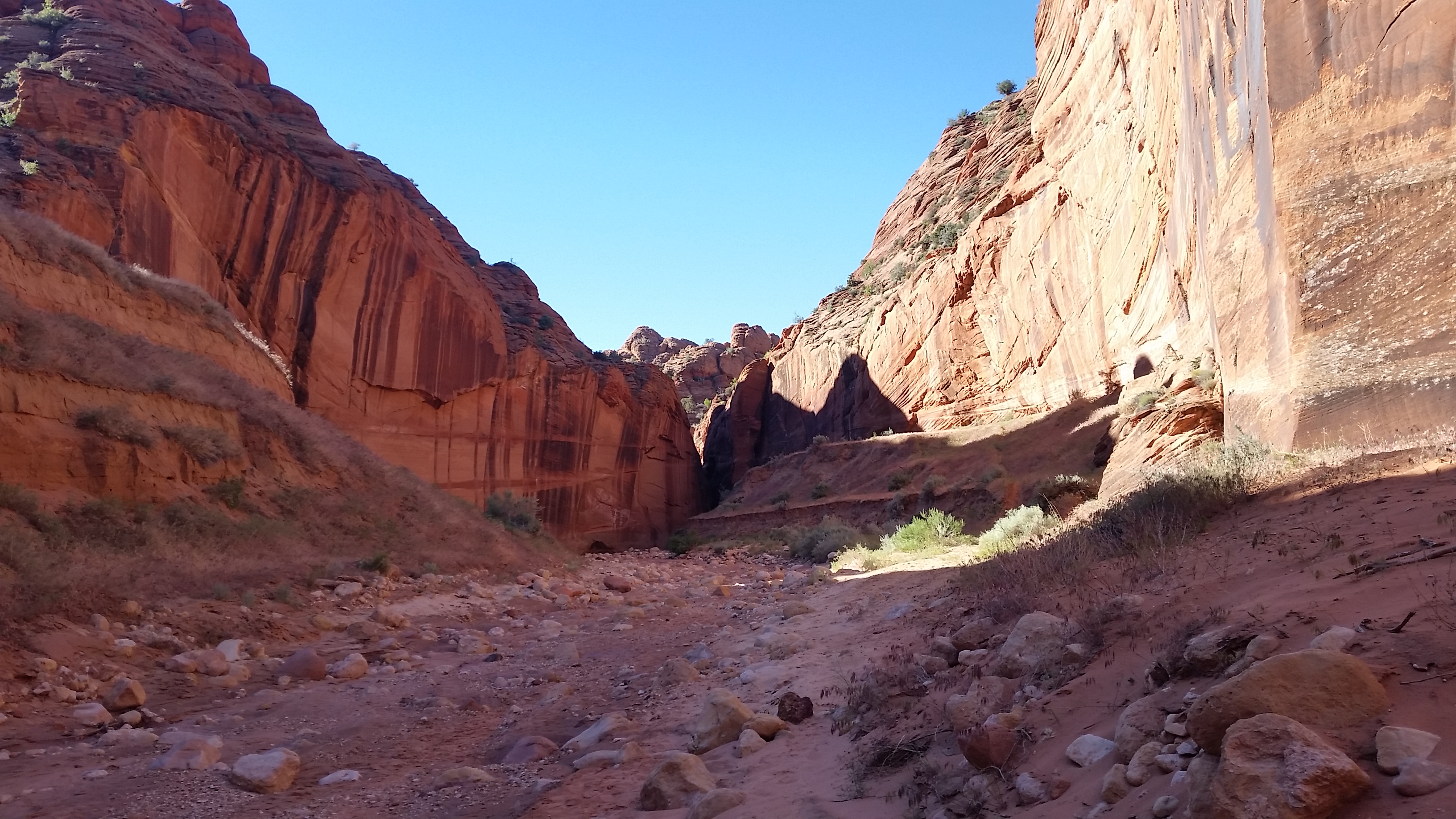
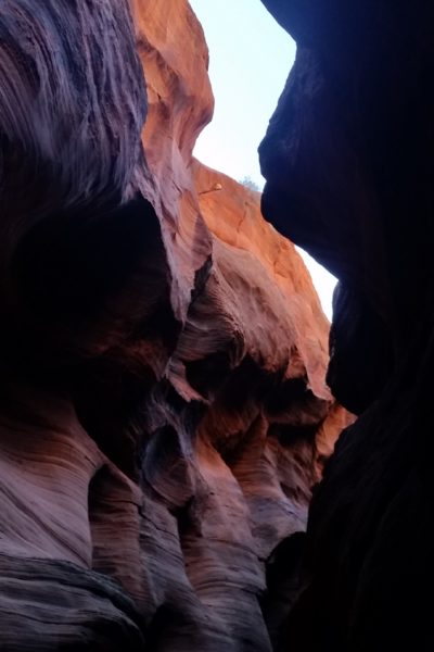
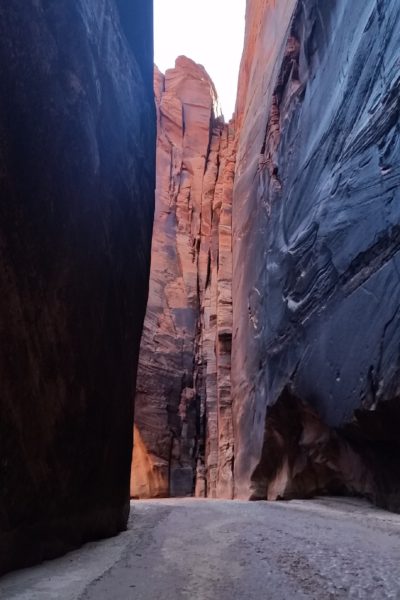
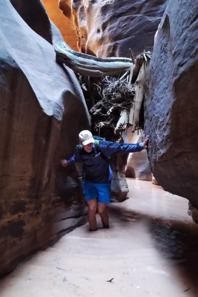
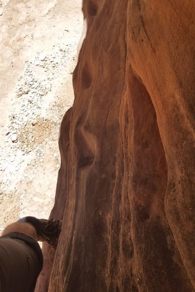
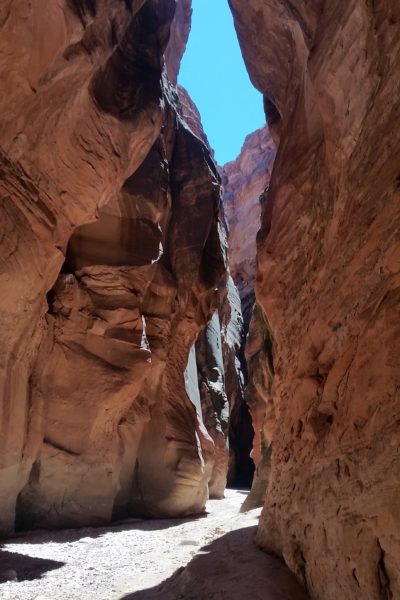
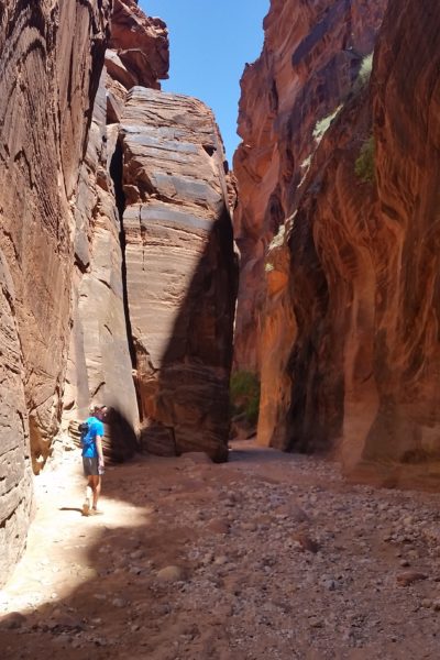
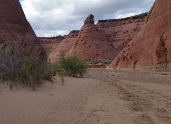
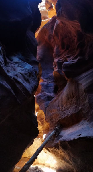
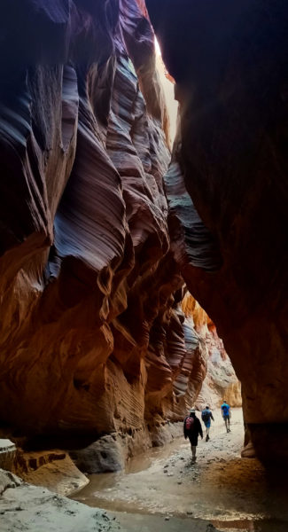
The four of us trekked down the open sandy wash that lead to Wirepass, chatting about future trekking goals and fretting on the onset of the cold water and deep mud that was undoubtedly ahead. Before we knew it the wash narrowed, squeezing into the first section of the close-walled canyon. We shimmied our way down into the gap, surrounded by incredibly tall and beautiful sandstone walls shaped by water over thousands of years. Soon we came to our first obstacle, a nice little 7-foot down climb. I dropped down first and gave the other guys a hand one by one until we were all safely on the ground.
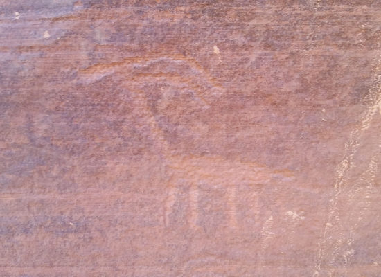
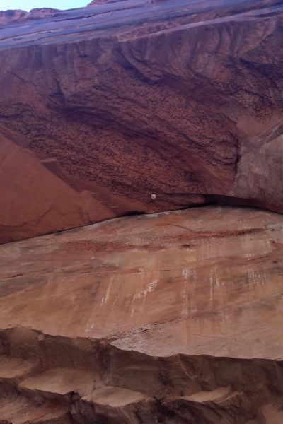
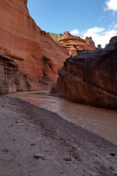
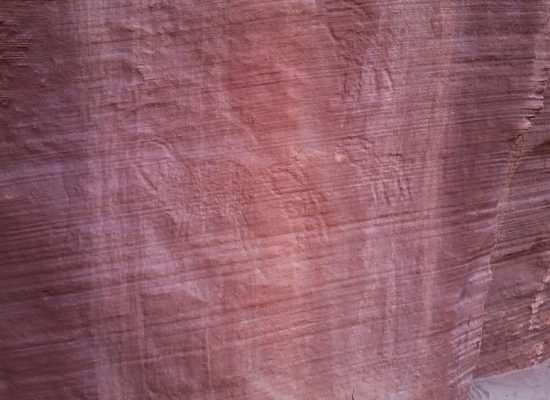
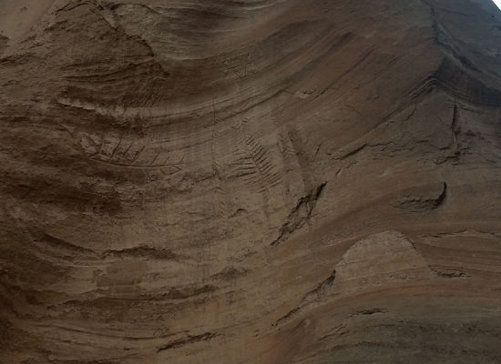
We pressed on until finally opening up into a large confluence between Wirepass and the Buckskin Gulch…it was game time! On the right wall a collection of glyphs were etched into the rock, still bright, standing the test of time. Knowing we didn’t have all day to hang around we pressed on down the gulch.
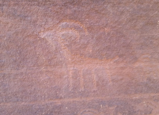
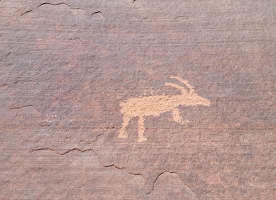
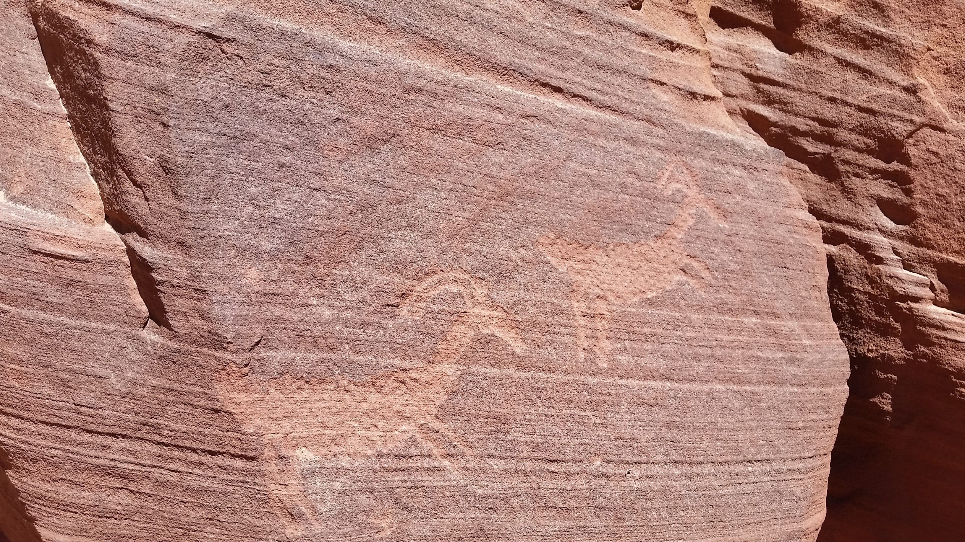
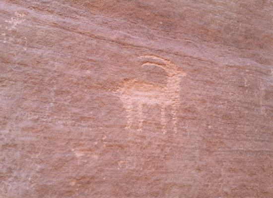 Bighorn Sheep Petroglyph
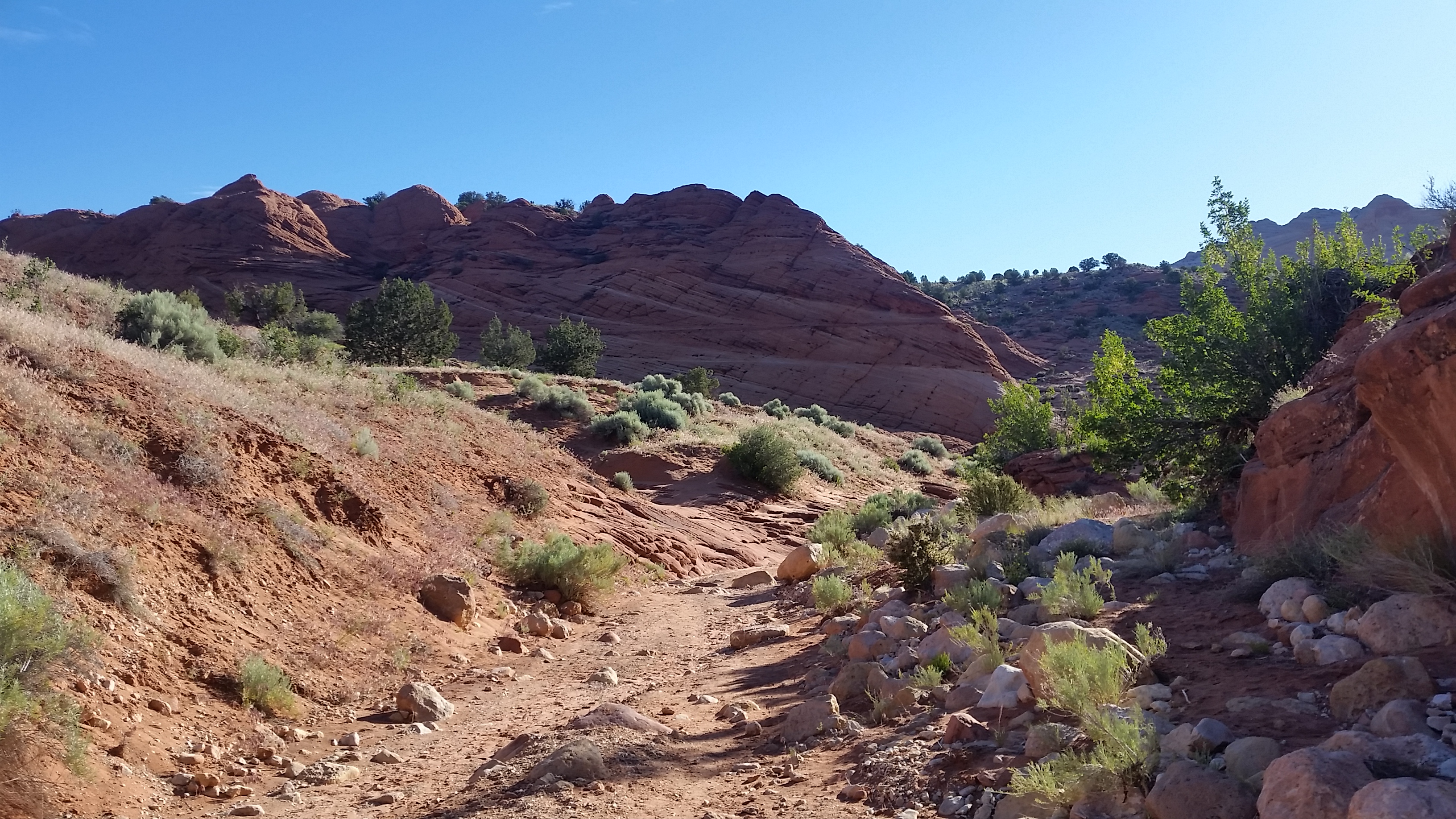
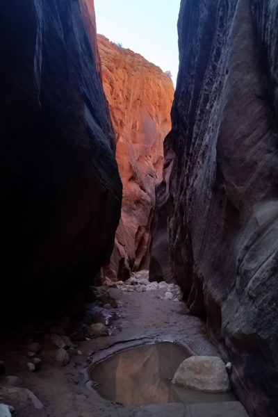
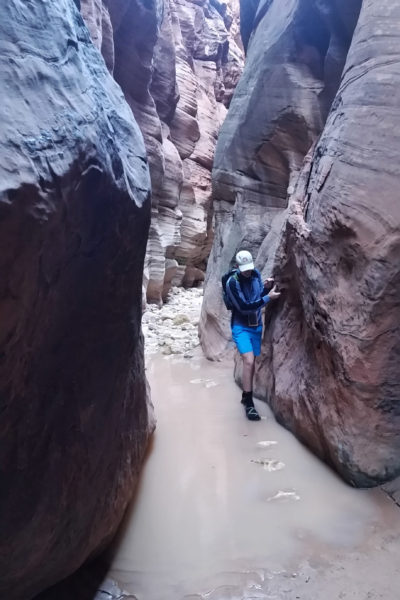
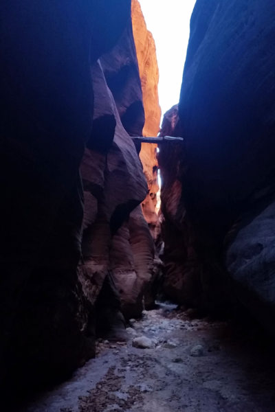
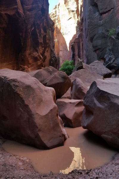
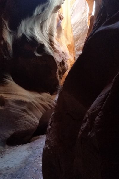
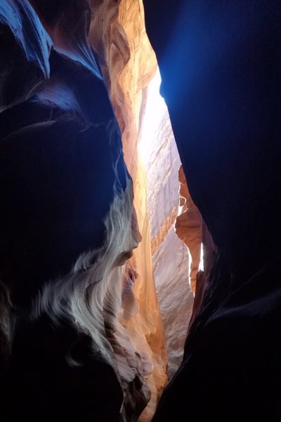
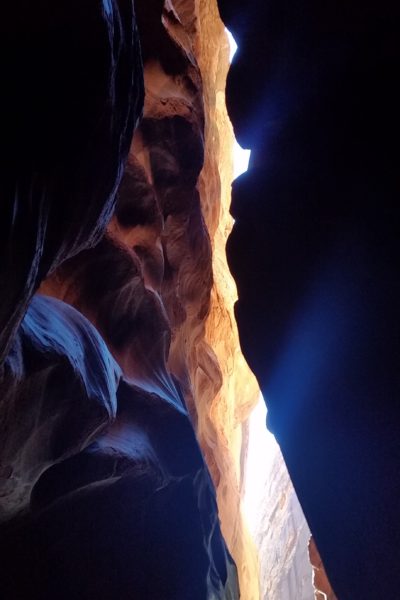
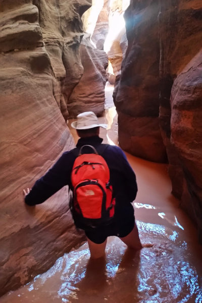
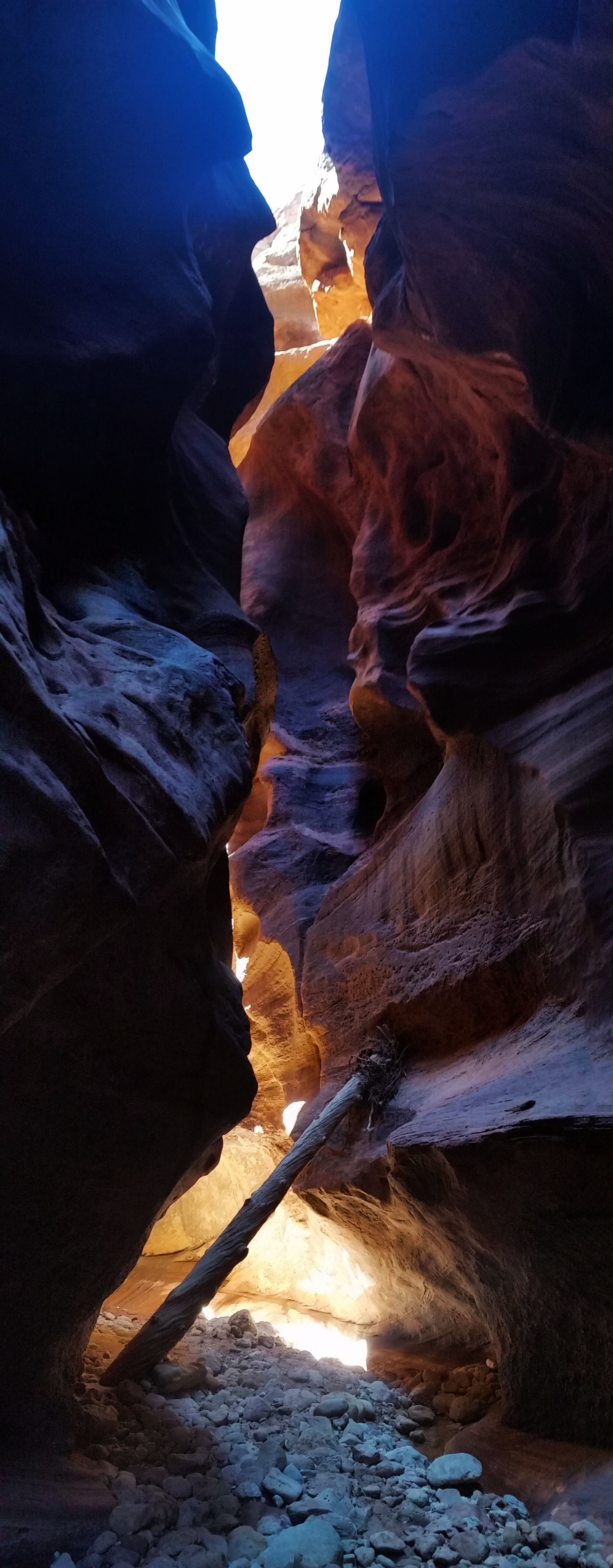
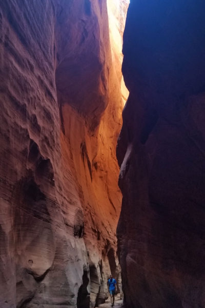
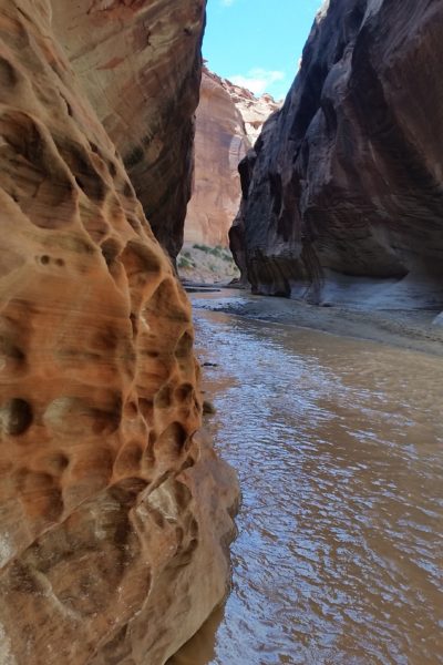
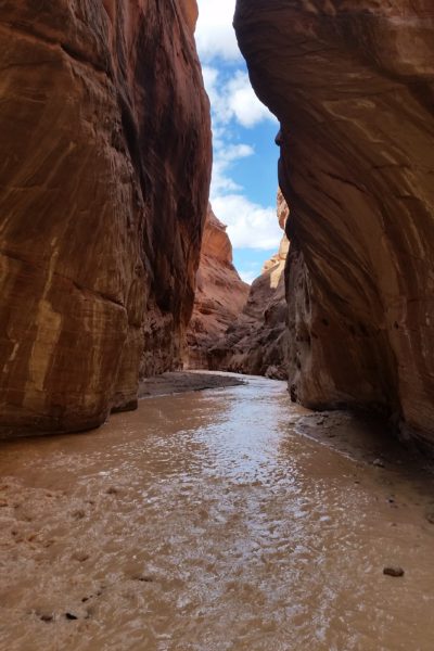
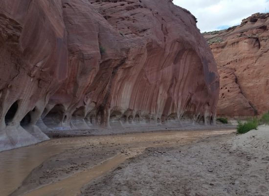
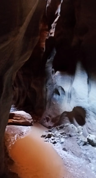
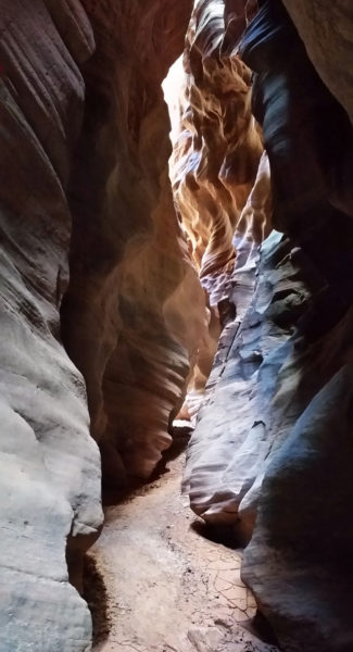
The huge walls rose higher and higher around us. The light touched the tops of the canyon, but only in certain places and at just the right time did it reach the canyon floor. We made our way through the muddy canyon floor, moving quick on anything dry and watching our steps on all the boulders so as not to twist an ankle. Before long we were to the cesspool, a one mile section of deep dark pools that hardly ever see light. I watched Larry, who was leading, as he pushed in the nearest pool and the water went higher and higher around his legs. Whew man it looked cold! Soon after Larry, I plunged in as well. Luckily my neoprene socks aided in warding off the chill of the 40 degree water temps.
 Here comes the mud!
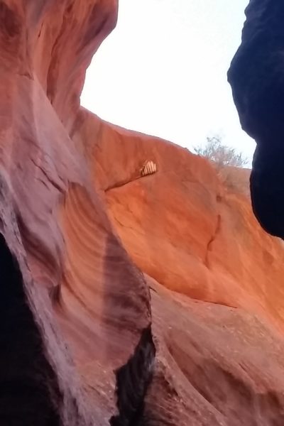
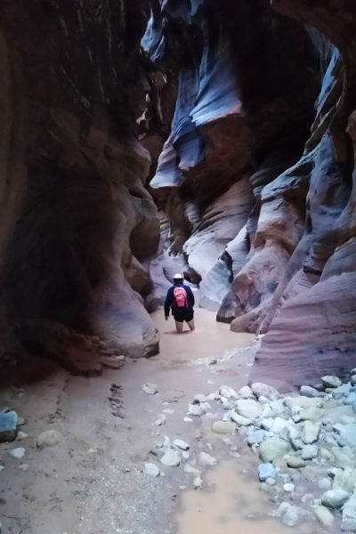
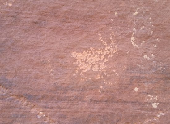
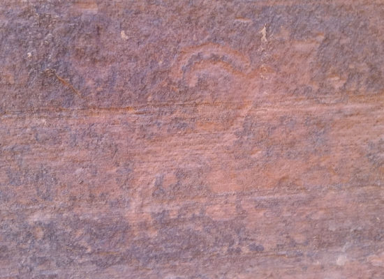
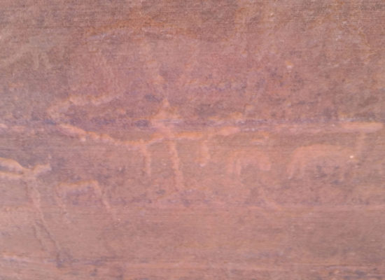
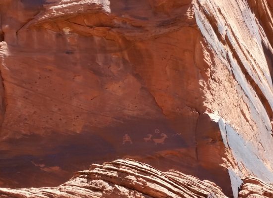
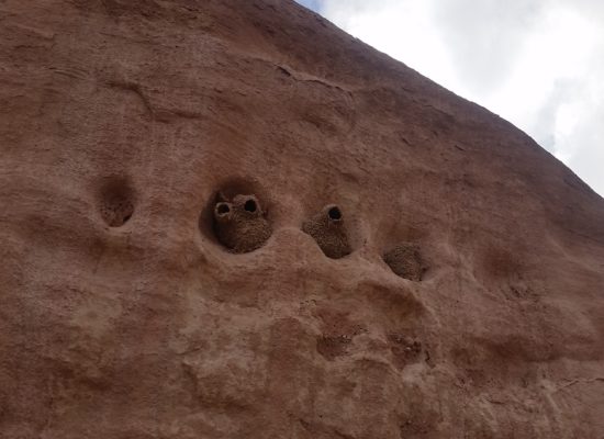
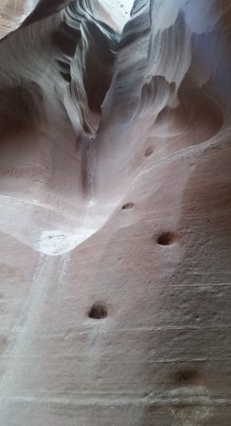
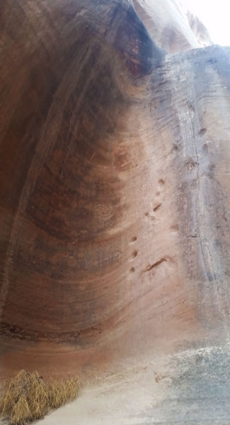
We exited the cesspool and found ourselves at the middle trail, signified by 2 bighorn sheep on the north wall at the base of the escape route. It was steep and sandy, not the kind of place you wanted slip on! I backed away to look high above for a hidden petroglyph panel that was supposed to be 100 ft off the deck. I climbed some cool moki steps on the south side of the gulch and finally found them. How cool! I still have no idea how they got that high to etch the symbols.
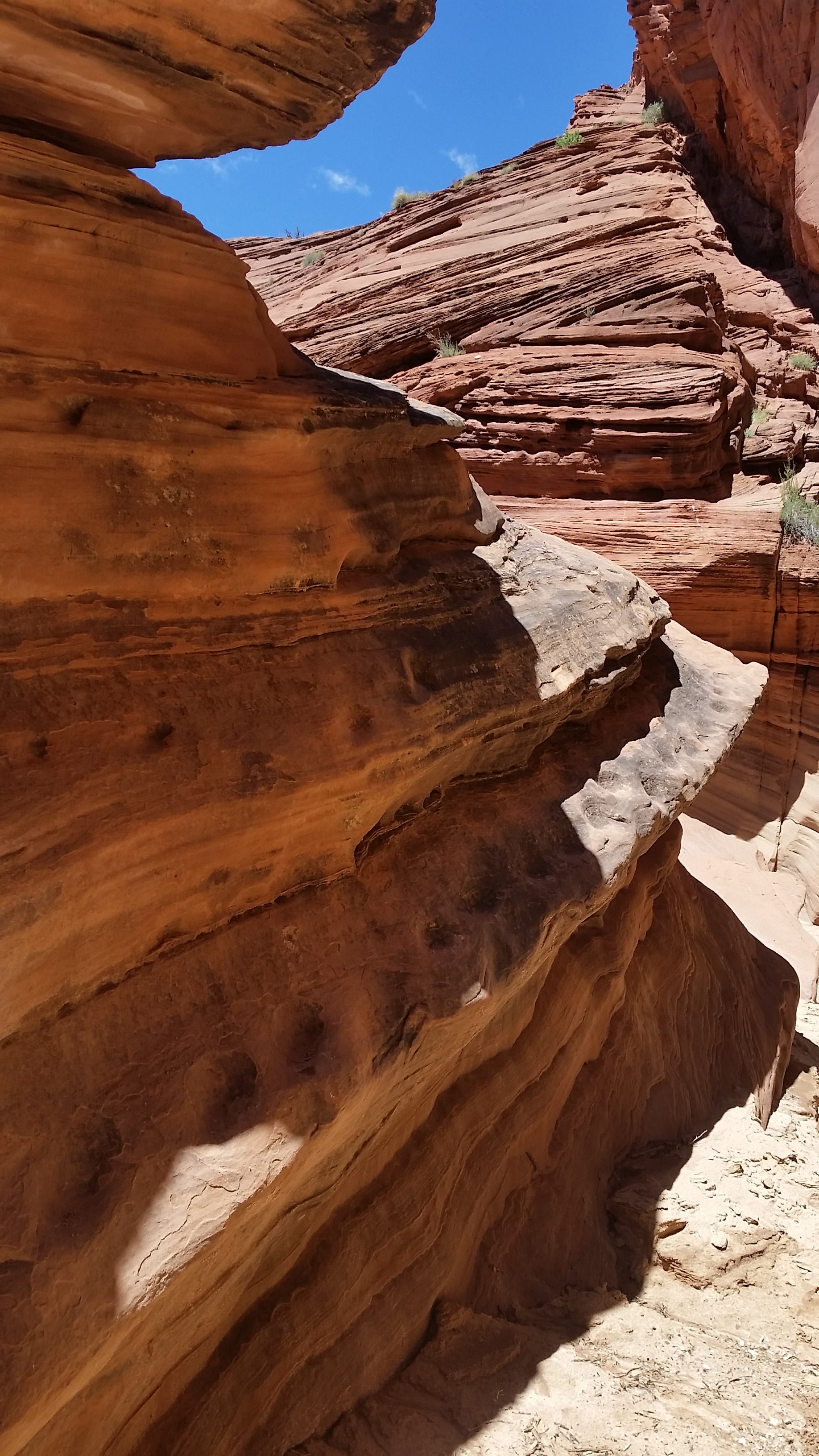
 Looking up on the North face hidden above a ledge is a killer petroglyph panel
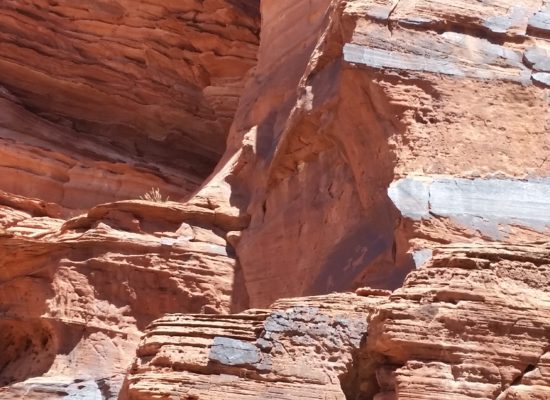
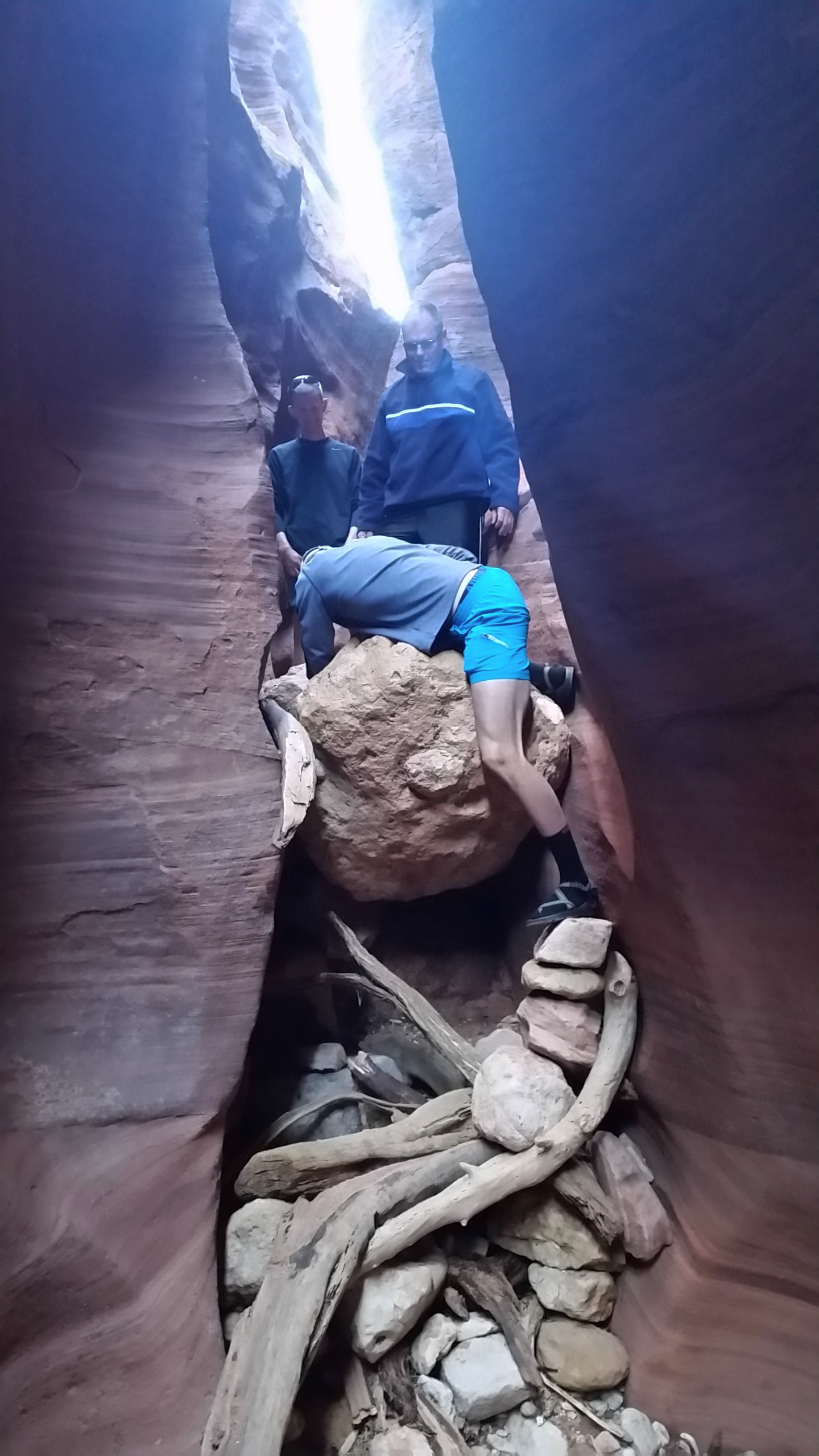
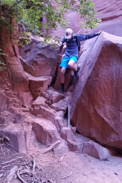
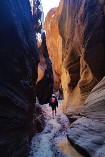
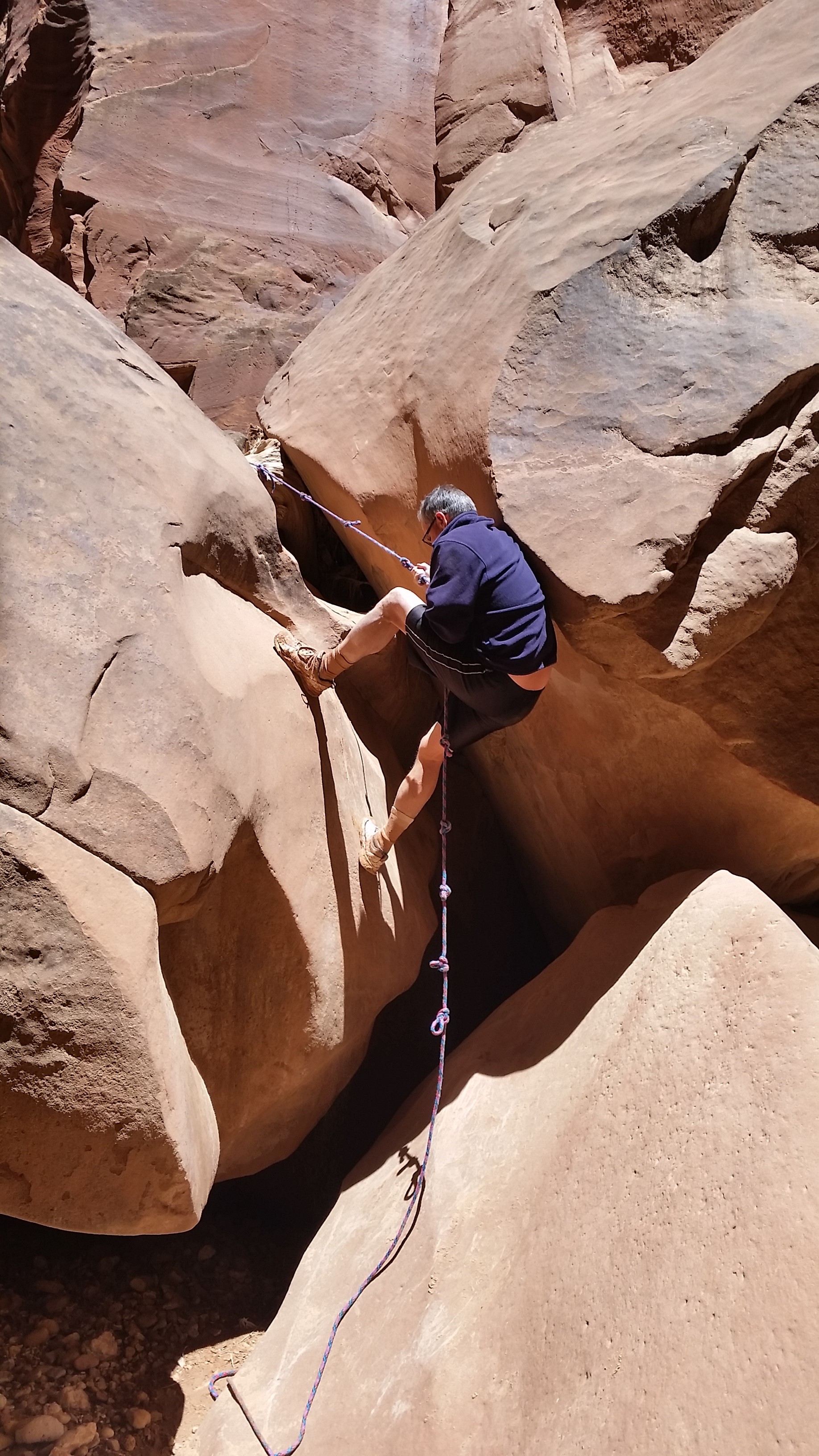
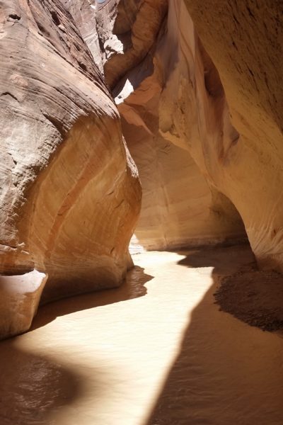
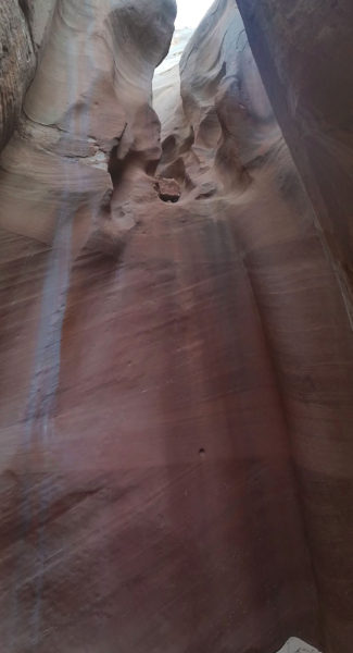
After checking out the area it was time to press on. From there the trail was relatively dry, no more pool wading and the mud was at a minimum. We couldn’t have prayed for better conditions! The gulch opened wider in sections, and cottonwoods grew out at the edges on sand bars. After a large opening in the gulch it would constrict back down, twisting and turning the further we trekked. Soon we reached the “Rockfall” which required decent by using a good fixed rope. One at a time we slid down and were soon safely on the bottom. I looked to the right and re-climbed some moki steps, just for fun!
 Moki steps!
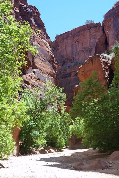
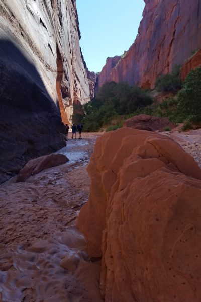
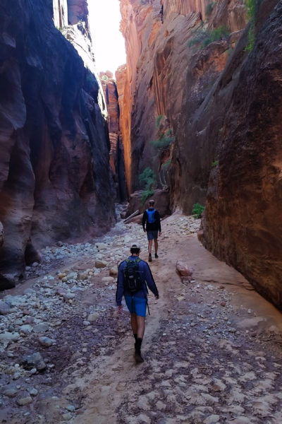
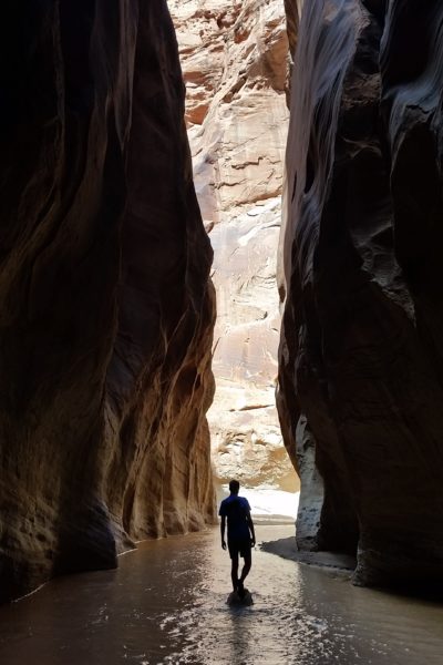
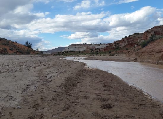
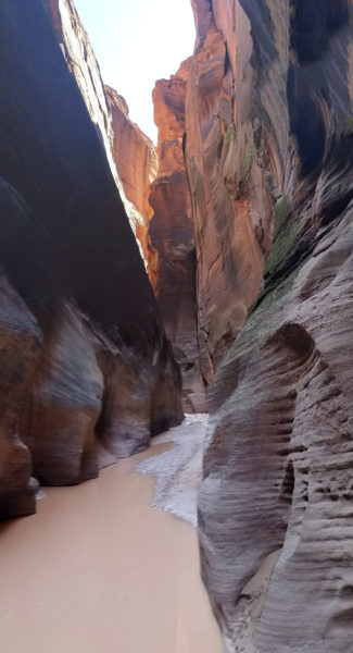
From there we knew we weren’t far from the designated camping area at Wolf’s Knoll near the confluence. Sure enough the canyon soon opened wide to two large vegetated dirt mounds on both sides which served as the campsites, high up and safe from flash floods. We took in the beautiful sights of the walls stretching up all around us and kept on pressing until finally finding the confluence of the Buckskin Gulch and Paria River. What a beautiful sight! The Paria was flowing gently, brown yet beautiful, through the gulch.
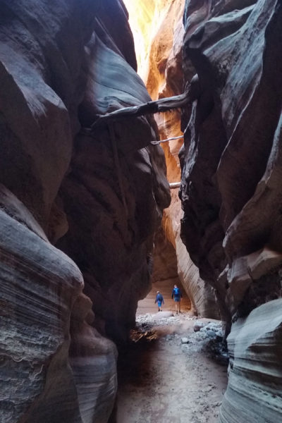
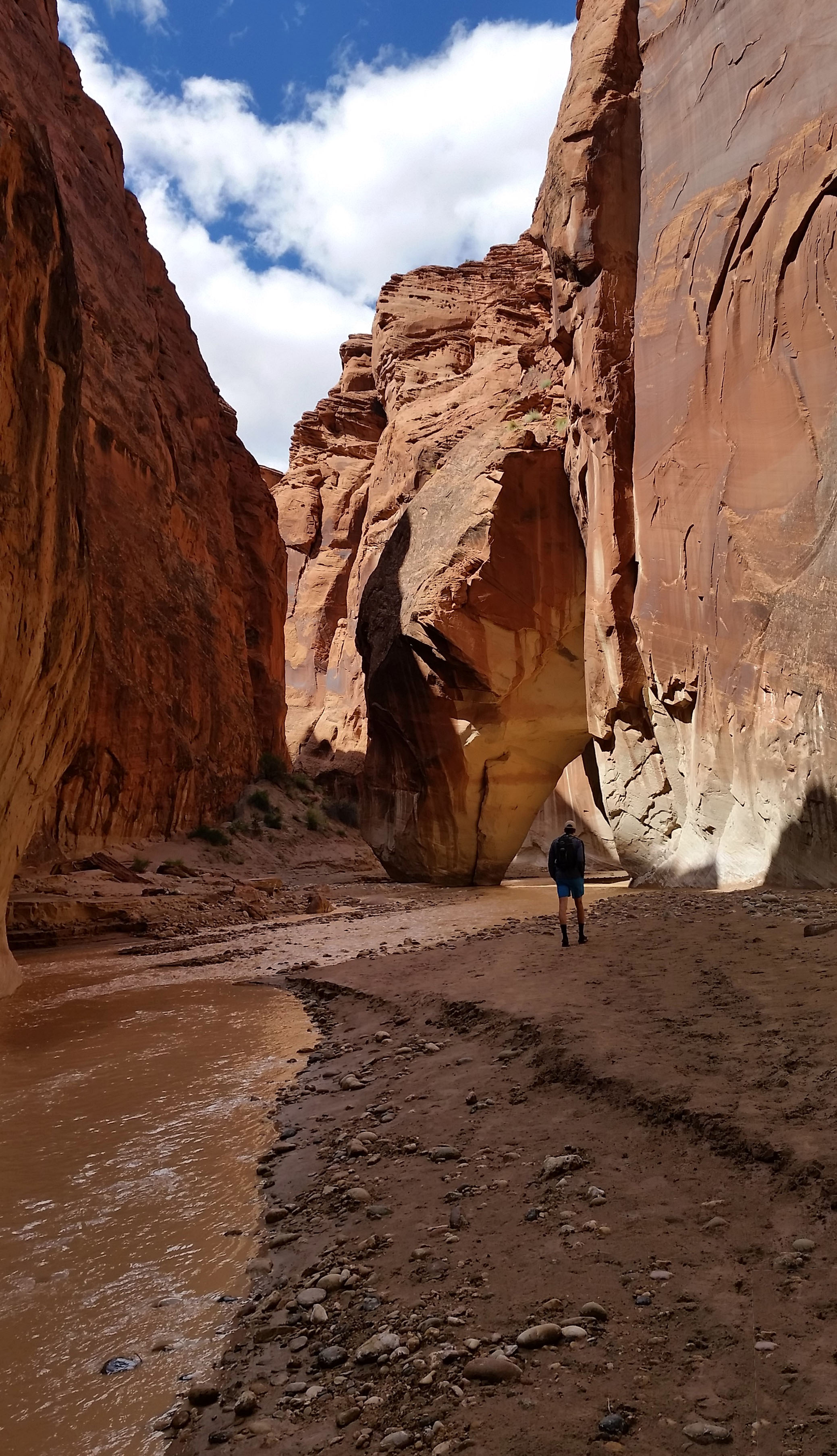
 Eric pushes further on
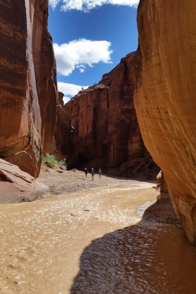
We turned upstream and finished pushing the 7.1 miles up towards the Whitehouse Rock trailhead. For the first few miles we were still constricted in a gulch, but then finally the walls opened up to wide views of the sandstone hills of the Utah upper desert. I searched for more petroglyphs along the way as we made our way back and forth across the river. Finally our trek ended where it started, everyone in pretty good spirits and ready for dinner. Another incredible day spent outside!
ADDITIONAL PICTURES:
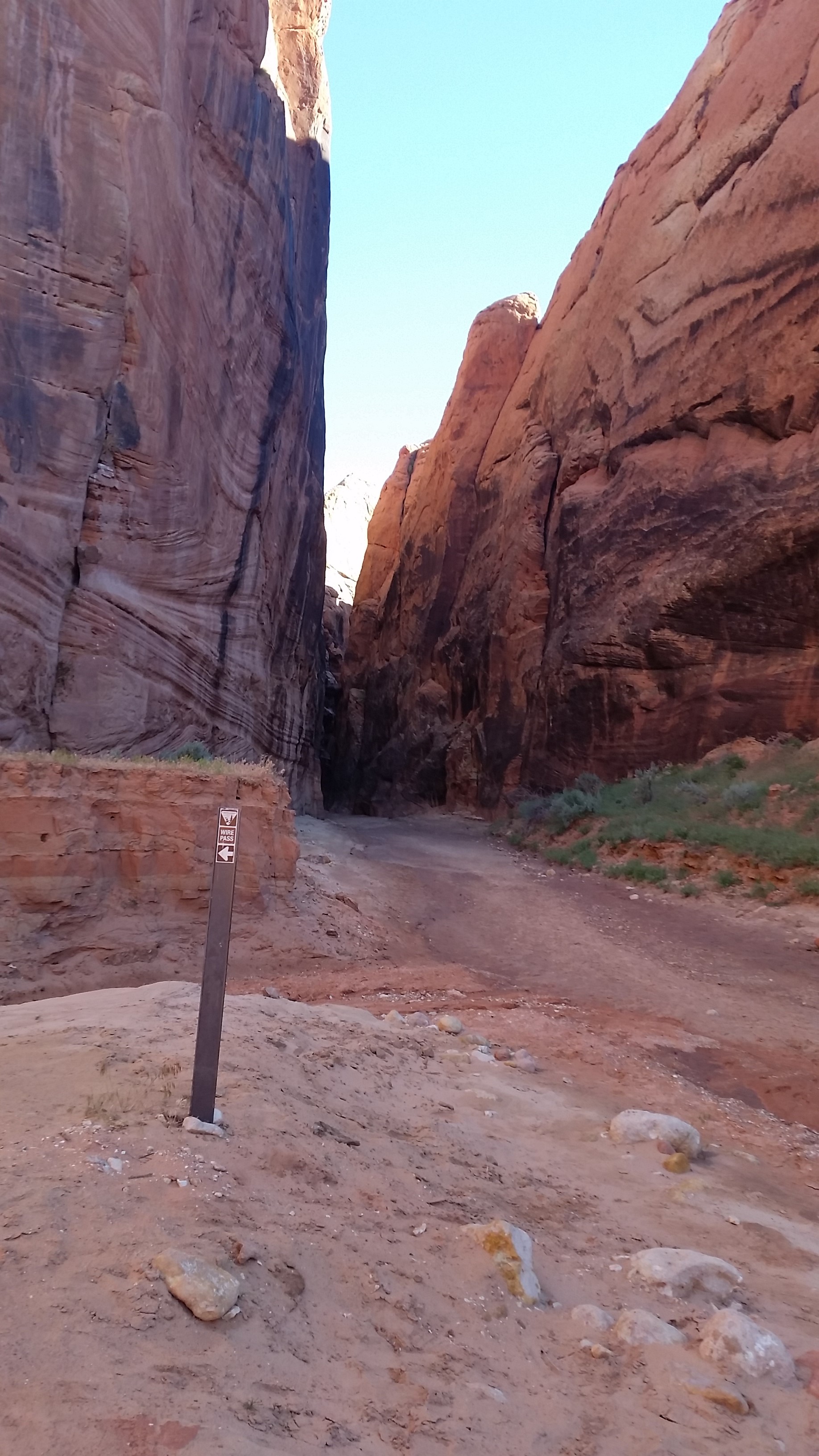
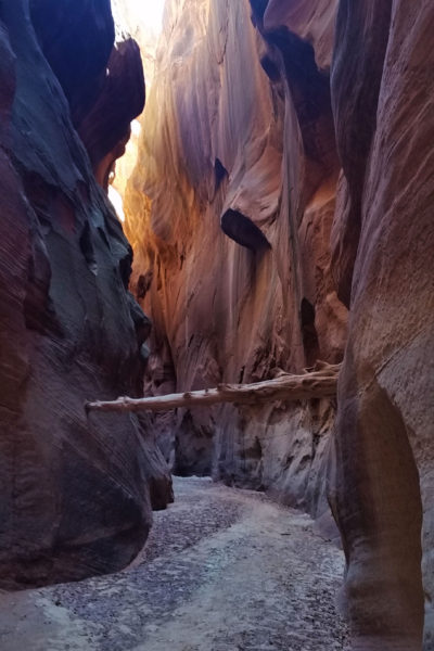
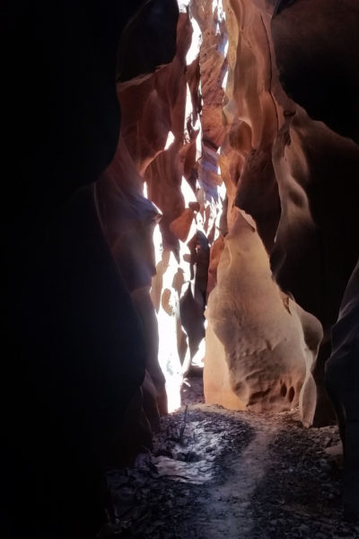
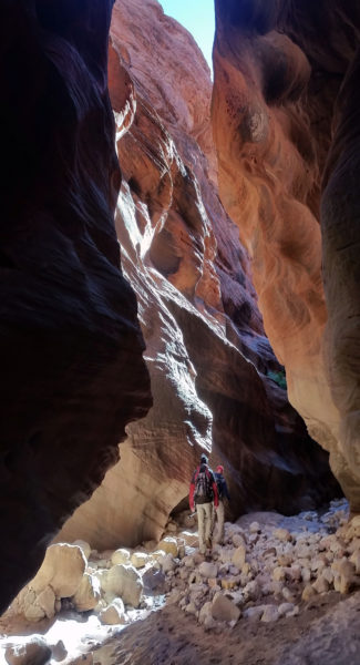
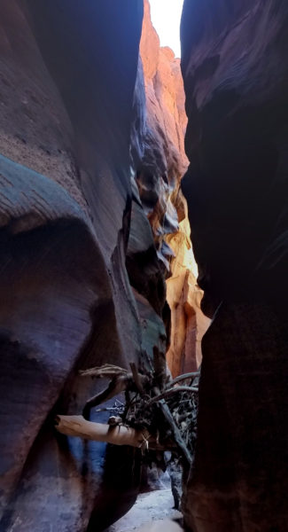
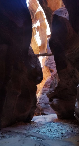
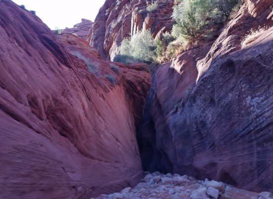 Enter the Gulch! (Wire Pass)
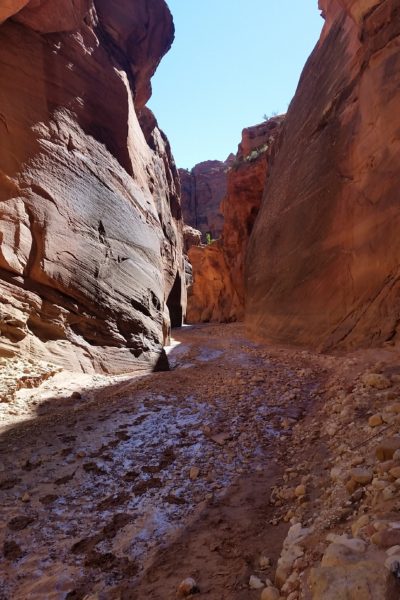
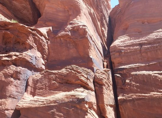
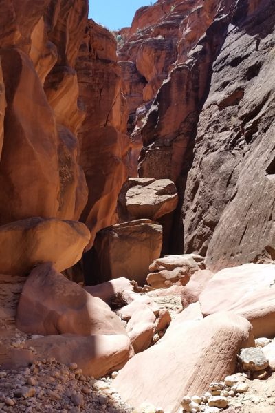
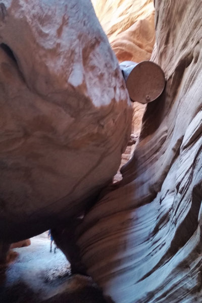
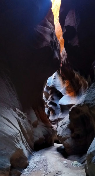
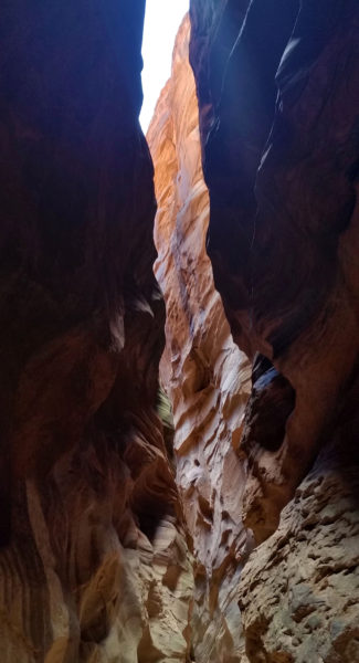
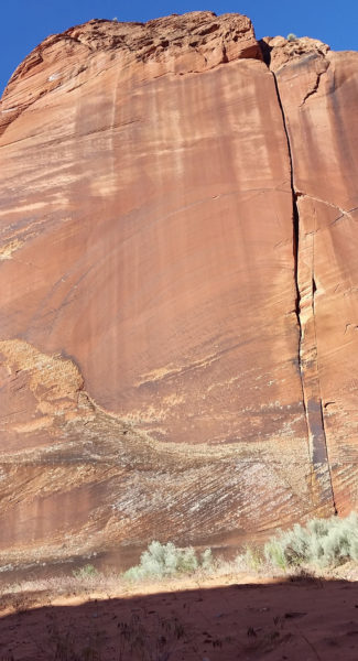 Rockface @ confluence of Wire Pass and Buckskin Gulch
HIKE INFO:
Wire Pass through Buckskin Gulch to Paria River Confluence: http://hikearizona.com/decoder.php?ZTN=16112
Paria River Confluence to White House Campground: http://hikearizona.com/decoder.php?ZTN=391 (obviously we won’t be doing the whole Paria, just the section from the confluence of buckskin north to White House (right at UT/AZ boarder))
HIKE STATS:
- Weather: Hi 60s, Low 40s, Sunny
- Water: 3 liters
- Food: 2 Protien Bars, 2 granola bars, 1 Cliff Bar, 1 apple, 1 bag of jerky, bag of salt and vinegar chips, PB&J (thanks for the bite Andrew), gummy worms
- Time: 10 hours
- Distance: 21 miles
- Accumulated Gain: 500 feet
GEAR:
- The Don Camelback backpack (3 liter bladder)
- SPOT Tracker
- Neoprene Sox
- Black Diamond trekking poles
CLOTHING:
- Cotton Handkerchief
- Icebreaker wool shirt
- Patagonia pants
- Merrell Mid Moab Hiking Boots
- Darn Tough Medium Wool Sox
- Arcteryx Atom hoody
