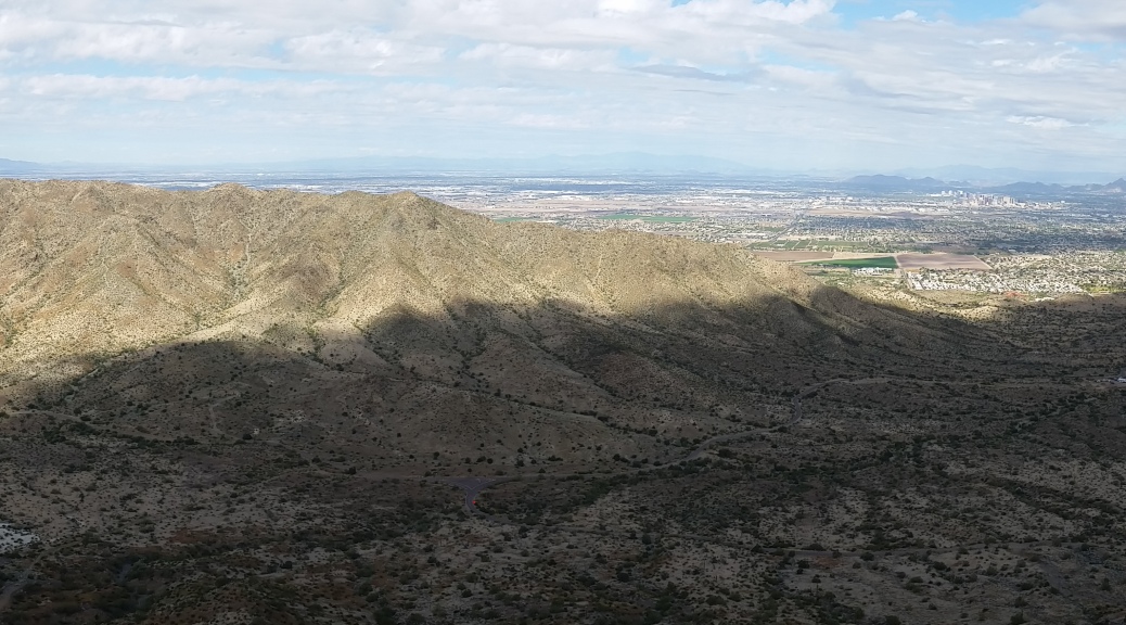
 View of the Northern Ridge of SoMo from the Southern Ridge up on National Trail (click to enlarge)
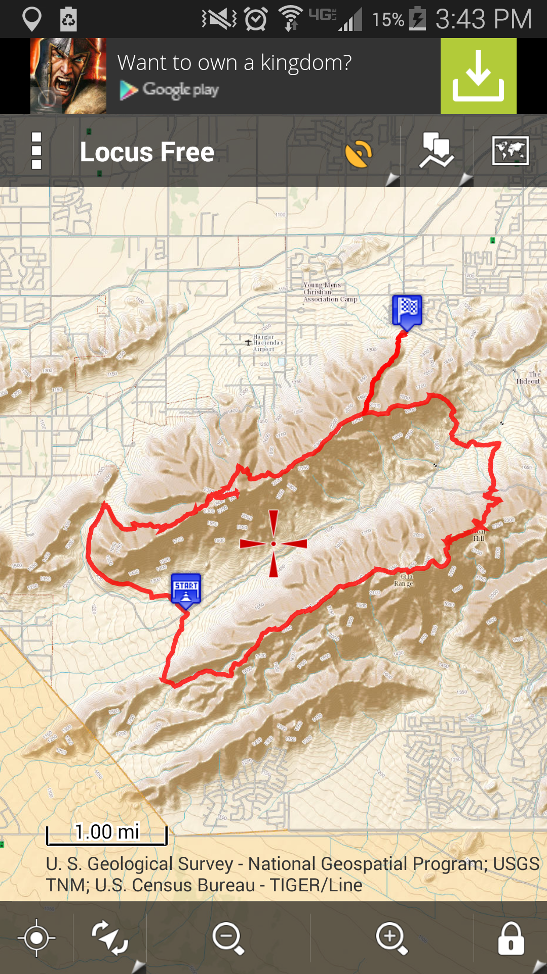
The Two Ridge Tango – a sweet loop on SoMo (South Mountain) consisting of 14 miles of some official and some not-so-official trails.
Was an awesome day in Phoenix with killer temps and even better views. Just needed to get out and grind down some miles to recenter myself. Nothing like some good quality time on a trail to get your head right!
I was surprised to see the amount of people out, but with such perfect weather (60s and overcast) how could you not take advantage. The hike starts with a grind up Warrior (non-official) trail. [Get to the trailhead by going south on 19th Ave until dead ending into SoMo] The gain is killer quick to start with 900 ft of elevation gain in 0.84 miles. I scared up about 5 coyote’s on the push up the ridge. After seeing these guys I hiked for a while with rocks in my hands like ready catapults just in case, but it was really cool seeing such a wild animal so close.
Hit the ridge and went to work on the loop. I came across 2 small groups of people on Alta trail coming from the neighborhoods in South Phoenix, another couple riding horses (sipping on cervezas), and later a big boy-scout troop putting down a 10 miler up on National trail.
I made sure to touch Maricopa peak (highest point near Alta trail) and Goat Hill (high point just east of where Ranger trail ties into National). Took a few picks, enjoyed the views and kept trekkin.
Finally dropped down Ranger and worked my way across the desert and found an old use trail that went up the Ridge, spoke with a cool family of 4 just hanging out and enjoying the views on the North Ridge of SoMo for a moment before pushing on, finishing my loop and getting back to the truck.
2.5 liters of water, 5 hours 0 mins Time, 1 clif bar, 1 avocado, 1 natur valley peanut butter bar, 1 protien bar, 1 plum
Nothing can be said for just getting out and putting a grind down on some trail and really just putting everything behind you and enjoying being outside!
Below is the aerial topo GPX for the loop


Looks great brother!
Blog is looking good! Nice work!