

Back country route finding skills are critical in finding your way through the mountains safely on less traveled paths. Most trails are well maintained and obvious, but as you venture further into the unknown, the skills required keeping you safe change. It’s not just about mindlessly clicking along at 3mph, keeping on trail and only monitoring your water and food. Routes as opposed to trails can be faint, unpredictable, and hard to follow. Good route finding involves proper research, looking at maps and GPX tracks, noticing signs of foot travel, locating cairn markers, and self rescue.
Before I jump into the meat of it, why care? Why not tread wherever you like?! Good route finding not only keeps you safe and on track, but also saves the plants and animals in the region from unnecessary harm. Some landscapes take a long time to recover once trampled. By trampling on desert soil crust (which is alive), and stepping on plants native animal species rely on, both set precedence for future trekkers to follow in your footsteps and cause lasting damage that may have a farther reach than you think. Sometimes off trailing is warranted, but just try to tread lightly and think about the lasting impact your footsteps have on a landscape and its inhabitants. 
Research and Planning
Do some research before you go. See if anyone has completed your track before, and if so read about the hard to navigate areas and study them well. Look at topo maps, make a track, understand possible cliff drop-offs, dead ends, and places that could be dangerous to foot traffic or places where it could be easy to get turned around. For some more rugged tracks where hitting the right notch in a ridge line is important, pictures of the route can be helpful, especially in climbing or scrambling routes.
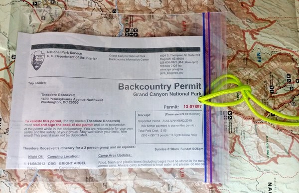
Also in your research, be sure to understand the land ownership. Are there any restrictions? Special permits? Trespassing laws? Are you trekking on National Forest, National Park, National Monument, BLM, State, Private, State Land, or Indian Reservation? Each land ownership comes with different rules and regulations you can reach out to the appropriate administrator (Private land owner, Indian Affairs Committee, National Park Back country Office, BLM Office, etc) in the area to make sure you are legal in your venture. Be sure to know what you are getting into before you go.
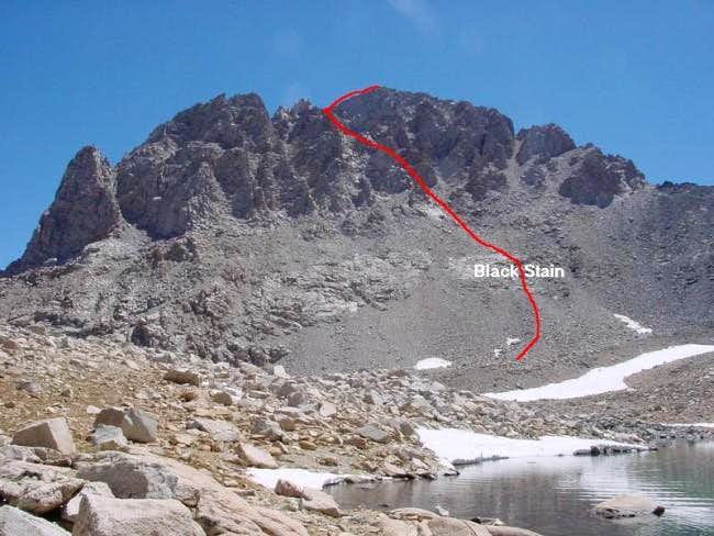
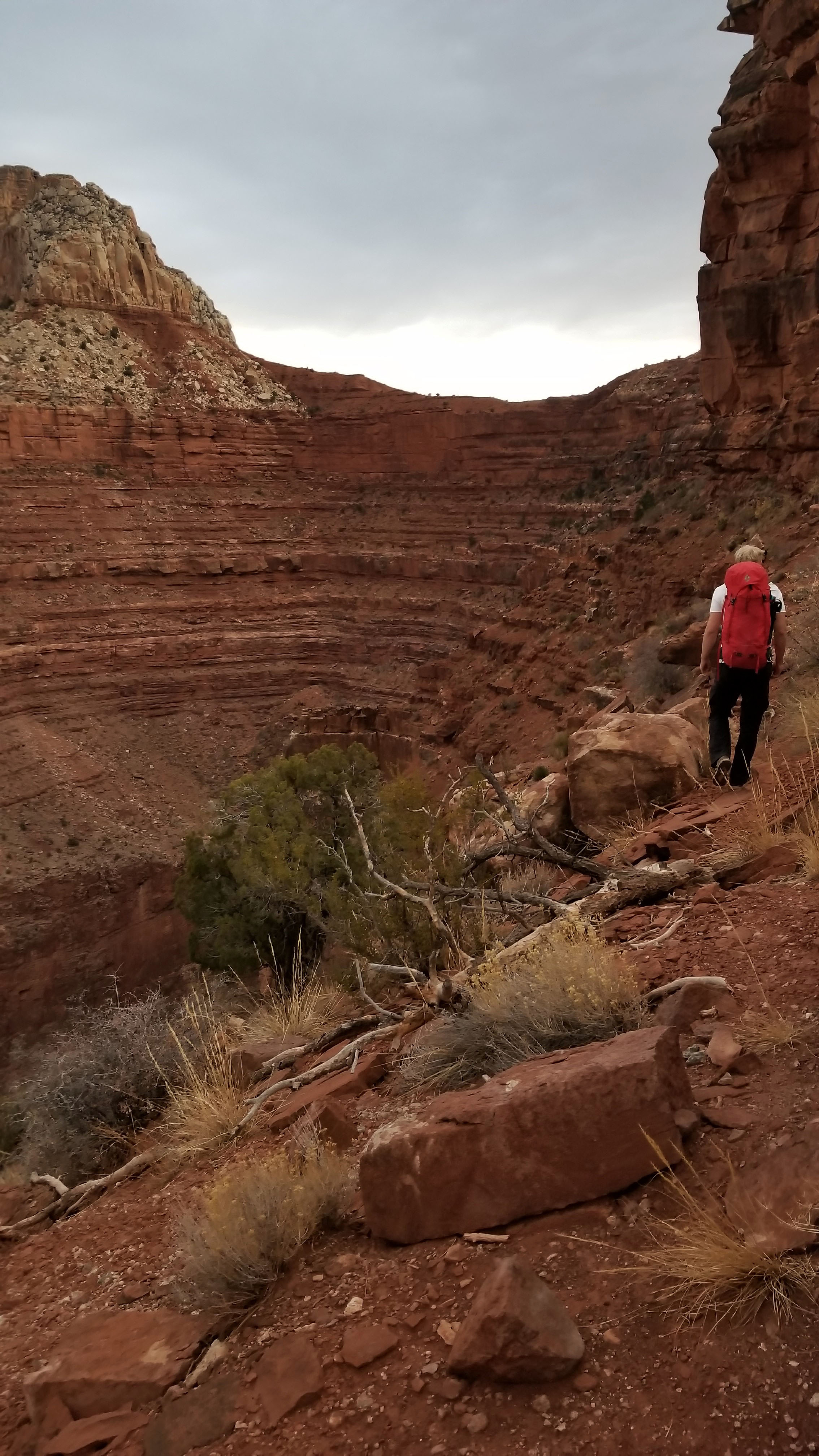
Example: Here is a photo from a trip report on Mt Williamson which gives a visual line of the approach for the summit. This can be crucial info in safely finding your way to the top!
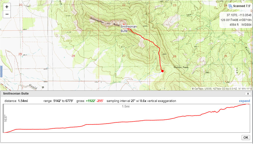
GPS Tracks + Maps
Always carry two forms of navigation (GPS + maps or pictures of your route). Global Positioning Systems (GPS) can be very helpful in following your intended path; however you must be able to not completely rely on them. A GPS track (GPX is the file type) is only meant to get you in the general vicinity and it’s up to you to find the path and follow it. GPS track drawn improperly can also lead you off cliff sides and over untrackable terrain, so be careful when creating them. There are a number of devices for using GPS tracks such as Garmin and even phone Apps, such as LocusPro. If you are using your GPS you should have a paper map and compass as your secondary for any trek.
CalTopo is a great resource for manually drawing GPX tracks with almost any map layer you would like. It also has land ownership layers so you can understand the regulations of the area you plan to trek in.
Reading the Route
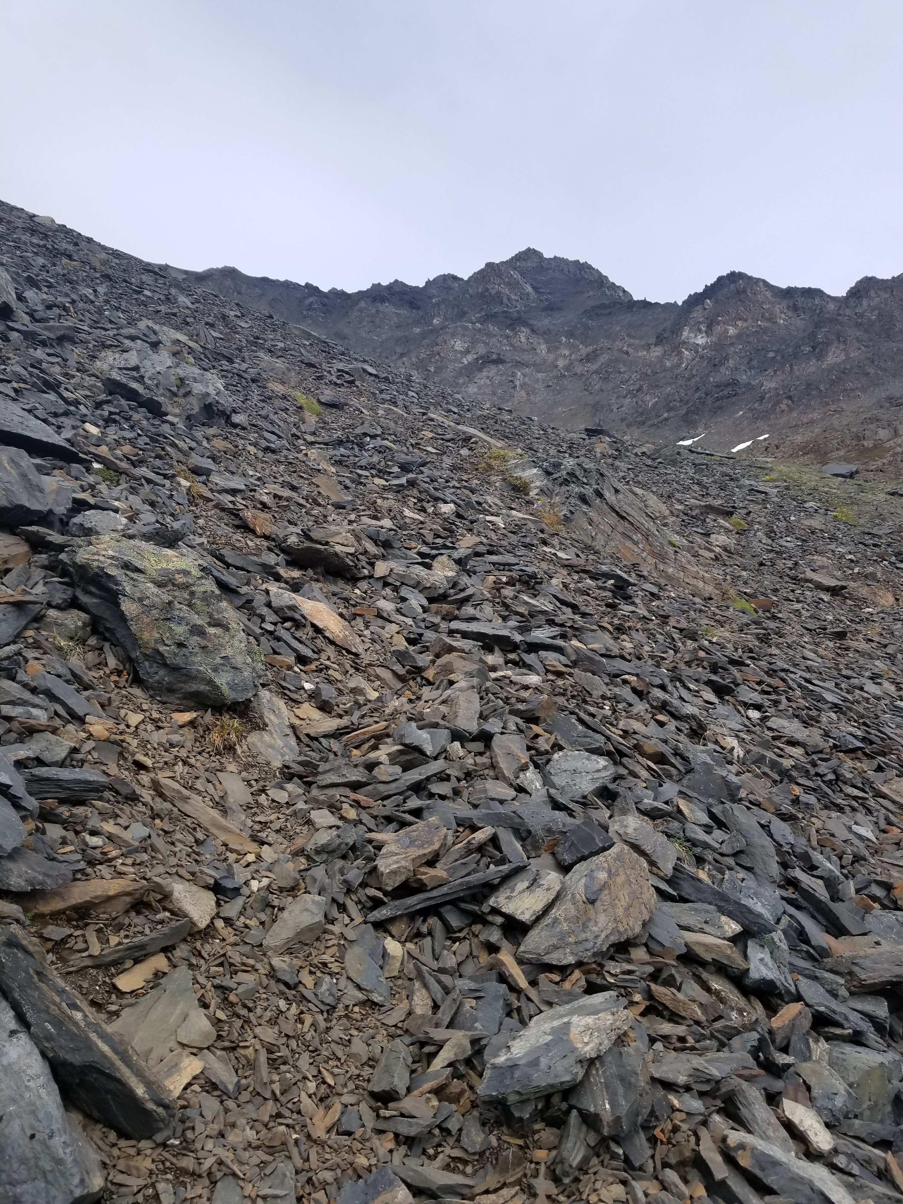
Being able to read the signs of a route are critical to following the path. Patted down grass, broken tree limbs, compacted down dirt, dirt smudges from feet on rock faces, shiny tree limbs or rock features from continual contact with sweaty hands, vee shaped indents in a riverbank, obvious notches or breaks in a ridgeline, slight discoloration of the ground in contrast to its surroundings… seeing that path of least resistance across a landscape can guide your way. The more you practice these techniques, the better you get at reading landscape like a book and keeping yourself on track. Remember that not every track may be your route, for example natural washouts from water runoff and animal tracks will leave an imprint on a landscape, but doesn’t necessarily mean they are the right path. Think of this like practicing to be a tracker, read the signs, know the way. Some signs can be very obvious, like a cairn.
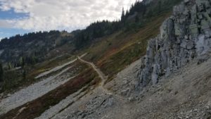
Here are a few examples of signs that you’re on the right track: indents in the rocks, impressions in the dirt, even spray paint from an old Via Ferrata route, and of course cairns.
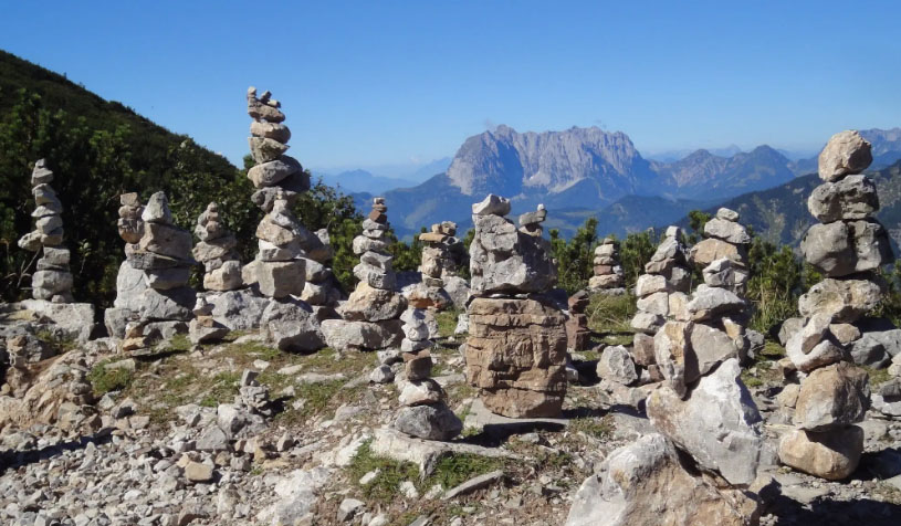
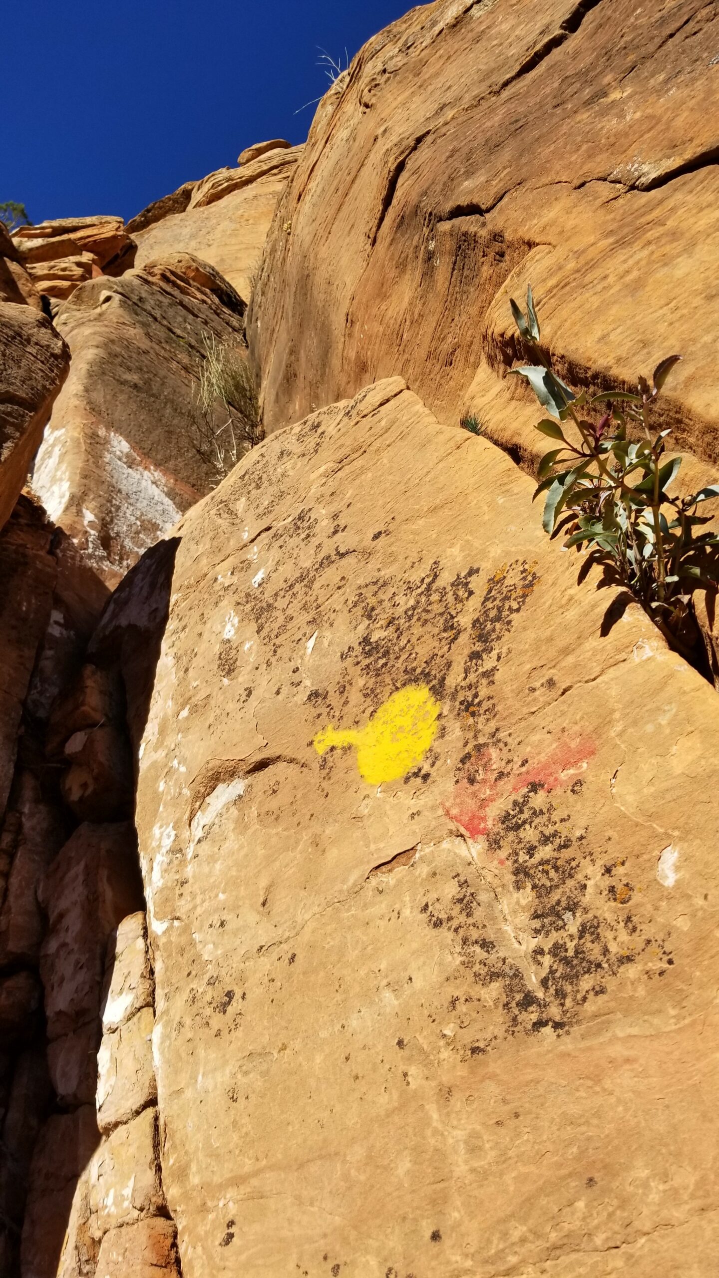
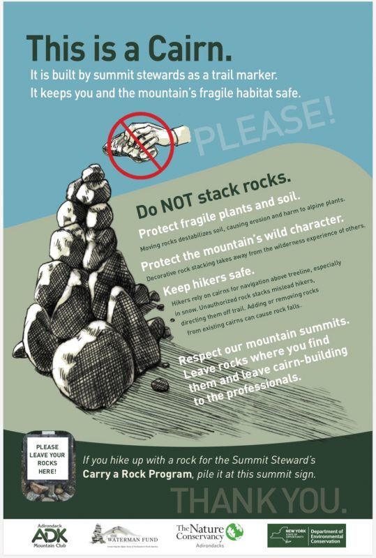
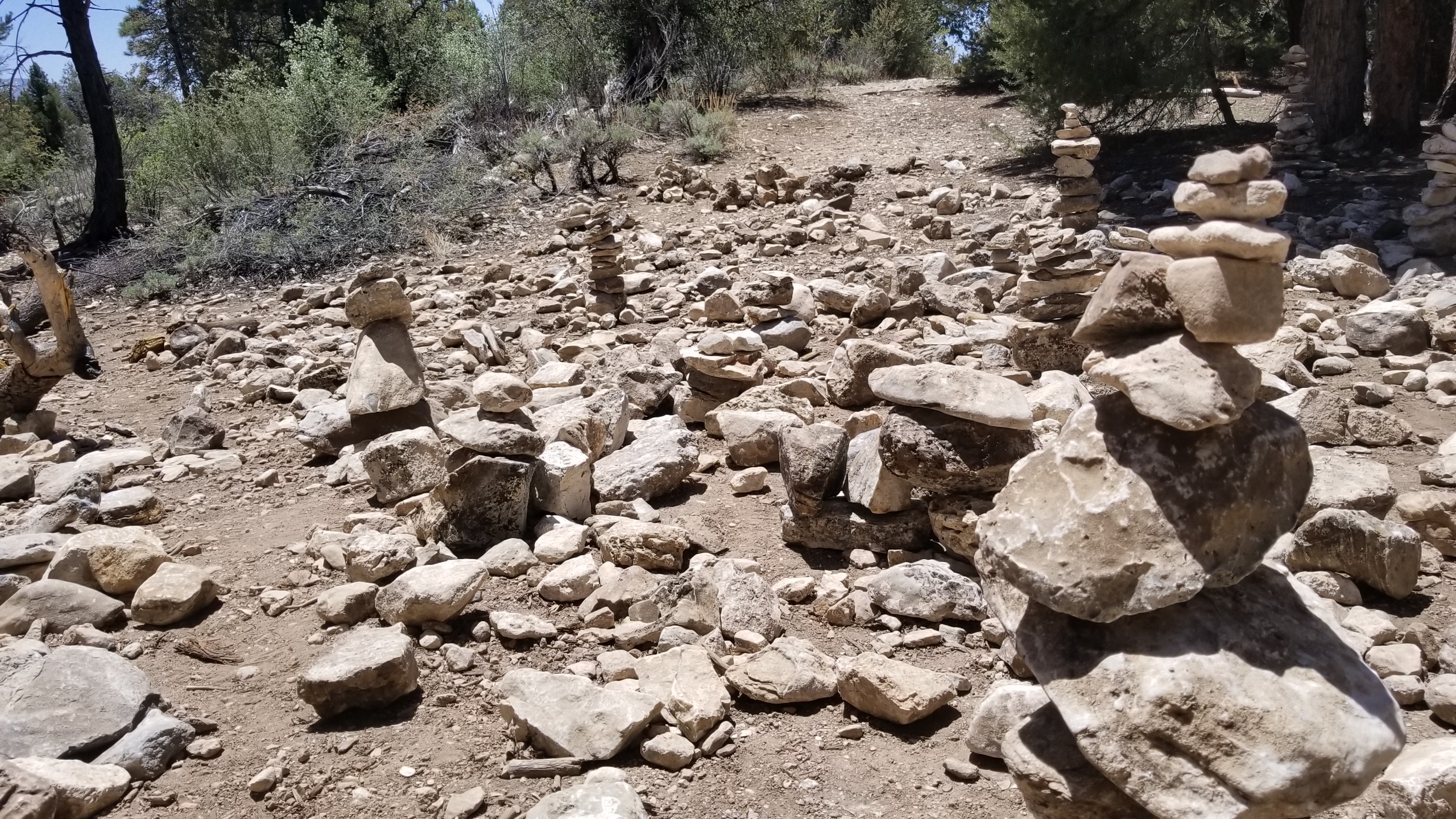
The Cairn Controversy
A cairn is a small rock stack that someone left behind like a breadcrumb trail to help guide future trekkers to find their way. The challenge here becomes when a cairn violates leave no trace, and instead of being a useful tool to guide trekkers through a route, it takes away from experiencing nature. Cairns are not needed on very established trails where is it very obvious where to go and are trekked by thousands of people per year. Establishing a cairn on a well marked trail is discouraged by all the park services across the states, and even though they can be pretty, they aren’t necessary. The exception here is when you are traveling on a route, not a trail, and sometimes cairns can be critical in saving a life, keeping trekkers on route and keeping them from getting lost.
Self Rescue – Getting Lost in the Backcountry
Now you’ve done your research, know the general neighborhood of where you are going, let’s start trekking! The biggest challenge sometimes is when you have lost the trail and there is no more sign of it. Your padded grass, cairns, and any sign of a route have all vanished leaving you in wonder of where to go. There is a simple solution to fix this.
TURN BACK. This very simple rule has saved me so many times. Most people want to push forward and heroically find the path once again. Save yourself a lot of trouble and just turn around and go back the way you came until you find the last notable sign (like a cairn) that you are on route. Start searching for the next sign and often you will find where you went wrong and get back on the right track. If you see that many people have made the same mistake you have (by show of footprints), sometimes it’s good to barricade off the side trek with a rock line or sticks to ensure future trekkers don’t make the same mistake. Before you do this, be absolutely sure that what you are blocking off isn’t another track.
In the worst of cases and you are utterly lost and your maps and GPS navigation have failed you, you can rely on a SPOT tracker, InReach, or other forms of signals to bring rescuers to your aid. Surviving in the wild is a different discussion all together. Conclusions
Be smart, plan your trek, and understand the requirements of the journey you’re about to embark on. Watch for trail signs, use your intuition, stay on track, and make good judgment when boldly going into the unknown. Stays safe out there guys, and never stop exploring!
References:
- GPX Creation – CalTopo
- Phone Map App – LocusPro
- LNT – Leave No Trace Ethics
- InReach & SPOT trackers
- Maps can be purchased online, in parks, or at your local hiking shop.
