

So I figured I’d do a quick addition to my Mazatzal Peak post (original post: https://goatmanmike.com/2016/01/mazatzal-peak-central-az-12-30-15/). The first time I took the peak, I went up Y-bar trail and summited from the south side before returning the same way to the trailhead. I decided to come back (since the rugged Manzanita bushwhack wasn’t enough the first time) three months later with a group I hike with (TLC) and give it another go. I was glad I did!
Instead of climbing down the southern ascent route, the crew planned to take a non-technical canyoneering route to the north that would tie into Barnhardt trail for the return loop to the trailhead. I was pleasantly surprised with what the trail had to offer. Taylor and I led the charge up to the peak, and along the way found a cool climb (upper class 4 scramble) to bypass a long section of the leg scratching Manzanita! Once we popped back out onto the main path, we found our way to the top where the rest of the group soon gathered. It was chilly as the wind nipped at everyone’s faces, and all I could think was “man I’m glad I brought my hoody!” as I snitched it on tight.
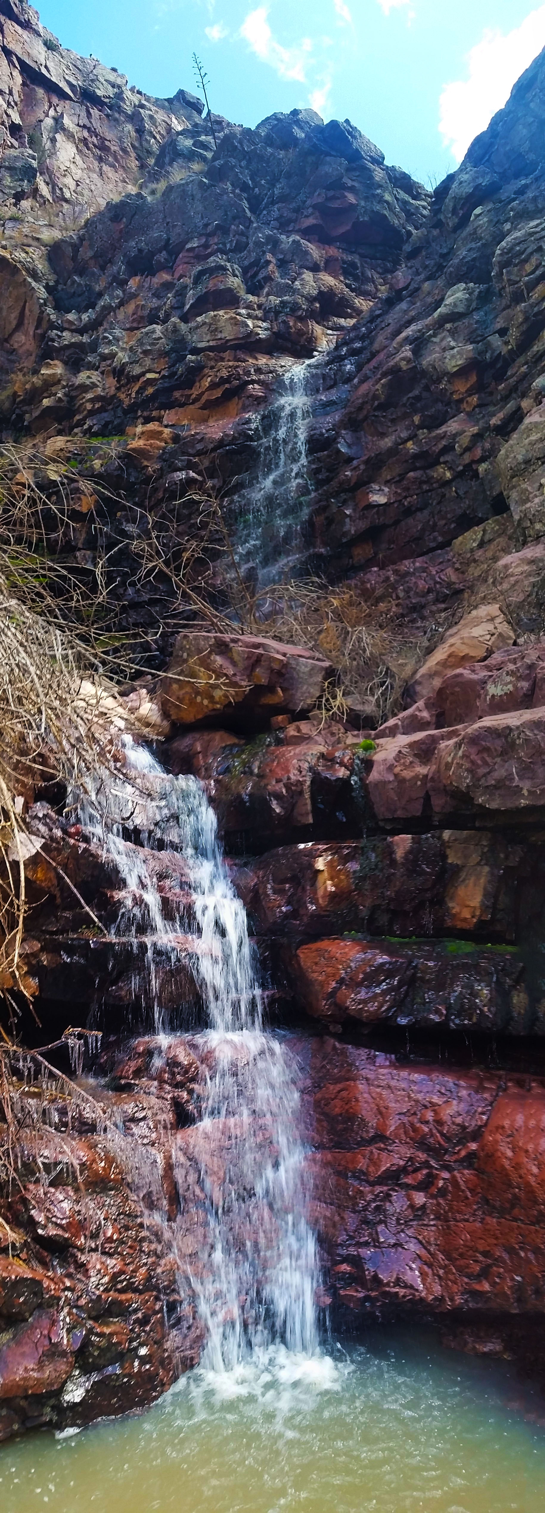
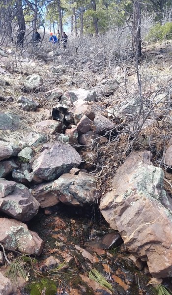
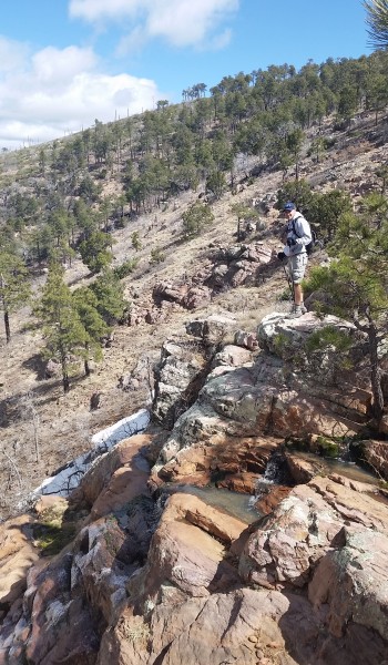
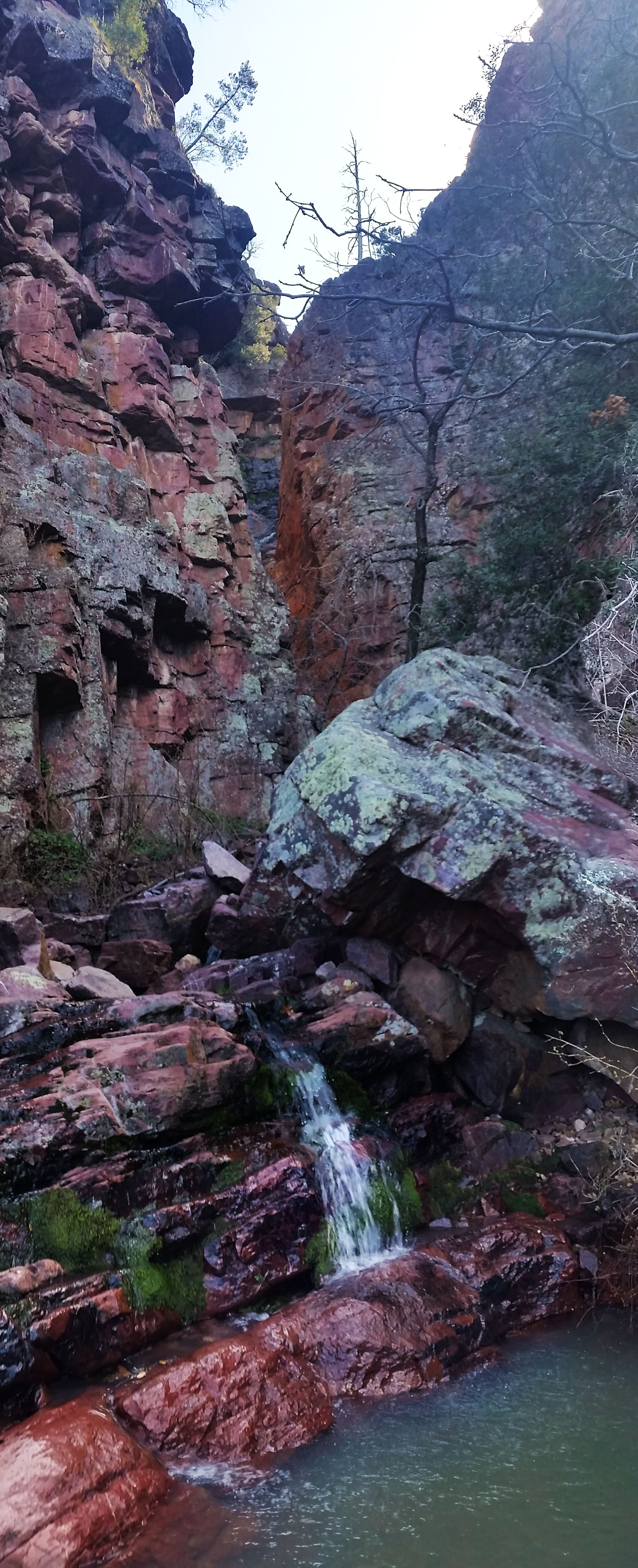
After a quick register signing everyone was ready to get off the windswept peak. Eric, Rick, and I had a quick route/GPS coordination then headed north, following suicide ridge until we found the correct canyon to bomb down. This is where the fun began. Before coming on the trip I had read that it was a total bushwhack and pain in the ass. So far it didn’t seem too bad, just an innocent walk down a canyon with a creek in the bottom! As we plunged further down, we soon encountered a few nice drop-offs with icy waterfalls and great views. The first few drops were easy to bypass, but the open and inviting sides of the canyon soon turned to rock face and began to close in on us as we descended.
The bushwhack became thicker. The trees and thorned bushes grasped at our clothes, attempting to hamper our progress and spirits, until we finally escaped onto a ledge overlooking a 120-foot cascading waterfall. What a view! On one hand I was blown away by the beauty of what I would have missed had I not descended this route with the crew, but on the other hand I couldn’t help but think “how the heck are we going to get down!?” After some quick searching we found a cairn stack (oh you awesome trusty cairn you!) and hopped over into the next canyon. That gave way to a muddy trail, eventually throwing us into the creek itself and further down the canyon.
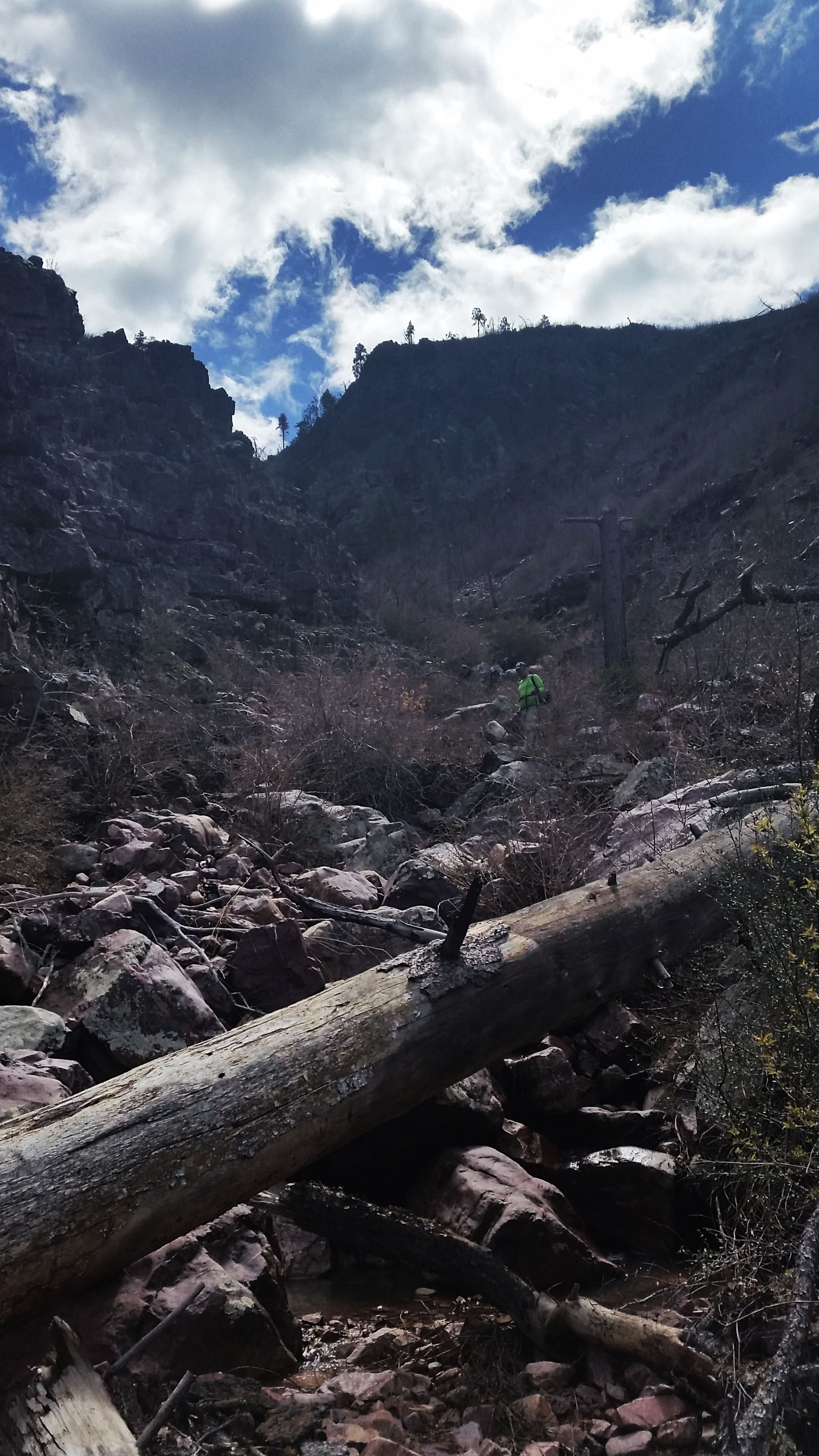
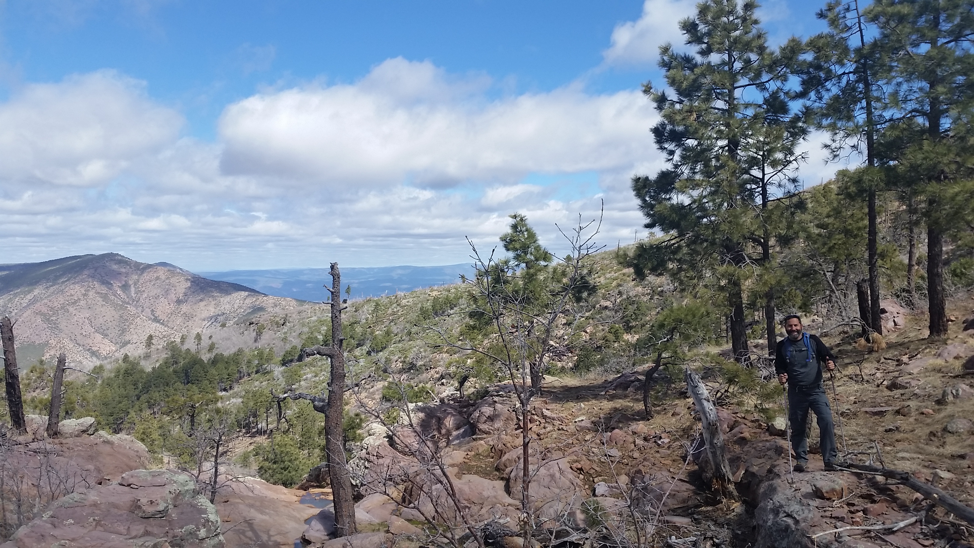
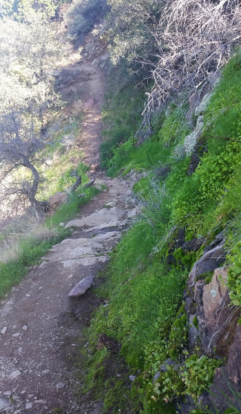
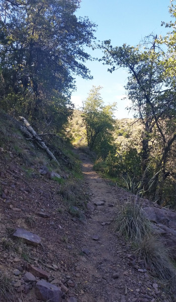
Feeling recharged, we were all back on our feet and ready to face the final 3 miles to the trailhead. The canyon wasn’t the only pleasant surprise on this trek, Barnhardt was a far more beautiful trail than I expected. Y-bar is a sun-drenched mountain skirt providing expansive views, but is mostly covered in shrub and manzanita (though the small patch of pines found ¾ of the way up is pretty cool). Barnhardt, on the other hand, is tucked away on the north side of the peak. Shaded from the sun and sipping on creeks and falls from winter snowmelt, the vegetation here was totally different. Lush and green, it was like a little desert oasis! Talk about a tale of two trails, night and day difference.

The rest of the crew pushed ahead while I lingered behind snapping pictures and taking in the sights. After getting my fill, I picked up the pace to try and catch up. At the Barnhardt falls, the trail descended rapidly with a few switchbacks before finally settling out, skirting the base of the mountain and back to the trailhead. What another awesome trek with good people!
P.S. Brain Mildener was there too =)
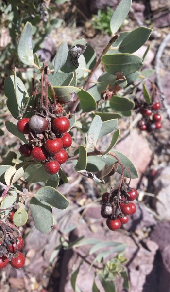
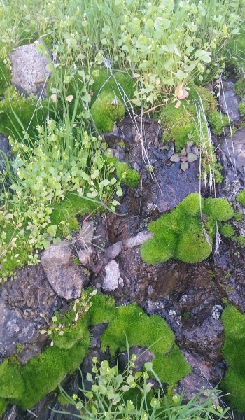
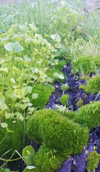
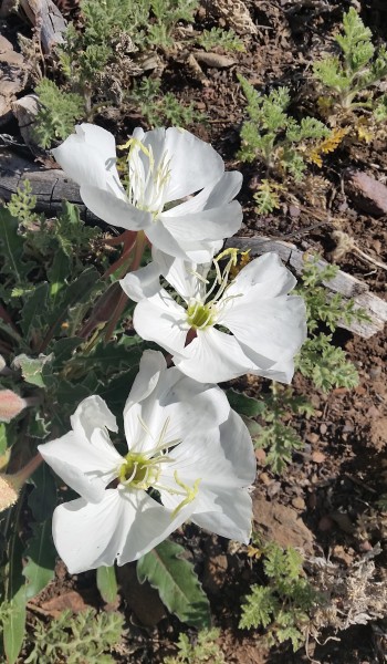 Desert Flowers on Y-Bar

HIKE INFO:
https://hikearizona.com/decoder.php?ZTN=202
HIKE STATS:
- Weather: Hi 70s, Low 50s, Sunny
- Water: 2.0 liters
- Food: 1 Cliff Builders Bar, 1 Bag Trailmix with Macadamia nuts and pretzels, 1 Nature valley sweet and salty bar, mixed 1 bag of salt and vinegar chips, Pro Bar strawberry gummies
- Time: 8 hours
- Distance: 14.8 miles Round Trip
- Accumulated Gain: 3,200 feet
GEAR:
- Mule Camelback backpack (3 liter bladder)
CLOTHING:
- Smart Wool 195 weight long sleeve shirt
- Arc’teryx Hoody
- Cotton Handkerchief
- Underarmor shorts
- Merrell Mid Moab Hiking Boots
- Darn Tough Medium Wool Sox
