

My breath spewed from my mouth like smoke in the cool crisp morning air. Before sunup I woke in my tent to my alarm signaling the start of the day. My morning ritual began; throwing on hiking cloths, making breakfast, and boiling water for coffee. This morning there was an additional excitement in my step due to not only putting my feet on new dirt, but also the expectation to find Salado Indian ruins on the rout I selected for the day.
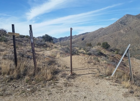
The Superstition Mountains are a rough rugged area unforgiving to its visitors, much like the drive I made to the trailhead the night before. From the trailhead, chilled in the morning air, I turned up the first hill to get moving. Rising up to the hilltop I could see across the vast Supes, the sun was just peaking over the hills and the trail was still frosted over in areas. I pushed on arriving at a standing windmill which I could only imagine was still working, however you could never tell by the absence of cattle, or farmhands.
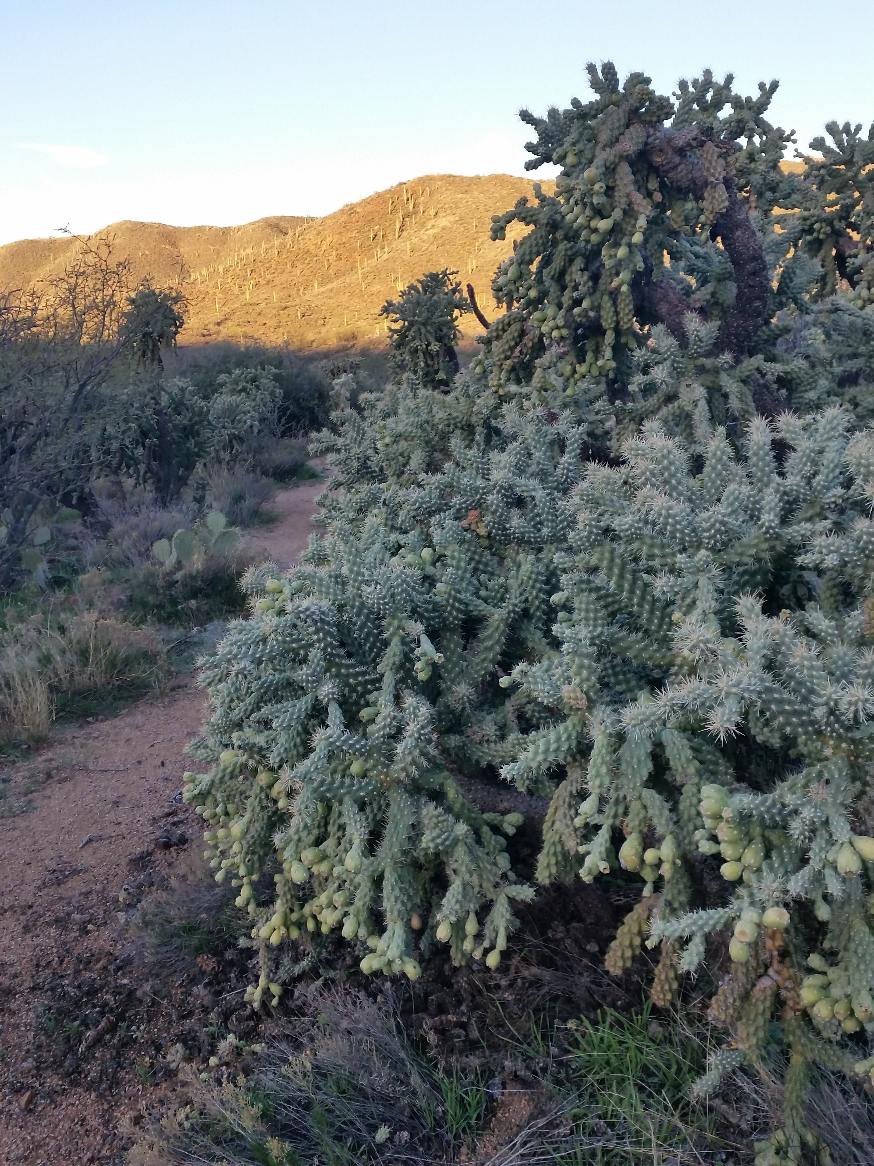
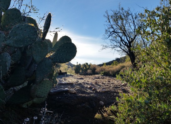
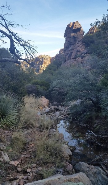
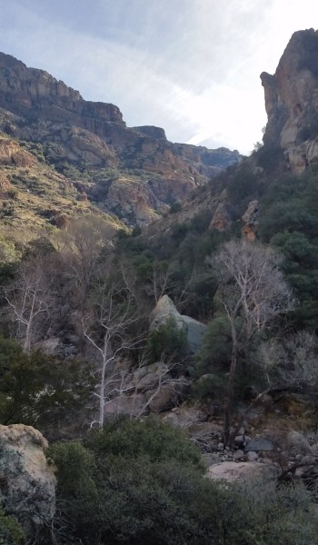
From here the cactus lined trail narrowed and dove down to the creek coming up the other side gaining elevation towards the far off saddle. In the sunlight it was warm enough not to shiver, but in the cool of the shade where frost clung to the plants and any standing water was a frozen slate of ice. Buckhorn cholla grew here like someone was regularly watering it with fertilizer! I trekked on heading up and up, until finally I found the first sign of life I saw on the trail. A fella covered from head to toe in camo just getting ready outside his trailside tent for what I could only imagine to be a hunt was putting camo face paint. I wasn’t sure what he was hunting, but like me was too busy to chat and I headed about my way.
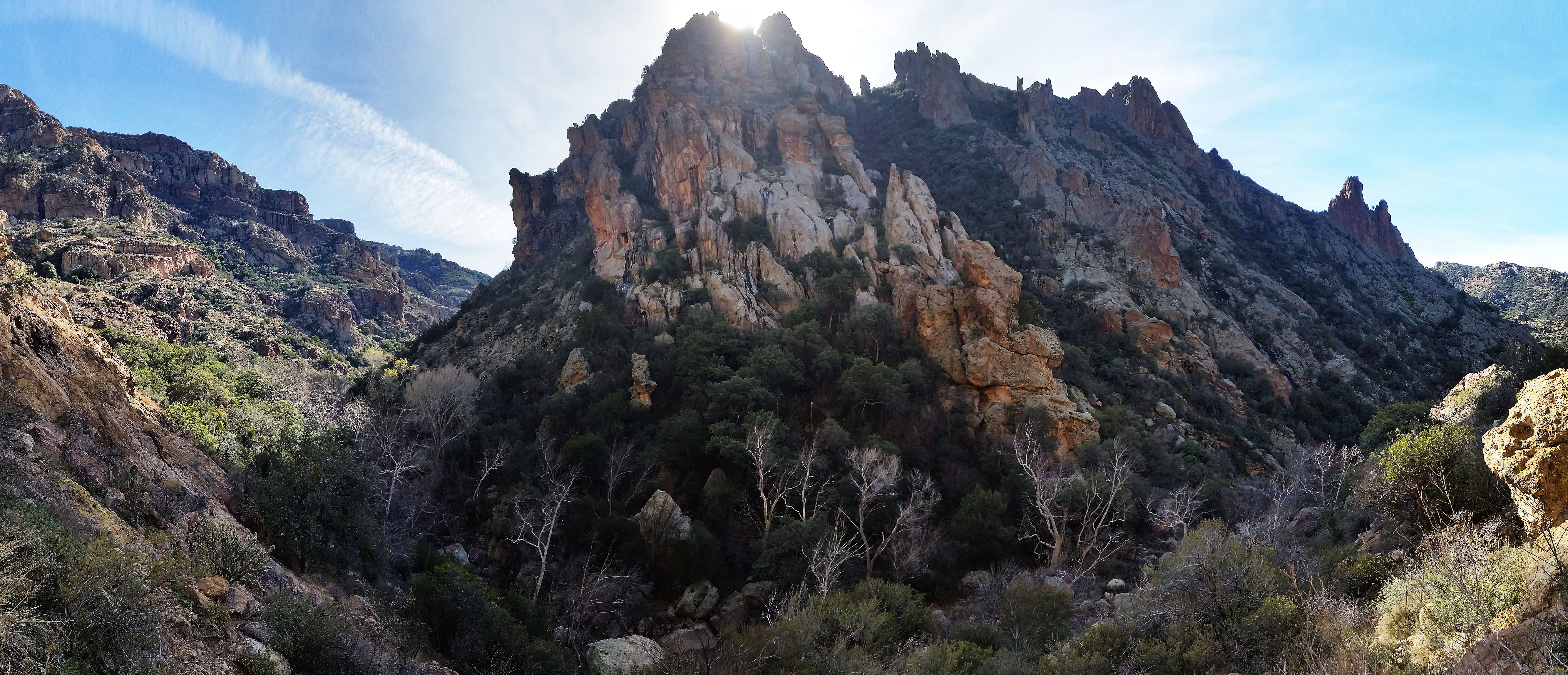
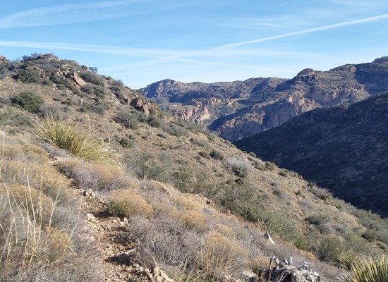
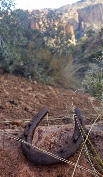
I trekked up and out finally re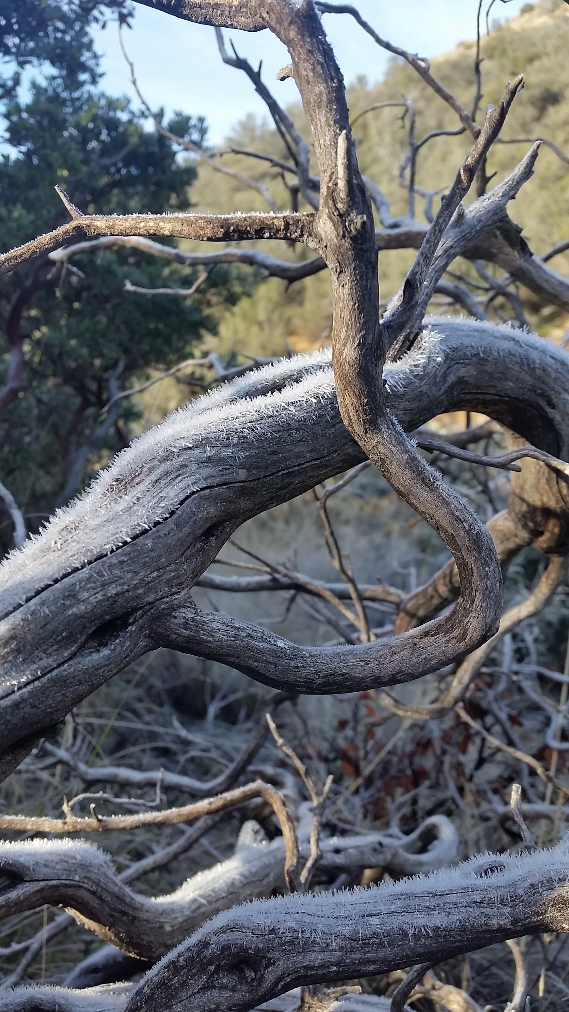 aching the saddle before diving down into the shaded canyon to the north. Here manzanita reigns supreme, it is everywhere. As I trekked down towards the creek the rocks started jetting up and trees shaded the frost covered trail. Heading down I found an old rusted horseshoe at trailside. It was a cool find, I left it for the next hiker to stumble across.
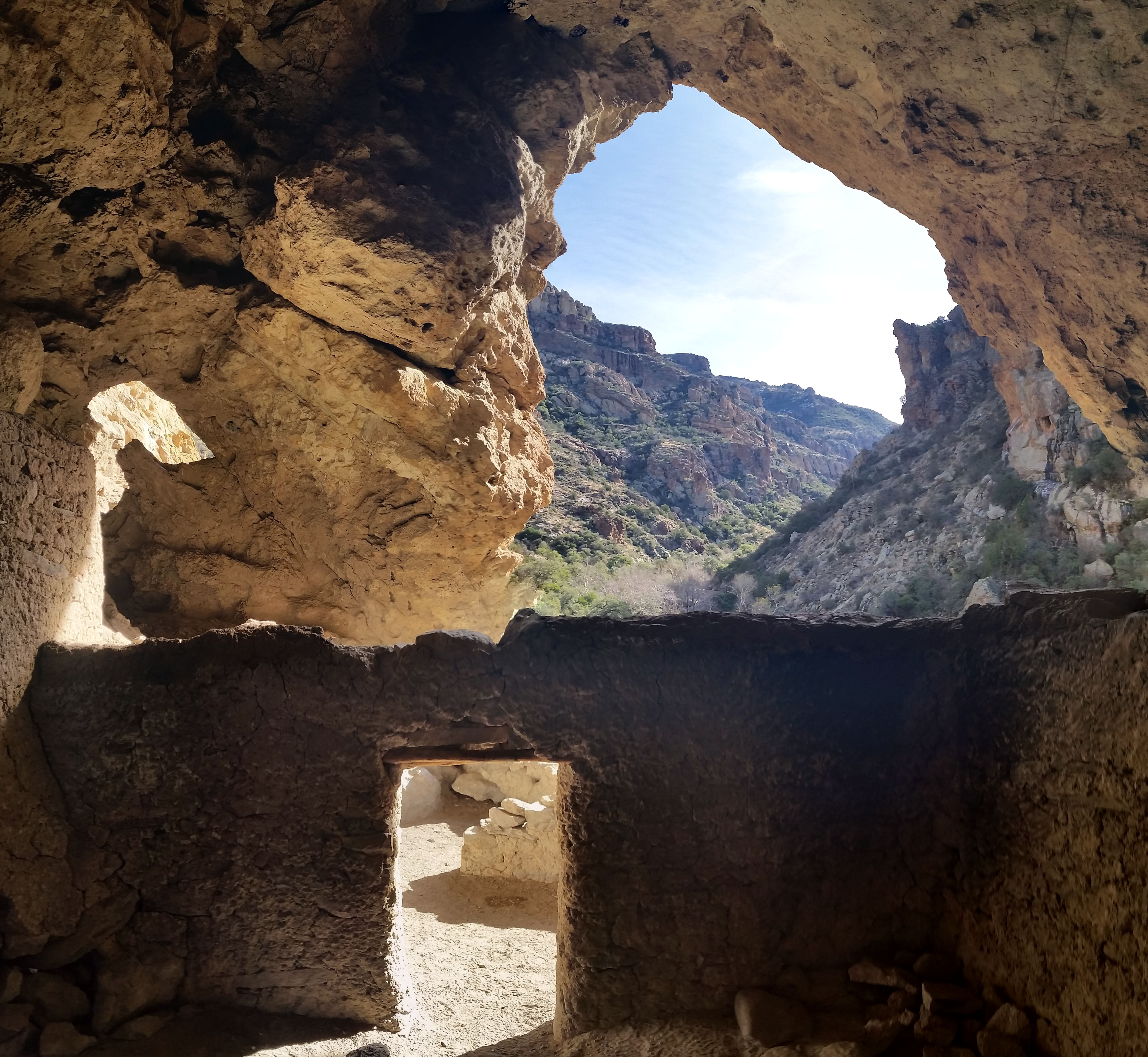
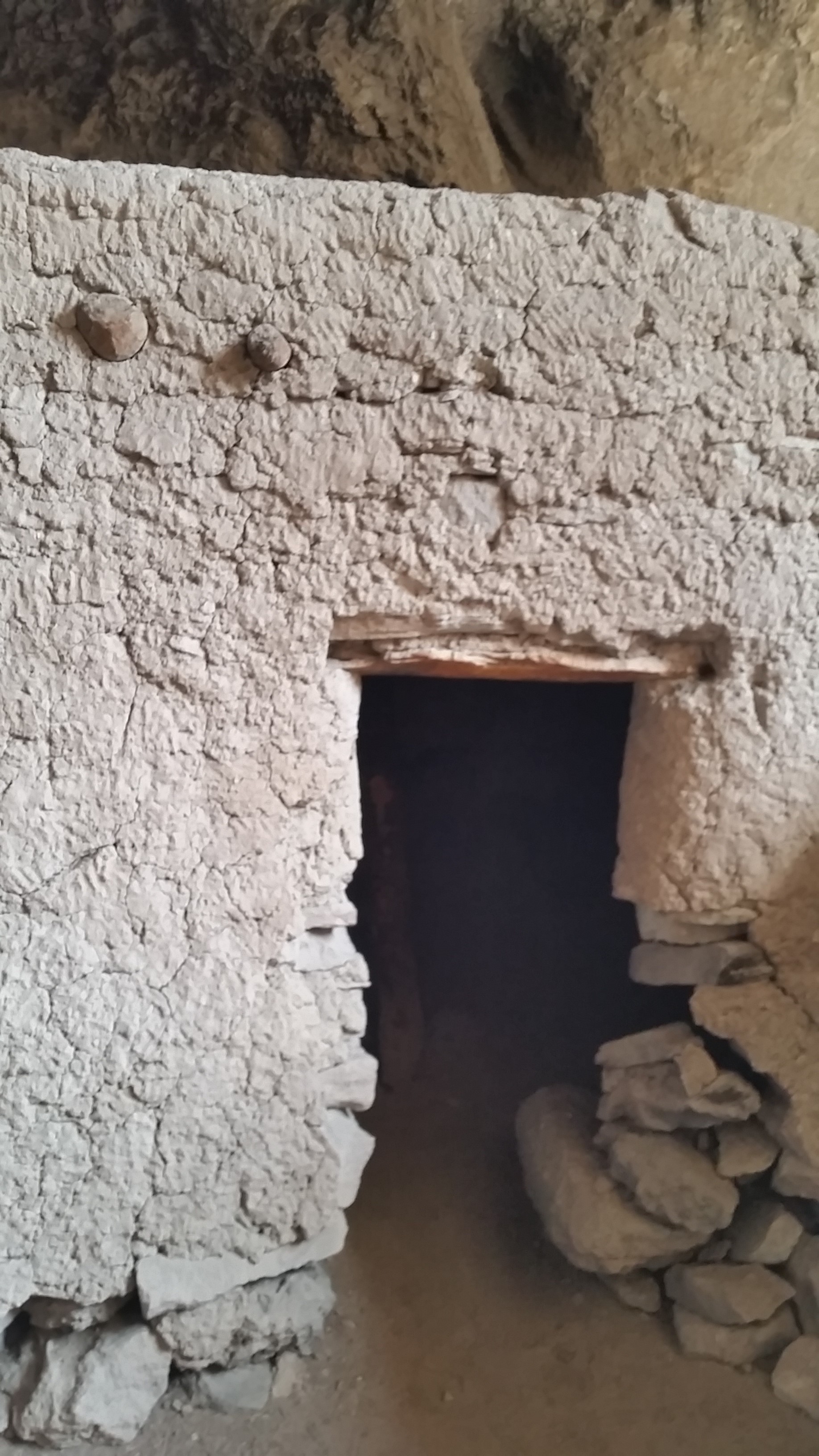
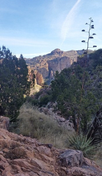
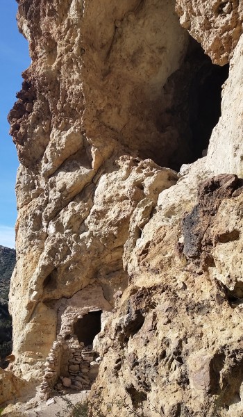
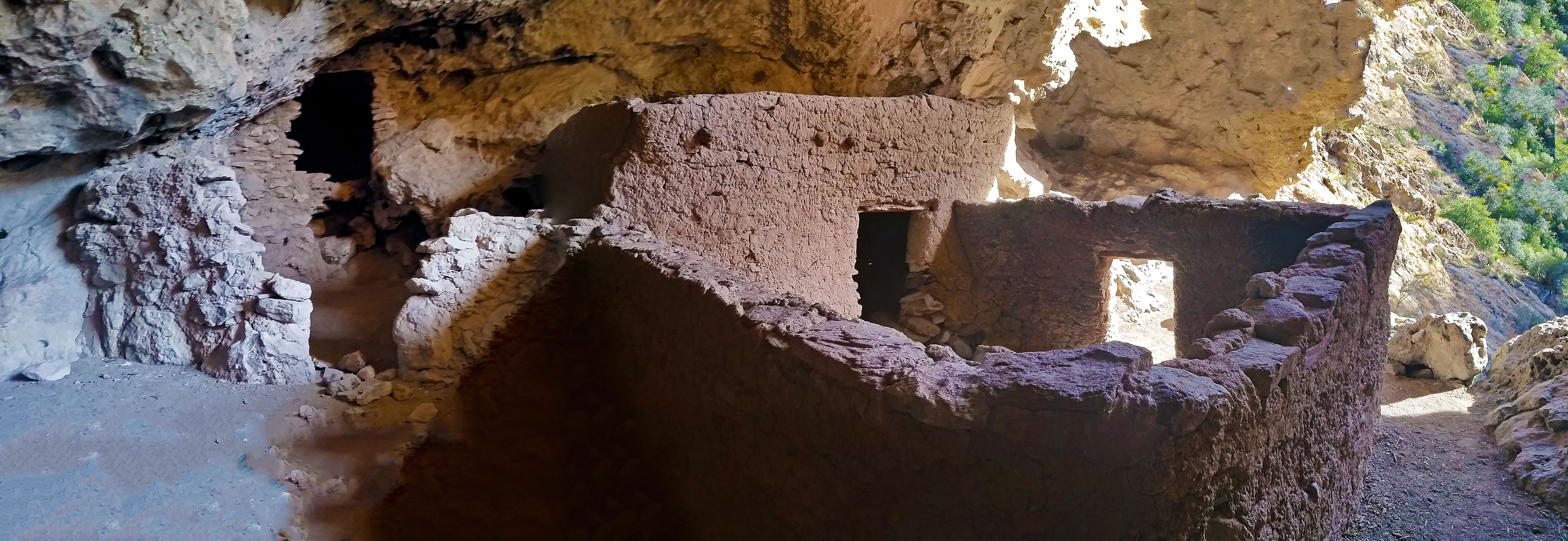
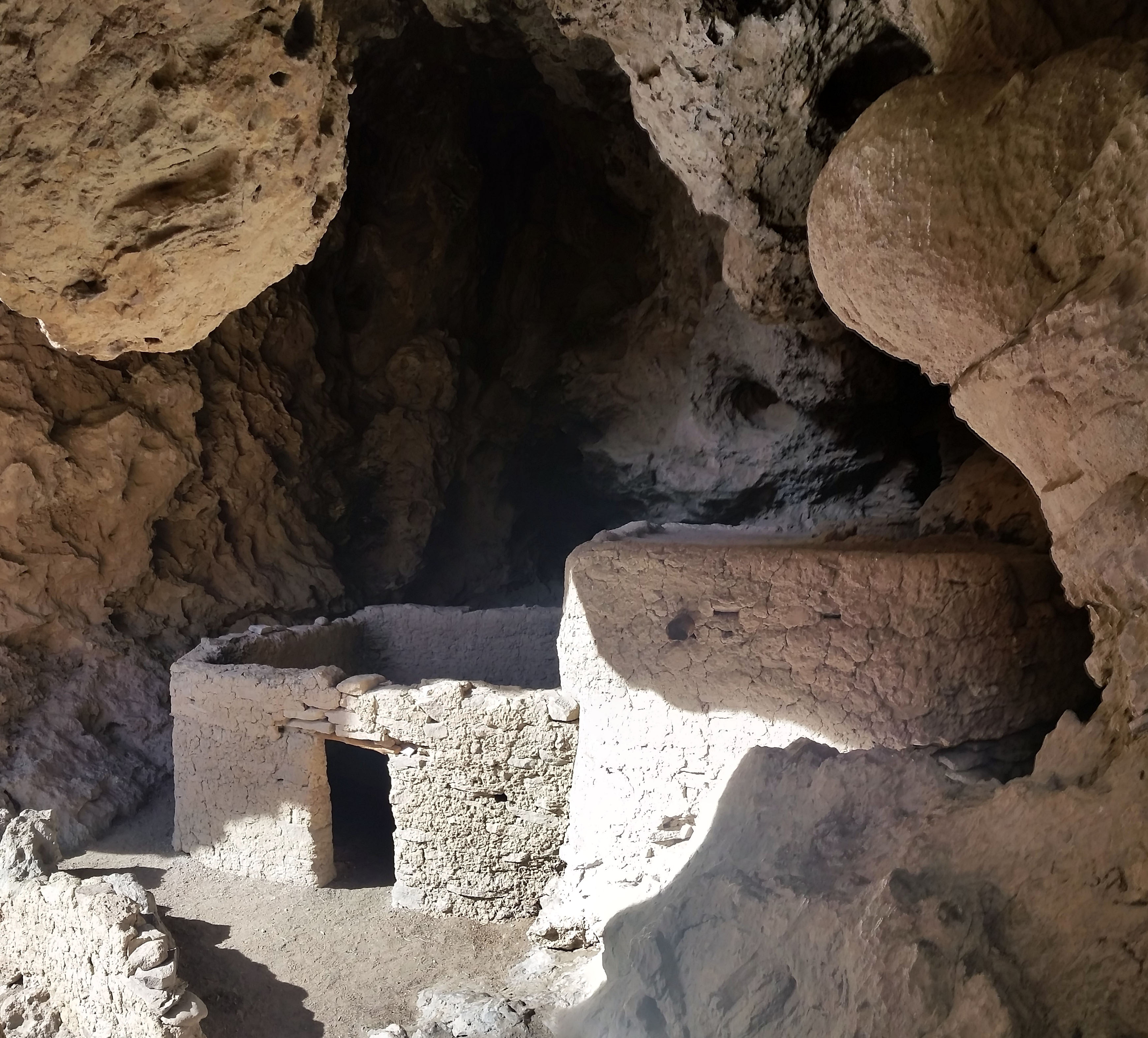
Soon I found my way among the rocks to a wooden sign that stated the Salado people inhabited the area nearly 600 years ago. In the rocks above I found their dwellings. This find made the trip well worth the trek. The first visible dwelling is a rock wall covering a natural short cave where signs of fire on the cave roof can be seen. A much larger cave has a less impressive rock wall, but well visible black marks on all the walls and roof where massive fires were undoubtedly built. After snapping a few pictures and taking in the sights form what the Indians would see I decided to turn and leave. As I walked down I glanced back up to the rockface housing the dwellings to see a larger cave up above the two I just explored.
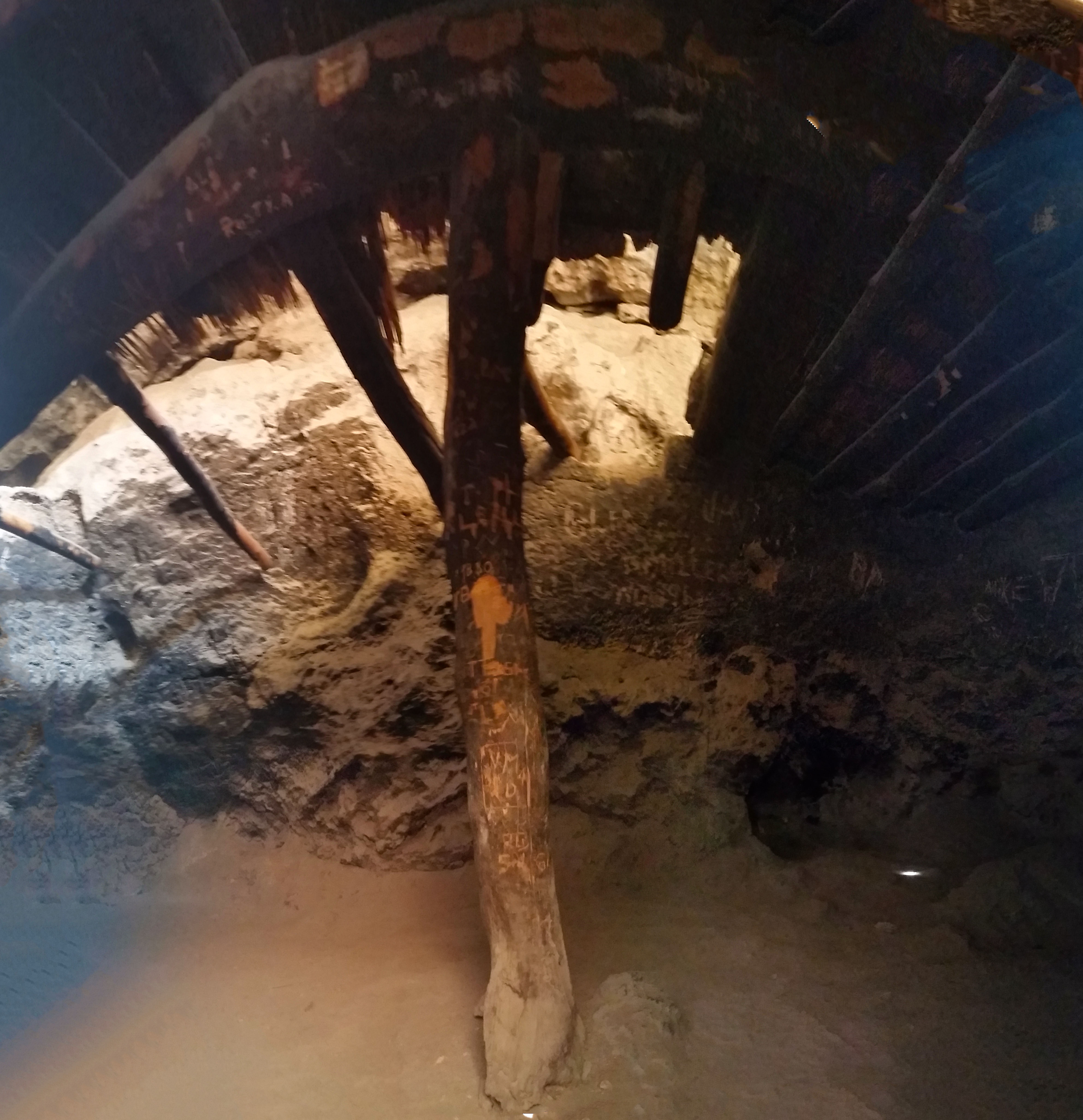
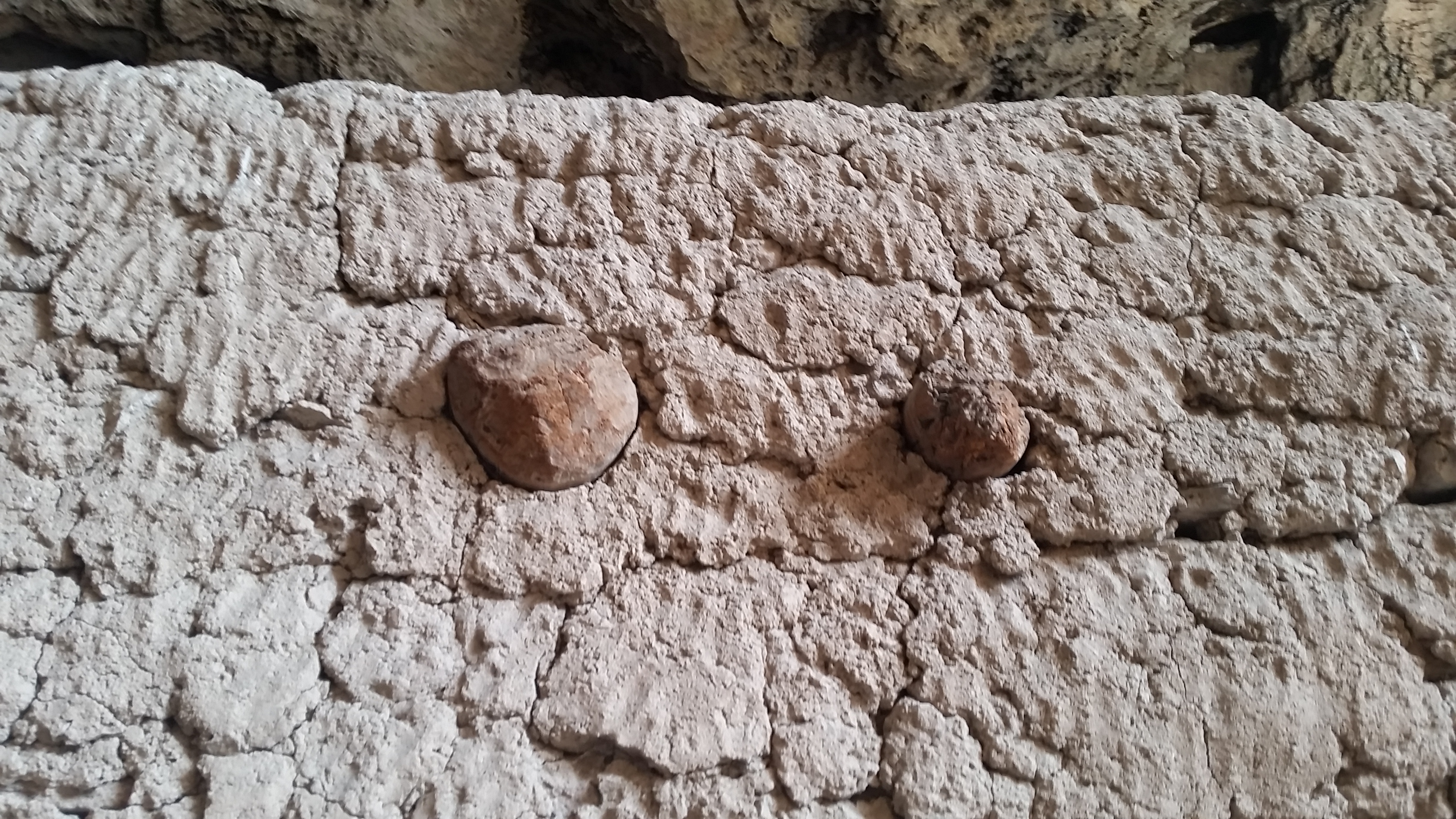
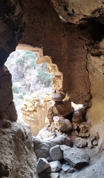
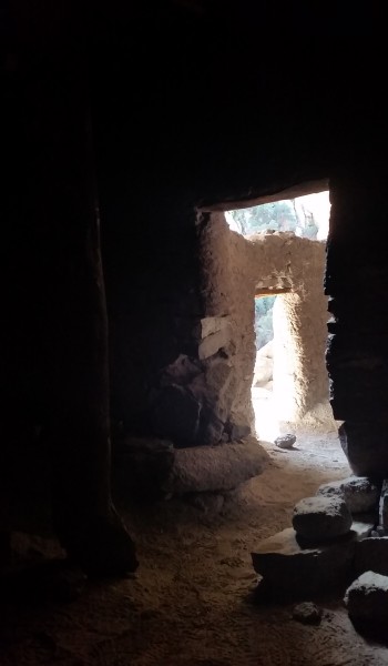
Curiosity of course got the better of me. I approached the face of a seemly climbable rock and went to work. Before I know it (without having any idea of how to get down) I found myself standing in the third cave. The dwelling here was by far the most impressive of all three. Fully intact walls and most of a roof of the enclosed in the largest room. In the mud used to cake the walls, fingerprints of the Indians could be seen, it was incredibly impressive.
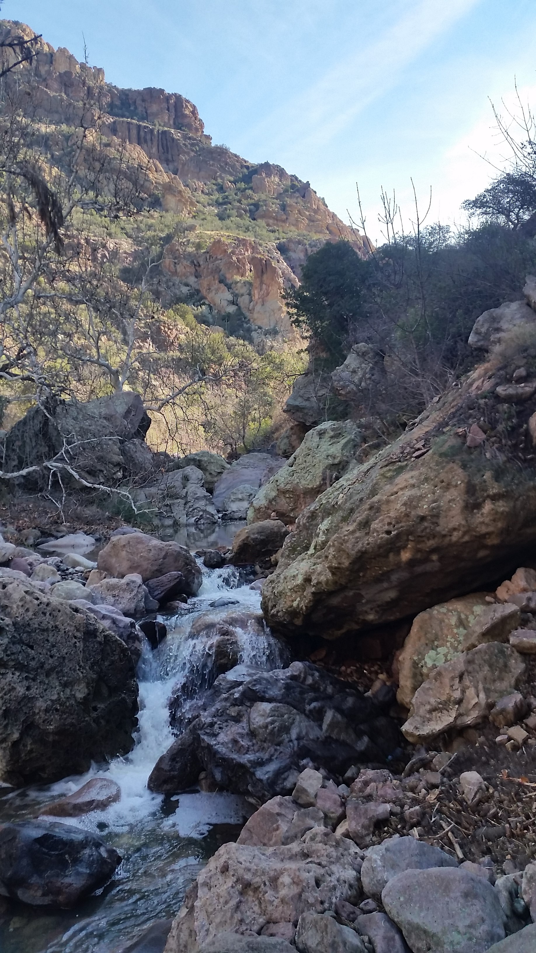
Happy with my find I decided to trek on back to the trailhead. I climbed down from the rocks and started boulder hopping along the creek bed under the shade of the trees back up the canyon in an easterly direction closing out the loop I started.
I trekked on enjoying the light passed through the trees, crossing the creek, trekking the sparse trail, really enjoying being there, imagining what it was like when those Indians inhabited the canyon. How long were they there? Was the climate the same? How hard was it to find/gather food in this remote area? What adaptive skills did they use to survive while being impacted by the seasons? What an incredibly special place; to be shared, but most of all respected, leave no trace.
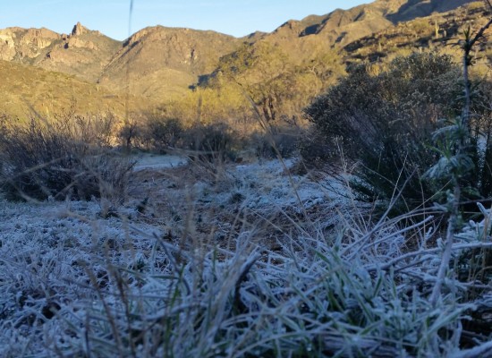 Frost on the ground
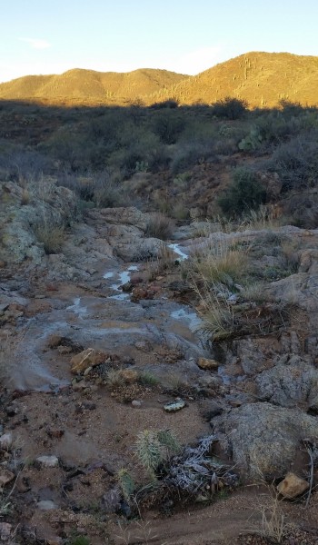 Ice in the puddles
MORE PICTURES:
HIKE INFO:
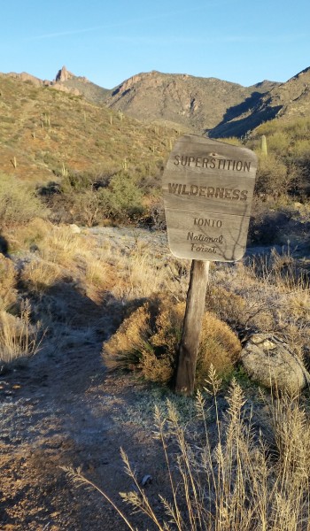
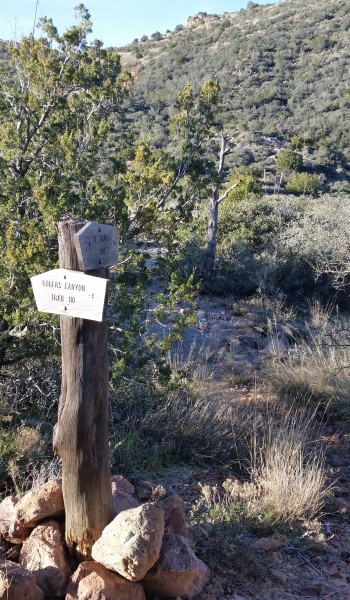
Superstition Mountains – JF Trail to Rodgers Canyon Loop
HIKE STATS:
- Weather: Hi 65s, Low 28s, Sunny
- Water: 2.0 liters
- Food: 1 Clif Builders bar, 1 trailmix bar, almonds, Apple,
- Time: 7 hours
- Distance: approx 14 miles Round Trip
- Accumulated Gain: 2,900 feet
GEAR:
- Mule Camelback backpack (3 liter bladder)
CLOTHING:
- 195 Smart wool long sleeve shirt
- Cotton Handkerchief
- Nike running shorts
- Merrell Mid Moab Hiking Boots
- Arkteryx Hoody
- Darn Tough Medium Wool Sox
